Showing 531 items matching "mining history - victoria"
-
 The Beechworth Burke Museum
Photograph
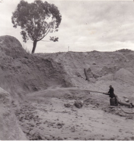
This image shows an unknown location in the area of Beechworth that was possibly used as a sluicing mining site for gold during the Victorian Gold Rush. This era saw an influx of Chinese immigrants and Australian prospectors hoping to strike it rich on the fields. Many companies such as the Rocky Mountain Extended Gold Sluicing Company Ltd and the Cocks Pioneer Gold &Tin Sluicing Company also set up mines in the area. This site may be the location of one of these company's mines. The wooden logs are reminiscent of known sluicing operations in the era from that time. Sluicing involved the use of high-pressured hoses to clear away soil from earth that had been dug up by miners and was a popular method of excavation in the area, although it had severe impacts on the environment.The search for gold is ingrained into the history of Victoria and therefore, images like this one which portray an open cut sluicing site can reveal important information for society and technology for the date when the photograph was taken. This image is of important historical significance for its ability to convey information about sluicing and the methods used to find gold. It also shows a location where sluicing was undertook which provides insight into the impact of sluicing on the environment at a time when it was done.A colour rectangular photograph printed on glossy photographic paperReverse: 6855 /beechworth, gold rush, sluicing, mining -
 The Beechworth Burke Museum
Postcard, George Symons, c.1990
The photograph printed on this postcard comes from the collection of the Mitchell Library in Sydney. It is sepia in tone and depicts seven men standing and sitting around a mine shaft in the Beechworth region. The photograph has been dated to approximately 1872. This period in history post-dates the Victorian gold rushes which occurred 1852-1853 in Ballarat, Bendigo and Beechworth. During this period, in the 1870s, the surface alluvial gold had been discovered and removed from location. Therefore, in order to reach the deeper and less accessible alluvial gold, diggers began to dig shafts into the earth. These shafts sunk below the ground level by 20 to 30 feet and required timber structures around the entrance and winches to bring the paydirt to the top. The top of this wooden structure is visible behind the man standing in the upper right of the image. This type of mining was highly dangerous as mines often caved in which injured the minors and often resulted in death. Thus, following this period, in the early 1900s, miners opted instead for hydrolic slucing which cut away the earth without the devastating consequences of a mine cave in. This particular group of miners appear to have been unable to afford a horse (then worth around 50 pounds) which were generally used at mines like this to help pull buckets attached to ropes up and down the mine. Instead, this group brought the buckets up and down by windlass. The windlass was a wooden structure mounted over the mining shaft and fitted with a hand-cranked winch which enabled the bucket attached to the rope to be brought up and down.Gold was first discovered in Beechworth in Spring and Reid's Creek in the summer of 1852-1853. At its popularity, this region had approximately 8000 people on the gold fields searching for gold on the banks of these creeks. These periods did not require the use of heavy machinery or the digging of deep mining shafts like the one depicted in this image. Therefore, this image has important connotations for the technologies associated with mining during the approximated 1870s when gold was harder to access. This is a later period in gold history which does not fit into the "gold rush" period. Instead, it occurred after the surface gold had disappeared and therefore, is essential for researchers who are investigating the mining techniques and structures used to reach the alluvial gold which was located deeper under ground in the 1870s. This period predates the use of big heavy machinery used to mine in the 1900s which include dredges. Images such as this one can also impart essential information as to the wardrobe and fashion of men during this period. It also imparts knowledge about the landscape of Beechworth which is useful for people researching the environment and impact of gold mining in the north-east region of Victoria. In addition, since this image is a postcard reproduction of an early Australian image which may date to approximately 1990 it can impart knowledge as to the interests of people during this time period when there may have been an increase into Australian history.A sepia tone facsimile of an early Australian photograph (circa 1872) printed as a postcard.Obverse: BEECHWORTH / Victoria, Australia / Reverse: GM 2 3275 / CORRESPONDENCE / AUSTRALIAN / YESTERYEAR / CARDS / ADDRESS / Published by George Symons (057) 65 3240 / THE MINEHEAD C. 1872 / The easily gleaned gold of the early fields did / not last very long. In order to reach less / accessible alluvial gold diggers began sinking shafts as much as twenty to thirty feet down / and the mines required timbering and winches / to bring the paydirt to the top. / This syndicate has been unable to afford the / luxury of a horse (about 50 pounds) and so everything / must go up and down by windlass and rawhide / bucket. / Photo: Mitchell Library, Sydney / A sepia tone facsimile of / an early Australian photographmining album, gold mine, beechworth, burke museum, mine shaft, postcard, australian yesteryear cards, george symons, the minehead, gold fields, alluvial gold, early australia, c.1872, 1872, gold diggers, north east victoria -
 The Beechworth Burke Museum
Photograph
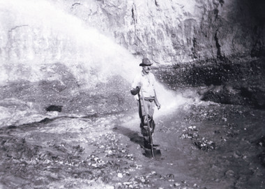
... mining which was widespread across Victoria during the 1870s ...This photograph depicts a man in dark clothing, standing in front of a cut away section of earth. He is undertaking hydraulic sluicing, which involves the use of high powered hoses, in order to cut away the earth which can then be sifted for gold. There is a single tree in the background and the earth contains numerous signs of damage because of the mining. Beechworth become a mining settlement after the discovery of gold in 1852. Gold fever had already spread across Australia's colonies and the American states. Sluicing the landscape for gold, as shown in this photograph, was done by diverting water and washing away the lighter dirt, allowing the gold particles to sift down in to catchments for collection. In Beechworth, there was considerable discontent caused by attempts to restrict water use for sluicing to those with certain 'water rights'. The extensive use of hydraulic sluicing, and the washing away of top soils has continued to impact the surrounds of Beechworth in to the present day. Sluicing as a method for gold mining which was widespread across Victoria during the 1870s. The erosion of the top soil in search of gold has a continuing environmental impact on the landscape and this photograph depicts but one example of this occurring and can provide much information to a researcher interested in understanding the history of gold mining in Victoria. This image of the miner and hose is historically important because it demonstrates the methods of goldmining employed in the later years of the goldrush at Beechworth. It shows how much land is washed away by the use of this technology. The image has good interpretive capacity because it allows researchers to see a different mining technique to what is usually presented. Black and white square photograph on card.reverse: 84-50-3 / 1997 3141 / smdsluicing, goldmining, beechworth, burke museum, miners, gold miners, gold sluicing, environmental impact -
 The Beechworth Burke Museum
Photograph - Photograph - Reproduction, c1920
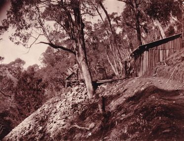
This photograph depicts mining operations (in particular, hydrolic sluicing) at Three Mile Mine, Barramutha, during the later periods of mining, 1920s-1950s. Three Mile Mine was a major site of mining activity sating back to the 1850s, although was often not as prosperous as other sites such as those situated on the Woolshed Valley. Many miners would leave Three Mile Mine for better prospects on other claims. The main, most successful 'rush' at Three Mile Mine occurred during and immediately following September 1855. This photograph, however, depicts a much later period.The search for gold is ingrained into the history of Victoria and therefore, images like this one which portray a miner at a sluicing site can reveal important information for society and technology for the date when the photograph was taken. This image, and its related images, it important for its historical significant of labour and mining extraction used for gold during the latter gold rushes in the 1900s. The Beechworth Burke Museum has additional images relating to gold mining in the region which can be analysed and studied alongside images like this one.A black and white rectangular photograph printed on matte photographic paperreverse: 7597.4 / copied from original on loan from Webb (Qld) / Donated Nov 2009 / Baarmutha Three Mile Mine 1920-1950 / Owned by Plain Bros then Parkinsons / John Weir or Jack Cox / Sluicing /mining, barramutha, three mile mine, sluicing, mine, beechworth -
 The Beechworth Burke Museum
Photograph
This photograph depicts four men standing near a large unidentified building. This building is the entrance to a deep lead mine shaft. There is a bridge entering the building, which was used to access the elevator to the shaft. Deep lead mining involved placing large shafts into the ground which miners use to access deeper locations in order to excavate the rocks in the search for lead. Deep lead mining was highly dangerous as roofs could cave in of the soil was loose. Therefore, this particular mining considered to be highly undesirable profession as many miners did not want to work long hours nor risk their lives in the search for lead. Indigo Shire was a large area where deep lead mining took place, and thus the landscape and environment was largely impacted by these mining businesses. The Indigo Shire grew in population and wealth in the early 1850s when people came into this location in the hopes of finding gold and making a fortune. Ultimately, the accessibility and availability of gold and precious metals decreased once the gold reserves dried up and alongside this, the large population moved away. The Ovens was also heavily impacted environmentally as deep mining resulted in the change in land formation.The search for gold is ingrained into the history of Victoria and therefore, images like this one which portray an open cut sluicing site can reveal important information for society and technology for the date when the photograph was taken. This image is of important historical significance for its ability to convey information about the methods used to find gold in Indigo Shire. It also shows a location where deep mining was undertook which provides insight into the impact of deep mining on the environment at a time when it was done. This image is important for current research into the history of Indigo Shire, a region in Victoria's north-east. Therefore, this image has the capacity to be beneficial for research into society and the motivations of those living and working in this region during this period and therefore, has social significance. The Beechworth Burke Museum has additional images relating to deep lead mining and Indigo Shire which can be analysed and studied alongside images like this one.Sepia coloured retangular photo printed on gloss photographic paper.Reverse: 1997, 2510/ A02570/ Deep Lead Mining/ page 94/ 65%/ Burke Museum, Photo 44beechworth, burke museum, indigo shire, deep lead mining, mining, gold, gold mining -
 The Beechworth Burke Museum
Photograph
This photograph dating between the 1850s and early 1900s depicts an open cut sluicing site located in Allan's Flat looking upon the open cut from Staghorn Flat Number 1. Sluicing was undertaken in the area from 1850 to 1904. The image depicts a location mined by Yackandandah Sluicing Co. It portrays and open space with pipes laying on the ground and connected to pipes leaving the barge. These pipes were used to wash and seperate the qaurtz. There are two small buildings on high ground over looking the barge. Yackandandah Sluicing Co. was created by J.A. Wallace in the 1880s. The Yackandandah Sluicing Co. operated from the mid-1880s to the early 1900s, when resources eventually ran out. Open cut sluicing involved the use of high-powered hoses which used the centrifugal sand pump system (known as hydraulic sluicing) which broke down the soil which was then processed for quartz, gold and other materials. After the resources where drained, Wallace reaped the benefits of his mining business. Allan's Flat is located on the Yackandandah Creek, and is 10km north-east of Yackandandah and 20km south of Wodonga in Victoria's regional north-east. Allan's Flat was initially used to mine gold through alluvial methods, however that came to an end with little results. The mining business was then revived by J.A. Wallace with the introduction of hydraulic sluicing.The search for gold is ingrained into the history of Victoria and therefore, images like this one which portray an open cut sluicing site can reveal important information for society and technology for the date when the photograph was taken. This image is of important historical significance for its ability to convey information about sluicing and the methods used to find gold and other minerals in the lat 19th Century. It also shows a location where sluicing was undertook which provides insight into the impact of sluicing on the environment at a time when it was done. This image is important for current research into the history of Allan's Flat, a small regional location near Yackandandah in Victoria's North East. Therefore, this image has the capacity to be beneficial for research into society and the motivations of those living and working in this region during this period and therefore, has social significance. The Beechworth Burke Museum has additional images relating to gold sluicing and Allan's Flat which can be analysed and studied alongside images like this one.Sepia coloured retangular photograph printed on gloss photographic paper mounted on board.Revers: Sluicing at Allan's Fortallan's flat, north east gold, sluicing, gold sluicing, hydraulic sluicing, mining, gold and quartz mine, beechworth, burke museum, yackandandah -
 The Beechworth Burke Museum
Photograph, Late 1900s
This photograph dating to the late 1900s depicts the entrance to a reef mine the in Beechworth division. The image depicts two men outside the entrance, which is covered by a hut, where one is standing near a mine cart. The mine car was used to haul soil from the mine. The Beewchworth divison consisted of 5 locations: Beechworth, Stanley, El Dorado, Hurdle Flat and Stony Creek. These locations were set up due to speculative fever that more gold could be found. In places such as El Dorado, Beechworth and Stanley there was profit, however Hurdle Flat and Stonry Creek, gold could not be found in the quantities that was required. By 1880 the Beechworth division was in depression due to the reserves being used up. However, in spite of the depression mining was continued until the late 20th Century.The search for gold is ingrained into the history of Victoria and therefore, images like this one which portray an open cut sluicing site can reveal important information for society and technology for the date when the photograph was taken. This image is of important historical significance for its ability to convey information about reef mining in the late 1900s. It also shows a location where reef mining was undertook which provides insight into the impact of reef mining on the environment at a time when it was done. This image is important for current research into the history of Beechworth , a town in Victoria's north-east. Therefore, this image has the capacity to be beneficial for research into society and the motivations of those living and working in this region during this period and therefore, has social significance. The Beechworth Burke Museum has additional images relating to reef mining and Beechworth which can be analysed and studied alongside images like this one.Sepia coloured retangular photograph printed on newspaper.Reverse: 7813beechworth, beechworth division, mining, reef mining, gold, gold mining, 1990 -
 The Beechworth Burke Museum
Photograph, 1907-8
The photo from 1907-8 is a sepia print, depicting a small valley with building at base. There are flumes visible above areas of water, trees on hills and a few small cottages on the hillside. Cock's Pioneer Gold & Tin Sluicing Co NZ No 2 Site. The photo was taken of Matthews Gully looking west. Sluicing was undertaken in the area from 1900 to 1942 with some short breaks between these periods. The image depicts a location mined by Cocks Pioneer Gold and Tin Sluicing Company (as recorded on the annotation on the card mount) The Cocks Pioneer Gold and Tin Mines N.L was one of El Dorado's two largest open cut sluicing mines of the 20th Century. The other was named the Cocks El Dorado Gold Dredging Company. The Cocks Pioneer Mines operated from 1901 until 1941 and found a total of 117,378 ounces of Gold and 1,673 tones of tin concentrates over these years. The Cocks company was formed in 1898 and operated until 1941. Open cut sluicing involved the use of high-powered hoses which used the centrifugal sand pump system (known as hydraulic sluicing) which broke down the soil which was then processed for gold and other precious metals. From 1914 , four years after this image was captured, the company reformed to Cocks Pioneer Gold and Tin Mines NL (previously it was known as Cocks Pioneer Sluicing Co) and undertook large scale sluicing operations until 1929 and then 1934-1941. El Dorado is located on Reedy Creek and is surrounded by forested country to the north and east. It is 20 km east of Wangaratta in Victoria's regional north-east. John Cock was the son of a Cornish minor who arrived in El Dorado in 1858. Cock founded his gold and tin mining company which ran successfully for many years in the El Dorado region. It was an open cut sluicing company because of the abandonment of underground mining after this was deemed too dangerous. In 1935 Cock's El Dorado Company commissioned the floating dredge which is still visible in El Dorado today. The dredge was built by the Thompson engineering works, Castlemaine, and weighed over 2,000 tones and today has a place on the Victorian Registers of historic buildings. Interestingly, the name El Dorado does not derive from the gold in the region, but from the Barambogie pastoral run completed by William Baker in 1840-1841. Gold was discovered in El Dorado 1854 but the gold was too deep for individual prospectors to find, it required the use of heavy machinery.The search for gold is ingrained into the history of Victoria and therefore, images like this one which portray an open cut sluicing site can reveal important information for society and technology for the date when the photograph was taken. This image is of important historical significance for its ability to convey information about sluicing and the methods used to find gold in 1910. It also shows a location where sluicing was undertook which provides insight into the impact of sluicing on the environment at a time when it was done. This image is important for current research into the history of El Dorado, a small regional location near Wangaratta in Victoria's North East. Therefore, this image has the capacity to be beneficial for research into society and the motivations of those living and working in this region during this period and therefore, has social significance. The Beechworth Burke Museum has additional images relating to gold sluicing and El Dorado which can be analysed and studied alongside images like this one.Sepia coloured rectangle photograph printed on gloss photographic paper Reverse: 1997. 2613/ A02613/ No2 site/ Matthews Gully/ Cocks Pioneer G&T. ?? Co NZ/ No2 Site looking West/ 1907-8/ (7)sluicing, hydraulic sluicing, 1907, 1908, mining, cock's pioneer gold & tin sluicing co nz, nz, site no 2, matthews gully, west, valley, building, cottages, hillside, trees, water, gold and tin mine -
 The Beechworth Burke Museum
Photograph, 1910 - 1911
This photograph depicts Cock's Pioneer G & T Sluicing site No. 4 in El Dorado. Looking eastwards, the photo captures a wooden and tin building with various mining equipment strewn in the foreground. Underneath the verandah, figures can be seen. These are believed to be a Mr. Hollister (left), Mrs. Breustedt (4th from left), children Min and Chris Breustedt, and Kate Timmons holding a girl's hand. The Cocks Pioneer Gold and Tin Mines N.L was one of El Dorado's two largest open-cut sluicing mines of the 20th Century. The other was named the Cocks El Dorado Gold Dredging Company. The Cocks Pioneer Mines operated from 1901 until 1941 and found a total of 117,378 ounces of Gold and 1,673 tones of tin concentrates over these years. The Cocks company was formed in 1898 and operated until 1941. Open cut sluicing involved the use of high-powered hoses which used the centrifugal sand pump system (known as hydraulic sluicing) which broke down the soil which was then processed for gold and other precious metals. From 1914, four years after this image was captured, the company reformed to Cocks Pioneer Gold and Tin Mines NL (previously it was known as Cocks Pioneer Sluicing Co) and undertook large-scale sluicing operations until 1929 and then 1934-1941. The Cocks Pioneer was an extremely successful mining company during the 20th century. In the Annual Report of the Secretary for Mines for the year 1915, the Cocks Pioneer was the largest producer of gold and tin collecting 5,535 ozs. of gold and £7,500 of tin. Twenty years later in 1935, Cocks Pioneer was still one of the most profitable mines in Victoria, ranking as the second-highest dividend paying mine. The company produced a total of 3,650 kg of gold. El Dorado is located on Reedy Creek and is surrounded by forested country to the north and east. It is 20 km east of Wangaratta in Victoria's regional northeast. John Cock was the son of a Cornish miner who arrived in El Dorado in 1858. Cock founded his gold and tin mining company which ran successfully for many years in the El Dorado region. It was an open-cut sluicing company because of the abandonment of underground mining after this was deemed too dangerous. In 1935 Cock's El Dorado Company commissioned the floating dredge which is still visible in El Dorado today. The dredge was built by the Thompson engineering works, Castlemaine, and weighed over 2,000 tones and today has a place on the Victorian Registers of historic buildings. Interestingly, the name El Dorado does not derive from the gold in the region, but from the Barambogie pastoral run completed by William Baker in 1840-1841. Gold was discovered in El Dorado in 1854 but the gold was too deep for individual prospectors to find, it required the use of heavy machinery.The search for gold is ingrained into the history of Victoria and therefore, images like this one which portray an open cut sluicing site can reveal important information for society and technology for the date when the photograph was taken. This image is of important historical significance for its ability to convey information about sluicing and the methods used to find gold in 1910. It also shows a location where sluicing was undertook which provides insight into the impact of sluicing on the environment at a time when it was done. This image is important for current research into the history of El Dorado, a small regional location near Wangaratta in Victoria's North East. Therefore, this image has the capacity to be beneficial for research into society and the motivations of those living and working in this region during this period and therefore, has social significance. The Beechworth Burke Museum has additional images relating to gold sluicing and El Dorado which can be analysed and studied alongside images like this one.A black and white copy of a sepia coloured rectangular photograph printed on matte photographic paper mounted on boardObverse: COCKS PIONEER G + T SL CO, N.L. / 1910 - 11 / NO 4 SITE LOOKING EAST / 4 Reverse: 1997.2508 / AUG 29 1909cocks pioneer gold and tin sluicing company, el dorado, mining, sluicing, hydraulic mining, hollister, breustedt, timmons, gold, tin, gold rush, victoria -
 The Beechworth Burke Museum
Photograph, 1910
This photograph dating to 1910 depicts an open cut sluicing site located in El Dorado captured looking east up the open cut from the number 3 Barge site. Sluicing was undertaken in the area from 1900 to 1942 with some short breaks between these periods. The image depicts a location mined by Cocks Pioneer Gold and Tin Sluicing Company (as recorded on the annotation on the card mount). It portrays open cut rocks with a crevice in the center of the image where the sluicing was being undertaken. There is a small timber structure on the right of the image which could be an entrance to a mine or supports made of wood to prevent a cave in at the open cut site and above the cut rock there is bush. The timber structure has rail tracks on top of the bridge which could suggest the identification of this structure as a mine entrance. The rail tracks were used for little carts which hauled soil from the mine. The Cocks Pioneer Gold and Tin Mines N.L was one of El Dorado's two largest open cut sluicing mines of the 20th Century. The other was named the Cocks El Dorado Gold Dredging Company. The Cocks Pioneer Mines operated from 1901 until 1941 and found a total of 117,378 ounces of Gold and 1,673 tones of tin concentrates over these years. The Cocks company was formed in 1898 and operated until 1941. Open cut sluicing involved the use of high-powered hoses which used the centrifugal sand pump system (known as hydraulic sluicing) which broke down the soil which was then processed for gold and other precious metals. From 1914 , four years after this image was captured, the company reformed to Cocks Pioneer Gold and Tin Mines NL (previously it was known as Cocks Pioneer Sluicing Co) and undertook large scale sluicing operations until 1929 and then 1934-1941. El Dorado is located on Reedy Creek and is surrounded by forested country to the north and east. It is 20 km east of Wangaratta in Victoria's regional north-east. John Cock was the son of a Cornish minor who arrived in El Dorado in 1858. Cock founded his gold and tin mining company which ran successfully for many years in the El Dorado region. It was an open cut sluicing company because of the abandonment of underground mining after this was deemed too dangerous. In 1935 Cock's El Dorado Company commissioned the floating dredge which is still visible in El Dorado today. The dredge was built by the Thompson engineering works, Castlemaine, and weighed over 2,000 tones and today has a place on the Victorian Registers of historic buildings. Interestingly, the name El Dorado does not derive from the gold in the region, but from the Barambogie pastoral run completed by William Baker in 1840-1841. Gold was discovered in El Dorado 1854 but the gold was too deep for individual prospectors to find, it required the use of heavy machinery.The search for gold is ingrained into the history of Victoria and therefore, images like this one which portray an open cut sluicing site can reveal important information for society and technology for the date when the photograph was taken. This image is of important historical significance for its ability to convey information about sluicing and the methods used to find gold in 1910. It also shows a location where sluicing was undertook which provides insight into the impact of sluicing on the environment at a time when it was done. This image is important for current research into the history of El Dorado, a small regional location near Wangaratta in Victoria's North East. Therefore, this image has the capacity to be beneficial for research into society and the motivations of those living and working in this region during this period and therefore, has social significance. The Beechworth Burke Museum has additional images relating to gold sluicing and El Dorado which can be analysed and studied alongside images like this one.Sepia coloured rectangular photograph printed on gloss photographic paper mounted on board.Obverse: COCKS PIONEER Q + T SL CO, N.L. / 1910 / LOOKING EAST UP OPEN CUT / FROM NO3 BARGE SITE / Reverse: 1997 . 2611 / A02611el dorado, north east gold, sluicing, gold sluicing, hydraulic sluicing, 1910, gold and tin mine, open cut mining, mining, gold mining, north-east victoria, beechworth, burke museum -
 Ringwood and District Historical Society
Book, Diane Baird, Digging Into History - Goldmining in Warrandyte, 2007
Information about early mining in Victoria's first gold field. Cover photographs: Front cover - Fossickers working below the water-wheen driven stamper battery located on the south side of the Yarra River upstream of the Warrandyte Bridge. Back cover - The Old Post Office, Warrandyte, in 1906, now the premises of the Warrandyte Historical Society Museum and Archive, 111 Yarra Street.Acknowledgements: Several members of the Warrandyte Historical Society were involved in the development of this publication. It was developed and written by Diane Baird; Murray Houghton and Ted Rotherham provided specialist historical details and further references; Jo Laurence and Shirley Rotherham collected and identified photographs; Brian Laurence prepared images for electronic format; and Richard Morton edited and formatted the text. The Society gratefully acknowledges the dedicated work of all its members who collect, preserve and share Warrandyte's history. In particular, the research by the late Bruce Bence and the dedicated work of the late Jo Laurence have been an invaluable contribution to the history of Warrandyte. -
 Warrnambool and District Historical Society Inc.
Letter, Power of Attorney Augustus Bostock, 1888
Augustus Bostock was the 9th child of Robert & Rachael Bostock of Vaucluse Epping Forest, Van Diemen’s Land. He was only 4 years old when his mother died. He was inspired by his father to seek his fortune in the Western District of Victoria. He arrived around 1850. He married Margaret Aitkin in July 1865. Augustus owned several properties in the district and leased others. He sat on the court of Warrnambool, Mortlake or Hexham as required. He resided at Marramook in Hawkesdale and later moved to Vaucluse in Hopetoun Road Warrnambool, where he died in 1920 at the age of 87. He was involved in many aspects of life in the Western District, racing, cricket, and social activities to name a few. This document relates specifically to power of Attorney in relation to the Croydon goldfields in Northern Queensland which operated in the latter part of the 19th century. By 1907 it was failing although there were attempts to revive it in the 1920’s. Patrick O’Neil authorized as the agent for Augustus Bostock was a confidential mining agent for Sandhurst mines one of the larger mining companies at that period of Australian history.This is one of a number of documents which relate to the Bostock family who were one of the most important pioneering families of the Western District. They owned and leased various properties around Warrnambool and were involved in many aspects of social and business life. This letter records one of Augustus Bostock’s many interests, being for the Croydon goldmine which is situated on the Gulf of Carpentaria.White lined paper handwritten in black ink. Coomete, Hexham, Victoria printed at top right hand corner.Signed Augustus Bostock.warrnambool, augustus bostock, croydon goldmines, sandhurst mines, 1888, goldmining, patrick o’neil, -
 Eltham District Historical Society Inc
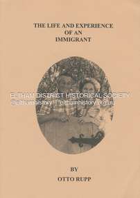
Book, Otto Rupp, The Life and Experience of an Immigrant, 1999
An autobiography by Otto Rupp (1904 -1993). Transcribed by the Yarrambat Historical Society from the original manuscript in 1993. Otto Rupp was born in Switzerland in 1904. He migrated to Australia in 1927 and after working in the South Australian outback bought land in Yarramabt. He married Edna Young in 1935. This diary includes recollections of his life from 1927 to 1983. Bachelor Days, 1919-1935: Murray Bridge, Karoonda, Wirrabara, Appilia, South Australia, Central Australia, Tancks Corner (Yarrambat), Balranald, and Yarramabt. Married Life, Gold in Yarrambat, Times, People and Memories, 1943-1987.58 p. : ill., fascsims., geneal. table ; 30 cmnon-fictionAn autobiography by Otto Rupp (1904 -1993). Transcribed by the Yarrambat Historical Society from the original manuscript in 1993. Otto Rupp was born in Switzerland in 1904. He migrated to Australia in 1927 and after working in the South Australian outback bought land in Yarramabt. He married Edna Young in 1935. This diary includes recollections of his life from 1927 to 1983. Bachelor Days, 1919-1935: Murray Bridge, Karoonda, Wirrabara, Appilia, South Australia, Central Australia, Tancks Corner (Yarrambat), Balranald, and Yarramabt. Married Life, Gold in Yarrambat, Times, People and Memories, 1943-1987.otto rupp, edna young, yarrambat, tancks corner victoria, autobiography, migrant -
 Marysville & District Historical Society
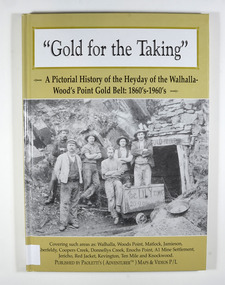
Book - Hardcover book, Gold for the Taking-A Pictorial History of the Heyday of the Walhalla-Wood's Point Gold Belt: 1860's-1960's, 2007
A pictorial history of the heyday of the Walhalla-Wood's Point gold belt in the 1860's-1960'sHardcover. The cover is a gold colour. The front cover has a photograph of a group of miners in front of the entry to a mine. On the top entry timber piece is a sign saying "Old Mine". The beginning of the wording is obscured by one of the miners standing in front of the entry. There is also an old mining trolley standing on tracks which lead into the mine.There is also an old gold mining dish sitting on a rock to the left of the entry into the mine.On the back cover is a photograph of Walhalla in modern times as well as a photograph of the publisher of this book. There is also a blurb about the publisher.Stamp of the Marysville & District Historical Society Inc / P.O. Box 22 / Marysville 3779gold, gold fields, gold mining, a1 mine settlement, aberfeldy, beardmore, black river group, coopers creek, donnellys creek, enochs point, fulton creek, gaffneys creek, gooleys creek, jamieson, jordan valley, kevington, knockwood, matlock, ten mile, walhalla, wood's point, history, victoria -
 Marysville & District Historical Society
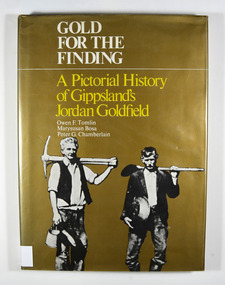
Book - Hardcover book, Gold for the Finding-A Pictorial History of Gippsland's Jordan Goldfield, 1979
... of Gippsland's Jordan goldfield gold gold mining gold mines victoria ...A pictorial history of Gippsland's Jordan goldfieldHardcover. Gold dust cover. Front cover has a photograph of two miners carrying mining equipment.This work is dedicated to the people of the Jordan Goldfields,/ the Pioneers who worked, lived, loved and died in the moun-/ tains of Gippsland, giving us a rich and varied heritage. It is especially dedicated to Mr William Rae, Gentleman, Late of/ Jericho, without whose assistance this work would have/ remained a dream. Stamp of the Marysville & District Historical Society Inc / P.O. Box 22 / Marysville 3779gold, gold mining, gold mines, victoria, gippsland, history, bosa, marysusan, tomlin, owen f., chamberlain, peter g. -
 Marysville & District Historical Society
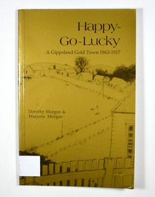
Book - Paperback book, Happy-Go-Lucky-A Gippsland Gold Town 1863-1917, 1987
A history of a gold mining town in the Gippsland area of Victoria Paperback. Gold cover. Cover has a pencil sketch of a gold mining town as well as a large gum tree on the back cover. Cover illustration runs across the whole cover.Stamp of the Marysville & District Historical Society Inc / P.O. Box 22 / Marysville 3779. Sticker - DISTRIBUTED BY: / Paoletti's (Adventurer) Maps P/L / 15 Nirvana Close, / Langwarrin. 3910 / Tel: 03 9789 6985 / Fax: 03 9776 6798 / Email: [email protected] / Other products & information Website: http://users.netlink.com.au/~maptrapgold, gold mining, gold town, gippsland, victoria, australia, history, gold miner, morgan, dorothy, morgan, marjorie -
 Marysville & District Historical Society
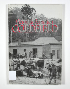
Book - Paperback book, Victoria's Forgotten Goldfield-A History of the Dargo, Crooked River Goldfield, 1996
A history of the Dargo, Crooked River goldfieldPaperback. Cover has a black and white photograph of a couple of buildings surrounded by forest. Photograph is probably of Dargo. One building has a sign that says S. Frankenberg. Another has a sign of which only the letters PION visible. In the photograph there are a number of men standing around the buildings as well as what appears to be two children sitting on a bench outside a building. There is also a large wagon-like vehicle to which is attached are a large train of oxen. In the foreground of the photograph is another group of oxen which appear to be chained together. There is also two men standing near the second group of oxen, both appear to be holding whips.The stamp of the Marysville & District Historical Society Inc / P.O. Box 22 / Marysville 3779gold, gold mining, gold town, dargo, gold miner, gold field, gippsland, victoria, australia, history -
 Marysville & District Historical Society
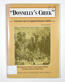
Book - Paperback book, Donnelly's Creek-From rush to ruin of a Gippsland Mountain Goldfield, 1990
A history of the Donnelly's Creek gold mine in VictoriaPaperback. Front cover has a drawing depicting two horses carrying packs followed by a man mounted on a horse. There is also two men on foot following with packs and walking poles. They are walking along a forest track that has some tree stumps alongside it.The back cover has two colour photographs. The top one is of an old wooden building with what appears to be an attached lean to. Both of the buildings have stone chimneys. There is a group of people sitting and standing outside the main building. The bottom photograph appears to be the ruins of a building and a fence. There are three people viewing the ruins.The captions accompanying the photographs are: History revisited - O'Sullivans Old Toombon Hotel Recreated and Remnants of a Bygone Mining Era.Stamp of the Marysville & District Historical Society Inc / P O Box 22 / Marysville 3779gold, gold miner, gold mining, gold field, gippsland, victoria, australia, history, fulton's creek, seaton, walhalla, aberfeldy, jericho, wood's point -
 Marysville & District Historical Society
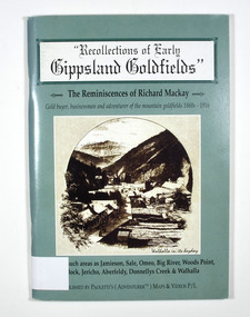
Book - Paperback book, Recollections of Early Gippsland Goldfields-The Reminiscences of Richard Mackay, 2000
Recollections by Richard Mackay of the early history of the Gippsland goldfieldsPaperback. Cover is green. Front cover has a sepia photograph of a drawing with the caption 'Walhalla in its heyday. Back cover has a photograph of an old building with a sign on it that says 'Copper Mine Hotel'. There is a man standing in front of the building. In the foreground is a four wheel drive vehicle.Stamp of the Marysville & District Historical Society Inc / P.O. Box 22 / Marysville 3779gold, gold fields, gold miner, gold mining, gold town, gippsland, victoria, australia, history, jamieson, sale, omeo, big river, wood's point, matlock, jericho, aberfeldy, donnelly's creek, walhalla -
 Marysville & District Historical Society
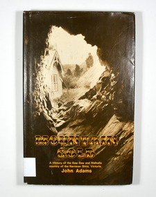
Book - Hardback book, Mountain Gold-A History of the Baw Baw and Walhalla country of the Narracan Shire, Victoria, 1980
A history of the Baw Baw and Walhalla country of the Narracan Shire, VictoriaHardback. Brown dust cover. Photograph on front cover looks out from the entry of a mine onto the front of a building which has a hill to the side of it. The back cover has a photograph of the side of a hill with some trees on it.G&V THOMAS Stamp of the Marysville & District Historical Society Inc / P.O. Box 22 / Marysville 3779gold, gold field, gold miner, gold mining, gold town, walhalla, baw baw, gippsland, victoria, australia, history -
 Marysville & District Historical Society
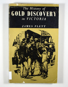
Book - Paperback book, The History of Gold Discovery in Victoria, 1979
... discovery in Victoria gold gold field gold miner gold mining gold ...A history of gold discovery in VictoriaPaperback. Gold front cover. Front cover has a drawing of a group of miners outside a shop. Back cover has a drawing of a group of mounted police riding roughshod through a group of people and dogs.Stamp of the Marysville & District Historical Society Inc / P.O. Box 22 / Marysville 3779gold, gold field, gold miner, gold mining, gold town, victoria, australia, history -
 Marysville & District Historical Society
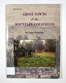
Book - Paperback book, Ghost Towns of the Mountain Goldfields, 1999
Ghost towns of the mountain goldfields in VictoriaPaperback. Cover has a drawing depicting horses, both ridden and pack, walking along a forest track on their way to a small town. There are heavily forested mountains in the distance. Overlaid onto the drawing is a modern photograph of an old stone building. In the foreground is a green timber building with a water tank and verandah. It is all set in the clearing in the middle of a forest.Stamp of the Marysville & District Historical Society Inc / P.O. Box 22 / Marysville 3779 Also the inscription: To Alma / Thanks for your help / Signature / LS / November 1999gold, gold mining, gold town, ghost town, victoria, australia, history -
 Marysville & District Historical Society
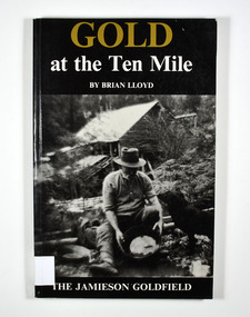
Book, Gold at the Ten Mile-The Jamieson Goldfield, 1995
... of the Jamieson gold field gold mines gold mining victoria jamieson ...A history of the Jamieson gold fieldPaperback. Black cover. Front cover has a photograph of a man gold panning with his dog in a river. In the background is an old wooden house.To the memory of my great grandfather Tom Allen,/ my grandfather Jim, Wray, my father Ben Lloyd and/ his uncle, Charlie Lloyd - all seekers of gold at the/ Ten Mile. Stamp of the Marysville & District Historical Society Inc / P.O. Box 22 / Marysville 3779 Stamp of the Marysville & District / Historical Society Inc.gold mines, gold mining, victoria, jamieson district, australia, history -
 Marysville & District Historical Society
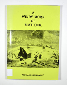
Book, A Windy Morn of Matlock, 1998
A history of the town of Matlock, VictoriaPaperback. Green cover. Front cover has a drawing depicting two men with packs and walking poles walking through knee deep snow past a wooden hut. In the background are several tree stumps and a small town of wooden buildings.For/ James and Lucienne/ Bailey Stamp of the Marysville & District Historical Society Inc / P.O. Box 22 / Marysville 3779gold mining, gold mine, matlock, victoria, australia, history, anne bailey, robin bailey -
 Marysville & District Historical Society
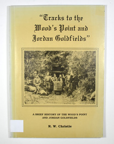
Book, Tracks to the Wood's Point and Jordan Goldfields-A brief history of the Wood's Point and Jordan Goldfields
A history of the Wood's Point and Jordan gold fieldsPaperback. Beige cover. Front cover has a black and white photograph of miners standing and sitting around a mine cart that is sitting on railway tracks at the entrance to a mine.Back cover has a cartoon drawing of a pack horse that has fallen down a cliff with his rider trying to pull him back up by his tail. Inside the cover is a drawn map entitled 'Map of the Mining District round Wood's point'.Stamp of the Marysville & District Historical Society Inc / P.O. Box 22 / Marysville 3779 gold, gold field, gold mining, gold town, wood's point, jordan goldfields, victoria, australia, history, r w christie -
 Marysville & District Historical Society
Book, Tracks to the Wood's Point and Jordan Goldfields-A brief history of the Wood's Point and Jordan Goldfields
A history of the Wood's Point and Jordan gold fieldsPaperback. Beige cover. Front cover has a black and white photograph of miners standing and sitting around a mine cart that is sitting on railway tracks at the entrance to a mine.Back cover has a cartoon drawing of a pack horse that has fallen down a cliff with his rider trying to pull him back up by his tail. Inside the cover is a drawn map entitled 'Map of the Mining District round Wood's point'.Stamp of Marysville & District / Historical Society Inc / P.O. Box 22 / Marysville 3779 gold, gold field, gold mining, gold town, wood's point, jordan goldfields, victoria, australia, history, r w christie -
 Marysville & District Historical Society
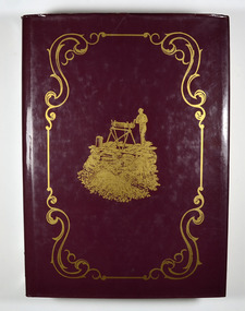
Book, The Goldfields and Mineral Districts of Victoria, 1980
A history of the goldfields and mineral districts of VictoriaHardcover. Front cover has an illustration of a miner standing next to a hole in the ground which is surrounded by logs. He is standing on top of a platform made out of planks of wood and he is turning a handle on a hand winch to bring up a bucket.Stamp of the Marysville & District Historical Society Inc / P.O. Box 22 / Marysville 3779gold mining, gold mine, mineral resources, victoria, australia, history, robert brough smyth -
 Federation University Historical Collection
Book - Book - Scrapbook, Ballarat College of Advanced Education: Scrapbook of newspaper cutting, Book 13; May 1983 to October 1983
Newspaper cuttings relating to Ballarat College of Advanced Education. These are from various newspapers and include The Age, Ballarat Courier, The Australian, The Herald. The cuttings cover the period from 23 May 1983 to 26 October 1983. . Book with beige cover, front. Spiral bound.employment advertisements, application for enrolment, outline of courses, deputation to see minister re gas levy, role for colleges, computing at bcae, engineering students may transfer, institutions fear information act, bust of prof smith presented to smb, western mining corporation awards, john de vries, ian carroll, wayne herbertson, soil conservationists, bust of dick richards, chinese actress visits ballarat, bcae host to hundreds, tertiary orientation program, russian violinist at founders hall, teachers not out of touch, employment prospects for teacher graduates, bcae open day, dr alan reid from csiro, short course on micro computers, victoria howlett potter, charles fahey on oral histories, computers becoming part of school system, mining raises living standards, antarctic oldtimer remembers, ethel reynolds - sculptor, tribute in bronze, dick richards, beaufort house 'home for students', jacqueline culvenor - potter, deaf and smart, `students condemn council sacking, brendan mcauley, jump rope for heart, students give papers on engineering projects, australians lucky says uk artist, selwyn hoffman shows in exhibition -
Federation University Historical Collection
Book, Digging for Gold: A guide to researching family and local history in Victoria's Central Goldfields, 1988
Yellow covered book of 121 pagesnon-fictiongold, mining, genealogy, family history, local history, localities, historical societies -
 Federation University Historical Collection
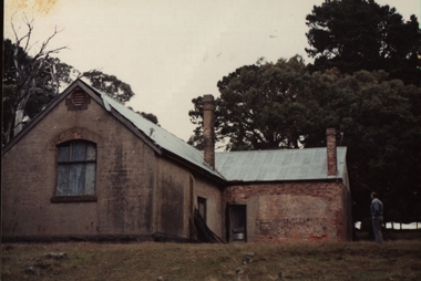
Photograph - Photograph - Colour, Happy Valley School, 1985
This photo was taken in 1985. Alf Watson, a descendent of settlers of the district - the Smiths and the Yungs whose children attended this school, is standing to the right of the building. The history of Happy Valley State School 1863 The school opened as Lucky Woman's in 1863. The school was located in the Linton area, a small mining township. The first head teacher was Thomas Lea. 89 students had enrolled. 1883 The name of the school changed to Happy Valley. The brick school building was built in this period. 1920s Enrolment declined in the 1920s to around 10 students. 1932 Enrolment continued to decline and the school was closed. 1933 The school reopened briefly under head teacher Selina McFarlane. 1936 It closed again at some stage before reopening in 1936 under head teacher Maxwell Brown. The school was closed finally in 1936. 1940 The building was sold. 150 years: Happy Valley State School Learn about the history of Happy Valley State School, one of Victoria’s oldest public schools. Key information Address: Ballarat, 3350 Opened: 1 February 1860 Closed: 31 December 1940 School type: Primary School number: 376 Other names: Lucky Woman's Common School, Lucky Woman's State School Search for more school profiles The history of Happy Valley State School 1863 The school opened as Lucky Woman's in 1863. The school was located in the Linton area, a small mining township. The first head teacher was Thomas Lea. 89 students had enrolled. 1883 The name of the school changed to Happy Valley. The brick school building was built in this period. 1920s Enrolment declined in the 1920s to around 10 students. 1932 Enrolment continued to decline and the school was closed. 1933 The school reopened briefly under head teacher Selina McFarlane. 1936 It closed again at some stage before reopening in 1936 under head teacher Maxwell Brown. The school was closed finally in 1936. 1940 The building was sold. Can you help us find records for this school? The Public Record Office Victoria (PROV) only hold historical correspondence records for this closed school. If you have any, or if you know of any, please let us know by emailing [email protected] Updated 19 May 2022.1 Happy Valley State School photographed in June 1985. Alf Watson observing the building. .2 View from the back and side of the Happy Valley State School.1 Verso: Grandma Watson's school Happy Valley June 1985 (Grandma nearly 97 years) Alf in bacckground. Edith Emma Watson b Yung. Alf - son of Edith and John Richard Watson. .2 Verso: School where Grandma Watson eudcated. Happy Valley. June 1985happy valley state school, lucky womans, lucky woman's common school, lucky woman's state school