Showing 51 items matching "moorabool river"
-
 National Wool Museum
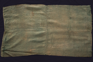
Textile - Green Wheat Bag Wagga, Percy Perkins, 1945
Mr Perkins joined the police force in his early twenties and apart from an 18-month posting in Melbourne, spent the rest of his career serving communities in country Victoria. He was a keen fisherman and hunter- his first love was sitting on the banks of the Murray River with a fishing rod in his hand. Family camping trips were spent by the river where everyone slept on stretchers with several army blankets underneath and a wheat bag wagga on top. The green colour of this wagga is from "Dekkol" a preservative which Mr Perkins used to protect his cotton fishing nets from rotting.Quilt made of two standard size jute wheat bags (a bushel = 150lbs) split and hand bound along seams.It is an example of the basic type of wagga made by shearers, farmers or swagmen. The green colour results from the application of "Dekkol" a preservative used for cotton fishing nets.quilting history, running stitch group, running stitch collection, highlights of the national wool museum: from waggas to the wool quilt prize - exhibition (22/09/2001 - 02/12/2001), perkins, mr percy, quilting - history -
 National Wool Museum
Shoes
Australian womens shoes from the formal uniform for the Sydney 2000 Olympic Games. Manufactured by Rivers Shoes.fashion, woolmark company rivers shoes, sport, the woolmark company 2000 australian olympic display - exhibition (21/12/2001 - 24/05/2002) -
National Wool Museum
Shoes
Australian mens shoes from the formal uniform for the Sydney 2000 Olympic Games. Manufactured by Rivers Shoes.fashion, woolmark company rivers shoes, sport, the woolmark company 2000 australian olympic display - exhibition (21/12/2001 - 24/05/2002) -
 National Wool Museum
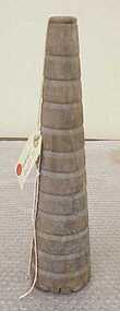
Spindle
Was found washed up on bank of Barwon River at Marshall. Object is marked GK probably an abbreviation for Geelong Knitwear or George Kinnear.GK -
 Ballarat Tramway Museum
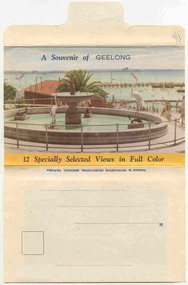
Postcard - Folder set, Nu-color-vue or Nucolorvue Productions, "A Souvenir of Geelong", 1950's
Set of 12 colour views of Geelong on a folded strip, glued within a colour printed cover, titled "A Souvenir of Geelong", printed on both sides of the strip. Booklet printed with an address area on rear. Produced by Nulcolorvue Productions, Mentone, Victoria. The rear has a slit on the rear cover that allowed the folder to be secured. On the inside of the front cover, has an introduction to Geelong, notes "modern tram and bus routes" Pictures are: 1. Gheringhap St showing Geelong City Hall and Post Office 2. The Barwon River, Geelong 3. T&G Building, Ryrie St - shows tramway overhead 4. Christ Church, Moorabool St 5. Malop St Geelong 6. Art Gallery and Park 7. St Marys Roman Catholic Cathedral 8. The Geelong Post Office with buses in background and a Safety Zone sign 9. Moorabool St Geelong - has overhead and a bar traffic light/ 10. Queens Park Geelong 11. The Waterfront at Geelong. 12. Eastern Beach Swimming Pool. Made during the early 1950's, given motor cars in the photo. trams, tramways, geelong, moorabool st, ryrie st -
 Ballarat Tramway Museum
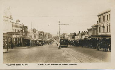
Postcard, Moorabool St, Geelong with Birney No. 14
Postcard contained within the Wal Jack Bendigo and Geelong Album, see Reg Item 5003 for more details. Valentine Series Postcard, No. 498 looking north along Moorabool St, Geelong with Birney No. 14 approaching the camera on the single line section. The tram has the destination of South (prior to extension from the Barwon River to Belmont in 1927) and is fitted with two trolley poles. There are two other trams in the photograph along with many motor vehicles and horse drawn vehicles - mid 1920's. Moorabool St has centre poles. In the photo are Sully's National Hotel, White Hart Hotel, Leitch Cycles and sports goods and a T&G building (prior to the new one being built?). Published by Valentines Publishing Co of Queen St Melbourne. See related documents for a email from Richard Gilbert providing further documents.trams, tramways, south, belmont, geelong, moorabool, tram 37, tram 36 -
 National Wool Museum
Badge
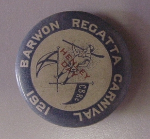
Badge produced as a souvenir of the Barwon River rowing regatta (Henley Day, after Henley-on-the-Thames in England where the public schools and universities compete in rowing races) held in 1921. The initials CBRC are probably for a local rowing club.BARWON REGATTA CARNIVAL 1921 / HENLEY / DAY / CBRCsport -
 National Wool Museum
Textile - Cloak, Dr Deanne Gilson, Bundjil the Eagle Creator Spirit Cloak, 2022
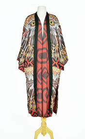
Standing proud, still here, the spirit of ten ancestral matriarchs adorned in contemporary ceremonial cloaks. Representing our women past, present and future, her Spirit, our culture, our Country (spelt with a capital for its importance and this is part of First Peoples protocols on acknowledging Country, our strength, our resilience and healing towards a sustainable future). Bunjil the eagle used to be a man called Karringalabil. As a man he created the first man and woman out of bark from the sacred manna gum tree and clay from the river bed. He created the plants, animals, mountains, waterways, sky and under Country. After which he turned himself into an eagle. He has two wives, Kunuwarra the black swan sisters. After he completed all of creation he flew up into the sky at Lal Lal Falls and he now watched over us as a star in the night sky and as an eagle by day.Brown, red and white tone feather motif with yellow eye design on outer clock, red and black diamond and circle design in lining. Solid black trimming. Cloak is machine sewn and handstitched with hand stitching on shoulder seam.deanne gilson, wadawurrung dja, first nations art, cloak -
 National Wool Museum
Book - A Forecast of the textile vogues for the coming season from R. S. & S. Woollen Mill, Geelong Part IV, Returned Soldiers and Sailors Mill, 1941
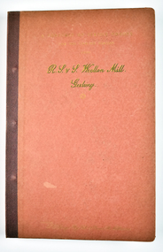
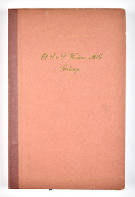
The Returned Soldiers and Sailors Mills was located near the Barwon river on Pakington Street, Geelong, where its building still stands. The mill was established in October 1922 with capital acquired from War Gratuity Bonds. The mill produced fine grade woollen products with its speciality being ‘Retsol’ travelling rugs.31 page red book bound with metal pins containing fabric samples glued onto paper, with some printed text.cover: [printed] A FORECAST OF TEXTILE VOGUES / FOR THE COMING SEASON / FROM / R. S. & S. Woollen Mill. / Geelongr. s. & s mill, soldiers, sailors, geelong, war, wool, mill -
 National Wool Museum
Book - A Forecast of the textile vogues for the coming season from R. S. & S. Woollen Mill, Geelong Part 1, Returned Soldiers and Sailors Mill, 1941
The Returned Soldiers and Sailors Mills was located near the Barwon river on Pakington Street, Geelong, where its building still stands. The mill was established in October 1922 with capital acquired from War Gratuity Bonds. The mill produced fine grade woollen products with its speciality being ‘Retsol’ travelling rugs.25 page red book bound with metal pins containing fabric samples glued onto paper, with some printed text.cover: [printed] A FORECAST OF TEXTILE VOGUES / FOR THE COMING SEASON / FROM / R. S. & S. Woollen Mill. / Geelongr. s. & s mill, soldiers, sailors, geelong, war, wool, mill -
 National Wool Museum
Album - Photo Album, 2 of 3, J W Allen, 1928-1929
This album is one of three albums compiled and owned by J W Allen, Secretary of New South Wales Grazier's, and is associated with the New South Wales Graziers Association world tour of sheep 1928-1929. This album contains photographs of travel, sheep, farms, stations, people and landscapes from around the world. Locations include Kenya, Kinangop, Naivasha, Elementeita, Lake Nakuru, Njoro, Namibia, Otjihavera, Mt Kenya, Isiolo, Yemen, Aden, Suez, River Jordan, Jerusalem, Hebron, Bethlehem, Beersheba, Galilee, Lake Tiberias, Mt Hermon, Canada, Mt Robson, Fraser River Canyon, British Columbia, Merrit, Canford, Alberta, Cardston, Pekisko Creek, Turner Valley, Calgary, Saskatoon, Manitoba, Winnipeg, Portage la Prairie, Niagara Falls, Quebec, Sainte-Anne-de-la-Pocatière and St Lawrence River. Properties depicted include Kenton Estates, Kekopey Ranch, Soysambu Ranch, Larmudiac, SX Ranch, Neilson's Ranch, EP Ranch and CX Ranch. The album was found in a clean out at the Great Southern Agricultural Research Institute and donated to the National Wool Museum, along with other related material such as photographs, glass lantern slides and ephemera.Photo album with card cover and silk string binding. Inside are twenty four pages of brown carded paper with black and white photos and hand written black text. A white piece of paper with hand written text has been added to the inside front page.new south wales graziers association, world tour, sheep, farm, rural, agriculture, ranch, travel, kenton estates, kekopey ranch, soysambu ranch, larmudiac, sx ranch, neilson's ranch, ep ranch, cx ranch, kenya, kinangop, naivasha, elementeita, lake nakuru, njoro, namibia, otjihavera, mt kenya, isiolo, yemen, aden, suez, river jordan, jerusalem, hebron, bethlehem, beersheba, galilee, lake tiberias, mt hermon, canada, mt robson, fraser river canyon, british columbia, merrit, canford, alberta, cardston, turner valley, pekisko creek, calgary, saskatoon, manitoba, winnipeg, portage la prairie, niagara falls, quebec, sainte-anne-de-la-pocatiere, st lawrence river -
 National Wool Museum
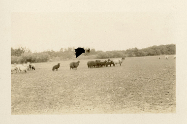
Photograph - Karakul Sheep, J W Allen, 1928-1929
This photograph was found loose in the second of three albums compiled and owned by J W Allen, Secretary of New South Wales Grazier's, and is associated with the New South Wales Graziers Association world tour of sheep 1928-1929. The album contains photographs of travel, sheep, farms, stations, people and landscapes from around the world. Locations include Kenya, Kinangop, Naivasha, Elementeita, Lake Nakuru, Njoro, Namibia, Otjihavera, Mt Kenya, Isiolo, Yemen, Aden, Suez, River Jordan, Jerusalem, Hebron, Bethlehem, Beersheba, Galilee, Lake Tiberias, Mt Hermon, Canada, Mt Robson, Fraser River Canyon, British Columbia, Merrit, Canford, Alberta, Cardston, Pekisko Creek, Turner Valley, Calgary, Saskatoon, Manitoba, Winnipeg, Portage la Prairie, Niagara Falls, Quebec, Sainte-Anne-de-la-Pocatière and St Lawrence River. Properties depicted include Kenton Estates, Kekopey Ranch, Soysambu Ranch, Larmudiac, SX Ranch, Neilson's Ranch, EP Ranch and CX Ranch. The album was found in a clean out at the Great Southern Agricultural Research Institute and donated to the National Wool Museum, along with other related material such as photographs, glass lantern slides and ephemera.Black and white image showing sheep in a paddock.world tour, sheep, graziers, photograph, karakul, winnipeg, canada, manitoba, agriculture -
 National Wool Museum
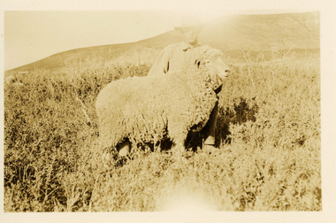
Photograph - 'Harvey' Ram at Neilson's Ranch, J W Allen, 1928-1929
This photograph was found loose in the second of three albums compiled and owned by J W Allen, Secretary of New South Wales Grazier's, and is associated with the New South Wales Graziers Association world tour of sheep 1928-1929. The album contains photographs of travel, sheep, farms, stations, people and landscapes from around the world. Locations include Kenya, Kinangop, Naivasha, Elementeita, Lake Nakuru, Njoro, Namibia, Otjihavera, Mt Kenya, Isiolo, Yemen, Aden, Suez, River Jordan, Jerusalem, Hebron, Bethlehem, Beersheba, Galilee, Lake Tiberias, Mt Hermon, Canada, Mt Robson, Fraser River Canyon, British Columbia, Merrit, Canford, Alberta, Cardston, Pekisko Creek, Turner Valley, Calgary, Saskatoon, Manitoba, Winnipeg, Portage la Prairie, Niagara Falls, Quebec, Sainte-Anne-de-la-Pocatière and St Lawrence River. Properties depicted include Kenton Estates, Kekopey Ranch, Soysambu Ranch, Larmudiac, SX Ranch, Neilson's Ranch, EP Ranch and CX Ranch. The album was found in a clean out at the Great Southern Agricultural Research Institute and donated to the National Wool Museum, along with other related material such as photographs, glass lantern slides and ephemera.Black and white image showing a man and a sheep in the foreground with mountains in the background.Back: [handwritten] Harvey ram / at Neilson’s / Harvey / Neilson’s ranch [printed] A 40world tour, sheep, graziers, photograph, canada, agriculture, cardtson, alberta -
 National Wool Museum
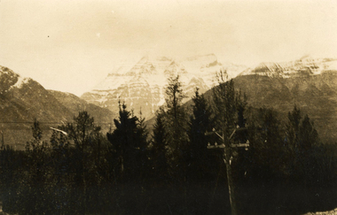
Photograph - Mount Robson, J W Allen, 1928-1929
This photograph was found loose in the second of three albums compiled and owned by J W Allen, Secretary of New South Wales Grazier's, and is associated with the New South Wales Graziers Association world tour of sheep 1928-1929. The album contains photographs of travel, sheep, farms, stations, people and landscapes from around the world. Locations include Kenya, Kinangop, Naivasha, Elementeita, Lake Nakuru, Njoro, Namibia, Otjihavera, Mt Kenya, Isiolo, Yemen, Aden, Suez, River Jordan, Jerusalem, Hebron, Bethlehem, Beersheba, Galilee, Lake Tiberias, Mt Hermon, Canada, Mt Robson, Fraser River Canyon, British Columbia, Merrit, Canford, Alberta, Cardston, Pekisko Creek, Turner Valley, Calgary, Saskatoon, Manitoba, Winnipeg, Portage la Prairie, Niagara Falls, Quebec, Sainte-Anne-de-la-Pocatière and St Lawrence River. Properties depicted include Kenton Estates, Kekopey Ranch, Soysambu Ranch, Larmudiac, SX Ranch, Neilson's Ranch, EP Ranch and CX Ranch. The album was found in a clean out at the Great Southern Agricultural Research Institute and donated to the National Wool Museum, along with other related material such as photographs, glass lantern slides and ephemera.Black and white image showing trees, power pole and power lines in the foreground and snow covered mountains in the background. world tour, sheep, graziers, photograph, canada, agriculture, british columbia, mount robson, mt robson -
 National Wool Museum
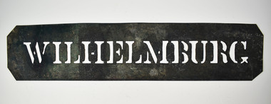
Stencil - WILHELMBURG
This stencil was used as a location stamp for the transportation of wool bales. Wilhelmburg is a quarter of Hamburg, Germany, on the banks of the River Elbe. Wool bales marked WILHELMBURG would have been transported to Wilhelmburg by sea.Wool bale export stencil - WILHELMBURGWILHELMBURGwool sales, wool transportation, wool export -
 National Wool Museum
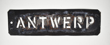
Stencil - ANTWERP
This stencil was used as a location stamp for the transportation of wool bales. Antwerp is a port city on Belgium’s River Scheldt. Wool bales marked ANTWERP would have been transported to Belgium by sea.Wool bale stencil - ANTWERPANTWERPwool - transportation, wool sales -
 National Wool Museum
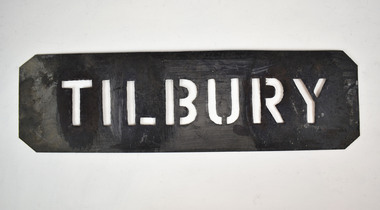
Stencil - TILBURY
This stencil was used as a location stamp for the transportation of wool bales. Tilbury is a port located on the River Thames at Tilbury in Essex, England. Wool bales marked TILBURY would have been transported to England by sea.Wool bale export stencil - TILBURYTILBURYwool - transportation, wool sales, wool class, wool classers -
Bacchus Marsh & District Historical Society
Plaque, Shire of Bacchus Marsh Coat of Arms
Coat of Arms used by the Shire of Bacchus Marsh in the 1980s and 1990s. A coat of arms has been in use in the Shire at least from the early 20th century. This earlier coat of arms described in 1910 featured two cows standing on two bales of lucerne hay, with lucerne fields and fruit trees and rolling hills all round a central valley with two rivers running through it. This early coat of arms was superseded by the slightly different design shown here. When this change took place is not known. When the Bacchus Marsh Shire amalgamated with other Shires to form Moorabool Shire in 1994 this design was superseded.The plaque showing the Bacchus Marsh Shire Coat of Arms is in near perfect condition and as such is an excellent example of the physical symbols used to demonstrate the presence of local government in the Bacchus Marsh region. The images on the coat of arms also depict key economic and agricultural activities in the region which provides historical information about the region in a visual and artistic way.Painted cast bronze plaque with inscription on outer white band in black capital lettering: SHIRE OF BACCHUS MARSH. Inner circle painted blue with shield and decorative branches bearing yellow leaves on either side. Shield quartered and surmounted by stylised sunrise. In four quarters, representations of significant local primary and secondary industries. SHIRE OF BACCHUS MARSH.coats of arms, shire of bacchus marsh -
 Melton City Libraries
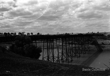
Photograph, Melton Viaduct, 1976
The Melton Viaduct, opened in 1886, is one of Australia’s largest early metal bridges. When opened it was the second longest Australian metal truss bridge, after the 1862 Moorabool railway viaduct (396 metres).The Melton Viaduct is a trestle bridge over the Werribee River (now Melton Reservoir)transport -
 Ballarat Tramway Museum
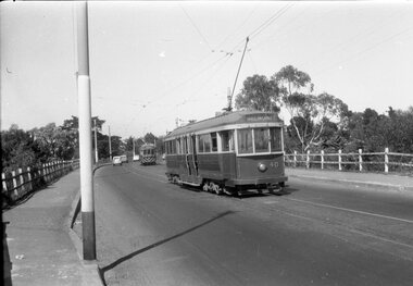
Negative - Geelong trams 33 & 40 Barwon Bridge, Laurie Gallop, early 1956
Photo shows Geelong trams 33 & 40 in Moorabool St just south of the Barwon Bridge on the long crossing loop. Based on the running board at item 8267, most likely tram No. 33. One of a set of photos was taken between 15/2/1956 and 3/3/1956 when services operated only between Belmont and North before the final closure of the Belmont route on 25/31956 and that bogie tram 31 is not shown on the board, having gone to Ballarat on 15/2/1956 - see item 5554. See item 8213 for an article on the Geelong system by Keith Kings. Yields information about the Geelong operations toward the closure of the tram system.Black and white Negative - 120 sizetramways, geelong, moorabool st, tram 33, tram 40, barwon river -
 Federation University Historical Collection
Book, Final recommendations Ballarat Study Area Land Conservation Council, Victoria, 1982, 1982
Yellow soft covered report of 95 pages . The contents of the report include: Parks, reference areas, wildlife reserves, water production, hardwood production, softwood production, flora Reserves and Flora and Fauna reserves, bushland reserves, historic area and reserves, rivers and streams, Roadside conservation and Highway parks, Education areas and School Plantations, Lake Reserves, geological reserves, recreation, scenic reserves, agriculture, mineral and stone production, utilities and survey, township land, Uncommitted Land, military training, other reserves and public land. Maps include: The Study area 1: 250 000 Supplementary Mapsland conservation authority, ballarat, endowment plantations, pine plantations, langi ghiran state park, mount buangor state park, enfield state park, ballarat-creswick regional park, rossbridge, black lake, flax mill swamp, dereel lagoon, lake bolac, lake wongan, langi ghiran reservoir, gong gong reservoir, pincotts reservoir, beales reservoir, wilsons reservoir, moorabool reservoir, korweinguboora, korweinguborra reservoir, learmonth bores, sago hill, illabarook reservoir, ballarat water commission, dunneworthy, mount cole, mont lonarch, ben major, waterloo, trawalla, linton, ross creek, canadian, shepherds flat, lal lal, mount doran, raglan, chute, carngham, buninyong, watsons hill, enfield, cape clear, illabrook, rokewood junction, mount warrenheip, nerrina, jubilee, golden stream, australasian deep lead mine, happy valley school, piggoreet, berringa, bulldog, ballarat common, wildlife, water, timber, flora, rivers, geology, agriculture, warrenheip, biodiversity