Showing 60 items
matching mountain trail
-
 Eltham District Historical Society Inc
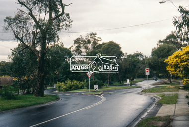
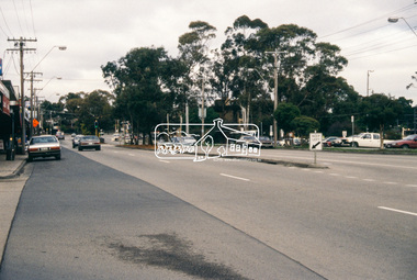
Slide - Photograph, Grand Boulevard, Montmorency, c.Aug. 1990
Part of a presentation, "Roads and Byways of the Shire of Eltham", by Russell Yeoman to the 12 September 1990 Society meeting. Slides shown included copies of old photos and recent images ranging from the suburban streets of Eltham and Montmorency to the mountain roads of Kinglake. In the byways category are views of some iof the Shire's bicycle paths including then recently completed sections of the Main Yarra Trail at Lower Plenty.35mm colour positive transparency (1 of 37) Mount - Agfachrome Agfa CS System black 8 dotsinfrastructure, roads, grand boulevard, montmorency -
 Eltham District Historical Society Inc
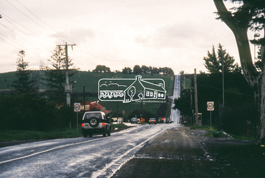
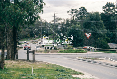
Slide - Photograph, Kangaroo Ground Supply Store, Eltham-Yarra Glen Road, Kangaroo Ground, c.Aug. 1990
Part of a presentation, "Roads and Byways of the Shire of Eltham", by Russell Yeoman to the 12 September 1990 Society meeting. Slides shown included copies of old photos and recent images ranging from the suburban streets of Eltham and Montmorency to the mountain roads of Kinglake. In the byways category are views of some iof the Shire's bicycle paths including then recently completed sections of the Main Yarra Trail at Lower Plenty.35mm colour positive transparency (1 of 37) Mount - Agfachrome Agfa CS System black 8 dotsinfrastructure, roads, eltham-yarra glen road, kangaroo ground, kangaroo ground store, kangaroo ground supply store -
 Eltham District Historical Society Inc
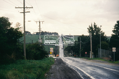
Slide - Photograph, Eltham-Yarra Glen Road, Kangaroo Ground, c.Aug. 1990
Part of a presentation, "Roads and Byways of the Shire of Eltham", by Russell Yeoman to the 12 September 1990 Society meeting. Slides shown included copies of old photos and recent images ranging from the suburban streets of Eltham and Montmorency to the mountain roads of Kinglake. In the byways category are views of some iof the Shire's bicycle paths including then recently completed sections of the Main Yarra Trail at Lower Plenty.35mm colour positive transparency (1 of 37) Mount - Agfachrome Agfa CS System black 8 dotsinfrastructure, roads, eltham-yarra glen road, kangaroo ground, kangaroo ground store, kangaroo ground supply store -
 Eltham District Historical Society Inc
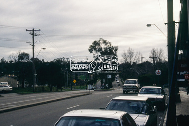
Slide - Photograph, Shopping Centre, Main Road, Eltham, c.Aug. 1990
Part of a presentation, "Roads and Byways of the Shire of Eltham", by Russell Yeoman to the 12 September 1990 Society meeting. Slides shown included copies of old photos and recent images ranging from the suburban streets of Eltham and Montmorency to the mountain roads of Kinglake. In the byways category are views of some iof the Shire's bicycle paths including then recently completed sections of the Main Yarra Trail at Lower Plenty.35mm colour positive transparency (1 of 37) Mount - Agfachrome Agfa CS System black 8 dotsinfrastructure, roads, eltham, luck street, main road, shopping centre -
 Eltham District Historical Society Inc
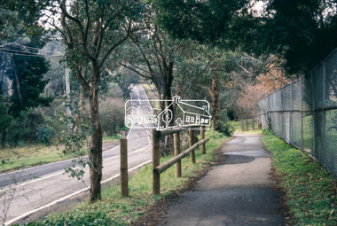
Slide - Photograph, Main Road, Research, c.Aug. 1990
Part of a presentation, "Roads and Byways of the Shire of Eltham", by Russell Yeoman to the 12 September 1990 Society meeting. Slides shown included copies of old photos and recent images ranging from the suburban streets of Eltham and Montmorency to the mountain roads of Kinglake. In the byways category are views of some iof the Shire's bicycle paths including then recently completed sections of the Main Yarra Trail at Lower Plenty.35mm colour positive transparency (1 of 37) Mount - Agfachrome Agfa CS System black 8 dotsinfrastructure, roads, ingrams road, main road, raglan road, research (vic.) -
 Eltham District Historical Society Inc
Slide - Photograph, Ingrams Road, Research, c.Aug. 1990
Part of a presentation, "Roads and Byways of the Shire of Eltham", by Russell Yeoman to the 12 September 1990 Society meeting. Slides shown included copies of old photos and recent images ranging from the suburban streets of Eltham and Montmorency to the mountain roads of Kinglake. In the byways category are views of some iof the Shire's bicycle paths including then recently completed sections of the Main Yarra Trail at Lower Plenty.35mm colour positive transparency (1 of 37) Mount - Agfachrome Agfa CS System black 8 dotsinfrastructure, roads, ingrams road, research (vic.), research preschool -
 Eltham District Historical Society Inc
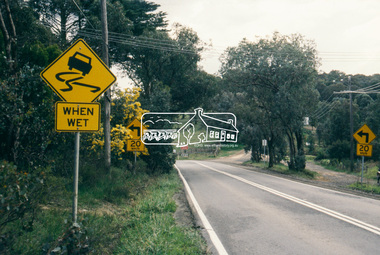
Slide - Photograph, Eltham-Yarra Glen Road, Research, c.Aug. 1990
Part of a presentation, "Roads and Byways of the Shire of Eltham", by Russell Yeoman to the 12 September 1990 Society meeting. Slides shown included copies of old photos and recent images ranging from the suburban streets of Eltham and Montmorency to the mountain roads of Kinglake. In the byways category are views of some iof the Shire's bicycle paths including then recently completed sections of the Main Yarra Trail at Lower Plenty.35mm colour positive transparency (1 of 37) Mount - Agfachrome Agfa CS System black 8 dotsinfrastructure, roads, research (vic.), cassells road, eltham-yarra glen road -
 Eltham District Historical Society Inc
Slide - Photograph, Eltham-Yarra Glen Road, Research, c.Aug. 1990
Part of a presentation, "Roads and Byways of the Shire of Eltham", by Russell Yeoman to the 12 September 1990 Society meeting. Slides shown included copies of old photos and recent images ranging from the suburban streets of Eltham and Montmorency to the mountain roads of Kinglake. In the byways category are views of some iof the Shire's bicycle paths including then recently completed sections of the Main Yarra Trail at Lower Plenty.35mm colour positive transparency (1 of 37) Mount - Agfachrome Agfa CS System black 8 dotsinfrastructure, roads, research (vic.), eltham-yarra glen road -
 Eltham District Historical Society Inc
Slide - Photograph, Catherine Court, Eltham, c.Aug. 1990
Part of a presentation, "Roads and Byways of the Shire of Eltham", by Russell Yeoman to the 12 September 1990 Society meeting. Slides shown included copies of old photos and recent images ranging from the suburban streets of Eltham and Montmorency to the mountain roads of Kinglake. In the byways category are views of some iof the Shire's bicycle paths including then recently completed sections of the Main Yarra Trail at Lower Plenty.35mm colour positive transparency (1 of 37) Mount - Agfachrome Agfa CS System black 8 dotsinfrastructure, roads, catherine court, eltham -
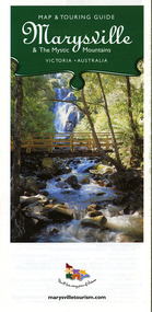
 Marysville & District Historical Society
Map (Item) - Map and touring guide, Murrindindi Regional Tourism Association Inc, Marysville & The Mystic Mountains VICTORIA-AUSTRALIA, 08-2002
A fold out map and touring guide of Marysville and the surrounding district published in 2002 by Murrindindi Regional Tourism Association Inc.A fold out map and touring guide of Marysville and the surrounding district published in 2002 by Murrindindi Regional Tourism Association Inc.marysville, victoria, australia, map and touring guide, mystic mountains tourism, the beeches rainforest walk, lake mountain, cambarville, cathedral range state park, the cumberland, abbey green b&b cottages, anastasia fairytale cottage, ashlar cottage b&b, somerled mountain retreat, baree mudbrick cottages, blackwood cottages, camellia cottage, cathedral view b&b, cottage riverside, crossways country inn, dalrymples guest cottages, esa country ministries, hillcrest, keppels hotel motel, kerami house, lomatia lodge, lyell guest cottages, marylands country house, marysville caravan park, marysville holiday cottages, maryton park, melina cottage, moondai farm b&b, mountain lodge marysville, mount cathedral lodge, mystic mountains holiday cottages, nanda binya lodge, rendezvous on murchison, scenic b&b, the hermitage, tower motel, waratah house, willowbank at taggerty, woodlands of narbethong, keppels, lake mountain resort cafe, lanterns at willowbank, mantirri blueberry farm, marysville country bakery, the old woolshed cafe, clearstream olives, uncle fred & aunty val's old style lolly shop, acheron valley alpacas country store & gallery, bruno's art and sculpture garden, country touch, things of sand & stone, willowbank gallery, marysville auto & hardware, marysville newsagency & general store, marysville visitor information centre, narbethong visitor information centre, gallipoli park, keppels lookout, lady talbot drive, steavenson falls, steavenson river, taggerty river, acheron river, black spur trail riding centre, buxton trout farm, lake mountain resort ski hire, lake mountain ski school, marysville district country club, marysville ski centre, narbethong ski hire, rubicon horse riding, country touch tours, murrindindi regional tourism association inc -
 Marysville & District Historical Society
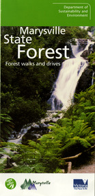
Ephemera (Item) - Information brochure, Department of Sustainability and Environment, Marysville State Forest, 2003
An information brochure on various forest walks and drives throughout the Marysville State Forest that was published by the Victorian Department of Sustainability and Environment in 2003.An information brochure on various forest walks and drives throughout the Marysville State Forest that was published by the Victorian Department of Sustainability and Environment in 2003.marysville, victoria, australia, information brochure, marysville state forest, lady talbot forest drive, taggerty river picnic area, the beeches, coupe loop, leadbeater's possum, beckter lookout, steavenson falls, marysville visitor information centre, department of sustainability & environmnet, lake mountain, cambarville, yarra ranges national park, cathedral range state park, murrindindi scenic reserve, gilberts gully loop, beauty spot nature trail, trestle track, michaeldene track, keppel lookout, marysville tour -
 Marysville & District Historical Society
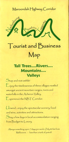
Map (Item) - Tourist and business map, Narbethong Community and Tourism Group, Narbethong Buxton Taggerty Tourist and Business Map, 04-2008
A tourist and business map of Narbethong, Buxton and Taggerty. This map was produced by the Narbethong Community and Tourism Group in April 2008. It was produced to promote the natural attractions, adventure activities and food trail from the Black Spur, through Narbethong, Buxton and Taggerty.A tourist and business map of Narbethong, Buxton and Taggerty.This publication has been produced by the Narbethong Community and Tourism/ Group (NCTG) to promote the natural attractions, adventure activities and food/ trail from the Black Spur, through Narbethong, Buxton and Taggerty./ the information provided in this publication has been supplied by the individual/ members. NCTG takes no responsibility for its accuracy./ April 2008narbethong, buxton, taggerty, victoria, australia, tourist and business map, narbethong community and tourism group, acheron valley, yarra track, wood's point, black spur, mystic mountains, the meeting of the waters, cathedral range, danico design counted cross stitch, things of sand & stone, buxton zoo nursery & oddz & enz, willowbank at taggerty, safe trek 4wd services, pnl 4wdriving, buxton trout and salmon farm, mystic mountains ski hire & outdoors, narbethong ski hire, highwood health centre, cathedral view natural therapies, narby cabinets, plants by shelian, gb timber, executive signs, rb automotive repairs, buxton car care, marysville towing & equipment hire, martyn slade building design, cathedral peak framing, black spur roadhouse & ski hire, tudor lodge roadhouse & ski hire, buxton roadhouse & persian bazzar, buxton post office general store & niche bar, igloo roadhouse, taggerty store, narby eggs, marapana agistment park, mantirri blueberry farm, carmyle farm, hazelwood hazelnuts, south cathedral lavender farm, cathedral cherries, black spur motel & caravan park, woodlands rainforest retreat, chestnut glade, black spur inn, wombat cottage, abbey lake luxury b & b spa cottages, blue views holiday cottages, camp narbethong, marapana farm stay b & b, mantirri blueberry farm b & b, little dene garden cottages, silverstream b & b cottages, nareen cabins, moondai farm b & b, south cathedral farm luxury b & b cottages, yarrolyn caravan park, sarsens rest, lomah retreat, pinjarra gardens, kingbilli country estate, henry viii manor house, buxton hotel, butters cafe of buxton, wagtail wines, little river wines, lanterns at willowbank, wirrawilla rainforest walk, wilhemina falls, the cascades -
 Marysville & District Historical Society
Map (Item) - Tourist and business map, Narbethong Community and Tourism Group, Narbethong Buxton Taggerty Tourist and Business Map, 04-2008
A tourist and business map of Narbethong, Buxton and Taggerty. This map was produced by the Narbethong Community and Tourism Group in April 2008. It was produced to promote the natural attractions, adventure activities and food trail from the Black Spur, through Narbethong, Buxton and Taggerty.A tourist and business map of Narbethong, Buxton and Taggerty.This publication has been produced by the Narbethong Community and Tourism/ Group (NCTG) to promote the natural attractions, adventure activities and food/ trail from the Black Spur, through Narbethong, Buxton and Taggerty./ the information provided in this publication has been supplied by the individual/ members. NCTG takes no responsibility for its accuracy./ April 2008narbethong, buxton, taggerty, victoria, australia, tourist and business map, narbethong community and tourism group, acheron valley, yarra track, wood's point, black spur, mystic mountains, the meeting of the waters, cathedral range, danico design counted cross stitch, things of sand & stone, buxton zoo nursery & oddz & enz, willowbank at taggerty, safe trek 4wd services, pnl 4wdriving, buxton trout and salmon farm, mystic mountains ski hire & outdoors, narbethong ski hire, highwood health centre, cathedral view natural therapies, narby cabinets, plants by shelian, gb timber, executive signs, rb automotive repairs, buxton car care, marysville towing & equipment hire, martyn slade building design, cathedral peak framing, black spur roadhouse & ski hire, tudor lodge roadhouse & ski hire, buxton roadhouse & persian bazzar, buxton post office general store & niche bar, igloo roadhouse, taggerty store, narby eggs, marapana agistment park, mantirri blueberry farm, carmyle farm, hazelwood hazelnuts, south cathedral lavender farm, cathedral cherries, black spur motel & caravan park, woodlands rainforest retreat, chestnut glade, black spur inn, wombat cottage, abbey lake luxury b & b spa cottages, blue views holiday cottages, camp narbethong, marapana farm stay b & b, mantirri blueberry farm b & b, little dene garden cottages, silverstream b & b cottages, nareen cabins, moondai farm b & b, south cathedral farm luxury b & b cottages, yarrolyn caravan park, sarsens rest, lomah retreat, pinjarra gardens, kingbilli country estate, henry viii manor house, buxton hotel, butters cafe of buxton, wagtail wines, little river wines, lanterns at willowbank, wirrawilla rainforest walk, wilhemina falls, the cascades -
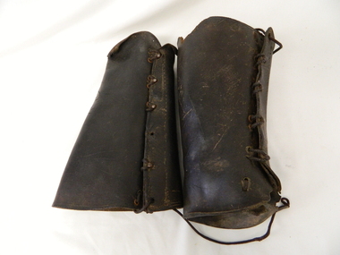 Kiewa Valley Historical Society
Gaiters Riding, Late 19th Century
These gaiters where used circa 1800's to mid 1900's, by horse riders "cattle men" to protect their shins and long trousers against wear and tear. They were used rather than having expensive boots damaged. Gaiters were a lot easier to fasten and clean than boots. They were used in the Kiewa Valley and the High Plains grazing areas.These gaiters were part of a cattleman's "out fit". The Gaiters were easily cleaned and did away with expensive riding boots. They were used throughout the valley and high plains areas both by horse riders herding cattle and the recreational rider of both sexes. After the 1950s more recreational riders from Melbourne ventured onto the high plains and not so rugged mountain slopes. Small settlements such as Mount Beauty, Bogong village and Falls Creek provided a secure backdrop for short term horse back adventures. The increasing pressure of city life provided a greater flow of stressed out city dweller to find the peace and quiet that city life does not have. Horse riding preceded the modern trail bikes and other recreational vehicles of the late 1900s. Thick leather tapered gaiters with six metal Hooks and Leather lacing through metal eyelets. All bar two eyelets have a metal reinforced punch holes. Left gaiter missing most of lacing.horse, country, leather, gaiters, high, grazing, cattlemen, laces, studs -
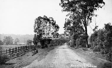 Eltham District Historical Society Inc
Photograph, Tom Prior, Nearing Eltham, from Research, Vic., c.1905, c.1905
View looking south along the main road from Research to Eltham Part of a presentation, "Roads and Byways of the Shire of Eltham", by Russell Yeoman to the 12 September 1990 Society meeting. Slides shown inclyuded copies of old photos and recent images ranging from the suburban streets of Eltham and Montmorency to the mountain roads of Kinglake. In the byways category are views of some iof the Shire's bicycle paths including then recently completed sections of the Main Yarra Trail at Lower Plenty.This photo forms part of a collection of photographs gathered by the Shire of Eltham for their centenary project book,"Pioneers and Painters: 100 years of the Shire of Eltham" by Alan Marshall (1971). The collection of over 500 images is held in partnership between Eltham District Historical Society and Yarra Plenty Regional Library (Eltham Library) and is now formally known as the 'The Shire of Eltham Pioneers Photograph Collection.' It is significant in being the first community sourced collection representing the places and people of the Shire's first one hundred years. The Reynolds family were early settlers in Research. The Reynolds/ Prior collection of photographs were taken by Tom Prior, the maternal uncle of Ivy Reynolds, around 1900 and the 60 photos in the album give a fine overview of many of the landmarks of Research and Eltham over 100 years ago. lvy lived in the family home for many years at 106 Thompson Cres Research. Ivy's father, Ernst Richard Reynolds and grandfather, Richard Reynolds, lived at the same address. Ivy's father Richard worked for Mr. Trail on his property in Research. Reynolds Road is named after the family. Mr Tom Prior (wife Eva) worked at the Melbourne zoo. He was very innovative and made his own camera, using the black cloth hood to exclude the light. The photographs are a reminder of the rural nature of Research and Eltham and its rich heritage.Digital image (Neg missing)shire of eltham pioneers photograph collection, eltham, main road, research (vic.), reynolds prior collection -
 Marysville & District Historical Society
Map (Item) - Map and touring guide, Murrindindi Regional Tourism Association Inc, Marysville & The Mystic Mountains VICTORIA-AUSTRALIA, 08-2002
A fold out map and touring guide of Marysville and the surrounding district published in 2002 by Murrindindi Regional Tourism Association Inc.A fold out map and touring guide of Marysville and the surrounding district published in 2002 by Murrindindi Regional Tourism Association Inc.marysville, victoria, australia, map and touring guide, mystic mountains tourism, the beeches rainforest walk, lake mountain, cambarville, cathedral range state park, the cumberland, abbey green b&b cottages, anastasia fairytale cottage, ashlar cottage b&b, somerled mountain retreat, baree mudbrick cottages, blackwood cottages, camellia cottage, cathedral view b&b, cottage riverside, crossways country inn, dalrymples guest cottages, esa country ministries, hillcrest, keppels hotel motel, kerami house, lomatia lodge, lyell guest cottages, marylands country house, marysville caravan park, marysville holiday cottages, maryton park, melina cottage, moondai farm b&b, mountain lodge marysville, mount cathedral lodge, mystic mountains holiday cottages, nanda binya lodge, rendezvous on murchison, scenic b&b, the hermitage, tower motel, waratah house, willowbank at taggerty, woodlands of narbethong, keppels, lake mountain resort cafe, lanterns at willowbank, mantirri blueberry farm, marysville country bakery, the old woolshed cafe, clearstream olives, uncle fred & aunty val's old style lolly shop, acheron valley alpacas country store & gallery, bruno's art and sculpture garden, country touch, things of sand & stone, willowbank gallery, marysville auto & hardware, marysville newsagency & general store, marysville visitor information centre, narbethong visitor information centre, gallipoli park, keppels lookout, lady talbot drive, steavenson falls, steavenson river, taggerty river, acheron river, black spur trail riding centre, buxton trout farm, lake mountain resort ski hire, lake mountain ski school, marysville district country club, marysville ski centre, narbethong ski hire, rubicon horse riding, country touch tours, murrindindi regional tourism association inc -
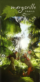 Marysville & District Historical Society
Map (Item) - Walking map, Department of Sustainability and Environment, marysville TRAILS, 07-2011
... cambarville lake mountain trails cumberland falls mystic mountains ...A map showing all the walking trails in and around Marysville and the district. This map was produced by the Department of Sustainability and Environment in July 2011.A map showing all the walking trails in and around Marysville and the district.ISBN 978-1-74287-122-6 (print)marysville, victoria, australia, marysville trails, department of sustainability and environment, parks victoria, steavenson falls trail, beauty spot trail, gilberts gully trail, tree fern gully trail, michaeldene trail, wilks creek trail, keppel lookout trail, lady talbot drive, taggerty cascades, the beeches, keppel falls, phantom falls, cathedral range state park, cambarville, lake mountain trails, cumberland falls, mystic mountains tourism -
 Federation University Historical Collection
Documents - Reports, Paul Cropper, Myths & Monsters Conference Papers, 10/2001
The Myths and Monsters conference was something of a landmark in Australian mystery animal research. It was the first cryptozoological conference held in Australia, and the first time Australia's leading researchers had been able to present their findings and meet with others working in the same field. 82 page proceedings of the Myths and Monsters Conference printed onto white paper. The following topics were presented: * A brief History of Australian Cryptozoology (Paul Cropper) * Would the Real Orang-Utan Please Stand Up and be Counted? In search of unidentified relic hominoids in Southeast Asia (Helmut Loofs-Wissowa) * Strange Creatures on the Antipodean UFO trail (Bill Chalker) * The Bunyip (Gary Opit) * Sightings of Some Anomolous Sea Creatures (Malcolm Smith) * Investigating Cryptic Hominids (Yowies) in the Blue Mountains of New South Wales (MIchael Hallett & David McBean) * "High Strangeness" in Yowie Reports (Tony Healy) * The Mystery of the Australian Big Cat: A Brief Summary (Peter Chapple) * Quest for the Thylacine (Peter Chapple) [Australian Animal Folklore Collection]Signed on cover "Simon Townsend"australian animal folklore collection, paul cropper, ruby lang, helmut loofs wissowa, bill chalker, gary opit, malcolm smith, michael hallett, david mcbean, tony healy, peter chapple, bunyip, blue montains, yowie, thylacine, big cat, puma, panther, ufo, goolma, woodenbong, narrabeen lakes, cecil mcgann, dorothy middleton, lee kelly, brown bittern, bay monster, simon moir, footprints, blue mountains cryptid, prehistoric bipedal primates, gigantopithecus, meganthropus, homo rudolfensis, homo habilis, homo erectus, homo ergaster, hominid, bigfoot, psychic phenomena, black panther, lake monster, blue labyrinth, australian rare fauna research association, marsupial lion, thylocoleo carnifex, australian big cat, tasmanian devil, sarcophilus harrisi, eric guiler, yellingbo, thylacinus cynocephalus, tantanoola tiger, rilla martin, mundrabilla, predatory animal, mythical, myth, folklore -
 National Vietnam Veterans Museum (NVVM)
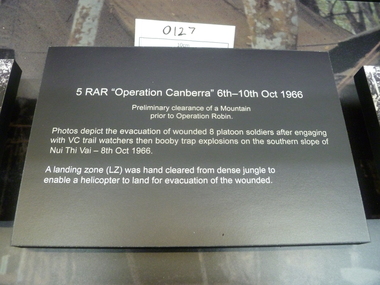
Poster - Poster, Information Board, 5RAR "Operation Canberra" 6th-10th Oct 1966
A black board with white text about "5RAR "Operation Canberra"6th-10th Oct 1966"5RAR "Operation Canberra" 6th-10th Oct1966 Premilinary clearance of a Mountain prior to Operation Robin. Photos depic the evacuation of wounded 8 platoon soldiers after engaging with VC trail watchers then booby trap explosions on the southern slope of Nui Thi Vai - 8th Oct 1966 A landing zone (LZ) was hand cleared from dense jungle to enable a helicopter to land for evacuation for the wounded.honours and awards, 5 rar -
 Bendigo Historical Society Inc.
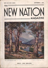
Magazine - AILEEN AND JOHN ELLISON COLLECTION: THE NEW NATION MAGAZINE
The New Nation Magazine Sept. Oct. Nov. Issue. September 1, 1932. On the front cover a painting "The Murrumbidgee River by J. R. Jackson. Price 1 shilling the magazine has 112 pages, the last two pages are ripped and the back cover is missing. Contents: Frontispiece "morning of the dogger bank" (by T. Benetter)- The British commonwealth of Nations - Switzerland, land of lakes and mountains (by Hilary lofting) - Highways of the Syrian desert (by Francis Birtles) - Seven ages of the Australian aboriginal - The game of the empire, the approaching cricket test matches (by M. A. Noble) - Short story, the last run (by H. H. Cardinal) - "The hidden bird" (by E. M. England) - North Australia trails ( by C. Price Conigrave) - Tales of the turf Fred Archer (by S. A. Marden) - The wide world round - Cape Horn (by J. Newman Barker) - "The home in the clearing" (by Sydney long) - Whitsunday passage (by Henry G. Lamond) - Old bridges (by J. L. Ranken) - The city of the longest drink (by A. C. Cummins) - The life of the cuckoo (by M. S.) - Radio - The world of music (by A. L. Kelly) - The world of women (by E. G. Manby Suttor) - Shopping from an easy chair - The Australian wool trade - Our verse farm - My wool clip (by H. W. Wright) - Windjammer days (by Gerald M. Moody) - Quarterly review of the stock and meat industry (by J. B. Cramsie) - New Zealand letter - At ye booksellers today - A number of things - The modern home - Portland cement - The good housewife (by E. G. Manby Suttor) - Cousin Shirley.book, magazine, the new nation -
 Tatura Irrigation & Wartime Camps Museum
Folder, Army, 1944-1945
Written for Australian Army SoldiersBlack binder containing 4 x Army magazines (November 1944, December 1944, January 1945, February/March 1945) featuring sketches and stories written by Australian Army members. 1 x Battle of the Ridges magazine (no 3) Scene of mountains on the front cover with green, black and white printing 1 x Battle of Wau magazine. A map is on the front cover with green, black and white printing. 1 x Jungle Trail (no front cover) magazines, army (4 copies), australian army magazine, battle of the ridges, the battle of wau, jungle trail, tatura, ww2 australian army, books -
 Falls Creek Historical Society
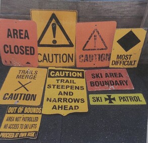
Sign - Falls Creek Ski Patrol
The first ski patroller in Falls Creek was Brian Caddy with two casual ski patrollers Rob Sarroff and David Crooke in the 1960s. In 1972 the “official” Falls Creek Ski Patrol was created under the advisement of Dr Rodney Moss with the support of the Management Committee. By 1977 there were six or seven patrollers, and currently there are around 40 patrollers on the team with 13-14 rostered on each day during peak season. In 1974 the Australian Ski Patrol Association (ASPA) was formed. On the 14th March 1975, the Falls Creek Tourist Area Management Committee applied for membership to ASPA. At that time, Falls Creek Ski Patrol was known as Falls Creek Ski Rescue. From that time, Falls Creek patrollers began wearing the recommended uniform of a white cross on a red parka.These signs are significant as they are representative of the work carried out by Falls Creek Ski Patrol to keep skiers safe.A variety of signs used by Falls Creek Ski Patrol to alert tourists to conditions on the mountains in the area.A range of words and symbols including:- AREA CLOSED CAUTION MOST DIFFICULT TRAILS MERGE - CAUTION CAUTION TRAIL STEEPENS AND NARROWS AHEAD SKI AREA BOUNDARY SKI PATROL OUT OF BOUNDS / AREA NOT PATROLLED / NO ACCESS TO SKI LIFTS / PROCEED AT OWN RISKfalls creek ski patrol, skiing safety -
 Falls Creek Historical Society
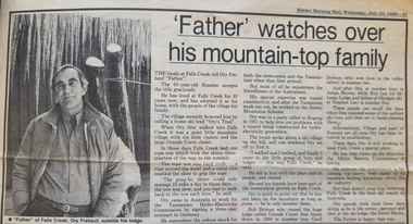
Article - "Father" watches over his mountain-top family, 30 July 1986
This article acknowledged the naming of Ory's Trail at Falls Creek in 1986. Orest “Ory” Frueauf was born in Kharkov, Russia in 1925 and moved to Germany with his family to escape persecution. He was conscripted to the German Army during the Second World War. He was a POW until 1948. He was recruited by a French construction company to work as and interpreter on a hydroelectricity project in Tasmania. Ory then moved to work on the Snowy Mountain Scheme including driving a truck to fill the wall of the Rocky Valley dam. In 1952 Ory was recruited by the Albury Ski Club as its lodge supervisor. That year he also entered into a business partnership with Cecil Dobson, running the general store “Whitehaven” and Post Office at Falls Creek. They extended their business by adding accommodation turning Whitehaven into one of the best commercial lodges at Falls Creek. Ory and Cecil dissolved their business partnership in 1963 and Ory went on to build a new lodge called “Snowhaven” at the site of the present day Frueauf Village, Falls Creek. Ory retired to Tawonga, Victoria in 1992 and passed away in 1999.This article is significant because it documents the naming of Ory's Trail to recognise a pioneer of Falls Creek.A newspaper item about Ory Freauf on the occasion of the naming of Ory's Trail at Falls Creek.falls creek pioneers, frueauf, ory frueauf -
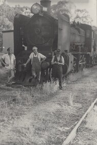 Wodonga & District Historical Society Inc
Photograph - Fred Rochow Railways Collection - Shunting at Shelley Station, 1961
The Fred Rochow Railways Collection incorporates photos related to the operation of the Wodonga Railway Station including different types of trains and railways staff C. 1930 – 1990. It was donated to the Wodonga Historical Society by Fred Rochow, a railwayman who spent many years based in Wodonga. He joined the Victorian Railways on 17th June l947 and retired in 1988. For some time, he was a member of the Australian Federated Union of Locomotive Enginemen and served a term as a member of the Trades Hall Council. He had an extensive knowledge of the struggles that took place to achieve better conditions for railway workers. Fred worked for many years as a fireman and then worked his way up the ranks to driver, experiencing many changes from the days of steam locomotives through to diesel trains, locomotives and even the modern XPT train. He worked throughout Victoria at different stages of his career, with his final working years focused on the northeast of Victoria and the Albury to Melbourne line. After his retirement, Fred continued to share his love of steam miniature trains with the community. Shelley Railway Station - Shelley was once Victoria's highest railway station, located 781 metres above sea level. The Shelley Railway Station was opened in 1916 and closed in 1979. The railway was used early in its life to transport farmer’s livestock from the Upper Murray to Wodonga. From the 1950s the railway was used heavily to transport equipment and machinery from Wodonga to the Upper Murray to help build the Snowy Mountains Hydro Electric Scheme. The Snowy Hydro Scheme was completed in 1974 and after several years of low level use, the railway was closed. Some remnants of the Shelley Station passenger platform can still be seen today, along with some information boards. The Shelley Railway Station now forms part of the High Country Rail Trail.This collection has local and statewide significance as it captures images of trains, locomotives and personnel who operated the railway services in Wodonga and throughout Northeast Victoria. The railways played a critical role in opening up Victoria and connecting Australia for trade, business, social communication and transport.Left to Right: Fireman Bert Cadman, Driver Wally Riley, Guard Hugh Fraser. Locomotive S300 - the ‘Matthew Flinders’ The S class diesel locomotives were built by Clyde Engineering in 1957 for the Victorian Railways. Designed as premier express passenger diesels, they assumed the ‘S class’ title from a fleet of steam locomotives. They were also given names of famous Australians. The S300 took the name ‘Matthew Flinders’. In 1962, S300 was converted from the Victorian broad gauge of 5’3” to the New South Wales gauge of 4’8.5”, in order to operate the new Southern Aurora between Sydney & Melbourne. As the locomotive grew older it was removed from these duties and was sold to Chicago Freight Car Leasing Australia (CFCLA) in 2004. It is now owned by a private owner and is on loan to the Canberra Railway Museum.railways wodonga, fred rochow, wodonga railwaymen, s class locomotive -
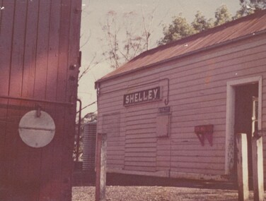 Wodonga & District Historical Society Inc
Photograph - Fred Rochow Railways Collection - Shelley Station
The Fred Rochow Railways Collection incorporates photos related to the operation of the Wodonga Railway Station including different types of trains and railways staff C. 1930 – 1990. It was donated to the Wodonga Historical Society by Fred Rochow, a railwayman who spent many years based in Wodonga. He joined the Victorian Railways on 17th June l947 and retired in 1988. For some time, he was a member of the Australian Federated Union of Locomotive Enginemen and served a term as a member of the Trades Hall Council. He had an extensive knowledge of the struggles that took place to achieve better conditions for railway workers. Fred worked for many years as a fireman and then worked his way up the ranks to driver, experiencing many changes from the days of steam locomotives through to diesel trains, locomotives and even the modern XPT train. He worked throughout Victoria at different stages of his career, with his final working years focused on the northeast of Victoria and the Albury to Melbourne line. After his retirement, Fred continued to share his love of steam miniature trains with the community. Shelley Railway Station - Shelley was once Victoria's highest railway station, located 781 metres above sea level. The Shelley Railway Station was opened in 1916 and closed in 1979. The railway was used early in its life to transport farmer’s livestock from the Upper Murray to Wodonga. From the 1950s the railway was used heavily to transport equipment and machinery from Wodonga to the Upper Murray to help build the Snowy Mountains Hydro Electric Scheme. The Snowy Hydro Scheme was completed in 1974 and after several years of low level use, the railway was closed. Some remnants of the Shelley Station passenger platform can still be seen today, along with some information boards. The Shelley Railway Station now forms part of the High Country Rail Trail.This collection has local and statewide significance as it captures images of trains, locomotives and personnel who operated the railway services in Wodonga and throughout Northeast Victoria. The railways played a critical role in opening up Victoria and connecting Australia for trade, business, social communication and transport.Shelley Railway Station. This image shows the tank where the hand brakes were lifted. They were applied again at the "up" side of Koetong for about another 10 miles then lifted near Bullioh.railways wodonga, fred rochow, shelley station, high country rail trail -
Tatura Irrigation & Wartime Camps Museum
Painting - Painting, Oil, Centaur, 1945
Harry Gorry bid for & purchased on internet auction site. The seller's mother was putting these & other items up for auction. Her father, the seller's grandfather was Dr. Bruno Koenig, a German surgeon detained by Allied forces while fleeing New Guinea in 1941. He was detained & sent to be interned in Camp 3, Tatura. There he met the painter Cesare Vagarini & they became friends, thus 4 years later upon the end of the war Vagarini gave the surgeon the two paintings in thanks & in memory of their friendship. Dr Koening then passed the paintings down to his daughter, where they remained in the family for 60 years. The seller's mother decided it was time to sell & was happy that the paintings went to a good home, as the family was until now unaware of the connection between Vagarini and the Tatura Museum. Harry Gorry just happened to notice a familiar name in an auction that he came across by accident & purchased them for our benefit. (Most information copied from Tatura Bulletin article, April 2014).Oil painting, depicting mythological scene. Female figure (unclothed), holding a red cloth/ garment trailing behind her. Centaur / faun? walking beside her. Outdoor scene. Trees, mountains & cloudy blue sky visible in background. Sandy coloured soil. Painted on reverse of old "Choice Tea" box.(On back): 1945 Tatura; ... remember ..... and us, Cesare and Maria Vagarini; On back, on sticker: Va(r)garini, Tatura Internment Camp, 1945 "Choice Tea" stencilled on back, part of original box material.tatura, camp 3, cesare vagarini, camp 3 artwork, victorian internment camps, doctor bruno koenig -
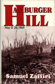 National Vietnam Veterans Museum (NVVM)
Book, Zaffiri, Samuel, Hamburger Hill, May 11-20, 1969 (Copy 1)
The battle for Ap Bia Mountain, (Hill 937) Vietnam, 1969, became famous both for the dramatic and fierce battles involved and for the ensuing controversy in the media and on the floor of the United States Senate.The battle for Ap Bia Mountain, (Hill 937) Vietnam, 1969, became famous both for the dramatic and fierce battles involved and for the ensuing controversy in the media and on the floor of the United States Senate.ap bia (mountain) vietnam, united states senate, nva, a shau valley, hue, ho chi minh trail, 3d brigade, 101st airborne, 3d arvn regiment, 9th marine regiment, operation apache snow -
 National Vietnam Veterans Museum (NVVM)
Book, Zaffiri, Samuel, Hamburger Hill, May 11-20, 1969 (Copy 2)
The battle for Ap Bia Mountain, (Hill 937) Vietnam, 1969, became famous both for the dramatic and fierce battles involved and for the ensuing controversy in the media and on the floor of the United States Senate.The battle for Ap Bia Mountain, (Hill 937) Vietnam, 1969, became famous both for the dramatic and fierce battles involved and for the ensuing controversy in the media and on the floor of the United States Senate.ap bia (mountain) vietnam, united states senate, nva, hue, tet offensive, ho chi minh trail, 3d brigade, 101st airborne, 9th marine regiment, 3d arvn regiment, operation apache snow, a shau valley