Showing 34 items matching "tower hill estate"
-
 Surrey Hills Historical Society Collection
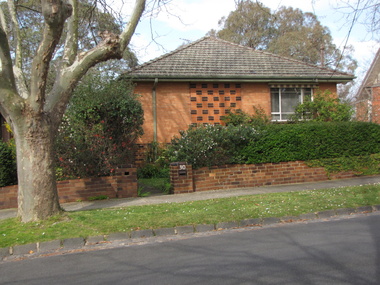
Photograph - 30 Tower Street, Surrey Hills, The Street Where You Live Project
Photos documenting this address as part of a photographic series undertaken by volunteer photographers during 2013 and 2014 for The Street Where You Live Project. This was organised through the Surrey Hills Neighbourhood Centre and covered the postcode 3127 in the cities of Boroondara and Whitehorse.These photos provide a snapshot of real estate in the suburbs of Mont Albert and Surrey Hills during a period of rapid change with many properties on large blocks demolished to create higher density residential development or renewal of single dwellings. At particular risk were properties not covered by heritage overlays, in particular interwar housing and post 1950's housing. -
 Surrey Hills Historical Society Collection
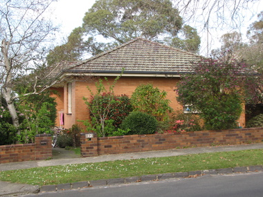
Photograph - 32 Tower Street, Surrey Hills, The Street Where You Live Project
Photos documenting this address as part of a photographic series undertaken by volunteer photographers during 2013 and 2014 for The Street Where You Live Project. This was organised through the Surrey Hills Neighbourhood Centre and covered the postcode 3127 in the cities of Boroondara and Whitehorse.These photos provide a snapshot of real estate in the suburbs of Mont Albert and Surrey Hills during a period of rapid change with many properties on large blocks demolished to create higher density residential development or renewal of single dwellings. At particular risk were properties not covered by heritage overlays, in particular interwar housing and post 1950's housing. -
 Surrey Hills Historical Society Collection
Folder of real estate advertisements, Folders of real estate advertisements (Streets beginning with T), Various
A4 folders with individual pockets for each property in streets beginning with T located in Surrey Hills and Mont Albert. Folders are ordered by street name and then chronologically by property number. Each property has its own pocket. This may include multiple real estate advertisements collected from sales over time. It may also include copies of any research undertaken by Alan Holt and / or members of the SHNCHC team. These are augmented by cards in the Alan Holt index file and by his property registers of Surrey Hills and Mont Albert.tevelton lane, thames street, the avenue, theodore street, thistle street, thornton avenue, tower street, trafalgar street, tyndall street -
 Warrnambool and District Historical Society Inc.
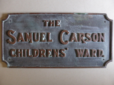
Plaque - Brass Plate, The Samuel Carson Childrens' Ward, C 1925
... and towards Tower Hill near Gorman's lane. By the time of his death... and towards Tower Hill near Gorman's lane. By the time of his death ...Samuel Carson was a local farmer who in the late 1800's acquired land to the West of Warrnambool in the Farnham park estate and towards Tower Hill near Gorman's lane. By the time of his death on May 23, 1920 he left an amount of 11666 pounds. Apart from amounts left to individuals, he bequeathed one hundred pounds each to ten different orphanages, and homes for neglected children and the blind and leaving the remainder to charitable organisations at the discretion of his trustees.The donation of 3500 pounds in August 1922 was in the latter category. This plaque commemorates Samuel Carson's generosity to the newly refurbished Warrnambool Base Hospital. He left a son William who farmed at Yangery at the time of his father's death. This item is significant in that it links a local identity through his generous donation to the local hospital. It therefore has strong social,historical and interpretative value. His generosity is a significant part of the history of Warrnambool Base Hospital.Heavy rectangular cast brass plate with raised edge and text in capitals. Corners have rounded cutouts and there is a hole in each corner for attachment. The Samuel Carson Childrens' Ward.warrnambool, warrnambool base hospital, samuel carson, samuel carson warrnambool, childrens' ward warrnambool 1928