Showing 1010 items
matching tramway maps
-
 Ballarat Tramway Museum
Newspaper, John Dyall, "Trams gone but not forgotten", 19/09/1981 12:00:00 AM
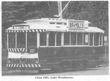
... Craig's Hotel. 1635i3 - map of the tramway system from a Modern... Hotel. 1635i3 - map of the tramway system from a Modern Tramway ...Newspaper clipping from The Courier Ballarat, Saturday Sept. 19, 1981 - Saturday Magazine - featuring the BTPS and 10 years since the closure of the Ballarat System. Article contains story of the Ballarat tramways, the establishment of the Museum, closure and statement from Richard Gilbert, General Manager of the BTPS. Article written by John Dyall. Notes that the depot extension is to be "officially opened today" and that coupons are printed in the newspaper, giving free rides for the day. Article features: 1635i1 - photo of tram 27 in Wendouree Parade with the Brambles advertisement on the roof, Twin Lakes sign and showing 'St Aidans Drive'. 1635i2 - photo of single truck car southbound in Lydiard St. North, taken from Craig's Hotel. 1635i3 - map of the tramway system from a Modern Tramway Magazine. Map prepared by W. J. Wyse compiled from a sketch drawn by A.T. Marshall. Map dated 3/62 2nd copy added 26-05-2006 1635.1 - Free ride coupon - giving details of free ride offer on 19 and 20 Sept. 1981. 1635.2 - pages 28 and 29 and associated pages of The Courier, containing the above items. btps, 10th anniversary, depot extensions, ballarat history -
 Melbourne Tram Museum
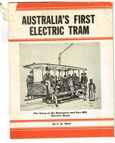
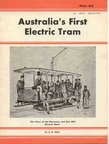
Book, J. K. Moir, "Australia's First Electric Tram", 1957
... . The story of the Doncaster and Box Hill Electric Road (tramway... ceremony at Box Hill, poster advertising the tramway, a map ...Twenty page book including paper covers titled "Australia's First Electric Tram" written by John Kinmont Moir and published by Traction Publications, Historical Series No. 1 in 1957. The story of the Doncaster and Box Hill Electric Road (tramway). Publishers Note on page 6, advises that this book was the 3rd edition and gives the background history. Has a sketch on the front cover of the opening ceremony at Box Hill, poster advertising the tramway, a map, foreword written by J.K. Moir about Mr. H. J. Hilton who operated the tramway, the birth of the tramway, the company that was formed to operate it, , a sample ticket, opening, operation, timetable, reminiscences of H. J. Hilton. Includes notes on the subsequent work of Mr. Hilton, and on the back cover a details of the AETA , office bearers, publications and contact details. Includes a number of photographs. .1 - Copy of the 4th edition, dated 1961, added 19/11/14 - see image i4. Front inside cover has a different arrangement. See image htd420i5.pdf See Reg Item 2058 for the second edition - 1950 and 3850 for the 1940 edition.420 - In pencil on the front cover 2/- 420.1 - has label of "From the library of Esmey Herscovitch" on lower left hand corner of page 3, and "Herscovitch" in ink on the top of the same page.trams, tramways, box hill, doncaster, tramways -
 Ballarat Tramway Museum
Magazine, Australian Railway and Locomotive Historical Society, "ARLHS Bulletin", 1945
... and the Prahran and Malvern Tramways Trust, including a map on page 35... Tramways Trust, including a map on page 35, but pages 31 to 35 have ...Set of 12 Australian Railway and Locomotive Historical Society Bulletins for the period Jan 1945 to December 1945. Each page has been stencil duplicated. Index sheets for the journals at the front of the documents. Pages 1, 2, 32, 35, 50, 62 and 69, on the Elsternwick Horse Lines, Kew Horse Line and the Prahran and Malvern Tramways Trust, including a map on page 35, but pages 31 to 35 have been removed as has pages 62 to 65. All issues are contained loose within a fly sheet from a spring back binder.museums railways, tramways -
 Ballarat Tramway Museum
Document - Report, Booz-Allen Hamilton, "Final Draft Report - Ballarat Heritage Trams - Tourism Transportation Scope & Feasibility Study", Mar. 2002
... of the Tramway and Conclusions, with maps, financial and cost analysis... Parade Ballarat Ballarat goldfields Trams tramways Ballarat City ...Eighty one page A4 size document, bound with clear plastic cover, black coloured card back cover using a black comb binder, titled "Final Draft Report - Ballarat Heritage Trams - Tourism Transportation Scope & Feasibility Study". Produced by Booz Allen Hamilton as part of the project study for the return of trams to the central part of the City of Ballarat. Dated March 2002 - as discussion paper for the steering committee meeting of 14/3/2001. Contains Introduction, Role of the Tourist Tramway, Viability of the Tramway and Conclusions, with maps, financial and cost analysis, patronage estimates and comparison with other similar operations.trams, tramways, ballarat city tramway, ballarat revival, tourism, market -
 Ballarat Tramway Museum
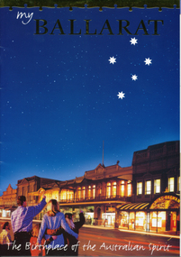
Pamphlet, Ballarat Tourism, "My Ballarat, the Birthplace of the Australian Spirit", Nov/Dec. 1998
... standing by phone in uniform. P45 has City of Ballarat map... of Ballarat map, showing tramway and museum/depot. Track does ...48 page, colour printed on glossy paper, Ballarat Tourism brochure designed for interstate and overseas tourist to make Ballarat, their destination. P13 associated with Steve Moneghetti's story of 'my Ballarat', including a photograph of tram 26, at Gardens Loop during a Begonia festival. Conductor in rear compartment of 26. Telephone box open, obscuring a BTM member standing by phone in uniform. P45 has City of Ballarat map, showing tramway and museum/depot. Track does not project beyond depot spur to Carlton St. Brochure features stories from Ballarat residents and visitors, including other district items, features and accommodation section.trams, tramways, ballarat tourism, city of ballarat, btm -
 Bendigo Historical Society Inc.
Map - GUIDE MAP OF BENDIGO & EAGLEHAWK, Late 1920's
... , Lithographer. Map shows tramways & bus routes. Map shows Agricultural... tramways & bus routes. Map shows Agricultural Showgrounds located ...Map. Guide Map of Bendigo & Eaglehawk. Light brown coloured booklet containing folded map of Bendigo and Eaglehawk. Outer cover is printed in blue and red ink and states - With compliments of J H Curnow & Son, Auctioneers, Real Estate Agents, Farm & Dairy Produce Merchants, Bendigo. Printed by J B Young, Lithographer. Map shows tramways & bus routes. Map shows Agricultural Showgrounds located between Park Street, Water Street, Barnard Street and Bridge Lane. Also shows Acclimitization Reserve located behind The Botanical Gardens at White Hills. Shows the location of Sailors Gully, Peg-Leg Gully, Jobs Gully, California Gully, Long Gully, Ironbark Gully, Golden Gully, Poverty Gully, Sheepshead Gully, Charcoal Gully, Eaglehawk Creek, Bendigo Creek and Back Creek. Contains interesting facts about Bendigo - Area 7,900 acres. Population - 26,000. First Council elected - 1855. Proclaimed a Borough - 1863. Proclaimed a City - 1871. Gold Rush broke out - 1851. For first 10 years gold yield averaged 8,600 ozs. per week . Total gold yield to 1923 - 572 tons valued at 82,000,000 pounds. Deepest mines - Victoria Quartz 4,614 ft., New Chum Railway 4,318 ft. 13 mines over 3.000 ft. deep. 53 mines over 2,000 ft. deep. Sewering of City commenced 1922, all principal buildings now sewered. Map printed by Arnall & Jackson, General Printers, Stationers & Engravers, 476 Collins Street. Map displays advertisement for J H Curnow & Son, Bendigo's leading Auctioneer and Estate Agents, Mitchell & Queen Sts. Bendigo. Map Scale 20 chs. = 1 in.cottage, miners, guide map of bendigo and eaglehawk -
 Ballarat Tramway Museum
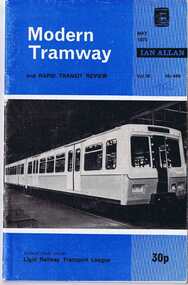
Magazine, John Price and David Menzies, "A Museum Trilogy", 1975
... Ballarat Tramway System history, with Map of System complied... Tramway System history, with Map of System complied by W.J.Wyse 3 ....1 - Modern Tramway & Rapid Transit Review - May 1975 issue, Vol38 No. 449 p157. - from the Part One of Three part article Ballarat Tramway System history, with Map of System complied by W.J.Wyse 3/62 from sketch by A.T.Marshall with various photos of Bendigo and Ballarat. Part 1 of "A Museum Trilogy", written by John Price and David Menzies. .2 - Modern Tramway & Rapid Transit Review - August 1975 issue, Vol. 38, No 451, p267, part 3 of 3 part article, Bendigo, with map of system, by W. J. Wyse 4/62, completed from sketch by A.T. Marshall, along with various photos. Part 2 of "A Museum Trilogy", written by John Price and David Menzies. Record revised and images of cover, index and article added.Both issues with biro "75c"trams, tramways, trams, rapid transit, ballarat tramways, bendigo -
 Melbourne Tram Museum
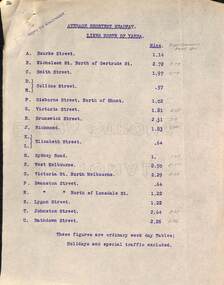
Document - Report, Tramway Board, "Average Shortest Headway lines north and south of the Yarra", c1916 to 1920
... these reports, titled "Map showing tramway Lines", which has been marked... Trams tramways Cable Trams Reports Services Map MTO Co Royal ...Set of typed sheets and map: .1 - carbon copy on quarto paper titled "Average Shortest Headway lines north of Yarra", giving the average headway for each street, route, eg Collins St, .57mins and for West Melbourne 8.5mins. Has in pencil alongside in pencil, the times for "Royal Commission Report 1911" .2 - ditto "Average Shortest Headway lines south of Yarra" Has a note that these numbers were for ordinary weekday tables, holidays and special traffic excluded. .3 - Map - accompanied these reports, titled "Map showing tramway Lines", which has been marked up in red with numbers and the road names. Not understood what the numbers mean, could be a reference to a report numbering. All documents undated, c 1916 to 1920.1 - has stamp "Copy to Engineer" in top left hand corner.trams, tramways, cable trams, reports, services, map, mto co, royal commission, timetables -
 Ballarat Tramway Museum
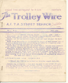
Magazine, Australian Electric Traction Association (AETA), "The Trolley Wire", Vol 1, No. 6, "The Trolley Wire", Vol 3, No. 5, Jul. 1952
... , with map, Brisbane news, Sydney news, Gladesville to Lane Cove...Ballarat Tramway Museum South Gardens Reserve Wendouree ...Yields information about Sydney trams in the early 1950s and demonstrates means of publishing information of the era.105.1 - Spirit duplicated magazine, 8 quarto pages, single sided - " The Trolley Wire", Vol 1, No. 6, July 1952, stapled down along the left hand side. Has items on Brisbane, with map, Brisbane news, Sydney news, Gladesville to Lane Cove proposed tramway and Western Suburbs Destination Roll, 1947 - 1950. 105.2 - Spirit duplicated magazine, 9 quarto pages, single sided - " The Trolley Wire", Vol 3, No. 5, 20th May 1954, stapled down along the left hand side. Has notes on association matters, map of tramways in the Moore Park area, Drummoyne Bridge and Iron Cove tram lines, Easter workings, Sydney news. See Reg Item 5685 for other Vol 1 issues and Reg Item 5686 for Vol. 2 issues. Scan with care.Vol 3, No. 5 has pencil inscription of "H.Matthews"trams, tramways, tramway news, history, sydney, brisbane -
 Ballarat Tramway Museum
Book, J. K. Moir (author), "Australia's First Electric Tram", 1950 to 1977'
... . The story of the Doncaster and Box Hill Electric Road (tramway... the tramway, a map, foreword written by J.K. Moir about Mr. H. J ...Twenty page book including card covers titled "Australia's First Electric Tram" written by John Kinmont Moir and published by Traction Publications, Historical Series No. 151 in 1961. The story of the Doncaster and Box Hill Electric Road (tramway). Note on page 6, advises that this book was the 4th edition. Price at the time 2/3d. Has a sketch on the front cover of the opening ceremony at Box Hill, poster advertising the tramway, a map, foreword written by J.K. Moir about Mr. H. J. Hilton who operated the tramway, the birth of the tramway, the company that was formed to operate it, , a sample ticket, opening, operation, timetable, reminiscences of H. J. Hilton. Includes notes on the subsequent work of Mr. Hilton, the AETA, Traction publications and a short biography on the back cover of the author, J. K. Moir. Includes a number of photographs. 2458.2 - ditto - Red card cover (see images i2 and i3) - Second edition - 1950. 2458.3 - ditto - cover same as 4th Edition, - Third Edition 1957 - see image .4 2458.4 - Thirty two page book, centre stapled, including light green card covers titled "Australia's First Electric Tram" written by John Kinmont Moir and the story of the Doncaster and Box Hill Electric Road (tramway). Republished by Rotary Club of Box Hill, May 1977, see back cover for publication details. Has a photo on the front cover of the opening ceremony at Box Hill, poster advertising the tramway, a copy of a share certificate, foreword written by J.K. Moir about Mr. H. J. Hilton who operated the tramway, the birth of the tramway, the company that was formed to operate it, a sample ticket, opening, operation, timetable, reminiscences of H. J. Hilton. See images 5 and 6.On the front cover in black ink "Ex ARHS Archives" 2458.2 and 3 and .4 - has "I. J. Stanley" written in ink on page 3.trams, tramways, box hill, doncaster, tramways -
 Ballarat Tramway Museum
Magazine, Australian Electric Traction Association (AETA), "The Trolley Wire", Vol 2, No. 4, "The Trolley Wire", Vol 2, No. 5, "The Trolley Wire", Vol 2, No. 6, "The Trolley Wire", Vol 2, No. 7, "The Trolley Wire", Vol 2, No. 8, "The Trolley Wire", Vol 2, No. 9, 1953
... to Rockdale, map of the VR tramway to Brighton Beach, tramways... hand side. Has items on proposed tramway to Rockdale, map ...5686.1 - Spirit duplicated magazine, 8 quarto pages, single sided - " The Trolley Wire", Vol 2, No. 4, April 1953, stapled down along the left hand side. Has items on proposed tramway to Rockdale, map of the VR tramway to Brighton Beach, tramways and ferry connecting services in Sydney, Eastern Suburbs tramways, Sydney news, tram destination roll for Ashfield (1910), list of destination boards on Sydney steam trams. 5686.2 - Spirit duplicated magazine, 7 quarto pages, single sided - " The Trolley Wire", Vol 2, No. 5, May 1953, stapled down along the left hand side. Has notes on Tempe to Rockdale (map), tramways and ferry connecting services in Sydney, Rushcutters Bay depot track layout, opening dates of Sydney tramway extensions, Sydney news, association news and signs used on Sydney trams. 5686.3 - Spirit duplicated magazine, 7 quarto pages, single sided - " The Trolley Wire", Vol 2, No. 6, June 1953, stapled down along the left hand side. Has an editorial on Sydney transport, tramways and ferry connecting services in Sydney, Sydney news, introduction of electric trams into Sydney, Light St depot, Brisbane track layout, Sydney news, association news. 5686.4 - Spirit duplicated magazine, 9 quarto pages, single sided - " The Trolley Wire", Vol 1, No. 7, July 1953, stapled down along the left hand side. Has notes on replacement with buses on the Ryde line, tramways and ferry connecting services in Sydney, Sydney news, Honeysuckle Depot 1887, Iron Cove or Drummoyne Bridge, Sydney news, Association and Museum news. 5286.5 - Spirit duplicated magazine, 6 quarto pages, single sided - " The Trolley Wire", Vol 2, No. 8, August 1953, stapled down along the left hand side. Has notes on the commencement of electric trams in Sydney, Iron Cove or Drummoyne Bridge, Association and Museum news, map of Sydney electric lines in 1899 and opening dates of Sydney tramway extensions. 5286.6 - Spirit duplicated magazine, 6 quarto pages, single sided - " The Trolley Wire", Vol 2, No. 9, September 1953, stapled down along the left hand side. Has notes on an electric train tour, tramways and ferry connecting services in Sydney, Sydney news, Iron Cove or Drummoyne Bridge, Association news and Newcastle news. See Reg Item 5685 for other Vol 1 issues and Reg Item 105 for Vol 1, No. 6 and Vol. 3 No. 5All copies have pencil or typed inscription of "H. H. Matthews "along top edge.trams, tramways, tramway news, history, sydney, newcastle, map -
 Melbourne Tram Museum
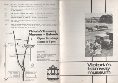
Pamphlet, Tramway Museum Society of Victoria (TMSV), "Victoria's tramway museum", mid 1970's to July 1982
... line history of Victoria's tramways and a location map... Trams tramways TMSV Bylands Museums Horse Trams 1601.2 - has ...Set of two pamphlets or booklets, titled "Victoria's tramway museum", providing details of the Tramway Museum Society's TMSV collection, the site and its exhibits and a brief time line history of Victoria's tramways and a location map on the rear cover. See Reg Item 5151 for a print of the photograph that was cropped for the front cover. .1 - 12 pages -folded A5 size - white cover - centre stapled - has a photo of the Royal Park horse tram operating on the Bylands site - mid 1970's? See Reg Item 5151 for a print of the photograph that was cropped for the front cover. .2 - 12 pages - folded A5 size - blue cover, white sheets internally - centre stapled - has the TMSV logo on the front cover - late 1970's. .3 - as above, white cover with an tram front image on the front cover, has "Interim edition July 1983 - internal connects the same as .1.1601.2 - has a price lable of 20c on the front cover.trams, tramways, tmsv, bylands, museums, horse trams -
 Ballarat Tramway Museum
Magazine, Jack Richardson, "Tram Tracks - The Electric Traction Monthly", Feb. 1949 to August 1949
... tramway history, map of CBD Melbourne, Melbourne and Sydney... tramway history, map of CBD Melbourne, Melbourne and Sydney ...2467.1 - Vol. 4 No. 2, February 1949 of "Tram Tracks - The Electric Traction Monthly" of the Australian Electric Traction Association. Magazine consists of 16 printed pages with a 12 page supplement titled "Fifty Questions and Answers about trams in Australia". Has a single staple on the saddle. Incorporated within the magazine are articles or editorials on Tramways and Tramway Experts (Sydney and bus replacement), Interurban to St Kilda (conversion of VR St. Kilda line). General news items on Brisbane, Geelong, Launceston closure, Hobart, Bourke St routes, Perth, Adelaide, NSW, Christchurch, Overseas tramways and railways. Also has letters to the Editor, plans of a Birney tram for model makers and AETA Notes. Issue has advertisements for the Model Dockyard, ARLHS, The Hobby Shop, Barnes Tennis Centre, Fleet, Christie Model Railway Equipment of Sydney, Meadmore Model Engineering, Austral Bronze, Wattle Park, Traction Publications and Robilt "O" gauge locomotives. 2467.2 - Vol 4, No. 5 - May 1949 - 20 pages - red cover, 4th year, article by Peter Duckett with photos of Board members, "PCC Trucks here", MMTB advert for staff, news from Sydney, Newcastle, Melbourne (applications for new Chairman to replace Mr. Bell), Bendigo, Perth, Christchurch, Wellington, Wanganui, Bourke St construction work (photo of poles), Brisbane tramway history, map of CBD Melbourne, Melbourne and Sydney suburban railways, AETA News. 2467.3 - Vol 4, No. 6 - June 1949 - 16 pages - green pages, tramways and private cats, news from Sydney, Newcastle, Melbourne, Launceston, Hobart, article "Scrap Sydney Tams by 1960 - Newcastle this years say London experts", buses tackle football crowds (Sydney), Fremantle (Wal Jack letter), and Melbourne and Sydney suburban railways, AETA News. 2467.4 - Vol 4, No. 7 - July 1949 - 16 pages - tramways and the public, news from Sydney, Newcastle, Melbourne, appointment of R. Risson as new chairman, Perth, Adelaide, Launceston, tramcar solenoid brakes, National City Lines USA, and Melbourne and Sydney suburban railways, AETA News. 2467.5 - Vol 4, No. 8 - August 1949 - 8 pages - tramways and politics, photo of new points for Latrobe and William Sts, East Hills Line by C. C. Singleton, general tramway news, and advertisement for Robilt model railways. .2 to .4 added 15-2-2016 from the collection of Ian Stanley. .5 added 24-3-18 - from consolidation of Melbourne Tram Museum and BTM collections)trams, tramways, electric traction, aeta, australian tramways, mmtb, pcc, closure, sydney, newcastle, brisbane -
 Bendigo Historical Society Inc.
Map - GUIDE MAP OF BENDIGO & EAGLEHAWK, Late 1920's
... is compiled by E E Parker, Eaglehawk. Map shows tramways, bus routes.... Map shows tramways, bus routes and cost one shilling. Map ...Map. Guide map of Bendigo & Eaglehawk. Folded map of Bendigo & Eaglehawk with blue outer cover booklet. Map is compiled by E E Parker, Eaglehawk. Map shows tramways, bus routes and cost one shilling. Map shows Agricultural Showgrounds located between Park Street, Water Street, Barnard Street and Bridge Lane. Also shows Acclimitization Reserve located behind the Botanical Gardens at White Hills. Shows the location of Sailors Gully, Peg-Leg Gully, Jobs Gully, California Gully, Long Gully, Ironbark Gully, Golden Gully, Poverty Gully, Sheepshead Gully, Charcoal Gully, Eaglehawk Creek, Bendigo Creek and Back Creek.Contains interesting facts about Bendigo:- Area - 7,900 acres, Population - 26,000, First Council elected - 1855, Proclaimed a City - 1871. Gold Rush broke out - 1851. For first 10 years gold yield averaged 8,600 ozs. Per week. Total gold yield to 1923 - 572 tons valued at 82,000,000 pounds. Deepest mines - Victoria Quartz 4,614 ft., New Chum Railway 4,318 ft., 13 mines over 3,000ft. deep, 53 mines over 2,000 ft. deep. Sewering of City commenced 1922. All principal buildings now sewered. Map printed by Arnall & Jackson, General Printers, Stationers & Engravers, 476 Collins Street. Outer map blue cover printed in red and blue ink by J B Young, Lithographer. Map displays advertisement for Bendigo Timber Co. Outer blue cover displays advertisement for Campbell Connelly & Co. Pty. Ltd, Ironmongers, Timware Manufacturers, Plumbers, Sewerage Contractors, High and Forest Sts, Bendigo 9outside back cover) and for Hartleys ( J L Shoosmith) Bendigo, displaying Indian Motor Cycles (inside back cover).map, bendigo, township, guide map of bendigo & eaglehawk -
 Glen Eira Historical Society
Article - Tram Shelter, Dandenong Road
National Trust of Australia, Victoria, report giving details of tram shelters on the tramways routes of Melbourne; history of cable car system and reasons for tramways amalgamations, includes architectural plan, map and photocopies of two photographs before restoration 1994. Includes bibliography. Two coloured photographs of tram shelter Dandenong Road opposite Hawthorn Road taken in 1978. Detailed history from the Trust News 2000 on history of Melbourne Tram Shelters, various architectural design features, where erected and who design by.dandenong road, hawthorn road, north caulfield, glen eira, flannagan l.s., prahran and malvern tramways trust, street furniture, tram shelters, edwardian style, architectural features, glenhuntly road, caulfield, orrong road, balaclava road, watson stephen, storey rohan, ward andrew -
 Marysville & District Historical Society
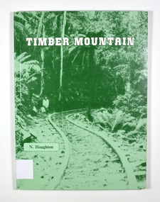
Book - Paperback book, Timber Mountain, 1986
... at the side of the railway. In the inside back cover is a fold out map... is a fold out map titled "Sawmills & Tramways of the Murrindindi ...Paperback. Front cover has an old photograph of a timber railway leading into a forest. There is also a man standing at the side of the railway. In the inside back cover is a fold out map titled "Sawmills & Tramways of the Murrindindi Forest 1885-1950.Stamp of Marysville & District / Historical Society Inc / P.O. Box 22 / Marysville 3779history, sawmilling, murrindindi forest, victoria, north east victoria, houghton, n -
 Marysville & District Historical Society
Book - Paperback book, Timber Mountain, 1986
... at the side of the railway. In the inside back cover is a fold out map.... In the inside back cover is a fold out map titled "Sawmills & Tramways ...Paperback. Front cover has an old photograph of a timber railway leading into a forest. There is also a man standing at the side of the railway. In the inside back cover is a fold out map titled "Sawmills & Tramways of the Murrindindi Forest 1885-1950.history, sawmilling, murrindindi forest, victoria, north east victoria, houghton, n -
 Bendigo Military Museum
Plan - MAP, TOURIST, L Joly, A Maunier, WWI
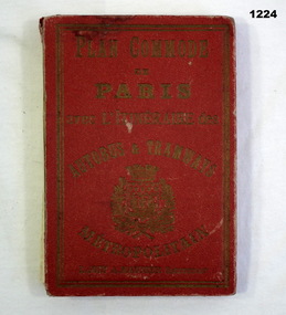
... avec l'itineraire des autobus & tramways metropolitan" Map ...The map belonged to Jack Grinton No 1043 38th Batt AIF. At Wars end extensive leave was granted, Jack journeyed to Paris, Nice, Monte Carlo taking many photos. Part of the Grinton collection which included hundreds of negatives and developed photos that he took during the War. Refer Cat No 1280 for service details. Refer 1317P, 1320P.Map of Paris. Red cardboard or paper hardcover, new edition guide of metropolitan Paris (ministries, tramways, monuments), Index in front, folded paper map attached to back cover. "Plan commode de Paris avec l'itineraire des autobus & tramways metropolitan"documents-maps, french -
 Greensborough Historical Society
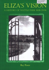
Book, Ray Pearce, Eliza's vision: a history of Wattle Park 1838-2006, 2006
An outline of the history of Wattle Park (Vic).207 p., illus., colour map.non-fictionAn outline of the history of Wattle Park (Vic).urban parks - melbourne, wattle park (vic.), parks - melbourne - history -
 Glen Eira Historical Society
Document - PRAHRAN AND MALVERN TRAMWAYS TRUST
This file has 3 items. 1/Photocopy of Caulfield Conservation Study Report by Andrew Ward dated January 1995 of 6-8 Rusden Street, Elsternwick being former Prahran and Malvern Tramways Trust substation. Report includes image, existing registrations, description of substation building and condition. 2/Original photograph (black and white) of tram shelter at corner of Balaclava Road and Orrong Road, Caulfield North, outside Grimwade House (school), description written on back of photo. 3/Original copy of magazine of the Tramway Museum Society of Victoria Ltd. ‘Running Journal’ Vol 7 No. 3 dated June 1970. Article (pages 3-7) entitled ‘Feeding & Filling, The Story of the Prahran & Malvern Tramways Trust’ written by Graeme Breydon. Article written for the 60th anniversary of the trust which opened for business on 30/05/1910 and describes the establishment and development of Tramways between suburbs of Malvern & Prahran including Elsternwick, Caulfield & Glen Huntly. Article includes 4 images plus map and diagram. Included: Photograph 3: Opening ceremony of tramway extension from Balaclava junction to Elsternwick railway station on Glen Huntly Road dated 13/11/1913. Diagram of various tramway routes including Prahran & Malvern Tramways Trust routes.prahran and malvern tramways trust, p+mtt, tram companies, land transport, public transport, substation, tram shelter, powerhouse, parapet, brick, stuccoed, roof lanterns, historic buildings register, national estate register, national trust register, rusden street, balaclava road, orrong road, hawthorn road, dandenong road, glen huntly road, grange road, elsternwick, elsternwick railway station, caulfield, caulfield north, caulfield railway station, point ormond, grimwade house, breydon graeme, tramcar, edwardian, transport, trams, tram depot -
Glen Eira Historical Society
Document - GLEN HUNTLY (HISTORY OF)
... owned by William Ross, plus a map identifying said land blocks... owned by William Ross, plus a map identifying said land blocks ...This file contains one item: 1/A loose-leaf, 23-page document titled ‘The History of Glen Huntly’, by Alfred R. Jones, dated 20/06/1991, describing the history of the suburb. The author has drawn heavily from the 4 sources noted in the bibliography. Subjects covered include the ship the suburb is named after, the suburb’s State School, the suburb’s churches, the Rosstown Railway and Sugar Mill, the origin of the name of Carnegie, the suburb’s aerodrome, and the beautification of the Glen Huntly Shopping Centre. The final 12 pages consist of 9 appendices relating to the aforementioned subjects. Appendix A is a typewritten letter from Ron McLeod, secretary of the Place Names Committee, to Mr. D. R. Aylen, CEO of the City of Caulfield, notifying the latter of the alteration of the name ‘Glenhuntly’ to ‘Glen Huntly’. Appendix B is a list of the ministers of St. David’s Uniting Church from its formation in 1916 to the present. Appendix C identifies the persons portrayed in St. David’s stained glass windows. Appendix D is a poster announcing the auction of 41 blocks of land between Hawthorn and Bambra Road formerly owned by William Ross, plus a map identifying said land blocks and anither fir locality. Appendix E is an A4 plan of the Rosstown Railway. Appendix F is a drawing of the Rosstown Sugar Mill. Appendix G is a poem titled ‘The Swagman’s Retreat’, by Herb Arnott, about the failure of the Mill. Appendix H is a map of Caulfield’s horse tramways plus a list of opening and closing dates. Appendix J is a list of streets explaining the meanings of their names.glen huntly, glenhuntly, local history, ‘glen huntly’ (ship), ‘glen huntlely’ (ship), quarantine stations, glen huntly road, lake street, mernda avenue, glen huntly state school no. 3703, ormond francis, ormond, garden avenue, grange road, churches, congregational church, glen huntly presbyterian church, st. david’s, st. david’s uniting church, anglican church, jenkin william ‘boss’, methodist church, wattle avenue, smith a. w. mr., glen huntly post office, glen huntly road, king f. l. mr., uniting church, child care centre, presbyterian church of eastern australia, glen huntly methodist church, sun aria, miller mary, stained glass, phrenologists, trinity congregational church, primitive methodists, ‘the victorian independent’, mercy mr., greek orthodox original old calendar church, wanalta road, salvation army, halls, myrtle street, catholic church, st. anthony’s roman catholic church, foundation stones, neerim road, mannix archbishop, st. agnes’ anglican church, booran road, sunday schools, clergy residences, ‘see’ anglican news magazine, lees archbishop, booth archbishop, glen huntly presbyterian church, el nido grove, tennis courts, bollard v. w. right rev., waratah avenue, royal avenue, munster avenue, james street, rothschild street, peace memorial organ, singers, bremner marie, scotland betty, carden joan, rosstown railway, south caulfield, plants, marata road, curraweena road, bambra road, ross william murray, ross leila, ross constance, vautin constance, ‘the grange’, north road, leila road, wild cherry road, caulfield roads board, elsternwick, land sales, sugar mills, koornang road, woornack road, elsternwick railway station, riddell parade, clarence street, dover street, oakleigh road, murrumbeena crescent, carlisle crescent, railways, trains, parks and reserves, caulfield council, sussex street, caulfield city council, swamps, rosstown sugar mill, rosstown estate, ‘the swagman’s retreat’, arnott herb, rosstown, carnegie, ‘ross’s folly’, carnegie andrew, rosstown hotel, dandenong road, rosstown road, rosstown plate horse race, caulfield racecourses, ames avenue, rosstown court, hostels, murrumbeena, cinemas, innovations (cabinetry film), films, music, pianos, manchester grove, safeway store, squash courts, airports, lord reserve, aeroplanes, air navigation act 1921, neville street, larkin sopwith aviation company of australasia, lyons street, morgan street, bookmakers, nightsoil, poultry, weatherboard buildings, glen huntly railway station, rosedale avenue, rifle clubs, scout groups, 1st glen huntly troop, ana, dowding jack mr., glen huntly infant welfare and family planning clinic, vermador private hospital, watson grove, rowlands (drapers), bones plant nursery, caulfield railway station, bridges, trams, horse tramways, glen eira road, elsternwick railway station, kooyong road, aboriginal peoples, truganini road, hannan lyn mrs. (urban planning officer), glen huntly shopping centre, sculptures, street beautification scheme, “flying the yellow flag”, moore olive, “return to rosstown”, jowett d. f., weickhardt i. s., “from sand swamp and health”, murray peter r., wells john c., caulfield historical society, newsletters, place names committee, mcleod ron, aylen d. r. mr., jones hugh rev., king joseph, scarfe james, vertigan sidney, vertigan earle, rance victor, flavell cameron, denholm robin, moorhead ken, taliai siupeli, eccles james leslie, little agnes, hutchins william r., dickie may a., gordon ivey agnes, theobald a. a. mrs., brownbill lloyd norman, ash georgette, land sales, auctions, messrs. crews & arkle, street names -
Glen Eira Historical Society
Article - Grand Union Tramway Junction, Balaclava Road and Hawthorn Road
... of the junction at the time of writing. Report also includes a map... of the Grand Union Junction, and a further map of Melbourne Tramways ...This file contains three items. 1. A three-page Caulfield Conservation Study of the Balaclava Road/Hawthorn Road Tramway Crossing, undertake by Andrew Ward and dated September 1994. Study includes a brief history of the junction and a statement of significance. Study also includes Four black and white photographs of the junction and of architectural details of the tram tracks. 2. A letter from the Conservation Manager of the National Trust of Australia (Victoria) to the manager of the Planning Section for the City of Glen Eira, dated 15/06/2001 and attached to a six-page Classification Report. The letter informs of the Classification of the Grand Union Junction at the intersection of Balaclava and Hawthorn Road by the national trust, signed by Conservation Manager Ian Pausacker. Classification Report includes details such as the date of construction, a statement of significance, history of the junction, physical description of the junction and the condition of the junction at the time of writing. Report also includes a map of the Melbourne Tram Network drafted by Keith Kings and dated 01/005/1956, with illustration of the layout of fifteen tram depots, and updated aerial illustration of the Grand Union Junction, and a further map of Melbourne Tramways developed by North Melbourne Electric Tramways and Lighting Co. and Prahran and Malvern Tramways Trust, drafted by Keith Kings and dated January 1914 with illustrations of three tram depots. 3. Two articles from the Caulfield Leader written by Aaron Langmaid and dated 13/02/2007 and the Melbourne Bayside Weekly dated 21/02/2007 written by Joanne Sim, both concerning the Grand Union Junction. The article from the Caulfield Leader includes a picture of Executive Officer of the council of Tramway Museum of Australia Craig Tooke in front of the intersection. The article from the Bayside Weekly includes a picture of a tram passing through the junction and a brief history of the junction and tram network in Caulfield. The article also refers to twp local tram shelters at the intersection of Dandenong Road and Alma Road and also Orrong Road and Balaclava Road.caulfield, caulfield conservation, study, balaclava road, hawthorn road, grand union junction, ward andrew, tramway crossings, transport, acland street, caulfield racecourse, tram tracks, race events, event, tram routes, thorough fares, melbourne and metropolitan tramways board, prahran and malvern tramway trust, prahran and malvern district tramways, caulfield electric tramways, caulfield city council, architectural detail, city of glen eira, balaclava road and hawthorn road intersection, balaclava road and hawthorn road junction, dandenong road, glenhuntly road, four-way tram junctions, access covers darling road, cast metal access covers, hadfields patent, caulfield park, tram systems, tram networks, heritage, tramway heritage, kings keith, tram depots, glenhuntly depot, maps, glen eira, melbourne electric tramways, north melbourne electric tramways and lighting co., prahran and malvern tramways trust, caulfield leader, bayside weekly, tooke craig, tourist attractions, grand union tramways junction, caulfield junction, cable car tramways, tram shelters, building, sheds, alma road, orrong road, caulfield electric line, balaclava junction, elsternwick railway station, caulfield station, caulfield station loop, tram services, transport establishments, thoroughfares, buildings, structures, establishments, parts of buildings or structures, documents, commercial industry, sites, historic sites, melbourne bayside weekly -
 Federation University Historical Collection
Book, Mining Engineers Handbook Volume 1 & 2, 1941
The book was used by Charles Bacon who studied at the University of Nevada in the late 1930s/early 1940s. Bacon worked at Bunker Hill Mines and Kellogg Idaho, before arriving in Australian in 1951. He worked for CN Myers, a company involved with paper converting. CN Myers was a family business (on Charles Bacon's maternal line). Robert Peele was Professor Emeritus of mining Engineering at the School of Mines, Columbia University.Maroon hardcovered books. .1) Volume 1 - Chapters include Mineralogy, Geology and Mineral Deposits, Earth Excavation, Explosives, Rock Excavation, Tunneling, Shaft Sinking in Rock, Shaft sinking in Unstable and Waterbearing Ground, Boring, Underground Transport, Mine Ventilation. .2) Volume 2 - Chapers include Compressed Air Practice, Electric Power for mine Service, Surveying,Underground Surveying, Mine Geologic Maps and models, Cost of mining, Mining Laws, Ore sampling, Assaying, Aerial Tramways and Cableways, Gold Amalgamation and Cyanidation, etc.Inside front cover "Charles Bacon"charles bacon, mining engineering, mining, engineering, university of nevada, mackay school of mines, explosives, timbering -
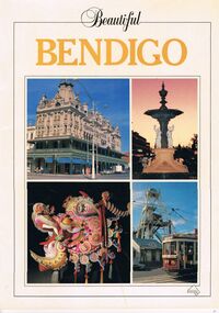 Bendigo Historical Society Inc.
Book - PICTURES AND ATTRACTIONS OF BENDIGO: BEAUTIFUL BENDIGO
Booklet (18 pages) ''Beautiful Bendigo'' - coloured pictures of Bendigo and attractions with one page foreword. Published in association with the Bendigo and District Tourism Association, 1987. Includes city map at back of booklet.Printed in Singapore by Toppan Printing Company. Published by Robert Brown & Associated (Aust) Pty Ltd.bendigo, tourism, guide, tramways, george lansell, gold mines hotel, specimen cottage, queen elizabeth oval, secred heart cathedral, camp hill primary school, public library, conservatory gardens, school of mines. central deborah mine. dai gum san wax museum, kwan gung joss house, bendigo's sun loong dragon. sandhurst town, map of bendigo. -
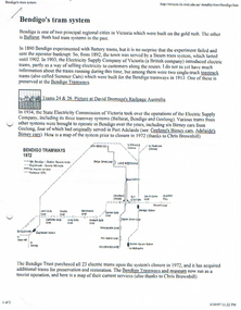 Bendigo Historical Society Inc.
Document - LONG GULLY HISTORY GROUP COLLECTION: BENDIGO'S TRAM SYSTEM
Information on trams. Includes small photo of Trams 24 & 26, Map of Bendigo Tram routes 1972and 1996, Ballarat No 26 tram, S 164 tram, and No 38 tram. Mentioned is the individual history and where they can be found, operating and non operating trams, different classes of trams. Geelong's Birney Cars, two of which came to Bendigo and the Type G (Birney Safety Cars). Other information includes Nos, First introduced, Last withdrawn, Electrics (motors), Size and Seating/Crush Load. (8 pages).bendigo, history, long gully history group, the long gully history group - bendigo's tram system, battery trams, steam trams, electricity supply company of victoria, toastrack trams, david bromage, bendigo tramways, state electricity commission of victoria, the bendigo trust, chris brownbill, bendigo talking tram, david hoadley, prahran and malvern tramways trust, hawthorn tramways trust, fitzroy northcote and preston tramways trust, melbourne brunswick and coburg tramways trust, north melbourne electric tramway and lighting co, sydney tramway museum, tramway museum of victoria, railpage australia, ballarat vintage tramway, andrew cox, russell jones, australian electric transport museum, birney cars, j g brill & co, bob hawke, adelaide municipal tramways trust, tim blythman, bill winn, john radcliffe -
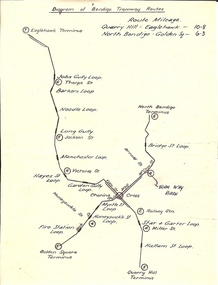 Bendigo Historical Society Inc.
Document - BASIL MILLER COLLECTION: TRAMS - DIAGRAM BENDIGO TRAMWAY ROUTES
... Hand drawn map of Bendigo tramway Routes indicating... PERSON Individual basil miller Hand drawn map of Bendigo tramway ...Hand drawn map of Bendigo tramway Routes indicating location of loops and where lines terminated. Reverse: Bottom left corner 31/2 handwritten in blue ink.person, individual, basil miller -
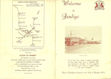 Bendigo Historical Society Inc.
Document - BASIL MILLER COLLECTION: TRAMS - EVOLUTION BENDIGO TRAMWAYS
3 copies of a Yellow booklet printed in reddish brown ink 'Welcome to Bendigo' featuring image of trams in Charing Cross on cover. 'Evolution of Bendigo Tramways' composes the centre spread detailing the various tram types through the ages. Backcover shows map of the routes and places of interest.Arthur Hocking, Printer.person, individual, basil miller -
 Bendigo Historical Society Inc.
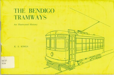
Book - THE BENDIGO TRAMWAYS AN ILLUSTRATED HISTORY, 1972
The Bendigo Tramways - an illustrated history 80 pages, photographs, illustrations and map. Published by Hedges and Bell Pty. Ltd. Maryborough. Chapters include battery trams, steam trams, electric supply company years and S.E.C. era.K.S. Kingstramways, history, trams, electric traction, public transport -
Bendigo Historical Society Inc.
Book - TALKING TRAMS, 1973
Talking Trams Present, past and future. History of tramways in Bendigo, including horsedrawn, battery and electric trams. Description of route taken by talking tram. Photographs, illustrations, maps, plates, artwork by Clearad Pty. Ltd. With IndexJanWerner Hente Bendigo Trusttramways, history, bendigo talking trams, bendigo, tramsways, talking tram. -
Bendigo Historical Society Inc.
Document - BASIL MILLER COLLECTION: TRAM, TRAMWAY ROUTES AND SECTION DESTINATIONS, c1971?
Document. State Electricity Commission of Victoria. Electricity Supply Department - Bendigo Tramways. Tramway routes and section destinations. 15 copies of same route map.organization, business, bendigo trams