Showing 110 items
matching walk guide
-
 Eltham District Historical Society Inc
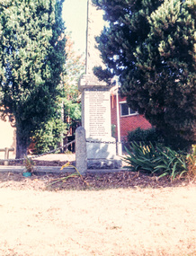
Photograph, War Memorial at front of Eltham RSL, Main Road, Eltham, April 1989, 1989
... will be a guided walk around Eltham featuring a number of buildings... will be a guided walk around Eltham featuring a number of buildings ...[from EDHS Newsletter No. 65, March, 1989:] ELTHAM HERITAGE WALK The Society's contribution to Heritage Week this year will be a guided walk around Eltham featuring a number of buildings and locations of historical and environmental interest. Three dates are listed as official Heritage Week events, Sundays 16th and 23rd April and Saturday 22nd. In addition, there will be a walk on Saturday 15th for Society Members. All walks will start at 1:00 p.m. in Panther Place near Shillinglaw Cottage. Each will take about four hours and the distance is about 5km. Old photos of locations visited will be available for viewing.Colour photographeltham rsl sub-branch, main road -
 Eltham District Historical Society Inc
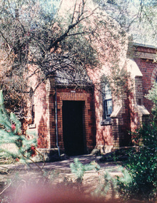
Photograph, Uniting Church, cnr Main Road and John Street, Eltham, April 1989, 1989
... will be a guided walk around Eltham featuring a number of buildings... will be a guided walk around Eltham featuring a number of buildings ...[from EDHS Newsletter No. 65, March, 1989:] ELTHAM HERITAGE WALK The Society's contribution to Heritage Week this year will be a guided walk around Eltham featuring a number of buildings and locations of historical and environmental interest. Three dates are listed as official Heritage Week events, Sundays 16th and 23rd April and Saturday 22nd. In addition, there will be a walk on Saturday 15th for Society Members. All walks will start at 1:00 p.m. in Panther Place near Shillinglaw Cottage. Each will take about four hours and the distance is about 5km. Old photos of locations visited will be available for viewing.Colour photographjohn street, main road, uniting church -
 Eltham District Historical Society Inc
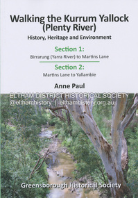
Book, Anne Paul, Walking the Kurrum Yallock (Plenty River), 25 July 2023
... . The Kurrum Yallock walks aim to guide people along the River Trail.... The Kurrum Yallock walks aim to guide people along the River Trail ...Kurrum Yallock - the Plenty River is Melbourne's third river. It is a defining feature of the region weaving its way through local suburbs and parklands. It is often hidden from general view, emerging at bridges and along its extensive trail network. While diminished since European settlement, the River provides an important environmental, wildlife corridor and recreational resource, along with many links to its settlement heritage. The Kurrum Yallock walks aim to guide people along the River Trail, while providing insight into key aspects of our recent history, an opportunity for reflection and an enhanced enjoyment of the River's special environment and landscape.birrarung, greensborough historical society, kurrum yallock, martins lane, plenty river, yallambie, yarra river -
 Eltham District Historical Society Inc
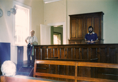
Photograph, Eltham Courthouse, 730 Main Road, Eltham; 15 April 1989, 15/04/1989
... contribution to Heritage Week this year will be a guided walk around... contribution to Heritage Week this year will be a guided walk around ...L-R: Doug Orford, Russell Yeoman [from EDHS Newsletter No. 65, March, 1989:] ELTHAM HERITAGE WALK The Society's contribution to Heritage Week this year will be a guided walk around Eltham featuring a number of buildings and locations of historical and environmental interest. Three dates are listed as official Heritage Week events, Sundays 16th and 23rd April and Saturday 22nd. In addition, there will be a walk on Saturday 15th for Society Members. All walks will start at 1:00 p.m. in Panther Place near Shillinglaw Cottage. Each will take about four hours and the distance is about 5km. Old photos of locations visited will be available for viewing.Colour photographheritage excursion, activities, doug orford, russell yeoman, eltham courthouse -
 Eltham District Historical Society Inc
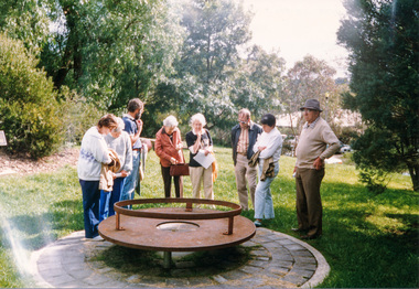
Photograph, Monument and Time Capsule, Eltham Community Centre, cnr Main Road and Pitt Street, Eltham; 15 April 1989, 15/04/1989
... [from EDHS Newsletter No. 65, March, 1989:] ELTHAM HERITAGE WALK... [from EDHS Newsletter No. 65, March, 1989:] ELTHAM HERITAGE WALK ...L-R: Phyllis McDonald, Dolly Smith, Russell Yeoman, Joyce McMahon, Opal Smith, Brian Smith, Lu Robertson, Jack Shallard [from EDHS Newsletter No. 65, March, 1989:] ELTHAM HERITAGE WALK The Society's contribution to Heritage Week this year will be a guided walk around Eltham featuring a number of buildings and locations of historical and environmental interest. Three dates are listed as official Heritage Week events, Sundays 16th and 23rd April and Saturday 22nd. In addition, there will be a walk on Saturday 15th for Society Members. All walks will start at 1:00 p.m. in Panther Place near Shillinglaw Cottage. Each will take about four hours and the distance is about 5km. Old photos of locations visited will be available for viewing.Colour photographheritage excursion, main road, eltham, 150th anniversary monument, 20th anniversary, activities, eltham community centre, pitt street, plaques, time capsule -
 Ballarat Tramway Museum
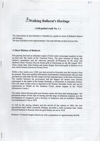
Ephemera - Tour Notes, Jennifer Barnes, 'Walking Ballarat's Heritage', Aug. 1998
... 18 page self-guided walk No. 1 of Ballarat with three... Visitor Information Centre. 18 page self-guided walk No. 1 ...18 page self-guided walk No. 1 of Ballarat with three staples along left hand edge. Page 1 incorporates a short history of Ballarat, followed by tour commencing at Ballarat Visitor Information Centre, 33 Sturt St., west to Lydiard St., south to former goal (jail) and return to Railway station. Returning to Sturt St. via Mair and Camp Streets finishing up in Bridge St. Mall. Interest: Page 3, under "2. Sturt St.", on paragraph on electric trams and second re 'Ballarat Vintage Tramway'. Mrs. Jennifer Barnes is the wife of City of Ballarat Councillor, Mr. John Barnes$2 (in blue biro top left hand corner page 1) - cost price of purchase from Ballarat Visitor Information Centre.local history, ballarat railway station, heritage buildings, tourism -
 Halls Gap & Grampians Historical Society
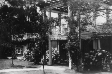
Photograph - B/W, C 1931
... and guided walks were taken out by local guide Gilbert Rogers.... riding and guided walks were taken out by local guide Gilbert ...A major rebuilding project took place. Brothers John & Thomas Morgan with local storekeeper Harold Goodwin Taylor designing and building a grand new Guest House with 22 bedrooms plus the original bungalows. Unheard of at the time the guests bedrooms had hand basins with hot & cold running water. This was achieved by building a weir on Stony Creek and piping the water to a high holding tank at the guest house. The dining room was a grand affair, a 4.5 metre high ceiling with beautiful gold leaf cornices, art deco ceiling and wall lights with feature plaster lights in the form of blue bells, wall to wall carpet and Kentia palms completed the picture. Ladies & gentlemen dressed for dinner, the ladies resplendent in their long evening gowns and jewellery would come down the stairway from the entrance hall to the lounge then the dining room. The tables were beautifully appointed with damask table cloths & fine silverware. The kitchen was well appointed with a huge coal fired range and a donkey for hot water. Milk & cream, bacon & pork, chicken & eggs together with vegetables were all home grown on the property. A large ballroom with a beautiful timber floor was the scene after dinner for many dances and party nights with guests from other establishments and locals joining in for the night. A huge fernery was also a feature of the gardens. During the day tennis parties would be held on the courts, together with horse riding and guided walks were taken out by local guide Gilbert Rogers.Photo of newly built Grampian Houseaccommodation, guesthouses, accommodation, grampian house -
 Surrey Hills Historical Society Collection
Work on paper - Vertical file, Beckett Park and Maranoa Gardens
... , undated (1 page). 14. Maranoa Gardens Self-guided walk, undated (4..., undated (1 page). 14. Maranoa Gardens Self-guided walk, undated (4 ...1. ‘Observation tower Beckett Park’, B.H. Reporter, 23.11.1934 (2 pages). 2. ‘Glory of a native garden’, F. Chapman, Literary Section unknown paper, 2.9.1939 (1 page, 2 copies original and copy). 3. Copy ‘Centenary tower’, The Herald, 21.5.1937 (1 page). 4. ‘Maranoa’, Camberwell City News, August, 1990 (1 page). 5. ‘Rotary Club’s gift to garden’, ? Age, 1990s ? (1 page) 6. ‘Maranoa Gardens & Beckett Park’ supplement, Boroondara Bulletin, 1997 (2 page spread). 7. ‘Beckett Park revisited’ by Annie Gillison, 8.7.1985, Melbourne Week ? (1 page). 8. Maranoa gardens Boroondara Council brochure (undated) (1 page). 9. Re Mr. Arthur J. Swaby, information from various sources, undated (1 page). 10. Beckett Park – ‘Glory of a Native Garden’, F. Chapman, unnamed newspaper, 2.9.1939, copy. (1 page). 11. Beckett Park: information re Robert Beckett from various sources (2 pages). 12. ‘Most will like gardens plan’, unnamed newspaper, letter from Dennis Whelan, undated (1 page). 13. Extracts from J.A. Allan’s unpublished history of Camberwell re Beckett Park & Maranoa Gardens, undated (1 page). 14. Maranoa Gardens Self-guided walk, undated (4 page brochure). 15. Notes on F. Chapman and interests, various sources, (2 pages). 16. Empire Day celebrations, extract from Argus, 24.5.1937 (1 page). 17. Extract from Camberwell Conservation Plan, 1989 by McConville (1 page). 18. ‘A lesson in serenity’, Maranoa Botanic Gardens, Balwyn, Domain Review, 7.7.2021 (2 pages). 19. Boroondara City Council Notice of proposed naming of reserve, Progress Leader, 5.12.2019 (1 page). 20. Maranoa Botanic Gardens, undated (double sided pamphlet). 21. 2 extracts from Box Hill Recorder, 23.10.1925 and 27.11.1925 (1 page). 22. Extract from BHR, 15.1.1926 ‘Visit of Field Naturalists Club of Victoria’ (1 page). -
 Warrnambool and District Historical Society Inc.
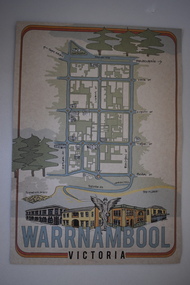
Document, Ella Webb, Warrnambool artist, Street Walks of Warrnambool, 2018
This is a tourist guide to Warrnambool produced by a local artist, Ella Webb, in conjunction with the Warrnambool and District Historical Society. It includes a sketch map showing the location of some points of interest – buildings and sites of historical interest, places of interest that are no longer existing, some natural features (mainly along the coast) and some information about incidents and people in the past. It is an attractive broadsheet that is a useful guide for visitors to Warrnambool. This sheet is of interest as a modern-day tourist map produced in an artistic fashion by a local Warrnambool artist.This is a single sheet of thick paper printed on both sides in green, brown, yellow and beige tonings. One side of the sheet has sketches of buildings and places of interest and printing and the other side has a sketch map of some of the main streets of Warrnambool and some of its attractions. -
 Eltham District Historical Society Inc
Document - Folder, Shire of Eltham Historical Society, Heritage Week, 1982-1996
Various informational material for Heritage Week themes by year along with Shire of Eltham Historical Society forms and copies of activities Includes 1989 self guided tour with map of 36 historical locations provided as part of the Shire of Eltham Historical Soiciety's activities for Heritage Week 1989 and also 1983 (recreated from display materials)eltham heritage walk, heritage week, heritage week 1989, shire of eltham historical society -
 Marysville & District Historical Society
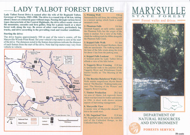
Flyer (item) - Brochure, Department of Natural Resources and Environment-Forest Service, Marysville State Forest-Forest walks and drives-Lady Talbot Forest Drive, Pre 2009
A brochure that was produced as a guide to Lady Talbot Forest Drive in Marysville in Victoria.A brochure that was produced as a guide to Lady Talbot Forest Drive in Marysville in Victoria. Lady Talbot Drive a 24 kilometer scenic rainforest car journey which passes a number of walks and waterfalls in the Yarra Ranges National Park. Lady Talbot Drive is named after Lady Sarah Elizabeth, the wife of Sir Reginald Talbot, who was the Governor of Victoria from 25th April, 1904 to 6th July 1908.50 cents Bob McNamara/ Real Estate Agent/ Tourism Info Centre Co-Ordinatorlady talbot forest drive, lady talbot drive, sir reginald talbot, lady sarah elizabeth talbot, marysville, wishing well, phantom falls, keppel falls walk, keppel falls lookout, taggerty river, beeches rainforest walk, logging, mount sugarloaf, victoria -
 Marysville & District Historical Society
Flyer (item) - Brochure, Natural Resources and Evironment, Marysville State Forest-Forest walks and drives-Lady Talbot Forest Drive, Pre 2009
A brochure that was produced as a guide to Lady Talbot Forest Drive in Marysville in Victoria.A brochure that was produced as a guide to Lady Talbot Forest Drive in Marysville in Victoria. Lady Talbot Drive a 24 kilometer scenic rainforest car journey which passes a number of walks and waterfalls in the Yarra Ranges National Park. Lady Talbot Drive is named after Lady Sarah Elizabeth, the wife of Sir Reginald Talbot, who was the Governor of Victoria from 25th April, 1904 to 6th July 1908.lady talbot forest drive, lady talbot drive, sir reginald talbot, lady sarah elizabeth talbot, marysville, wishing well, phantom falls, keppel falls walk, keppel falls lookout, taggerty river, beeches rainforest walk, logging, mount sugarloaf, victoria -
 Marysville & District Historical Society
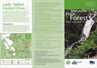
Flyer (item) - Brochure, Dept. Sustainability & Environment, Marysville State Forest-Forest walks and drives-Lady Talbot Forest Drive, 2003
A brochure that was produced as a guide to Lady Talbot Forest Drive in Marysville in Victoria.A brochure that was produced as a guide to Lady Talbot Forest Drive in Marysville in Victoria. Lady Talbot Drive a 24 kilometer scenic rainforest car journey which passes a number of walks and waterfalls in the Yarra Ranges National Park. Lady Talbot Drive is named after Lady Sarah Elizabeth, the wife of Sir Reginald Talbot, who was the Governor of Victoria from 25th April, 1904 to 6th July 1908.ISBN 1 74106 695 6lady talbot forest drive, lady talbot drive, sir reginald talbot, lady sarah elizabeth talbot, marysville, wishing well, phantom falls, keppel falls walk, keppel falls lookout, taggerty river, beeches rainforest walk, logging, mount sugarloaf, victoria, leadbeater's possum, beckter lookout, steavenson falls, isbn 1 74106 695 6 -
Marysville & District Historical Society
Flyer (item) - Information Flyer, Artworkz Tourism, Marysville-Phantom Falls, Post 2009
A flyer that was produced as a guide to Phantom Falls near Marysville in Victoria.A flyer that was produced as a guide to Phantom Falls near Marysville in Victoria. Phantom Falls is located off Lady Talbot Drive. Lady Talbot Drive a 24 kilometer scenic rainforest car journey which passes a number of walks and waterfalls in the Yarra Ranges National Park. Lady Talbot Drive is named after Lady Sarah Elizabeth, the wife of Sir Reginald Talbot, who was the Governor of Victoria from 25th April, 1904 to 6th July 1908.phantom falls, marysville, victoria, lady talbot drive, lady talbot forest drive, sir reginald talbot, lady sarah elizabeth talbot, yarra ranges national park -
 Marysville & District Historical Society
Booklet (Item) - Tourist guide, Ian and Danese Walshe et al, MARYSVILLE and district TOURIST GUIDE, 1982
A tourist guide outlining services, accommodation, activities and places of interest to visit in and around Marysville and the local district.A tourist guide outlining services, accommodation, activities and places of interest to visit in and around Marysville and the local district.marysville, victoria, australia, tourist guide, marysville hotel, castles' store, hawthorne's corner shop, tudor lodge, black spur motel and caravan park, buxton general store, golden fleece roadhouse, marysville garage, burrengeen park, lake mountain, steavenson falls, nanda binya lodge, alpenglow nursery, black spur inn hotel, silver stream trout farm, mccfarlane's grocery, barton's drapery, marysville newsagency, eildon explorer, beauty spot nursery, crossways, pumpernickel, mckenzie's tourist services, blue hills riding school, mountain view horse hire, pitt's garage, maryton park, j l gould sawmill, eildon deer park, eildon weir, maroondah dam, snob's creek, healesville sanctuary, graceburn park, cathedral range, beauty spot walk, tree fern gully walk, michaeldene track, keppel track, woods lookout track, cumberland scenic reserve, cambarville, the big tree, cora-lyn falls, barton's lookout, cumberland falls, sovereign view, wirreanda festival, scenic motel, tower motel, marylands guest house, kooringa guest house, marylyn guest house, mountain lodge, el kanah, marysville hotel motel, buxton hotel motel, black spur inn, buxton caravan park, marysville caravan park, the cumberland, marysville recreation and fun park -
 Marysville & District Historical Society
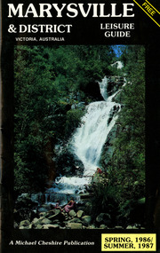
Booklet (Item) - Leisure guide, Michael Chesire & Associates Pty. Ltd, MARYSVILLE & DISTRICT LEISURE GUIDE-SPRING, 1986/SUMMBER, 1987, 1986
A free leisure guide to Marysville and the surrounding district published for Spring 1986, and Summer, 1987. This was produced by Michael Cheshire as a free publication to promote tourism in Marysville and the surrounding district. It includes maps of the Big River Valley, Cumberland Valley, Lady Talbot Forest Drive, the Marysville area, and the township of Marysville. It was released in the spring of 1986. A free leisure guide to Marysville and the surrounding district published for Spring 1986, and Summer 1987.Kilmore Historical Society *10/183 *MDL.1.marysville, victoria, australia, leisure guide, michael cheshire & associates pty ltd, marysville golf club, blackwood lodges, sir colin mackenzie fauna park, lake eildon, fraser national park, yarra valley wineries, marysville coach tours, kooringa, marylands guest house, lady talbot forest drive, wishing well, taggerty river recreation area, athols abbey, phantom falls, keppel falls, the beeches walking track, marylyn guest house, kufstein inn motel, the cumberland, marysville tourist & progress association, marysville newsagency & general store, crossways restaurant & motel, beauty spot walk, tree fern gully walk, michaeldene track, keppel track, woods lookout track, marysville hotel motel, lake mountain ski hire, marysville recreation and fun park, mytanta horseback safaris, upper big river valley, the big culvert, marysville mountain view horse hire, maryton park, amber view holiday lodges, cathedral restaurant, the top shop, tower motel, menzes garage, beauty spot nursery, marysville ski hire, lake mountain ski school, faraway forest, scenic motel, buxton trout farm, marysville hardware, timbertop steakhouse, marysville trout farm, healesville sanctuary, buxton hotel motel, nanda binya lodge, buxton antique and furniture mart, the black spur inn hotel, alexandra, lake mountain, j l gould sawmills pty. ltd., geoffrey pope & associates, marysville crafts & gifts, olde yarra track shoppe, cumberland scenic reserve, tudor lodge road house, fruit salad farm, highwayman's retreat -
 Marysville & District Historical Society
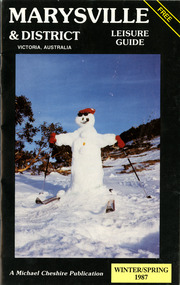
Booklet (Item) - Leisure guide, Michael Chesire & Associates Pty. Ltd, MARYSVILLE & DISTRICT LEISURE GUIDE-WINTER/SPRING 1987, 1987
A free leisure guide to Marysville and the surrounding district published for Winter and Spring, 1987. This was produced by Michael Cheshire as a free publication to promote tourism in Marysville and the surrounding district. It includes maps of the Big River Valley, Cumberland Valley, Lady Talbot Forest Drive, the Marysville area, and the township of Marysville. It was released in the winter of 1987. A free leisure guide to Marysville and the surrounding district published for Winter and Spring, 1987.marysville, victoria, australia, leisure guide, michael cheshire & associates pty ltd, marysville golf club, blackwood lodges, sir colin mackenzie fauna park, lake eildon, fraser national park, yarra valley wineries, marysville coach tours, kooringa, marylands guest house, lady talbot forest drive, wishing well, taggerty river recreation area, athols abbey, phantom falls, keppel falls, the beeches walking track, marylyn guest house, kufstein inn motel, the cumberland, marysville tourist & progress association, marysville newsagency & general store, crossways restaurant & motel, beauty spot walk, tree fern gully walk, michaeldene track, keppel track, woods lookout track, marysville hotel motel, lake mountain ski hire, marysville recreation and fun park, mytanta horseback safaris, upper big river valley, the big culvert, marysville mountain view horse hire, maryton park, amber view holiday lodges, cathedral restaurant, the top shop, tower motel, menzes garage, marysville ski hire, lake mountain ski school, faraway forest, scenic motel, buxton trout farm, marysville hardware, timbertop steakhouse, marysville trout farm, healesville sanctuary, buxton hotel motel, nanda binya lodge, buxton antique and furniture mart, the black spur inn hotel, alexandra, lake mountain, j l gould sawmills pty. ltd., geoffrey pope & associates, marysville crafts & gifts, olde yarra track shoppe, cumberland scenic reserve, tudor lodge road house, fruit salad farm, highwayman's retreat, beauty spot display gardens & nursery, ski lake mountain cross country ski hire & kitchen, buxton store, valley view marysville, acheron way, mt donna buang road, snow gum woodlands, alpine ash forests, mountain ash forests, stringybark forests, messmate forests, manna gum forests -
 Marysville & District Historical Society
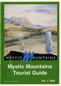
Ephemera (Item) - Tourist Guide, Michael Nash et al, Mystic Mountains Tourist Guide Vol. 1 1994, 1994
A tourist guide outlining services, accommodation, activities and places of interest to visit in and around Marysville and the local district.A tourist guide outlining services, accommodation, activities and places of interest to visit in and around Marysville and the local district.ACKNOWLEDGEMENTS:/ Marysville and District Tourist and Progress Association, Marysville/ Office of the Department of Conservation & Natural Resources, Shire/ of Alexandra Visitors Guide and all our advertisers whom without/ their support this publication would not have been possible.marysville, victoria, australia, tourist guide, mystic mountains, michael nash, dudley jones, marysville and district tourist and progress association, department of conservation & natural resources, shire of alexandra, paperwork professionals, pp art services, harrier printing, darrowby deer farm, heidi boesch, hidden talent craft gallery, olde yarra track shoppe, lady talbot forest drive, mathilde's of marysville country guest house, wishing well, taggerty river picnic area, taggery river, phantom falls, keppel falls, the beeches walking track, mount sugarloaf, beauty spot walk, tree fern gully walk, michaeldene track, keppel track, woods lookout track, marysville caravan park, baree mud brick cottages, cumberland scenic reserve, nanda binya lodge, cambarville, the big tree, barton's lookout, cumberland falls, our lady of the snows catholic church, anglican church christ, marysville christian fellowship, sovereign view, the big culvert, st fillan, steavenson's restaurant, the birches resort, cathedral range state park, tower motel, marysville post shop, lake mountain, wirreanda festival, cross country ski hire, marysville hotel motel, kerami house, marysville holiday cottages, missing links miniature golf, top shop pancake parlour, marylands guest house, dalrymples guest cottages, crossways country inn, esa camping & conference centre, scenic motel, the cumberland, maryton park holiday cottages, lomatia lodge holiday house, willowbank gallery and art centre, igloo roadhouse, a model tours, geoffrey pope & associates -
 Marysville & District Historical Society
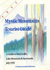
Ephemera (Item) - Tourist Guide, Graeme Haycraft, Mystic Mountains Tourist Guide July 1995, 07-1995
A tourist guide outlining services, accommodation, activities and places of interest to visit in and around Marysville, Lake Mountain and the local district.A tourist guide outlining services, accommodation, activities and places of interest to visit in and around Marysville, Lake Mountain and the local district.Acknowledgements/ Mystic Mountains Tourism Association, Marysville Office of the Dept. of Conser/ vation & Natural Resources, Mrs Elaine Postlethwaite, Ms Sue Henry & every/ advertiser without whose support this Guide would not have been possible.marysville, victoria, australia, tourist guide, mystic mountains, lake mountain, tourism australia, graeme haycraft, magic creek nursery, missing links miniature golf, phelps bakery, blackwood cottages, marysville hotel motel, tower motel, kerami house, marylands guest house, lomatia lodge, willowbank at taggerty, barree mud brick cottages, scenic motel, somerled mountain retreat, dalrymples guest cottages, nanda binya lodge, mathilde's of marysville country guest house, the birches resort, mystic mountains tourist information, marysville caravan park, the cumberland, igloo roadhouse, top shop pancake parlour, the silver birch restaurant, steavenson's restaurant, olde yarra track shoppe, danish coffee gardens, oscars take-away, country touch pottery studio & gallery, cumberland memorial scenic reserve, cathedral range state park, lady talbot forest drive, wishing well, taggerty river picnic area, taggerty river, phantom falls, keppels falls, the beeches walking track, mount sugarloaf, maryton park holiday cottages, snowviews, esa camping & conference centre, wirreanda festival, marysville post shop, hidden talent craft gallery, marysville automotive repairs, geoffrey pope & associates, beauty spot walk, tree fern gully walk, michaeldene track, marysville riding school, gerraty's ski centre, marysville holiday cottages, marysville triangle taxi service, fruit salad farm, lake mountain alpine resort, marysville ski hire, lake mountain ski school, cross country ski hire, lake mountain ski hire, marysville country club -
 Marysville & District Historical Society
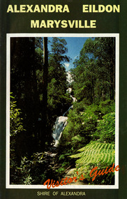
Ephemera (Item) - Visitor's Guide, Shire of Alexandra, ALEXANDRA EILDON MARYSVILLE Visitor's Guide, Unknown
A tourist guide for Alexandra, Eildon and Marysville produced by the Shire of Alexandra.A tourist guide for Alexandra, Eildon and Marysville produced by the Shire of Alexandra.alexandra, eildon, marysville, victoria, australia, tourist guide, steavenson falls, blackwood lodges, marysville hotel motel, the cumberland, gallery restaurant marysville, marysville gallery, cross country ski hire, marylyn guest house, marylands guest house, marysville crafts & gifts, hearts of oak antiques, geoffrey pope & associates, cedron house marysville, amber view holiday lodges marysville, marysville ski hire, lake mountain ski school, fruit salad farm, taggerty general store, arbor green galleries marysville, black spur roadhouse, black spur motel & caravan park, marysville caravan park, the hermitage narbethong, danish coffee garden, maryton park, buxton trout farm, lake mountain outdoor centre marysville, australian bush pioneer's farm, the camel farm and zoo buxton, marysville mountain view horse hire, marysville golf and bowls club, yarrolyn holiday park taggerty, riverland lodge taggerty, beauty spot walk, tree fern gully walk, michaeldene track, keppel track, woods lookout track -
 Marysville & District Historical Society
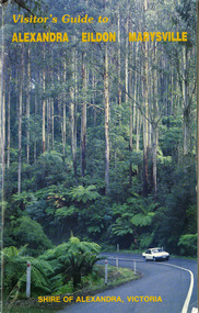
Ephemera (Item) - Visitor's Guide, Shire of Alexandra, Visitor's Guide to ALEXANDRA EILDON MARYSVILLE, Unknown
A tourist guide for Alexandra, Eildon and Marysville produced by the Shire of Alexandra.A tourist guide for Alexandra, Eildon and Marysville produced by the Shire of Alexandra.alexandra, eildon, marysville, victoria, australia, tourist guide, the cumberland, tudor lodge road house, the hermitage narbethong, blue views ski hire and holiday units narbethong, blackwood lodges marysville, marysville hotel motel, kufstein inn marysville, lake mountain, mary-lyn resort marysville, kooringa resort and conference centre marysville, mary's ville marysville, marysville crafts & gifts, geoffrey pope & associates, nanda binya lodge marysville, crossways country inn marysville, steavenson falls, scenic motel, marylands guest house, marysville holiday cottages, marysville newsagency & general store, el kanah, roseleigh holiday units, restaurant tirol, olde yarra track shoppe, marysville caravan park, dalrymples guest cottages, danish coffee garden, maryton park, tower motel, marysville golf and bowls club, taggerty general store, the camel farm and zoo buxton, buxton trout farm, yarrolyn holiday park, riverland lodge, marysville mountain view horse hire, beauty spot walk, tree fern gully walk, michaeldene track, keppel track, woods lookout track -
 Marysville & District Historical Society
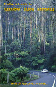
Ephemera (Item) - Visitor's Guide, Shire of Alexandra, Visitor's Guide to ALEXANDRA EILDON MARYSVILLE, Unknown
A tourist guide for Alexandra, Eildon and Marysville produced by the Shire of Alexandra.A tourist guide for Alexandra, Eildon and Marysville produced by the Shire of Alexandra.alexandra, eildon, marysville, victoria, australia, tourist guide, the cumberland, tudor lodge road house, the hermitage narbethong, blue views ski hire and holiday units narbethong, blackwood lodges marysville, marysville hotel motel, kufstein inn marysville, lake mountain, mary-lyn resort marysville, kooringa resort and conference centre marysville, mary's ville marysville, marysville crafts & gifts, geoffrey pope & associates, nanda binya lodge marysville, crossways country inn marysville, steavenson falls, scenic motel, marylands guest house, marysville holiday cottages, marysville newsagency & general store, el kanah, roseleigh holiday units, restaurant tirol, olde yarra track shoppe, marysville caravan park, dalrymples guest cottages, danish coffee garden, maryton park, tower motel, marysville golf and bowls club, taggerty general store, the camel farm and zoo buxton, buxton trout farm, yarrolyn holiday park, riverland lodge, marysville mountain view horse hire, beauty spot walk, tree fern gully walk, michaeldene track, keppel track, woods lookout track -
 Marysville & District Historical Society
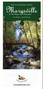
Map (Item) - Map and touring guide, Murrindindi Regional Tourism Association Inc, Marysville & The Mystic Mountains VICTORIA-AUSTRALIA, 08-2002
A fold out map and touring guide of Marysville and the surrounding district published in 2002 by Murrindindi Regional Tourism Association Inc.A fold out map and touring guide of Marysville and the surrounding district published in 2002 by Murrindindi Regional Tourism Association Inc.marysville, victoria, australia, map and touring guide, mystic mountains tourism, the beeches rainforest walk, lake mountain, cambarville, cathedral range state park, the cumberland, abbey green b&b cottages, anastasia fairytale cottage, ashlar cottage b&b, somerled mountain retreat, baree mudbrick cottages, blackwood cottages, camellia cottage, cathedral view b&b, cottage riverside, crossways country inn, dalrymples guest cottages, esa country ministries, hillcrest, keppels hotel motel, kerami house, lomatia lodge, lyell guest cottages, marylands country house, marysville caravan park, marysville holiday cottages, maryton park, melina cottage, moondai farm b&b, mountain lodge marysville, mount cathedral lodge, mystic mountains holiday cottages, nanda binya lodge, rendezvous on murchison, scenic b&b, the hermitage, tower motel, waratah house, willowbank at taggerty, woodlands of narbethong, keppels, lake mountain resort cafe, lanterns at willowbank, mantirri blueberry farm, marysville country bakery, the old woolshed cafe, clearstream olives, uncle fred & aunty val's old style lolly shop, acheron valley alpacas country store & gallery, bruno's art and sculpture garden, country touch, things of sand & stone, willowbank gallery, marysville auto & hardware, marysville newsagency & general store, marysville visitor information centre, narbethong visitor information centre, gallipoli park, keppels lookout, lady talbot drive, steavenson falls, steavenson river, taggerty river, acheron river, black spur trail riding centre, buxton trout farm, lake mountain resort ski hire, lake mountain ski school, marysville district country club, marysville ski centre, narbethong ski hire, rubicon horse riding, country touch tours, murrindindi regional tourism association inc -
Federation University Historical Collection
Book - Book - Scrapbook, Ballarat School of MInes: Scrapbook of Newspaper Cuttings, Book 60, February 1994 to April 1994
Collection of newspaper articles related to Ballarat School Of Mines.They cover activities and advertisements for staff. The papers concerned are The Courier, Ballarat, The Australian, The Age over the period of 15 February 1994 to 13 April 1994.Book with yellow cover, front, spiral bound. teaching positions advertised, pre-employment courses, courses available, enrolment for smb courses, ararat tafe left out of guide, open learning program, smb helps disabled people, gwyn hanssen-pigott potter, rob gravestocks, paul parker, theatre teachers, computers put smb at the top, kelvin jarvis, history in education, adult literacy tutors, poetry in pottery, wayne braybrook wins vce award, walk against want, michael bracher, compic menus at city hotels, smb community college plan -
 Greensborough Historical Society
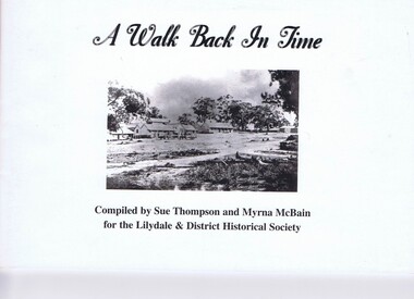
Booklet, Sue Thompson et al, A walk back in time, 1990s
... .) Photos and text from a self-guided walk around Lilydale. 43 p ...Photos and text from a self-guided walk around Lilydale.43 p., illus., map.non-fictionPhotos and text from a self-guided walk around Lilydale.historic buildings, pioneer walks, lilydale (vic.) -
 Greensborough Historical Society
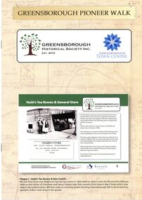
Booklet, Greensborough Historical Society Inc, Greensborough Pioneer Walk, 2021
A guide to the historic photographs which have been mounted on 12 plaques in Greensborough Town Centre. 8 p., photographs, captions and mapgreensborough, pioneer walks, greensborough historical society -
 Greensborough Historical Society
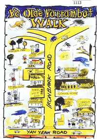
Leaflet, Yarrambat Historical Society, Ye Olde Yarrambat Walk, 2013_
This brochure is a self-guided tour of the historical buildings remaining in Yarrambat. The walk takes in 13 sites which link ‘Olde’ Yarrambat to today including the Eltham & District Woodworkers and the original school house site. A guide is available from the Old Yarrambat General Store and Yarrambat Post Office. One page leaflet, colour images.yarrambat, yarrambat historical society -
 Greensborough Historical Society
Folder, Lower Plenty River Heritage Walk 2011, 01/05/2011
Contains information about the sites visited on the Heritage Walk 2011 through Yallambie and Viewbank. Notes compiled by Anne Paul with assistance from Russell Yeoman.20-page plastic binder, redcover. Contains 12 page guide.plenty river, heritage trail, anne paul, greensborough historical society, yallambie, viewbank, russell yeoman -
 Eltham District Historical Society Inc
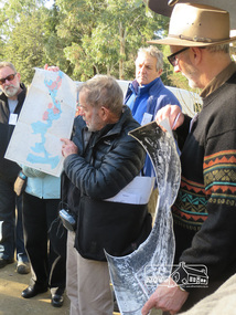
Photograph, Liz Pidgeon, Heritage Excursion; Eltham Lower Park Walk and Talk, 1 July 2017, 1 July 2017
Local Historian Russell Yeoman and EDHS President Jim Connor with a map and aerial photograph of the area the heritage walk will cover. Newsletter No., 234, June 2017 Heritage Excursion - Saturday 1st July - Eltham Lower Park - Walk and Talk Eltham Lower Park has played an important part in the history of our area since the early days of European settlement when it was used by local residents as an informal racecourse. Prior to that its location at the junction of the Diamond Creek and the Yarra River made it an important meeting place for the Wurundjeri people. The park combines formal elements and sporting facilities with remnant bushland that is of environmental significance. It is home to sporting and horse riding clubs, popular play spaces and the Diamond Valley Miniature Railway, which attracts large numbers of visitors. The park will be the venue for our July excursion which will comprise a walk of about 3.5 km around the park and adjacent areas. Along the way we will discuss the history and natural history of the area. The path along the creek and the river provides a pleasant and scenic walk. This walk on Saturday 1st July is about 3.5 km in length and will take 2 to 2.5 hours. It will start at 2pm at the Main Road car park at the front of the park. (Melway ref 21 H 10). Born Digitalheritage excursion, activities, eltham district historical society, eltham lower park, russell yeoman, jim connor, guide -
 Eltham District Historical Society Inc
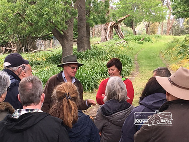
Photograph, Peter Pidgeon, Killeavey, Laughing Waters Road, Eltham 5 Nov 2016, 5 Nov 2016
Heriitage Excursion - Kileavey Walk and Talk Cam from Parks Victoria and Jane Woollard, author of 'Laughing Waters Road:art, landscape and memory in Eltham' were our guides today through the Morrison's property, 'Killeavey'Born Digitalactivities, eltham district historical society, heritage excursion, kileavey, parks victoria, laughing waters road, eltham, jane woollard