Showing 423 items matching " map of system"
-
 Bendigo Military Museum
Photograph - AUTOMAP 1 Production – Army Survey Regiment, Fortuna, Bendigo, c1979
This collection of 19 photos was most likely taken in 1980. The AUTOMAP 1 computer assisted cartography and mapping system was introduced in 1975. The components of AUTOMAP 1 were the Input Sub-System of four Wild B8s stereoplotters and three Gradicon digitising tables, the Optical Line Following Sub-System – Gerber OLF, the Verification Sub-System – Gerber 1442 drum plotter, the General Purpose Sub-system – HP21MX computer and the Output Sub-System – Gerber 1232 flatbed plotter). The first map was published in 1978 (Strickland 3665-3, 1:50,000). AUTOMAP 1 was the first computer assisted cartography and mapping system utilised by the Survey Corps and was the first system used by Australian mapping organisations. The history of the AUTOMAP 1 system is covered in more detail with additional historic photographs, in pages 116-118 of Valerie Lovejoy’s book 'Mapmakers of Fortuna – A history of the Army Survey Regiment’ ISBN: 0-646-42120-4. See items 6122.20P, 6410.24P, 6184.20P, 6200.5P, and 6222.17P for additional photographs of the AUTOMAP 1 system.This is a set of 19 photographs of Air Survey Squadron military and civilian personnel operating AUTOMAP 1 equipment at the Army Survey Regiment at Fortuna, Bendigo, c1979. The photographs were on 35mm negative film and were scanned at 96 dpi. They are part of the Army Survey Regiment’s Collection. .1) - Photo, colour, c1979, Gradicon edit table, SSGT John Bennett. .2) - Photo, colour, c1979, Gradicon edit table. .3) - Photo, colour, c1979, HP21MX computer General Purpose Sub-system. .4) - Photo, colour, c1979, HP21MX computer General Purpose Sub-system. L to R: CAPT Graham Baker, SPR Ian Belmont. .5) - Photo, colour, c1979, Gerber verification drum plotter. 1130 System administration, unidentified. .6) - Photo, colour, c1979, Gerber Optical Line Follower (OLF). .7) - Photo, colour, c1979, Gerber OLF .8) - Photo, black & white, c1979, Programming and system administration, L to R: WO1 Don Taylor, Robert Cox, Tony Spurling, SSGT John Bennett, SGT Alan Toogood. .9) to .14) - Photo, black & white, c1979, .15) - Photo, black & white, c1979, Gerber OLF, unidentified. .16) - Photo, black & white, c1979, Gerber verification drum plotter, unidentified using Gradicon edit table. .17) to .18) - Photo, black & white, c1979, - Photo, black & white, c1979, Programming and system administration, SSGT John Bennett. .19)- Photo, black & white, c1979, - Photo, black & white, c1979, HP21MX computer General Purpose Sub-system..1P to .19P No personnel are identified.royal australian survey corps, rasvy, army survey regiment, army svy regt, fortuna, asr, automap 1 -
 Bendigo Military Museum
Photograph - AUTOMAP 1 Production – Army Survey Regiment, Fortuna, Bendigo, c1980
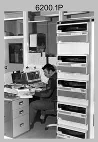
This collection of five photos was most likely taken in c1980. The AUTOMAP 1 computer assisted cartography and mapping system was introduced in 1975. The components of AUTOMAP 1 were the Input Sub-System of four Wild B8s stereoplotters and three Gradicon digitising tables, the Optical Line Following Sub-System – Gerber OLF, the Verification Sub-System – Gerber 1442 drum plotter, the General Purpose Sub-system – HP21MX computer and the Output Sub-System – Gerber 1232 flatbed plotter). The first map was published in 1978 (Strickland 3665-3, 1:50,000). AUTOMAP 1 was the first computer assisted cartography and mapping system utilised by the Survey Corps and was the first system used by Australian mapping organisations. The history of the AUTOMAP 1 system is covered in more detail with additional historic photographs, in pages 116-118 of Valerie Lovejoy’s book 'Mapmakers of Fortuna – A history of the Army Survey Regiment’ ISBN: 0-646-42120-4. See items 6410.24P, 6122.20P, 6183.19P, 6184.20P and 6222.17P for more photos of the AUTOMAP 1 computer system.This is a set of five photographs of Air Survey Squadron military personnel operating AUTOMAP 1 equipment at the Army Survey Regiment at Fortuna, Bendigo, c1980. Black and white photos are on photographic paper and were scanned at 300 dpi. They are part of the Army Survey Regiment’s Collection. .1) - Photo, black & white, c1980, SGT Cliff Webb operating AUTOMAP 1 terminal. .2) - Photo, black & white, c1980, HP21MX computer General Purpose Sub-system. .3) - Photo, black & white, c1980, Gerber verification drum plotter. .4) and .5) - Photo, black & white, c1980, unidentified personnel operating AUTOMAP 1 terminal. .1P to .5P - No personnel are identified.royal australian survey corps, rasvy, army survey regiment, army svy regt, fortuna, asr, automap 1 -
 Melbourne Tram Museum
Map, Melbourne & Metropolitan Tramways Board (MMTB), Melbourne's tramway routes and timetables - MMTB, 1925
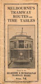
... and the development of the Melbourne system. Trams tramways MMTB tramway maps ...Map of the MMTB Tramway routes 1925 with a list of first and last cars, along with photographs of Wattle Park, Luna Park, and Studley Park. Provides information for the Prahran and Malvern lines, Hawthorn, Footscray, Essendon, Coburg, Kew, St Kilda, cable tram routes, and buses. Also provides information for passengers. The cover photo is of the front of W 296, with the destination of Esplanade. The map is dated by the opening of the line to West Brunswick as far as Albion St, the City Road to St Kilda line via Sturt St lines, and the electric line in Flemington Road which were all opened during mid to late 1925. See Reference. Shows a number of buildings and locations by a numbered reference list, including the Federal Parliament house. The map has advertisements around the outside of the map for Kiwi Shoe or boot polish.Yields information about the Melbourne tramway system in 1925 and demonstrates the methodology the MMTB used to provide information to travellers. Shows both cable and electric tram lines and the development of the Melbourne system.Map book - 15 fold paper titled "Melbourne's tramway routes and timetables"trams, tramways, mmtb, tramway maps, wattle park, studley park, timetables, cable trams, w class tram, tram 296, kiwi shoe polish -
 Melbourne Tram Museum
Document - Folder, Kemp & Boyce Printers, "Melbourne Tramways Trust - Cable Tramways", March 1889
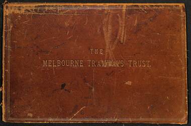
Plans and documents prepared by George Duncan for the Melbourne Tramways Trust showing details of the track construction, drainage and costs for the construction of the Melbourne cable tram and horse tram system for the Melbourne and Tramway Omnibus Co. Part 1 - track cross sections for both cable and horse trams and various rail weights - lbs/yard part 2 - details costs and mileages for each liine, report from George Duncan and remnant part of a printed map missing the lower half. part 3 - drainage report detailing the works and cost for each line. part 4 - continuation of drainage report - and last part of the book Map printed on cloth - blue print - showing the various lines. Note the Windsor to St Kilda line shown as a horse tram line, but was built as a cable line - the last to be opened.Yields information about the construction of the cable tram system by the Melbourne Tramway TrustFolder - heavy card leather covered covers with gold lines around the edges and gold blocked title. Has marbled glued end papers, containing 9 cloth backed blue print drawings, 22 printed sheets and two foldout maps. The lower half of the first fold out map has been torn out and lost. The second fold out map, a cloth backed blue print.Date stamped in two places with "The Melbourne Tramways Trust Engineers 9 Mar 89" (1889), in two places.tramways, trams, cable trams, mtt, mtoco, melbourne tramway trust, construction, drainage, maps, george duncan, track work, costs -
 Melbourne Tram Museum
Document, Ministry of Transport, Melbourne Public Transport Map - No. 12, 1982
Map No. 12 - Includes description of tram and bus routes, private bus routes. On the front cover is composite image of Melbourne public transport vehicles. Has contact details for bookings and lost property etc and how to use the map. Priced at 40c, issue No. 12 of c1982. Has details of the then new Travelcard ticket system. Yields information about Melbourne public transport services in 1982.Fold out map (36 sections 9 across x 4 deep), "Public Transport Map", coloured of Melbourne's Tram and Bus routes, route numbers, rail lines, detailed for the central part of Melbourne and the outer Metropolitan services.tramways, melbourne, tram services, bus services, railways, travelcard -
 Merbein District Historical Society
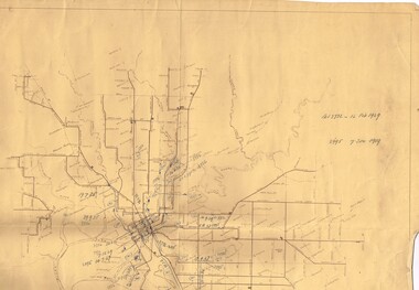
Map, Merbein Irrigation District Drainage Systems, 5 Dec.1936
... Drainage Irrigation Merbein Irrigation District Drainage Systems ...drainage, irrigation -
 Bendigo Historical Society Inc.
Document - AUSTRALIAN BUZZA ANCESTRY, 2013
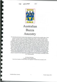
Thomas Buzza (1833-1904) was a Cornish born miner who came to Bendigo in 1853. He bought the BAckCreek sawmill (1861-1865). He had several other sawmilling enterprises and later operated a hay and corn produce store. He also built and operated paddle-steamers in the Murray Darling system. He left Myers Flat in 1893 and died in Goolwa, SA in 1904. He had married Emily Rainsdon (1852-1926) in 1867.Printed family history spiral bound with perspex cover. Contents page - no index. Contains family trees, summary of Thomas Buzza and his migration from Cornwall, details of descendants of Thomas Buzza, photographs, maps and images of birth, death and marriage certificates.Darren McFarlanegenealogy, family, cornish, buzza, bendigo, eaglehawk -
University of Melbourne, Burnley Campus Archives
Map, Kororoit Creek Proposed ..... [words obscured], 1998
Composite photocopy so title partly obscured, by Thompson Berrill Landscape Design DWC No KC 13 Sheet 13 of 14 dated March 1998. Scale 1:200. Legend includes: Vegetation, Drainage and Flood Management Issues and Action, Water Quality, Stream System V? Issues, Primary Objectives (partially obscured).thompson berrill, landscape design, kororoit creek, water quality, vegetation -
 Melbourne Tram Museum
Pamphlet, Metlink, "Travelling on a concession fare" "Public Transport Fares Guide", Dec. 2009
Set of two DL pamphlets issued by Metlink. .1 - Three fold, titled "Travelling on a concession fare", issued Dec. 09, with images of allowable concession cards, notes travelling on both Metcards and Myki. Has contact details, languages and Metlink logos. .2 - Twelve page + cover with fold out maps of the CBD city save section, Metro trains and tram system titled "Public Transport Fares Guide". Centre stapled. Dated Sept. 2011, has Metlink logos.trams, tramways, fares, tickets, metlink, metcard, concession fares, public transport -
 Melbourne Tram Museum
Pamphlet, Metlink, "Fares and Travel Guide", 2009
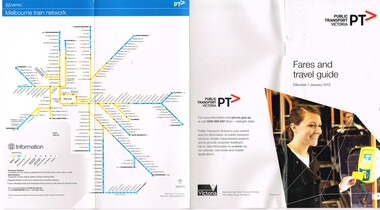
Set of four "Fares and Travel Guide" for 2009. Has contact details, and maps of the tram and train systems of Melbourne. Details fares, Metcard products, buying and validating Metcards, concession cards, refunds, travelling with pets, surfboards, general info. .1 - English .2 - Italian .3 - Chinese .4 - Arabictrams, tramways, tickets, fares, yarra trams, guides -
 Melbourne Tram Museum
Pamphlet, Metlink, "Fares and Travel Guide", 2003 to 2008
Set of nine "Fares and Travel Guide" for years 2003 (2 issues) to 2008. Each have contact details, and maps of the tram and train systems of Melbourne. Details fares, Metcard products, buying and validating Metcards, concession cards, refunds, travelling with pets, surfboards, general info. .1 - 2003 - Pamphlet - DL size, blue coloured covers six fold full colour printed on gloss paper, with details of operators - M>Train, Connex, M>Tram, Yarra trams - early 2003. .2 - 2003 - Pamphlet - DL size, red coloured covers six fold full colour printed on gloss paper, with details of operators - M>Train, Connex, M>Tram, Yarra trams - late 2003. .3 - 2004 - Pamphlet - DL size, red coloured covers six fold full colour printed on gloss paper, with details of operators - Yarra trams and Connex Trains. .4 - 2005 - Pamphlet - DL size, red coloured covers six fold full colour printed on gloss paper, with details of operators - Yarra trams and Connex Trains. Dated Jan. 2005. .5 - 2006 - Book - DL size, red coloured covers 20 pages, centre stapled, colour printed on gloss paper with fold out map, has index, ticket guides and other details about the Melbourne transport system. Dated Jan. 2006. .6 - 2007 - Book - DL size, red coloured covers 24 pages, centre stapled, colour printed on gloss paper with fold out map, has index, ticket guides and other details about the Melbourne transport system. Dated Jan. 2007. .7 - 2007 - June - as for .6 .8 - 2008 - January 2008 - as for .6, with D1 3510 and Flinders St station on front cover. (.7 added 16-11-2015 and .8 added 16-8-2017) .9 added - as for .5, but dated Feb. 2006. - added 8/7/2018. .10 - 2010 - 32 pages, red cover with an C2 class at Southern Cross station, etc - added 19/11/2020 See 2476.1 > 2476.4 for 2009 copy and another three languages. See 2328 for a 2011 copy. See 2393 for a 2013 copy. See 2507 for 2000 and 2001 copies.trams, tramways, tickets, fares, connex, m>tram, m>train, yarra trams, guides -
 Melbourne Tram Museum
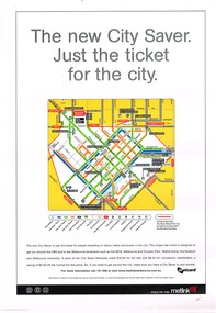
Poster, Metlink, "City Saver Metcards", Jan. 2004
Poster - A3 - full colour printed on gloss white paper, advertising the City Saver Metcards and the availability within the city area shown by a map with the various routes and station stations. Also shows places of interest. Gives details as to the ticket system and the costs. Published by Metlink, has Metlink logos. Weblink - to a website published by Rob O'Regan - http://www.robx1.net/ accessed 3/1/2015 - gives the date of introduction as 1/1/2004 - see http://www.robx1.net/victkt/metcard/html/citysav.htmtrams, tramways, posters, metlink, tickets, metcard -
 Bendigo Historical Society Inc.
Map - STATE RIVERS AND WATER SUPPLY COMMISSION : LAKE EPPALOCK
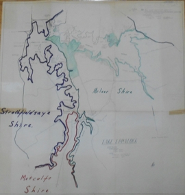
... . Coliban System. Lake Eppalock. Map of Lake Eppalock foreshore area... of Victoria. Coliban System. Lake Eppalock. Map of Lake Eppalock ...State Rivers and Water Supply Commission of Victoria. Coliban System. Lake Eppalock. Map of Lake Eppalock foreshore area. Colour is used to delineate the areas of the Lake included in the three councils - McIvor Shire, Metcalf Shire and Strathfieldsaye Shire. Scale is 1 inch = 40 chains. Various notations in pencil have been added, with 'Coliban Office Plan' written and circled in the top right corner. A coloured (green) area is scaled as 'fore shore area in the charge of Derrinal Recreational Area Management Committee'. Individual leasing details have been added. state infrastructure, water supply, coliban system, state rivers and water supply commission of victoria. coliban system. lake eppalock. -
 Ballarat Tramway Museum
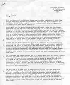
Document - Letter/s, Dave Macartney, Nov. 1970
Yields information in the form of a letter from an active tram enthusiast at the time recommending that part of the Ballarat system be retained for heritage tramway operation by the TMSV.Two typed A4 size sheets, photocopied, undated, early 1971 written by Dave Macartney of Albert Park to a number of people recommending that the TMSV establish a tramway museum in Ballarat around the shores of Lake Wendouree. Includes a map showing a possible track layout. Gives supporting cases, issues, problems, notes tourism potential, street running and other matters. Has been hand address to "Graeme". Dave Macartney advised 6/10/2007 that written November 1970, 50 copies made."Graeme" in blue ink.trams, tramways, ballarat, preservation, tmsv -
 Ballarat Tramway Museum
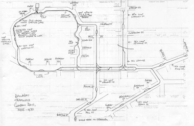
Document - Photocopy, Dave Macartney, Drawing of ESCo Ballarat Tramways, c1990
Photocopy of a drawing prepared by Dave Macartney in the mid 1980's of the track layout of the Electric Supply Co. of Victoria's Ballarat Tramway system, excluding the single track to Sebastopol. Plan shows the location of the loops, loop type, street names, position of replacement loops installed by the SEC during the reconstruction, depot layout, powerhouse siding and railway in Lydiard St. North. Prepared from inspecting the Plans of Ballarat services drawings in the Ballarat Water Board's Offices. Drawn on the back of old import forms of a light weight paper and has shown through the printing underneath. Titled "Ballarat Tramways Company Days 1905 - 1930" Number of small differences to the map drawn for Keith Kings, "The Ballarat Tramways" book, page 22.trams, tramways, ballarat, esco, track layout, map -
 Victorian Railway History Library
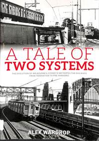
Book, Wardrop, Alex, A Tale of Two Systems, 2022
A detailed comparison of the Melbourne and Sydney electric suburban railways.index, ills, maps, p.337.A detailed comparison of the Melbourne and Sydney electric suburban railways.suburban railways - sydney, suburban railways - melbourne -
 Melbourne Tram Museum
Drawing, Melbourne & Metropolitan Tramways Board (MMTB), "MMTB Electric Tramway System 1971", 1971
Map or drawing titled "MMTB Electric Tramway System 1971", giving a detailed layout of the Melbourne tram system in 1971. shows depot, storage depots, workshops and tramway terminus names and route numbers. Has a drawing number of P14359 See Reg Item 253 for a 1979 copy.trams, tramways, mmtb, melbourne, map, routes -
 Melbourne Tram Museum
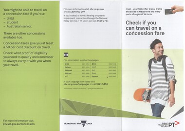
Pamphlet, Public Transport Victoria (PTV), "Check if you can travel on a concession fare", late 2017 to 4/19
.1 - Three fold, DL titled "Check if you can travel on a concession fare", issued late 2017 early 2018 with images of allowable concession cards, including senior and other concession card. ..2 - Five fold DL titled "Your go-to guide to myki" explaining the Myki system costs, types, the Explorer pack for visitors and has a map of the CBD Free Tram Zone. .3 - two fold DL titled "Explore the Night" giving details of night services for trains, trams, bus and coaches. .4 - three fold DL update of .1, issued April 19. Has contact details, languages and Transport for Victoria logo with PTV web address. Printed on recycled paper.trams, tramways, fares, tickets, myki, concession fares, public transport, free tram, night trams -
 Melbourne Tram Museum
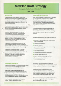
Document - Report, The Met, "Metplan Draft Strategy - May 1988", May. 1988
Report - summary - folded A3 sheet titled "Metplan Draft Strategy - May 1988". Gives introduction, purpose, strategy, maps, options for the various regions, system improvements, resources and next stops. Has the Met logo on the rear.trams, tramways, the met, reports, melbourne, metplan, new tramcars, planning, mta -
Melbourne Tram Museum
Newspaper, “From this…to this”, c1969
Newspaper clipping titled - “from this…to this” Undetermined source Melbourne’s trams and buses swing over to London numbering system from November 1 Route 10, West Preston, Wilcox – transport minister, new public transport map, tram services to be numbered from one to 100, eliminating numbers such as 2A, 4D and 9A. Tramway bus services to be numbered 200 to 300. Route information to follow London stye. Trams will display destination and main areas along the route on front of tram. Transport Minister, Mr Wilcox, said new system was part of policy to inform public about Melbourne's expanding street public transport services and to eliminate possible confusion. Conversion to new system to coincide with publication of pocket-size map of street public transport services. Map will show routes covered by trams and buses.trams, tramways, route 10, west preston, route numbers, destination roll -
 Melbourne Tram Museum
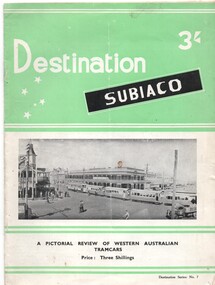
Book, Jack Richardson, "Destination Subiaco", 1967
... , Onslow and Roebourne light tramway (non electric) systems..., Onslow and Roebourne light tramway (non electric) systems ...1305.1 - book - 20 pages including cover, printed on semi gloss paper, centre stapled with two colour covers (light green and black) titled "Destination Subiaco", providing details of the Perth, Fremantle, Kalgoorlie and Leonora tramcars or rolling stock and the Collie, Broome, Carnarvon, Derby, Esperance, Onslow and Roebourne light tramway (non electric) systems, complete with maps. Published by Traction Publications, in 1957, edited by Jack Richardson with Associate Editors of A. Cooke and K.S. Kings. Provides details on the trams that operated in the four cities that had electric trams. Has a list of tramway and railway books on page 19. See image htd1305i1.pdf for a scan of this version. 1305.2 - Book - 48 pages + card coves, printed on gloss paper, centre stapled, with two colour covers (green and black) titled "Destination Subiaco", providing details of the Perth, Fremantle, Kalgoorlie and Leonora tramcars or rolling stock. Published by Traction Publications, in 1967, edited by Jack Richardson. Provides details on the trams that operated in the four cities. Has a list of tramway and railway books on the rear cover. See image htd1305i2.pdf for a scan of this version.trams, tramways, western australia, perth, fremantle, kalgoorlie, leonora, depot, tramcars -
 Melbourne Tram Museum
Map, Track plan or track map or layout of the Melbourne system, c1973
... plan or track map or layout of the Melbourne system showing ...Track plan or track map or layout of the Melbourne system showing track layout, crossovers, depots, workshops and route numbers, terminus, substations, Bundy clocks, layout of Preston works. On the rear is a detailed layout of the city area. Shows railway stations but not the station names and rivers. Printed on cartridge paper. No details of to who prepared the plan or the drawing or date. Wattle Park line has been duplicated (Sept 1970), but the Essendon Airport line remains (closed Oct. 1976).trams, tramways, mmtb, track layout, junction, depots, substation, plans, trackwork, route numbers, terminus, map, bundy clock -
 Melbourne Tram Museum
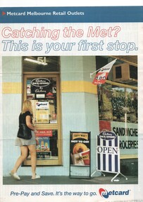
Pamphlet, VicTrip, "Catching the Met? - This is your first stop.", Apr. 1999
... of the tram and train systems. The maps show both Yarra and Swanston... Melbourne, along with maps of the tram and train systems. The maps ...Pamphlet - four fold - special size - full colour titled "Catching the Met? - This is your first stop." giving the list of Metcard shops in central and suburban Melbourne, along with maps of the tram and train systems. The maps show both Yarra and Swanston trams with route numbers along with Bayside and Hillside trains and the various ticket zones at the time. The number of car parking spots at each station also shown. On the rear is general information about Metcard with ticket machines, and validators. List dated effective from April 1999.trams, tramways, maps, metcard, yarra trams, swanston trams, hillside trains, bayside trains, tickets -
 Melbourne Tram Museum
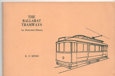
Book, Keith Kings, "The Ballarat Tramways", 1971
Book, 64 pages, gloss art paper, in black ink with a yellow card cover in green ink, centre stapled, titled "The Ballarat Tramways" Details history of Ballarat tramways, its tramcars and the involvement of the various operators. Has maps and photographs. Written by Keith Kings and published by the Victorian Division of the Australian Railway Historical Society and others at the time of the closure of the Ballarat system. Has details of the various organisations that published the book on the rear cover. 1345.2 - 2nd Edition Oct. 1971 - see image i4. For a complete image of the book see pdf files i1 to i3.'1345.2 - has the "Technical Book * Mag Co." yellow name label on the front cover and "75c" in pencil in the top right hand corner.trams, tramways, ballarat tramways, history, tramcars of ballarat -
 Melbourne Tram Museum
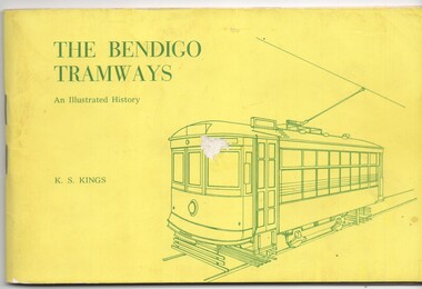
Book, Keith Kings, "The Bendigo Tramways", Feb. 1972
Book, 80 pages, gloss art paper, in black ink with a yellow card cover in green ink, centre stapled, titled "The Bendigo Tramways" Details history of Bendigo tramways, its tramcars and the involvement of the various operators. Has maps and photographs. Written by Keith Kings and published by the Victorian Division of the Australian Railway Historical Society and others at the time of the closure of the Bendigo system. Has details of the various organisations that published the book on the rear cover.trams, tramways, bendigo, battery trams, steam trams, history -
 Melbourne Tram Museum
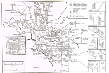
Map, Russell J. Nowell, "The Melbourne Tramway System", mid 1960's
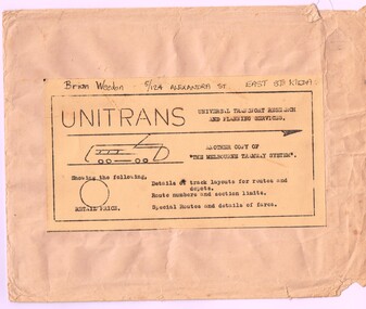
... as a tiff file. "The Melbourne Tramway System" Map Russell J. Nowell ...Printed map (dye line process) on a large sheet of paper contained within an envelope. .1 - Brown paper envelope with a printed sheet glued to the envelope - giving title "The Melbourne Tramway System", publisher ("Unitrans - Universal Transport Research and Planning Services" - with a space for the retail price. .2 - Map printed on paper and folded into 16 parts - details the track layouts for routes and depot, route numbers, sections, Latrobe and William St services and details of fares. Has a sketch of tram 980 in the top right hand corner along with details of the tram system. Also includes depot locations, reserved tracks and derails at level crossings, though railway level crossings are not shown. Produced by Russell J. Nowell - gives address and phone number along with the "UniTrans" logo. Advised by other members, he was a Tasmanian. Not dated, but appears to be mid 1960's. Plan scanned 1-3-2016 as a tiff file.Envelope has the name and address of the donor "Brian Weedon 5/124 Alexandra St East St Kilda"trams, tramways, map, mmtb, depots, tram routes, trackwork -
 Melbourne Tram Museum
Pamphlet, Public Transport Victoria (PTV), "Fares and Travel Guide", Dec. 2012
Pamphlet "Fares and Travel Guide" - effective Jan. 2013. .Book - DL size, red coloured covers 20 pages, centre stapled, colour printed on gloss paper, has table of contents and fold out map of the tram and rail system. Givers details on travelling conditions, Myki tickets, fares and zones, touching on, refunds, Passenger information, Hours of Operation and Translated information. Has the PTV Logos. Two copies heldtrams, tramways, tickets, fares, metro trains, guides, yarra trams, ptv, tram 5013 -
 Melbourne Tram Museum
Pamphlet, Yarra Trams, "Tram and Bus connections just got smarter", 2008
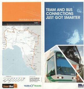
Pamphlet - two fold DL full colour printed on semi gloss paper, titled ""Tram and Bus connections just got smarter", introducing Smart Bus route 903 from Mordialloc to Altona connecting with 9 different bus routes. Gives details of the smart bus system, its route, timetable information and has a map of the route on the rear. Dated 2008.trams, tramways, smart bus, buses, public transport, maps -
 Melbourne Tram Museum
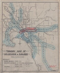
Drawing, H. S McComb, "Tramway Map of Melbourne & Suburbs", mid 1930's
Set of 19 drawings showing the development of the Melbourne tramway system between 1885 and 1921. Based on MMTB drawing "Tramway Map of Melbourne & Suburbs" P4609, 18 sheets showing year by year development of the cable and electric tram system, printed on off white paper. Mr. McComb had intended it would appear to do further work - with some 20 sheets printed on brown card paper but not used (.19 - same drawing) Each sheet has the year in red at the bottom right hand corner of the sheet. .1 - 1885 - with the Richmond line and main rail lines coloured in showing a catchment area. .2 - 1886 - shows the new cable line in Collins St and has a note that no suburban line constructed in 1886 .3 - 1887 - Bourke and northern lines and Brighton Beach to Sandringham and Hawthorn to Kew .4 - 1888 - Swanston St, Domain Road, Chapel and inner circle and towards Hurstbridge.\ .5 - 1889 - Rathdown St and Toorak Road .6 - 1890 - South and Port Melbourne, North Melbourne and Northcote. Rail lines - Ashburton and parts of the outer circle to Oakleigh. .7 - 1891 - St Kilda Esplanade and northern section of the outer circle. .8 - 1906 - NMETL .9 - 1910 - PMTT - High St and Wattletree Road .10 - 1911 - PMTT Dandenong Road .11 - 1913 - Glenferrie Road, Cotham Road, Balaclava and Glenhuntly Road .12 - 1914 - small extension in High St .13 - 1915 - Malvern Road and High St Kew .14 - 1916 - HTT and MBCTT lines and Whitehorse Road .15 - 1917 - Burke Road .16 - 1918 - Burke Road north of Camberwell station .17 - 1920 - FNPTT - St Georges Road and Plenty Road .18 - 1921 - Footscray lines .19 - base drawing only. Does not show the VR tramlines. See Reg Item 2154 for associated notes.See individual sheets.trams, tramways, times, cable trams, railways, tramways, melbourne, maps -
 Melbourne Tram Museum
Drawing, Melbourne & Metropolitan Tramways Board (MMTB), MMTB Cable Tramway System, 1950's
Set of two drawings used by Mr McComb in his work to identify the various tramways, cable tram closure dates and authorisation's for the consolidation and revision of the 1958 MMTB Act. Based on MMTB Drawing P11819, titled "MMTB Tramway System", signed by Mr. Eakins in March 1952. .1 - sub-titled - "MMTB Cable Tramway System" with hand written dates of closure alongside the various cable tram lines and references to Acts. .2 - sub-titled - "MMTB Electric Tramway System" with hand written notes and references to Acts or Orders in Council and dates. Has the various numbers alongside each line that was used in the 1958 Act Schedules.have a date stamp of "3 July 1950" on rear.trams, tramways, cable trams, maps, closure, authority, acts of parliament, order in council