Showing 2470 items
matching house plan
-
 Eltham District Historical Society Inc
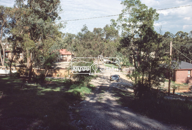
Slide, McCarthy Grove, Montmorency looking east towards Reichelt Avenue, near no. 27, c.Oct. 1980
One of a series of images of roads and infrastructure taken by Eltham Shire Council Planning and Engineering officers. They provide perspective of the changes in housing styles and road development that began sweeping in from the mid 1970s with increasing urbanisation of what was once more outlying suburbs and regions.35 mm colour positive transparency Mount - Kodak Kodachrome CardProcessed Oct 1980houses, infrastructure, mccarthy grove, montmorency, roads -
 Eltham District Historical Society Inc
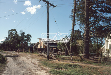
Slide, Quinn Estate, McCarthy Grove ext. driveway, Montmorency, near no. 31, c.Oct. 1980
One of a series of images of roads and infrastructure taken by Eltham Shire Council Planning and Engineering officers. They provide perspective of the changes in housing styles and road development that began sweeping in from the mid 1970s with increasing urbanisation of what was once more outlying suburbs and regions.35 mm colour positive transparency Mount - Kodak Kodachrome CardProcessed Oct 1980houses, infrastructure, mccarthy grove, montmorency, roads -
 Eltham District Historical Society Inc
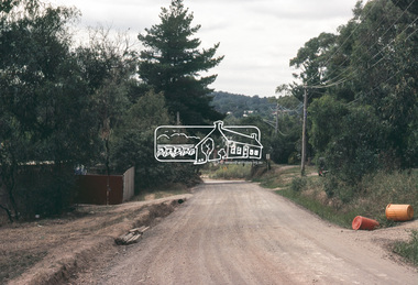
Slide, Looking towards 99 Buena Vista Drive, Montmorency, c.Oct. 1980
One of a series of images of roads and infrastructure taken by Eltham Shire Council Planning and Engineering officers. They provide perspective of the changes in housing styles and road development that began sweeping in from the mid 1970s with increasing urbanisation of what was once more outlying suburbs and regions.35 mm colour positive transparency Mount - Kodak Kodachrome CardProcessed Oct 1980houses, infrastructure, mccarthy grove, montmorency, roads -
 Eltham District Historical Society Inc
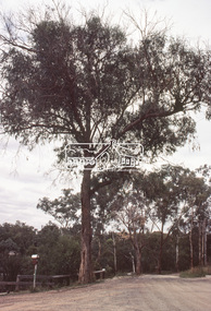
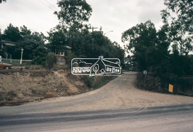
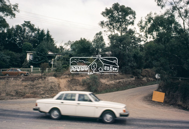
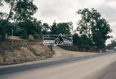
Slide, Adam Crescent, Montmorency, c. Feb. 1981
One of a series of images of road infrastructure focussed on Adam Crescent in Montmorency taken by Eltham Shire Council Planning and Engineering officers. They provide perspective of the changes in housing styles and road development that began sweeping in from the mid 1970s with increasing urbanisation of what was once more outlying suburbs and regions. All images have been identified with GPS though house numbers have changed35 mm colour positive transparency (1 of 21) Mount - Kodak Kodachrome CardProcessed Feb 1981adam crescent, infrastructure, montmorency, roads -
 Eltham District Historical Society Inc
Slide, Adam Crescent, Montmorency, c. Feb. 1981
One of a series of images of road infrastructure focussed on Adam Crescent in Montmorency taken by Eltham Shire Council Planning and Engineering officers. They provide perspective of the changes in housing styles and road development that began sweeping in from the mid 1970s with increasing urbanisation of what was once more outlying suburbs and regions. All images have been identified with GPS though house numbers have changed35 mm colour positive transparency (1 of 21) Mount - Kodak Kodachrome CardProcessed Feb 1981adam crescent, infrastructure, montmorency, roads, gordon grove -
 Eltham District Historical Society Inc
Slide, Adam Crescent, Montmorency, c. Feb. 1981
One of a series of images of road infrastructure focussed on Adam Crescent in Montmorency taken by Eltham Shire Council Planning and Engineering officers. They provide perspective of the changes in housing styles and road development that began sweeping in from the mid 1970s with increasing urbanisation of what was once more outlying suburbs and regions. All images have been identified with GPS though house numbers have changed35 mm colour positive transparency (1 of 21) Mount - Kodak Kodachrome CardProcessed Feb 1981adam crescent, infrastructure, montmorency, roads -
 Eltham District Historical Society Inc
Slide, Adam Crescent, Montmorency, c. Feb. 1981
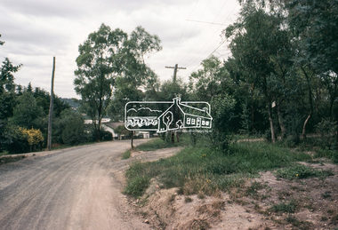
One of a series of images of road infrastructure focussed on Adam Crescent in Montmorency taken by Eltham Shire Council Planning and Engineering officers. They provide perspective of the changes in housing styles and road development that began sweeping in from the mid 1970s with increasing urbanisation of what was once more outlying suburbs and regions. All images have been identified with GPS though house numbers have changed35 mm colour positive transparency (1 of 21) Mount - Kodak Kodachrome CardProcessed Feb 1981adam crescent, infrastructure, montmorency, roads, gordon grove -
 Eltham District Historical Society Inc
Slide, Adam Crescent, Montmorency, c. Feb. 1981
One of a series of images of road infrastructure focussed on Adam Crescent in Montmorency taken by Eltham Shire Council Planning and Engineering officers. They provide perspective of the changes in housing styles and road development that began sweeping in from the mid 1970s with increasing urbanisation of what was once more outlying suburbs and regions. All images have been identified with GPS though house numbers have changed35 mm colour positive transparency (1 of 21) Mount - Kodak Kodachrome CardProcessed Feb 1981adam crescent, infrastructure, montmorency, roads -
 Eltham District Historical Society Inc
Slide, Adam Crescent, Montmorency, c. Feb. 1981
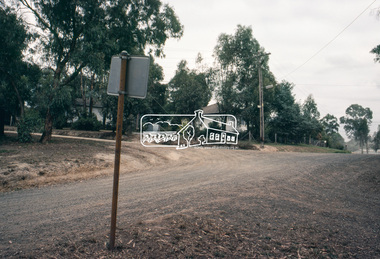
One of a series of images of road infrastructure focussed on Adam Crescent in Montmorency taken by Eltham Shire Council Planning and Engineering officers. They provide perspective of the changes in housing styles and road development that began sweeping in from the mid 1970s with increasing urbanisation of what was once more outlying suburbs and regions. All images have been identified with GPS though house numbers have changed35 mm colour positive transparency (1 of 21) Mount - Kodak Kodachrome CardProcessed Feb 1981adam crescent, infrastructure, montmorency, roads, gordon grove -
 Eltham District Historical Society Inc
Slide, Adam Crescent, Montmorency, c. Feb. 1981
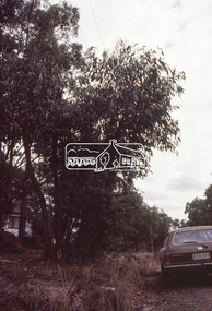
One of a series of images of road infrastructure focussed on Adam Crescent in Montmorency taken by Eltham Shire Council Planning and Engineering officers. They provide perspective of the changes in housing styles and road development that began sweeping in from the mid 1970s with increasing urbanisation of what was once more outlying suburbs and regions. All images have been identified with GPS though house numbers have changed35 mm colour positive transparency (1 of 21) Mount - Kodak Kodachrome CardProcessed Feb 1981adam crescent, infrastructure, montmorency, roads, sherbourne road -
 Eltham District Historical Society Inc
Slide, Adam Crescent, Montmorency, c. Feb. 1981
One of a series of images of road infrastructure focussed on Adam Crescent in Montmorency taken by Eltham Shire Council Planning and Engineering officers. They provide perspective of the changes in housing styles and road development that began sweeping in from the mid 1970s with increasing urbanisation of what was once more outlying suburbs and regions. All images have been identified with GPS though house numbers have changed35 mm colour positive transparency (1 of 21) Mount - Kodak Kodachrome CardProcessed Feb 1981adam crescent, infrastructure, montmorency, roads, sherbourne road -
 Eltham District Historical Society Inc
Photograph, Belle Vue, Livingstone Road, Eltham, c.1960, 1960c
Photo taken at time of ownership by Eric Staff. Originally purchased by pioneer Eltham farmer Henry Stooke, Belle Vue farm comprised about 56 ha (140 acres) extending northerly from the northern boundary of Holloway’s 1851 Little Eltham subdivision. On the present day map the southern boundary was just north of Elsa Court and Grove Street. The western boundary was the Diamond Creek and extended northerly to Main Road where it turns easterly towards Research. It was traversed by the main road to Kangaroo Ground and beyond and from 1912 by the railway to Hurstbridge. From 1895 the farm was owned by William Williams and his wife Mary Ann. In 1914-1915 they built a new house now known as “Belle Vue”. They sold the land in 1920 and residential subdivision began soon after that. “Belle Vue” remains today on a large residential lot in Livingstone Road. The house and many old trees on the site have been subject to a heritage overlay under the Nillumbik Planning Scheme. Despite that overlay, most of the heritage trees were removed during sub-division and development of the property.Digital file only from scan of copy on loan to EDHSbelle vue, eltham, eric staff, houses, livingstone road, staff family -
 Eltham District Historical Society Inc
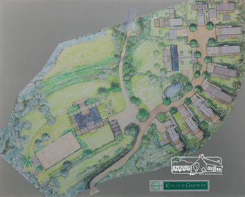
Drawing, Architectural Concept Plan: Kinloch Gardens proposed development, 93 Arthur Street, Eltham, 1997, 1997
Proposed design for Kinloch Gardens project with 12 sites illustrated plus Kinloch Main House. Ian Jelbart owned the entire Woodridge Estate but retained the top of the hill in Arthur Street until this development in 1997-1998, which he developed in conjunction with Graeme Gunn. Ian Jelbart inherited the land from his father who had purchased it cheap during the Great Depression. Kinloch is a castle in Scotland. Ink, wash and pencil on paper adhered to 13mm thick polyurethane boardKinloch Gardensarthur street, eltham, graeme gunn, ian jelbart, jelbart property, kinloch gardens -
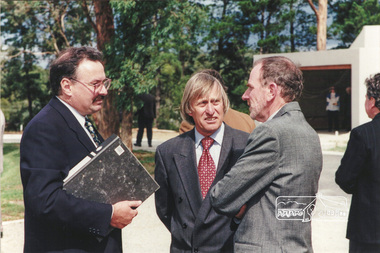 Eltham District Historical Society Inc
Photograph, Ian Jelbart (right) and Robert Marshall (centre) at the launch of the Kinloch Gardens development, 93 Arthur Street, Eltham, April 1998, April 1998
Launch of the Kinloch Gardens development, 12 new double and triple storey homes along a private road in the gardens of Kinloch, a mansion set on 2.4ha in Arthur St. The launch was attended by Planning Minister Rob Maclellan and Nillumbik Shire president Robert Marshall, Architects Graeme Gunn and Ian Jelbart and approximately 100 guests.8 images; digital file only; created from scan undertaken by EDHS of a set of 26 colour 10 x 15 cm prints arthur street, eltham, graeme gunn, houses, ian jelbart, jelbart property, kinloch gardens, robert marshall, woodridge estate -
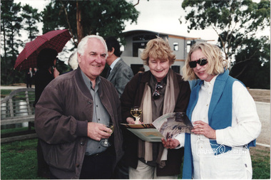 Eltham District Historical Society Inc
Photograph, Architect Graeme Gunn with unknown guests at the launch of the Kinloch Gardens development, 93 Arthur Street, Eltham, April 1998, April 1998
Launch of the Kinloch Gardens development, 12 new double and triple storey homes along a private road in the gardens of Kinloch, a mansion set on 2.4ha in Arthur St. The launch was attended by Planning Minister Rob Maclellan and Nillumbik Shire president Robert Marshall, Architects Graeme Gunn and Ian Jelbart and approximately 100 guests.1 images; digital file only; created from scan undertaken by EDHS of a set of 26 colour 10 x 15 cm prints arthur street, eltham, graeme gunn, houses, ian jelbart, jelbart property, kinloch gardens, robert marshall, woodridge estate -
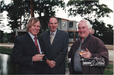 Eltham District Historical Society Inc
Photograph, Nillumbik Shire President Robert Marshall on left with Architects Ian Jelbart (centre) and Graeme Gunn at the launch of the Kinloch Gardens development, 93 Arthur Street, Eltham, April 1998, April 1998
Launch of the Kinloch Gardens development, 12 new double and triple storey homes along a private road in the gardens of Kinloch, a mansion set on 2.4ha in Arthur St. The launch was attended by Planning Minister Rob Maclellan and Nillumbik Shire president Robert Marshall, Architects Graeme Gunn and Ian Jelbart and approximately 100 guests.4 images; digital file only; created from scan undertaken by EDHS of a set of 26 colour 10 x 15 cm prints arthur street, eltham, graeme gunn, houses, ian jelbart, jelbart property, kinloch gardens, robert marshall, woodridge estate -
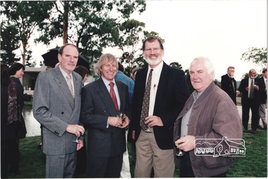 Eltham District Historical Society Inc
Photograph, L-R: Architect Ian Jelbart, Nillumbik Shire President Robert Marshall, Nillumbik Cr. John Graves and Architect Graeme Gunn at the launch of the Kinloch Gardens development, 93 Arthur Street, Eltham, April 1998, April 1998
Launch of the Kinloch Gardens development, 12 new double and triple storey homes along a private road in the gardens of Kinloch, a mansion set on 2.4ha in Arthur St. The launch was attended by Planning Minister Rob Maclellan and Nillumbik Shire president Robert Marshall, Architects Graeme Gunn and Ian Jelbart and approximately 100 guests.3 images; digital file only; created from scan undertaken by EDHS of a set of 26 colour 10 x 15 cm prints arthur street, eltham, graeme gunn, houses, ian jelbart, jelbart property, john graves, kinloch gardens, robert marshall, woodridge estate