Showing 1318 items matching "layout"
-
 Ringwood and District Historical Society
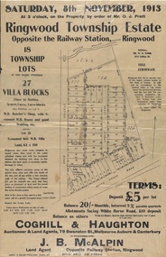
Flyer, Auction Sale Advertisements - Ringwood Township Estate, Ringwood, Victoria - 1913
Advertisements for auction sale of retail and residential blocks opposite the Ringwood Railway Station on Saturday, 8th November, 1913, showing subdivision layout, terms of sale, and summary of local features and services. Auction at 3 o'clock on the property by order of Mr. O.J. Pratt - 18 township lots, 27 villa blocks, also weatherboard butcher's shop with 5-roomed weatherboard house and good stabling, and 5-roomed new weatherboard villa. Subdivision includes Station Road (later Warrandyte Road), Pratt Street, and Whitehorse Road. Agents - Coghill & Haughton, 79 Swanston Street, Melbourne, Auburn & Canterbury, in conjunction with J.B. McAlpin, Opposite Railway Station, Ringwood. Additional 2 partially trimmed copies allotment maps on cardboard backing with handwritten sales notations. -
 Rutherglen Historical Society
Aperture Card microfilm, Victorian Land Tiltes Office, Parish Schedule Carlyle (Superseded)
Town layout schedule of Carlylecard with a single microfilm insertschedule -
 Rutherglen Historical Society
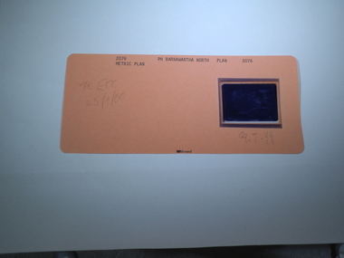
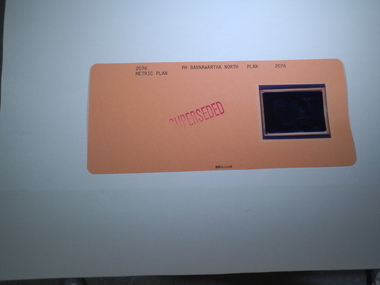
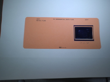
Aperture Card microfilm, Victorian Land Tiltes Office, Town Plan Barnawartha, August/1996
Town layout of Barnawartha Northcard with a single microfilm insertplan, town, boundries, lots, roads -
 Rutherglen Historical Society
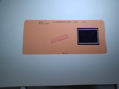
Aperture Card microfilm, Victorian Land Tiltes Office, Town Plan Barnawartha, August/1996
Town layout of Barnawartha Northcard with a single microfilm insertplan, town, boundries, lots, roads -
 Rutherglen Historical Society
Aperture Card microfilm, Victorian Land Tiltes Office, Parish Plan Barnawartha North, 29/07/1999
Town layout of Barnawartha Northcard with a single microfilm insertplan, town, boundries, lots, roads -
 Rutherglen Historical Society
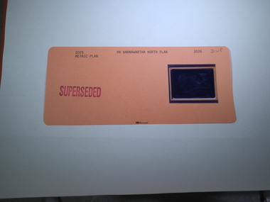
Aperture Card microfilm, Victorian Land Tiltes Office, Parish Plan Barnawartha North (Superseded)
Town layout of Barnawartha Northcard with a single microfilm insertplan, town, boundries, lots, roads -
 Rutherglen Historical Society
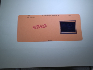
Aperture Card microfilm, Victorian Land Tiltes Office, Parish Plan Barnawartha North (Superseded)
Town layout of Barnawartha Northcard with a single microfilm insertplan, town, boundries, lots, roads -
 Rutherglen Historical Society
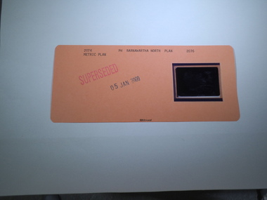
Aperture Card microfilm, Victorian Land Tiltes Office, Parish Plan Barnawartha North (Superseded), 5/01/2000
Town layout of Barnawartha Northcard with a single microfilm insertplan, town, boundries, lots, roads -
 Rutherglen Historical Society
Aperture Card microfilm, Victorian Land Tiltes Office, Parish Plan Barnawartha North (Superseded)
Town layout of Barnawartha Northcard with a single microfilm insertplan, town, boundries, lots, roads -
 Rutherglen Historical Society
Aperture Card microfilm, Victorian Land Tiltes Office, Parish Plan Barnawartha North (Superseded)
Town layout of Barnawartha Northcard with a single microfilm insertplan, town, boundries, lots, roads -
 Rutherglen Historical Society
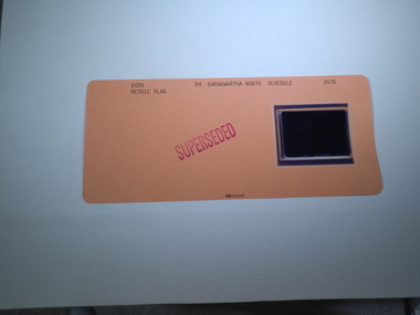
Aperture Card microfilm, Victorian Land Tiltes Office, Parish Schedule Barnawartha North (Superseded)
Town layout of Barnawartha Northcard with a single microfilm insertschedule -
 Rutherglen Historical Society
Aperture Card microfilm, Victorian Land Tiltes Office, Parish Schedule Barnawartha North (Superseded)
Town layout of Barnawartha Northcard with a single microfilm insertschedule -
 Rutherglen Historical Society
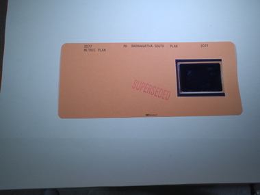
Aperture Card microfilm, Victorian Land Tiltes Office, Parish Plan Barnawartha South (Superseded)
Town layout of Barnawartha Southcard with a single microfilm insertplan, town, boundries, lots, roads -
 Rutherglen Historical Society
Aperture Card microfilm, Victorian Land Tiltes Office, Parish Plan Barnawartha South, 18/07/1995
Town layout of Barnawartha Southcard with a single microfilm insertplan, town, boundries, lots, roads -
 Bendigo Historical Society Inc.
Document - MINING IN BENDIGO COLLECTION: COMPRESSED AIR
Four page document . Australian Compressed Air Institute Quarterly Newsletter dated September 1971. Items mentioned are: Early Pneumatics, Pumping by Air Lift. There is also a table of efficient practice and average practice for air-lift pumps. Also an Air Pipeline Layout in Small Factories and two tables for volumes of air. Also a diagram for air pipeline layout. Also a smaller piece of paper with the Australian Compressed Air Institute Members at September 1971.document, mining, compressed air, australian compressed air institute, a r jackson -
 Melbourne Tram Museum
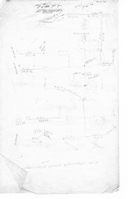
Document - Research Notes, H. S. McComb, development and timing of the "PMTT" - part 1, 1950's
Set of papers, handwritten concerning the development and timing of the "PMTT", Prahran and Malvern - about 13 sheets. Prepared by H. S. McComb - gives layout of the PMTT system, sketches of track layout, opening dates, sketches of various junctions, bridges, track miles, junctions, reconciliations of track lengths from various sources, Camberwell Junction and cross overs. Items 2041 to 2052 within box 72.3 in a brown folder marked "PMTT" in red pencil.trams, tramways, pmtt, malvern, routes, track, malvern depot, camberwell junction, surveys -
 Ringwood and District Historical Society
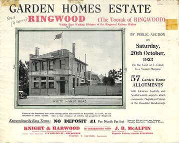
Flyer, Subdivisional Land Auction Sale Brochure, Garden Homes Estate, Ringwood, Vic. - 1923
Double sided multi-folded page advertising auction sale of residential allotments highlighting local facilities, services and layout of the estate. Includes panoramic view of Ringwood and other local photographic images.Subdivision includes Mullum Mullum Road, The Centreway, Wattle Crescent and Reserve Crescent. Agents - Knight & Harwood, 315 Collins Street, Melbourne, Phone 10615, 10616 Central, in conjunction with J.B. McAlpin, Opposite Railway Station, Ringwood. Phone Ringwood 7. -
 Ringwood and District Historical Society
Flyer, Land Sale Advertisement - East Ringwood Township Estates, East Ringwood, Victoria - circa 1920
The date of the flyer as circa 1920 can be estimated from the references to the (decision on) "electrification of the Croydon Railway Line" which eventually occurred in 1923, letting of tenders for the state school building which opened in 1924, and the "proposed new railway station" (East Ringwood) which opened in 1925, Advertisement for three retail and residential allotment land sales in East Ringwood Township including maps showing layout of subdivisions. Township Estate, State School Estate, and East Ringwood Station Estate.Subdivision plans include Mount Dandenong Road, Grey Street, Eastfield Road, King Street, Everard Road, Holland Road, Purser Avenue, and Charles Street. (Agents) Spencer Jackson, Subdivider & Homebuilder, 341 Collins Street, Melbourne, Phones: M2327 (3 lines), also at Dromana, Phone 65. -
 Ringwood and District Historical Society
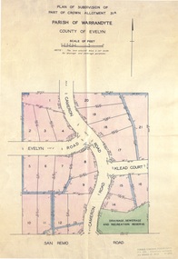
Document - Real Estate Folder, Savernake Estate, Ringwood, Victoria - Stage one - 1967
Plan of Subdivision, Part of Crown Allotment 31A and advertisement for sale of residential allotments with map showing layout of subdivision. Typewritten pricelist attached outlining suggested terms of sale as of 14 September, 1967.Subdivision includes Evelyn Road, Cameron Road, Klead Court, and San Remo Road. Agent - C.E. Carter & Son., 126 Whitehorse Road, Ringwood. (Phone) 87-6024, 87-6830, 870-2519, After hours: 723 3298, 878 2648. Subdivision Plan stamped Donald Cameron Consultants Pty. Ltd., Consulting Engineers, 472 Bourke Street Melbourne - 67-2602. -
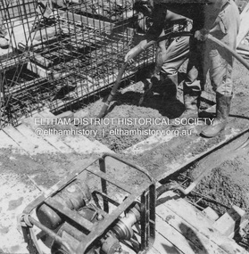 Eltham District Historical Society Inc
Album - Photograph, J.A. McDonald, Eltham-Yarra Glen Road, Jan. 1956
Watsons Creek Layout – January 1956Record of various Shire of Eltham infrastructure works undertaken during the period of 1952-1962 involving bridge and road reconstruction projects, sometimes with Eltham Shire Council Project Reference numbers quoted. It was during this period that a number of significant improvements were made to roads and new bridges constructed within the shire that remain in place as of present day (2022). In many situations, the photos provide a tangible visible record of infrastructure that existed throughout the early days of the Shire. The album was put together by or under the direction of the Shire Engineer, J.A. McDonald.infrastructure, road construction, shire of eltham, bridge construction, 1956-01, eltham-yarra glen road, w.e. wolf, watsons creek -
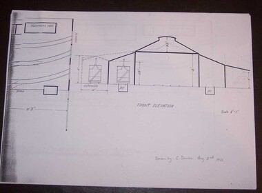 Ballarat Tramway Museum
Document - Photocopy, Alan Bradley, "Plan and Front Elevation of Car Depot", 2000
Set of three A3 size photocopies of a drawing held by the Public Records Office Victoria of the Ballarat ESCo Tramway Depot, dated 2/8/1912. Drawn at a scale of 1/16" = 1', shows building layout, track layout, overall dimensions, a proposed extension to hold eleven trailers, a front elevation showing pits, extension (drawn at 1/8" = 1'). On the current tracks, shows the individual track capacities - 26 trams. Drawings copied by Alan Bradley for archives and research.trams, tramways, ballarat, esco, depot, drawings -
 Melbourne Tram Museum
Document - Research Notes, H. S. McComb, "Coburg System" - part 2 of 2, c1956
Set of papers, handwritten concerning the development and timing of the "Coburg Tramway system" - 9 sheets by the Melbourne Brunswick Coburg Tramways Trust. Prepared largely by H. S. McComb, with notes dates, depot, track layout, lengths, the Act, dates and calculations, curves, details of depot, track layouts, intersections and extensive details of the interface with the cable tram at Queensberry and Swanston Streets. Items 2034 and 2034 within box 72.3 in a brown folder marked "MB&CTT" in red pencil.trams, tramways, mbctt, coburg, brunswick, opening, cable trams, queensberry, madeline st, moreland rd, sydney rd -
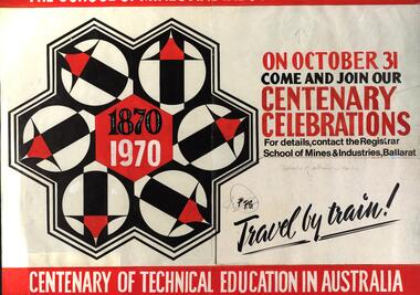 Federation University Historical Collection
Poster - Poster - artwork, The School of Mines and Industries, Ballarat: Centenary 1970, 1970
Layout for a proposed poster celebrating 100 yearsPlanning document for poster to celebrate the centenary. Red, white and black printing on cream paper Sections are glued on Marks in pencil indicate changes in position maybe required. ballarat school of mines, centenary, train travel -
 Tatura Irrigation & Wartime Camps Museum
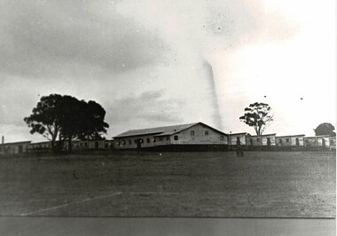
Photograph, Camp 3 Barracks
Depicts the layout and size of the barracks at Camp 3.Black and white photograph with tree in left hand side, a row of barracks and two trees to the right of picture. camp 3 barracks -
 Peterborough History Group
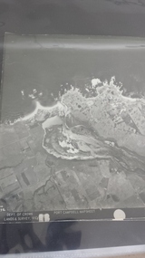
Photograph - Aerial Photograph Peterborough, Department of Crown Lands & Survey, Jan 1971
Aerial photograph showing the past layout of the townSignificant in that it shows the town as it was in 1971.Square 9" x 9" aerial photograph x 4 - (2 photos in duplicate)Stamped Dept of Crown Lands & Surveypeterborough 3270, curdies estuary, bay of islands, crown land photograph, aerial photograph, department of crown lands -
 City of Moorabbin Historical Society (Operating the Box Cottage Museum)
A laminated , photocopy of the ‘Plan of Box Cottage c 1865 ‘, 1985
The original small, pioneer cottage was built in the late 1840s to early1850s, by an unknown pioneer. It was located on part of a 30 Acre allotment that was originally part of Dendy’s Special Survey granted in 1841. The doors and window sashes, (made of red deal joinery timber), as well as the brass locks and fittings, are from the original cottage, and were imported from England. The fire-place bricks are from the original cottage, and are sun-dried, (not kiln fired), and are hand-made. Convict marks can be seen on two bricks. There is a small display of external cladding shingles from the original pioneer cottage. These shingles were hand-split, and most likely made from locally collected timber The nails included in this display were used to fasten the shingles on the original cottage, and are also hand-made. The cottage was occupied by William Box and family from 1865 until 1914 when it was sold to William Reitman who resided there until 1950. The enamel nameplate, “Colonial”, on the wall of the cottage, was the name chosen for the original pioneer cottage by Mr William Reitman, when he purchased the property in around 1915, for 1200 Pounds approximately. In 1974 Mr Lewis, a timber specialist, found the dilapidated building on property he had recently purchased in Jasper Rd and suggested it be reconstructed and relocated. Moorabbin Council agreed and the cottage was rebuilt just about 250 metres from its original site. The cost of the rebuild was met by 'Victoria's 150th Committee, plus a small grant from the City of Moorabbin, and Mr Laurie Lewis donated much of the timber for the reconstruction. The re-constructed cottage plan has followed faithfully the original dimensions, and plan of the original pioneer cottage, and as many original items from that cottage’s long occupation have been incorporated. The photographs in Album 1 record the progress of the reconstruction from February 1984 to the First Public Open Day November 18th 1984Mrs H Deam and Mr A. Smith, CMHS members, photographed the progress of the 'Reconstruction' from February 1984 to November 1984. Although 'Box Cottage' is a re-construction, it is an unique museum that, being located in the midst of a modern community in Ormond Victoria, can educate and demonstrate many aspects of the early settler’s way of life in Victoria. As such, it is an invaluable resource for students and all kinds of visitors. A laminated , photocopy of the ‘Plan of Box Cottage c 1865 ‘ Hand drawn layout of 2 houses with shrubs, trees, plants, wells, gardens on the Box Cottage site c1930 as recalled by Stefanie Rietman Rennick. brighton, moorabbin, cottages, pioneers, ormond, colonial, mckinnon, dendy henry, box william, box elizabeth, reitman william, convicts lewis timber co. ltd., deam h, museums, box alonzo, smith a, -
The Ed Muirhead Physics Museum
Stamp album, The International Stamp Album
Brown and black, hardcover stamp collector's album titled 'The International Stamp Album' and featuring pages sectioned by country with a grid layout for adhering stamps. A mix of blank pages and pages with various numbers of stamps. -
 Ballarat Tramway Museum
Document - Form/s, Ballarat Tramway Preservation Society (BTPS), "Ballarat Tourist Tramway Passenger Survey", 1975
Duplicated sheet of foolscap paper, titled "Ballarat Tourist Tramway Passenger Survey", - form. Has two forms per sheet - layout different, but questions the same. Used 1975. Asks 15 questions.trams, tramways, btps, forms, surveys -
 Ballarat Tramway Museum
Photograph - Colour Print/s, Warren Doubleday, 14/09/2003 12:00:00 AM
Colour photograph of Albert St. Sebastopol at the site of the Grey St Loop, looking south. Shows the road layout in 2003. Photo taken by Warren Doubleday on 14/09/2003. Printed on Agfa paper. On rear of each photo in brown felt tip pen, the words "Grey St. Loop site" and "14/9/02".albert st, grey st loop -
 Queen Victoria Women's Centre
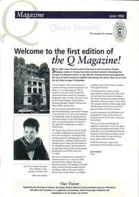
Newletter, Q Magazine: Welcome to the first edition of the Q Magazine!, June 1996
First edition of the Q MagazinePrinter paper. 8 pages. Navy and taupe on white. Grey scaled images throughout of women who are employed by the Trust or are sitting on the trust. Middle pages include original planned layout for the QVWC building. newsletters, historic buildings, cultural structures and establishments