Showing 2312 items
matching infrastructure
-
 Melbourne Tram Museum
Document - Instruction, The Met, PTC tram driver training notes, c1995 for A, Z2 and Z3, Mar. 1989
Set of instructions - 22 A4 sheets, stapled in the top left hand corner - PTC tram driver training notes, c1995 for A, Z2 and Z3 tramcars. Looks at the objectives and steps to be done for each module, eg Switches, locations and function, tram operations, fault finding, doors, insulated trams, AVM, practical tram driving, preparing tram, braking system, road rules and track infrastructure.Written in ink on first sheet top right hand corner "PTC tram driver training notes, c1995 for A, Z2 and Z3"trams, tramways, z class, training, instructions, z3 class -
 Melbourne Tram Museum
Pamphlet, Metcard, "Tickets please - have the right ticket when you travel", early 2000's
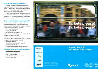
Pamphlet - DL size, three fold full colour printed on gloss paper titled "Tickets please - have the right ticket when you travel" Notes the need to produce a valid tickets, talks about on board ticketing machines, complaints, has the logos of connex, M>tram, M>train, Yarra and Vic bus industry on rear. Printed by Metcard - Dept. of Infrastructure. Two copies held.trams, tramways, metcard, metlink, m>tram, yarra trams, tickets -
 City of Kingston
Photograph - Black and white, 5 January 1984
Cheltenham and Heatherton are suburbs in the City of Kingston that were originally established as a rural market gardening community. The market gardens, farms and paddocks have gradually been sub-divided into housing and industrial estates and associated infrastructure such as schools and shopping facilities. This aerial image covers a diverse section of the City of Kingston, taking in the suburbs of Cheltenham, Heatherton, Mentone and Parkdale. By 1984, the market gardens of the district have been replaced by housing and factories. The Nylex factory is visible and now closed. Mentone Bowl on the corner of Warrigal Road and Nepean Highway has now been replaced by high rise apartments, another feature of the changing landscape in the City of Kingston. The vacant land now occupied by the Moorabbin Airport Direct factory Outlet (DFO) is also depicted.Aerial photograph of Cheltenham, Heatherton, Mentone and Parkdale within the City of Kingston. The area depicted in the 1984 aerial view includes Centre Dandenong Road and Cheltenham East Primary School (top left), Kingston Heath Reserve (top right), intersection of Lower Dandenong Road, Warrigal Road, Balcombe Road and Nepean Highway (bottom left), Balmoral Drive/McSwain Street Parkdale (bottom right).White text: 3831-179 Lens information [indecipherable] RINGWOOD M/S 7922-3 RUN 16 [Clockface image] 5,300' ASL VIC DLS© 5-1-84cheltenham, heatherton, mentone, parkdale, market gardens, urbanisation -
 Ballarat Heritage Services
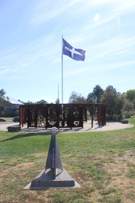
Photograph - Colour, 'Eureka Circle' by Dr. Anton Hasell, 25/10/2018
Eureka Circle marks the 150th anniversary of the Eureka Rebellion, and captures its sacrifices, sense of noble cause and spirit of unity. Commissioned by the City of Ballarat and the Victorian Government's Regional Infrastructure Development Fund. Unveiled by Premier Steve Bracks 26th November 2004.Colour photographs of a sculpture in the Eureka Stockade Memorial Gardens.eureka stockade memorial gardens, eureka circle, eureka stockade, sculpture -
 Ballarat Heritage Services
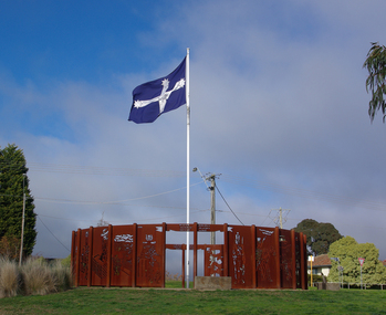
Photograph - Photograph - Colour, Lisa Gervasoni, 'Eureka Circle' by Dr. Anton Hasell, 03/07/2013
Eureka Circle marks the 150th anniversary of the Eureka Rebellion, and captures its sacrifices, sense of noble cause and spirit of unity. Commissioned by the City of Ballarat and the Victorian Government's Regional Infrastructure Development Fund. Unveiled by Premier Steve Bracks 26th November 2004.Colour photographs of a sculpture in the Eureka Stockade Memorial Gardens.eureka stockade memorial gardens, eureka circle, eureka stockade, sculpture, anton hassell -
![Photograph - Colour, Clare Gervasoni, 'Eureka Circle' [detail] by Dr. Anton Hasell, 31/03/2013](/media/collectors/57a00a4fd0cdd1210422a51e/items/5d3ef8a921ea6716b032dc77/item-media/5d3ef8be21ea6716b03305f3/item-fit-380x285.jpg) Ballarat Heritage Services
Ballarat Heritage ServicesPhotograph - Colour, Clare Gervasoni, 'Eureka Circle' [detail] by Dr. Anton Hasell, 31/03/2013
Eureka Circle marks the 150th anniversary of the Eureka Rebellion, and captures its sacrifices, sense of noble cause and spirit of unity. Commissioned by the City of Ballarat and the Victorian Government's Regional Infrastructure Development Fund. Unveiled by Premier Steve Bracks 26th November 2004.Colour photographs of a panel from sculpture in the Eureka Stockade Memorial Gardens.eureka stockade memorial gardens, eureka circle, eureka stockade, sculpture, miltary, soldier -
![Photograph - Colour, Clare Gervasoni, 'Eureka Circle' [detail] by Dr. Anton Hasell, 31/03/2013](/media/collectors/57a00a4fd0cdd1210422a51e/items/5d3ef94121ea6716b03355b9/item-media/5d3ef94e21ea6716b0336381/item-fit-380x285.jpg) Ballarat Heritage Services
Ballarat Heritage ServicesPhotograph - Colour, Clare Gervasoni, 'Eureka Circle' [detail] by Dr. Anton Hasell, 31/03/2013
Eureka Circle marks the 150th anniversary of the Eureka Rebellion, and captures its sacrifices, sense of noble cause and spirit of unity. Commissioned by the City of Ballarat and the Victorian Government's Regional Infrastructure Development Fund. Unveiled by Premier Steve Bracks 26th November 2004.Colour photographs of a panel from sculpture in the Eureka Stockade Memorial Gardens.eureka stockade memorial gardens, eureka circle, eureka stockade, sculpture, miltary, soldier -
![Photograph - Colour, Clare Gervasoni, 'Eureka Circle' [detail] by Dr. Anton Hasell, 31/03/2013](/media/collectors/57a00a4fd0cdd1210422a51e/items/5d3ef98c21ea6716b033b82b/item-media/5d3ef9a521ea6716b033d770/item-fit-380x285.jpg) Ballarat Heritage Services
Ballarat Heritage ServicesPhotograph - Colour, Clare Gervasoni, 'Eureka Circle' [detail] by Dr. Anton Hasell, 31/03/2013
Eureka Circle marks the 150th anniversary of the Eureka Rebellion, and captures its sacrifices, sense of noble cause and spirit of unity. Commissioned by the City of Ballarat and the Victorian Government's Regional Infrastructure Development Fund. Unveiled by Premier Steve Bracks 26th November 2004.Colour photographs of a panel from sculpture in the Eureka Stockade Memorial Gardens.eureka stockade memorial gardens, eureka circle, eureka stockade, sculpture, digger -
![Photograph - Colour, Clare Gervasoni, 'Eureka Circle' [detail] by Dr. Anton Hasell, 31/03/2013](/media/collectors/57a00a4fd0cdd1210422a51e/items/5d3efe7321ea6716b038183e/item-media/5d3efe7a21ea6716b0381e5e/item-fit-380x285.jpg) Ballarat Heritage Services
Ballarat Heritage ServicesPhotograph - Colour, Clare Gervasoni, 'Eureka Circle' [detail] by Dr. Anton Hasell, 31/03/2013
Eureka Circle marks the 150th anniversary of the Eureka Rebellion, and captures its sacrifices, sense of noble cause and spirit of unity. Commissioned by the City of Ballarat and the Victorian Government's Regional Infrastructure Development Fund. Unveiled by Premier Steve Bracks 26th November 2004.Colour photographs of a panel from sculpture in the Eureka Stockade Memorial Gardens.eureka stockade memorial gardens, eureka circle, eureka stockade, sculpture, digger -
 Melbourne Tram Museum
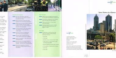
Pamphlet, Yarra Trams, "Yarra Trams at a Glance", Apr. 2008
Pamphlet - DL size, 5 fold printed in full colour on white paper, titled "Yarra Trams at a Glance". Gives details of the services, staff, state projects, tram fleet upgrade, innovation, Tram Tracker, awards, infrastructure projects, the network, tram fleet and contact details. Has the logos of Yarra Trams - Dated April. 2008. See Reg Item 1124 for the Oct. 2008 issue. Two copies held.trams, tramways, yarra trams, logos, tramcars, information -
 Melbourne Tram Museum
Pamphlet, Yarra Trams, "Yarra Trams at a Glance", Oct. 2008
Pamphlet - DL size, 5 fold printed in full colour on white paper, titled "Yarra Trams at a Glance". Gives details of the services, staff, state projects, tram fleet upgrade, innovation, Tram Tracker, awards, infrastructure projects, the network, tram fleet and contact details. Has the logos of Yarra Trams, TransdevTSL and Tram Tracker. Dated Oct. 2008. See Reg item 2397 for an April 2008 issuetrams, tramways, yarra trams, transdev, logos, tramcars, information -
 Ballarat Clarendon College
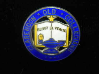
Badge, Clarendon Old Collegians
The Clarendon Old Collegians Association existed from very early times in the school history and was a singificant controbutor to school socail capacity and infrastructure. The OC's regularly donated funds and purchases to special projects. Sections of the society met in different geographic areas, such as Melbourne or the Wimmera. Three circular enamel brooches featuring outer circle in royal blue with lettering enclosing features of school crest - open book in white with gold border, royal blue lamp with gold flame at base of book and gold star at top of bookLettering around border: CLARENDON OLD COLLEGIANSclarendon-presbyterian-ladies-college, clarendon-old-collegians -
 Kiewa Valley Historical Society
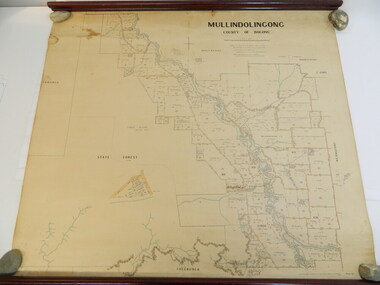
Map - Kiewa Valley, Parish Map of Mullindolingong, 12/10/1906
The map shows the names of people living in the parish of Mullindolingong in 1906. These people had leases or licences giving the reader an insight into the number of people in the area and an understanding of the size of their holdings. Infrastructure is also given including shops, schools, churches etc. Presumably it was used by the Ryder family.This map gives an historical insight into the parish of Mullindolingong as it names people and the infrastructure - roads, buildings etc. as it was in 1906. This enables the reader to compare the area at the time with other times and other places and to have an understanding of the early settlers in the area.This is a very old paper or parchment map with wooden rods top and bottom. The top rod has ribbons attached to enable hanging. The map shows the current leases and licences and when they were held by during this period, circa 1906.Mullindolingong County of Bogong. This plan has been prepared by The Most Reliable Data in the Possession of the Department up to the date of its Compilation. Information respecting Leases or Licences which await Final Completion is not recorded.parish of mullindolingong map; ryder family; early settlers; -
 Southern Sherbrooke Historical Society Inc.
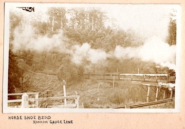
Photograph, Horse Shoe Bend on Narrow Gauge Line
Photo of Puffing Billy coming around the horseshoe bend at Selby and beginning to cross the trestle bridge, heading away from Belgrave. The engine is only part shown. It is hauling four open-sided carriages with canvas covers, and a further six or so enclosed carriages. There appears to be no wind as the smoke is hanging above the train. Railway infrastructure (barrier fences) can be seen in the foreground, and there are wires across the left side of the photo. c. 1920 -
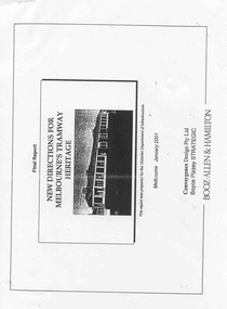 Ballarat Tramway Museum
Document - Photocopy, Boyce Pizzey and Booz Allen & Hamilton, "Final Report - New Directions for Melbourne's Tramway Heritage", 2001
Photocopied Report - 105 pages, titled "Final Report - New Directions for Melbourne's Tramway Heritage", dated Jan. 2001, prepared for the Department of Infrastructure by Booz Allen & Hamilton, Convergence Design Pty Ltd and Boyce Pizzey Strategic. Chapters are Introduction, Tramcar Collections, Other Tramway Heritage, Heritage Significance, Opportunities and Management Plan. Held by a large spring back binder. See Reg item 4264 and 4266 for associated papers. trams, tramways, melbourne, heritage, trams, museum, conservation -
 Kew Historical Society Inc
Plan - Subdivision Plan, Six Big Home Sites, Camberwell North, c.1936
Subdivision plans are historically important documents used as evidence of the growth of suburbs in Australia. They frequently provide information about when the land was sold on which a built structure was subsequently constructed as well as evidence relating to surveyors and real estate and financial agents. The numerous subdivision plans in the Kew Historical Society's collection represent working documents, ranging from the initial sketches made in planning a subdivision to printed plans on which auctioneers or agents listed the prices for which individual lots were sold. In a number of cases, the reverse of a subdivision plan in the collection includes a photograph of a house that was also for sale by the agent. These photographs provide significant heritage information relating house design and decoration, fencing and household gardens.A subdivision in what is currently Balwyn, but which was advertised as being in Camberwell North. The subdivision included six allotments facing Buchanan Avenue and Houghton Street. The subdivision was to the east of the Pointed Firs Estate (1936). In addition to the intrinsic value of this subdivision plan, it also reveals information about the development of transport infrastructure in this area. The subdivision plan notes that the Tramways Board has approved the extension of the tram route past the current terminus at Balwyn Road.subdivision plans - camberwell -
City of Kingston
Photograph - Black and white, 5 January 1984
Moorabbin, Cheltenham and Highett are suburbs in the City of Kingston with a diverse mix of development and zoning. The market gardens, farms and paddocks have gradually been sub-divided into housing and industrial estates and associated infrastructure such as schools and shopping facilities. The area includes many parks, reserves and golf courses.This aerial image covers a diverse section of the City of Kingston, taking in the suburbs of Cheltenham, Moorabbin, Beaumaris and Highett. By 1984, the market gardens of the district have been replaced by housing and factories. The Gas and Fuel state-of-the-art Scientific Services Department is visible on Nepean Highway Highett. The CSIRO Highett site can also be seen. Both sites have now been demolished and have undergone remediation. The Southland site is visible and yet to be redeveloped by Westfield. This image portrays the diversity of development in the City of Kingston with a mixture of green spaces, housing and commercial and industrial features.Aerial photograph of Cheltenham, Beaumaris, Moorabbin and Highett within the City of Kingston. The area depicted in the 1984 aerial view includes Eden Street and Edward Street, Cheltenham (top left), Weatherall Road and Reserve Road, Cheltenham/Beaumaris (top right), Turner Road and Chesterville Road, Moorabbin (bottom left), Nepean Highway (left section), Graham Road and Middleton Street, Highett (bottom right). A large section of this image includes Cheltenham Park and Victoria Golf Club.White text: 3831-219 Lens information [indecipherable] RINGWOOD M/S 7922-3 RUN 15 Clockface image 5,300' ASL VIC DLS© 5-1-84cheltenham, highett, industrialisation, urbanisation, moorabbin, beaumaris -
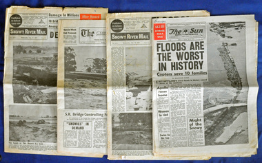 Orbost & District Historical Society
newspapers, February 1971
The 1971 floods at Orbost were the worst on record. At Jarrahmond the river rose to a height of 11 metres and on the flats spread to one and a half kilometres wide. Considerable damage was done to railway infrastructure, roads and farms. More information from the APRIL, 2008 newsletter by John Phillips. (see orbosthistory.com.au)These newspapers are contemporary records of a significant local event.Four newspapers and a set of clippings from various papers. They contain information and photographs pertaining to the 1971 floods in Orbost. 2557.1 is a Sun News Pictorial dated 8.2.1971. 2557.2 is a Snowy River Mail dated 10.2.1971. 2557.3 is an east Gippsland News dated 12.2.1971. 2557.4 is a Snowy River mail dated 12.2.1971 and 2557.5 is a collection of various clippings.floods-orbost-1971 newspaper snowy-river-mail sun-news-pictorial -
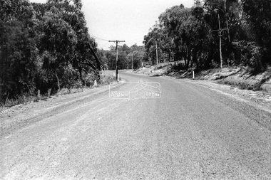 Eltham District Historical Society Inc
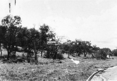
Photograph - Black and White Print, Unidentified road, Eltham district, c. Sep. 1966
Black and white photographic printOriginally located in a Filmpro King Size Prints processing envelope $3.01 Shire of Eltham 9/9/66 and noted as Calrossie Ave area and crossed out Eltham-Yarra Glen Road, Bridge Street to Elsa Court existing conditions mid 1967infrastructure, roads, unidentified -
 Eltham District Historical Society Inc
Photograph - Black and White Print, Unidentified road, Eltham district, possibly Montmorency, c. Sep. 1966
Black and white photographic printOriginally located in a Filmpro King Size Prints processing envelope $3.01 Shire of Eltham 9/9/66 and noted as Calrossie Ave area and crossed out Eltham-Yarra Glen Road, Bridge Street to Elsa Court existing conditions mid 1967infrastructure, roads, unidentified -
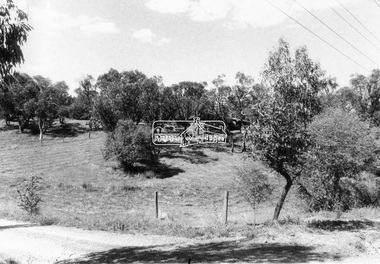
 Eltham District Historical Society Inc
Slide - Photograph, Shalbury Avenue, Eltham, c.Aug. 1990
Part of a presentation, "Roads and Byways of the Shire of Eltham", by Russell Yeoman to the 12 September 1990 Society meeting. Slides shown included copies of old photos and recent images ranging from the suburban streets of Eltham and Montmorency to the mountain roads of Kinglake. In the byways category are views of some iof the Shire's bicycle paths including then recently completed sections of the Main Yarra Trail at Lower Plenty.35mm colour positive transparency (1 of 37) Mount - Agfachrome Agfa CS System black 8 dotseltham, infrastructure, shalbury avenue -
 Eltham District Historical Society Inc
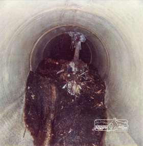
Photograph, Tree roots in stormwater drain, Shire of Eltham, c.1980, 1980c
Colour photographPolaroid R Manufacturer's Batch No. 06031017011 (June 1980)drainage works, infrastructure, polaroid -
 Eltham District Historical Society Inc
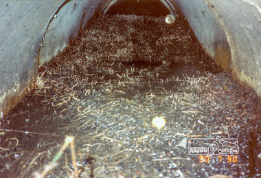
Photograph, Fitzsimons Lane pipe section between inlet and pit, 30 July 1990, 30/07/1990
Colour photographdrainage works, infrastructure, fitzsimons lane -
 Eltham District Historical Society Inc
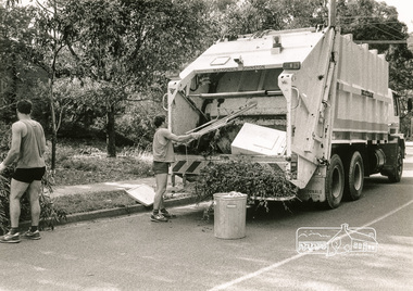
Photograph, Hard Waste Collection, Shire of Eltham, c.Oct 1987, 1987
Black and white photographhard waste collection, infrastructure, shire of eltham -
 Eltham District Historical Society Inc
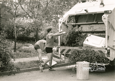
Photograph, Hard Waste Collection, Shire of Eltham, c.Oct 1987, 1987
Black and white photographhard waste collection, infrastructure, shire of eltham -
 Eltham District Historical Society Inc
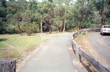
Negative - Photograph, Shire of Eltham, Eltham Lower Park carpark east of Diamond Valley Railway, c.1989
Roll of 35mm colour negative film, 5 strips Colour print 10 x 15 cmKodak GA100 5095eltham lower park, eltham south, infrastructure -
 Eltham District Historical Society Inc
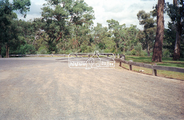
Negative - Photograph, Shire of Eltham, Eltham Lower Park carpark east of Diamond Valley Railway, c.1989
Roll of 35mm colour negative film, 5 strips Colour print 10 x 15 cmKodak GA100 5095eltham lower park, eltham south, infrastructure -
 Eltham District Historical Society Inc
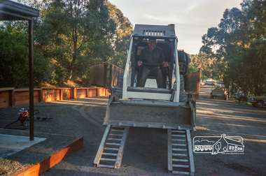
Photograph, Road construction operations, Shire of Eltham, c.1988, 1988c
Roll of 35mm colour negative film, 5 stripsFuji 100infrastructure, road construction, eltham shire council -
 Eltham District Historical Society Inc
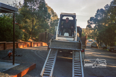
Photograph, Road construction operations, Shire of Eltham, c.1988, 1988c
Roll of 35mm colour negative film, 5 stripsFuji 100infrastructure, road construction, eltham shire council