Showing 2048 items
matching parish
-
 Rutherglen Historical Society
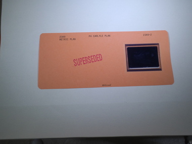
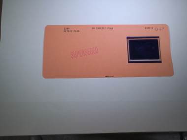
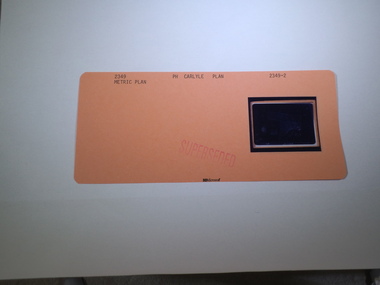
Aperture Card microfilm, Victorian Land Tiltes Office, Parish Plan Carlyle (Superseded)
Town layout of Carlylecard with a single microfilm insertplan, town, boundries, lots, roads -
 Rutherglen Historical Society
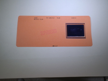
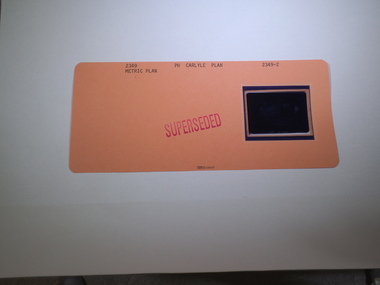
Aperture Card microfilm, Victorian Land Tiltes Office, Parish Plan Carlyle (Superseded)
Town layout of Carlylecard with a single microfilm insertplan, town, boundries, lots, roads -
 Rutherglen Historical Society
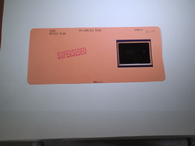
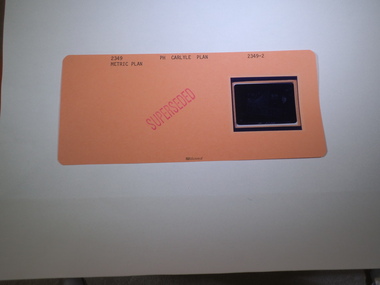
Aperture Card microfilm, Victorian Land Tiltes Office, Parish Plan Carlyle (Superseded)
Town layout of Carlylecard with a single microfilm insertplan, town, boundries, lots, roads -
 Rutherglen Historical Society
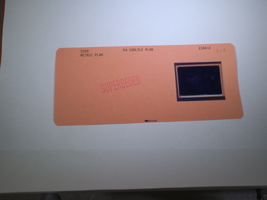
Aperture Card microfilm, Victorian Land Tiltes Office, Parish Plan Carlyle (Superseded)
Town layout of Carlylecard with a single microfilm insertplan, town, boundries, lots, roads -
 Rutherglen Historical Society
Aperture Card microfilm, Victorian Land Tiltes Office, Parish Plan Carlyle (Superseded)
Town layout of Carlylecard with a single microfilm insertplan, town, boundries, lots, roads -
 Rutherglen Historical Society
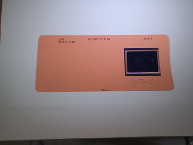
Aperture Card microfilm, Victorian Land Tiltes Office, Parish Plan Carlyle (Superseded), 11/07/2000
Town layout of Carlylecard with a single microfilm insertplan, town, boundries, lots, roads -
 Rutherglen Historical Society
Aperture Card microfilm, Victorian Land Tiltes Office, Parish Plan Carlyle (Superseded)
Town layout of Carlylecard with a single microfilm insertplan, town, boundries, lots, roads -
 Rutherglen Historical Society
Aperture Card microfilm, Victorian Land Tiltes Office, Parish Plan Carlyle (Superseded)
Town layout of Carlylecard with a single microfilm insertplan, town, boundries, lots, roads -
 Rutherglen Historical Society
Aperture Card microfilm, Victorian Land Tiltes Office, Parish Plan Carlyle (Superseded)
Town layout of Carlylecard with a single microfilm insertplan, town, boundries, lots, roads -
 Rutherglen Historical Society
Aperture Card microfilm, Victorian Land Tiltes Office, Parish Plan Carlyle (Superseded)
Town layout of Carlylecard with a single microfilm insertplan, town, boundries, lots, roads -
 Rutherglen Historical Society
Aperture Card microfilm, Victorian Land Tiltes Office, Parish Plan Carlyle (Superseded)
Town layout of Carlylecard with a single microfilm insertplan, town, boundries, lots, roads -
 Rutherglen Historical Society
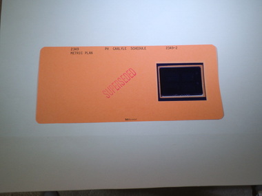
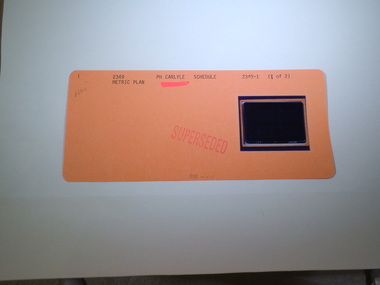
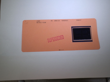
Aperture Card microfilm, Victorian Land Tiltes Office, Parish Schedule Carlyle (Superseded)
Town layout schedule of Carlylecard with a single microfilm insertschedule -
 Rutherglen Historical Society
Aperture Card microfilm, Victorian Land Tiltes Office, Parish Plan Carlyle (Superseded)
Town layout of Carlylecard with a single microfilm insertplan, town, boundries, lots, roads -
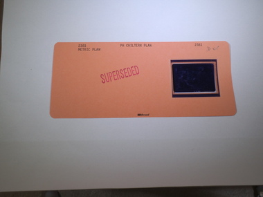
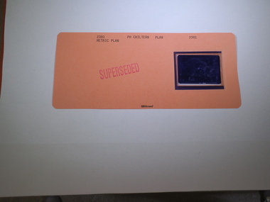
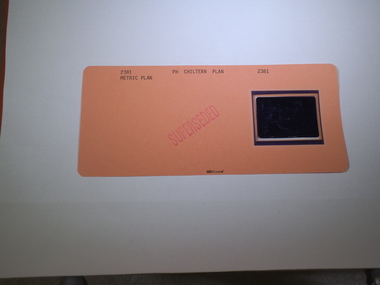
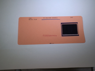 Rutherglen Historical Society
Aperture Card microfilm, Victorian Land Tiltes Office, Parish Schedule Chiltern (Superseded)
Town layout of Chilterncard with a single microfilm insertschedule -
 Rutherglen Historical Society
Aperture Card microfilm, Victorian Land Tiltes Office, Parish Plan Chiltern
Town layout of Chilterncard with a single microfilm insertplan, town, boundries, lots, roads -
 Rutherglen Historical Society
Aperture Card microfilm, Victorian Land Tiltes Office, Parish Plan Chiltern (Superseded)
Town layout of Chilterncard with a single microfilm insertplan, town, boundries, lots, roads -
 Rutherglen Historical Society
Aperture Card microfilm, Victorian Land Tiltes Office, Parish Plan Chiltern (Superseded)
Town layout of Chilterncard with a single microfilm insertplan, town, boundries, lots, roads -
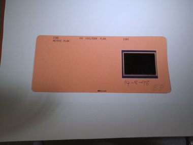 Rutherglen Historical Society
Aperture Card microfilm, Victorian Land Tiltes Office, Parish Plan Chiltern, 14/08/1998
Town layout of Chilterncard with a single microfilm insertplan, town, boundries, lots, roads -
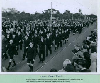 Department of Health and Human Services
Catholic Primary Schools and Parish association Students marching over Princes Bridge towards the Melbourne Town Hall on Swanston Street, Melbourne CBD Australia, from the War Memorial - Department of Health – National Fitness Office (Sports & Recreation) – Historical Press Release Photo Collection
Department of Health – National Fitness Office (Sports & Recreation) – Historical Press Release Photo - Empire Youth Day & Royals on Tour CollectionDepartment of Health – National Fitness Office (Sports & Recreation) – Historical Press Release Photo - Empire Youth Day & Royals on Tour Collection -
 Friends of St Brigids Association
Book - “Journey in Faith” Koroit Catholic Parish 1886-1986, Russell, John.J. 1986. “Journey in Faith” Koroit Catholic Parish 1886-1986. [Koroit, Vic.]: Timothy J. Auld
-
Clunes Museum
Map, Township of Clunes - Parish of Clunes - County of Talbot
Map of Clunes Township in 1951Photocopy of map, (comprising a number of A4 sheets taped together) showing Lot numbers and names of landholder. Reference Gaz 1951.1480. Scale measurement is in "chains"Niltownship of clunes map, 1951 -
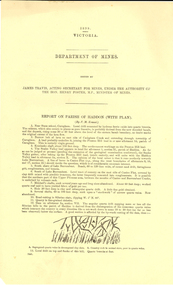 Federation University Historical Collection
Document, Report on Parish of Haddon, 1898
Ferdinand Krause was a lecturer at the Ballarat School of Mines.1 double sided printed page with 2 geological diagrams.haddon, ferdinand krause -
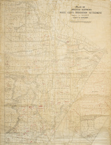 Merbein District Historical Society
Plan - Plan, Allotments, Plan of Homestead Allotments White Cliffs Irrigation Settlement Parish of Merbein County of Karkarooc
Large plan drawn in black ink on cream colour paper with linen backing. Some red ink addedWritten in red pen new owners of allotmentsallotments, merbein, irrigation, whitecliffs, county of karkarooc -
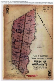 Ringwood and District Historical Society
Document, Titles of land subdivision, Crown Portions 32, 33 & 34, Parish of Warrandyte, 1884 and 1907, Ringwood, Victoria
Evolution of the subdivision and the use of landBlack plastic bound pockets containing copies of 18 LANDATA subdivision maps and mortgage transfer pages dating from 1884 for 303 acres 2 roods and 1 perch bounded by Warrandyte Road, Wonga Road, Oban Road and Mullum Mullum Creek in Ringwood, Victoria. Certificates of Title include Vol 1606 Fol 045 Frederick Walter Purches 1884 and subsequent transfers to 1902, and Vol 3232 Fol 646357 Ann Jane Kennedy 1907 and transfers to 1921. -
 University of Melbourne, Burnley Campus Archives
Plan, Burnley Gardens. City of Richmond. Parish of Jika Jika - County of Bourke, 1927
Part-coloured plan showing drainage, sewerage drains, taps and waterstops. Area bounded by Swan St. To N, Yarra River on E and Richmond Park on SW side. Contour lines of orchard depicted, laying pens and yards. Coloured area depicts pavilion with surrounding garden and paths layout pencilled in. Photo-Lithograph by Dept. of Lands & Survey, Melbourne by W. Butsonsewerage, drainage, lithograph, pavilion -
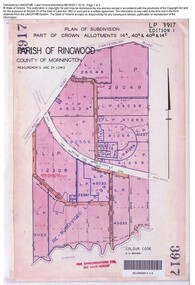 Ringwood and District Historical Society
Document, Sale of Land Act documents - Part of Crown Allotments 14A, 40A, 40B & 4C, Parish of Ringwood - 1895
Certificate of Title - Georgina Elizabeth Wingfield Knox, wife of William Robert Knox, part of allotments 14A and 40A, 27th November, 1895, and subsequent transfers up to 1959. Plan of Subdivision includes Allens Road, The Greenway, Dickasons Road, and Canterbury Road, Ringwood. (With further residential and commercial developments taking place since the 1920s, this area became part of the suburb of Heathmont.) -
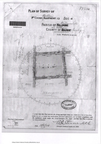
 Eltham District Historical Society Inc
Document - Photocopy, Survey Fleld Notes of Part of Crown Portion 13, Section 4 at Eltham, Parish of Nillumbik, County of Evelyn, 1902-1903
Main Road, Henry Street to Diamond Street; Silver Street to Bible Street Application No. 0337771902, 1903, arthur street, bible street, bird street, diamond creek (creek), diamond street, eltham, eltham railway station, henry street, main road, silver street, survey plan, vine street, application 33777, map -
 Eltham District Historical Society Inc
Document - Photocopy, Survey Fleld Notes of Part of Crown Portion 13, Section 4 at Eltham, Parish of Nillumbik, County of Evelyn, 18 May 1908
Portion of land bounded by: Main Road, Luck Street, Bible Street, Arthur Street Application 37314 W. P. Steane, M.C.E. Civil Engineer and Surveyor, 18 May 1908application 37314, arthur street, bible street, eltham, luck street, main road, map, survey plan -
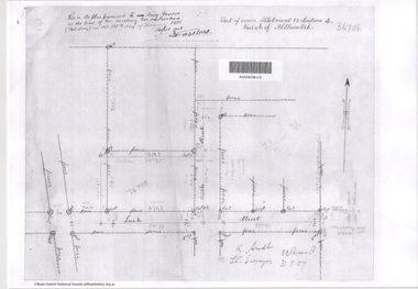 Eltham District Historical Society Inc
Document - Photocopy, Survey Fleld Notes of Part of Crown Portion 13, Section 4 at Eltham, Parish of Nillumbik, County of Evelyn, 31 May 1907
Portion of land east of Main Road and north of Luck Street bounded by Bible Street Application 36708 K. Arndt, Licensed Surveyor, 31 May 1907application 36708, bible street, eltham, luck street, main road, map, survey plan -
 Eltham District Historical Society Inc
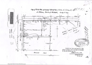
Document - Photocopy, Survey Fleld Notes of Part of Crown Portion 12, Section 4 at Eltham, Parish of Nillumbik, County of Evelyn, 30 September 1925
Portion of land bounded by: Main Road, Franklin Street, Bible Street, Brougham Street Application 46839 R. Woodcock, Licensed Surveyor, 30 September 1925application 46839, bible street, brougham street, eltham, franklin street, main road, map, survey plan