Showing 576 items matching "route map"
-
 Victorian Railway History Library
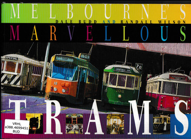
Book, University of New South Wales Press et al, Melbourne's marvellous trams, 1998
... with details of routes and vehicles. Ill, map, p.96. Melbourne's ...History of Melbourne trams from cable trams to the present with details of routes and vehicles.Ill, map, p.96.non-fictionHistory of Melbourne trams from cable trams to the present with details of routes and vehicles.tramways - melbourne - history, tramways - melbourne -
 Victorian Railway History Library
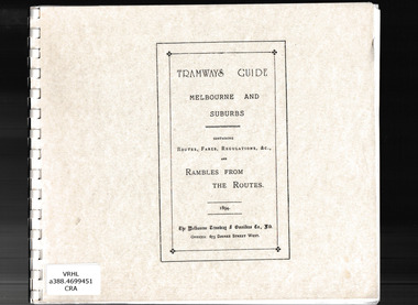
Book, Jack Cranston, Tramways guide: Melbourne and suburbs containing routes, fares, regulations and rambles from the routes, 1894
Illustrations, routes, descriptions and plans of Melbourne's cable trams 1885-1940.facsimile, Ill, maps, p.41.non-fictionIllustrations, routes, descriptions and plans of Melbourne's cable trams 1885-1940.urban transportation - melbourne, cable trams - melbourne -
 Victorian Railway History Library
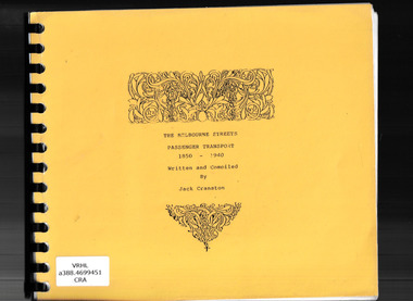
Book, Jack Cranston, The Melbourne streets: Passenger transport 1850-1940, ????
Illustrations, routes, descriptions and plans of Melbourne's cable trams 1850-1940.Facsimile, ill, maps, p.41.non-fictionIllustrations, routes, descriptions and plans of Melbourne's cable trams 1850-1940.urban transportation - melbourne, cable trams - melbourne, horse trams - melbourne -
 Victorian Railway History Library
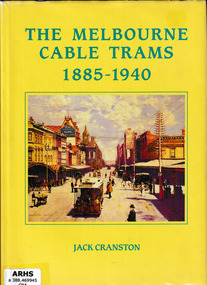
Book, Jack Cranston, The Melbourne cable trams 1885-1940, 1988
Illustrations, routes, descriptions and plans of Melbourne's cable trams 1885-1940.Ill, maps, p.41.non-fictionIllustrations, routes, descriptions and plans of Melbourne's cable trams 1885-1940.urban transportation - melbourne, cable trams - melbourne -
 Melbourne Tram Museum
Drawing, Melbourne & Metropolitan Tramways Board (MMTB), "MMTB Electric Tramway System 1979", 1979 original
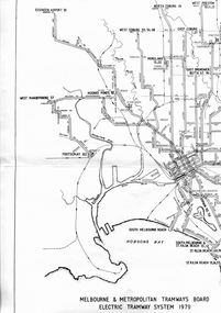
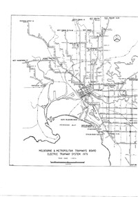
... Melbourne Map Routes Digital image of a drawing titled "MMTB ...See item 7740 for an original print.Digital image of a drawing titled "MMTB Electric Tramway System 1979", giving a detailed layout of the Melbourne tram system in 1979. shows depot, storage depots, workshops and tramway terminus names and route numbers. See htd253i.pdf for a high definition pdf file - this does not open on this system - Two page document. See Reg Item 1765 for a 1971 copy.trams, tramways, mmtb, melbourne, map, routes -
 Melbourne Tram Museum
Drawing, Melbourne & Metropolitan Tramways Board (MMTB), "Melbourne & Metropolitan Tramways Board Electric Tramway System 1979", 1979
... Trams tramways Melbourne Map Trackwork Depots Route Numbers ...Photocopy of the track plan for the Melbourne Tramway System in 1979 over two separate sheets - titled "Melbourne & Metropolitan Tramways original pr Board Electric Tramway System 1979". Shows the route numbers and terminus names, depot locations, rail lines, cross overs and junctions. Has the name J.Chau in bottom left hand corner. See item 7740 for an original print.trams, tramways, melbourne, map, trackwork, depots, route numbers, railways, junction -
 Melbourne Tram Museum
Pamphlet - PTC split, Public Transport Corporation (PTC), It's business as usual, 9/1997
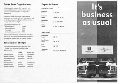
Gives details of the split of the tram division of the Public Transport Corporation Vic to come into effect on 1-10-1997 into two business divisions - Yarra Trams and Swanston Trams. Includes a map showing which entity was to operate what section of Melbourne Trams. Prepared for employee information. Provides information on who would be the senior managers, a timetable, depots and routes to be operated and the logos that would be used.Yields information about the split of the Public Transport Corporation Tram division in preparation for the future privatisation. Pamphlet - photocopy titled Pamphlet - It's business as usual about the split up of the PTC to Swanston Trams and Yarra Trams. Two copies held.trams, tramways, yarra trams, swanston trams, ptc, managers, depots, public transport corporation -
 Melbourne Tram Museum
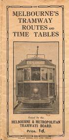
Map, Melbourne & Metropolitan Tramways Board (MMTB), Melbourne's tramway routes and timetables - MMTB, 1925
... Melbourne Tram Museum 8 Wallen Road Hawthorn melbourne Map ...Map of the MMTB Tramway routes 1925 with a list of first and last cars, along with photographs of Wattle Park, Luna Park, and Studley Park. Provides information for the Prahran and Malvern lines, Hawthorn, Footscray, Essendon, Coburg, Kew, St Kilda, cable tram routes, and buses. Also provides information for passengers. The cover photo is of the front of W 296, with the destination of Esplanade. The map is dated by the opening of the line to West Brunswick as far as Albion St, the City Road to St Kilda line via Sturt St lines, and the electric line in Flemington Road which were all opened during mid to late 1925. See Reference. Shows a number of buildings and locations by a numbered reference list, including the Federal Parliament house. The map has advertisements around the outside of the map for Kiwi Shoe or boot polish.Yields information about the Melbourne tramway system in 1925 and demonstrates the methodology the MMTB used to provide information to travellers. Shows both cable and electric tram lines and the development of the Melbourne system.Map book - 15 fold paper titled "Melbourne's tramway routes and timetables"trams, tramways, mmtb, tramway maps, wattle park, studley park, timetables, cable trams, w class tram, tram 296, kiwi shoe polish -
 Melbourne Tram Museum
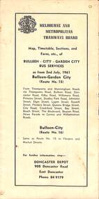
Map - Map, Timetable, Sections, and Fares, etc., of BULLEEN - CITY - GARDEN CITY BUS SERVICES
... Doncaster City Map, timetable & fares for Bulleen to City bus route ...Map of the MMTB Bulleen - City - Garden City bus routes. Map, timetable & fares for Bulleen to City bus routemmtb, buses, doncaster, city -
 Melbourne Tram Museum
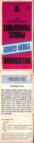
Document, Ministry of Transport, Melbourne Public Transport Map - No. 12, 1982
Map No. 12 - Includes description of tram and bus routes, private bus routes. On the front cover is composite image of Melbourne public transport vehicles. Has contact details for bookings and lost property etc and how to use the map. Priced at 40c, issue No. 12 of c1982. Has details of the then new Travelcard ticket system. Yields information about Melbourne public transport services in 1982.Fold out map (36 sections 9 across x 4 deep), "Public Transport Map", coloured of Melbourne's Tram and Bus routes, route numbers, rail lines, detailed for the central part of Melbourne and the outer Metropolitan services.tramways, melbourne, tram services, bus services, railways, travelcard -
 Vision Australia
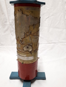
Map - Object, R.F. Tunley, Braille cylinder map, 1940-1950s
This map was produced by Richard Francis Tunley and given to the Victorian Braille Library for use by it's patrons. Mr Tunley was a prolific Braille map maker as well as producing other items for blind and vision impaired children, advocated for compulsory education for blind and deaf children and established the Queensland Braille Map and Model Club. Leading by example, his maps were treasured by those who used them and were an outstanding piece of craftsmanship. In this example, the metal cylinder sits on a wooden base and can be turned via a handle in the wooden top or rotating the sides. A brailled red metal plate occupies the bottom third, and large continents have a metal plate, cut to shape, upon which braille country/continent names are placed. Major rivers are traced through raised lines in the metal continental plates, twisted wire traces shipping routes with associated brailled metal plates, raised metal pins in some major locations and more explanatory plates sit in various oceans.1 metal cylindrical map with tactile markersCommercial & Strategic Map of the British Empire Presented to the Victorian Braille Librarybraille library of victoria, r.f. tunley -
 Melbourne Tram Museum
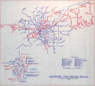
Map, Melbourne & Metropolitan Tramways Board (MMTB), "Melbourne tram and bus routes", c1961
... Map showing MMTB tram and bus routes following the closure ...Map showing MMTB tram and bus routes following the closure of the Point Ormond line on 22/10/1960 and before the closure of the Footscray lines on 10/3/1962. Shows route numbers at termini and along the route and points of interest in a reference table. Yields information the MMTB services c1961.Map - printed in two colours on paper. Two copies held.tramways, map, mmtb, tram, bus, routes -
 Melbourne Tram Museum
Document - Opening of Box Hill Extension Route 109 Press documents, Ministry of Transport, May 2003
Produced for the opening of the Box Hill Extension, 2 May 2003, extending the tram line from Union Road Mont Albert to Station Street Box Hill. Became known as Route 109 - Port Melbourne Box Hill.Provides the background to the 2003 extension of the Mont Albert tram to Box Hill.Documents - mainly folded to A4 enclosed within a card folder prepared for the event. .1 - folder - folded card to hold the following items .2 - 10 fold DL pamphlet providing map, technical information and tram stops. .3 - A2 folded sheet for the Route 109 project - introduction by the Minister for Transport, Peter Batchelor .4 - A3 folded sheet giving background history to the area .5 - 2 page Press Release dated 2/5/2003 .6 - A4 sheet with CD containing a photo of the 30/9/1916 Opening by Mr. A Bailey trams, tramways, new tramway, box hill, opening, route 109, mont albert -
 Melbourne Tram Museum
Map, Ministry of Transport, Melbourne Public Transport Map - No. 9, 1979
Map No. 9 - Includes description of tram and bus routes, private bus routes. Has contact details for bookings and lost property etc and how to use the map. Yields information about Melbourne public transport services in 1979Fold out map (27 sections 9 across x 3 deep), "Public Transport Map", coloured of Melbourne's Tram and Bus routes, route numbers, rail lines, detailed for the central part of Melbourne and the outer Metropolitan services.tramways, melbourne, tram services, bus services, railways, travelcard, maps -
 Melbourne Tram Museum
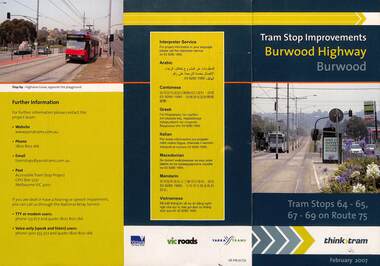
Pamphlet, VicRoads, "Tram stop improvements Burwood Highway Burwood", Feb. 2007
Pamphlet dated Feb. 2007 detailing the installation of platform or super stops in Burwood Highway Burwood in four locations. Has location map. Part of the VicRoads Yarra Trams Think Tram project. Route 75.Yields information about the installation of super stops in Burwood Highway during 2007.Pamphlet - 3 fold DL - full colour.trams, tramways, super stops, platform stops, route 75, burwood highway, burwood -
 Melbourne Tram Museum
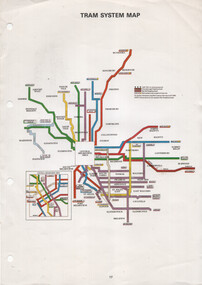
Map, The Met, "Tram System Map", c1990
... The Met map tram routes routes Printed A4 full colour sheet ...Tram system map published by The Met to show the various Melbourne tram routes, route numbers, principal road names, suburbs and tram routes within the Central Business District.Provides information about Melbourne tram routes c1990Printed A4 full colour sheet with four punch holes on left hand side.tramways, melbourne, the met, map, tram routes, routes -
 Bacchus Marsh & District Historical Society
Map, Tracing of plan shewing portion through Bacchus Marsh District of proposed new Main Road between Gisborne and Blackwood
... A single page paper map showing the proposed route... 1870s. Roads Road Plans Bacchus Marsh Victoria Maps Gisborne ...Road construction and planning was a primary function of the early local government authorities in rural and regional Victoria. This plan is indicative of the sort of documentation which generated considerable public interest and comment in rural communities. The date of this plan is not clear. Newspaper articles in the Bacchus Marsh Express around 1869 contain numerous references to the proposed new road between Gisborne and Blackwood which suggests this plan may date from the late 1860s or early 1870s.A single page paper map showing the proposed route of a main road to be constructed between Gisborne and Blackwood. The map is pasted into a bound volume containing 76 maps or plans in total. High resolution digital image stored on BMDHS computer network. roads, road plans, bacchus marsh victoria maps, gisborne to blackwood main road -
 Whitehorse Historical Society Inc.
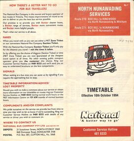
Pamphlet - Bus Timetable, National Bus Company Pty LTD, North Nunawading Bus Services, 10/10/1994
A National Bus Line map and timetable for North Nunawading in 1994 (Routes 270 and 271)A National Bus Line map and timetable for North Nunawading in 1994 (Routes 270 and 271)non-fictionA National Bus Line map and timetable for North Nunawading in 1994 (Routes 270 and 271) -
 Melbourne Tram Museum
Book, Metlink, "Information for public transport staff - 2009 Formula 1 Australian Grand Prix", 2008
Forty page full colour publication plus covers with fold out map on the rear cover titled "Information for public transport staff - 2008 Formula 1 Australian Grand Prix". Gives details of event for train, tram and bus crews, event program and transport map, including shunting details, announcements, bus replacement services, electric or automatic points, route alterations. On the back cover has contact telephone numbers and web addresses. 2 copies held.trams, tramways, grand prix, metlink, formula 1, albert park -
 Melbourne Tram Museum
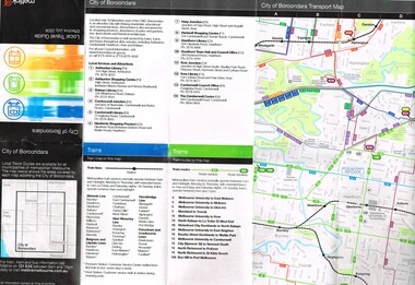
Map, Metlink, "City of Boroondara - Local Travel Guide - July 2008", Jul. 2008
Map, Guide book, Pamphlet, 21 fold, pocket size, titled "City of Boroondara - Local Travel Guide - July 2008" detailing public transport services in the City. Includes map of the tram, train networks, tickets information, tram traction , Connex SMS updates and info on Metlink including contact details. Has a detail map showing services in the city and adjacent overlap area of buses, trams and trains including route numbers. See Reg Item 2283 for Moonee Valley version,trams, tramways, city of boroondara, map, guides, bus services, metlink, connex -
 Melbourne Tram Museum
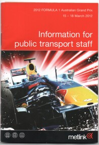
Book, Metlink, "Information for public transport staff - 2012 Formula 1 Australian Grand Prix", Feb. 2012
Book - 36 pages page full colour publication plus covers with fold out map on the rear cover titled "Information for public transport staff - 2012 Formula 1 Australian Grand Prix". Gives details of event for train, tram and bus crews, event program and transport map, including shunting details, announcements, bus replacement services, electric or automatic points, route alterations. On the back cover has contact telephone numbers and web addresses.trams, tramways, grand prix, metlink, formula 1, albert park -
 Melbourne Tram Museum
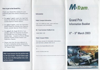
Pamphlet, M>Tram, "M>Tram - Grand Prix Information Booklet", Feb. 2003
Pamphlet - 3 fold DL from an A4 full colour sheet titled "M>Tram - Grand Prix Information Booklet" - 6-9/3/2003 printed for public distribution. Gives information on tram route changes, contact details, how to get to Albert Park, circuit map and what to take with you.trams, tramways, m>tram, grand prix, map, public transport -
 Melbourne Tram Museum
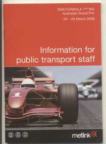
Book, Metlink, "Information for public transport staff - 2009 Formula 1 Australian Grand Prix", Feb. 2009
Forty page full colour publication plus covers with fold out map on the rear cover titled "Information for public transport staff - 2009 Formula 1 Australian Grand Prix". Gives details of event for train, tram and bus crews, event program and transport map, including shunting details, announcements, bus replacement services, electric or automatic points, route alterations. On the back cover has contact telephone numbers and web addresses. 2 copies held.trams, tramways, grand prix, metlink, formula 1, albert park -
 Melbourne Tram Museum
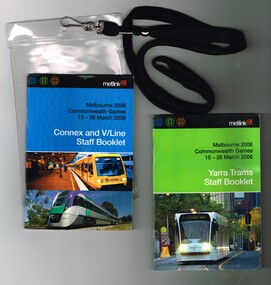
Ephemera - Timetable, Metlink, "Melbourne 2006 Commonwealth Games - 16-26 March 2006" - Yarra Trams Staff Booklet", Mar. 2006
Set of two books printed in full colour on gloss white paper, centre stapled providing information for transport staff involved in the Commonwealth Games held in Melbourne 16-26 March 2006. Both have details of event for train, tram and bus crews, event program and transport map, including shunting details, announcements, bus replacement services, electric or automatic points, route alterations and security information. On the back cover has contact telephone numbers and web addresses. Both have the Met Link logos on the front covers. Items contained with in a plastic envelope with a black neck band. .1 - "Melbourne 2006 Commonwealth Games - 16-26 March 2006" - Yarra Trams Staff Booklet" - 80 pages with a photo of 5014 on front cover. 2nd copy added 11-12-17 from Donation of Ron Scholten. .2 - "Melbourne 2006 Commonwealth Games - 16-26 March 2006" - Connex and V/Line Staff Booklet" - 96 pages with a Alstom suburban train and Bombardier Velocity set on the front covers. 2 copies held.trams, tramways, commonwealth games, connex, v/line, yarra trams, metlink -
 Melbourne Tram Museum
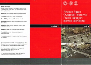
Pamphlet, Metlink, "Flinders Street Overpass Removal - Public transport service alterations", May. 2005
.1 - Pamphlet - DL three fold, full colour on gloss paper, titled "Flinders Street Overpass Removal - Public transport service alterations", giving details of the service alterations to trams and buses using Flinders St during the May 2005 to end of 2005 removal of the overpass. Has a map and images of the intersection of Flinders and King St - with very few cars! .2 - Timetable temporary change sheet for route 48 showing the change of the route to Market St and estimated frequency. Terminus at the time was "New Quay Docklands" .3 - ditto for the extension of Routes 24 to New Quay for the above works. .4 - ditto for route 24 and 30 during the above works. Published by Metlink. Route 48 timetrams, tramways, metlink, flinders st, kingsway, trackwork, route 48, timetables, route 24, route 30, new quay docklands -
 Melbourne Tram Museum
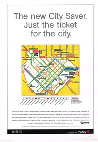
Poster, Metlink, "City Saver Metcards", Jan. 2004
... the city area shown by a map with the various routes and station... by a map with the various routes and station stations. Also shows ...Poster - A3 - full colour printed on gloss white paper, advertising the City Saver Metcards and the availability within the city area shown by a map with the various routes and station stations. Also shows places of interest. Gives details as to the ticket system and the costs. Published by Metlink, has Metlink logos. Weblink - to a website published by Rob O'Regan - http://www.robx1.net/ accessed 3/1/2015 - gives the date of introduction as 1/1/2004 - see http://www.robx1.net/victkt/metcard/html/citysav.htmtrams, tramways, posters, metlink, tickets, metcard -
 Melbourne Tram Museum
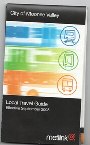
Map, Metlink, "City of Moonee Valley - Local Travel Guide - July 2008", Sep. 2008
Map, Guide book, Pamphlet, 21 fold, pocket size, titled "City of Moonee Valley - Local Travel Guide - July 2008" detailing public transport services in the City. Includes map of the tram, train networks, tickets information, tram traction , Connex SMS updates and info on Metlink including contact details. Has a detail map showing services in the city and adjacent overlap area of buses, trams and trains including route numbers. See Reg Item 2250 for City of Boroondara version.trams, tramways, city of moonee valley, map, guides, bus services, metlink, connex -
 Melbourne Tram Museum
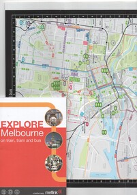
Book, Metlink, "Explore Melbourne on train, tram and bus", Jan. 2009
Book - 42 pages + cover + foldout map, perfect bound - titled "Explore Melbourne on train, tram and bus" giving details of many locations, venues that could be travelled to by public transport, how to buy Metcards, map of the inner area and transport routes. Places of Interesttrams, tramways, melbourne, local history, metlink, public transport, map -
 Melbourne Tram Museum
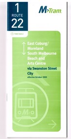
Ephemera - Timetable, M>Tram, Set of 21 M>Tram timetables, Sep. 2002
... , check points, map and description of routes, use of Metcards...Trams tramways M>Tram Tram Services Timetables Route 1 ...Set of 21 M>Tram timetables, light green cover with route number on cover, giving details of popular M>Tram destination, check points, map and description of routes, use of Metcards and contact details. .1 - Route 1 / 22 - East Coburg/Moreland to South Melbourne Beach - October 2000 - 36 pages. .2 - Route 3 - East Malvern - Melbourne University - January 2002 - 24 pages. .3 - Route 82 - Moonee Ponds - Footscray - October 2000 - 20 pages. .4 - Route 5 - Malvern (Burke Road) - Melbourne University - August 2003 - 32 pages. .5 - Route 6 - Glen Iris - Melbourne University - January 2002 - 24 pages. .6 - Route 8 - Toorak - Melbourne University - August 2003 - 24 pages. .7 - Route 16 - St Kilda Beach - Melbourne University - January 2002 - 24 pages. .8 - Route 19 - North Coburg - City - October 2000 - 36 Pages .9 - Route 55 - West Coburg - Domain Road Interchange - October 2000 - 28 pages. .10 - Route 57 - West Maribyrnong - City - October 2000 - 28 pages. .11 - Route 64 - East Brighton - Melbourne University - January 2002 - 32 pages. .12 - Route 67 - Carnegie - Melbourne University - January 2002 - 24 pages. .13 - Route 72 - Camberwell - Melbourne University - January 2002 - 24 pages. .14 - Route 78 / 79 - North Richmond - Prahran / St Kilda Beach - January 2003 - 20 pages. Full Image of .8 added 9/4/17 following a query about route 19 timetables - see image i2. .15 - Route 5 - Malvern (Burke Road) - Melbourne University - January 2002 - 32 pages .16 - Route 8 - Toorak - Melbourne University - January 2002 - 24 pages. .17 - Route 69 - Kew Cotham Road - St Kilda Beach - January 2002 - 20 pages .18 - Route 59 - Airport West - City - October 2000 - 32 Pages .19 - Route 78 / 79 - North Richmond - Prahran / St Kilda Beach - January 2002 - 20 pages. .20 - Route 82 - Moonee Ponds - Footscray - October 2000 - 20 pages. .21 - Route 67 - Carnegie - Melbourne University - Augst 2003 - 24 pagestrams, tramways, m>tram, tram services, timetables, route 1, route 22, route 82, route 5, route 6, route 8, route 16, route 19, route 55, route 57, route 64, route 67, route 72, route 78, route 79, route 69, route 59, route 82 -
 Melbourne Tram Museum
Map - Metlink folder - Travel Smart Maps, Travelsmart - Department of Infrastructure, "Melbourne's Public transport Map", 2005 to 2006
Set of four maps issued by Metlink - 2005 to 2006 contained within a Metlank badge plastic folder. Maps published in association with Melway 1 - 5 x 8 fold map with card cover dated Jan 2005 with a price of $2. Detailed map showing rail, tram and bus routes. 2 - 6 x 4 fold map for Moonee Valley - Travelsmart - for public transport, walking and cycling - dated 2005 3 - 7 x 4 fold map for Moreland - Travelsmart - for public transport, walking and cycling - dated October 2006 - includes notes on taxis. 4 - 7 x 4 fold map for Ride to Work day - 5 Oct. 2005Yields information about Melbourne Public Transport network.Metlink plastic folder containing maps.maps, metlink, public transport, moreland, moonee valley, travelsmart