Showing 3220 items
matching road map
-
 Mission to Seafarers Victoria
Document - Media release, Podcast reveals unique Melbourne experiences, April 2022
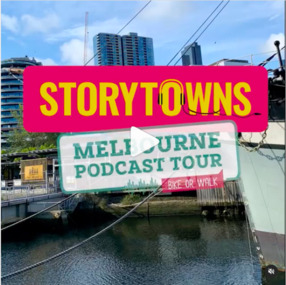
In April 2022, the City of Melbourne partnering Storytown, with launched the "Melbourne Podcast Tour". Storytown, an application created by Jarrod Pickford offering audio guides. This self-guided tour takes you along the Yarra River, from Southbank to Docklands, taking around 1.5 hours to complete by bike or 2 hours by foot. From their website: "Told by locals Discover Australia through the voices of its locals! Storytowns collaborates with communities to craft immersive audio guides, offering authentic travel tales from the heart of each neighborhood. Simply grab your headphones, download our app and explore Melbourne’s suburbs with with our fresh-out-the-oven “Railway Stories” audio guides! And if you’re feeling adventurous this weekend, take a road trip through regional Australia and let us jazz up your adventure, where the local folks are the true stars of the story. Sue Dight was interviewed to add to tThe interview was a to way to put the Mission to Seafarers on the map and increase its visitation. Unfortunately the tour is not avalaible anymore (as from 2023).Digital copy of a media releasecom, city of melbourne, app, storytown, sue dight, on the map, marketing, audioguide, jarrod pickford, audio guides, self-guides tour, podcast, radio interview -
 Phillip Island and District Historical Society Inc.
Photographs, Early 20th Century
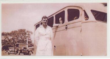
A collection of 27 photographs and 2 brochures of Tourists buses used during the 1930's to 1950's on Phillip Island. Also some photographs of penguins and mutton birds. Donated by Terry Watchorn. In reference to 288-17. A post on Facebook relating to this photo in Feb 2019 by Gwyneth Myers said “ there are some wonderful Knights restored amongst the Willy’s Car Club members”29 Photographs and Brochures of Tourist Buses, penguins and mutton birds. 288-01. Photograph of Herb Watchorn, driver, outside the bus. 288-02. Photograph of a new Ford Bus 1938. 288-03. Photograph of Herb Watchorn with a Mutton Bird. 288-04. Photograph of a 1946 Ford Car, new sheds with cars and house in Cowes. 288-05. Photograph of Elizabeth, Mary, Patricia and Herbet Watchorn outside Cora Lynn Guest House. 288-06. Photograph of a Chev Tourist Bus outside the Isle of Wight Hotel in Cowes. April 1935. Herb Watchorn & another man. 288-07. Photograph of a Tourist bus and passengers with a Bullock Team passing by. 1936. 288-08. Photograph of the Phillip Island Tourist Bus - "EY" Ford - used on the Dandenong Run. 288-09. Photograph of three 1946 Ford Buses, an Indiana Bus and a Chev. 288-10. Photograph of a Chevrolet bus 1934. 288-11. Photograph of a Ford Bus 1953. 288-12. Photograph of Herb Watchorn and Willys Knight Car. 288-13. Photograph of five buses - Chev, Indiana & Ford Buses. 288-14. Photograph of a Chev bus and passengers on the San Remo-Newhaven Punt. 1934. 288-15. Photograph of Herb Watchorn with a penguin. 288-16. Photograph of Bern Denham with a penguin. 288-17. Photograph of Willy's Knight at The Nobbies and a group of people. 288-18. Photograph of Herb Watchorn, passengers and Hudson at The Nobbies. 288-19. Photograph of a Chev Bus and passengers in the Esplanade, Cowes ? 288-20. Photograph of Herb Watchorn with passengers outside a bus. 288-21. Photograph of Bern Denham with a penguin. 288-22. Photograph of a penguin with young. 288-23. Photograph of Bern Denham with a penguin. 288-24. Photograph of Willys-Knight Sedan Car Service Tours and Price List. 288-25. Photograph of Bern Denham with a mutton bird. 288-26. Photograph of 3 Ford, an Indiana and Chev Buses in Cowes. 288-27. Photograph of Herb Watchorn outside a Ford Bus in front of The Isle of Wight Hotel - Feb 1941. 288-28. Photograph of a Chev Tourist Bus - Phillip Island Tourist Service Cowes - at the Cowes Pier. 1947. 288-29. Photograph of the Cowes - Dandenong Road Service Brochure. A Koala on one side and map on the other.All as above.tourist buses on phillip island, herb watchorn, wildlife - penguins, wildlife - mutton birds, bern denham, watchorn family, terry watchorn -
 Phillip Island and District Historical Society Inc.
Book, Broadbent's Official Road Guides Company, Broadbent's official guide : Gippsland and south-east corner of N.S.W. incorporating large scale maps, 1950
... and south-east corner of N.S.W. incorporating large scale maps. Book ...J.P. Anderson, 97 Salmon St., Hastings'victoria, guidebooks -
Phillip Island and District Historical Society Inc.
Book, F.E. Hiscocks &? Co, F.E. Hiscocks &? Co.'s new Victorian counties atlas, 1874 [cartographic material] : together with map of Victoria, indicating roads, distances, relative position of counties, &?c, 1874
... -island-and-the-bass-coast Victoria maps Labelled 'Cowes Free ...Labelled 'Cowes Free Public Library', 'Phillip Island Historical Society, Cleeland Bequest'.victoria, maps -
Glenelg Shire Council Cultural Collection
Souvenir - Tea Towel, Dorset, UK Tea Towel, n.d
Cotton tea towel. Green border, orange inner border with green leaves and yellow flowers. 'Dorset' (UK) - showing map and image from Portland, Dorset and other Dorset sites.Front: 'Made in Britain' 'Vista' 'all cotton' - black, bottom border. -
 Greensborough Historical Society
Newspaper Clipping - Digital Image, Ambitious plan for Plenty Valley Parklands 1965, 05/11/1965
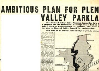
In 1965, the Diamond Valley Shire planning association recommended to Council that a large area of land north of Greensborough be acquired for Parkland. The idea of a Civic Centre was included with a map of the area from Grimshaw Street in the south to the MMBW pipeline reserve in the north. Includes a suggested new site for the local school, near Yando Street. This area is now part of the Plenty River Trail.An example of developments in the Greensborough area during the period of Shire of Diamond ValleyNews clipping, black and white text and map. Scanned in 3 parts.shire of diamond valley, civic drive greensborough, yando street greensborough, partingtons flat, plenty river trail -
 Greensborough Historical Society
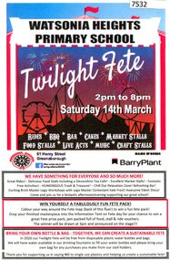
Flyer - Leaflet, Watsonia Heights Primary School Fete 2020 WH4935, 14/03/2020
The Watsonia Primary School Fete, held on Saturday 14th March, was one of the last activities held before the Covid lockdown in 2020Single page, printed in colour on front and black and white map of school on back.watsonia primary school, school fetes, henry street greensborough -
![Work on paper - Newsletter, North East Link getting it right [June 2020], 2020_06](/media/collectors/4f729f5697f83e03086015b8/items/6014ef952bef110c704f3c4c/item-media/6014f0882bef110c704f42bf/item-fit-380x285.jpg) Greensborough Historical Society
Greensborough Historical SocietyWork on paper - Newsletter, North East Link getting it right [June 2020], 2020_06
Banyule City Council comments on the North East Link project. This newsletter is to keep the community informed of developments. Includes a sketch map from the M80 Ring Road to Lower Plenty Road.2 page leaflet, colour text and images.north east link, banyule city council, watsonia -
 Greensborough Historical Society
Article, Norm Colvin, Events leading up to the Plenty Ladies' Petition 1842, 2020_
This article, written and researched by Norm Colvin, GHS Secretary, identifies the people involved in the events leading to the petition to the Governor of Victoria, C. J. La Trobe, from 'Ladies resident on Plenty River' requesting protection from bushrangers, 5 May 1842. It identifies the bushrangers, the owners of the stations robbed, the group of men who rode out to assist and the identity of the "ladies" who signed the petition.This article identifies the people involved in the incidents, a list of locals in the 1840s.12 pages typescript, map.plenty river, bushrangers, petitions -
 Greensborough Historical Society
Book - Report, Country Roads Board, Freeway F5 / Greensborough Road connection. December 1981, Summary Report, 1981_
Summary report of the Country Roads Board's 1981 proposals for the F5 Freeway (now Metropolitan Ring Road) between Dalton Road and Diamond Creek Road and the duplication of Greensborough Road (Greensborough By-pass).Historic proposal for roads in the Greensborough area51 pages, text, colour maps. Plastic binding.country roads board, greensborough bypass, metropolitan ring road, greensborough road -
 Greensborough Historical Society
Book - Atlas, Victoria. Department of Sustainability and Environment, Melbourne atlas, 2006_
The purpose of the Melbourne Atlas is to give a spatial view of physical , environmental, social, economic and cultural aspects of Melbourne which can be used in planning. It contains maps and graphs depicting many aspects of life in Melbourne. A snapshot of life in Melbourne in 2006.Various paging, text, illus., colour maps. Wire binding.melbourne, maps, town planning, social conditions -
 Greensborough Historical Society
Book - Planning Document, TTM Consulting Pty Ltd, Greensborough District Centre: Structure plan, 1989, 1989_07
A summary of investigations into impacts of the Greensborough District Centre in 1989, with plans for the development of the East side of Main Street Greensborough.91 pages text and black and white line drawings. One colour fold out map. Black plastic binding and clear plastic cover. greensborough district centre, main street greensborough, greensborough plaza -
 Greensborough Historical Society
Book - Report, Ross King et al, Youth, leisure and public policy: the case of Diamond Valley, 1977, 1977_11
119 pages text and black and white line drawings and tables. One colour fold out map. White plastic binding. non-fictionshire of diamond valley, leisure activities, sport -
 Greensborough Historical Society
Map, Banyule City, September 1996
City of Banyule map, including clubs, leisure, cultural & heritage facilities and other features.Colour map, street index on verso.city of banyule, maps -
 Greensborough Historical Society
Book, Isabel Ellender, The Plenty Valley Corridor: the archaeological survey of Aboriginal sites / by Isabel Ellender 1991, 1991_
This archaeological survey of the Plenty Valley was conducted by Isabel Ellender in 1991 for the Board of Works (Melbourne Water), in particular the Plenty Gorge Metropolitan Park. The area studied is north of Greensborough to Whittlesea. A number of Aboriginal sites were identified and recommendations made for the future.67 p., illus., maps. Plastic spiral binding.plenty river, aboriginal heritage sites, plenty gorge metropolitan park -
 Greensborough Historical Society
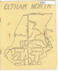
Newsletter, Eltham North Progress Association, Eltham North Progress Association Newsletter May 1969, 1969_05
Newsletter of the Eltham North Progress Association 1969 includes an article on the work of the Aboriginal Advancement League, an explanation of how (Diamond Valley) council deals with business and local news.12 p typescript, yellow cover with map of area.eltham north, eltham north progress association -
 Greensborough Historical Society
Pamphlet, Bus Association Victoria, Melbourne @ your fingertips: Melbourne's city and Northern suburbs, 2010s
An explanation of Melbourne's bus network in the city and Northern suburbs.Colour leaflet, double-sided, 6 p., map.public transport, buses -
 Greensborough Historical Society
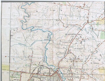
Map, John Monash, 1913 Map of Greensborough, 1913
1913 Map of Greensborough, possibly by John Monash. This map shows the area to the north of the township.Map, colour.greensborough - maps, 1913 -
 Greensborough Historical Society
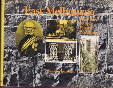
Book, Craftsmen Press, East Melbourne: 1837-1977: people, places, problems, 1977
A history of early development and more recent redevelopment in East Melbourne, from a town planning perspective.177 p., illus., maps.non-fictionA history of early development and more recent redevelopment in East Melbourne, from a town planning perspective.east melbourne, town planning, melbourne -
 Greensborough Historical Society
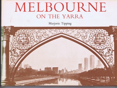
Book, Lansdowne Press, Melbourne on the Yarra, 1977
A pictorial history of Melbourne, illustrated with both old and new photographs96 p., illus., maps.non-fictionA pictorial history of Melbourne, illustrated with both old and new photographsmelbourne, yarra river -
 Greensborough Historical Society
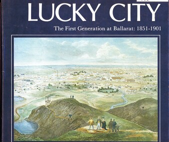
Book, Weston Bate, Lucky city: the first generation at Ballarat: 1851-1901, 1978
The history of Ballarat in its early goldmining days is entwined with the impact on the environment of the area.96 p., illus., maps.non-fictionThe history of Ballarat in its early goldmining days is entwined with the impact on the environment of the area.ballarat, gold rush, gold discoveries victoria -
 Greensborough Historical Society
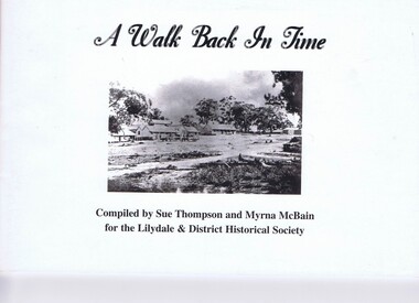
Booklet, Sue Thompson et al, A walk back in time, 1990s
Photos and text from a self-guided walk around Lilydale.43 p., illus., map.non-fictionPhotos and text from a self-guided walk around Lilydale.historic buildings, pioneer walks, lilydale (vic.) -
 Greensborough Historical Society
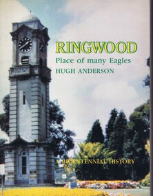
Book, Hugh Anderson, Ringwood: place of many eagles, 1988
A history of Ringwood (Vic.) revised for the Australian Bicentenary in 1988.282 p., illus., maps.non-fictionA history of Ringwood (Vic.) revised for the Australian Bicentenary in 1988.historic buildings, ringwood (vic.) -
 Greensborough Historical Society
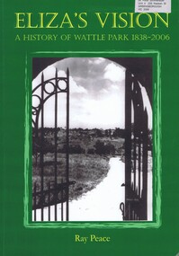
Book, Ray Pearce, Eliza's vision: a history of Wattle Park 1838-2006, 2006
An outline of the history of Wattle Park (Vic).207 p., illus., colour map.non-fictionAn outline of the history of Wattle Park (Vic).urban parks - melbourne, wattle park (vic.), parks - melbourne - history -
 Greensborough Historical Society
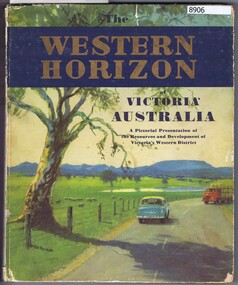
Book, Australian Publicity Council, The Western horizon of Victoria Australia, 1960c
A glossy publicity publication for the state of Victoria.111 p., illus. (some col.), maps.non-fictionA glossy publicity publication for the state of Victoria.victoria - history, western district (vic.), melbourne - history -
 Greensborough Historical Society
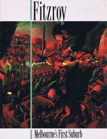
Book, Fitzroy Historical Society, Cutten History Committee, Fitzroy: Melbourne's first suburb, 1991
A history of the inner Melbourne suburb of Fitzroy354 p., illus., maps.non-fictionA history of the inner Melbourne suburb of Fitzroyfitzroy (vic.) - history, melbourne history -
 Greensborough Historical Society
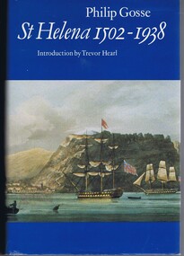
Book, Philip Gosse, St Helena 1502-1938 by Philip Gosse, 1990
A history of the island of St Helena in the South Atlantic Ocean.447 p., illus., maps.non-fictionA history of the island of St Helena in the South Atlantic Ocean. -
 Greensborough Historical Society
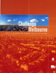
Book, Victoria. Department of Infrastructure, Challenge Melbourne: issues in metropolitan planning for the 21st century, 2000
A report on Melbourne's future growth and a strategic plan to manage this growth, 2000.36 p., text, col. illus., maps and col. plansmelbourne (victoria), town planning, infrastructure victoria -
 Greensborough Historical Society
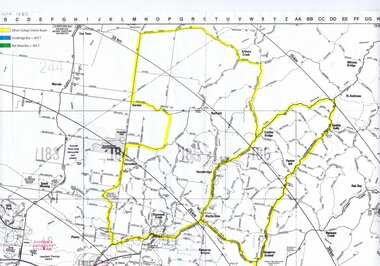
Map, Greensborough c 1980s, 1980s
Map of Greensborough and surrounds showing bus routes servicing Eltham College.Map of Greensborough and surrounds, black print with colour markings."Bundoora Retirement Village" marked in red pen at E20greensborough - maps, eltham college, bus routes, public transport -
 Greensborough Historical Society
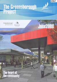
Newsletter, The Greensborough Project, 2008, 2016
The Greensborough Project June 2008 and Greensborough Community Update 2016 by Banyule City Council2 Newsletters, 4 pages each, colour illus., maps.urban development, greensborough, greensborough project