Showing 5415 items
matching eltham road district
-
 Eltham District Historical Society Inc
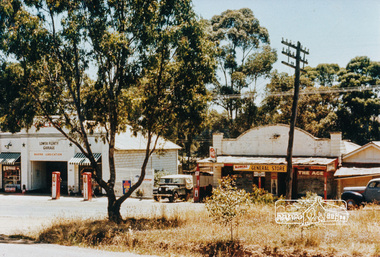
Photograph, Lower Plenty shops and garage
Colour photograph of old shops and service station Lower Plenty (prior to construction of present shopping centre). 4 x 6 print and 8 x 10 laminated printshops, service station, lower plenty, main road -
 Eltham District Historical Society Inc
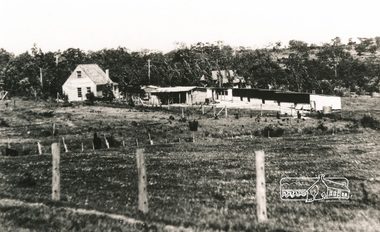
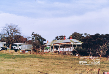
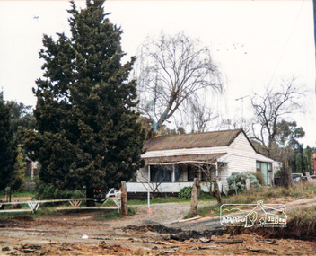
Photograph, De Bondy house, Lower Plenty
Four black and white photograph reproductions showing De Bondy house and property, Main Road, Lower Plentyhouses, main road, lower plenty, de bondy -
 Eltham District Historical Society Inc
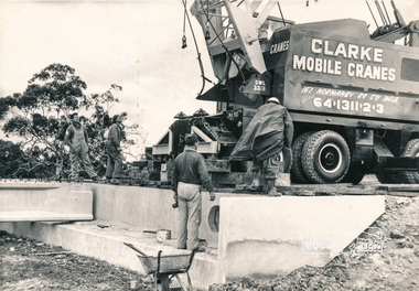
Photograph, Construction of Lower Plenty Bridge, Main Road, c.August 1966, 1966
Black and white photograph of construction of northern Lower Plenty Bridge 1969bridges, bridge construction, main road, lower plenty, plenty river, cranes -
 Eltham District Historical Society Inc
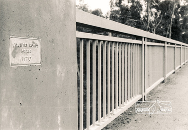
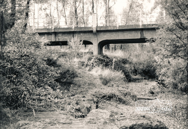
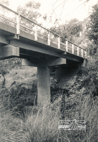
Photograph, Lower Plenty Bridge, 1970
Black and white photograph showing the hand rail and plaque 'Country Road Board 1970'bridges, main road, lower plenty, plenty river -
 Eltham District Historical Society Inc
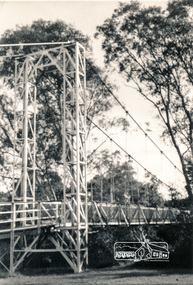
Photograph, Pedestrian suspension bridge over the Yarra River at Lower Plenty
Odyssey House drug rehabilitation centre in Bonds Road, Lower Plenty is a distinctive landmark, especially when viewed from across the Yarra at Templestowe. It was built in the 1950’s as a seminary for the Blessed Sacrament Fathers. Because of the poor and circuitous road access, a suspension footbridge was built across the river. As well as providing easy access for the priests residents of Templestowe could attend services at the seminary. The bridge is now part of the Yarra Trails system.Two black and white photographs of footbridge over Yarra River, part of the Ruffey Trail just off the Main Yarra Trail near the former seminary (now Odyssey House) Lower Plentybridges, yarra river, odyssey house, bonds road, lower plenty, seminary, blessed sacrament fathers -
 Eltham District Historical Society Inc
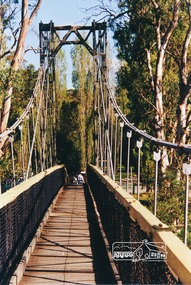
Photograph, Pedestrian suspension bridge over the Yarra River at Lower Plenty
Odyssey House drug rehabilitation centre in Bonds Road, Lower Plenty is a distinctive landmark, especially when viewed from across the Yarra at Templestowe. It was built in the 1950’s as a seminary for the Blessed Sacrament Fathers. Because of the poor and circuitous road access, a suspension footbridge was built across the river. As well as providing easy access for the priests residents of Templestowe could attend services at the seminary. The bridge is now part of the Yarra Trails system.Colour photograph of footbridge over Yarra River, part of the Ruffey Trail just off the Main Yarra Trail near the former seminary (now Odyssey House) Lower Plentybridges, yarra river, lower plenty, seminary, blessed sacrament fathers, odyssey house, bonds road -
 Eltham District Historical Society Inc
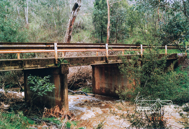
Photograph, Watsons Creek Bridge, 1970c
Black and white photograph of Yarra Glen Road Bridge over Watsons Creek at Watsons Creek (Kangaroo Ground) c.1970bridges, watsons creek, kangaroo ground, yarra glen road, eltham yarra glen road -
 Eltham District Historical Society Inc
Photograph, One Tree Hill Road Bridge, Christmas Hills
Colour photograph of bridge over Watsons Creek, One Tree Hill Road, Christmas Hillsbridges, watsons creek, one tree hill road, christmas hills -
 Eltham District Historical Society Inc
Photograph, Watsons Creek Bridge, Christmas Hills, 1970c
Black and white photograph of bridge over Watsons Creek, Christmas Hills (Clintons Road?) c.1970bridges, watsons creek, christmas hills -
 Eltham District Historical Society Inc
Photograph, Murray Road, Wattle Glen
Colour photograph of old house Murray Road, Wattle Glenwattle glen, murray road, houses -
 Eltham District Historical Society Inc
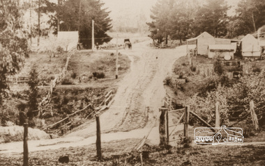
Photograph, Upper Diamond Creek, Silvan Gully area, 1911
Two colour photograph copies of originals of Main Road through Silvan Gully area upper Diamond Creek prior to construction of the railway in 1911upper diamond creek, wattle glen, hurstbridge, silvan gully, hurstbridge road, kinglake road, heielberg kinglake road -
 Eltham District Historical Society Inc
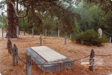
Photograph, Hurst family graves
Four colour photographs of Hurst family graves, Graysharps Road, Hurstbridgegraves, cemeteries, hurst, hurstbridge, graysharps road -
 Eltham District Historical Society Inc
Photograph, Old Warrandyte Bridge
Postcard showing old timber trestle Warrandyte Bridge over Yarra Riverbridges, yarra river, warrandyte, kangaroo ground road -
 Eltham District Historical Society Inc
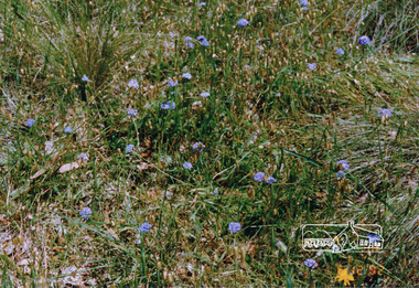
Photograph, Russell Yeoman, Blue pincushions, St Andrews
Colour photograph of blue pincushions, Wild Dog Creek Road, St Andrewspincushions, brunonia australis, st andrews, wild dog creek road, wildflowers -
 Eltham District Historical Society Inc
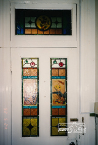
Photograph, Edendale Farm, May 1992, 1/5/92
Three colour photographs of the house at Edendale Farm, including leadlight windows and chandelier.edendale, houses, elham, gastons road -
 Eltham District Historical Society Inc
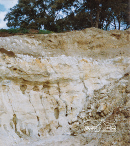
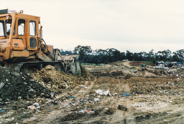
Photograph, Peter Bassett-Smith, Shire of Eltham Tip, west end of Graham Road, Kangaroo Ground
Colour photograph showing landfill at Shire of Eltham Tip, Graham Road, Kangaroo Groundtips, eltham shire council, council, kangaroo ground, graham road -
 Eltham District Historical Society Inc
Photograph, Peter Bassett-Smith, Briar Hill Timber and Trading Co., July 2000, 2000
Three colour photographs of Briar Hill Timber Trading Co. premises (established by F. Squire in 1934), Sherbourne Road, Briar Hill prior to closure.briar hill, shops, industries, briar hill timber, sherbourne road -
 Eltham District Historical Society Inc
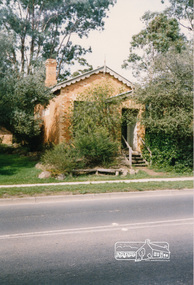
Photograph, Cottage, corner Main and Reynolds roads, Research, Vic, 1986
Wal and Bernie Dodkins, rented the house from Miss Reynolds probably from around 1938 until they left in the 1970s to become caretakers at the Kangaroo Ground Tower. Lyn Dodkins was born here and lived in this house for her first 19 years.Six colour photographs of old cottage corner Main and Reynolds roads at Research in 1986. The cottage was built by/for Grandfather Reynolds and was demolished 2 Mar 1987. Three views show widening of Main Road.houses, main road, reynolds road, research (vic.), lyn dodkins, wal dodkins, bernie dodkins, miss reynolds -
 Eltham District Historical Society Inc
Photograph, Council Tip, Graham Road, Kangaroo Ground
Colour photograph of earthmoving equipment at Council Tip, Graham Road Kangaroo Groundtips, landfill, earthmoving, graham road, kangaroo ground, eltham shire council -
 Eltham District Historical Society Inc
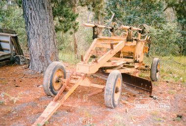
Photograph, Council Graders, 1990s
Eight colour photographs showing Council graders 1-7. old towed grader in Council yard 8. Road grader, 1990sgraders, equipment, eltham shire council, grader towed, roadmaking -
 Eltham District Historical Society Inc
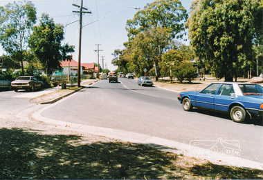
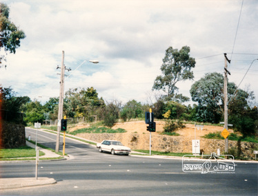
Photograph, Heidelberg-Kinglake Road, Hurstbridge; looking north east towards Kinglake
Two colour photographs taken near the location of the present roundabout intersection of Anzac Road (on right) and Arthurs Creek Road (on left) with the Heidelberg-Kinglake Road at Hurstbridge. [37�38'14.8"S 145�11'39.6"E -37.637459, 145.194322]main street, kinglake road, heidelberg/kinglake road, hurstbridge -
 Eltham District Historical Society Inc
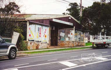
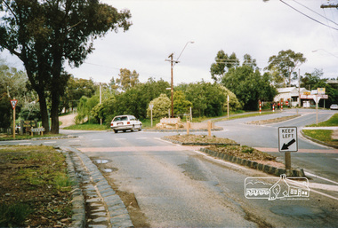
Photograph, Main Road, Panton Hill
Colour photograph of Main Road, Panton Hill looking east. Panton Hill General Store immediately on right just out of view [37�38'31.0"S 145�14'22.5"E -37.641941, 145.239592]main road, st andrews road, kangaroo ground/st andrews road, panton hill -
 Eltham District Historical Society Inc
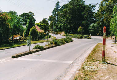
Photograph, Main Road, Panton Hill
Colour photograph of Main Road Panton Hill showing roundabout at Bishops Road.main road, st andrews road, kangaroo ground/st andrews road, bishops road, roundabouts, panton hill -
 Eltham District Historical Society Inc
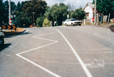
Photograph, Main Road, Panton Hill
Six colour photographs of Main Road Panton Hill showing Bishops Road roundaboutmain road, st andrews road, kangaroo ground/st andrews road, bishops road, roundabouts, panton hill -
 Eltham District Historical Society Inc
Photograph, Main Road, Panton Hill
Two colour photographs of Main Road Panton Hill showing Bishops Road roundaboutmain road, st andrews road, kangaroo ground/st andrews road, bishops road, roundabouts, panton hill -
 Eltham District Historical Society Inc
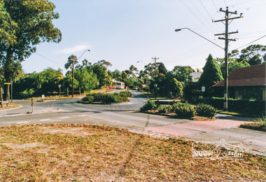
Photograph, Main Road, Panton Hill
Two colour photographs of Main Road Panton Hill showing roundabout at Church Road/Roger Road intersectionmain road, st andrews road, kangaroo ground/st andrews road, church road, roger road, roundabouts, panton hill -
 Eltham District Historical Society Inc
Photograph, Main Road, Eltham, 1990c
Two colour photographs of Main Road, Eltham from corner of Bridge Street, c. early 1990smain road, eltham, york street, bridge street -
 Eltham District Historical Society Inc
Photograph, Bootmakers cottage, 701 Main Road Eltham
Colour photograph of Bootmakers cottage at 701 Main Road Eltham, adjacent to Diamond Creek Trail, opposite Dalton Street701 main road, eltham, main road, bootmakers cottage, white cloud cottage, jarrold cottage, dalton street -
 Eltham District Historical Society Inc
Photograph, Former Commercial Bank of Australia building, Main Road, Eltham
Colour photograph of Church Opportunity Shop, Main Road Eltham, former CBA Bankeltham, main road, opportunity shop, banks, buildings -
 Eltham District Historical Society Inc
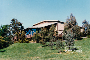
Photograph, Eltham Community Centre
Australia’s first mud brick community building was opened in 1978. In 2018 a major upgrade took place. Colour photograph of mud brick Eltham Community Centre at corner of Main Road and Pitt Streeteltham, community centre, buildings, mud brick, main road, pitt street, eltham community reception centre