Showing 6986 items
matching historical parks
-
 Eltham District Historical Society Inc
Document - Property Binder, 608 Main Road, Eltham
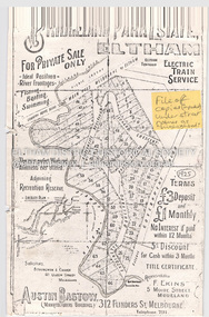
Photocopy of advertisement for Bridgeland Park Estate Eltham, 1925. Email exchanges re Bridgeland Park Residents Association Newsletters May 2013 re donation of newsletters compiled by the late Dr Helen Bartley.main road, property, houses, bridgeland park estate, bridgeland park residents association, eltham (vic) -
 Eltham District Historical Society Inc
Document - Property Binder, 855 Main Road, Eltham
Individual Research Project, Catherine Loftus-Hills 1982: To what extent is the Eltham Town Park successful in providing a recreational facility for the entire community? Newspaper article: Diamond Valley News, 24 August 1982, Byways of History, Early view of Little Eltham, illustrated by photograph sometime 1902-1920. Newspaper article: Diamond Valley News, 24 August 1982, Pauline thrives on work, Australian Labor Party member of Victorian parliament. Newspaper article: unidentified, undated: Many attempts to change name, letter from Frank Burgoyne. Newspaper article: unidentified, undated: Anger over park renaming. Photocopy letter from Office of the Place Names Committee to Eltham and District Historical Society, 25 February 1982, stating naming of Eltham Town Park, not Alistair Knox Park. Newspaper article: Former shire president honoured, Diamond Valley News, Tuesday September 9, 1986, p3 (on rverse page an advertisement for Research Mowers & Chainsaws National Trust Public Art Register: Citation, 18 February 1997, of major work by sculptor Ernst Frie. Newspaper article: Diamond Valley Leader, 8 June 2005, Sign not before time, erection of Welcome to Eltham Town sign made by Greg Bebbington and Hamish Knox. Newspaper article: Diamond Valley News, 9 June 2005, p3, Former shire president honoredmain road, eltham, businesses, public art, ernst frie, eltham town park, alistair knox park, j m holloway, pauline toner, catherine loftus-hills, greg bebbington, hamish knox, frank lynch, greg johnson, advertising, research mowers & chainsaws -
 Eltham District Historical Society Inc
Document - Property Binder, 875 Main Road, Eltham
Letter Office of the Place Names Committee to Eltham Historical Society, 10 November 1980: Seeking Society's opinion of naming of Eltham Common and Alistair Knox Park. Letter Office of the Place Names Committee to Eltham Historical Society, 7 April 1981, seeking response to letter 10 November 1980 re naming proposal. Letter Shire of Eltham Historical Society to Place Names Committee, 30 April1981, No objection to name Eltham Common but considered Eltham Town Park more appropriate, providing a history of area. Letter Office of the Place Names Committee to Eltham Historical Society, 9 July 1981: Resolved to assign name Eltham Common. Letter Office of the Place Names Committee to Eltham Historical Society, 23 October 1981: No objections to Government Gazette notice re naming of Eltham Common. Newspaper article: Diamond Valley News, 12 November 1991, Correction, restaurant review of Shillinglaw Cottage in Diamond Valley News, 5 November 1991, said founder was Grant Phelan, correctly Martin Brown.main road, eltham, property, houses, businesses, j m hjolloway, alistair knox, john hicks petty, eltham common, shillinglaw cottage, grant phelan, martin brown -
 Eltham District Historical Society Inc
Document - Property Binder, 967 Main Road, Eltham
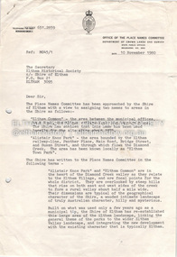
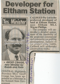
Newspaper article: Developer for Eltham Station, The Advertiser, April 16, 1996 The original Station Master's house situated in present-day bus bay was sold in 1986 for $1 to save it from demolition and was then relocated to 58 Park Road.58 park road, 967 main road, businesses, eltham, eltham railway station, houses, main road, property, station masters house, station master's house eltham -
 Eltham District Historical Society Inc
Document - Folder, McLean, 1984-1999
References to McLean family, Hector John McLean and Louisa Frances (nee Green) and six daughters who lived in Eltham during the period 1930 to 1934 inclusive. Lived in the former Evelyn Hotel at the time it was destroyed by fire and being part of the Centenary Parade in 1934 where the family won the Group Section for their entry “Pioneers of Eltham” Reminiscences provided by Edith Jones (nee M1934 flood, ballroom, baptism, barber shop, bittern, boy scouts, bremner's flat, burgoyne's shop, cable tram, cemetery road, centenary celebrations, centenary parade, christening, coach house, collis grocery, dalton street, depression, dole, dorothy jean mclean, edith jones (nee mclean), eltham fire brigade, eltham high school, eltham higher elementary school, eltham lower park, eltham railway station, eltham state school no. 209, evelyn hotel, fire damage - buildings, flinders naval depot, fordham, gladys evelyn mclean, gold mining, gwenneth mae mclean, gwladys evelyn mclean, headmistress, hector john mclean, isherwood house and shop, louisa frances mclean (nee green), metery road, methodist church, miss finnin, miss grant cottage, motor bike races, mrs barrett, mrs bremner, mrs hurley, olive isabel mclean, parade, phoebe lillian mclean, picnic, pioneers of eltham, pitt street, research fire brigade, rev. r.g. arthur, shed, shops, st margarets church hall, st margaret's church, stables, state savings bank of victoria, susso books, todaro, vinnie willet, warrandyte bridge, warrandyte, wingrove park, yarra river -
 Eltham District Historical Society Inc
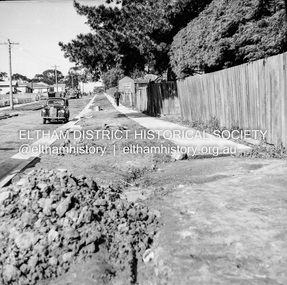
Negative - Photograph, J.A. McDonald, Eltham, Pryor Street, Sep. 1955
Construction of new concrete kerbing and footpath in Pryor Street, Eltham The truck on the left of the road is parked ouside the Eltham Police Station at No. 23. On the right is the present-day Woolworths carparkRecord of various Shire of Eltham infrastructure works undertaken during the period of 1952-1962 involving bridge and road reconstruction projects, sometimes with Eltham Shire Council Project Reference numbers quoted. It was during this period that a number of significant improvements were made to roads and new bridges constructed within the shire that remain in place as of present day (2022). In many situations, the photos provide a tangible visible record of infrastructure that existed throughout the early days of the Shire. The album was put together by or under the direction of the Shire Engineer, J.A. McDonald.1955-09, footpaths and gutters, pryor street, eltham police station, infrastructure, shire of eltham -
 Eltham District Historical Society Inc
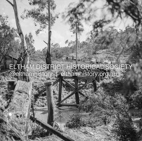
Negative - Photograph, J.A. McDonald, Eltham-Diamond Creek Road, 21 Sep 1959
Bridge construction Eltham-Diamond Creek road over the Diamond Creek (Wattletree Road), Eltham, September 1959 After some delay in receiving funds, work started on the bridge approaches in early September 1959. Traffic was still using the old bridge upstream. On Sunday, 20 September 1959, heavy flooding occurred in the stream and at 3:53 pm the old bridge was washed out. This photo was taken the day after. To the left is the Diamond Creek side abutment for the new Wattletree Road bridge under construction. Where the trucks are parked is near the present-day intersection with Progress Road. At the time Progress Road did not exist and was merely a road reserve on the map. The bridge was originally built as a replacement for an older private bridge built by a man named Foley around 1880. In 1911 Heidelberg and Eltham agreed to share the costs to build a new bridge. Construction began in June 1915 and it was officially opened by Cr. Taylor on Cup Day, November 1915.Record of various Shire of Eltham infrastructure works undertaken during the period of 1952-1962 involving bridge and road reconstruction projects, sometimes with Eltham Shire Council Project Reference numbers quoted. It was during this period that a number of significant improvements were made to roads and new bridges constructed within the shire that remain in place as of present day (2022). In many situations, the photos provide a tangible visible record of infrastructure that existed throughout the early days of the Shire. The album was put together by or under the direction of the Shire Engineer, J.A. McDonald.infrastructure, shire of eltham, bridge construction, bridge, diamond creek (creek), eltham, eltham north, glen park bridge, 1959-09-21, flood damage, wattletree road bridge -
 Eltham District Historical Society Inc
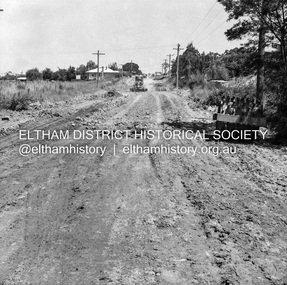
Negative - Photograph, J.A. McDonald, Eltham, Susan Street, Jan. 1961
January 1961 Looking towards Dalton Street (present-day Withers Way) Just south of Brougham Street. To the immediate left is the present-day car park for the Elham Leisure Centre. The house on the left is immediately opposite Cromwell street and adjacent to the southwest corner of the Leisure Centre buiding (where the Williams house sits hidden from view)Record of various Shire of Eltham infrastructure works undertaken during the period of 1952-1962 involving bridge and road reconstruction projects, sometimes with Eltham Shire Council Project Reference numbers quoted. It was during this period that a number of significant improvements were made to roads and new bridges constructed within the shire that remain in place as of present day (2022). In many situations, the photos provide a tangible visible record of infrastructure that existed throughout the early days of the Shire. The album was put together by or under the direction of the Shire Engineer, J.A. McDonald.shire of eltham, infrastructure, 1961-01, cromwell street, eltham leisure centre, road construction, susan street -
 Eltham District Historical Society Inc
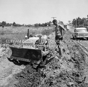
Negative - Photograph, J.A. McDonald, Eltham, Susan Street, Jan. 1961
January 1961 Looking south Brown excavating Brougham to Dalton (present-day Withers Way) F. Woods Consolidating showing soft fill over culvert after 9 months Just south of Brougham Street. To the immediate left is the present-day car park for the Elham Leisure Centre. The house on the left is immediately opposite Cromwell street and adjacent to the southwest corner of the Leisure Centre buiding (where the Williams house sits hidden from view)Record of various Shire of Eltham infrastructure works undertaken during the period of 1952-1962 involving bridge and road reconstruction projects, sometimes with Eltham Shire Council Project Reference numbers quoted. It was during this period that a number of significant improvements were made to roads and new bridges constructed within the shire that remain in place as of present day (2022). In many situations, the photos provide a tangible visible record of infrastructure that existed throughout the early days of the Shire. The album was put together by or under the direction of the Shire Engineer, J.A. McDonald.shire of eltham, infrastructure, 1961-01, cromwell street, eltham leisure centre, road construction, susan street -
 Eltham District Historical Society Inc
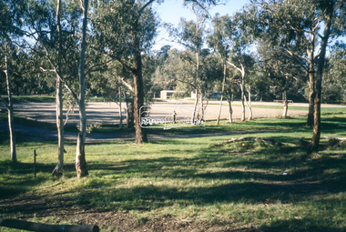
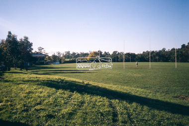
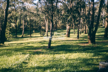
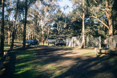
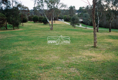
Slide - Photograph, Eltham Lower Park, c.May1990
35mm colour positive transparency (1 of 25) Mount - Kodak EktachromeProcessing Date Code Jun 90Meltham lower park -
 Eltham District Historical Society Inc
Slide - Photograph, Eltham Lower Park, c.May1990
35mm colour positive transparency (1 of 25) Mount - Kodak EktachromeProcessing Date Code Jun 90Meltham lower park -
 Eltham District Historical Society Inc
Slide - Photograph, Eltham Lower Park, c.May1990
35mm colour positive transparency (1 of 25) Mount - Kodak EktachromeProcessing Date Code Jun 90Meltham lower park -
 Eltham District Historical Society Inc
Slide - Photograph, Eltham Lower Park, c.May1990
35mm colour positive transparency (1 of 25) Mount - Kodak EktachromeProcessing Date Code Jun 90Meltham lower park -
 Eltham District Historical Society Inc
Photograph - Colour Print, Alistair Knox Park, Eltham, Victoria, Australia, c.1990
alistair knox park, bridge street, bridge street bridge, eltham -
 Eltham District Historical Society Inc
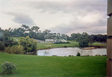
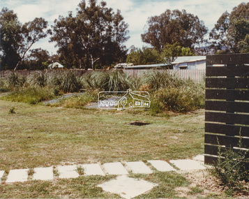
Photograph - Colour Print, Unidentified park, c.1990
lake, parks and gardens, unidentified -
 Eltham District Historical Society Inc
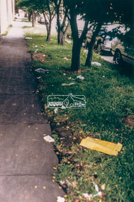
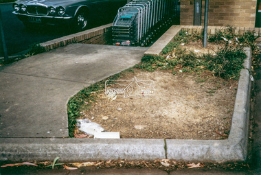
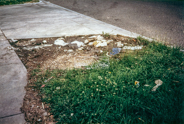
Photograph - Colour Print, Eltham Shire Council, Litter, Luck Street, Eltham, c.1988
One of a series of 6 images taken by Eltham Shire Council officers recording litter being prevalent around the shopping precinct and carparks spreading from Luck Street through Commercial Place top Arthur Street, Elthamarthur street, car park, carparks, commercial place, eltham shopping centre, eltham shops, litter, luck street -
 Eltham District Historical Society Inc
Photograph - Colour Print, Eltham Shire Council, Litter, Luck Street carpark, Eltham, c.1988
Luck Street Carpark near entrance to Frankllin's Supermarket, now present-day Dan Murphy's store, One of a series of 6 images taken by Eltham Shire Council officers recording litter being prevalent around the shopping precinct and carparks spreading from Luck Street through Commercial Place top Arthur Street, Elthamarthur street, car park, carparks, commercial place, eltham shopping centre, eltham shops, litter, luck street, dan murphy's, franklins supermarket -
 Eltham District Historical Society Inc
Photograph - Colour Print, Eltham Shire Council, Litter, Luck Street carpark entrance, Eltham, c.1988
One of a series of 6 images taken by Eltham Shire Council officers recording litter being prevalent around the shopping precinct and carparks spreading from Luck Street through Commercial Place top Arthur Street, Elthamarthur street, car park, carparks, commercial place, eltham shopping centre, eltham shops, litter, luck street -
 Eltham District Historical Society Inc
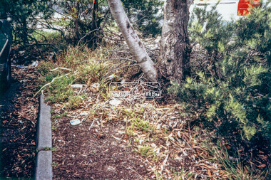
Photograph - Colour Print, Eltham Shire Council, Litter near entrance ramp to old Woolworths/Coles store in Eltham Village, c.1988
One of a series of 6 images taken by Eltham Shire Council officers recording litter being prevalent around the shopping precinct and carparks spreading from Luck Street through Commercial Place top Arthur Street, Elthamarthur street, car park, carparks, commercial place, eltham shopping centre, eltham shops, litter, luck street -
 Eltham District Historical Society Inc
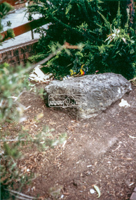
Photograph - Black and White Print, Moor-rul Viewing Platform, March 2007
Early stages - no display panels installed. OPENING OF THE VIEWING PLATFORM AT KANGAROO GROUND Nillumbik Council has advised that the viewing platform at Kangaroo Ground 27km NE of Melbourne is to be opened to the public on Wednesday, March 26th 2008 (Melway 271 , G10). The function of the platform is to provide shelter adjacent to the War Memorial Tower whilst allowing all people to enjoy the stunning panoramic views. From the platform you. can see the Dandenongs, the city of Melbourne, the You Yangs, Mount Macedon, the Kinglake Ranges and the Mt Baw-Baw Ranges where the Yarra River starts. This landscape covers all the ancestral lands of the Wurundjeri and some of the wider Kulin nation land. The platform has been given the name Moor-rut, a name which described the fertile soils of the Kangaroo Ground area in contrast to the poorer (Silurian) country of its surrounds, which the Wurundjeri knew as 'Nillumbik' or less rich country. The full 360 degree view can be seen from the adjacent Tower of Remembrance which has 53 stairs. The viewing platform however can be accessed by wheelchair. Inside the viewing platform there are eight double sided interpretive panels giving the history and information regarding this special area. The viewing platform's interpretive panels set out the Aboriginal and European history of the area and also the geology and the local flora and fauna, so that the casual visitor comes away understanding more about this significant part of Victoria. The concept of the viewing platform is part of the refurbishment project for the Kangaroo Ground War Memorial Park which has taken place since 1997 with the active approval and financial assistance of the Nillumbik Shire Council. This project has been guided by an Advisory Committee with volunteer community representatives from the local Historical Societies, the Country Fire Authority, the Returned Services League and the Wurundjeri people. Other allied groups such as the Nillumbik Reconciliation Group have been called upon for their expertise. The initial idea for the viewing platform came from Dean Stewart when he was the caretaker while living at the park. He discussed this idea with local author Mick Woiwod and Harry Gilham of Eltham District Historical Society when they were planning the refurbishment of the War Memorial Park in 1996. When the committee was formalised by the Nillumbik Council in 1997, Nicholas Pelling, representing the CFA and RSL, joined the group. Dennis Ward, local architect, then volunteered to develop the concept plan for the refurbishment of the park and later drew up the plans for the viewing platform. The Kangaroo Ground War Memorial Park and its Tower of Remembrance is located on one of the highest locations in the Yarra Valley. The Tower of Remembrance is a unique war memorial constructed from local stone standing 14 metres high. It was built in the style of a Scottish watchtower reflecting the strong Scottish influence of the first European settlers of the district from the 1840s onward. The park was opened in 1921 and the Tower of Remembrance was dedicated in 1926 recognising the local people who served in the First World War. Those who served in the Second World War were recognised by plaques dedicated in 1951 and more recently those who served in Korea, Borneo, Malaya and Vietnam by plaques unveiled in 2001. Harry Gilham, Advisory Committee Convenor - Eltham District Historical Society Newsletter N0 179 March 2008 Black and white inkjet print on paper 14 x 21 cmmoor-rul viewing platform, garden hill, kangaroo ground, memorial park -
 Eltham District Historical Society Inc
Photograph - Colour Print, Unidentified, possibly Eltham area, c.1980
On reverse - Ex 5landscape, parks and gardens, unidentified -
 Eltham District Historical Society Inc
Photograph - Aerial Photograph, Intersection of Main Road and Bridge Street, c.1995
View of Main Road from Henry Street to Brougham Street across to the Diamond Creek showing the Eltham Shire Offices (demolished 1996), the Eltham Library (opened 1994)aerial photo, alistair knox park, bridge street, brougham street, central park, diamond creek (creek), eltham, eltham community centre, eltham courthouse, eltham justice precinct, eltham living and learning, franklin street, henry street, local history centre, main road -
 Eltham District Historical Society Inc
Book, D. Pendavingh, Yarra River Trail Plan 1989: Banksia Street to Warrandyte, 1989
Also contains a loose A3 mylar plan inserted - Depart of Planning and Urban Growth, Heidelberg; Main Yarra Trail; Warringal Parklands and Banyule Flats, Detail Plan and Locality Plan -
 Eltham District Historical Society Inc
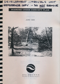
Book, Melbourne Parks & Waterways, Diamond Creek Concept Plan, June 1995
-
 Eltham District Historical Society Inc
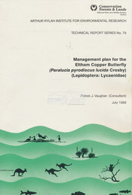
Book, Pat Vaughan, Management plan for the Eltham Copper Butterfly (Paralucia pyrodiscus lucida Crosby), (Lepidoptera: Lycasenidae); Arthur Rylah Institute for Environmental Researcg, Technical Report Series No. 79, July 1988
-
 Eltham District Historical Society Inc
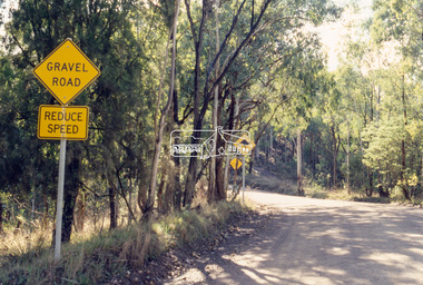
Slide - Photograph, Unidentified rural road within the Shire of Eltham, c.May 1988
Located bewteen Watson's Creek Antiques, Eltham-Yarra Glen Road and Panton Hill Memorial Park35mm colour positive transparency (1 of 25) Mount - Kodak EktachromeProcess Date MAY 88Minfrastructure, roads, shire of eltham, unidentified, rural road -
 Eltham District Historical Society Inc
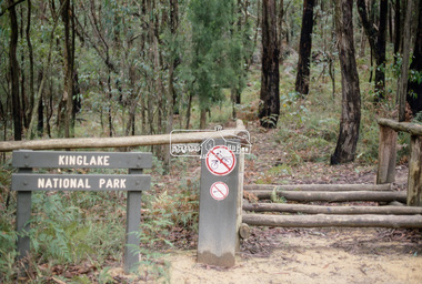
Slide - Photograph, Kinglake National Park, c.May 1988
35mm colour positive transparency (1 of 25) Mount - Kodak EktachromeProcess Date MAY 88Mkinglake national park -
 Eltham District Historical Society Inc
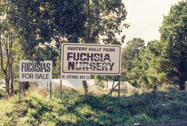
Slide - Photograph, Watery Gully Park Fuchsia Nursery, Wattle Glen, c.May 1988
35mm colour positive transparency (1 of 25) Mount - Kodak EktachromeProcess Date MAY 88Mwatery gully park fuchsia nursery, wattle glen, fuchsia nursery, watery gully park -
 Eltham District Historical Society Inc
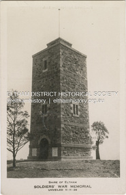
Photograph, Studios Ltd, Shire of Eltham Soldiers' War Memorial Unveiled 11-11-26, 1926
The Shire of Eltham War Memorial, a tower of remembrance to those who laid down their lives in serving their country during the Great War was opened in 1926. It is situated within the Shire of Eltham Memorial Park which was established in honour of all those who enlisted in the Great War to end all wars Processed by Studios Ltd POSTCARD 1905-1940s Like the carte-de-visite, postcards enjoyed a collecting craze by large numbers of people, and were often kept in albums through which the interested visitor could browse. Postcards were posted or exchanged in huge numbers. Postal authorities in Australia only allowed the private printing of postcards from 1898. At this time the back of the card was reserved for the address and postage stamp, and the front was used for the message and a picture. In 1902 British authorities allowed a "divided back", so that the left side could be used for the message, the right side for the address and stamp, and the whole of the front was devoted to the picture. France followed suit in 1904, Germany and Australia in 1905, and the United States in 1907. - Frost, Lenore; Dating Family Photos 1850-1920; Valiant Press Pty. Ltd., Berwick, Victoria 1991marg ball collection, postcard, shire of eltham memorial park, shire of eltham war memorial, war memorial tower