Showing 8446 items
matching snowy-river-dry-cleaners
-
 Wodonga & District Historical Society Inc
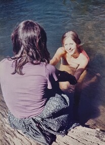
Album - Ringer's River by Des Martin - Plate 9 - O'Day meets Elaine and Ruby
Resting in the shade above the river after he has brought his cattle over it, O'Day is disturbed by voices, and rolls over to discover Montieth's daughter Elaine, and her aboriginal companion, Ruby, enjoying themselves in the river. This first encounter with Elaine makes an impression on the young manager that is to last throughout his lifetime.The album and images are significant because they document literature written by a prominent member of the Wodonga community. The presentation of this precis was supported by several significant district families and individuals.Ringer's River Album Coloured photo Plate 9 Resting in the shade above the river after he has brought his cattle over it, O'Day is disturbed by voices, and rolls over to discover Montieth's daughter Elaine, and her aboriginal companion, Ruby, enjoying themselves in the river. This first encounter with Elaine makes an impression on the young manager that is to last throughout his lifetime. Geni Dynon as Ruby and Joan Lehmann as Elaine.des martin, many a mile, ringer's river, northeast victoria stories -
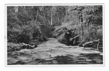
 Marysville & District Historical Society
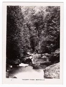
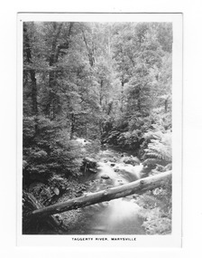
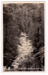
Photograph (item) - Black and white photograph, Rose Stereograph Company, Taggerty River, Marysville, 1913-1967
An early black and white photograph of the Taggerty River in Marysville, Victoria.An early black and white photograph of the Taggerty River in Marysville, Victoria. The photograph was published by the Rose Stereograph Company ans was used to produce the Rose Series postcard P. 2338.marysville, victoria, photograph, taggerty river, p. 2338, rose stereograph company, souvenir, rose series postcard -
 Marysville & District Historical Society
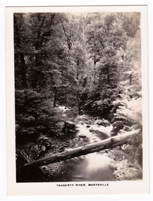
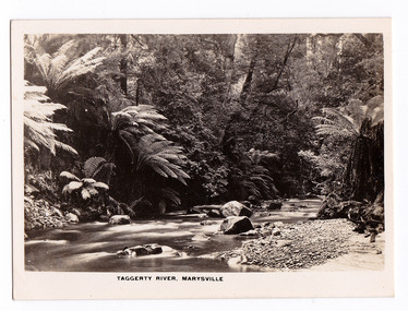
Photograph (item) - Black and white photograph, Rose Stereograph Company, Taggerty River, Marysville, 1913-1967
An early black and white photograph of the Taggerty River in Marysville, Victoria.An early black and white photograph of the Taggerty River in Marysville, Victoria. The photograph was also used to produce the Rose Series postcard P. 2308.marysville, victoria, photograph, taggerty river, p. 2308, rose stereograph company, souvenir, rose series postcard -
 Marysville & District Historical Society
Photograph (item) - Black and white photograph, Rose Stereograph Company, Taggerty River, Marysville, 1913-1967
An early black and white photograph of the Taggerty River in Marysville, Victoria. An early black and white photograph of the Taggerty River in Marysville, Victoria. The photograph was published by the Rose Stereograph Company ans was used to produce the Rose Series postcard P. 2338.marysville, victoria, photograph, taggerty river, p. 2338, rose stereograph company, souvenir, rose series postcard -
 Marysville & District Historical Society
Photograph (item) - Black and white photograph, Rose Stereograph Company, Taggerty River, Marysville, 1913-1967
An early black and white photograph of the Taggerty River in Marysville, Victoria.An early black and white photograph of the Taggerty River in Marysville, Victoria. The photograph was also used to produce the Rose Series postcard P. 2308.marysville, victoria, photograph, taggerty river, p. 2308, rose stereograph company, souvenir, rose series postcard -
 Marysville & District Historical Society
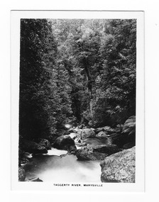
Photograph (item) - Black and white photograph, Rose Stereograph Company, Taggerty River, Marysville, 1913-1967
An early black and white photograph of the Taggerty River in Marysville, Victoria.An early black and white photograph of the Taggerty River in Marysville, Victoria. The photograph was also used to produce the Rose Series postcard P. 2337.marysville, victoria, photograph, taggerty river, p. 2337, rose series postcard, souvenir, rose stereograph company -
 Kew Historical Society Inc
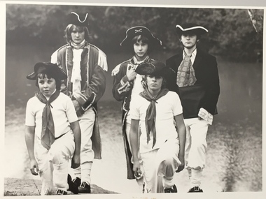
Photograph, Standard Newspapers, Charles Grimes Re-enactment, Yarra River, 1978
The party of the British surveyor Charles Grimes were the first Europeans to view the River Yarra, as it was later to be named. Members of the party reached the area now known as Studley Park in 1803. This local re-enactment commemorated 175 years since that event.Charles Grimes, Re-enactment, Yarra River, Kew, 1978. Inscription on reverse: "Trinity Grammar School students taking part in Grimes' journey up the Yarra, 1803. Re-enactment Historical Society Kew contribution to the 1978 Festival of Kew."charles grimes re-enactment, trinity grammar school, cr whiting -- mayors -- kew (vic.), yarra river, andrew allen, kew historical society -
 Kew Historical Society Inc
Photograph, Standard Newspapers, Charles Grimes Re-enactment, Yarra River, 1978
The party of the British surveyor Charles Grimes were the first Europeans to view the River Yarra, as it was later to be named. Members of the party reached the area now known as Studley Park in 1803. This local re-enactment commemorated 175 years since that event.Charles Grimes, Re-enactment, Yarra River, Kew, 1978. Inscription on reverse: "KH-191. Grimes' party in boat on Yarra 1978. Re-enactment organised by Kew Historical Society. Actors Trinity Grammar boys. Mrs Argyle's History class." Sticker on back: "771. Standard News. WHS. Festival. 4 cols. May 3. [Page] 5."charles grimes re-enactment, yarra river (kew) 1978, cr whiting (mayor of kew), andrew allen, trinity grammar school, kew historical society -
 Eltham District Historical Society Inc
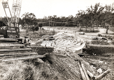
Photograph, Construction of new bridge over the Plenty River, Main Road, Lower Plenty, c.Aug. 1966
Construction of the Main Road bridge over the Plenty River. Includes structural members, construction personnel, vehicles and a Clarke mobile crane.Local significanceBlack and white printMarking on back of photograph - Plenty River Bridge Main Road 1969 (sic)lower plenty, main road, plenty river, bridge, bridge construction, civil engineering, cranes, mobile cranes -
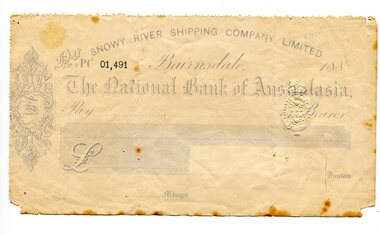 Orbost & District Historical Society
cheque, 1880's
Snowy River Shipping Company formed in 1880. They were soon shipping produce (mainly vegetables) from the area to Melbourne. The Snowy River Shipping Company was formed by Mr Henry James during the 1880s, with Captain McNeil as master. Captain Hegarty was the shipping agent at Marlo. Towing a line of small barges these paddle steamers plied their trade between the port of Marlo, and the farms along the river banks, churning their way almost twenty miles upstream to a landing beside what is now Frank Richardson’s property. On these trips, the barges carried mail and supplies to the townspeople and farmers, loading their produce, mostly maize, on the return trip to the coast. The coming of the railway in 1915 spelt the end for the little river boats. ( ref. F. W. RODWELL in the “Snowy Review”) Frank Richardson 1877-1950 was a sawmiller at Tabbara and helped build and run paddle steamer "Curlip"as engineer.This item is associated with an early transport business of the local district. The Snowy River once had its own paddle steamers. This item is reminiscent of that time.A light blue and white blank cheque for the Snowy River Shipping Company. The cheque is for The National Bank of Australasia and is numbered 01,491 in bold black print. It has a one penny stamp duty imprint.snowy-river-shipping-company james-harry -
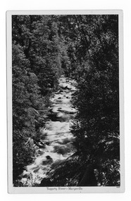
 Marysville & District Historical Society
Postcard (item) - Black and white postcard, Valentine Publishing Co. Pty. Ltd, Taggerty River, Marysville. V.19, 1923-1963
An early black and white photograph of the Taggerty River in Marysville in Victoria.An early black and white photograph of the Taggerty River in Marysville in Victoria. This postcard was produced by the Valentine Publishing Co as a souvenir of Marysville.VALENTINE'S POST CARD A GENUINE PHOTOGRAPHtaggerty river, marysville, victoria, valentine publishing co, postcard, souvenir, v.19 -
 Marysville & District Historical Society
Postcard (item) - Black and white postcard, Taggerty River - Marysville, Unknown
An early black and white photograph of the Taggerty River in Marysville in Victoria.An early black and white photograph of the Taggerty River in Marysville in Victoria.POST CARD CORRESPONDENCE/ ADDRESS ONLY KODAK AUSTRALtaggerty river, marysville, victoria, postcard, souvenir -
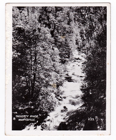
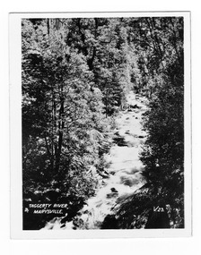 Marysville & District Historical Society
Photograph (item) - Black and white photograph, Valentine Publishing Co. Pty. Ltd, Taggerty River, Marysville. V. 23, 1923-1963
An early black and white photograph of the Taggerty River in Marysville, Victoria.An early black and white photograph of the Taggerty River in Marysville in Victoria. This photograph was published by the Valentine Publishing Co. Pty. Ltd. as a souvenir of Marysville.taggerty river, marysville, victoria, photograph, valentine publishing co, souvenir -
 Marysville & District Historical Society
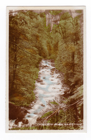
Photograph (item) - Colour tinted photograph, Valentine Publishing Co. Pty. Ltd, No.11. Taggerty River, Marysville, 1923-1963
An early colour tinted photograph of the Taggerty River in Marysville in Victoria.An early colour tinted photograph of the Taggerty River in Marysville in Victoria. This photograph was published by the Valentine Publishing Co Pty. Ltd. as a souvenir of Marysville.taggerty river, marysville, victoria, valentine publishing co, souvenir -
 Marysville & District Historical Society
Photograph (item) - Black and white photograph, Valentine Publishing Co. Pty. Ltd, No.11. Taggerty River, Marysville, 1923-1963
An early black and white photograph of the Taggerty River in Marysville in Victoria.An early black and white photograph of the Taggerty River in Marysville in Victoria. This photograph was published by the Valentine Publishing Co Pty. Ltd. as a souvenir of Marysville.taggerty river, marysville, victoria, valentine publishing co, souvenir -
 Marysville & District Historical Society
Photograph (item) - Black and white photograph, Valentine Publishing Co. Pty. Ltd, Taggerty River, Marysville. V. 23, 1923-1963
An early black and white photograph of the Taggerty River in Marysville, Victoria.An early black and white photograph of the Taggerty River in Marysville in Victoria. This photograph was published by the Valentine Publishing Co. Pty. Ltd. as a souvenir of Marysville.taggerty river, marysville, victoria, photograph, valentine publishing co, souvenir -
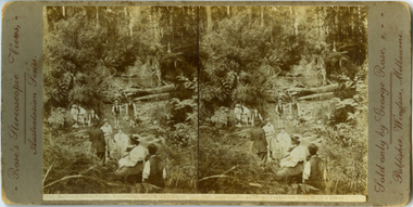 Yarra Ranges Regional Museum
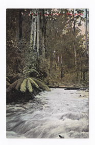
Photograph, Rational Dress Picnic, Fernshaw, Vic Watt's River, c. 1895
This is an early stereoview by George Rose. The women in the picture wears 'Rational Dress', which referes to a dress reform during the late Victorian era. THe reform was particulally realted to womens undergarments which were modified to be more comfortable and less restrictive. Stereographic photo - Rational Dress Picnic, Fernshaw, VIC., Watts River Printed in brown along left edge : Rose's Stereoscopic Views,- / Australian Seriies. Printed in brown along right edge: Sold only by George Rose, - / Publisher, Windsor, Melbourne. Printed underneith image: 743, Rational Dress Picnic, Fernshaw, VIC, Watts Riverrose series, fernshaw, rational dress, watts river -
 Victorian Interpretive Projects Inc.
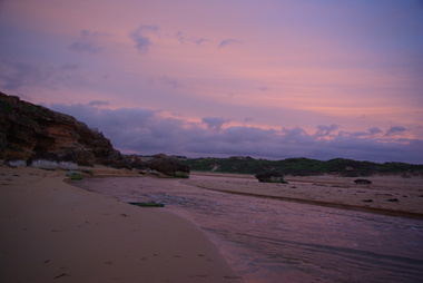
Photograph - Colour, Clare Gervasoni, Mouth of the Hopkins River, Warrnambool, 2013, 22/12/2013
The Hopkins River flows through WarrnamboolFive colour photographs of Warrnambool's Hopkins River. This area, also known as Blue Hole, features ciiffs, rock formations and rock pools. warrnambool, hopkins river, mouth, blue hole -
 Wodonga & District Historical Society Inc
Album - Ringer's River by Des Martin - Plate 23 - Plans for a ring-in at Nuggety track
Keiran, Artie Klinberg, and an old horse trainer named Tim Byrne combine to make friends with Grapeshot. Nightly they row across the river, feed him on oats, and train him. Their intention is to ring Grapeshot in for Smokey at the Nuggety Flat meeting where Klinberg will punt him well. Des Martin as Byrne. Lt. Col. Tony Hammett as Klinberg.The album and images are significant because they document literature written by a prominent member of the Wodonga community. The presentation of this precis was supported by several significant district families and individuals.Ringer's River Album Coloured photo Plate 23des martin, many a mile, ringer's river, northeast victoria stories -
 Port Fairy Historical Society Museum and Archives
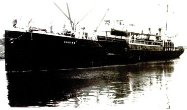
Photograph
SS Casino - Moyne River - Portside viewBlack & white photograph of S.s. Casino sailing up rivership, steamer, coastal transport, ss casino, moyne river -
 Marysville & District Historical Society
Postcard (item) - Colour tinted postcard, The Taggerty River, Marysville, Unknown
An early colour tinted photograph of the Taggerty River in Marysville in Victoria.An early colour tinted photograph of the Taggerty River in Marysville in Victoria.POST CARD Stamp/ here Printed in Australia This space may be used for Correspondence/ within the Commonwealth without/ extra postage THIS SPACE FOR NAME AND/ ADDRESStaggerty river, marysville, victoria, postcard, souvenir -
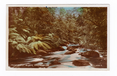 Marysville & District Historical Society
Photograph (item) - Colour tinted photograph, Valentine Publishing Co. Pty. Ltd, Taggerty River, Marysville. NO.7, 1923-1963
An early colour tinted photograph of the Taggerty River in Marysville, Victoria. An early colour tinted photograph of the Taggerty River in Marysville, Victoria. This photograph was published by the Valentine Publishing Co Pty. Ltd as a souvenir of Marysville.taggerty river, marysville, victoria, valentine publishing co, souvenir -
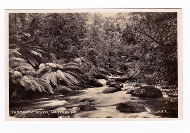 Marysville & District Historical Society
Photograph (item) - Black and white photograph, Valentine Publishing Co. Pty. Ltd, Taggerty River, Marysville. NO.7, 1923-1963
An early black and white photograph of the Taggerty River in Marysville, Victoria. An early black and white photograph of the Taggerty River in Marysville, Victoria. This photograph was published by the Valentine Publishing Co Pty. Ltd as a souvenir of Marysville.taggerty river, marysville, victoria, valentine publishing co, souvenir -
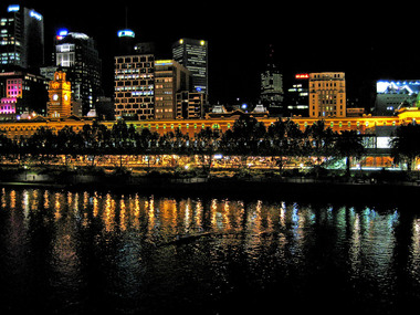 Ballarat Heritage Services
Digital photographs, L.J. Gervasoni, Yarra River rowing at night, c2011
yarra river, flinders street, cbd, night, rowing, melbourne -
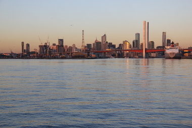
 Ballarat Heritage Services
Digital photographs, birds Yarra River Melbourne Docklands, 2015
Digital Imagesyarra river melbourne docklands, yarra river, dock, docklands, shipping, port, channel, birds, water -
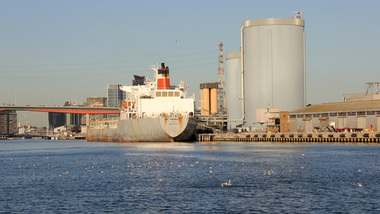
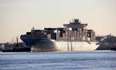 Ballarat Heritage Services
Digital photographs, L.J. Gervasoni, Yarra River Melbourne Docklands MOL Earnest container ship, 2015
Digital Imagesyarra river melbourne docklands, yarra river, dock, docklands, shipping, port, channel, water, mol, earnest -
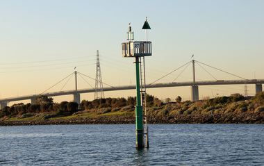 Ballarat Heritage Services
Digital photographs, L.J. Gervasoni, Yarra River Melbourne Docklands Westgate Bridge, 2015
Digital Imagesyarra river melbourne docklands, yarra river, dock, docklands, shipping, port, channel, water, west gate bridge, bridge -
 Ballarat Heritage Services
Digital photographs, Yarra River Melbourne Docklands Bolte Bridge, 2015
Digital Imagesyarra river melbourne docklands, yarra river, dock, docklands, shipping, port, channel, water, bridge, bolte bridge -
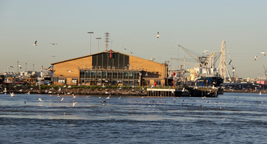 Ballarat Heritage Services
Digital photographs, L.J. Gervasoni, Yarra River Melbourne Docklands Victoria Dock, 2015
Digital Imagesyarra river melbourne docklands, yarra river, dock, docklands, shipping, port, channel, water, victoria dock -
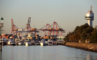 Ballarat Heritage Services
Digital photographs, L.J. Gervasoni, Yarra River Melbourne Docklands container dock cranes, 2015
Digital Imagesyarra river melbourne docklands, yarra river, dock, docklands, shipping, port, channel, water, container, cranes