Showing 524 items
matching department of lands
-
 Federation University Historical Collection
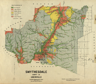
Map, Smythesdale, County of Grenville, 1888, 1889
... Lands Department, Melbourne. ... School of Mines. This land was printed form the Crown Lands ...The map maker, Ferdinand M. Krause, was a professor at the Ballarat School of Mines. This land was printed form the Crown Lands Department, Melbourne. Coloured map of the County of Grenville. The edge has been taped. The scale is 40 chains to 1 inch. The map is accompanied with a foolscap sheet printed by the Mines Department in 1898. It is a Report on the Parish of Smythesdale by F.M. Krause and includes information on the water reserve, worked quartz veins, Watson's Hill, Surface Hill and Sugarloaf Hill, Haddon, Trunk Lead and the Crucible Shaft. smythesdale, krause, f.m. krause, ferdinand krause, nitingbool, watson's hill, surface hill, sugarloaf hill, haddon -
 Port Melbourne Historical & Preservation Society
Map - Foreshore, Sandridge, 1840
... with respective jetties. Originals with Lands Department, Melbourne... and Marine hotels with respective jetties. Originals with Lands ...Bromide of surveyor's sketch of the foreshore of Sandridge (Liardet's Beach), 1840, showing Pier and Marine hotels with respective jetties. Originals with Lands Department, Melbourne. (possibly the work of William Wedge DARKE?) '5' on backbusiness and traders - hotels, piers and wharves, william wedge darke -
University of Melbourne, Burnley Campus Archives
Plan, [Historical Maps of Richmond Park], 1862-2000
... of Bourke. Department of lands & Survey, 1919 (annotations i.e. Melb... of Bourke. Department of lands & Survey, 1919 (annotations i.e. Melb ...(1) Proposed reserve for Horticultural & Experimental Garden in the Survey paddock Richmond. R.19A (1865). Shows Swan Street Extension. Gazettals 1877, 1887. (2) As (1). Half of map only Annotation by A. Purchas, 9 October, 1862. (3) Plan of Richmond park. A.L. Martin Authorised Surveyor, 31st August, 1872. [Dept. of lands & Survey Melbourne, J. Noone, 6th September 1872.] Map in 4 sheets. (4) Richmond Park. Surveyed by Geo. Black, Authorised Surveyor 13.8.91 (2 copies). (5) [Richmond Park] Shows road alignments gazetted 1871 & 1881 (part copy only - Neg. 18375). (6) City of Richmond Parish of Jika Jika County of Bourke. Department of lands & Survey, 1919 (annotations i.e. Melb. City Link, Amrad, etc. to 1994.) (7) Burnley gardens, 2000. Produced by P. Tulk, Institute of Land & Food Resources, Burnley College, 2000 (re area proposed for heritage listing.)richmond park, survey paddock -
 Bendigo Historical Society Inc.
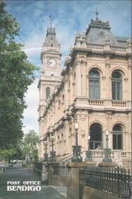
Postcard - BENDIGO POST OFFICE COLLECTION: POST OFFICE
... and Crown Lands department and Postmaster's quarters...., Sub-Treasury and Crown Lands department and Postmaster's ...Coloured postcard of the Bendigo post office. Opened in 1887 as Sandhurst Public Offices, it was occupied by the Colonial Posts, Telegraphs, Police, Water supply, Sub-Treasury and Crown Lands department and Postmaster's quarters.bendigo, buildings, post office -
 Federation University Historical Collection
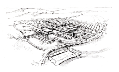
Photograph - Black and White, Aerial Depiction of a Plan for the Mount Helen Campus, c1969, c1969
... special equipment in the offices of Department of Crown Lands... of Department of Crown Lands, treasury Place, Melbourne. federation ...The new campus at Mount Helen was part of the Ballarat School of Mines, and was known as Ballarat Institute of Advanced Education. The drawing was prepared in the early stages of the Mount Helen campus development, while Stage I buildings ('E', 'F', 'G') were constructed. the Union Building (now Albert Coates Centre), Library, 'S' Building and student accommodation were in the design stage. The original drawing was photographed by using special equipment in the offices of Department of Crown Lands, treasury Place, Melbourne.Artwork showing an aerial view of a planned academic campus at Mount Helen. .1) Black and white print of a line drawing. 2) Transparency of above imagefederation university, federation university australia, feduni, university of ballarat, ballarat institute of advanced education, harrison, vernon, campus, mount helen -
 Surrey Hills Historical Society Collection
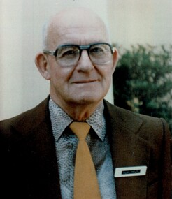
Photograph, Alan Holt
... Hills. He worked in the Lands Department and drew up maps... Hills. He worked in the Lands Department and drew up maps ...Alan Holt was keenly interested in the history of Surrey Hills. He worked in the Lands Department and drew up maps of the area based on research he conducted there in his spare time and after retirement. He also compiled a survey of owners / occupants of all Surrey Hills listings from Sands & MacDougall directories at 10 year intervals. These are meticulously entered into hand-written ledgers. All his work is also entered on to index cards. With a lifetime's knowledge of local history and research techniques, Alan found himself after retirement, in constant demand as an amateur historian working for the Box Hill Historical Society and the History Group of the Surrey Hills Neighbourhood Centre. When the Surrey Hills Historical Society was formed, Alan and Edna became its first and only Life Members. Alan began work in the Department of Crown Lands and Survey. In the 1950s-60s he moved to the Premier's Department where he assisted with the planning for the Queen's 1954 visit. He was promoted to Permanent Head of the Lands Department until retirement in 1972. He was associated with the Surrey Hills Uniting Church all his life. There is a copy of this photo in a brass frame.A colour portrait photo of the late Alan Holt.alan holt -
 Eltham District Historical Society Inc
Newsletter, Newsletter, No. 25 July 1982
... matters o Former Lands Department building o Development... matters o Former Lands Department building o Development ...Contents: • Next meeting – Examination and collation of historical photographs • Former Falkiner Cottage • Other Council matters o Former Lands Department building o Development of Council Pound site o Maroondah Aqueduct The Shire of Eltham Historical Society was formed in October 1967. The first newsletter of the Society was issued May 1978 and has been published continuously ever since on a bi-monthly basis. With the cessation of the Shire of Eltham in late 1994, the Society's name was revised to Eltham District Historical Society and this name first appeared with issue No. 103, July 1995. The collection of the Society's newsletters provides a valuable resource on the history of the Society's activities, office bearers and committee members, guest speakers and subjects of historical interest pertinent to the former Shire of Eltham and the Eltham District.A4 photocopied newsletter distributed to membersnewsletter, eltham district historical society, shire of eltham historical society -
 Orbost & District Historical Society
map/poster, Victorian Government Printer, 22.4.1926
... The Department of Crown Lands and Survey was originally... gippsland The Department of Crown Lands and Survey was originally ...The Department of Crown Lands and Survey was originally established in 1857 as part of the Board of Land and Works. In 1964 it ceased to be controlled by the Board. The Department functioned for almost twenty more years before being combined with other Ministries to form the Department of Conservation, Forests and Land. It was responsible for the management of the State's Crown land and pastoral estates. This map was used by Don Mehlert after 1928. The VERMIN AND NOXIOUS WEEDS ACT 1928 was an Act to consolidate the Law relating relating to Vermin and Noxious Weeds. E. J. E. G. Pemberton who published this poster was Superintendent of Field Staff, Dept. of Lands and Survey. This map and posters are significant records of early settlement history in Murrangower, between Cabbage Tree and Orbost,A paper map of Murrangower showing settlement subdivisions. This is glued onto the back of four overlapping cloth poster of "Notices of Vermin Destruction". All print is black."DON MEHLERT" in black pen. Pike's block shaded in blue. School site marked in blue pencil. on poster "MURRANGOWAR" along side.map-murrangower poster-vermin-and-noxious-weeds murrangower-settlement -
 Orbost & District Historical Society
Book - front cover, The Corringle Creek to Sydenham Inlet Coastal Reserve A RESOURCES STUDY, 1977
... by the Department of Crown Lands and Survey, Victoria 1977. Printed by James... of the Coastal Management Committee by the Department of Crown Lands ...This 1977 Resources Study was a joint project of the Shire of Orbost & the Dept. of Crown Lands & Survey with the purpose of collating information on natural resources, pattern of public use, and constraints on future use so that management can be formulated.This report gives and understanding of the resources and management directions of coastal land in East Gippsland in 1977. A buff coloured cover with black printing and blue tape binding. 71 pages + maps/charts. THE CORRINGLE CREEK TO SYDENHAM INLET COASTAL RESERVE. A resources study with comment on the implications for management by IAN R. BROWN Research officer and PETER B. LAVERY Land Management Oficer. Coastal management Committee Victoria 1977. Published under the authority of the Coastal Management Committee by the Department of Crown Lands and Survey, Victoria 1977. Printed by James Yeates Printing, Bairnsdale 3875.corringle creek, sydenham inlet, natural resources survey -
 Wycheproof & District Historical Society Inc.
Dempsey Book, Dempsey Land Selection, 2003l
... . Comprises official Lands Department Papers detailing Mr John... land at Wycheproof. Several official Lands Department ...Mr Dempsey and family were the first selectors to arrive at Mt Wycheproof 1872 or early 1873. One Dempsey Land Application is dated 15-3-1873.Factual documents obtained from a Melbourne archive show settler,John Dempsey,securing land at Wycheproof. Several official Lands Department correspondence provides evidence of Dempsey's early land acquisition at the beginning of the town's farming history and settlement from 1872 - 1882. This is an A3 sized Display book with grey spine. Comprises official Lands Department Papers detailing Mr John Dempsey's Land Applications and acquisition at Wycheproof. Dated documentation is from 1872 through to 1882.Locally researched references give an overview about the Dempsey family.dempsey, land -act, bunguluke -
 Bendigo Historical Society Inc.
Document - REPORT FROM THE SELECT COMMITTEE UPON THE CLAIMS OF HENRY FRENCHAM, 1890
... . (William) Sandbach 18th Sep 1890 and Lithographed at the Department... and Lithographed at the Department of Lands and Survey Melbourne by S. B ...( x ref 5673 , 8235 , Box 83 , 9077 ) Reports from the Gold Enquiry Select Committee from September 4th 1890 - 23rd October, including a list of witnesses, Minutes of Evidence 11th September 1890, 18th September 1890 and 25th September 1890; also, Appendices A - T, and also a location map drawn from memory by W. (William) Sandbach 18th Sep 1890 and Lithographed at the Department of Lands and Survey Melbourne by S. B. Bonney 28th October 1890. This enquiry covers the opinions of Robert Atkinson, Henry Frencham and Robert Francis Walker in relation to who was the first person to locate gold in the Bendigo field. Members of the Committee were Mr Bailes, in the chair, Mr Burrowes, Mr Cameron, Mr A, Young, Mr Gordon, and Mr Foster. Other name at the enquiry were, David Dunlop, John Paton, William Steward, Christian Asquith, James Graham, Ben. Bannister, Mr Fenton, T. J. Rossiter, P. P. Farrell, Thomas Robinson. Other persons who had made claims were; Patrick Peter Farrell, Frederich Fenton, Mrs. Margaret Kennedy, William Henry Johnson, Edward Pepperell, Henry Byass, William Sandbach, William Steward, Mrs John Barnett, widow of Christian Asquith's son, Robert Francis Walker, David Dunlop, John Paton.gold enquiry, henry frencham, gold discovery, david dunlop, john paton, william steward, christian asquith, james graham, ben. bannister, mr fenton, t. j. rossiter, p. p. farrell, patrick peter farrell, frederich fenton, mrs. margaret kennedy, william henry johnson, edward pepperell, henry byass, william sandbach, mrs john barnett, thomas robinson -
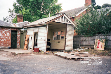
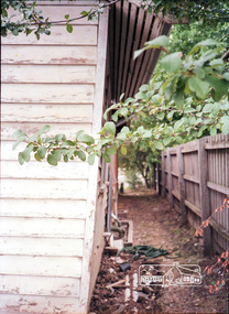
 Eltham District Historical Society Inc
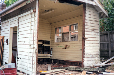
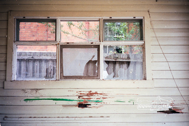
Photograph, The former Police residence at 728 Main Road under renovation work for future Shire of Eltham use, c.Nov. 1991
... and Noxious weeds Destruction Section of the Department of Crown Lands... and Noxious weeds Destruction Section of the Department of Crown Lands ...The original Eltham Police Station was used up till about 1960. The building was then taken over and used by the Vermin and Noxious weeds Destruction Section of the Department of Crown Lands and Survey. They vacated the building c.March 1981 and it remained unoccupied for a period of time whilst its future was discussed in Council. About 1986 the Shire took over use of the Police Residence and renovated it for use by the Shire Parks and Environment Office. The original Police Station was termite infested and was removed. It was later replaced by a replica building which was used as a lunchroom for Council employees working at the site. Based on photos contained in the 1992 Bick Heritage Study of the Police Residence and Stable, this roll of film was taken Nov 1991.Roll of 35mm colour negative film, 7 stripsKodak GA 100 5095shire of eltham, justice precinct, police residence, police station, local history centre -
 Eltham District Historical Society Inc
Photograph, The former Police residence at 728 Main Road under renovation work for future Shire of Eltham use, c.Nov. 1991
... and Noxious weeds Destruction Section of the Department of Crown Lands... and Noxious weeds Destruction Section of the Department of Crown Lands ...The original Eltham Police Station was used up till about 1960. The building was then taken over and used by the Vermin and Noxious weeds Destruction Section of the Department of Crown Lands and Survey. They vacated the building c.March 1981 and it remained unoccupied for a period of time whilst its future was discussed in Council. About 1986 the Shire took over use of the Police Residence and renovated it for use by the Shire Parks and Environment Office. The original Police Station was termite infested and was removed. It was later replaced by a replica building which was used as a lunchroom for Council employees working at the site. Based on photos contained in the 1992 Bick Heritage Study of the Police Residence and Stable, this roll of film was taken Nov 1991.Roll of 35mm colour negative film, 7 stripsKodak GA 100 5095shire of eltham, justice precinct, police residence, police station, local history centre -
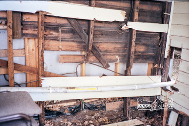
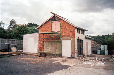
 Eltham District Historical Society Inc
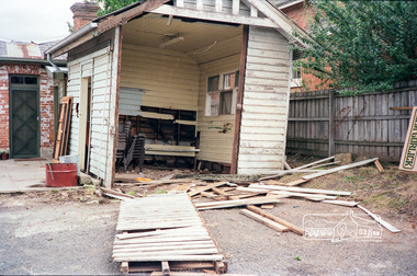
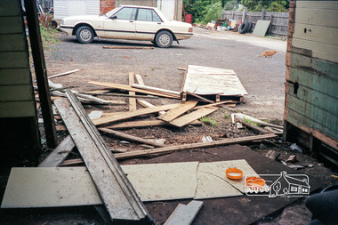
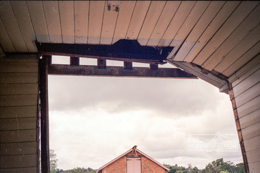
Photograph, The original Police Stables at 728 Main Road under renovation work for future Shire of Eltham use, c.Nov. 1991
... and Noxious weeds Destruction Section of the Department of Crown Lands... and Noxious weeds Destruction Section of the Department of Crown Lands ...The original Eltham Police Station was used up till about 1960. The building was then taken over and used by the Vermin and Noxious weeds Destruction Section of the Department of Crown Lands and Survey. They vacated the building c.March 1981 and it remained unoccupied for a period of time whilst its future was discussed in Council. About 1986 the Shire took over use of the Police Residence and renovated it for use by the Shire Parks and Environment Office. The original Police Station was termite infested and was removed. It was later replaced by a replica building which was used as a lunchroom for Council employees working at the site. Based on photos contained in the 1992 Bick Heritage Study of the Police Residence and Stable, this roll of film was taken Nov 1991.Roll of 35mm colour negative film, 7 stripsKodak GA 100 5095shire of eltham, justice precinct, police residence, police station, local history centre -
 Eltham District Historical Society Inc
Photograph, The original Police Stables at 728 Main Road under renovation work for future Shire of Eltham use, c.Nov. 1991
... and Noxious weeds Destruction Section of the Department of Crown Lands... and Noxious weeds Destruction Section of the Department of Crown Lands ...The original Eltham Police Station was used up till about 1960. The building was then taken over and used by the Vermin and Noxious weeds Destruction Section of the Department of Crown Lands and Survey. They vacated the building c.March 1981 and it remained unoccupied for a period of time whilst its future was discussed in Council. About 1986 the Shire took over use of the Police Residence and renovated it for use by the Shire Parks and Environment Office. The original Police Station was termite infested and was removed. It was later replaced by a replica building which was used as a lunchroom for Council employees working at the site. Based on photos contained in the 1992 Bick Heritage Study of the Police Residence and Stable, this roll of film was taken Nov 1991.Roll of 35mm colour negative film, 7 stripsKodak GA 100 5095shire of eltham, justice precinct, police residence, police station, local history centre -
 Melbourne Tram Museum
Document - report, Norm Wadeson, "Sorrento Tramway", 1961
... Notes prepared by Norm Wadeson 1961 from Lands Department... Notes prepared by Norm Wadeson 1961 from Lands Department ...Notes prepared by Norm Wadeson 1961 from Lands Department Records about the history of the Sorrento Tramway. Has notes on the formation, operation, passengers carried, land, possible extension, deputations to the Minister, Mr George Copin, and closure. See item 7717 for maps and photographs.Yields information about the Sorrento tramway co. and its Lands Department records.Two quarto sheets, typed - stapled in top left hand corner.tramways, tramcars, sorrento, george coppin -
 Surrey Hills Historical Society Collection
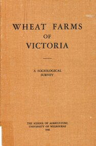
Book, Wheat farms of Victoria: a sociological survey, 1946
... of the Lands Department. Donated by Max Holt who was one of his sons... locally and was Secretary of the Lands Department. Donated by Max ...The owner, Alan Judge Holt lived locally and was Secretary of the Lands Department. Donated by Max Holt who was one of his sons. This book goes into considerable detail on all facets of wheat farm life, providing the basis for a real understanding of the problems of the man who grows wheat.Cloth-covered hardback book of 179p. Alan J. Holtwheat, social surveys, agriculture, (mr) alan holt, farming -
University of Melbourne, Burnley Campus Archives
Plan, Alton-Hascombe Feature Survey, c. 1990
... 1 tracing paper and 2 paper copies of plan by Department... tracing paper and 2 paper copies of plan by Department ...1 tracing paper and 2 paper copies of plan by Department of Conservation, Forests and Lands, Division of Survey and Mapping, of adjoining gardens Alton and Hascombe at Mount Macedon, Victoria. Scale 1:1000. Plan of properties includes buildings, gardens and paddocks. 1 copy has significant buildings coloured.feature survey, mount macedon, gardens, alton, hascombe -
 Forests Commission Retired Personnel Association (FCRPA)
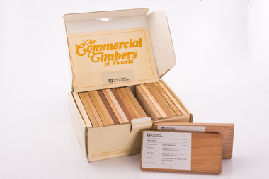
Commercial timbers of Victoria, Sample Box
... by the Department of Conservation Forests and Lands. (CFL). ... by the Department of Conservation Forests and Lands. (CFL). Sample Box ...Some decades ago a card sorting set for the identification and description of Australian timbers was developed for timber species which were available commercially and were in common usage, by the Commonwealth of Australia (CSIRO, Division of Forest Products) To complement and inform this national timber set each State or Territory developed reference timber sets of representative species. The Commercial Timbers of Victoria set was Victoria’s most recent (circa 1984) expression of this Victorian timber samples were sourced from logs selected by Forest Commission of Victoria (FCV) District Foresters and milled locally. Kiln drying and machining was carried out at timber producers Row, Web and Anderson, in Port Melbourne. Labeling and boxing was done by FCV Timber Inspectors, with box and booklet design and graphics handled in-house More recent timber samples were badged as Conservation Forests & Lands, reflecting historical government restructuring in the early 1980s Info: Simon MurphyProvided the public, industry (timber and associated), and educational facilities with a reference collection of notable Victorian timbers. Initially in a reduced format from 1940-50s, with boxed sets produced from 1981 until 1984A boxed set of timber samples representing the 20 tree species that were considered to be the most notable in Victoria. The set also includes an information booklet. Each timber specimen has information on species, occurrence, uses and physical properties Produced for sale by the the FCV and later by the Department of Conservation Forests and Lands. (CFL). forests commission victoria (fcv) -
![Map, [Coornmill land area available for leasing for grazing, Parish of Coornmill]. Circa 1904](/media/collectors/5e461d8021ea67224c82f2a1/items/677cde147f2053f3e5d277c3/item-media/677cdeea7f2053f3e5d27bb4/item-fit-380x285.jpg) Bacchus Marsh & District Historical Society
Bacchus Marsh & District Historical SocietyMap, [Coornmill land area available for leasing for grazing, Parish of Coornmill]. Circa 1904
... . A photo lithographed Lands Department Map. No scale indicated... lithographed Lands Department Map. No scale indicated. The map ...This map shows an area of land north of Bacchus Marsh in the Larderderg State Park area known as the Parish of Coornmill.The map indicates an area of land which was to be made available by public tender for grazing leaseholders. The plan to do this was discussed in the Bacchus Marsh Express newspaper on the 16 July, 1904, page 2, column 7. The area reserved for grazing leases is identified by red lines on the map. The Express described the area available for grazing was 12,000 acres.A single page paper map showing an area of land in the Parish of Corrnmill to be made available for grazing leases. A photo lithographed Lands Department Map. No scale indicated. The map is pasted into a bound volume containing 76 maps or plans in total. High resolution digital image stored on BMDHS computer network. coornmill parish maps, lerderderg state park maps, agriculture bacchus marsh area -
 Department of Energy, Environment and Climate Action
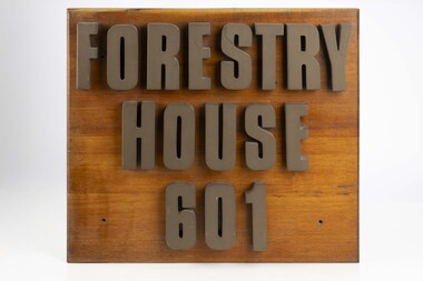
Forestry House Sign
... in the late 1980s after the formation of the Department... in the late 1980s after the formation of the Department ...Forestry House was the fist time that Forests Commission Head office staff had been housed in a purpose built building in Melbourne 601 Bourke street is on the corner of Bourke and King streets The building opened in the late 1970s but staff relocated in the late 1980s after the formation of the Department of Conservation Forests and Lands (CFL)Large wooden sigh from outside Forestry House at 601 Bourke Streetforests commission victoria (fcv), forest signs -
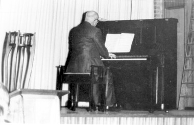 Surrey Hills Historical Society Collection
Photograph, Alan Judge Holt at the piano
... lands department... to the Lands Department. He became Secretary of that department... to the Lands Department. He became Secretary of that department ...His dates: 1913-1993. ‘Kenilworth’, 9 Beatrice Avenue was home of Edmund Holt, his wife and 3 sons Ray, Fred and Alan who attended Surrey Hills State School in their primary years. The family were very involved with the Methodist (Uniting) Church. Alan became organist and for some years also played at the Canterbury Presbyterian Church. He was well-liked from his days as a newspaper delivery boy, and after marriage lived at 62 Broughton Road and then 2 Earle Street taking part in various local activities with his wife Edna and three boys. After completing his secondary education at University High Alan joined the Public Service and after a time in the Premier’s Department moved to the Lands Department. He became Secretary of that department and after retirement moved to 13 Berry Street, Box Hill. He keenly researched the history of Surrey Hills. He left his collection of Surrey Hills history to the people of Surrey Hills. A black and white photograph of a man playing at a piono. He is dressed in a suit and has his back to us. There is a planter stand to the left of the photo.kenilworth, beatrice avenue, surrey hills, mr alan judge holt, lands department, organist, surrey hills methodist church, canterbury presbyterian church, mrs edna holt, broughton road, earle street, pianist -
 Bendigo Historical Society Inc.
Legal record - Right to occupy a residential area
... letter from a Mr. L. Gibney of the department of Crown lands... of the department of Crown lands and survey dated 24th July 1972 addressed ...Four books of stubs. Originally the books had 20 right to occupy residence area forms. The stubs record the date of issue, the replacing right No., the fee paid, the receipt no. and a signature. only one of the books has the original form attached, two of the books have handwritten notes attached. One has a typewritten letter from a Mr. L. Gibney of the department of Crown lands and survey dated 24th July 1972 addressed to the district land officer, Bendigo. In the letter Mr. Gibney tells the officer in Bendigo that a pad containing 20 unnumbered residence area right forms D. The dates on the stubs are 17/04/1961, 16/04/1971, 07/09/1972, 08/05/1975land sales, right to occupy, government -
 City of Kingston
Photograph - Black and white, 20 December 1945
... of aerial photographs commissioned by the Department of Crown Lands... by the Department of Crown Lands and Survey and taken by Adastra Airways ...Cheltenham is a suburb in the City of Kingston that was originally established as a rural market gardening community. The area is bordered by Highett, Mentone and Heatherton. The market gardens, farms and paddocks have gradually been sub-divided into housing and industrial estates. The Southland shopping centre is a major feature of the area.Cheltenham was established as a rural market gardening community. The Le Page family lived in Cheltenham since 1854 when Nicholas Le Page, a tailor from the Channel Island of Guernsey, bought two acres of land on Chesterville Road near Bernard Street to establish a market garden. Over the years the Le Pages purchased more land in the area. In 1875-76 Nicholas' son Frank and his wife Mary built 'Daphne Cottage' near the corner of Bernard and Wilson Streets. n the 1940s Frank's son, Everest Le Page, bought five more lots of land in Chesterville Road from the Tuck family. The Le Pages grazed horses, ponies and cows on this land, and grew pumpkins, carrots, parsnips, onions, potatoes and cabbages. Many buildings and locations within in Cheltenham commemorate the Le Page family's contribution to the Cheltenham community.Aerial photograph taken in 1945 of the Cheltenham district within the City of Kingston. The image includes Chesterville Road, the future site of Turner Road pool (now Waves) and Highett Reserve, (top left), Jellicoe Street, Argus Street, Bernard Street, Wilson Street, the Methodist Children Homes (now Southland), McIvor Street, Goulburn Street, Nepean Highway, Jamieson Street and Barker Street (bottom left), market gardens and paddocks. In the top centre of the image, "Daphne Cottage", the home of Frank T. Le Page is visible on the corner of Bernard and Wilson Streets. Much of the land depicted in this image was owned by the Le Page family. This image is possibly from the collection of aerial photographs commissioned by the Department of Crown Lands and Survey and taken by Adastra Airways.Black and white ink: 57250 White print: VIC-170 57250 20.12.45 Run 6 PROJ. No. 5 MELB. METROP AREA Black type 10200 FTS 30' LENS 20.12.45cheltenham, market gardens, industry, le page family