

Historical information
The Department of Crown Lands and Survey was originally established in 1857 as part of the Board of Land and Works. In 1964 it ceased to be controlled by the Board. The Department functioned for almost twenty more years before being combined with other Ministries to form the Department of Conservation, Forests and Land.
It was responsible for the management of the State's Crown land and pastoral estates.
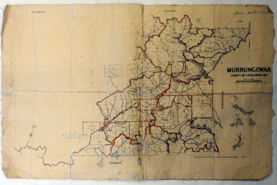
This map was used by Don Mehlert after 1928.
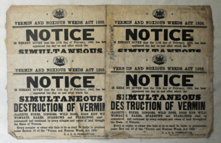
The VERMIN AND NOXIOUS WEEDS ACT 1928 was an Act to consolidate the Law relating relating to Vermin and Noxious Weeds. E. J. E. G. Pemberton who published this poster was Superintendent of Field Staff, Dept. of Lands and Survey.
Significance
This map and posters are significant records of early settlement history in Murrangower, between Cabbage Tree and Orbost,
Physical description
A paper map of Murrangower showing settlement subdivisions. This is glued onto the back of four overlapping cloth poster of "Notices of Vermin Destruction". All print is black.
Inscriptions & markings
"DON MEHLERT" in black pen. Pike's block shaded in blue. School site marked in blue pencil.
on poster "MURRANGOWAR" along side.