Showing 1102 items
matching information map
-
 Bendigo Historical Society Inc.
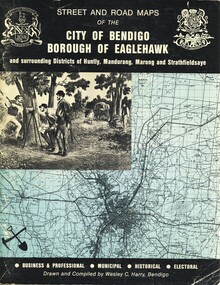
Book - STREET AND ROAD MAPS OF THE CITY OF BENDIGO BOROUGH OF EAGLEHAWK, c1980
Street and Road Maps of the City of Bendigo Borough of Eaglehawk and surrounding Districts of Huntly, Mandurang, Marong and Strathfieldsaye, in color. Drawn and compiled by Wesley C Harry, Bendigo. Publisher: Cambridge Press, Bendigo. ISBN: 9598608.2.2. 68 pages. Photographs, Illustrations & maps. Photos include: Bendigo buildings, scenery mines, streetscapes, parades, pioneer leaders of Bendigo. Many advertisements throughout. List of Justices of the Peace, hospitals, homes for the aged, schools, churches. Page 58: Copy of ''Freedom of the City to the Australian Survey Regiment'' proclamation, 14th June 1970. Maps cover an area of some 169 sq. miles (43,772 hectares). Origin of the name Bendigo. Information on the five Wards of Bendigo, and their councilors.Wesley C Harrybook, bendigo, bendigo & district maps, bendigo and districts map, buildings, streetscapes, historical pictures, advertisements, historical information, commisioners camp, sandhurst -
 Bendigo Historical Society Inc.
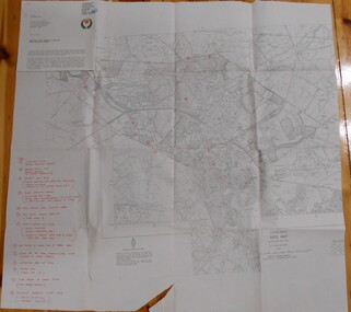
Map - BENDIGO HISTORICAL SOCIETY COLLECTION: EAGLEHAWK MINE MAP
Base map Australian map grid of Eaglehawk area. Map has letter attached from the Department of Conservation, Forests and Lands, 22 March, 1990, addressed to Felicity Kingerlie, BHS, requesting information regarding the historic mining sites marked on the map. Sites marked are: A. Golden Age Mine, engine mountings present B. Johnson's No. 2 Mine, engine mountings, old boiler foundations C. Johnson's No. 1 Mine, mullock retaining wall made from sandstone, engine mountings, remains of old building demolished? D. Toma's Eucalyptus Factory, old boiler still there, boiler shed, chimney (remnants of) outlet drain, distilling vats, dam, remnant of winch. E. New Argus Mine,mullock heap F. New Moon Mines Dams (1) stone walls G. North Lightning Hill Mine, engine mountings, quartz retainer wall, Pascoe and Simmons open cuts and other open cuts here too H. New Prince of Wales Mine and Poppet Head I. Quarry site for stone, excavation (for miners cottages in Clarke Street) J. Lancashire open cut mine K. Virginia Hill (cynaide vats etc) L. South Prince of Wales mine, now capped and fenced M (possibly ) Catherine United Mine, engine mountings, battery mountings?bendigo, mining, eaglehawk mines -
 Bendigo Historical Society Inc.
Document - AULSEBROOK COLLECTION: HISTORY OF AYERS ROCK BOOKLET, 1968-1970
The Significance if Ayers Rock for Aboriginies A5 Booklet, black and white, gloss paper 20 pages Extensive information on the local Aboriginal history in Ayers Rock Various images of Ayers Rock and maps -
 Bendigo Historical Society Inc.
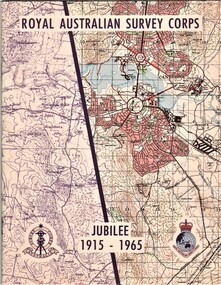
Document - AULSEBROOK COLLECTION: ROYAL AUSTRALIAN SURVEY CORPS JUBILEE 1965, 1965
Aulsebrook Collection: two pamphlets relating to a Jubilee events at the Royal Australian Survey Corps. Title: Royal Australian Survey Corps, Jubilee 1915-1965 (x 2 pamphlets) Two pamphlets for same event, A5, colourful map on the front of the booklet, -First pamphlet is a dinner and wine menu for Jubilee event -Second pamphlet is a information booklet on a brief history of the Corps, and a list of ranks and individuals in the Survey Corps. Booklet also has some photos of Fortuna where the Corps is. -
 Bendigo Historical Society Inc.
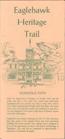
Document - EAGLEHAWK HISTORICAL SOCIETY COLLECTION: EAGLEHAWK HERITAGE TRAIL
Small brochure titled: Eaglehawk Heritage trail, after an introduction a map of the points of interests, few drawing of different buildings, in total the brochure give small information on 33 locations.eaglehawk, history, walking tour -
 Bendigo Historical Society Inc.
Document - GOLDEN GULLY ALLUVIAL WORKINGS
Golden Gully alluvial workings, Diamond Hill area, site number 1.1. Document has map/grid references, parcel number and location - runs along Woodward Road. History from 1851 to 186 detailed. . Information from David Bannear's Bendigo goldfields survey. -
 Bendigo Historical Society Inc.
Document - DIAMOND HILL HISTORIC AREA PARKS VICTORIA
Document, two pages, prepared by Parks Victoria in relation to the Diamond Hill Historic Area. Contains information regarding the history of the area; German Miners; Plants and animals. On second page is a map of the area showing historic features: Deborah Consolidated Gold workings Red, White and Blue Extended gold workings Goldfields Extended gold workings Dead Dog Gully, alluvial gold workings Glasgow & Golconda Gold workings and tramway Surface gold mining site Hansel Mundy gold workings Bendigo Goldfields Pty gold workings Stafford gold workings Langdon gold workings Great Opossum Gully alluvial gold workingsbendigo, mining, diamond hill -
 Bendigo Historical Society Inc.
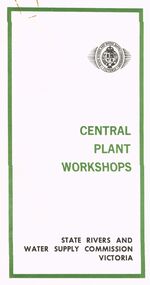
Document - STATE RIVERS AND WATER SUPPLY COMMISSION VICTORIA : CENTRAL PLANT WORKSHOPS
State Rivers and Water Supply Commission of Victoria. Brochure titled 'Central Plant Workshops'. Double-sided, three pages on each. Information about the workshops (CPW for short) and the setting up of the Bendigo site from 1946. There is a map of the layout of the site, and information given under the following headings - Central Plant Workshops, Work of the CPW, Meter Wheels, Pump Station Equipment, Steel Fabrication, Precast Concrete, and the Area and its Equipment. The brochure is dated June, 1968.state infrastructure, water supply, coliban system, state rivers and water supply commission of victoria. coliban system. central plant workshops. -
Bendigo Historical Society Inc.
Book - THE AUSTRALIAN BOY SCOUT DIARY 1933, 1933
The Australian Boy Scout Diary 1933. Inside front cover is an intimate picture of Chief & his family. With specially written notes and Sketches for Cubs, Scouts, Rovers and Scouters. Obtainable at all State Headquaters in Australia. Prepared and Published by the Victorian Section in conjuntion with the Federal Scout Council of Australia. Printed by Exchange Press Pty Ltd, 310 Spencer Street, Melbourne. Index: Boy Scouts. Bush Fires. Calendars 1933, 1934. 1934 Calendar. Conventional Signs and Maps. Fires. First Aid. Headquaters Address. Holidays. Knots, Bends and Hitches. List of Badges. Local Fixtures. Morse. Our Flag. Personal Memoranda. Pioneering. Plan of Camp. Rover Scouts. Scout Uniform. Scout Signs and Salutes. Sea Scouts. Sea Scouting - Notes on Boat Handling. Semaphore. South by the Stars. Swimming. Torch. Treatment of Snakebite. Troop Camps. Weights and Measures. Wolf Cubs. Wood Badge. Uses of Scout Staff. Inside rear cover is a sepia photo of the site of the 1933 Jamboree at Godollo, Hungary. Book is very detailed giving information on all aspects of Scout life, with sketches for knots, maps, etc. Inscriptions are on page 58: Troup or Pack - 1st Epsom Pack. Watch No. 4133033. Season Ticket No. Commonwealth acc 957. Savings No. 4729. Size in Hats: 7. Size of Boots: 5. Size of Collar 14 1/2. Size of Gloves 6 1/4. Iinscription on page 60: Books Read: In Search of Wales, Morton. Faraway, Priestly. Jock the Scot, Alice Grant Rosemary. Bernard Shaw, Frank Harris.Exchange Press Pty Ltd., Melbournebook, bendigo, scouts, the australian boy scout diary 1933. photo of chief & his family. notes and sketches for cubs, scouts, rovers and scouters. obtainable at all state headquarters in australia. published by the victorian section in conjunction with the federal scout council of australia. exchange press pty ltd, melbourne. index: boy scouts. bush fires. calendars 1933, 1934. 1934 calendar. conventional signs and maps. fires. first aid. headquarters address. holidays. knots, bends and hitches. list of badges. local fixtures. morse. our flag. personal memoranda. pioneering. plan of camp. rover scouts. scout uniform. scout signs and salutes. sea scouts. sea scouting - notes on boat handling. semaphore. south by the stars. swimming. torch. treatment of snakebite. troop camps. weights and measures. wolf cubs. wood badge. uses of scout staff. sepia photo of the site of the 1933 jamboree at godollo, hungary. information on all aspects of scout life, with sketches for knots, maps, etc. inscriptions page 58: troup or pack - 1st epsom pack. watch no. 4133033. season ticket no. commonwealth acc 957. savings no. 4729. size in hats: 7. size of boots: 5. size of collar 14 1/2. size of gloves 6 1/4. page 60: books read: in search of wales, morton. faraway, priestly. jock the scot, alice grant rosemary. bernard shaw, frank harris. -
 Bendigo Historical Society Inc.
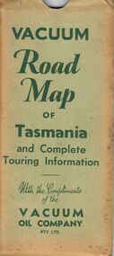
Document - BILL ASHMAN COLLECTION: VACUUM MAP OF TASMANIA
Vacuum Road Map of Tasmania and Complete Touring Information with the Compliments of the Vacuum Oil Company Pty Ltd. Coloured map of Tasmania with trucks, aeroplane, oil bottles and petrol bowsers in the margins. Alphabetical Index of Towns, Lakes, Mountains, Bays, Capes, etc., with key and Licensed Public Aerodromes in Tasmania and Their Location. On the back is Outlets of Hobart, Outlets of Launceston, What to See in Hobart, Beauty Spots and Tourist Information, What to See in Launceston, Vacuum Products, Traffic Hints, Super Plume or Plume, Making Sure of a Trouble-Free Trip and the front cover picture of a lady, child and a man in their car at the petrol bowser. Map folds up and is kept in a light green folder.map, bill ashman collection - correspondence, vacuum road map of tasmania and complete touring information, vacuum oil company pty ltd -
 Bendigo Historical Society Inc.
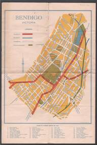
Map - BILL ASHMAN COLLECTION: MAP OF BENDIGO
... shield on the left under the map. Also some brief information... some brief information about Bendigo. Map BILL ASHMAN ...Map of Bendigo. Contains street of Bendigo with Places of Interest marked, Map of the Bendigo Area with Places of Interest marked, and on the centre page is Bendigo the Golden Gateway to the North. There is a map with circles around Bendigo and their distance from centre Bendigo. Circles go to a distance of 20 miles. Information includes General Information, Scenic Attractions, Industrial Activities, Industries already Established, Sporting Facilities - Bendigo and District, and Cultural Organizations. JCI shield on the left under the map. Also some brief information about Bendigo.sciences, instruments - general, scalebuoy, bill ashman collection - correspondence, map of bendigo, cambridge press, a r mcconnachie, bendigo junior chamber of commerce, bendigo city council -
 Bendigo Historical Society Inc.
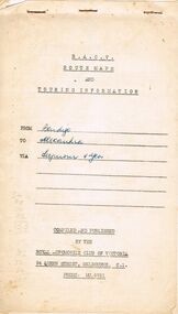
Document - J W SWATTON COLLECTION: RACV ROUTE MAPS
... Four RACV Route Maps and Touring Information, Bendigo... Route Maps and Touring Information, Bendigo to Alexandra via ...Four RACV Route Maps and Touring Information, Bendigo to Alexandra via Seymour and Yea, Bendigo to Mt Gambier and return, Bendigo to Horsham via Ararat and Bendigo to Anglesea, dated 1 March 76. Also an unsigned Safe Driving Pledge.j w swatton collection, royal automobile club of victoria -
 Bendigo Historical Society Inc.
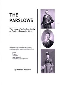
Book - THE PARSLOWS
The Parslows - the story of a Parslow family of Coaley Gloucestershire. Includes information on Eli Parslow who lived in Bendigo in the 1860's.Soft cover with 192 pages photographs and maps.Frank McGuirebook, bendigo, parslow, family - parslow-bendigo -
 Bendigo Historical Society Inc.
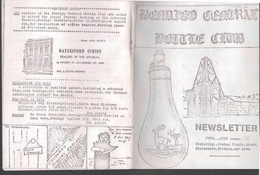
Document - JAMES LERK COLLECTION: BENDIGO CENTRAL BOTTLE CLUB NEWSLETTER
Bendigo Central Bottle Club Newsletter - James Lerk Collection (June /July 1976). Article on ''Old Inglewood'' (by Ken Arnold) - information on 1858 - 1860s with sketch map of gullies in area; Reference to bottle of T R Jones, Chemist of Bendigo (Pall Mall, near Allans Walk); list of some other bottle manufacturers in Bendigo. -
Bendigo Historical Society Inc.
Map - YALLOOK : COUNTY OF BENDIGO, 1957
Map. Yallook, County of Bendigo, Talambe, Neilborough, Yarraberb, Salisbury, Pompapiel. Drawn and reproduced at the Department of Lands and Survey, Melbourne,1957. Distances shown on the plan are derived from original surveys of varying dates and whilst approximately correct do not necessarily conform to modern standards of accuracy. For survey information application should be made to the central plan office, or to the office of titles. Some ink scibbles appear at the right top of this map. Price 2/-. (number 14 in map cupboard 1)By Authority W.M.Houston, Govt.Printer,Melbourne.map, bendigo, yallook -
Port Melbourne Historical & Preservation Society
Pamphlet - South Melbourne - Port Melbourne Historical & Preservation Society, "A walk around Port Melbourne", c. 1980
South Melbourne - Port Melbourne Historical & Preservation Society was in operation from the 1970s for approximately 20 years1980s information pamphlet as a guided walk around Port Melbourne. Produced by the South Melbourne - Port Melbourne Historical and Preservation Society. Map on front cover ; pink paper.built environment, heritage, recreation, south melbourne - port melbourne historical & preservation society -
 National Vietnam Veterans Museum (NVVM)
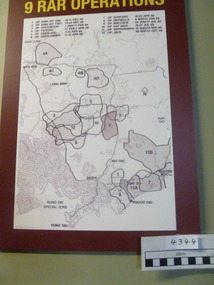
Poster - Poster, Information Board, 9 RAR Operations
... Poster Information Board Map of 9 RAR operations with a burgundy ...Map of 9 RAR operations with a burgundy background. there is a list of operations and dates on the board9 rar, map of operations, poster, information board -
 Port Melbourne Historical & Preservation Society
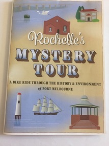
Pamphlet - Rochelle's Mystery Tour, bicycle tour of Port Melbourne identifying historic locations, Rochelle BELL, Rochelle's Mystery Tour, Jan 2017
Coloured 4 fold pamphlet with map, photographs of historic bike tour through Port Melbourne. Inside is large map marked with points of interest corresponding to photo and information on reverse sideRochelle's Mystery Tour a ride through the history and environment of Port Melbournebuilt environment, recreation, social activities, celebrations fetes and exhibitions, piers and wharves - princes pier, piers and wharves - station pier, rochelle bell, social health inclusion program (ship), danielle mccaffrey, centenary bridge, natural environment - beaches and foreshore, band rotunda, westgate park, lagoon reserve, liardet community centre, sandridge trugo club, garden city -
Port Melbourne Historical & Preservation Society
Poster, History of a Street Precinct
A cultural grant was given to Margaret BRIDE to implement this study, which she did with the help of her husband Graham and several residents of the study area including PMH&PS members Emily LOCK, David THOMPSON, Jack BOLT and Kerrie MATHEE.History of a Street Precinct, documenting 80 years plus of the history of the area bounded by Williamstown Road and Evans, Bridge and Farrell Streets, since 1880. One of two products of a 2005 project (which subsequently won the 2007 Victorian Local History Award for research). A brochure containing a map of the area and photos and information on key properties. An interactive CD (2148.02) containing information and photographs on 91 buildings and their occupants over time was also produced. built environment -
Port Melbourne Historical & Preservation Society
Mixed media, History of a Street Precinct
A cultural grant was given to Margaret BRIDE to implement this study, which she did with the help of her husband Graham and several residents of the study area including PMH&PS members Emily LOCK, David THOMPSON, Jack BOLT and Kerrie MATHEE.History of a Street Precinct, documenting 80 years plus of the history of the area bounded by Williamstown Road and Evans, Bridge and Farrell Streets, since 1880. One of two products of a 2005 project (which subsequently won the 2007 Victorian Local History Awards for research). An interactive CD containing information and photographs. This was packaged with a brochure (2148.01) containing a map of the area and photos and information on key properties and individuals on 91 buildings and their occupants over time.built environment -
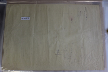 Coal Creek Community Park & Museum
Mine Map, 1933
6299.1 - Very faded map of Outtrim coal mine area detailing mine tunnels, tramways, topography and other information. Shows later small addendum/modification in ball point pen, Done 26/06/1953 -
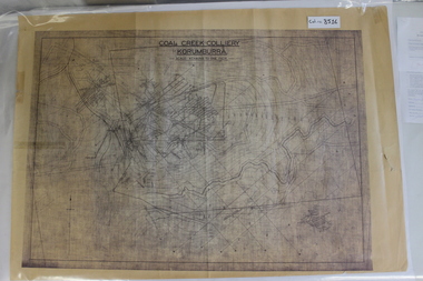 Coal Creek Community Park & Museum
Map of Mine and Details, Coal Creek Colliery Korumburra
8516.1 - Schematic/map of coal creek mine workings, also detailing number surface features such as topographic heights, roads, railways, boreholes, etc. No Legend. Most information seems to be printed, with topography drawn on. -
Port Melbourne Historical & Preservation Society
Document - Photocopy, maps, 1890s maps, 30 April 1890 .01 11 March 1890 .02
.01 Copy of Map 3084B - Port Melbourne, Willamstown Road to Esplanade East; to Graham Street; to Boundary Road & Pickles Street. .02 Copy of map of Port Melbourne, Bay Street to Clark Street; to Foreshore; to Pickle Street & Spring Street..01 for title information see parcels index 47,53,54,55,56 & 57. .02 Parcels index 3084-B 16 (City of Port Melbourne)built environment - commercial, built environment - domestic, city of port melbourne, parish of south melbourne -
Port Melbourne Historical & Preservation Society
Map - Proposed cut and Ferguson Dock, Port Melbourne, Jul 2008
... information on back - weather and some local information Map Proposed ...Map of proposed cut and Ferguson Dock which would have run from near the location of Princes Pier to swinging basin in Yarra River. Varied information on back - weather and some local informationpiers and wharves - miscellaneous, melbourne harbor trust - port of melbourne authority, mr ferguson, fishermans bend, ferguson dock -
 Bendigo Historical Society Inc.
Book - STREET AND ROAD MAPS OF THE CITY OF BENDIGO BOROUGH OF EAGLEHAWK, c1980
Street and Road Maps of the City of Bendigo Borough of Eaglehawk and surrounding Districts of Huntly, Mandurang, Marong and Strathfieldsaye, in color. Drawn and compiled by Wesley C Harry, Bendigo. Publisher: Cambridge Press, Bendigo. ISBN: 9598608.2.2. 68 pages. Photographs, Illustrations & maps. Photos include: Bendigo buildings, scenery mines, streetscapes, parades, pioneer leaders of Bendigo. Many advertisements throughout. List of Justices of the Peace, hospitals, homes for the aged, schools, churches. Page 58: Copy of ''Freedom of the City to the Australian Survey Regiment'' proclamation, 14th June 1970. Maps cover an area of some 169 sq. miles (43,772 hectares). Origin of the name Bendigo. Information on the five Wards of Bendigo, and their councilors. Revised Edition 1986Wesley C Harrybook, bendigo, bendigo & district maps, bendigo and districts map, buildings, streetscapes, historical pictures, advertisements, historical information, commisioners camp, sandhurst -
 Monbulk RSL Sub Branch
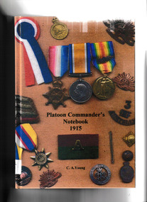
Book, CA Young, Platoon commander's notebook 1915, 2007
Based on the original notebook of Lieutenant Robert Cowey - written at Gallipoli - this book describes him and his men. His notebook is a ready reference to all relevant information including; all casualties, every movement, transfers, promotions and evacuations to hospital for any reason.Bibliography, ill, facsims, port, maps , p.317.non-fictionBased on the original notebook of Lieutenant Robert Cowey - written at Gallipoli - this book describes him and his men. His notebook is a ready reference to all relevant information including; all casualties, every movement, transfers, promotions and evacuations to hospital for any reason.world war 1914-1918- regimental histories - australia, world war 1914-1918- personal records - australia -
 Monbulk RSL Sub Branch
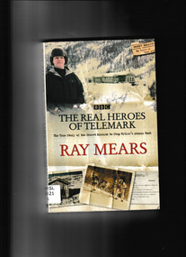
Book, Ray Mears, The real heroes of Telemark, 2004
Sixty years ago, specially trained men were parachuted onto a Norwegian glacier, carrying only the most basic equipment. Their mission was to prevent the Nazi regime from building an atomic bomb. Now wilderness expert Ray Mears tells the true story of this gruelling campaign, showing how these men's ability to survive in extreme conditions influenced the outcome of the Second World War. Using crucial military information which has only recently been declassified, shows how a highly secretive operation came into being. TitleIndex, ill, maps, p.274.non-fictionSixty years ago, specially trained men were parachuted onto a Norwegian glacier, carrying only the most basic equipment. Their mission was to prevent the Nazi regime from building an atomic bomb. Now wilderness expert Ray Mears tells the true story of this gruelling campaign, showing how these men's ability to survive in extreme conditions influenced the outcome of the Second World War. Using crucial military information which has only recently been declassified, shows how a highly secretive operation came into being. Titleworldwar 1939-1945 - special operations, norwegian heavy water sabotage -
 Monbulk RSL Sub Branch
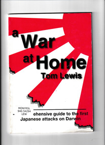
Book, Tall Stories, A war at home : a comprehensive guide to the first Japanese attacks on Darwin, 1999
A comprehensive guide to the first Japanese attacks on Darwin on 19th February 1942, written by Dr Tom Lewis, OAM. An essential reference work on this controversial subject that includes a full list of those killed as well as other detailed appendices. It also includes fascinating information on what wartime sites are still accessible in and around the northern capital. Originally published in 1999, until recently it has mainly been available only in Darwin itself.Index, bibliography, ill, maps, p.73.non-fictionA comprehensive guide to the first Japanese attacks on Darwin on 19th February 1942, written by Dr Tom Lewis, OAM. An essential reference work on this controversial subject that includes a full list of those killed as well as other detailed appendices. It also includes fascinating information on what wartime sites are still accessible in and around the northern capital. Originally published in 1999, until recently it has mainly been available only in Darwin itself.world war 1939-1945 - air raids - darwin, world war 1939-1945 - aerial operations - japan -
 Monbulk RSL Sub Branch
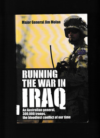
Book, HarperCollins, Running the war in Iraq : an Australian general, 300,000 troops, the bloodiest conflict of our time, 2008
Jim Molan is the Australian General who served in Iraq with the Coalition during 2004-05. Initially, under General Ricardo Sanchez, he worked on infrastructure: trying to restore/maintain the provision of water, power and rail services. Under General George W. Casey, he became Deputy Chief of Staff for Strategic Operations with the Multi National Forces Iraq and ran the operations for all the US and Coalition forces assigned to the Iraqi area of operations. He had to interact with the new interim Iraqi government, bringing the political, diplomatic, information, economic and reconstruction sectors into line with the military side. In this book he describes his background and military career, but focuses on describing key aspects of his time in Iraq.Ill, map, p.352.non-fictionJim Molan is the Australian General who served in Iraq with the Coalition during 2004-05. Initially, under General Ricardo Sanchez, he worked on infrastructure: trying to restore/maintain the provision of water, power and rail services. Under General George W. Casey, he became Deputy Chief of Staff for Strategic Operations with the Multi National Forces Iraq and ran the operations for all the US and Coalition forces assigned to the Iraqi area of operations. He had to interact with the new interim Iraqi government, bringing the political, diplomatic, information, economic and reconstruction sectors into line with the military side. In this book he describes his background and military career, but focuses on describing key aspects of his time in Iraq.australian army - iraq war - 2003, iraq war - personal narratives -
 Bendigo Historical Society Inc.
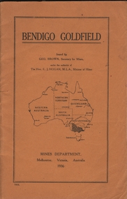
Book - BENDIGO GOLDFIELD
booklet, 51 pages. 'Bendigo Goldfield' issued by Geo Brown, Secretary for Mines. Mines Department 1936. Contains information on the geology of the Bendigo goldfield and major lines of reef and mines. Map of goldfield showing reef lines and mines attached to back cover.bendigo, mining, bendigo goldfield