Physical description
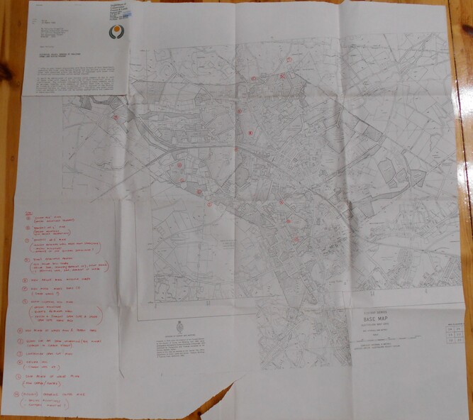
Base map Australian map grid of Eaglehawk area. Map has letter attached from the Department of Conservation, Forests and Lands, 22 March, 1990, addressed to Felicity Kingerlie, BHS, requesting information regarding the historic mining sites marked on the map. Sites marked are:
A. Golden Age Mine, engine mountings present
B. Johnson's No. 2 Mine, engine mountings, old boiler foundations
C. Johnson's No. 1 Mine, mullock retaining wall made from sandstone, engine mountings, remains of old building demolished?
D. Toma's Eucalyptus Factory, old boiler still there, boiler shed, chimney (remnants of) outlet drain, distilling vats, dam, remnant of winch.
E. New Argus Mine,mullock heap
F. New Moon Mines Dams (1) stone walls
G. North Lightning Hill Mine, engine mountings, quartz retainer wall, Pascoe and Simmons open cuts and other open cuts here too
H. New Prince of Wales Mine and Poppet Head
I. Quarry site for stone, excavation (for miners cottages in Clarke Street)
J. Lancashire open cut mine
K. Virginia Hill (cynaide vats etc)
L. South Prince of Wales mine, now capped and fenced
M (possibly ) Catherine United Mine, engine mountings, battery mountings?