Showing 10832 items
matching maps
-
 Glenelg Shire Council Cultural Collection
Map - Map - Western Victoria / South Australia, n.d
Port of Portland Authority Archivesport of portland archives -
Glenelg Shire Council Cultural Collection
Photograph - Photograph - T. C. Jarrett, n.d
Port of Portland Authority archivesFront: (no inscriptions) Back: Theo Jarrett (blue pen, centre)port of portland archives -
 City of Moorabbin Historical Society (Operating the Box Cottage Museum)
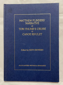
Book, Flinders, Matthew, Matthew Flinders' narrative of Tom Thumb's cruise to Canoe Rivulet, 1985
xvii, 34 p., 1 leaf of plates : ill., facsims., map, ports. non-fictiontom thumb (boat), matthews flinders, discovery and exploration -
 Bendigo Historical Society Inc.
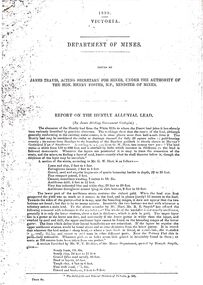
Document - STRAUCH COLLECTION: DEPT OF MINES,REPORT ON HUNTLY ALLUVIAL LEAD
1898 Victoria Department of Mines report on the Huntly Alluvial Lead with assorted maps.mining, extraction, alluvial -
 Bendigo Historical Society Inc.
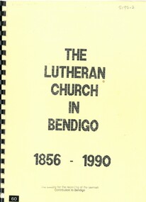
Book - THE LUTHERAN CHURCH IN BENDIGO 1856 - 1990, 1990
The Lutheran Church in Bendigo 1856 - 1986. 55 pages with photos, illustrations and maps.Pastor C.G. Schmidtbendigo, church, lutheran, bendigo, lutheran church, church -
 Bendigo Historical Society Inc.
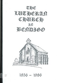
Book - THE LUTHERAN CHURCH IN BENDIGO 1856 - 1986, 1986
The Lutheran Church in Bendigo 1856 - 1986. 42 pages with photos, illustrations and maps.Pastor C.G. Schmidtbendigo, church, lutheran, bendigo, lutheran church, church -
 Bendigo Historical Society Inc.
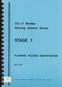
Book - CITY OF BENDIGO PLANNING SCHEME REVIEW STAGE 1, 1978
City of Bendigo Planning Scheme Review Stage 1. 101 pages, with maps.Meldrum Burrows & Partnersbendigo, planning, policies, bendigo, planning, planning scheme. -
 Bendigo Historical Society Inc.
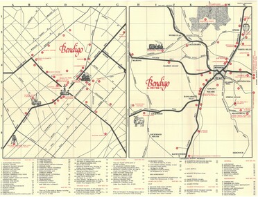
Document - TED BEATIE COLLECTION: MAP, Pre 1980s
Bendigo tourist map and information guide - printed by the Bendigo and District tourist Association -
 Bendigo Historical Society Inc.
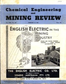
Book - CHEMICAL ENGINEERING AND MINING REVIEW, February 10th, 1939
Chemical Engineering and Mining Review February, 10th 1939 with photographs, maps and illustrations.books, technical, mining -
 Bendigo Historical Society Inc.
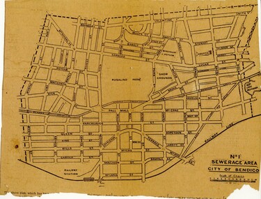
Newspaper - BENDIGO SEWARAGE AREA NEWSPAPER CUTTING, 1921
Newspaper cutting showing map of the No 1 Sewerage Area City of Bendigo. 1921bendigo, planning, sewerage, bendigo sewerage -
 National Vietnam Veterans Museum (NVVM)
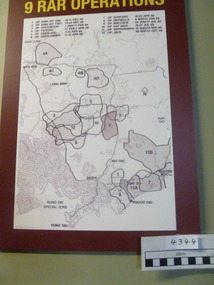
Poster - Poster, Information Board, 9 RAR Operations
Map of 9 RAR operations with a burgundy background. there is a list of operations and dates on the board9 rar, map of operations, poster, information board -
Port Melbourne Historical & Preservation Society
Pamphlet - Promotional bike map of South Melbourne, Port Melbourne and St Kilda, "Explore by Bike", 1990s
Promotional bike map for the cities of South Melbourne, Port Melbourne and St Kildalocal government - city of port melbourne, local government, city of st kilda, city of south melbourne -
 HMAS Cerberus Museum
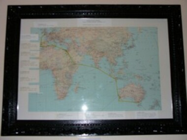
Map of voyage (H.M.V.S Cerberus)
Map of the world depicting voyage H.M.V.S Cerberus with datesevents in black ornate frame.Voyage of H.M.V.S Cerberus sailed plymouth England 7 November 1870 arrived Hobsons bay 9 April 1871. -
 Churchill Island Heritage Farm
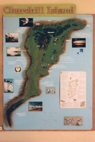
Photograph - Photograph of Visitor's display of Churchill Island
Churchill Island Heritage Farm has a large photograph collection dating from the nineteenth century. Photograph of the visitor's centre display showing a map of Churchill Island with information and photographs.Catalogue number on reverse in pencil.churchill island, photograph -
 Churchill Island Heritage Farm
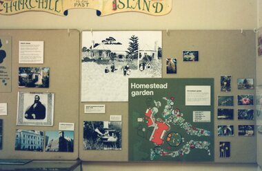
Photograph - Photograph of 'Window to the Past' visitor's display
Churchill Island Heritage Farm has a large photograph collection dating from the nineteenth century. Photograph of 'Window to the Past' display in Churchill Island's visitor's centre with maps and photographsCatalogue number on reverse in pencil.churchill island, photograph -
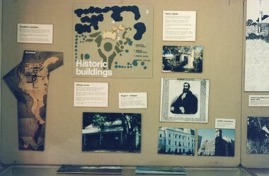 Churchill Island Heritage Farm
Photograph - Photograph of Visitor's Centre Display
Churchill Island Heritage Farm has a large photograph collection dating from the nineteenth century. Photograph of Visitor's Centre Display showing historic buildings, a map of the Heritage PrecinctCatalogue number on reverse in pencil.churchill island, photograph -
Port Melbourne Historical & Preservation Society
Article - Newspaper cutting, Analysis of proposed dock and cutting, Jul 2008
Newspaper cutting with proposal for dock and cutting by Mr Ferguson. Analysis of the scheme and mappiers and wharves - miscellaneous, melbourne harbor trust - port of melbourne authority, mr ferguson, fishermans bend, ferguson dock -
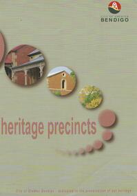 Bendigo Historical Society Inc.
Map - HERITAGE PRECINCTS
Map. Heritage precincts. City of Greater Bendigo - dedicated to the preservation of our heritage.map, bendigo, heritage precincts -
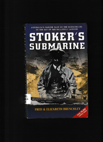 Monbulk RSL Sub Branch
Book, Harper Collins et al, Stoker's submarine, 2003
On 25 April 1915 - the day the Anzacs landed at Gallipoli - Lieutenant Commander Dacre Stoker set out as captain of the Australian submarine AE2 on a mission to breach the treacherous Dardanelles Strait with the intention of disrupting Turkish supply lines to the isolated Gallipoli peninsula. Facing dangerous currents, mines and withering enemy fire, Stoker and his men succeeded where British and French submarines had come to grief." "Stoker's achievement meant much in military terms, and even more emotionally in boosting the morale of embattled Allied troops. But what was proclaimed at the time as 'the finest feat in submarine history' has since sunk into oblivion. Few Australians even know their country had a submarine at Gallipoli, much less that it achieved daring feats, sank an enemy craft, and possibly played a pivotal role in Anzac troops staying on the beachhead for eight months." "Now, finally, Stoker's Submarine tells the story of a remarkable naval hero and the men under his command. And the AE2 itself, still lying intact on the floor of the Sea of Marmara, is celebrated as the most tangible relic of Australia's role at Gallipoli, the crucible of nationhood.Index, bibliography, notes, ill. (some col.), maps, ports, p.318.non-fictionOn 25 April 1915 - the day the Anzacs landed at Gallipoli - Lieutenant Commander Dacre Stoker set out as captain of the Australian submarine AE2 on a mission to breach the treacherous Dardanelles Strait with the intention of disrupting Turkish supply lines to the isolated Gallipoli peninsula. Facing dangerous currents, mines and withering enemy fire, Stoker and his men succeeded where British and French submarines had come to grief." "Stoker's achievement meant much in military terms, and even more emotionally in boosting the morale of embattled Allied troops. But what was proclaimed at the time as 'the finest feat in submarine history' has since sunk into oblivion. Few Australians even know their country had a submarine at Gallipoli, much less that it achieved daring feats, sank an enemy craft, and possibly played a pivotal role in Anzac troops staying on the beachhead for eight months." "Now, finally, Stoker's Submarine tells the story of a remarkable naval hero and the men under his command. And the AE2 itself, still lying intact on the floor of the Sea of Marmara, is celebrated as the most tangible relic of Australia's role at Gallipoli, the crucible of nationhood.world war 1914-1918 - campaigns - gallipoli, gallipoli campaign - naval operations, submarine ae2 -
 Bendigo Historical Society Inc.
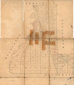
Map - JACK FLYNN COLLECTION: TARNAGULLA SHEET 4, 25/11/1926
Map: Parish of Tarnagulla Sheet 4, Counties of Gladstone and Bendigo. Parish plan.Photo-Lithographed at the Department of lands and Survey, Melbourne by W. J. Butson. 25.11.26map, gladstone, parish plan, tarnagulla sheet 4 -
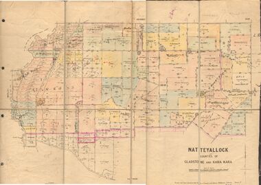 Bendigo Historical Society Inc.
Map - JACK FLYNN COLLECTION: NATTE YALLOCK, 22/06/1937
Map: Parish of Natte Yallock, Counties of Gladstone and Kara Kara. Parish plan.By Authority H.J. Green Government Printer Melbourne. Drawn and Reproduced at the Depart., of Lands and Survey, Melbourne, Victoria.map, gladstone, parish plan, natte yallock -
 Bendigo Historical Society Inc.
Map - JACK FLYNN COLLECTION: LAANACOORIE, No date visible
Map: Parish of Laanacoorie, County of Bendigo. Parish plan. Half of the sheet is missing.By Authority H.J. Green. Govt, Printer.map, bendigo, parish plan, laanacoorie -
 Bendigo Historical Society Inc.
Map - JACK FLYNN COLLECTION: VILLAGE OF BETLEY, 30/06/1874
Map: Village of Betley, on the Bet Bet Creek, Parish of Dunolly. Parish plan.Photo Lithographed at the Department of Lands and Survey Melbourne by J. Noone 30.6.74map, gladstone, village, betley, bet bet creek, dunolly -
 Bendigo Historical Society Inc.
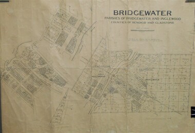
Map - JACK FLYNN COLLECTION: BRIDGEWATER, 10/09/1931
Map: Bridgewater, Parishes of Bridgewater and Inglewood, Counties of Bendigo and Gladstone. Parish plan.map, bendigo, parish plan, bridgewater inglewood -
Bendigo Historical Society Inc.
Map - KANGAROO FLAT ?, Circa 1880
Map: Parish plan showing area from Kangaroo Flat to Spring Gullymap, bendigo, parish plan, kangaroo flat, spring gully -
Bendigo Historical Society Inc.
Map - NERRING SHEET 3, 1/12/1894
Map:Neriing sheet 3. parish plan ( number 188 in Map Cupboard 1)map, bendigo, parish plan, nerring -
Bendigo Historical Society Inc.
Book - ORIGINS OF BENDIGO STREET NAMES BOOK 2, 2007
ORIGINS OF BENDIGO STREET NAMES BOOK 2. 34 pages with photos and mapRita Hullbendigo, hospital, street names, bendigo, street names -
Bendigo Historical Society Inc.
Map - MIAMI ( MIA MIA), 26/06/1906
Map: Township of Miami (Mia Mia), Parish of Spring Plains, County of Dalhousiemap, dalhousie, township, miami, mia mia -
 Bendigo Historical Society Inc.
Slide - AHQ,SURVEY REGT, FORTUNA,BENDIGO, April 1970
Slide. AHQ, Survey Regt, Fortuna, Bendigo. A Survey member inspecting a map.slide, bendigo, ahq, survey regt, fortuna, bendigo., ahq, survey regt, fortuna, bendigo. -
National Vietnam Veterans Museum (NVVM)
Document, The Australian Counterinsurgency campaign in the Vietnam War: the ambush battle, 2014
3 photocopies of the article published in the Journal of Maps, vol.10, No.1, 2014.1 atf, counterinsurgency campaign