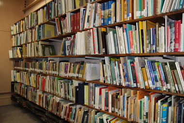
Showing 800 items
matching heritage planning
-
 Federation University Historical Collection
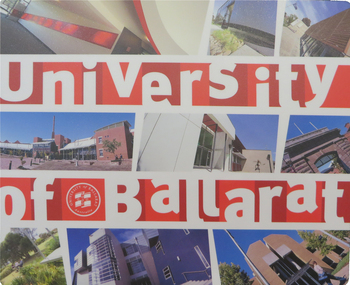
Promotional Card, University of Ballarat Outdoor Education, 2005, 2005
Federation University Australia was established on 1 January 2014. Formerly known as the University of Ballarat, its enabling legislation was the University of Ballarat Amendment (Federation University Australia) Act 2013. Although formally created as a University in 1994, the University of Ballarat has a lineage back to 1870 with the establishment of the School of Mines Ballarat, making it the third institution of higher learning to be established in Australia and the first to be established in regional Australia. On 1 January 1994, Ballarat University College became the University of Ballarat and in 1998 the University merged with three TAFE Institutes to become a dual sector institution with multiple campuses. On 1 January 2014, the University of Ballarat amalgamated with the Monash University Gippsland Campus to form Federation University Australia. The Gippsland Campus also had a long lineage dating back to 1928 with the establishment of the Yallourn Technical School which became a predecessor institution to the Gippsland College of Advanced Education formed in 1968. In 1990, it was renamed the Monash University College and in 1993 became the Gippsland Campus of Monash University. In 2016, Federation University Australia announced plans to take possession, over a two-year period, of Monash’s Berwick Campus in the south-east corridor of Melbourne. Federation University Australia, or FedUni, is headquartered in Ballarat and offers programs in Higher Education and Vocational Education and Training to regional Victoria and beyond. The University’s commitment to educational and social equity, teaching excellence, research distinction, environmental sustainability and regional capacity building has enabled it to develop in a way that draws on its proud heritage to inform its future. Its regional character sets a framework for the University’s priorities but does not constrain it from serving wider community interests, nationally and internationally. The name Federation University Australia was chosen to convey the scope and capacity of an expanded regional university with a federated network of campuses.A double sided card with four folds, making it around the size of a business card. The card gives Outdoor Education and Environmental Course Content and images.university of ballarat, outdoor education, environmental education -
 Federation University Historical Collection
Promotional Card, University of Ballarat School of Information Technology & Mathematical Sciences, 2005, 2005
Federation University Australia was established on 1 January 2014. Formerly known as the University of Ballarat, its enabling legislation was the University of Ballarat Amendment (Federation University Australia) Act 2013. Although formally created as a University in 1994, the University of Ballarat has a lineage back to 1870 with the establishment of the School of Mines Ballarat, making it the third institution of higher learning to be established in Australia and the first to be established in regional Australia. On 1 January 1994, Ballarat University College became the University of Ballarat and in 1998 the University merged with three TAFE Institutes to become a dual sector institution with multiple campuses. On 1 January 2014, the University of Ballarat amalgamated with the Monash University Gippsland Campus to form Federation University Australia. The Gippsland Campus also had a long lineage dating back to 1928 with the establishment of the Yallourn Technical School which became a predecessor institution to the Gippsland College of Advanced Education formed in 1968. In 1990, it was renamed the Monash University College and in 1993 became the Gippsland Campus of Monash University. In 2016, Federation University Australia announced plans to take possession, over a two-year period, of Monash’s Berwick Campus in the south-east corridor of Melbourne. Federation University Australia, or FedUni, is headquartered in Ballarat and offers programs in Higher Education and Vocational Education and Training to regional Victoria and beyond. The University’s commitment to educational and social equity, teaching excellence, research distinction, environmental sustainability and regional capacity building has enabled it to develop in a way that draws on its proud heritage to inform its future. Its regional character sets a framework for the University’s priorities but does not constrain it from serving wider community interests, nationally and internationally. The name Federation University Australia was chosen to convey the scope and capacity of an expanded regional university with a federated network of campuses.A double sided card with four folds, making it around the size of a business card. The card gives information on Information Technology and Mathematical Sciences Content and images.university of ballarat, school of information technology and mathematical sciences, itms, promotional, marketing, computer games, earn as you learn, business systems, mathematics, information technology -
 Federation University Historical Collection
Letterhead, University of Ballarat Aboriginal Education Centre Letterhead, 2012, c2012
Federation University Australia was established on 1 January 2014. Formerly known as the University of Ballarat, its enabling legislation was the University of Ballarat Amendment (Federation University Australia) Act 2013. Although formally created as a University in 1994, the University of Ballarat has a lineage back to 1870 with the establishment of the School of Mines Ballarat, making it the third institution of higher learning to be established in Australia and the first to be established in regional Australia. On 1 January 1994, Ballarat University College became the University of Ballarat and in 1998 the University merged with three TAFE Institutes to become a dual sector institution with multiple campuses. On 1 January 2014, the University of Ballarat amalgamated with the Monash University Gippsland Campus to form Federation University Australia. The Gippsland Campus also had a long lineage dating back to 1928 with the establishment of the Yallourn Technical School which became a predecessor institution to the Gippsland College of Advanced Education formed in 1968. In 1990, it was renamed the Monash University College and in 1993 became the Gippsland Campus of Monash University. In 2016, Federation University Australia announced plans to take possession, over a two-year period, of Monash’s Berwick Campus in the south-east corridor of Melbourne. Federation University Australia, or FedUni, is headquartered in Ballarat and offers programs in Higher Education and Vocational Education and Training to regional Victoria and beyond. The University’s commitment to educational and social equity, teaching excellence, research distinction, environmental sustainability and regional capacity building has enabled it to develop in a way that draws on its proud heritage to inform its future. Its regional character sets a framework for the University’s priorities but does not constrain it from serving wider community interests, nationally and internationally. The name Federation University Australia was chosen to convey the scope and capacity of an expanded regional university with a federated network of campuses.A number of sheets of Aboriginal Education Centre letterhead. university of ballarat, university of ballarat aboriginal education centre, letterhead, aboriginal education centre -
 Federation University Historical Collection
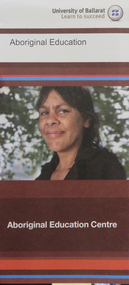
Pamphlet - Brochure, University of Ballarat Aboriginal Education Centre Brochure, c2012, c2012
Federation University Australia was established on 1 January 2014. Formerly known as the University of Ballarat, its enabling legislation was the University of Ballarat Amendment (Federation University Australia) Act 2013. Although formally created as a University in 1994, the University of Ballarat has a lineage back to 1870 with the establishment of the School of Mines Ballarat, making it the third institution of higher learning to be established in Australia and the first to be established in regional Australia. On 1 January 1994, Ballarat University College became the University of Ballarat and in 1998 the University merged with three TAFE Institutes to become a dual sector institution with multiple campuses. On 1 January 2014, the University of Ballarat amalgamated with the Monash University Gippsland Campus to form Federation University Australia. The Gippsland Campus also had a long lineage dating back to 1928 with the establishment of the Yallourn Technical School which became a predecessor institution to the Gippsland College of Advanced Education formed in 1968. In 1990, it was renamed the Monash University College and in 1993 became the Gippsland Campus of Monash University. In 2016, Federation University Australia announced plans to take possession, over a two-year period, of Monash’s Berwick Campus in the south-east corridor of Melbourne. Federation University Australia, or FedUni, is headquartered in Ballarat and offers programs in Higher Education and Vocational Education and Training to regional Victoria and beyond. The University’s commitment to educational and social equity, teaching excellence, research distinction, environmental sustainability and regional capacity building has enabled it to develop in a way that draws on its proud heritage to inform its future. Its regional character sets a framework for the University’s priorities but does not constrain it from serving wider community interests, nationally and internationally. The name Federation University Australia was chosen to convey the scope and capacity of an expanded regional university with a federated network of campuses.A 4 bi-folded brochure outlining the role of the University of Ballarat Aboriginal Education Centre, entrance policy, and Reconciliation Statement. university of ballarat, university of ballarat aboriginal education centre, logo, statement of reconciliation, shirley morgan, aboriginal education centre -
 Federation University Historical Collection
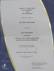
Invitation, City of Ballarat Reception Invitation to Mark the 140th Anniversary of the University of Ballarat, 2010, 27/04/2010
Federation University Australia was established on 1 January 2014. Formerly known as the University of Ballarat, its enabling legislation was the University of Ballarat Amendment (Federation University Australia) Act 2013. Although formally created as a University in 1994, the University of Ballarat has a lineage back to 1870 with the establishment of the School of Mines Ballarat, making it the third institution of higher learning to be established in Australia and the first to be established in regional Australia. On 1 January 1994, Ballarat University College became the University of Ballarat and in 1998 the University merged with three TAFE Institutes to become a dual sector institution with multiple campuses. On 1 January 2014, the University of Ballarat amalgamated with the Monash University Gippsland Campus to form Federation University Australia. The Gippsland Campus also had a long lineage dating back to 1928 with the establishment of the Yallourn Technical School which became a predecessor institution to the Gippsland College of Advanced Education formed in 1968. In 1990, it was renamed the Monash University College and in 1993 became the Gippsland Campus of Monash University. In 2016, Federation University Australia announced plans to take possession, over a two-year period, of Monash’s Berwick Campus in the south-east corridor of Melbourne. Federation University Australia, or FedUni, is headquartered in Ballarat and offers programs in Higher Education and Vocational Education and Training to regional Victoria and beyond. The University’s commitment to educational and social equity, teaching excellence, research distinction, environmental sustainability and regional capacity building has enabled it to develop in a way that draws on its proud heritage to inform its future. Its regional character sets a framework for the University’s priorities but does not constrain it from serving wider community interests, nationally and internationally. The name Federation University Australia was chosen to convey the scope and capacity of an expanded regional university with a federated network of campuses. The reception was attended by Clare Gervasoni, the University's Curator: Art & Historical Collections.City of Ballarat invitation to a civic reception celebrating 140 years of technical educatoin by the University of Ballarat. The reception was held in the Ballarat Town Hall. invitation, anniversary, city of ballarat, city of ballarat reception, judy verlin, university of ballarat, ballarat school of mines, 140th anniversary, ballarat school of mines 140th anniversary, ballarat town hall, city of ballarat logo, clare gervasoni -
Federation University Historical Collection
Document, James Baker, Ballarat School of Mines Collector, James Baker, 1870, 1870
Information related to the establishment of the Ballarat School of Mines, the first of its kind in Australia. Federation University Australia was established on 1 January 2014. Formerly known as the University of Ballarat, its enabling legislation was the University of Ballarat Amendment (Federation University Australia) Act 2013. Although formally created as a University in 1994, the University of Ballarat has a lineage back to 1870 with the establishment of the School of Mines Ballarat, making it the third institution of higher learning to be established in Australia and the first to be established in regional Australia. On 1 January 1994, Ballarat University College became the University of Ballarat and in 1998 the University merged with three TAFE Institutes to become a dual sector institution with multiple campuses. On 1 January 2014, the University of Ballarat amalgamated with the Monash University Gippsland Campus to form Federation University Australia. The Gippsland Campus also had a long lineage dating back to 1928 with the establishment of the Yallourn Technical School which became a predecessor institution to the Gippsland College of Advanced Education formed in 1968. In 1990, it was renamed the Monash University College and in 1993 became the Gippsland Campus of Monash University. In 2016, Federation University Australia announced plans to take possession, over a two-year period, of Monash’s Berwick Campus in the south-east corridor of Melbourne. Federation University Australia, or FedUni, is headquartered in Ballarat and offers programs in Higher Education and Vocational Education and Training to regional Victoria and beyond. The University’s commitment to educational and social equity, teaching excellence, research distinction, environmental sustainability and regional capacity building has enabled it to develop in a way that draws on its proud heritage to inform its future. Its regional character sets a framework for the University’s priorities but does not constrain it from serving wider community interests, nationally and internationally. The name Federation University Australia was chosen to convey the scope and capacity of an expanded regional university with a federated network of campuses.Copy of a letter signed by James Baker outlining that he had been appointed Collector to the proposed Ballarat School of Mines, and requested co-operation and pecuniary assistance torwards the establishment and maintenance of the new school. School of Mines for the COlony of Victoria Ballarat, 1870 Sir,- Having been appointed to the Trustees of this proposed Institutin, I have the honor to request your co-operatoin and pecuniary assistance towards its establishment and maintenance. Your attention is respectfully requested to the appended outline of the Institution, with the names of gentlemen who have accepted provisional offices. The object sought to be obtained is the cobinatin of the highest scientific with the most practical training for all men engaghed in the enterprise of mining in its various branches, whether so engaged as mining managers, engineers, surveyors, mechanists, working miners, directors or promoters of companies. Hitherto, in this Colony, no means of scientific educatin, in this most important occupation has been provided. The result has been an enormous waste of captial, time, and labor. Indeed, it may be fairly stated that the persent depression in the mining market and the distrust of mining property as an inverstment may in great part be traced to the numerous failures of enterprises either ignorantly entered upon or unscientifically, pursued. The scientific education of those engaged in mining pursuits would, it is believed, not merely render gold mining a safe and generally more productive speculation, but would bring into profitable prominence and activity many branches of mining now wholly neglected, or distrustfully, and consequently unsuccessfully, pursued. The Government has so far recognised the attempt to estalish this, so much wanted, Institution as to grant a ease, at a nominal lease, of the old Court-house in Lydiard street : and steps are being taken to put the building in repair and adapt it to the requirement so fhte proposed School. You will see from the appended Outline that L600 at least much be subscribed before the School can be opened. Towards thos sum several public bodies and private persons have given subscriptions; either as Life Governors, Annual Governors, or Donors, by whose liberality the Institution may be not only opened, but permanently maintained in the highest state of efficiency. I trust therefore that you will pardon my earnestly requesting your assistance, which many be effectually rendered by your returning to me one of the enclised forms, signed by you either as a Life Governoe (L50), and Annual Governor (L3 3s), or simply as a Donor of any sum which you may see fit to give. I have the honor to be, Sir, Your most obedient Servant, James Baker, Collector to School of Mines.ballarat school of mines, ballarat school of mines establishment, balalrat school of mines collector, james baker -
Federation University Historical Collection
Booklet, University of Ballarat Foundation - Chancellor's Circle, 2011, 2011
Federation University Australia was established on 1 January 2014. Formerly known as the University of Ballarat, its enabling legislation was the University of Ballarat Amendment (Federation University Australia) Act 2013. Although formally created as a University in 1994, the University of Ballarat has a lineage back to 1870 with the establishment of the School of Mines Ballarat, making it the third institution of higher learning to be established in Australia and the first to be established in regional Australia. On 1 January 1994, Ballarat University College became the University of Ballarat and in 1998 the University merged with three TAFE Institutes to become a dual sector institution with multiple campuses. On 1 January 2014, the University of Ballarat amalgamated with the Monash University Gippsland Campus to form Federation University Australia. The Gippsland Campus also had a long lineage dating back to 1928 with the establishment of the Yallourn Technical School which became a predecessor institution to the Gippsland College of Advanced Education formed in 1968. In 1990, it was renamed the Monash University College and in 1993 became the Gippsland Campus of Monash University. In 2016, Federation University Australia announced plans to take possession, over a two-year period, of Monash’s Berwick Campus in the south-east corridor of Melbourne. Federation University Australia, or FedUni, is headquartered in Ballarat and offers programs in Higher Education and Vocational Education and Training to regional Victoria and beyond. The University’s commitment to educational and social equity, teaching excellence, research distinction, environmental sustainability and regional capacity building has enabled it to develop in a way that draws on its proud heritage to inform its future. Its regional character sets a framework for the University’s priorities but does not constrain it from serving wider community interests, nationally and internationally. The name Federation University Australia was chosen to convey the scope and capacity of an expanded regional university with a federated network of campuses.Four paged promotional document for the University of Ballarat Foundation and Chancellor's Circle. The University of Ballarat Foundation was established in 2010. The last page is a timeline showing the history of the University in a graphic form/timeline, university of ballarat, robert h.t. smith, david battersby, wai-man woo, chancellor's circle, university of ballarat foundation -
Federation University Historical Collection
Book, Ballarat School of Mines Minute Book, 1956-1961, 1956-1961
Federation University Australia was established on 1 January 2014. Formerly known as the University of Ballarat, its enabling legislation was the University of Ballarat Amendment (Federation University Australia) Act 2013. Although formally created as a University in 1994, the University of Ballarat has a lineage back to 1870 with the establishment of the School of Mines Ballarat, making it the third institution of higher learning to be established in Australia and the first to be established in regional Australia. On 1 January 1994, Ballarat University College became the University of Ballarat and in 1998 the University merged with three TAFE Institutes to become a dual sector institution with multiple campuses. On 1 January 2014, the University of Ballarat amalgamated with the Monash University Gippsland Campus to form Federation University Australia. The Gippsland Campus also had a long lineage dating back to 1928 with the establishment of the Yallourn Technical School which became a predecessor institution to the Gippsland College of Advanced Education formed in 1968. In 1990, it was renamed the Monash University College and in 1993 became the Gippsland Campus of Monash University. In 2016, Federation University Australia announced plans to take possession, over a two-year period, of Monash’s Berwick Campus in the south-east corridor of Melbourne. Federation University Australia, or FedUni, is headquartered in Ballarat and offers programs in Higher Education and Vocational Education and Training to regional Victoria and beyond. The University’s commitment to educational and social equity, teaching excellence, research distinction, environmental sustainability and regional capacity building has enabled it to develop in a way that draws on its proud heritage to inform its future. Its regional character sets a framework for the University’s priorities but does not constrain it from serving wider community interests, nationally and internationally. The name Federation University Australia was chosen to convey the scope and capacity of an expanded regional university with a federated network of campuses.Hard Cover book, partly bound in leather with Ballarat School of Mines Council Minutes, and Finance Committee minutes. ballarat school of mines, ballarat school of mines council, ballarat school of mines council minutes, ballarat school of mines finance committee, josephine brelaz schlarship, a.j. affleck, h.l. allnut, arblaster, h.e., aston, robert, barker, k.c., barrell, g.w., beaston, c.w, benney, v, blackwood, r.r., noel brelaz, brelaz guido, brinsden, neville bunning, james caldwell, callow, n.l, clelland, john, corbould, day, p.l., dewsnap, n.f., w.g. durant, elliott, m., faulkner, f, ferguson, f.e., finn, william, gallagher, b., garner, l, gordon, i.r., hancock, v, heseltine, mary, hooper, noel, hullick, k, m.b. john, johnson, alan ernest, johnson, b.a., bullarto, bullarto excursion, ballarat gaol, m.b. john brassworks, motor mechanics huts, 90th anniversary, josephine brelaz, v. hancock, alfred mica smith, john wolfe, s.d. wynes, r.w. richards award, spargo creek, spargo creek excursion -
Federation University Historical Collection
Ephemera - Stickers, University of Ballarat Stickers
Federation University Australia was established on 1 January 2014. Formerly known as the University of Ballarat, its enabling legislation was the University of Ballarat Amendment (Federation University Australia) Act 2013. Although formally created as a University in 1994, the University of Ballarat has a lineage back to 1870 with the establishment of the School of Mines Ballarat, making it the third institution of higher learning to be established in Australia and the first to be established in regional Australia. On 1 January 1994, Ballarat University College became the University of Ballarat and in 1998 the University merged with three TAFE Institutes to become a dual sector institution with multiple campuses. On 1 January 2014, the University of Ballarat amalgamated with the Monash University Gippsland Campus to form Federation University Australia. The Gippsland Campus also had a long lineage dating back to 1928 with the establishment of the Yallourn Technical School which became a predecessor institution to the Gippsland College of Advanced Education formed in 1968. In 1990, it was renamed the Monash University College and in 1993 became the Gippsland Campus of Monash University. In 2016, Federation University Australia announced plans to take possession, over a two-year period, of Monash’s Berwick Campus in the south-east corridor of Melbourne. Federation University Australia, or FedUni, is headquartered in Ballarat and offers programs in Higher Education and Vocational Education and Training to regional Victoria and beyond. The University’s commitment to educational and social equity, teaching excellence, research distinction, environmental sustainability and regional capacity building has enabled it to develop in a way that draws on its proud heritage to inform its future. Its regional character sets a framework for the University’s priorities but does not constrain it from serving wider community interests, nationally and internationally. The name Federation University Australia was chosen to convey the scope and capacity of an expanded regional university with a federated network of campuses.Seven University of Ballarat Stickers.sticker, university of ballarat, flag, logo -
 Federation University Historical Collection
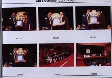
Book, University of Ballarat Graduation Ceremonies, 2006, 2006
Federation University Australia was established on 1 January 2014. Formerly known as the University of Ballarat, its enabling legislation was the University of Ballarat Amendment (Federation University Australia) Act 2013. Although formally created as a University in 1994, the University of Ballarat has a lineage back to 1870 with the establishment of the School of Mines Ballarat, making it the third institution of higher learning to be established in Australia and the first to be established in regional Australia. On 1 January 1994, Ballarat University College became the University of Ballarat and in 1998 the University merged with three TAFE Institutes to become a dual sector institution with multiple campuses. On 1 January 2014, the University of Ballarat amalgamated with the Monash University Gippsland Campus to form Federation University Australia. The Gippsland Campus also had a long lineage dating back to 1928 with the establishment of the Yallourn Technical School which became a predecessor institution to the Gippsland College of Advanced Education formed in 1968. In 1990, it was renamed the Monash University College and in 1993 became the Gippsland Campus of Monash University. In 2016, Federation University Australia announced plans to take possession, over a two-year period, of Monash’s Berwick Campus in the south-east corridor of Melbourne. Federation University Australia, or FedUni, is headquartered in Ballarat and offers programs in Higher Education and Vocational Education and Training to regional Victoria and beyond. The University’s commitment to educational and social equity, teaching excellence, research distinction, environmental sustainability and regional capacity building has enabled it to develop in a way that draws on its proud heritage to inform its future. Its regional character sets a framework for the University’s priorities but does not constrain it from serving wider community interests, nationally and internationally. The name Federation University Australia was chosen to convey the scope and capacity of an expanded regional university with a federated network of campuses.Three black hard covered books with colour images of the December 2006 graduation ceremonies at the University of Ballarat.graduation, university of ballarat, david battersby, rosemary green, robert h.t. smith, dick de fegely, honorary doctorate -
 Federation University Historical Collection
Ephemera - Object, University of Ballarat Mouse Pad, c2012, c2012
Federation University Australia was established on 1 January 2014. Formerly known as the University of Ballarat, its enabling legislation was the University of Ballarat Amendment (Federation University Australia) Act 2013. Although formally created as a University in 1994, the University of Ballarat has a lineage back to 1870 with the establishment of the School of Mines Ballarat, making it the third institution of higher learning to be established in Australia and the first to be established in regional Australia. On 1 January 1994, Ballarat University College became the University of Ballarat and in 1998 the University merged with three TAFE Institutes to become a dual sector institution with multiple campuses. On 1 January 2014, the University of Ballarat amalgamated with the Monash University Gippsland Campus to form Federation University Australia. The Gippsland Campus also had a long lineage dating back to 1928 with the establishment of the Yallourn Technical School which became a predecessor institution to the Gippsland College of Advanced Education formed in 1968. In 1990, it was renamed the Monash University College and in 1993 became the Gippsland Campus of Monash University. In 2016, Federation University Australia announced plans to take possession, over a two-year period, of Monash’s Berwick Campus in the south-east corridor of Melbourne. Federation University Australia, or FedUni, is headquartered in Ballarat and offers programs in Higher Education and Vocational Education and Training to regional Victoria and beyond. The University’s commitment to educational and social equity, teaching excellence, research distinction, environmental sustainability and regional capacity building has enabled it to develop in a way that draws on its proud heritage to inform its future. Its regional character sets a framework for the University’s priorities but does not constrain it from serving wider community interests, nationally and internationally. The name Federation University Australia was chosen to convey the scope and capacity of an expanded regional university with a federated network of campuses.Foam mouse pad with scenes of buildings from University of Ballarat campuses. university of ballarat, architecture, computers -
 Federation University Historical Collection
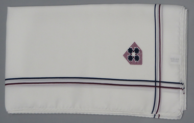
Costume, Hollygreen Pty Ltd, Ballarat University College Scarf, c1990, c1990
Federation University Australia was established on 1 January 2014. Formerly known as the University of Ballarat, its enabling legislation was the University of Ballarat Amendment (Federation University Australia) Act 2013. Although formally created as a University in 1994, the University of Ballarat has a lineage back to 1870 with the establishment of the School of Mines Ballarat, making it the third institution of higher learning to be established in Australia and the first to be established in regional Australia. On 1 January 1994, Ballarat University College became the University of Ballarat and in 1998 the University merged with three TAFE Institutes to become a dual sector institution with multiple campuses. On 1 January 2014, the University of Ballarat amalgamated with the Monash University Gippsland Campus to form Federation University Australia. The Gippsland Campus also had a long lineage dating back to 1928 with the establishment of the Yallourn Technical School which became a predecessor institution to the Gippsland College of Advanced Education formed in 1968. In 1990, it was renamed the Monash University College and in 1993 became the Gippsland Campus of Monash University. In 2016, Federation University Australia announced plans to take possession, over a two-year period, of Monash’s Berwick Campus in the south-east corridor of Melbourne. Federation University Australia, or FedUni, is headquartered in Ballarat and offers programs in Higher Education and Vocational Education and Training to regional Victoria and beyond. The University’s commitment to educational and social equity, teaching excellence, research distinction, environmental sustainability and regional capacity building has enabled it to develop in a way that draws on its proud heritage to inform its future. Its regional character sets a framework for the University’s priorities but does not constrain it from serving wider community interests, nationally and internationally. The name Federation University Australia was chosen to convey the scope and capacity of an expanded regional university with a federated network of campuses.Three predominantly white scarves with maroon and blue trim, and Ballarat University College logo.university of ballarat, scarf, costume, university of ballarat logo, ken clements -
 Federation University Historical Collection
Costume, Noone, University of Ballarat Tie, c1990
Federation University Australia was established on 1 January 2014. Formerly known as the University of Ballarat, its enabling legislation was the University of Ballarat Amendment (Federation University Australia) Act 2013. Although formally created as a University in 1994, the University of Ballarat has a lineage back to 1870 with the establishment of the School of Mines Ballarat, making it the third institution of higher learning to be established in Australia and the first to be established in regional Australia. On 1 January 1994, Ballarat University College became the University of Ballarat and in 1998 the University merged with three TAFE Institutes to become a dual sector institution with multiple campuses. On 1 January 2014, the University of Ballarat amalgamated with the Monash University Gippsland Campus to form Federation University Australia. The Gippsland Campus also had a long lineage dating back to 1928 with the establishment of the Yallourn Technical School which became a predecessor institution to the Gippsland College of Advanced Education formed in 1968. In 1990, it was renamed the Monash University College and in 1993 became the Gippsland Campus of Monash University. In 2016, Federation University Australia announced plans to take possession, over a two-year period, of Monash’s Berwick Campus in the south-east corridor of Melbourne. Federation University Australia, or FedUni, is headquartered in Ballarat and offers programs in Higher Education and Vocational Education and Training to regional Victoria and beyond. The University’s commitment to educational and social equity, teaching excellence, research distinction, environmental sustainability and regional capacity building has enabled it to develop in a way that draws on its proud heritage to inform its future. Its regional character sets a framework for the University’s priorities but does not constrain it from serving wider community interests, nationally and internationally. The name Federation University Australia was chosen to convey the scope and capacity of an expanded regional university with a federated network of campuses.Three predominantly blue ties with a blue, red and yellow University of Ballarat logo featuring the Southern Cross in a golden wreath. university of ballarat, costume, university of ballarat logo, tie -
Federation University Historical Collection
Bag, Monash University Gippsland / University of Ballarat Carry Bag, 2013, c2013
Federation University Australia was established on 1 January 2014. Formerly known as the University of Ballarat, its enabling legislation was the University of Ballarat Amendment (Federation University Australia) Act 2013. Although formally created as a University in 1994, the University of Ballarat has a lineage back to 1870 with the establishment of the School of Mines Ballarat, making it the third institution of higher learning to be established in Australia and the first to be established in regional Australia. On 1 January 1994, Ballarat University College became the University of Ballarat and in 1998 the University merged with three TAFE Institutes to become a dual sector institution with multiple campuses. On 1 January 2014, the University of Ballarat amalgamated with the Monash University Gippsland Campus to form Federation University Australia. The Gippsland Campus also had a long lineage dating back to 1928 with the establishment of the Yallourn Technical School which became a predecessor institution to the Gippsland College of Advanced Education formed in 1968. In 1990, it was renamed the Monash University College and in 1993 became the Gippsland Campus of Monash University. In 2016, Federation University Australia announced plans to take possession, over a two-year period, of Monash’s Berwick Campus in the south-east corridor of Melbourne. Federation University Australia, or FedUni, is headquartered in Ballarat and offers programs in Higher Education and Vocational Education and Training to regional Victoria and beyond. The University’s commitment to educational and social equity, teaching excellence, research distinction, environmental sustainability and regional capacity building has enabled it to develop in a way that draws on its proud heritage to inform its future. Its regional character sets a framework for the University’s priorities but does not constrain it from serving wider community interests, nationally and internationally. The name Federation University Australia was chosen to convey the scope and capacity of an expanded regional university with a federated network of campuses.White bag with blue writing used durinng 2013 Open Day. The Monash Univeristy Gippsland Campus and University of Ballarat became Federation University Australia in 2014.monash university gippsland, university of ballarat, open day, federation university australia -
 Federation University Historical Collection
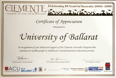
Certificate, Clemente: Celebrating 10 Years in Australia, 2013, 2013
The Clemente Australia Program enables people to embark on a transformational education journey. Federation University Australia was established on 1 January 2014. Formerly known as the University of Ballarat, its enabling legislation was the University of Ballarat Amendment (Federation University Australia) Act 2013. Although formally created as a University in 1994, the University of Ballarat has a lineage back to 1870 with the establishment of the School of Mines Ballarat, making it the third institution of higher learning to be established in Australia and the first to be established in regional Australia. On 1 January 1994, Ballarat University College became the University of Ballarat and in 1998 the University merged with three TAFE Institutes to become a dual sector institution with multiple campuses. On 1 January 2014, the University of Ballarat amalgamated with the Monash University Gippsland Campus to form Federation University Australia. The Gippsland Campus also had a long lineage dating back to 1928 with the establishment of the Yallourn Technical School which became a predecessor institution to the Gippsland College of Advanced Education formed in 1968. In 1990, it was renamed the Monash University College and in 1993 became the Gippsland Campus of Monash University. In 2016, Federation University Australia announced plans to take possession, over a two-year period, of Monash’s Berwick Campus in the south-east corridor of Melbourne. Federation University Australia, or FedUni, is headquartered in Ballarat and offers programs in Higher Education and Vocational Education and Training to regional Victoria and beyond. The University’s commitment to educational and social equity, teaching excellence, research distinction, environmental sustainability and regional capacity building has enabled it to develop in a way that draws on its proud heritage to inform its future. Its regional character sets a framework for the University’s priorities but does not constrain it from serving wider community interests, nationally and internationally. The name Federation University Australia was chosen to convey the scope and capacity of an expanded regional university with a federated network of campuses.Certificate presented to the University in recognition for their support of the Clemente Australia Program. The certificate is signed by Peter Howard (National Leader, Clemente Australia); Ann Gervasoni (Chair, Ballarat Clemente Steering Committee and Letitia Medwell (ACU Program Co-ordinator)clemente australia, anniversary, university of ballarat, letitia medwell, peter howard, ann gervasoni, john mcdonald -
Federation University Historical Collection
Invitation, Invitation to the Opening of the Ballarat School of Mines Museum, 1982, 03/1982
Federation University Australia was established on 1 January 2014. Formerly known as the University of Ballarat, its enabling legislation was the University of Ballarat Amendment (Federation University Australia) Act 2013. Although formally created as a University in 1994, the University of Ballarat has a lineage back to 1870 with the establishment of the School of Mines Ballarat, making it the third institution of higher learning to be established in Australia and the first to be established in regional Australia. On 1 January 1994, Ballarat University College became the University of Ballarat and in 1998 the University merged with three TAFE Institutes to become a dual sector institution with multiple campuses. On 1 January 2014, the University of Ballarat amalgamated with the Monash University Gippsland Campus to form Federation University Australia. The Gippsland Campus also had a long lineage dating back to 1928 with the establishment of the Yallourn Technical School which became a predecessor institution to the Gippsland College of Advanced Education formed in 1968. In 1990, it was renamed the Monash University College and in 1993 became the Gippsland Campus of Monash University. In 2016, Federation University Australia announced plans to take possession, over a two-year period, of Monash’s Berwick Campus in the south-east corridor of Melbourne. Federation University Australia, or FedUni, is headquartered in Ballarat and offers programs in Higher Education and Vocational Education and Training to regional Victoria and beyond. The University’s commitment to educational and social equity, teaching excellence, research distinction, environmental sustainability and regional capacity building has enabled it to develop in a way that draws on its proud heritage to inform its future. Its regional character sets a framework for the University’s priorities but does not constrain it from serving wider community interests, nationally and internationally. The name Federation University Australia was chosen to convey the scope and capacity of an expanded regional university with a federated network of campuses.Cream folded card invitation with an image of the Former Ballarat Circuit Court on the front. This building was used as the first Ballarat School of Mines when it first opened in 1870.ballarat school of mines, ballarat school of mines museum, g.h. beanland, museum reopening -
 Federation University Historical Collection
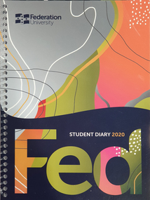
Booklet - Diary, University of Ballarat / Federation University Student Diaries, 2004-2020
Federation University Australia was established on 1 January 2014. Formerly known as the University of Ballarat, its enabling legislation was the University of Ballarat Amendment (Federation University Australia) Act 2013. Although formally created as a University in 1994, the University of Ballarat has a lineage back to 1870 with the establishment of the School of Mines Ballarat, making it the third institution of higher learning to be established in Australia and the first to be established in regional Australia. On 1 January 1994, Ballarat University College became the University of Ballarat and in 1998 the University merged with three TAFE Institutes to become a dual sector institution with multiple campuses. On 1 January 2014, the University of Ballarat amalgamated with the Monash University Gippsland Campus to form Federation University Australia. The Gippsland Campus also had a long lineage dating back to 1928 with the establishment of the Yallourn Technical School which became a predecessor institution to the Gippsland College of Advanced Education formed in 1968. In 1990, it was renamed the Monash University College and in 1993 became the Gippsland Campus of Monash University. In 2016, Federation University Australia announced plans to take possession, over a two-year period, of Monash’s Berwick Campus in the south-east corridor of Melbourne. Federation University Australia, or FedUni, is headquartered in Ballarat and offers programs in Higher Education and Vocational Education and Training to regional Victoria and beyond. The University’s commitment to educational and social equity, teaching excellence, research distinction, environmental sustainability and regional capacity building has enabled it to develop in a way that draws on its proud heritage to inform its future. Its regional character sets a framework for the University’s priorities but does not constrain it from serving wider community interests, nationally and internationally. The name Federation University Australia was chosen to convey the scope and capacity of an expanded regional university with a federated network of campuses..1) University of Ballarat TAFE Student Association Diary 2006 .2) University of Ballarat Student Association Diary 2006 .3) University of Ballarat TAFE Student Association Diary 2007 .4) University of Ballarat Student Association Diary 2007 .5) University of Ballarat TAFE Student Association Diary 2008 .6) University of Ballarat Student Association Diary 2008 .7) University of Ballarat TAFE Student Association Diary 2008 .8) University of Ballarat TAFE Student Association Diary 2008 .9) University of Ballarat Student Association Diary 2009 .10) University of Ballarat Diary 2012 .11) University of Ballarat Diary 2013 .12) Federation University Diary 2014 .13) Federation University Diary 2015 .14) Federation University Diary 2018university of ballarat, federation university, diary, students association, david battersby, helen bartlett, student association, student union, kerry cox, levi laurie, student senate -
Federation University Historical Collection
Report, Goldfields Regional Tourism Development Plan, 1997, 1997
White bound report with clear covergoldfields of victoria, goldfields tourism, marketing, tourism, road transport, rail transportair transport, aboriginal cultural heritage, tourism victoria, ballarat, maryborough, bendigo, maldon, clunes, creswick, dunolly, ararat, avoca, stawell, st arnaud, daylesford, goldfields railway, statistics, volcanos, castlemaine, talbot, wedderburn, sovereign hill, bendigo joss house, great westerngoldfields touring route, freat southern touring route, ballarat trams, eureka centre, ballarat east engine sheds, port phillip mine, clunes, bendigo gasworks, bendigo cathedral, central deborah mine, victoria hill mine, the great stupa of australia, diggings trail, castlemaine market, castlemaine-maldon tourist railway -
Federation University Historical Collection
Report, Goldfields Regional Tourism Development Plan, c1997, 1997
White bound report with clear cover and black plastic ring bindinggoldfields of victoria, goldfields tourism, marketing, tourism, road transport, rail transportair transport, aboriginal cultural heritage, tourism victoria, surveys, applied tourism business project -
Federation University Historical Collection
Book, Jacobs Lewis Vines Architects and Conservation Planners, Historic Sites Survey: Ballarat Study Area, 1980, 1980
This survey was commissioned by the Land Conservation Council, Australian Heritage Commission and the Ministry for Conservation 114 page report on historic sites in the Ballarat region. It includes information on sites, a schexdule of sites, silte selection and designated areas (ie around towns)historic sites, ballarat, wendy jacobs, miles lewis, gary vines, berringa, buninyong, creswick, dunnstown, fiery creek, lal lal, langi logan, cathcart, mount cole, mount egerton, nerrina, gong gong, wombat state forest, railways, explorers routes, early roads, land conservation council, ausralian hertiage commission, department of planning, icomos (burra) charter, nigel lewis, richard aitken, freehold land, public land, langi ghiran, new jubille mine, birthday tunnel mine, pitfield plains, smythesdale, buninyong company, mount clear, mt clear, canadian gully, warrenheip distillery, thomas mitchell, waterloo, trawalla, beaufort, raglan, internment camps, forestry, mining, mining, mt egerton, mary hollick collection, jubilee mine, burra charter, historica areas data form, explorers, egerton company, black horse mine, mt egerton government battery, kaolin mines, anderson brothers, barkstead, anderson's tramway, clarkesdale, berry leads, birthday tunnel mine berringa, warrenheip, australasian company, mount mercer, lanvi-kal-kal, water race -
Federation University Historical Collection
Booklet, Wendy Morris, A Guide to Maldon, 1983, 1983
Soft covered booklet featuring an aerial view of the town of Maldon on the cover. heritage, tourism, maldon, mining, streetscape, townscape, gardens, quartz reef mining, geology, maldon goldmines, maldon hospital, kangaroo hotel, architecture, conservation and planning, cast iron, forests, mount tarrangower, nuggetty ranges, beehive -
Federation University Historical Collection
Booklet, Buninyong Heritage Walks and other Interesting Cycle Rides and Scenic Drives, 2008
Blue soft covered book, with maps, plans and photographs relating to Buninyong, Victoria. buninyong, de soza park, buninyong tannery, buninyong railway station, eagle hotel, old buninyong library, hastie's hill, buninyong town hall, hastie's spring, crown hotel, buninyong post office, bowen tree, aborigines, buninyong primary school, buninyong cemetery, gold monument, mount buninyong, lal lal falls -
Federation University Historical Collection
Document, Federation University Organisational Chart, 2018, 2018
Federation University Australia was established on 1 January 2014. Formerly known as the University of Ballarat, its enabling legislation was the University of Ballarat Amendment (Federation University Australia) Act 2013. Although formally created as a University in 1994, the University of Ballarat has a lineage back to 1870 with the establishment of the School of Mines Ballarat, making it the third institution of higher learning to be established in Australia and the first to be established in regional Australia. On 1 January 1994, Ballarat University College became the University of Ballarat and in 1998 the University merged with three TAFE Institutes to become a dual sector institution with multiple campuses. On 1 January 2014, the University of Ballarat amalgamated with the Monash University Gippsland Campus to form Federation University Australia. The Gippsland Campus also had a long lineage dating back to 1928 with the establishment of the Yallourn Technical School which became a predecessor institution to the Gippsland College of Advanced Education formed in 1968. In 1990, it was renamed the Monash University College and in 1993 became the Gippsland Campus of Monash University. In 2016, Federation University Australia announced plans to take possession, over a two-year period, of Monash’s Berwick Campus in the south-east corridor of Melbourne. Federation University Australia, or FedUni, is headquartered in Ballarat and offers programs in Higher Education and Vocational Education and Training to regional Victoria and beyond. The University’s commitment to educational and social equity, teaching excellence, research distinction, environmental sustainability and regional capacity building has enabled it to develop in a way that draws on its proud heritage to inform its future. Its regional character sets a framework for the University’s priorities but does not constrain it from serving wider community interests, nationally and internationally. The name Federation University Australia was chosen to convey the scope and capacity of an expanded regional university with a federated network of campuses.A pdf of an organisational chart for Federation Universityfederation university organisational chart, federation university -
 Federation University Historical Collection
Photograph, Clare Gervasoni, Naming of Gnarrwirring Karung (Learning Place), Federation University Mt Helen Campus, 2018, 22/06/2018
Federation University Australia’s Student Commons Area at the Mt Helen Campus was the first FedUni building to be officially given an Aboriginal name, Gnarrwirring Karung. Meaning Learning Place in the local Wadawurrung language, the re-named centre (pronounced Narrowing Ker Ung) will provide recognition of the area’s cultural heritage and increase the vibrancy, diversity and rich culture throughout the campus. The re-naming ceremony was held at the Gnarrwirring Karung Student Commons Area, S Building, Mt Helen Campus. “The choice of name follows an extensive process of seeking suggestions from the student body, the University’s Aboriginal Education Centre and local Aboriginal custodians,” Geoff Lord, Chairman of the University’s Reconciliation Action Plan (RAP) Committee, said. “The official naming meets many elements recognised within the FedUni RAP such as enhancing community, embedding culture, providing opportunity and, most importantly, respect. “The ceremony is a fine example of putting Aboriginal culture at the centre of our daily lives.” Jasmine Graham, Manager of the Aboriginal Education Centre, said the re-naming was a milestone for the local Aboriginal community. “The University is committed to greater recognition of Aboriginal heritage and culture throughout all of its campuses,” Ms Graham said. “Gnarrwirring Karung will be an impressive landmark throughout the Mt Helen Campus and a welcoming learning place.” A number of photographs taken at the naming of a Federation University space in the Mt Helen Campus 'S' Building. The space has been named Gnarrwirring Karung, Waddawurrung for Learning Place. waddawurrung, gnarrwirring karung, aboriginal, mt helen campus, jasmine graham, helen bartlett, reconciliation action plan, university women -
 Federation University Historical Collection
Photograph, Federation University Centre for Gippsland Studies, 2016, 12/05/2016
Federation University Australia was established on 1 January 2014. Formerly known as the University of Ballarat, its enabling legislation was the University of Ballarat Amendment (Federation University Australia) Act 2013. On 1 January 2014, the University of Ballarat amalgamated with the Monash University Gippsland Campus to form Federation University Australia. The Gippsland Campus also had a long lineage dating back to 1928 with the establishment of the Yallourn Technical School which became a predecessor institution to the Gippsland College of Advanced Education formed in 1968. In 1990, it was renamed the Monash University College and in 1993 became the Gippsland Campus of Monash University. In 2016, Federation University Australia announced plans to take possession, over a two-year period, of Monash’s Berwick Campus in the south-east corridor of Melbourne. Federation University Australia, or FedUni, is headquartered in Ballarat and offers programs in Higher Education and Vocational Education and Training to regional Victoria and beyond. The University’s commitment to educational and social equity, teaching excellence, research distinction, environmental sustainability and regional capacity building has enabled it to develop in a way that draws on its proud heritage to inform its future. Its regional character sets a framework for the University’s priorities but does not constrain it from serving wider community interests, nationally and internationally. The name Federation University Australia was chosen to convey the scope and capacity of an expanded regional university with a federated network of campuses. Photographs of the Centre for Gippsland Studies located at the Churchill campus of Federation University.centre for gippsland studies, churchill campus, gippsland campus, grsc, gippsland campus collection -
Federation University Historical Collection
Transparency, University of Ballarat Mace, c1994
Federation University Australia was established on 1 January 2014. Formerly known as the University of Ballarat, its enabling legislation was the University of Ballarat Amendment (Federation University Australia) Act 2013. Although formally created as a University in 1994, the University of Ballarat has a lineage back to 1870 with the establishment of the School of Mines Ballarat, making it the third institution of higher learning to be established in Australia and the first to be established in regional Australia. On 1 January 1994, Ballarat University College became the University of Ballarat and in 1998 the University merged with three TAFE Institutes to become a dual sector institution with multiple campuses. On 1 January 2014, the University of Ballarat amalgamated with the Monash University Gippsland Campus to form Federation University Australia. The Gippsland Campus also had a long lineage dating back to 1928 with the establishment of the Yallourn Technical School which became a predecessor institution to the Gippsland College of Advanced Education formed in 1968. In 1990, it was renamed the Monash University College and in 1993 became the Gippsland Campus of Monash University. In 2016, Federation University Australia announced plans to take possession, over a two-year period, of Monash’s Berwick Campus in the south-east corridor of Melbourne. Federation University Australia, or FedUni, is headquartered in Ballarat and offers programs in Higher Education and Vocational Education and Training to regional Victoria and beyond. The University’s commitment to educational and social equity, teaching excellence, research distinction, environmental sustainability and regional capacity building has enabled it to develop in a way that draws on its proud heritage to inform its future. Its regional character sets a framework for the University’s priorities but does not constrain it from serving wider community interests, nationally and internationally. The name Federation University Australia was chosen to convey the scope and capacity of an expanded regional university with a federated network of campuses.Transparency for the Univesity of Ballarat Mace by Trefor Prestuniversity of ballarat, mace, trefor prest, graduation, federation university -
 Federation University Historical Collection
Photograph, Clare Gervasoni, Gnarrwirring Karung (Learning Place), Federation University Mt Helen Campus, 2018, 22/06/2018
Federation University Australia’s Student Commons Area at the Mt Helen Campus was the first FedUni building to be officially given an Aboriginal name, Gnarrwirring Karung. Meaning Learning Place in the local Wadawurrung language, the re-named centre (pronounced Narrowing Ker Ung) will provide recognition of the area’s cultural heritage and increase the vibrancy, diversity and rich culture throughout the campus. The re-naming ceremony was held at the Gnarrwirring Karung Student Commons Area, S Building, Mt Helen Campus. “The choice of name follows an extensive process of seeking suggestions from the student body, the University’s Aboriginal Education Centre and local Aboriginal custodians,” Geoff Lord, Chairman of the University’s Reconciliation Action Plan (RAP) Committee, said. “The official naming meets many elements recognised within the FedUni RAP such as enhancing community, embedding culture, providing opportunity and, most importantly, respect. “The ceremony is a fine example of putting Aboriginal culture at the centre of our daily lives.” Jasmine Graham, Manager of the Aboriginal Education Centre, said the re-naming was a milestone for the local Aboriginal community. “The University is committed to greater recognition of Aboriginal heritage and culture throughout all of its campuses,” Ms Graham said. “Gnarrwirring Karung will be an impressive landmark throughout the Mt Helen Campus and a welcoming learning place.” A number of photographs taken at the naming of a Federation University space in the Mt Helen Campus 'S' Building. The space has been named Gnarrwirring Karung, Waddawurrung for Learning Place. waddawurrung, gnarrwirring karung, aboriginal, mt helen campus, reconciliation action plan, s building, waddawurrung language, place names -
 City of Moorabbin Historical Society (Operating the Box Cottage Museum)
Book, Hutchinson, Garrie, Remember them : a guide to Victoria's wartime heritage, 2007
""Remember them" has been funded by the Government of Victoria, and produced by the Veteran's Unit, Department of Planning and Community Development."--Title page verso.308 p. : ill. (some col.), maps ; non-fiction""Remember them" has been funded by the Government of Victoria, and produced by the Veteran's Unit, Department of Planning and Community Development."--Title page verso.war memorials, soldier monuments, soldiers, world war one, world war two, korean war, vietnam war, south african war, monuments -
 Bendigo Historical Society Inc.
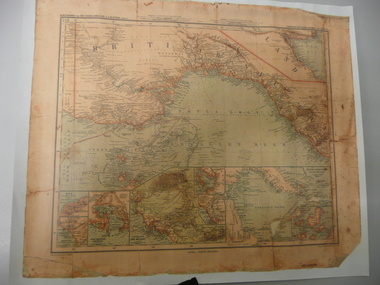
Map - STRAUCH COLLECTION: MAP BRITISCH PAPUA
Copy of original heritage map of ''Britisch Papua'' (N.G.) detailed & mapped by German (marine navigator) 'Gezeichnet von C.Barich & produced in the 'Langhans Deutscher Kolontal Atlas, Feb. 1893. Presented to German Society, 30.5.2008 by Mr P.Thwaites, Plans & Projects Officer (Digo 2008) Plus Society's laminated work copy of same map.map -
 Bendigo Historical Society Inc.
Document - CENTRAL GOLDFIELDS RESTORATION FUND
A document titled ' Central Goldfields Restoration fund.' Ministry for Planning and Environment. A Commonwealth/State Bicentennial Project. 1988.bendigo, planning, goldfields, central goldfields, document, restoration fund, bendigo, history, bendigo history, heritage, bendigo heritage, central goldfields, place, gold, victoria, australian bicentenery