Historical information
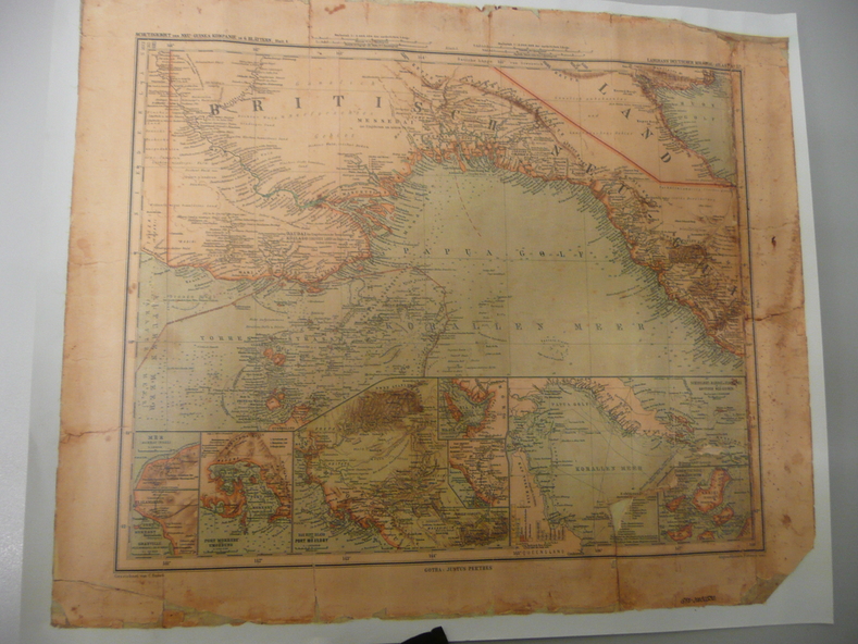
This map was one of the Langhans Deutscher Kolontal Atlas produced between 1893 and 1897. This atlas was the only complete set of maps of all German Protectorates. "Gezeichnet" mean drawn by.
Physical description
Copy of original heritage map of ''Britisch Papua'' (N.G.) detailed & mapped by German (marine navigator) 'Gezeichnet von C.Barich & produced in the 'Langhans Deutscher Kolontal Atlas, Feb. 1893. Presented to German Society, 30.5.2008 by Mr P.Thwaites, Plans & Projects Officer (Digo 2008) Plus Society's laminated work copy of same map.