Showing 3201 items
matching road map
-
 Lorne Historical Society
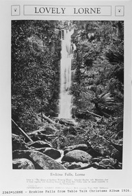
Pamphlet - Tourist Brochure, Lovely Lorne
... map of the roads, tracks and beauty spots. Inside the first... sketch tourist map of the roads, tracks and beauty spots. Inside ...The Victorian Railways promoted tourist destinations around Victoria. A folded paper tourist brochure about Lorne The front cover is a coloured painting of Lorne from above the Erskine River towards the main beach. , on the back is a black and white sketch tourist map of the roads, tracks and beauty spots. Inside the first fold are 6 black and white photographs, Cumberland River, Mt St George, Phantom Falls, Cumberland Cliffs, Teddy’s Lookout, leafy walk towards the pier. Inside contains written descriptions of the highlights of Lorne and six black and white photographs, four general views of Lorne, Lover’s Walk, Erskine Falls . souvenirs, victorian railways, publicity -
 Lorne Historical Society
Map, F W Niven Lithos, The Mountjoy Lorne Estate, 1889
In 1888 a company was formed to acquire and subdivide the land of the Mountjoy Brothers. The land totaled 197 acres and included Erskine House. The land colored red was that of the Mountjoys. The subdivision map was printed in 1889A paper map of the Mountjoy Estate Lorne , showing allotments, with their owners, and naming land use. It has four black and white line drawings , Erskine House, Mountain View’s, the Rapids, Erskine House sea view and Erskine Falls. The map is largely black and white with red and blue colouring. The map is mstuck to brown paper. lorne, subdivision map, erskine house, mountjoy brothers, -
 Lorne Historical Society
Map - Subdivision Map, J Batten Lithos, Plan of West Lorne Loutitt Bay Allotments IV and V
One of the early subdivision maps of Lorne.Black and white printed map on cream paper. The map shows allotments from the Erskine River to the Grand Pacific with an inset of allotments between Smith and Otway Streets. Allotments have the owners names.. The sea baths, Cobb and Co stables , Mountjoys Hotel, the Church of England, the telegraph line to Geelong and the jetty are also marked.lorne, subdivisions, -
Lorne Historical Society
Pamphlet - Tourist pamphlet Lorne, Lorne Victoria Australia
Victorian Railways printed a series of brochures publicizing holiday destinations.A folded paper souvenir pamphlet. The cover is a colored picture of Lorne from Scotsman’s Hill with two bathing suited young women in the foreground, and a blurb extolling the virtues of Lorne. On the back is a red, yellow and blue map of Lorne and district. Inside are eight black and white photographs of Lorne attractions,; the Main Street, tennis courts, Erskine River, walking tracks and the George River with the phrase ,” The resort that embraces everything for the perfect holiday.”souvenirs, pamphlets, victorian railways, -
 Koroit & District Historical Society
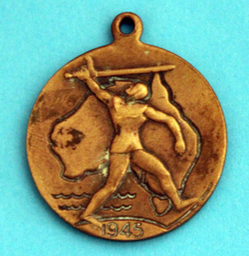
WWII school peace memorial 1945, Front with map of Australia, 1945
wwii, school, peace, medal, world war two -
 Koroit & District Historical Society
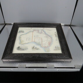
Framed Map of Australia
... Street Koroit great-ocean-road Framed Map of Australia ... -
 Mission to Seafarers Victoria
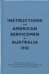
Book - Pocket book, Special Service Devision, Service of Supply, United States Army, Instructions for American Servicemen in Australia 1942, 2007
In 1942, the United States issued Instructions for American Servicemen in Australia as a quick guide to Australia's people, politics, history and culture for Americans stationed there during the Second World War. It was one of several similar sets of instructions put together by the US government to help its soldiers, sailors and airmen adjust to life abroad.Pocket size book of blue colour ix, [54] p. : ill., mapsnon-fictionIn 1942, the United States issued Instructions for American Servicemen in Australia as a quick guide to Australia's people, politics, history and culture for Americans stationed there during the Second World War. It was one of several similar sets of instructions put together by the US government to help its soldiers, sailors and airmen adjust to life abroad. 1942, american soldiers, australia -
 Phillip Island and District Historical Society Inc.
Photograph, Bryant West
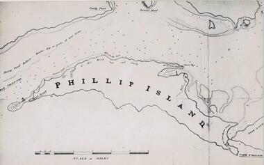
One of a collection of over 400 photographs in an album commenced in 1960 and presented to the Phillip Island & Westernport Historical Society by the Shire of Phillip IslandPhotograph of a Map of Phillip Island. The first to show Fort Dumaresq, track to beach and beginning of road to South coast. local history, photography, photographs, exploration, maritime, documents, maps, phillip island, john jenner, bryant west -
 Mission to Seafarers Victoria
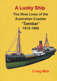
Book, Nautical Association of Australia Inc, A Lucky Ship – Nine Lives of Australian Coaster Tambar 1912-1960, 2013
This high-quality book is the extraordinary story of an ordinary little ship that had a long and eventful life. Perhaps few Australian coasters have had a more interesting and varied history. Built in Scotland in 1912 for the North Coast Steam Navigation Company, Tambar worked as a lifeline to isolated river and island communities, first in New South Wales, then for the Tasmanian Government and Holymans in Bass Strait (King Island) and as the last steamer serving the Gippsland Lakes. In between she even spent a few years in Papua New Guinea. When World War II broke out, Tambar was commissioned into the RAN as an auxiliary minesweeper, but after the terrible Darwin air raid in 1942 became the first vessel of the newly formed Salvage Board, later assisting in the search for survivors of the Battle of the Coral Sea. Returning to Bass Strait in 1944 for a few more years, she then spent the 1950s on standby as a salvage vessel in Melbourne, working on Merilyn, Terawhiti, E.J. Fairnie, and River Burnett. Craig Mair grew up in Grangemouth, Scotland where Tambar was built, and became interested after inheriting a builder's model from his father. He has consulted thousands of records, including the ship's logs, tracked down witnesses, and assembled over 100 photographs and maps to give a unique insight into Tambar's story, and coastal Australia in the middle decades of the twentieth century, before roads took over the transport task. Besides many colourful stories of shipwrecks and strandings, strange cargoes, salty characters, exotic places, wartime air raids, and salvage jobs, the book includes a definitive account of the worst Second World War 'friendly fire' incident in Australian waters in Moreton Bay in 1942.250 pages, Appendices, Bibliography and Indices, extensively illustratednon-fictionThis high-quality book is the extraordinary story of an ordinary little ship that had a long and eventful life. Perhaps few Australian coasters have had a more interesting and varied history. Built in Scotland in 1912 for the North Coast Steam Navigation Company, Tambar worked as a lifeline to isolated river and island communities, first in New South Wales, then for the Tasmanian Government and Holymans in Bass Strait (King Island) and as the last steamer serving the Gippsland Lakes. In between she even spent a few years in Papua New Guinea. When World War II broke out, Tambar was commissioned into the RAN as an auxiliary minesweeper, but after the terrible Darwin air raid in 1942 became the first vessel of the newly formed Salvage Board, later assisting in the search for survivors of the Battle of the Coral Sea. Returning to Bass Strait in 1944 for a few more years, she then spent the 1950s on standby as a salvage vessel in Melbourne, working on Merilyn, Terawhiti, E.J. Fairnie, and River Burnett. Craig Mair grew up in Grangemouth, Scotland where Tambar was built, and became interested after inheriting a builder's model from his father. He has consulted thousands of records, including the ship's logs, tracked down witnesses, and assembled over 100 photographs and maps to give a unique insight into Tambar's story, and coastal Australia in the middle decades of the twentieth century, before roads took over the transport task. Besides many colourful stories of shipwrecks and strandings, strange cargoes, salty characters, exotic places, wartime air raids, and salvage jobs, the book includes a definitive account of the worst Second World War 'friendly fire' incident in Australian waters in Moreton Bay in 1942.naa, australian national line, interest group, moreton bay, tambar, coaster, ships -
 Greensborough Historical Society
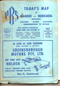
Map, To-day's Map of Ivanhoe - Heidelberg; including Rosanna, McLeod, Watsonia, Greensborough to Eltham, 1937-1953
Map of the suburbs of Ivanhoe, Heidelberg, Rosanna, Macleod, Watsonia, Greensborough and Eltham. Dates to mid 1950s. An Advertiser on this map may be found in the Hurstbridge Advertiser Friday 17 December 1937, page 7: "Lyon Bros, of Eltham garage, suggest in their advertisement on the front page of this issue. that motorists should have their cars checked over by them before Christmas, so that any 5mall defects which might militate against the pleasure of the trip, might be remedied." As does "The Montsalvat Plant Farm" in The Age of Saturday 5 September 1953, page 48.Shows early streets and open space in these areas.Fold out map in pale blue cover. Cover dimensions: 21.5x15cm. Map is surrounded by advertising for local businesses.ivanhoe, maps, heidelberg, rosanna, macleod, watsonia, greensborough, eltham -
 Greensborough Historical Society
Book, Angus & Robertson Ltd, Official History of Australia in the War of 1914-18; by C. E. W. Bean. 8th edition, 1938_
The official history of Australia in WW1 written by C. E. W. Bean12 volumes. Hard cover, dark red binding. Maps and black and white illustrationsPresented to James Gordon Saunders Longfellow St Norman Park Q July 1950c e w bean, world war i, australia army, gallipoli -
 Greensborough Historical Society
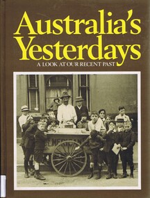
Book, Australia's yesterdays: a look at our recent past, 1974_
An illustrated history of 20th century Australia until 1978Hard cover book, 360 pages, illus (some colour), maps. Front cover: black and white illustration of boys in Sydney 1914, gathered around an ice cart.Inscribed with owner's name: Faye Isobel Fortaustralia history, australia social conditions, cyril pearl -
 Greensborough Historical Society
Folder, Aerial Imaging - Plenty River: by Ian Bryant, 2011_11
Investigates early land use along the Plenty River from north of the main aqueduct crossing in Greensborough to south of the golf course in Lower PlentyHistorical features seen from aerial and satellite images of the modern landscape may indicate earlier agricultural land usage.9 x A4 pages of text and colour annotated maps downloaded from nearmap.com.plenty river, ian bryant, lower plenty, greensborough, yallambie park, aerial photography -
 Greensborough Historical Society
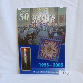
Book, Para Printing Pty Ltd, Our first 50 years: 1955-2005. St Mary's Parish Greensborough, 1955-2005
A history of St Mary's Parish Greensborough compiled to celebrate the 50th anniversary of the founding of the Parish 1955-2005.History of this Parish and those who have contributed to its development.74 pages, colour illustrations, maps. Soft cover with photograph of interior of church.Inside cover in pencil 'Bonnie Dickson', a contributor to the publication.st marys catholic church, greensborough, churches -
 Greensborough Historical Society
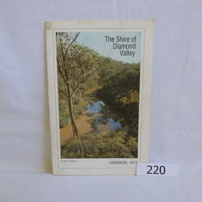
Book, Shire of Diamond Valley, The Shire of Diamond Valley Handbook 1977, 1977_
The Shire of Diamond Valley was a Local Government Area located about 20 kilometres northeast of Melbourne. The shire covered an area of 74.38 square kilometres and existed from 1964 until 1994.Annual guide to services in Shire of Diamond Valley18pages, illus (some colour), maps. Front cover photograph "Plenty Gorge".shire of diamond valley, greensborough, handbooks -
 Greensborough Historical Society
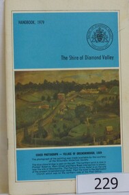
Book, The Shire of Diamond Valley Handbook 1979, 1979_
The Shire of Diamond Valley was a Local Government Area located about 20 kilometres northeast of Melbourne. The shire covered an area of 74.38 square kilometres and existed from 1964 until 1994.Annual guide to services in Shire of Diamond Valley32 pages, illus (some col.), maps. Cover illustration is a copy of the Ellis painting "Village of Greensborough 1889".shire of diamond valley, greensborough, handbooks -
 Greensborough Historical Society
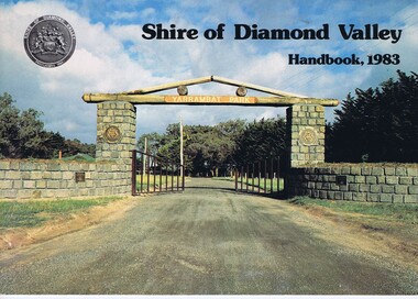
Book, Shire of Diamond Valley Handbook 1983, 1983_
Guide to services provided by Shire of Diamond Valley. The Shire of Diamond Valley was a Local Government Area located about 20 kilometres northeast of Melbourne. The shire covered an area of 74.38 square kilometres and existed from 1964 until 1994.Annual guide to services in Shire of Diamond Valley32 pages, col illus., maps. Cover illustration of the bluestone gateway, main entrance to Yarrambat Park, opened 1982.shire of diamond valley, greensborough, handbooks -
 Greensborough Historical Society
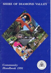
Book, Shire of Diamond Valley Community Handbook 1991, 1991_
Guide to services provided by Shire of Diamond Valley. The Shire of Diamond Valley was a Local Government Area located about 20 kilometres northeast of Melbourne. The shire covered an area of 74.38 square kilometres and existed from 1964 until 1994.Annual guide to services in Shire of Diamond Valley36 pages, col illus., maps. Front cover is a collage of scenes from Diamond Valley, back cover illustration of a copy of "Summer Panorama, Tabletop, NSW" by Max Dimmack, from the Shire of Diamond Valley Art Collection.shire of diamond valley, greensborough, handbooks -
 Greensborough Historical Society
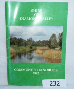
Book, Shire of Diamond Valley Community Handbook 1992, 1992_
Guide to services provided by Shire of Diamond Valley. The Shire of Diamond Valley was a Local Government Area located about 20 kilometres northeast of Melbourne. The shire covered an area of 74.38 square kilometres and existed from 1964 until 1994.Annual guide to services in Shire of Diamond Valley52 pages, col illus., maps. Cover illustration of Kalparrin Gardens Greensboroughshire of diamond valley, greensborough, handbooks -
 Greensborough Historical Society
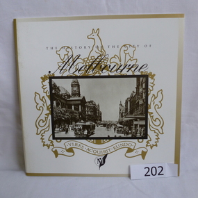
Booklet, The History of the City of Melbourne, 1997_11
The history of the Melbourne City councilHistorical notes on the foundation of Melbourne and the creation and growth of the Melbourne Cricket Club.44 page booklet, printed in black and white, illus., maps. With gold highlighting on the outer coversNilmelbourne settlement, melbourne landsales, melbourne local government, john batman, john pascoe fawkner -
 Greensborough Historical Society
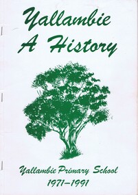
Book, Yallambie - a history; Yallambie Primary School 1971-1991, 1971-1991
20 year anniversary of Yallambie Primary School. Book also details the establishment of Yallambie as a suburb from early farms to the Simpson Barracks and A.V.Jennings estate, Yallambie Rise.A snapshot history of Yallambie.Soft cover book, 82 pages, black and white illus, maps throughout. White cover with green writing and sketch of a tree.Inside cover in pencil: Noel Withersyallambie, yallambie primary school, simpson barracks, a v jennings, yallambie rise -
 Greensborough Historical Society
Map, Keelbundora. Counties of Bourke and Evelyn, 1950_11
Covers area bounded by Merri Creek, Yarra River, Plenty River and Crown Portions 24 to 28, with section including Maroondah Aqueduct and Darebin Creek.Photocopy of digitised mapkeelbundora (parish) -
 Greensborough Historical Society
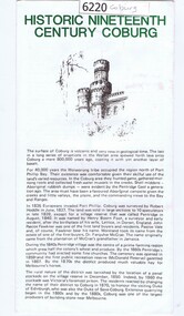
Leaflet, Coburg Historical Society, Historic nineteenth century Coburg, 1980s
A short history of 19th century Coburg, Victoria covering points of interest. Includes a map of the landmarks covered in the text. One page, printed on both sides in black and white text, drawings and photographs. Folded into 5. coburg (victoria), pentridge -
 Greensborough Historical Society
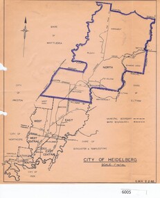
Map, City of Heidelberg, City of Heidelberg, 1962, 02/02/1962
Map of City of Heidelberg showing boundaries of its six wards; North Ward is highlighted, covering Watsonia, Greensborough, part Bundoora, St Helena, Plenty, Yarrambat and Diamond Creek.Blue print mapCity of Heidelberg Scale: 1" to 1 ml. G.M.H. 2.2.62city of heidelberg, heidelberg - maps -
 Greensborough Historical Society
Map, Banyule City Council, MMBW, 1:2500 Series. City of Banyule. Master overlay, 1994_
This master overlay is the key to the Melbourne and Metropolitan Board of Works maps: MMBW, 1:2500 Series. The overlay was made by the City of Banyule using the Melways base plan (Edition 23, 1994-95). This overlay can be used to position maps in this series.Laminated map, with overlay of MMBW map grid.mmbw, melbourne and metropolitan board of works, banyule city council -
 Greensborough Historical Society
Map, Melbourne and Metropolitan Board of Works. Survey Division, MMBW, Yarra 2500 / 13.21. Central Greensborough, 1979_05
Melbourne and Metropolitan Board of Works. Yarra 2500 [base map]. 13-21, Parishes of Keelbundora 2856 and Nillumbik 3310, Municipality of Diamond Valley 257. Shows street names, easement sizes, lot numbers, lodged plan numbers, names of prominent features, contour values, creek or river names. Central Greensborough. Prominent streets: Main Street, Para Road, St Helena Road and Diamond Creek Road.MMBW Map in 1:2500 [scale] series. Cream parchment with green tape reinforcing on edges and punched holes on left edge.mmbw, melbourne and metropolitan board of works, shire of diamond valley, greensborough - maps -
 Greensborough Historical Society
Map, Melbourne and Metropolitan Board of Works. Survey Division, MMBW, Yarra 2500 / 12.20. Watsonia Railway Station and environs, 1983_03
Melbourne and Metropolitan Board of Works. Yarra 2500 [base map]. 12-20, Parishes of Keelbundora 2856, Municipalities of Diamond Valley 257 and 228. Shows street names, easement sizes, lot numbers, lodged plan numbers, names of prominent features, contour values, creek or river names. Watsonia Railway Station and environs. Prominent streets: Watsonia Road, Elder Street, Morwell Avenue and Nepean Street. Includes former Watsonia Technical School and Gresswell Rehabilitation Centre sites.MMBW Map in 1:2500 [scale] series. Cream parchment with green tape reinforcing on edges and punched holes on left edge.mmbw, melbourne and metropolitan board of works, shire of diamond valley, watsonia - maps -
 Greensborough Historical Society
Map, Melbourne and Metropolitan Board of Works. Survey Division, MMBW, Yarra 2500 / 12.19. Watsonia, Simpson Army Barracks, 1983_03
Melbourne and Metropolitan Board of Works. Yarra 2500 [base map]. 12-19, Parish of Keelbundora 2856, Municipalities of Diamond Valley 257 and 228. Shows street names, easement sizes, lot numbers, lodged plan numbers, names of prominent features, contour values, creek or river names. Watsonia Barracks (Simpson Army Barracks) and environs. Prominent streets: Yallambie Road, Greensborough Road, and Strathallan Road. MMBW Map in 1:2500 [scale] series. Cream parchment with green tape reinforcing on edges and punched holes on left edge.mmbw, melbourne and metropolitan board of works, shire of diamond valley, watsonia - maps -
 Greensborough Historical Society
Map, Melbourne and Metropolitan Board of Works. Survey Division, MMBW, Yarra 2500 / 12.22. Watsonia North, 1978_03
Melbourne and Metropolitan Board of Works. Yarra 2500 [base map]. 12-22, Parishes of Keelbundora 2856, Municipalities of Whittlesea 239 and Diamond Valley 257. Shows street names, easement sizes, lot numbers, lodged plan numbers, names of prominent features, contour values, creek or river names. Watsonia Railway Station and environs. Prominent streets: Edmund Rice Parade and Macorna Street. Includes Christian Brothers Edmund Rice College and Janefield Special School sites and "proposed future freeway" (now Metropolitan Ring Road).MMBW Map in 1:2500 [scale] series. Cream parchment with green tape reinforcing on edges and punched holes on left edge.mmbw, melbourne and metropolitan board of works, shire of diamond valley, watsonia - maps, bundoora - maps -
 Greensborough Historical Society
Map, Melbourne and Metropolitan Board of Works. Survey Division, MMBW, Yarra 2500 / 12.21. Watsonia North, 1979_02
Melbourne and Metropolitan Board of Works. Yarra 2500 [base map]. 12-22, Parish of Keelbundora 2856, Municipality of Diamond Valley 257. Shows street names, easement sizes, lot numbers, lodged plan numbers, names of prominent features, contour values, creek or river names. Watsonia Railway Station and environs. Prominent streets: Grimshaw Street, William Street and Macorna Street. Includes former Institute of Social Welfare (now Loyola College) Lines Reserve and Binnak Park.MMBW Map in 1:2500 [scale] series. Cream parchment with green tape reinforcing on edges and punched holes on left edge.mmbw, melbourne and metropolitan board of works, shire of diamond valley, watsonia - maps, bundoora - maps