Showing 1870 items matching "the crescent"
-
 Eltham District Historical Society Inc
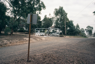
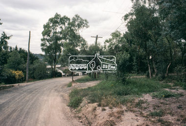
Slide, Belmont Crescent, Montmorency, c. Mar. 1981
One of a series of images of road infrastructure focussed on Belmont Crescent in Montmorency taken by Eltham Shire Council Planning and Engineering officers. They provide perspective of the changes in housing styles and road development that began sweeping in from the mid 1970s with increasing urbanisation of what was once more outlying suburbs and regions. All images have been identified with GPS35 mm colour positive transparency (1 of 8) Mount - Kodak Kodachrome CardProcessed Mar 1981infrastructure, montmorency, roads, belmont crescent, grand boulevard -
 Mt Dandenong & District Historical Society Inc.
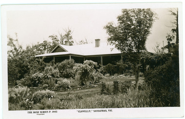
Photograph, Clovelly, c1920s
Clovelly Guest House was formerly Braco Park Guest House, owned and run by Eliza and Grace Murdoch. The original Guest House 'Clovelly' , owned by Mrs. Techow, was situated in The Crescent at Sassafras. After it burned down in 1921, Mrs. Techow purchased Braco Park and renamed it Clovelly. The site was purchased by the Education Department c1985 and is now Sherbrooke Community School. B & W Rose Series Postcard showing Front/Side view of Clovelly Guest House (formerly Braco Park) in Sassafras.The Rose Series P. 3942. "CLOVELLY" SASSAFRAS, VICclovelly, techow, murdoch, braco park, sherbrooke community school, guest house -
 Surrey Hills Historical Society Collection
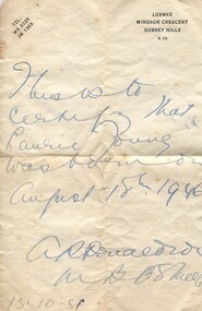
Work on paper - Certificate, Certificate re birth of Laurie Young, 15 October 1951
Dr Agnes Donaldson practised as a GP at 'Luxmee' in Windsor Crescent, Surrey Hills along with her sister, Dr Roberta Donaldson. The practice was originally in Blackburn Street commencing in the early 1920s. It moved to 'Luxmee' where Dr Navroji (Neville) Gandevia had previously practised. Their father had been a doctor at Linton, near Skipton and their brother was a doctor in Skipton. A one page note written on cream paper in blue ink."This is to / certify that / Laurie Young / was born on / August 18th 1946 / A R Donaldson / MB BS Melb / 15.10.51"laurie young, 'luxmee', windsor crescent, dr agnes donaldson, certificate -
 Surrey Hills Historical Society Collection
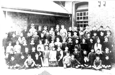
Photograph, Surrey Hills Primary School class photo, Grade 4, 1918, 1918
Ronald Keith Falconer - born 1908 in Surrey Hills; died 1983 in Surrey Hills. Son of Patrick Henry Falconer and Emily Victoria Aird. The family lived at 15 Albert Crescent (demolished) from c 1916 until the 1950s, thereafter at 33 Weybridge Street,Surrey Hills. From the dates it can be assumed that Ronald is one of the pupils in this photo.Class of 71 children ( 53 male and 18 female children) of Surrey Hills Primary School taken outside the school against a brick wall.schools, surrey hills primary school, education, primary education, children, ronald falconer -
 Vision Australia
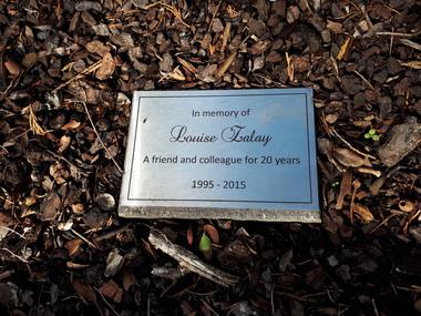
Plaque - Object, Louise Zalay plaque
Located in the garden at Kooyong, at the intersection of the path to Talbot Crescent and the path leading to the Club house, this plaque marks the contribution of Louise Zalay. Louise worked in the library area and was a familiar figure at Kooyong until her unexpected death in 2015. This plaque was unveiled by CEO Ron Hooten, with Louise's parents and many of her colleagues in attendance, and was accompanied with the planting of a rose bush.Metal plaque with inscription embedded in garden bed.In memory of Louise Zalay A friend and colleague for 20 years 1995-2015vision australia, nameplates -
 National Vietnam Veterans Museum (NVVM)
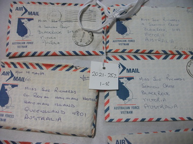
Letter
These items contribute to an understanding of the experience of those who served during the conflict in Vietnam. A collection of 8 Air Mail letters in Australian Force Vietnam envelopes. Front: Miss Sue Richards/9 Seaview Crescent/Blackrock. 3193/VICTORIA/AUSTRALIA. Back Number 2788764/Name L/CPL R.J.Jeffrey/Unit DET 17 CONST SQN RAE/AFPO 4, S.V.N GPO SYDNEY/ N S W/AUSTRALIAletters, l/cpl rj jeffrey, 2788764, australian army, vietnam, sue richards -
 Bendigo Historical Society Inc.
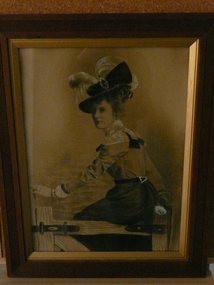
Photograph - MARY ELLEN DELANY (JACKSON)
Sepia & hand tinted photograph of Mary Ellen Delany, born Bendigo 1877, died Bendigo 1915. Mary married Frank Langdon Jackson 1900. Above details contained on separate square sheet pf paper. Photograph shows a female figure with large feathered hat seated on a hinged gate. On back of photo, envelope attached ' Dorothy Goodall, 8 Rassin Crescent, Callinvale, Queensland.' in brackets (grand daughter)person, individual, mary ellen delany -
 Surrey Hills Historical Society Collection
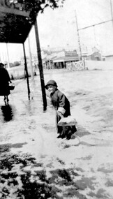
Photograph, Arthur Lyons in Union Road after a hail storm, 1924, 1924
The hail storm occurred on 2 December 1924. This is one in a series from the Lyons' photo collection. This was gifted to the SHNCHC by Arthur Frederick Lyons, son of Frederick Alphonsus (Fred) Lyons and Elizabeth Ruby Hall, who married in 1918. Fred Lyons died 4/10/1980. The Lyons’ home in Sunbury Crecent was called ‘Knopshambury’ - this was probably a misspelling of Knockshanbally in Co Kilkenny, the birth place of Fred’s father, Thomas Edmund Josias Lyons (1846-1915). Arthur was born in Surrey Hills on 12 Jun 1920. He became a motor mechanic / welder and lived at 55 Sunbury Crescent. The donation was made while he was in hospital. He died shortly afterwards (23 Sep 1990). Donation was finalised by a neighbour, Mrs Florence Ann Armitstead, wife of Glen Victor Armitstead. Glen was a local hairdresser. They moved to 11 Sunbury Crescent after their marriage in 1939. Arthur had no relatives to distribute the material to.Historically significant as it shows clearly the buildings and railway crossing in Union Road.Black and white photo of Arthur Lyons as a child with a shovel in hand taken at the cab rank near the Surrey Hills station, clearing up after a hail storm in 1924. The railway gates and overhead lines can be seen in the background. On back in pencil was "Copied 1996" and also "2/12/1924"railway crossings, hail storms, arthur lyons -
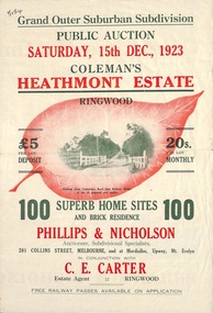 Ringwood and District Historical Society
Flyer, Land Sale Brochure, Coleman's Heathmont Estate, Ringwood, Vic. - 1923
Bi-fold advertisement for auction sale of residential sites, including photographs, map, and summary of subdivision features and local facilities. Auction date Saturday 15th December, 1923. Subsequent auction date Saturday 19th January, 1924, following previous sale stopped on account of rain. Initial newspaper advertisement (publication unknown) dated 16/11/23.Subdivision includes Bedford Road, Canterbury Road, Alvena Crescent, Leonard Street (later Royal Avenue), and Coleman Street. Agent - Phillips & Nicholson, 281 Collins Street Melbourne, (Phone) Central 10907, in conjunction with C.E. Carter, Main Street, Ringwood. Tel. Ringwood 24. -
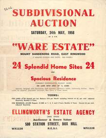 Ringwood and District Historical Society
Flyer, Subdivisional Auction Sale Brochure, Ware Estate, East Ringwood, Vic. - 1958
Folded double-sided advertisement for auction of 24 home sites and existing residence on Saturday, 24th May, 1958, including locality map, subdivision layout, terms of sale, and summary of local facilities and services. Additional plan of lots 28-33 dated 26/10/60 by Licensed Surveyor for Kirkpatrick & Webber, 225 Maroondah Highway Ringwood headed Plan of Subdivision of part of Crown Allotment 26A Parish of Ringwood.Subdivision includes Mount Dandenong Road, Ware Crescent, Davey Drive, and Grey Road (later Grey Street). Timber residence included in the subdivision was formerly Ware Kindergarten Holiday Home. (Agent) Ellingworth's Estate Agency, 580 Station Street, Box Hill - (Phone) WX1228. -
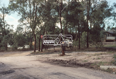
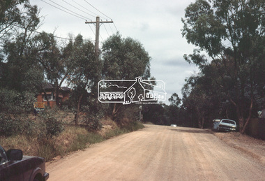
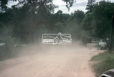
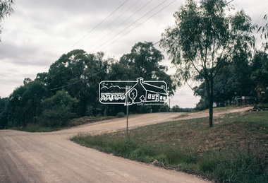
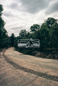
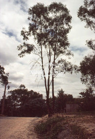
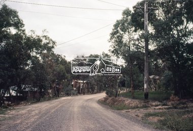
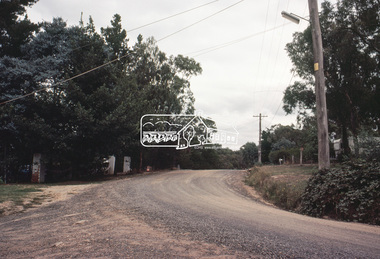
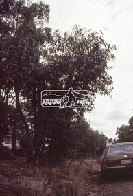
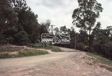
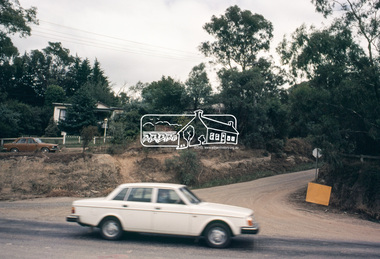
 Eltham District Historical Society Inc
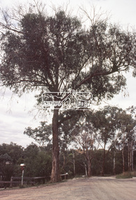
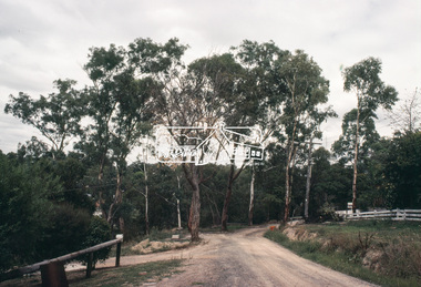
Slide, Adam Crescent, Montmorency, c. Feb. 1981
One of a series of images of road infrastructure focussed on Adam Crescent in Montmorency taken by Eltham Shire Council Planning and Engineering officers. They provide perspective of the changes in housing styles and road development that began sweeping in from the mid 1970s with increasing urbanisation of what was once more outlying suburbs and regions. All images have been identified with GPS though house numbers have changed35 mm colour positive transparency (1 of 21) Mount - Kodak Kodachrome CardProcessed Feb 1981adam crescent, infrastructure, montmorency, roads -
 Eltham District Historical Society Inc
Slide, Adam Crescent, Montmorency, c. Feb. 1981
One of a series of images of road infrastructure focussed on Adam Crescent in Montmorency taken by Eltham Shire Council Planning and Engineering officers. They provide perspective of the changes in housing styles and road development that began sweeping in from the mid 1970s with increasing urbanisation of what was once more outlying suburbs and regions. All images have been identified with GPS though house numbers have changed35 mm colour positive transparency (1 of 21) Mount - Kodak Kodachrome CardProcessed Feb 1981adam crescent, infrastructure, montmorency, roads -
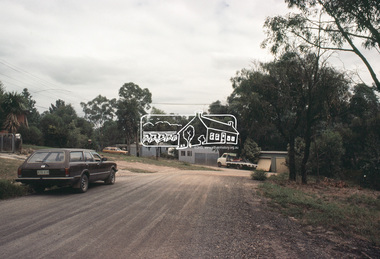
 Eltham District Historical Society Inc
Slide, Adam Crescent, Montmorency, c. Feb. 1981
One of a series of images of road infrastructure focussed on Adam Crescent in Montmorency taken by Eltham Shire Council Planning and Engineering officers. They provide perspective of the changes in housing styles and road development that began sweeping in from the mid 1970s with increasing urbanisation of what was once more outlying suburbs and regions. All images have been identified with GPS though house numbers have changed35 mm colour positive transparency (1 of 21) Mount - Kodak Kodachrome CardProcessed Feb 1981adam crescent, infrastructure, montmorency, roads, gordon grove -
 Eltham District Historical Society Inc
Slide, Adam Crescent, Montmorency, c. Feb. 1981
One of a series of images of road infrastructure focussed on Adam Crescent in Montmorency taken by Eltham Shire Council Planning and Engineering officers. They provide perspective of the changes in housing styles and road development that began sweeping in from the mid 1970s with increasing urbanisation of what was once more outlying suburbs and regions. All images have been identified with GPS though house numbers have changed35 mm colour positive transparency (1 of 21) Mount - Kodak Kodachrome CardProcessed Feb 1981adam crescent, infrastructure, montmorency, roads -
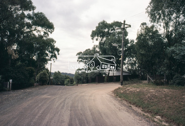
 Eltham District Historical Society Inc
Slide, Adam Crescent, Montmorency, c. Feb. 1981
One of a series of images of road infrastructure focussed on Adam Crescent in Montmorency taken by Eltham Shire Council Planning and Engineering officers. They provide perspective of the changes in housing styles and road development that began sweeping in from the mid 1970s with increasing urbanisation of what was once more outlying suburbs and regions. All images have been identified with GPS though house numbers have changed35 mm colour positive transparency (1 of 21) Mount - Kodak Kodachrome CardProcessed Feb 1981adam crescent, infrastructure, montmorency, roads, gordon grove -
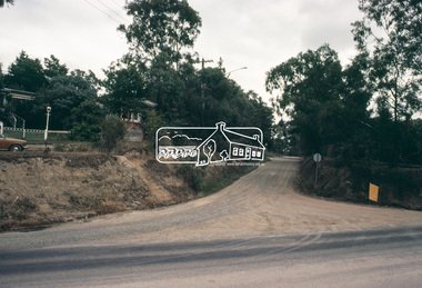
 Eltham District Historical Society Inc
Slide, Adam Crescent, Montmorency, c. Feb. 1981
One of a series of images of road infrastructure focussed on Adam Crescent in Montmorency taken by Eltham Shire Council Planning and Engineering officers. They provide perspective of the changes in housing styles and road development that began sweeping in from the mid 1970s with increasing urbanisation of what was once more outlying suburbs and regions. All images have been identified with GPS though house numbers have changed35 mm colour positive transparency (1 of 21) Mount - Kodak Kodachrome CardProcessed Feb 1981adam crescent, infrastructure, montmorency, roads -
 Eltham District Historical Society Inc
Slide, Adam Crescent, Montmorency, c. Feb. 1981
One of a series of images of road infrastructure focussed on Adam Crescent in Montmorency taken by Eltham Shire Council Planning and Engineering officers. They provide perspective of the changes in housing styles and road development that began sweeping in from the mid 1970s with increasing urbanisation of what was once more outlying suburbs and regions. All images have been identified with GPS though house numbers have changed35 mm colour positive transparency (1 of 21) Mount - Kodak Kodachrome CardProcessed Feb 1981adam crescent, infrastructure, montmorency, roads, gordon grove -
 Eltham District Historical Society Inc
Slide, Adam Crescent, Montmorency, c. Feb. 1981
One of a series of images of road infrastructure focussed on Adam Crescent in Montmorency taken by Eltham Shire Council Planning and Engineering officers. They provide perspective of the changes in housing styles and road development that began sweeping in from the mid 1970s with increasing urbanisation of what was once more outlying suburbs and regions. All images have been identified with GPS though house numbers have changed35 mm colour positive transparency (1 of 21) Mount - Kodak Kodachrome CardProcessed Feb 1981adam crescent, infrastructure, montmorency, roads -
 Eltham District Historical Society Inc
Slide, Adam Crescent, Montmorency, c. Feb. 1981
One of a series of images of road infrastructure focussed on Adam Crescent in Montmorency taken by Eltham Shire Council Planning and Engineering officers. They provide perspective of the changes in housing styles and road development that began sweeping in from the mid 1970s with increasing urbanisation of what was once more outlying suburbs and regions. All images have been identified with GPS though house numbers have changed35 mm colour positive transparency (1 of 21) Mount - Kodak Kodachrome CardProcessed Feb 1981adam crescent, infrastructure, montmorency, roads, gordon grove -
 Eltham District Historical Society Inc
Slide, Adam Crescent, Montmorency, c. Feb. 1981
One of a series of images of road infrastructure focussed on Adam Crescent in Montmorency taken by Eltham Shire Council Planning and Engineering officers. They provide perspective of the changes in housing styles and road development that began sweeping in from the mid 1970s with increasing urbanisation of what was once more outlying suburbs and regions. All images have been identified with GPS though house numbers have changed35 mm colour positive transparency (1 of 21) Mount - Kodak Kodachrome CardProcessed Feb 1981adam crescent, infrastructure, montmorency, roads, sherbourne road -
 Eltham District Historical Society Inc
Slide, Adam Crescent, Montmorency, c. Feb. 1981
One of a series of images of road infrastructure focussed on Adam Crescent in Montmorency taken by Eltham Shire Council Planning and Engineering officers. They provide perspective of the changes in housing styles and road development that began sweeping in from the mid 1970s with increasing urbanisation of what was once more outlying suburbs and regions. All images have been identified with GPS though house numbers have changed35 mm colour positive transparency (1 of 21) Mount - Kodak Kodachrome CardProcessed Feb 1981adam crescent, infrastructure, montmorency, roads, sherbourne road