Showing 504 items
matching victorian street maps
-
 Victorian Aboriginal Corporation for Languages
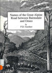
Book, P D Gardner, Names of the Great Alpine Road between Bairnsdale and Omeo : their origins, meanings and history, 1997
Lists the place names along the Victorian Alps, with descriptions and meanings.Maps, b&w illustrations, b&w photographsgunnai, kurnai, ngarigo, jaitmathang, brabiralung, tongiomunjie, tambo, tongio, bruthen, tambo, mount stringy, swifts creek -
 Victorian Aboriginal Corporation for Languages
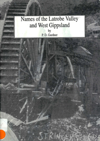
Book, P D Gardner, Names of the Latrobe Valley and West Gippsland : their origins, meanings and history, 1992
An account of the origins and histories of local names from Robin Hood to Kilmany, and from Mirboo North to Mt. Howitt.Maps, b&w illustrations, b&w photographsgunnai, kurnai, braiakaulung, bunerong, wurundjeri, kulin, coranderrk, warragul, morwell, rosedale, governor la trobe, drouin, noojee, darnum, walhalla, strzelecki, heyfield, gormandale -
 Victorian Aboriginal Corporation for Languages
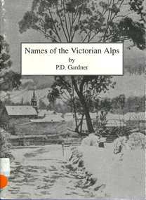
Book, P D Gardner, Names of the Victorian Alps : their origins, meanings and history, 1991
Gives a comprehensive account of the origins of local names in the area. Anecdotes of interesting pieces of history.Maps, b&w illustrations, b&w photographsjaitmathang, minjambuta, djilimatang, ngarigo, brabiralung, braiakaulung, yuin, gunnai, lake tyers, dargo river, omeo, bright, swifts creek, benambra, ovens valley, mount hotham, mount nugong, wonnangatta station -
 Victorian Aboriginal Corporation for Languages
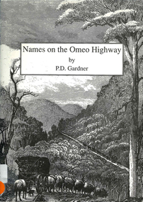
Book, P D Gardner, Names on the Omeo Highway between Bairnsdale and Omeo : their origins, meanings and history, 1992
An account of the origins and histories of local names between Bairnsdale and Omeo.Maps, b&w illustrations, b&w photographsgunnai, kurnai, brabiralung, jaitmathang, ngarigo, yuin, tongiomunjie, tongio gap, bruthen, tambo, hells gate, mount stringy, doctors flat -
 Victorian Aboriginal Corporation for Languages
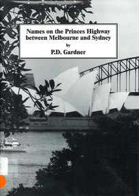
Book, P D Gardner, Names on the Princes Highway between Melbourne and Sydney : their origins, meanings and history, 2000
Place name list in a specific area. Giving descriptions and meanings.Maps, b&w illustrationsdandenong, genoa, south coast nsw, yarra river, moruya, kiama, captain cook, east gippsland, rosedale -
 Victorian Aboriginal Corporation for Languages
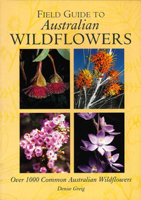
Book, Denise Greig, Field guide to Australian flowers : over 1000 common Australian wildflowers, 2001
Identification of native wildflowers from around Australia. Plant families are arranged in alphabetical order.Maps, b&w illustrations, colour photographswildflowers, plants, australia, grampians, identification, vegetation zones -
 Victorian Aboriginal Corporation for Languages
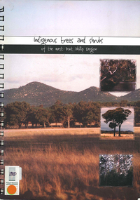
Book, Elise Jeffery, Indigenous trees and shrubs of the west Port Phillip region, 2000
A series of information sheets on the west Port Phillip region, divided into zones, giving a guide to the tree and shrub species that occurred in those areas and where in the landscape they occurred.maps, b&w photographs, colour photographs, illustrations, word lists, wall mapindigenous plants, vegetation, species guide, revegetation -
 Victorian Aboriginal Corporation for Languages
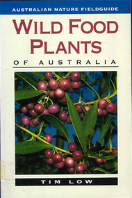
Book, Tim Low, Wild food plants of Australia, 2001
The fieldguide edition of Wild Food Plants of Australia. It is presented in a concise, convenient form to facilitate quick and ready reference in the field. Tim Low has provided a truly reliable guide to our edible flora, making identification easy. Thus it is a perfect companion for bushwalkers, naturalists, scientists and, with emphasis on wild food cuisine, gourmets. Low describes more than 180 plants - from the most tasty and significant plant foods of southern and eastern Australia to the more important and spectacular inland and tropical foods.Maps, colour photographs, b&w illustrationsedible wild plants, cooking, flora, cuisine, bush tucker -
 Victorian Aboriginal Corporation for Languages
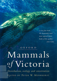
Book, Peter W Menkhorst, Mammals of Victoria : distribution, ecology and conservation, 1996
Arranged in family (type) groups with photos and detailed descriptions of each mammal.Maps, colour photographs, b&w photographs, graphsmammals, fauna, victoria -
 Victorian Aboriginal Corporation for Languages
Book, Neil Marriott et al, Grassland plants of South-Eastern Australia : a field guide to native grassland and grassy woodland plants of South-Eastern Australia, 1998
Detailed description of plants, one plant per page. Alphabetical listing according to botanical name, with common names provided.Maps, colour photographs, pronunciation guide, glossarygrassland, plants, south-eastern australia, botany, ecology -
 Victorian Aboriginal Corporation for Languages
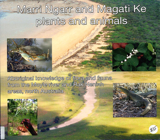
Book, Ngarul Jimmy Nambatu et al, Marri Ngarr and Magati Ke plants and animals : Aboriginal knowledge of flora and fauna from the Moyle River and Neninh areas, North Australia, 2009
Aboriginal knowledge of flora and fauna from the Moyle River and Neninh areas.Maps, b&w illustrations, b&w photographs, colour photographs,marri ngarr, magati ke, wadeye, moyle river, northern territory, flora, fauna, ethnobiology -
 Victorian Aboriginal Corporation for Languages
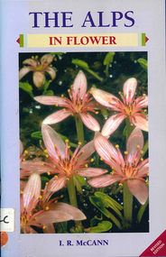
Book, I R McCann, The Alps in flower, 2001
Format using photographs and a brief description of each plant.Maps, colour photographsalps, victorian national parks association, bogong unit, alpine national park, mount buffalo national park, wonnangatta-moroka unit, kosciusko national park -
 Victorian Aboriginal Corporation for Languages
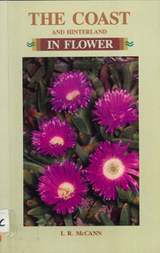
Book, I R McCann, The coast and hinterland in flower, 1992
Format using photographs and a brief description of each plant.Maps, colour photographswildflowers, plants, australia, grampians, identification, native plants -
 Victorian Aboriginal Corporation for Languages
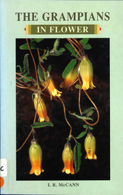
Book, I R McCann, The Grampians in flower, 2000
Contains brief descriptions of flowering plants in the Grampians area.Maps, colour photographswildflowers, plants, australia, grampians, identification -
 Victorian Aboriginal Corporation for Languages
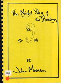
Book, John Morieson, The night sky of the Boorong
Based on historical notes of a variety of people, it explains the Night Skies of the Lake Tyrell area of Victoria and the mythology of the people regarding the legends of the skies.Maps, b&w illustrations, b&w photographsboorong, astronomy, ecological zodiac, william stanbridge, lake tyrell -
 Victorian Aboriginal Corporation for Languages
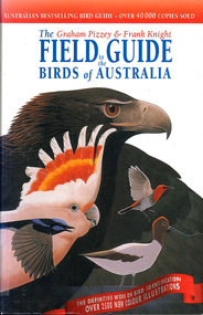
Book, Graham Pizzey et al, The Graham Pizzey &? Frank Knight field guide to the birds of Australia, 1999
Detailed descriptions of Australian native birds at all life stages, including their calls and range of habitat.Maps, colour illustrations, colour photographsbirds, australia, identification -
 Victorian Aboriginal Corporation for Languages
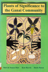
Book, Rob de Souza-Daw et al, Plants of significance to the Ganai Community, 2000
This publication identifies the plants which are known to have been used by the Ganai community. A photograph is provided for each plants and is accompanied by an explanation of the plant's usage. The scientific name, common name and the Ganai name, where known, is given for each plant.Maps, colour illustrations, colour photographs, glossaryganai, nulit, brayakaulung, brataualung, tatungalung, muk-thang, brabralung, thangquai, krauatungalung -
 Victorian Aboriginal Corporation for Languages
Book, PJF Coutts et al, Records of the Victorian Archaeological Survey : number 9, August 1979 : a preliminary investigation of Aboriginal mounds in North-Western Victoria, 1979
Maps, charts, graphs, b&w photographs, diagramsvictoria archaeological survey, murray valley, grampians -
 Victorian Aboriginal Corporation for Languages
Book, Records of the Victorian Archaeological Survey : number 10, June 1980, 1980
Maps, charts, graphs, b&w photographs, diagrams -
 Victorian Aboriginal Corporation for Languages
Book, Friends of Sherbrooke Forest, Sherbrooke Forest : its flora and history, 2000
Notes on plants in the area, including swamp/water plants.Maps, b&w illustrations, b&w photographs, colour photographsdandenong ranges national park, indigenous vascular plants, weed management -
 Victorian Aboriginal Corporation for Languages
Book, Sarina Singh, Aboriginal Australia & the Torres Strait Islands : guide to Indigenous Australia, 2001
Comprehensive text with maps, coloured photos etc., dealing with all of Indigenous Australia. Provides historical references. Details of the Mabo finding.maps, b&w photographs, colour photographs, illustrations, word listsculture, travel guide, tourism, art, food -
 Victorian Aboriginal Corporation for Languages
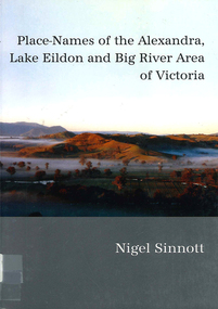
Book, Nigel Sinnott, Place-names of the Alexandra, Lake Eildon and Big River area of Victoria, 2003
Contains 2000 entries for the Alexandra area, giving a clearly detailed description of the site and source of the name.Maps, colour photographsplace names, alexandra, lake eildon, strathbogie ranges, yea, marysville, healesville -
 Victorian Aboriginal Corporation for Languages
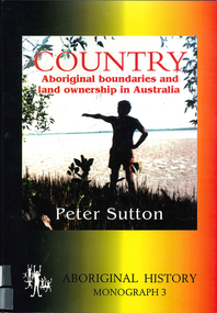
Book, Peter Sutton, Country : Aboriginal boundaries and land ownership in Australia, 1995
Critique of Davis and Prescott Aboriginal frontiers and boundaries in Australia and map, Davis, S. Australias extant and imputed traditional Aboriginal territories; uses anthropological and linguistic evidence to expose inaccuracies and lacunae in book and map; appended are comments on the Davis map by regional specialists.Maps, colour photographsindigenous land boundaries -
 Victorian Aboriginal Corporation for Languages
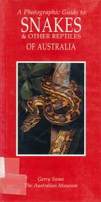
Book, Gerry Swan, A photographic guide to snakes &? other reptiles of Australia, 1997
Species accounts of snakes across Australia.Maps, colour photographssnakes, reptiles -
 Victorian Aboriginal Corporation for Languages
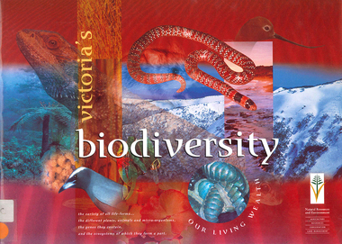
Book, Department of Natural Resources and Environment, Victoria's biodiversity : our living wealth, 1997
Lush colour photographs of the particular environments, including flora, fauna, birds etc and maps locating area.Colour illustrations, colour photographsconservation, sustainability, biodiversity, victorian alps, mallee -
 Victorian Aboriginal Corporation for Languages
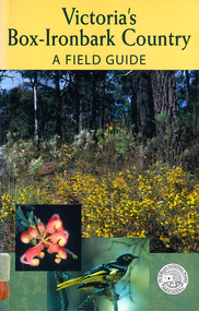
Book, Malcolm Calder et al, Victoria's box-ironbark country : a field guide, 2002
Gives thorough introduction to the dry-forest area and the plants and animals of that habitat.Maps, colour photographs, b&w illustrationsbox-ironbark forests, deforestation, sustainability, environment, biodiversity -
 Victorian Aboriginal Corporation for Languages
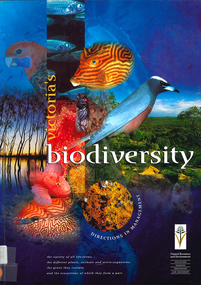
Book, Department of Natural Resources and Environment, Victoria's biodiversity : directions in management, 1997
Looking at Victoria in each region and examining the biodiversity of the environment, for management purposes.Maps (including two large maps) charts, graphs, colour photographs,biodiversity, sustainability, conservation -
 Victorian Aboriginal Corporation for Languages
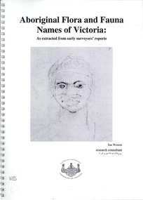
Book, Sue Wesson et al, Aboriginal flora and fauna names of Victoria : as extracted from early surveyors' reports, 2001
The Flora and Fauna Names Project is an initiative of the Victorian Aboriginal Corporation for Languages and the Victorian Biodiversity Strategy. The researcher has examined material from the archives of the Department of Natural Resources and Environment (NRE), the State Library of Victoria, the Victorian Public Records Office and the Australian Archives Office. This first stage of the project focussed on the NRE archives, in particular the field notebooks of the earliest surveyors and their maps although other NRE resources, libraries and public records were accessed. A total of 3028 words were found of which a significant proportion have previously been unknown to linguists. It appears that the place names and word lists in early surveyors notebooks, the 1858 surveyors responses to the Surveyor General and an extensive Wiradjuri wordlist by James Baylis have not yet been widely used or published. Fifteen percent of these 3028 words describe flora and fauna and six percent describe habitat. Of particular interest is the evidence provided by these lists of the existence of fauna in the mid nineteenth century in regions where it is now extinct. For example, magpie geese, eastern quolls, bustards and pademelons were assigned names in the Jardwadjali language area of the upper Glenelg and Wimmera Rivers. The outcomes of this project may help to assist in ascertaining the distribution of flora and fauna assets in Victoria.maps, b&w photographs, colour photographs, illustrations, word listswiradjuri, jardwadjali, glenelg river, wimmera river -
 Victorian Aboriginal Corporation for Languages
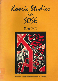
Book, Catholic Education Commission of Victoria, Koorie studies in SOSE : years 7-10, 2001
Section 1. Notes on the use of this resource Section 2. Policy support statements. Aboriginal Studies Policy Statement of Victorian Aboriginal Education Association Incorporated (VAEAI) National Principles and Guidelines for Aboriginal Studies and Torres Strait Islander Studies, K-12 Principles for the Introduction of Aboriginal Perspectives in the Curriculum of the Catholic School (Catholic Education Commission of Victoria Policy 1.3, 1987) Section 3. Language, culture and viewpoint: issues of terminology Section 4. Units of work Unit 1. Koorie people of south-east Australia: a contemporary view Unit 2. On sacred ground Unit 3. Koorie life in the pre-contact era Unit 4. Mulla Meea-Baa Gnuenjall: a long time ago, and today Unit 5. The land we share: human stories in the environment Unit 6. Frontier wars Unit 7. Aboriginal mission stations and reserves in Victoria Unit 8. Land, law and indigenous Australians Section 5. Directory of indigenous organisations and affiliated groups/?agencies. National organisations Victorian organisations Catholic Education Commission of Victoria Indigenous Education personnel Organisations within regions of the Archdiocese of Melbourne Organisations within regions of the Ballarat Diocese Organisations within regions of the Sale Diocese Organisations within regions of the Sandhurst Diocese Cultural centres/?camps across Victoria.maps, b&w photographsvaeai, history, curriculum development, koorie studies, catholic education commission of victoria, secondary school education, -
 Victorian Aboriginal Corporation for Languages
Book, Board of Studies NSW, Aboriginal languages : advice on programming and assessment for stages 4 and 5, 2003
Includes Advice on Planning and Assessment, Samples on each stage, Sample Units of Work, useful Resources.maps, tableseducation, curriculum development