Showing 1115 items
matching waterway
-
 Lakes Entrance Historical Society
Photograph, 1994
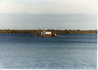
Also second identical copyColour photograph of a tiptruck being barged across Bancroft Bay from Metung to Boole Poole, Metung Victoriawaterways, transport -
 Lakes Entrance Historical Society
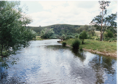
Photograph - Buchan River, Tambo Shire, 1994 c
Colour photograph of the Buchan river, showing stream flowing between low banks, hills rising in distance. Buchan Victoria topography, waterways -
 Lakes Entrance Historical Society
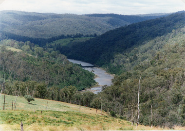
Photograph - Snowy River, Tambo Shire, 1994
Also second identical copyColour photograph of the Snowy River near The Basin, showing a river flowing between rocky banks, densely forested hills rising on both sides and into the far distance. Buchan Victoria topography, waterways -
 Lakes Entrance Historical Society
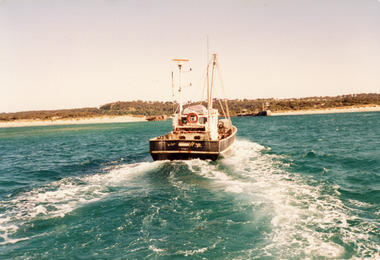
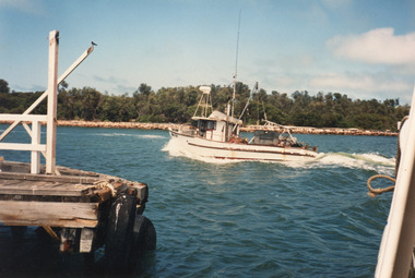
Photograph - Southern Hope, Hammarstrom Ian, 1987 c
Colour photograph of the fishing boat Southern Hope approaching the entrance channel, from the ocean, shows sandy beach each side of entrance piers and shallow water over the outer bar, sea calm. Lakes Entrance Victoriaships and shipping, waterways, fishing industry -
 Lakes Entrance Historical Society
Photograph - Sylvia, Hammarstrom Ian, 1987 c
Colour photograph of the fishing boat Sylvia which has just left Cunninghame Arm and is heading into the entrance channel on way to fishing grounds off Lakes Entrance, Victoria.ships and shipping, fishing industry, waterways, jetties -
 Lakes Entrance Historical Society
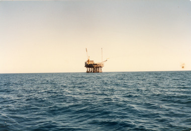
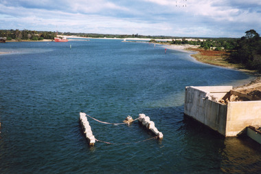
Photograph - Oil Rig, 2000 c
Second photograph of a trade vessel at the oil rig.Colour photograph of an oil rig in Bass Strait. Port Albert Victoriawaterways, oil and gas industry -
 Lakes Entrance Historical Society
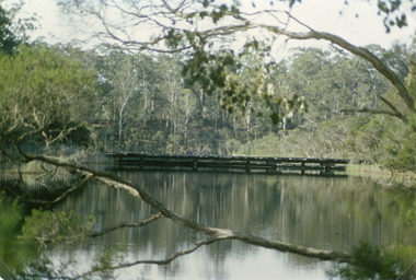
Photograph - North Arm Bridge, Holding M, 2000
Also two other photographs similar views.|Also one showing old bridge onlyColour photograph showing the building of the new North Arm bridge, old North Arm bridge in background, taken from tourist ferry Mulloway, returning to jetty in North Arm. Lakes Entrance Victoriabridges, waterways -
 Lakes Entrance Historical Society
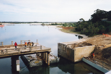
Photograph - Old North Arm Bridge, 2000
Date made May 2000Colour photograph showing the activity during the deconstruction of the old North Arm bridge showing cranes lifting handrails, circular saw cutting concrete bridge decking, and top of piers removed. Scene indicates how the bridge was constructed in 1917. Lakes Entrance Victoriabridges, waterways, demolition -
 Lakes Entrance Historical Society
Photograph, 2000
Date made May 2000.Colour photograph of diving operations to attach crane cable to underwater section of piers of old North Arm bridge. Diver in water, small tinny standing by with two men aboard. Lakes Entrance Victoria.bridges, waterways, public works -
 Lakes Entrance Historical Society
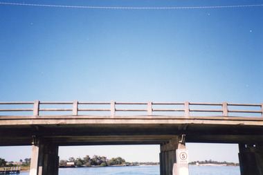
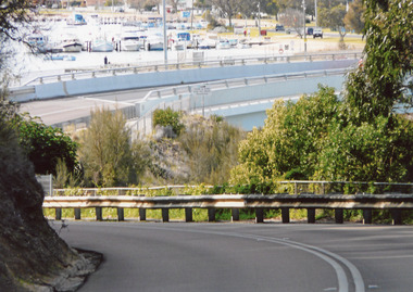
Photograph - North Arm Bridge, 2008
Date made September 2008Colour photograph showing the new North Arm bridge opened 2000, taken from pathway besides Princes Highway at west end of Lakes Entrance, Victoria.bridges, waterways, roads and streets -
 Lakes Entrance Historical Society
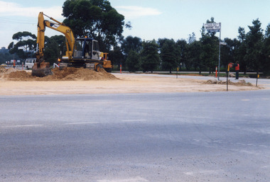
Photograph, 1999
Date made January 1999 - June 2000Colour photograph of North Arm bridge under construction. Lakes Entrance Victoriabridges, waterways, public works -
 Lakes Entrance Historical Society
Photograph - tramline Lake Bunga, Davies Judy, 2008
This is after paired photograph used in the 150 year, Lakes Entrance 1858-2008 display.|The before paired photograph number 02218|Also one 12 x 16 framed photograph used in room display.Colour photograph showing Lake Bunga near Lakes Entrance with the remains of tramline crossing, birds sitting on the remains. Lake Bunga Victoriabridges, waterways, transport, tramline -
 Lakes Entrance Historical Society
Photograph - tramline Lake Bunga, 1919
Three identical black and white copies, 8 x 10 cmSepia photograph showing Lake Bunga near Lakes Entrance, with tramline across lake with one panel missing. Lake full and clean. Hard to see whether the entrance is open or closed. (After 1919) Lake Bunga VictoriaLake Bunga Vic (on reverse)transport, waterways, tramline -
 Lakes Entrance Historical Society
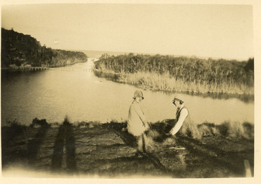
Postcard - tramline Lake Bunga, 1920
Small format black and white postcard showing a distant view of tramway bridge at Lakes Bunga, Victoria. Two women in foreground, image taken from Bunga Haven guesthouse.bridges, timber industry, waterways, tramline -
 Lakes Entrance Historical Society
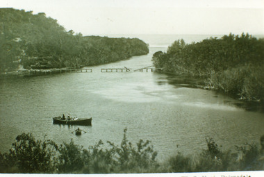
Photograph - tramline Lake Bunga, Vogt, W S, 1920
Also one enlarged copy 20.5 x 28.5 cm|Also one copy 12 x 17|Also giant colour postcardBlack and white photograph showing view of Lakes Bunga, near Lakes Entrance. Tramline across lake shows beginnings of disrepair, one panel gone, another panel broken, two row boats on lake, larger one contains two adults and four children, smaller row boat has one small child. Entrance appears to be closed, thick vegetation around lake. Lake Bunga VictoriaLake Bunga (Northrope's), W S Vogt, Bairnsdalewaterways, topography, bridges, tramline -
 Lakes Entrance Historical Society
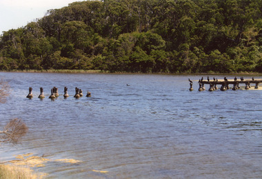
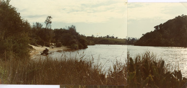
Photograph - Lake Bunga, Fish Marie, 1980
Two photographs stitched together to show a panoramic view.Colour photograph showing view of Lake Bunga, near Lakes Entrance, looking upstream from near the entrance. Tramway bridge almost gone. Some piles remain. Vegetation on sides of lake, background hill cleared, seats along the shoreline, lake full and clean. Lake Bunga Victoriabridges, waterways -
 Lakes Entrance Historical Society
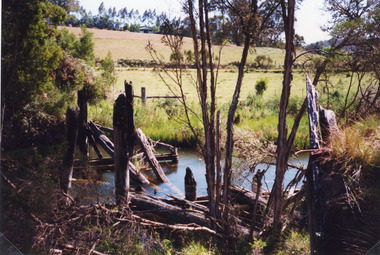
Photograph - Bridges, Fish Marie, 1965
Also scanned photograph of a vehicle crossing the original bridgeBlack and white photograph showing the old Burnt Bridge over Toorloo Arm before being closed to vehicular traffic, near Lakes Entrance, Victoria,bridges, waterways -
 Lakes Entrance Historical Society
Photograph - Bridges, 1998
Also photograph of bridge from different angleColour photograph of the crossing at Toorloo Arm on the previous main road from Lakes Entrance to Nowa Nowa known as Burnt Bridge. Lakes Entrance Victoriabridges, waterways, vegetation -
 Lakes Entrance Historical Society
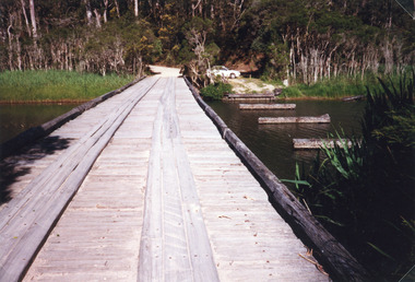
Photograph, 1998
Colour photograph of the remains of a timber bridge on the former Princes Highway at Toorloo Arm Road, Lake Tyers, Victoriabridges, waterways -
 Lakes Entrance Historical Society
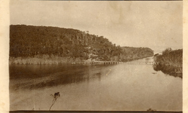
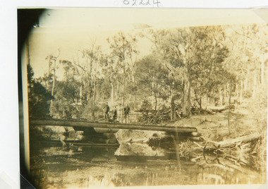
Photograph - Bridges, 1910
Sepia photograph showing old bridge over Boggy Creek, presumably near Nowa Nowa. Two men and boy on bridge. Bridge supported by rough logs in centre and at ends. Gippsland Victoriabridges, waterways -
 Lakes Entrance Historical Society
Postcard - The Entrance, Cooper Alexander, 1910c
Black and white large format postcard of the man made entrance to the Gippsland Lakes, it shows work in progress on the western pier of the entrance, Bullock Island, photo taken at low tide. Lakes Entrance VictoriaLakes Entrance Cunninghameislands, waterways, topography, ships and shipping -
 Lakes Entrance Historical Society
Photograph - Bullock Island, 1915c
On back of original 'To Rit with love from Arthur' (Arthur Seagrove - Head Teacher, Johnsonville Primary School - 1920)Black and white photograph of Bullock Island and the man-made entrance from Bass Strait. It shows the Western end of Bullock Island, some natural vegetation, jetty and timber groynes, trading vessel standing outside entrance. Lakes Entrance Victoriawaterways, islands, topography -
 Lakes Entrance Historical Society
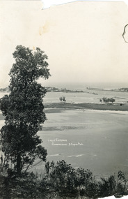
Photograph - The Entrance, 1995c
Colour photograph of the entrance from Bass Strait to the Gippsland Lakes, it shows the western end of Bullock Island and the built up area below Jemmys Point, both made during dredging operations over many years. Lakes Entrance Victoriaislands, fishing industry, waterways -
 Lakes Entrance Historical Society
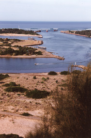
Photograph - The Entrance, 1995c
Colour photograph of the entrance from Bass Strait to the Gippsland. It shows the western and of Bullock Island and the built up area below Jemmys Point, all made during dredging operations over many years. Lakes Entrance Victoriafishing industry, islands, waterways -
 Lakes Entrance Historical Society
Photograph - Bullock Island, Fraser Ian, 1920c
Black and white photograph of Bullock Island, showing Prince's Highway from North Arm bridge, east end of Bullock Island and bridge, entrance to Bass Strait and sand dunes along Cunninghame Arm. Western end of Bullock Island bridge raised to allow small boats access to North Arm and Cunninghame Arm, became known as Humpy Bridge. Lakes Entrance Victoria islands, waterways, topography, bridges -
 Lakes Entrance Historical Society
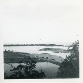
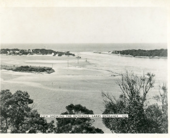
Photograph - The Entrance, Martin Orville, 1940c
Another copy Black and white 7 x 8.5 with inscription'View showing the Entrance, Lakes Entrance, Vic'Black and white photograph of Bullock Island, the New Works, township and entrance from Bass Strait to the Gippsland Lakes. Taken at high tide. Lakes Entrance Victoriaislands, waterways, topography -
 Lakes Entrance Historical Society
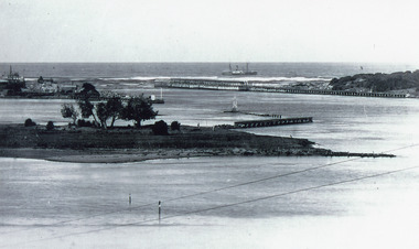
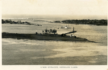
Postcard - Bullock Island, Bulmer H D, 1923c
Also same image|Faded copy 10x15|Black and White 12x17.5|Black and White 20x28.5Black and white postcard of the entrance to the Gippsland Lakes, showing buildings at New Works, cranes on ends of piers, jetty and bathing boxes on bullock Island, steamer passing island. Lakes Entrance VictoriaLakes Entrance, Gippsland Lakeswaterways, islands, topography -
 Lakes Entrance Historical Society
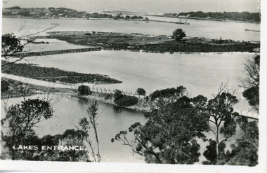
Postcard - Bullock Island, 1920c
1 x Faded miniature postcard 6.5 x 8.5|1 x Black and white 9.5 x 12 copied from album in private hands|1 x Sepia toned 10 x 15|1 x Black and white 12 x 17.5Black and white small format postcard of Bullock Island. It shows the approaches to the concrete North Arm Bridge over North Arm, the footbridge to Bullock Island, the entrance to the Gippsland Lakes from Bass Strait and part of the township on the hummocks. Lakes Entrance VictoriaLakes Entrancewaterways, topography, islands, bridges -
 Lakes Entrance Historical Society
Photograph - Bullock Island, 1920 c
Black and white photograph of Bullock Island. Steamer J C D passing Western end of Bullock Island. Lakes Entrance VictoriaLakes Entrancewaterways, islands, topography, shipping -
 Lakes Entrance Historical Society
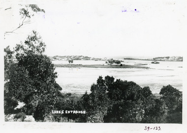
Photograph - The Entrance, 1922c
Black and white copy 9.5 x 15|Black and white copy 12x18Black and white photograph of the entrance and Bullock Island. It shows the western end of Bullock Island with bathing boxes, rock groynes, and sandy shore beneath Jemmys Point. Lakes Entrance VictoriaLakes Entrance, Gippsland Lakesislands, waterways, topography