Showing 8258 items
matching watering
-
 Eltham District Historical Society Inc
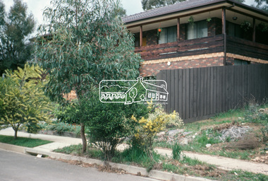
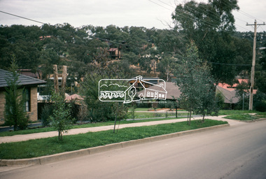
Photograph, Madine Way, Eltham, 3 Sep 1981
Roll of film taken by Eltham Shire Council officers of roads and houses in the Eltham East area, 3 September 1981 prior to construction of new water main; including views of existing damage to footpaths and gutters and general views of Beard Street. These images provide a perspective of housing estate developments and changes in housing styles and road development which began sweeping in from the mid 1970s with increasing urbanisation of what was once more outlying suburbs and regions.35mm colour positive transparency (1 of 28) Mount - Kodak Kodachrome Cardeltham, infrastructure, roads, madine way, tadema park -
 Eltham District Historical Society Inc
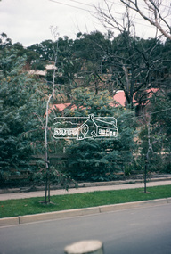
Photograph, Beard Street, Eltham, 3 Sep 1981
Roll of film taken by Eltham Shire Council officers of roads and houses in the Eltham East area, 3 September 1981 prior to construction of new water main; including views of existing damage to footpaths and gutters and general views of Beard Street. These images provide a perspective of housing estate developments and changes in housing styles and road development which began sweeping in from the mid 1970s with increasing urbanisation of what was once more outlying suburbs and regions.35mm colour positive transparency (1 of 28) Mount - Kodak Kodachrome Cardeltham, infrastructure, roads, beard street, frank street, shalbury avenue -
 Eltham District Historical Society Inc
Photograph, Beard Street, Eltham, 3 Sep 1981
Roll of film taken by Eltham Shire Council officers of roads and houses in the Eltham East area, 3 September 1981 prior to construction of new water main; including views of existing damage to footpaths and gutters and general views of Beard Street. These images provide a perspective of housing estate developments and changes in housing styles and road development which began sweeping in from the mid 1970s with increasing urbanisation of what was once more outlying suburbs and regions.35mm colour positive transparency (1 of 28) Mount - Kodak Kodachrome Cardeltham, infrastructure, roads, beard street -
 Eltham District Historical Society Inc
Photograph, Beard Street, Eltham, 3 Sep 1981
Roll of film taken by Eltham Shire Council officers of roads and houses in the Eltham East area, 3 September 1981 prior to construction of new water main; including views of existing damage to footpaths and gutters and general views of Beard Street. These images provide a perspective of housing estate developments and changes in housing styles and road development which began sweeping in from the mid 1970s with increasing urbanisation of what was once more outlying suburbs and regions.35mm colour positive transparency (1 of 28) Mount - Kodak Kodachrome Cardeltham, infrastructure, roads, beard street, frank street -
 Eltham District Historical Society Inc
Photograph, Beard Street, Eltham, 3 Sep 1981
Roll of film taken by Eltham Shire Council officers of roads and houses in the Eltham East area, 3 September 1981 prior to construction of new water main; including views of existing damage to footpaths and gutters and general views of Beard Street. These images provide a perspective of housing estate developments and changes in housing styles and road development which began sweeping in from the mid 1970s with increasing urbanisation of what was once more outlying suburbs and regions.35mm colour positive transparency (1 of 28) Mount - Kodak Kodachrome Cardeltham, infrastructure, roads, beard street, grove street, valonia drive, wycliffe crescent, livingstone road -
 Eltham District Historical Society Inc
Photograph, Beard Street, Eltham, 3 Sep 1981
Roll of film taken by Eltham Shire Council officers of roads and houses in the Eltham East area, 3 September 1981 prior to construction of new water main; including views of existing damage to footpaths and gutters and general views of Beard Street. These images provide a perspective of housing estate developments and changes in housing styles and road development which began sweeping in from the mid 1970s with increasing urbanisation of what was once more outlying suburbs and regions.35mm colour positive transparency (1 of 28) Mount - Kodak Kodachrome Cardeltham, infrastructure, roads, beard street -
 Eltham District Historical Society Inc
Photograph, Beard Street, Eltham, 3 Sep 1981
Roll of film taken by Eltham Shire Council officers of roads and houses in the Eltham East area, 3 September 1981 prior to construction of new water main; including views of existing damage to footpaths and gutters and general views of Beard Street. These images provide a perspective of housing estate developments and changes in housing styles and road development which began sweeping in from the mid 1970s with increasing urbanisation of what was once more outlying suburbs and regions.35mm colour positive transparency (1 of 28) Mount - Kodak Kodachrome Cardeltham, infrastructure, roads, beard street -
 Eltham District Historical Society Inc
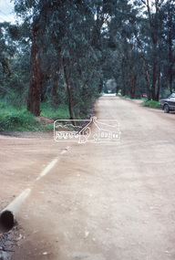
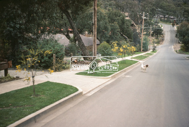
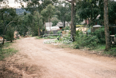
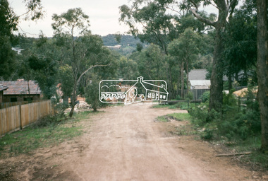
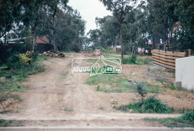
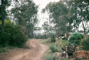
Photograph, Water Main Pipe Track (Madine Way-Bainbridge Drive), Eltham, 3 Sep 1981
Roll of film taken by Eltham Shire Council officers of roads and houses in the Eltham East area, 3 September 1981 prior to construction of new water main; including views of existing damage to footpaths and gutters and general views of Beard Street. These images provide a perspective of housing estate developments and changes in housing styles and road development which began sweeping in from the mid 1970s with increasing urbanisation of what was once more outlying suburbs and regions.35mm colour positive transparency (1 of 28) Mount - Kodak Kodachrome Cardeltham, infrastructure, roads, bainbridge drive linear reserve, madine way, water main pipe track -
 Eltham District Historical Society Inc
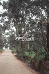
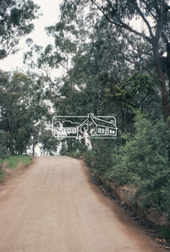
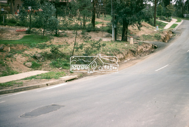
Photograph, Water Main Pipe Track (Madine Way-Eucalyptus Road), Eltham, 3 Sep 1981
Roll of film taken by Eltham Shire Council officers of roads and houses in the Eltham East area, 3 September 1981 prior to construction of new water main; including views of existing damage to footpaths and gutters and general views of Beard Street. These images provide a perspective of housing estate developments and changes in housing styles and road development which began sweeping in from the mid 1970s with increasing urbanisation of what was once more outlying suburbs and regions.35mm colour positive transparency (1 of 28) Mount - Kodak Kodachrome Cardeltham, infrastructure, roads, water main pipe track, madine way, eucalyptus road, tadema park -
 Eltham District Historical Society Inc
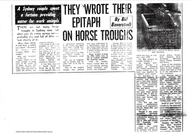
Folder, Bill Baverstock et al, Bills horse troughs
Photocopies of articles, some unsourced relating to the genral history of the Bills horse troughs. "Bills horse troughs are watering troughs that were manufactured in Australia and installed to provide relief for working horses in the first half of the twentieth century. The troughs were financed by a trust fund established through the will of George Bills. A total of around 700 troughs were distributed by the trust in Australia and 50 in several other countries" - Wikipedia There is a trough locally situated on Main Road, Research7 pageswater trough, bills horse trough, george bills -
 Eltham District Historical Society Inc
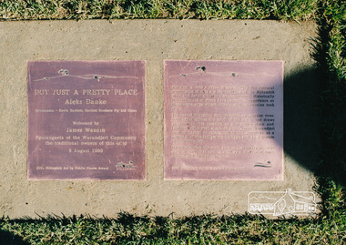
Photograph, Not Just a Pretty Place, Aleks Danko (2000), Lennister Farm, Eltham South, 2000c
Not Just a Pretty Place acknowledges the cultural significance of this site for the residents of Nillumbik Shire and for the Wurrundjeri community. Historically the confluence of rivers have particular importance as these were sites where rituals and ceremonies took place. The carved bluestone form presents an oversize river pebble that echoes the spirit of the water and draws attention to this location as a meeting place an landmark. Awarded the 2000 Nillumbik Art in Public Places Award and situated behind Lennister Farm near Yarra ParkColour photograph printaleks danko, eltham, lennister farm, yarra park -
 Eltham District Historical Society Inc
Photograph, Eltham - Floods in 1934
To the left of picture is the Main Road Bridge over the Diamond Creek in Eltham South when the Diamond Creek was in flood. The Yarra also was in flood. In early December 1934 the "Greatest flood in the history of the Yarra" occured, according to The Argus newspaper. Bridges and houses were swept away with hundreds of people left homeless across the state. The historic 1934 flood of the Diamond Creek and Yarra River set the criteria for future planning with respect to flood water rise.This photo forms part of a collection of photographs gathered by the Shire of Eltham for their centenary project book, "Pioneers and Painters: 100 years of the Shire of Eltham" by Alan Marshall (1971). The collection of over 500 images is held in partnership between Eltham District Historical Society and Yarra Plenty Regional Library (Eltham Library) and is now formally known as 'The Shire of Eltham Pioneers Photograph Collection.' It is significant in being the first community sourced collection representing the places and people of the Shire's first one hundred years.Digital image 4 x 5 inch B&W Negsepp, shire of eltham pioneers photograph collection, eltham, diamond creek (river), 1934 flood, diamond creek, floods, main road bridge -
 Hume City Civic Collection
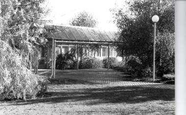
Photograph, Shire of Bulla Offices, 1966
Before the Shire of Bulla built permanent offices in Macedon Street, the council used to meet in the Memorial Hall and had rooms there to conduct regular business. Some cottages were demolished to build the new offices which were completed and opened in 1966. Over the years as the shire's population increased, further additions were added. After Sunbury became part of Hume City Council, the former council building was occupied by Wester Water and Vic Roads.Apart from the former Shire of Bulla Roads Board office built in Sunbury in the 1860s, the 1966 building is the first council building to be built in Sunbury.A black and white photograph of a single storey office building and the surrounding garden. There is a light pole in the foreground.shire of bulla, council offices -
 Robin Boyd Foundation
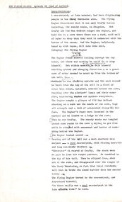
Document - Script, Robin Boyd, The Flying Dogtor. Episode 52 End of Series, 1963
This is the last episode of 'The Flying Dogtor'. The Dogtor found himself falling through the icy water, and there was nothing he could do to stop himself. But suddenly, he was shooting upwards and burst through the top of the well. A real sea serpent came to the Dogtor's rescue. Sir Thomas Persian, the Minister of Fishery, was so delighted when he learned that the mystery of the lake was solved, that he held a big parade through the streets of Canberra in honour of The Flying Dogtor.The Flying Dogtor" series was broadcast on Australian Television Network (later becoming the Seven Network) between February and April 1964 (see item D254 for schedule).Typewritten, carbon copy, foolscap, 2 pagesHandwritten pencil edits and additions.the flying dogtor, robin boyd, crawford productions, manuscript, ohm2022, ohm2022_4 -
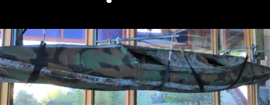 Queenscliffe Maritime Museum
Vehicle - Kayak, Commandos
The remarkable story when 74 soldiers fought in vain to save the lives of their mates off Portsea as 3 soldiers died. Tragically, Privates Roger Wood and Edward Meyer, and Warrant Officer George "Taffy" Drakopoulos, died. Please Note: "The Rip" is also known as "The Heads", which is a dangerous stretch of water connecting Port Phillip Bay and Bass Strait. This is the only entrance for all shipping into Port Phillip Bay and to and from the Port of Melbourne, Victoria, Australia.Kayak of a similar type as those used during the ill-fated army exercise with loss of life in the rip.rip disaster, commandos, kayak, military history - army -
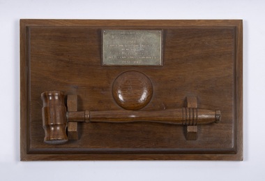 Bacchus Marsh & District Historical Society
Ceremonial object, Presentation Gavel and Sound Block presented to Shire of Bacchus Marsh in Memory of Alec William Bond, 1968
Alec William Bond was Secretary and Engineer for the Shire of Bacchus Marsh from 1924 until his death in 1968. The position of Secretary was similar to a Chief Executive Officer in contemporary terminology. Mr Bond was a prominent figure in the Bacchus Marsh community for nearly 50 years and as Shire Engineer was responsible for the design of a number of local infrastructure projects including the buildings and water scheme at the Lady Northcote Children's Farm at Glenmore and the public swimming pool in Grant Street, A physical memento that recognises the long and notable contributions of an important local government official and their service to the Bacchus Marsh Shire and community.A sound block with a green felt base and inscribed brass plaque with accompanying small hardwood mallet in a cradle.Engraved text on a brass plaque which reads: Presented by May Bond and Family to the Shire of Bacchus Marsh in memory of Alec William Bond Shire Secretary & Engineer 1924 – 1968.alec william bond, bacchus marsh shire council, gavel and sound blocks, local officials and employees, local government -
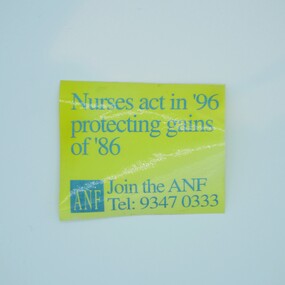 Australian Nursing & Midwifery Federation
Australian Nursing Federation strike remembrance campaign sticker
Run as part of recruitment campaign in 1996, a decade on from the 1986 Victorian 50-day nurses strike, the longest strike in Victorian nursing history. The 1990s saw new challenges for Victorian nurses, as the state government oversaw the widespread privatisation of the public health service and industrial reforms that gave greater power to employers. This resulted in site closures and the watering down of worker rights and conditions. This sticker recognises that the challenges for nurses are ongoing and encourages collective action.Rectangular gold and blue sticker. Sticker has warped and faded due to age. Sticker printed with 'Nurses act in '96 protecting gains of '86', the Australian Nursing Federation logo and 'Join the ANF Tel: 9347 0333'.nurses, nursing, australian nursing federation, sticker, stickers, campaigning, trade unions, labour history, victoria, jeff kennett -
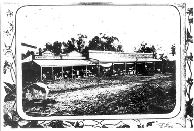 Tarnagulla History Archive
Photograph: Simpsons Store and Hotel, Newbridge after flood, Simpsons Store and Hotel, Newbridge after flood, 1909 (original image)
In this image, store merchandise, including drapery, is hung out to dry after the flood. On 20th August,1909 the Laanecoorie Weir broke away and released 18.3 million cubic metres of water through the opening and causing severe damage to all towns downstream. At Newbridge, Petersen's bakery collapsed and Simpson's Store and Hotel flooded to the roof. The billiard table was later found in a tree five miles down the Loddon near Learmonth. Murray Comrie Collection. Monochrome photograph, image depicting buildings in the area near Loddon River at Newbridge after major flood in 1909. This is a very grainy and dark copy of an older original. Copy probably made by Murray Comrie in the 1960s.newbridge, loddon river, flood, simpson, stores, hotels -
 Ballarat Tramway Museum
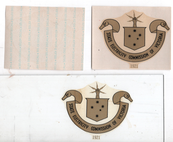
Sign - Small - SEC logo transfer, Selex Decal, c1960
Used to provide the SECV logo or Monogram onto doors, windows or vehicles used by the SEC. Ten copies held. The method of transferring the logo onto the sheet of glass was same as for car registration labels - soak in water until loose, place onto the glass, slide paper off and press to remove bubbles. See item 8548 for the large logo and 6953 for a medium size logo. See item 8741 for an example of use on a first aid box.Demonstrates the method of providing the SECV logoSECV logo, monogram or decal, glued transfer adhered to a sheet of paper with manufacturers name (Selex Decal) on one side. A sample has been placed onto a sheet of glass - 230 x 80. secv, signs, logos, monogrames, selex decal, emblems -
 Ballarat Tramway Museum
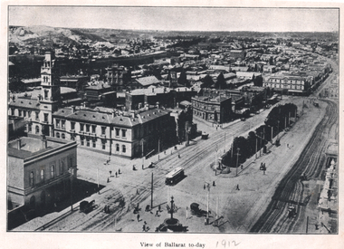
Photograph - Illustration, "View of Ballarat today", c1910
Illustration or photograph taken from the Town Hall, looking North East towards Black Hill. The Post Office, railway yards, Sturt St buildings are in view. Has a tram eastbound at Lydiard St and another waiting to depart Grenville St. There are two horse-drawn cabs in the view. The road surfaces have marks - either from being watered or graded. On the rear is a photograph of R O Henderson's New Furniture warehouse, View Point Bendigo. Yields information of Ballarat c1910.Black and white Illustration cut from a journal"1912" in pencil alongside the image title.tramways, trams, sturt st, esco, grenville st, bridge st, lydiard st north, black hill, post office -
 Darebin Parklands Association
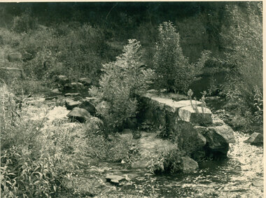
Bluestone weir, Rockbeare Park, February 1975, 1975
This bluestone weir is one of two in the same section of Darebin Creek and is a remanent from early farming days. A vineyard was established by Thomas Bear and produced award wining table wines in the 1860-70s. Orange trees were later grown on the slopes below Rockbeare Grove and mixed market gardening was established in this area as the land was progressively sub-divided and leased. The weirs were used to dam the creek and pumps used to pump water to the vineyards and orange grove.B&W photograph showing remains of bluestone weir across Darebin Creek This item and all other Darebin Parklands Association archival material is now held by State Library Victoria (Accession No: YMS 13746). Please contact State Library Victoria if access is required. -
 Melbourne Tram Museum
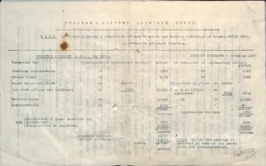
Document, Alex Cameron, "Chairman giving a comparison on cost estimates", 29/6/1907
Typed report by Mr Alex Cameron of the PMTT titled "Chairman giving a comparison between Original and Revised estimate of Noyes Bros in regard to proposed tramways" Orginal Estimate dated May 1906, revised June 1907. One of the principal savings was the purchase of power from the Electric Traction and Lighting Co instead of building their own Power Station. There were other changes to the estimates for track, alterations to sewers, water mains and drains, and rolling stock.Yields information about the cost of construction of the first stage of the PMTT in 1907.Document or report 5 foolscap sheets - carbon copytramways, tramcars, pmtt, costs, new tramways