Showing 10832 items
matching maps
-
 City of Moorabbin Historical Society (Operating the Box Cottage Museum)
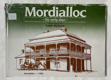
Book, McGuire, Frank, Mordialloc - the early days : a brief history, 1985
72 p. : ill., facsims., maps, ports. Ill. on lining papers. Bibliography: p. 70.non-fictionmordialloc, mordialloc history -
 Bendigo Historical Society Inc.
Book - 7 ROUTES SIGHTSEEING IN AND AROUND BENDIGO
7 Routes Sightseeing In And Around Bendigo, 32 pages with black and white maps and photographs. With IndexBendigo Chamber of Commerce & Industriesbendigo, tourism, guide -
 Bendigo Historical Society Inc.
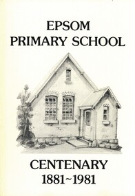
Book - EPSOM PRIMARY SCHOOL CENTENARY 1881-1981, 1981
Epsom Primary School Centenary 1881-1981. Photographs, illustrations and map. 80 pages. With Indexschool, centenary, epsom, education primary school centenary epsom history scholars teachers mothers' club honor roll 1914-1918 war township epsom salts, hotels, progress association, ww1, ww2, vineyards, palm trees, store, ascot park, local families, businesses, sports -
 Bendigo Historical Society Inc.
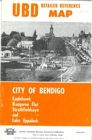
Map - U.B.D.MAP CITY OF BENDIGO, 1971
UBD Detail reference map City of Bendigo, Eaglehawk,Kangaroo Flat, Strathfieldsaye and Lake Eppalock.Universal Business Directories.bendigo, hospital, map, localities - bendigo and district street names. -
 Bendigo Historical Society Inc.
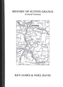
Book - HISTORY OF SUTTON GRANGE, 2006
History Of Sutton Grange (Central Victoria) 338 pages with black and white photographs, illustrations and maps.Ken James & Noel Davishistory, sutton grange, sutton grange - history -
 Bendigo Historical Society Inc.
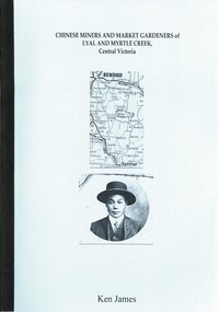
Book - CHINESE MINERS AND MARKET GARDENERS OF LYAL AND MYRTLE CREEK, 2005
CHINESE MINERS AND MARKET GARDENERS OF LYAL AND MYRTLE CREEK - 62 pages with photos, illustrations and mapsKen Jameshistory, chinese miners/lyal and myrtle cree, chinese miners, market gardeners, lyal creek, myrtle creek. -
 Bendigo Historical Society Inc.
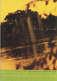
Book - CITY OF GREATER BENDIGO GUIDE TO COUNCIL SERVICES, 2000
City of Greater Bendigo easy reference guide to council services with maps and black & white photographs.cottage, miners -
 Bendigo Historical Society Inc.
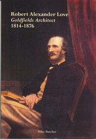
Book - ROBERT ALEXANDER LOVE, GOLDFIELDS ARCHITECT 1814 - 1876, 2000
Robert Alexander Love, goldfields architect 1814 - 1876. 113 page with photos and illustrations, maps.Mike Butcherbiography, robert alexander love, bendigo, architecture, heritage buildings, alexander love, architects -
 Bendigo Historical Society Inc.
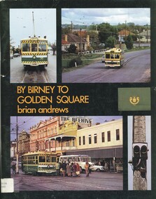
Book - BY BIRNEY TO GOLDEN SQUARE, 1973
By Birney to Golden Square 74 pages with photos, illustrations and map. The last years of Bendigo's tramways.Brian Andrewsbendigo, tramways, history, bendigo, trams, tramways, birney. -
 Bendigo Historical Society Inc.
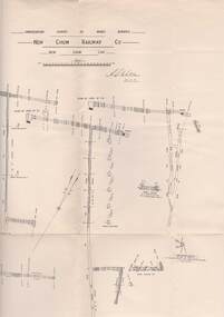
Map - STRUGNELL COLLECTION: UNDERGROUND SURVEY OF MINES, BENDIGO, 25-5-01
Map, Underground Survey of Mines, Bendigo, New Chum Railway Co, New Chum Line.A.S.Whitelawmap, bendigo, new chum railway co. -
Port Melbourne Historical & Preservation Society
Map - City of South Melbourne, 1854 - 1884
Detailed map of City of South Melbourne. Date uncertain. Shows early configuration of river and docks."South Melbourne, Sheet 2"emerald hill, town planning -
Churchill Island Heritage Farm
Book - Doctoral Thesis, "A History of Churchill Island Settlement, Land Use and the Making of a Heritage Site", May 2015
Dr Sanders' doctoral thesis provides a historical overview of the myriad owners and occupiers of Churchill Island from 1850 - 1929 while contextualising it with models of forming and collecting public history. This thesis involves a significant amount of original research and provides clarity and information on the previously obscured history of the Churchill Island Heritage Farm and precinct.This thesis gives new and unique information relating to the history of Churchill Island and has future research potentialA4 book, green hardback cover. Double sided print; b& w photos and maps"To the Friends of Churchill Island Society past, present and future./ Many thanks for your friendship and support. I could not have finished without you. /The errors that remain (and there are likely to be some!) are all my own fault./ I hope that this is of some use, even if I don't really solve the mystery of the location of the 1801 garden. May you forever "Preserve that which is precious". /Rebecca, 14th May 2016". churchill island, thesis, land use, settlement, heritage site, history, dr sanders, dr rebecca sanders -
Port Melbourne Historical & Preservation Society
Plan - Proposed Lorimer Street realignment, City of Port Melbourne, 28 Oct 1938
Printed map of City of Port Melbourne with proposed Lorimer Street realignment marked in red and blue.Pencilled lower right: Proposed realignment Lorimer St Also 'Request by Council under Sec 523 L. Getch' : (Getel?)engineering - roads streets lanes and footpaths, l getel, l getch -
Port Melbourne Historical & Preservation Society
Map - Chart, Hobson's Bay, river and navigational aids, 1839 - 1843
On back is handwritten note - Hobson's Bay pp from HMS Beagle 1838-43.Map (Chart) of Hobson's Bay, River and Navigational Aids 1839. (Latrobe Library). in photographic form.melbourne harbor trust - port of melbourne authority, hobson's bay -
 Monbulk RSL Sub Branch
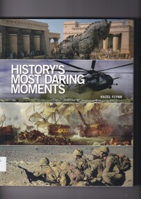
Hazel Flynn, History's most daring moments
The human psyche, when confronted by the all-but-impossible, can produce the most extraordinary reactions, acts of heroism, self-sacrifice, endurance and sheer grit that in many instances remain unbelievable. Whether these are the product of the extreme pressures of warfare, acts of faith or compassion, or examples of utter tenacity and determination against all odds, the outcomes are incredible. Many of the behind-the-scenes stories have remained secret, until now. No other book gathers together so many riveting and heroic tales of rescue and survival in a single volume. Divided into seven chronological sections, this book provides revealing insights and explains the significance of each operation, although not all proved to be successful. Detailed maps of each encounter, timelines, diagrams, archival photographs and official documents accompany these gripping stories.Index, ill (some colour), portraits (some colour), maps (some colour) p.254.non-fictionThe human psyche, when confronted by the all-but-impossible, can produce the most extraordinary reactions, acts of heroism, self-sacrifice, endurance and sheer grit that in many instances remain unbelievable. Whether these are the product of the extreme pressures of warfare, acts of faith or compassion, or examples of utter tenacity and determination against all odds, the outcomes are incredible. Many of the behind-the-scenes stories have remained secret, until now. No other book gathers together so many riveting and heroic tales of rescue and survival in a single volume. Divided into seven chronological sections, this book provides revealing insights and explains the significance of each operation, although not all proved to be successful. Detailed maps of each encounter, timelines, diagrams, archival photographs and official documents accompany these gripping stories.military history, politics and war -
 Bendigo Historical Society Inc.
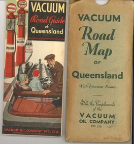
Document - BILL ASHMAN COLLECTION: VACUUM ROAD MAP QUEENSLAND
Vacuum Road Map of Queensland with Interstate routes with the compliments of the Vacuum Oil Company Pty Ltd.map -
 Bendigo Historical Society Inc.
Map - JACK FLYNN COLLECTION: ARCHDALE, 15/01/1936
Map: Parish of Archdale, County of Gladstone. Parish plan. The Allotments have been coloured in with pencil.By Authority H.J. Green, Government Printer Melbourne. Drawn and Reproduced at the Dept, of Lands and Survey, Melbourne, Victoria. 15/01/36map, gladstone, parish plan, archdale , gladstone -
Bendigo Historical Society Inc.
Map - HUNTLY, 9th June 1880
Map:Huntly, County of Bendigo. Parish plan Canvas backed. ( number 138 in Map Cupboard 1)map, bendigo, city streets, huntly, county of bendigo -
Bendigo Historical Society Inc.
Map - BOROUGH OF EAGLEHAWK RE-SURVEY, 6/06/1883
Map: Re-survey, Borough of Eaglhawk, Parishes of Nerring and Sandhurst, Sheet No. 1. Parish planmap, bendigo, re-survey, borough of eaglehawk, re-survey -
Bendigo Historical Society Inc.
Map - CITY OF SANDHURST RESURVEY SHEET 1, 21/05/1881
Map: City of Sandhurst resurvey sheet 1. Parish plan showing the Southeastern corner of the Municipalitymap, bendigo, parish plan, sandhurst, resurvey -
Bendigo Historical Society Inc.
Map - COUNTY OF RODNEY, No date visible
Map: Plan of the whole County of Rodney , showing areas available for selection, October 1st 1893.map, rodney, areas available for slection, county of rodney, areas available for selection -
 National Vietnam Veterans Museum (NVVM)
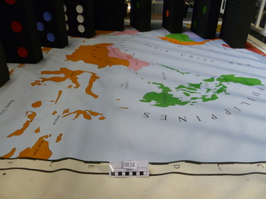
Map, Flawed Theory, 2009
Large PVC 1965 political map of South East Asia with nine large dominoes attached'Asia South East Political 1965'domino theory, 3rar, jones, geoffrey r -
 National Vietnam Veterans Museum (NVVM)
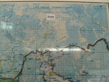
Map, 1 ATF Special Overprint (sheet 1) Map
Framed map of 1 ATF operating area, operating bases and operational zones and firebases are detailed.map, 1 atf, firebases -
 National Vietnam Veterans Museum (NVVM)
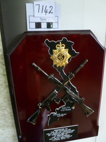
Plaque
Red Stained wooden plaque with map of Vietnam, Crossed rifles, RAAMC Badge and presentation detailsPresented to 1 Aust FD Hosp Assoc by Dorothy Mellowship in memory of her late husband WO1 'Blue' Mellowship Vietnam 1970-71wo1 'blue' mellowship, 1st australian field hospital -
 National Vietnam Veterans Museum (NVVM)
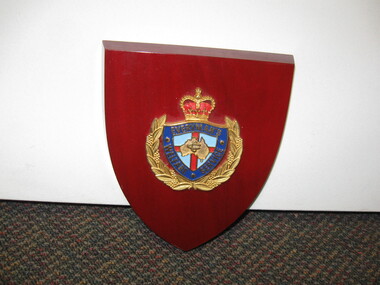
Plaque, Shield
A red varnish wooden shield bearing an emblem "Everyman's Welfare Service" with a map of Australia in the centreshield, everyman's welfare service -
 Tatura Irrigation & Wartime Camps Museum
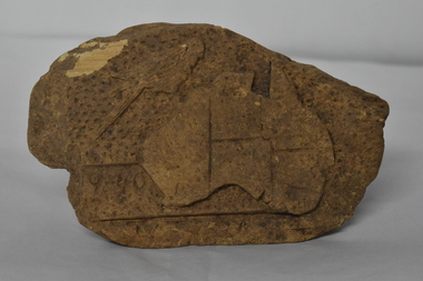
Sandstone Rock, 1940
This rock was found by a Year 3 boy, Beanie Cockram-Russell, in the Dhurringile Primary School garden bed.Piece of sandstone which has a, 1940, a map of Australia, a Rosella and the word Tatura Vic. carved into it.Australia, Rosella and Taturadhurringile primary school, carved sandstone rock -
Tatura Irrigation & Wartime Camps Museum
Book, A Brief History of Finland, 1997
A concise account of Finnish history events since 1809Grey plastic dust cover. Harbour scene on front cover, map on back. Purple writingfinland, klinge m, walcuzk e, history of finland -
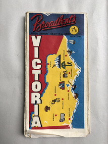 Robin Boyd Foundation
Map, Broadbents, Victoria
A well used large one sided map, which has been sellotaped down the centre.walsh st library -
Lakes Entrance Regional Historical Society (operating as Lakes Entrance History Centre & Museum)
Book, Fairweather, Keith McD, Bedrock, 1986
Mining in the Deptford and Bulumwaal districts of Gippsland, Victoria. Nominal index. Illustrated with photographs and maps. Reprint.mines and mining, township, settlers -
Lakes Entrance Regional Historical Society (operating as Lakes Entrance History Centre & Museum)
Book, Green Os, Marlo The Township the Plains The Cape, 1984
History of Marlo Victoria from its settlement until 1983 includes sketch maps and photographs.township