Showing 6427 items matching "housing"
-
 Whitehorse Historical Society Inc.
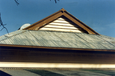
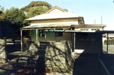
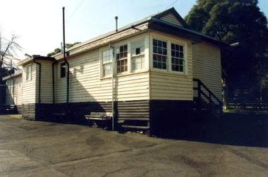
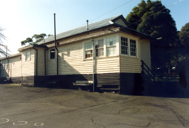
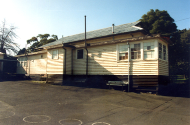
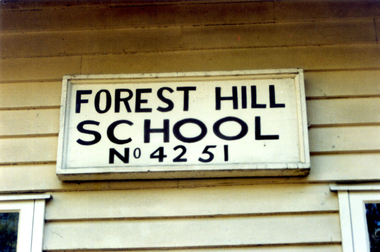
Photograph, Forest Hill State School, 1/08/1993 12:00:00 AM
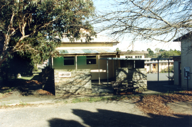
School closed , demolished and land sold for housing .Coloured Photo of Forest Hill State School No. 4251.Springvale Road, Forest Hill. Since demolished. Part of a group of 24.forest hill state school.no. 4251 -
 Whitehorse Historical Society Inc.
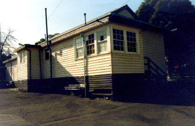
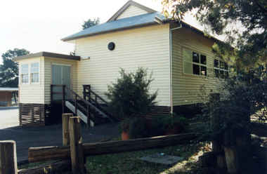
Photograph, Forest Hill State School, 1/08/1993 12:00:00 AM
School closed , demolished and land sold for housing .Coloured Photo of Forest Hill State School No. 4251.Springvale Road, Forest Hill. Since demolished. Part of a group of 24.forest hill state school.no. 4251 -
 Whitehorse Historical Society Inc.
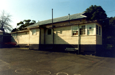
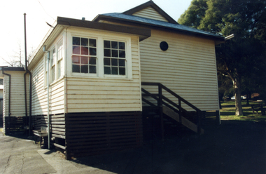
Photograph, Forest Hill State School, 1/08/1993 12:00:00 AM
School closed , demolished and land sold for housing .Coloured Photo of Forest Hill State School No. 4251.Springvale Road, Forest Hill. Since demolished. Part of a group of 24.forest hill state school. no. 4251 -
 Whitehorse Historical Society Inc.
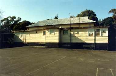
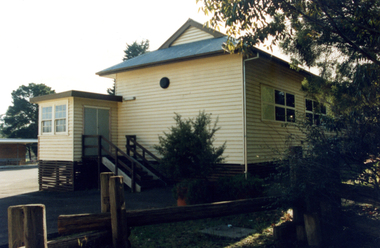
Photograph, Forest Hill State School, 1/08/1993 12:00:00 AM
School closed , demolished and land sold for housing .Coloured Photo of Forest Hill State School No. 4251.Springvale Road, Forest Hill. Since demolished. Part of a group of 24.forest hill state school. no. 4251 -
 Whitehorse Historical Society Inc.
Photograph, Forest Hill State School, 1/08/1993 12:00:00 AM
School closed , demolished and land sold for housing .Coloured Photo of Forest Hill State School No. 4251.Springvale Road, Forest Hill. Since demolished. Part of a group of 24.forest hill state school. no. 4251, school -
 Whitehorse Historical Society Inc.
Photograph, Forest Hill State School, 1/08/1993 12:00:00 AM
School closed , demolished and land sold for housing .Coloured Photo of Forest Hill State School No. 4251.Springvale Road, Forest Hill. Since demolished. Part of a group of 24.forest hill state school. no. 4251 -
 Whitehorse Historical Society Inc.
Photograph, Forest Hill State School, 1/08/1993 12:00:00 AM
School closed , demolished and land sold for housing .Coloured Photo of Forest Hill State School No. 4251.Springvale Road, Forest Hill. Since demolished. Part of a group of 24.forest hill state school. no. 4251, school -
 Whitehorse Historical Society Inc.
Photograph, Forest Hill State School, 1/08/1993 12:00:00 AM
School closed , demolished and land sold for housing .Coloured Photo of Forest Hill State School No. 4251.Springvale Road, Forest Hill. Since demolished. Part of a group of 24.forest hill state school. no. 4251, school -
 Whitehorse Historical Society Inc.
Photograph, Forest Hill State School, 1/08/1993
School closed , demolished and land sold for housing .Coloured Photo of sign on Forest Hill State School No. 4251 Springvale Road, Forest Hill, Victoria. Since demolished. Part of a group of 24 schools closed around 1993.forest hill state school. no. 4251 -
 Hume City Civic Collection
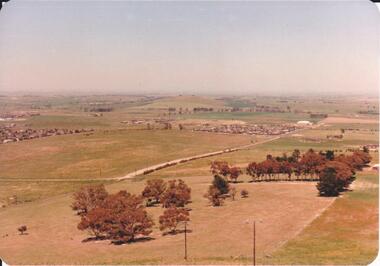
Photograph, 1980s
The photograph was taken above Reservoir Road on the lower slopes of Mt. Holden. It is looking south down Wilson's Lane towards some of the early Sunbury developments which grew around the Gap Road area in the early 1980s.A landscape coloured photograph with rounded corners. It is a panoramic view of Sunbury taken from the southern slopes of Mt. Holden. In the foreground there is a small cluster of trees and in the middle distance there is some evidence of housing development. Bald Hill can be seen on the skyline.wilson's lane, mt. holden, bald hill, sunbury, george evans collection -
 Hume City Civic Collection
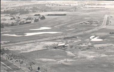
Photograph
A black and white aerial photograph of an aerial view of the newly established Goonawarra Golf Club. Sunbury Road is visible in the bottom LH corner and Francis Avenue crosses the photograph. The clubhouse is in the centre of the photograph and some early housing development is in the distance.goonawarra gold club, housing developments, regional newspaper, george evans collection -
 City of Kingston
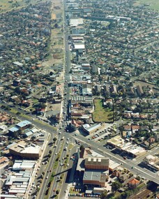
Photograph - Colour, c. 1982
This aerial photograph of South Road and Nepean Highway, Moorabbin shows the area where houses and shops on the south side of the Nepean Highway have demolished for the widening of the highway. The pressures of rapid urban development in Moorabbin and beyond, especially to the south of Moorabbin caused bottlenecks and delays, especially at the South Road and Nepean Highway intersection, hence the scheme to widen Nepean Highway.The pressures of rapid urban development in terms of people, housing construction, industrial development and commercial activity, in Moorabbin and beyond, especially to the south would put pressure on road infrastructure in the region. In the early 1980s, a major road expansion of the Nepean Highway was implemented to increase capacity on this major thoroughfare for vehicle commuters. Car use had also increased with commuters from the increasingly populous southern suburbs travelling to their place of work in the Melbourne CBD.Colour photograph of an aerial view of South Road and Nepean Highway, Moorabbin. The image shows houses on the south side of the Nepean Highway that have demolished for widening of road. It features housing and commercial buildings looking north towards Cummins Road.Handwritten blue ink: 82 - 5452 - 11 Handwritten red ink: 112% Handwritten black ink: Ch. 7nepean highway, south road, moorabbin, roads, transport, infrastructure -
 Eltham District Historical Society Inc
Photograph, Fitzsimons Lane Reserve bounded by Main Road, Bolton Street and Fitzsimons Lane, Eltham, c.May 2001
Now partially developed as the Monarch Ridge housing estateRoll of 35mm colour negative film, 7 stripsAgfa HDC 200 plus-2eltham, streets, main road, fitzsimons lane reserve, houses, monarch ridge estate -
 Eltham District Historical Society Inc
Photograph, Fitzsimons Lane Reserve bounded by Main Road, Bolton Street and Fitzsimons Lane, Eltham, c.May 2001
Now partially developed as the Monarch Ridge housing estateRoll of 35mm colour negative film, 7 stripsAgfa HDC 200 plus-2eltham, streets, main road, fitzsimons lane reserve, monarch ridge estate -
 Maldon Vintage Machinery Museum Inc
Pump - Centrifugal
Single stage end suction pump with part of casing cut away to reveal interior. Painted yellow with edges of cut away in red.Blue and white circular paper sticker on top with "Thompsons Kelly & Lewis Pumps made in Australia". Stylised bird in centre of sticker. On end of housing in relief "65x40-250 / 1.0108" (pump size & casing pattern No).machinery; pump; centrifugal; metalwork -
Glen Eira Historical Society
Photograph - Frogmore
This folder is about the subdivision of 'Frogmore':A black and white photograph (140mm x 90mm) of a real estate advertisement for the sale of housing blocks on the residential development Frogmore Estate, Murrumbeena. The advertisement includes a plan showing the location of the housing blocks and the surrounding roads.murrumbeena, carnegie, frogmore estate, neerim road, gnarwyn road, coorigil road, moonya road, woornack road, rosstown railway, carool road, warina road, murrumbeena road, frogmore road, wahgoo road, hethersett grove, hethersett, thomas j g, plans, housing estates, rosstown, caulfield council, land subdivision -
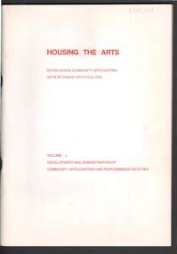 Bendigo Historical Society Inc.
Document - MERLE HALL COLLECTION: ''HOUSING THE ARTS'' VOL 1 AUSTRALIA COUNCIL 1979
''Housing the Arts - Establishing Community Arts Centres or Performing Arts Facilities'' Vol 1 Australia Council 1979 . A guide for local councils and arts groups, based on the results of a survey of thirty centres throughout Australia. (Ross Thorne. 81 pages -
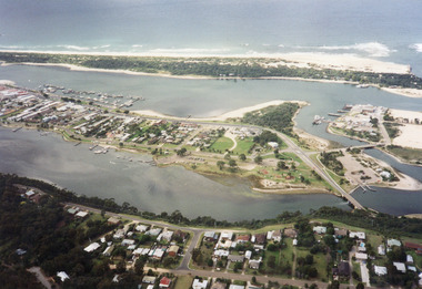 Lakes Entrance Historical Society
Photograph - Lakes Entrance, 1997c
Colour print of aerial view looking south of western side of township. Shows housing on Kalimna Hill, North Arm, part of Bullock Island, Cunninghame Arm, the outer barrier and east pier of man made entrance. Lakes Entrance Victoriawaterways, township