Showing 1813 items
matching north rd
-
 Eltham District Historical Society Inc
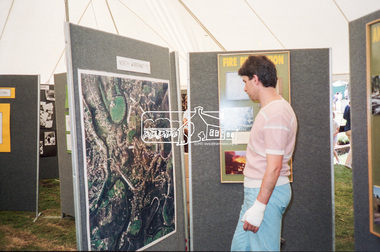
Negative - Photograph, Eltham Shire Council display, 1987 Eltham Community Festival, Alistair Knox Park, 7 Nov. 1987
Regular display by Council at the Eltham Festival providing ratepayers and visitors some insight into the daily operations of and services provided by Council and various equipment and machinery used.Roll of 35mm colour negative film, 4 stripsKodak GB 200 5096aerial photographs, alistair knox park, displays, eltham festival, eltham shire council, infrastructure, north warrandyte, shire of eltham -
 Eltham District Historical Society Inc
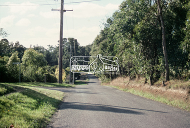
Slide - Photograph, Bells Hill Road, Research, c.May 1988
... Eltham District Historical Society Inc 728 Main Rd Eltham ...Looking north along Bells Hill Road at intersection with Kybrolyde Ct, Research, May 198835mm colour positive transparency (1 of 36) Mount - Kodak KodachromeProcess Date MAY 88Mbells hill road, infrastructure, kybrolyde ct, research (vic.), roads -
 Eltham District Historical Society Inc
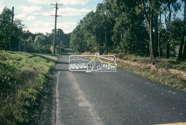
Slide - Photograph, Bells Hill Road, Research, c.May 1988
... Eltham District Historical Society Inc 728 Main Rd Eltham ...Looking north along Bells Hill Road at intersection with Kybrolyde Ct, Research, May 198835mm colour positive transparency (` of 36) Mount - Kodak KodachromeProcess Date MAY 88Mbells hill road, infrastructure, kybrolyde ct, research (vic.), roads -
 Eltham District Historical Society Inc
Slide, Looking north along Buena Vista Drive near Montmorency South Primary School, c.Oct. 1980
One of a series of images of roads and infrastructure focussed on the Quinn Estate in Montmorency taken by Eltham Shire Council Planning and Engineering officers. They provide perspective of the changes in housing styles and road development that began sweeping in from the mid 1970s with increasing urbanisation of what was once more outlying suburbs and regions.35 mm colour positive transparency Mount - Kodak Kodachrome CardProcessed Oct 1980buena vista drive, infrastructure, montmorency, montmorency south primary school, roads -
 Eltham District Historical Society Inc
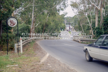
Slide - Photograph, Bridge Street, Eltham, c.June 1990
Intersection of Main Road and Bridge Streets, Eltham. Before reconstruction of Main Road, this intersection had deep cutting embankments on all four corners. Roadworks and private development have levelled the land on the low side of the road. The Eltham War Memorial was originally located on the north western corner. in 1919. 35mm colour positive transparency (1 of 36) Mount - Agfa CS System grey 8 dotsroads, bridge street, eltham -
 Eltham District Historical Society Inc
Slide - Photograph, Ryans Road, Eltham North, c.1992
35mm colour positive transparency Mount - Black and Whiteinfrastructure, roads, eltham north, ryans road -
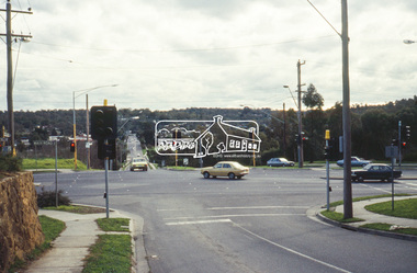
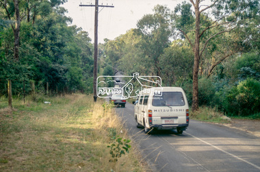
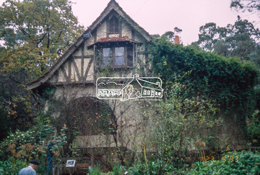
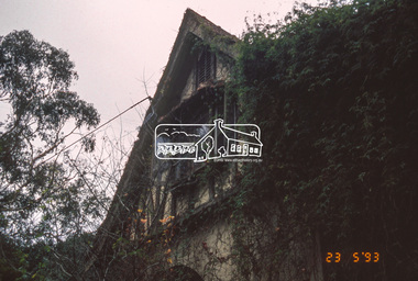 Eltham District Historical Society Inc
Slide - Photograph, The Robins. Kangaroo Ground-Warrandyte Road, North Warrandyte, 23 May 1993
The 1993 Eltham Heritage Tour was enjoyed by a busload of members of the Historical Society on a fine, calm day, Sunday May 23rd. Between 10.00 am and 4.30 pm, except for a brief lunch stop at the Eltham Living and Learning Centre, members passed about thirty places of local interest and others recommended for the Historic Buildings Register and the Register of the National Estate. A number of significant trees and buildings were also highlighted along with the opportunity to explored some of the properties.35mm colour positive transparency (1 of 24) Mount - Kodak Kodachromeactivities, kangaroo ground-warrandyte road, north warrandyte, shire of eltham historical society, the robins, heritage excursion -
 Eltham District Historical Society Inc
Slide - Photograph, Wattletree Road Bridge, Eltham, c.1993
35mm colour positive transparency Mount - Black and Whiteinfrastructure, roads, eltham, eltham north, level crossing, main road, park west road, railway crossing, sign, wattletree road, wattletree road bridge -
 Eltham District Historical Society Inc
Slide - Photograph, Stony Creek Road, North Warrandyte, c.1993
35mm colour positive transparency Mount - Black and Whiteinfrastructure, roads, doleen road, north warrandyte, stony creek road -
 Eltham District Historical Society Inc
Slide - Photograph, Stony Creek Road, North Warrandyte, c.1993
35mm colour positive transparency Mount - Black and Whiteinfrastructure, roads, doleen road, north warrandyte, stony creek road -
 Eltham District Historical Society Inc
Slide - Photograph, Silver Street, Eltham North, c.1993
35mm colour positive transparency Mount - Black and Whiteelm crescent, eltham north, highpoint crescent, infrastructure, roads, silver street -
 Eltham District Historical Society Inc
Slide - Photograph, Stony Creek Road, North Warrandyte, c.1993
35mm colour positive transparency Mount - Black and Whiteinfrastructure, roads, doleen road, north warrandyte, stony creek road -
 Eltham District Historical Society Inc
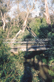
Slide - Photograph, Gum Glade Footbridge, Eltham North, c.Nov. 2001
Part of a slide show presentation "A Trip Down the Diamond Creek" by Russell Yeoman to the Eltham District Historical Society meeting of 14 Nov. 200135mm colour positive transparency Mount - Black and Whitegum glade footbridge, eltham north -
 Eltham District Historical Society Inc
Slide - Photograph, Development either side of Railway Road viewed from across Railway Parade, Eltham, c.Nov. 2001
Part of a slide show presentation "A Trip Down the Diamond Creek" by Russell Yeoman to the Eltham District Historical Society meeting of 14 Nov. 200135mm colour positive transparency Mount - Black and Whiteeltham north, housing estate, railway parade, railway road, eltham -
 Eltham District Historical Society Inc
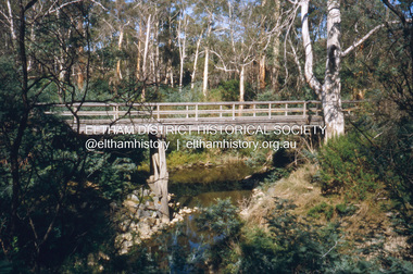
Slide - Photograph, Wattletree Road Bridge, Eltham North, c.Nov. 2001
Part of a slide show presentation "A Trip Down the Diamond Creek" by Russell Yeoman to the Eltham District Historical Society meeting of 14 Nov. 200135mm colour positive transparency Mount - Black and Whiteeltham north, eltham, wattletree road bridge -
 Eltham District Historical Society Inc
Slide - Photograph, Edendale Bridge, Eltham North, c.Nov. 2001
Part of a slide show presentation "A Trip Down the Diamond Creek" by Russell Yeoman to the Eltham District Historical Society meeting of 14 Nov. 200135mm colour positive transparency Mount - Black and Whiteeltham, edendale bridge, eltham north -
 Eltham District Historical Society Inc
Slide - Photograph, Murrays Bridge, Eltham North, c.Nov. 2001
Part of a slide show presentation "A Trip Down the Diamond Creek" by Russell Yeoman to the Eltham District Historical Society meeting of 14 Nov. 200135mm colour positive transparency Mount - Black and Whiteeltham north, murrays bridge -
 Eltham District Historical Society Inc
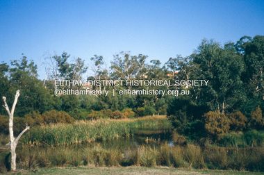
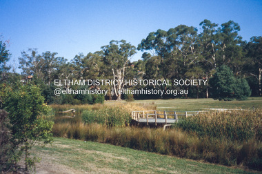
Slide - Photograph, Wetlands, Eltham North, c.Nov. 2001
Part of a slide show presentation "A Trip Down the Diamond Creek" by Russell Yeoman to the Eltham District Historical Society meeting of 14 Nov. 200135mm colour positive transparency Mount - Black and Whiteeltham north, wetlands -
 Eltham District Historical Society Inc
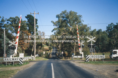
Slide - Photograph, Railway Level Crossing, Allandale Road, Eltham North, c.Nov. 2001
Part of a slide show presentation "A Trip Down the Diamond Creek" by Russell Yeoman to the Eltham District Historical Society meeting of 14 Nov. 200135mm colour positive transparency Mount - Black and Whiteallandale road, eltham north, infrastructure, level crossing, railway crossing, roads -
 Eltham District Historical Society Inc
Slide - Photograph, Private crossing over the Diamond Creek, Ninks Road, St Andrews North, c.Nov. 2001
Part of a slide show presentation "A Trip Down the Diamond Creek" by Russell Yeoman to the Eltham District Historical Society meeting of 14 Nov. 200135mm colour positive transparency Mount - Black and Whitediamond creek, ninks road, st andrews north -
 Eltham District Historical Society Inc
Photograph, Belle Vue, Livingstone Road, Eltham, c.1960, 1960c
Photo taken at time of ownership by Eric Staff. Originally purchased by pioneer Eltham farmer Henry Stooke, Belle Vue farm comprised about 56 ha (140 acres) extending northerly from the northern boundary of Holloway’s 1851 Little Eltham subdivision. On the present day map the southern boundary was just north of Elsa Court and Grove Street. The western boundary was the Diamond Creek and extended northerly to Main Road where it turns easterly towards Research. It was traversed by the main road to Kangaroo Ground and beyond and from 1912 by the railway to Hurstbridge. From 1895 the farm was owned by William Williams and his wife Mary Ann. In 1914-1915 they built a new house now known as “Belle Vue”. They sold the land in 1920 and residential subdivision began soon after that. “Belle Vue” remains today on a large residential lot in Livingstone Road. The house and many old trees on the site have been subject to a heritage overlay under the Nillumbik Planning Scheme. Despite that overlay, most of the heritage trees were removed during sub-division and development of the property.Digital file only from scan of copy on loan to EDHSbelle vue, eltham, eric staff, houses, livingstone road, staff family -
 Eltham District Historical Society Inc
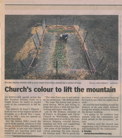
Folder, St Peter's Memorial Church, Kinglake, 1826-1912
The original St Peter’s was built in 1922 as a World War memorial church. It burned down on Black Saturday, February 7, 2009. This folder includes brief research on the local World War One Anzacs of Kinglake remembered at the church including the names Farlow, Ford, Ingham, Jarvis, Lawrey, Mains and North some of whom are remembered on the Shire of Eltham War Memorial at Kangaroo Ground. Also, information how to research WW1 veterans, brochure om Shrine of Remembrance and newspaper article on firespotting at the Kangaroo Ground TowerNewspaper articles, website printouts and handwritten notes HG Booklet 114harry gilham collection, st peter's kinglake, ww1, ford, samuel farlow, john henry ford, jarvis, francis ingham, george mains, c. north, fire spotting, kangaroo ground, shrine of remembrance -
 Eltham District Historical Society Inc
Folder, Linley Hartley et al, Meruka Park
Information about J.B. North and history of Meruka Estate, Meruka Park, Eltham "When life centred on a weekender" by Linley Hartley, Picture Ron Grant, Diamond Valley News, 25 September 1984 "Stalwart recalls the early days", by Sally McDonnell, Diamond Valley News, 30 September 1986 "A fine piece of Eltham history", Diamond Valley News, 1 March, 1997 EDHS Newsletter January 201222 pagesreminscences, marjorie north, montmorency, j. b. north, meruka estate, glen ellen estate -
 Eltham District Historical Society Inc
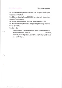
Work on paper (Sub-Item) - Photograph, The floodplain of Diamond Creek between Diamond Creek township and Eltham North
floodplain, eltham north -
 Eltham District Historical Society Inc
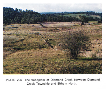
Work on paper (Sub-Item) - Aerial Photograph, Diamond Creek from Yarra River to Wattletree Road, Eltham
Black and white aerial photograph witrh key features around the central place of Eltham township marked inluding Yarra River, Main Road, Bridge Street and Ryans Road, Eltham North land development, real estate, aerial view, eltham, eltham north -
 Eltham District Historical Society Inc
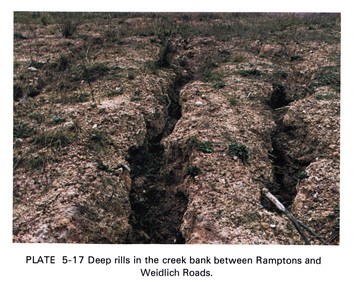
Work on paper (Sub-Item) - Photograph, Deep rills in the creek bank between Rampstons and Weidlich Roads
Colour photograph of deep rills in the Diamond Creek bank between Rampstons and Weidlich Roads, Eltham North. The shallow channels are cut into the soil by the erosive action of flowing water.eltham, creek bank, erosion, eltham north -
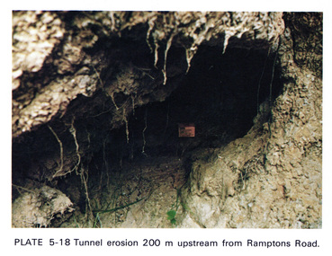 Eltham District Historical Society Inc
Work on paper (Sub-Item) - Photograph, Tunnel erosion 220 m upstream from Ramptons Road
Colour photograph of tunnel erosion 220 metres upstream from Ramptons Road, Eltham North eltham, erosion, eltham north, drain