Showing 40539 items matching "roads and streets"
-
 Ringwood and District Historical Society
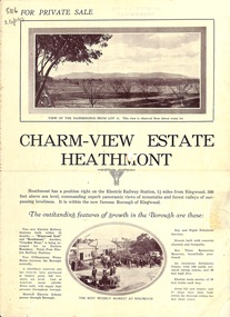
Flyer, Land Sale Brochure, Charm-View Estate, Heathmont, Vic. - c1926
Double sided folded page advertisement highlighting local facilities, services and layout of blocks for sale in Charm-View Estate.Subdivision includes Heathmont Road, Orchid Street, Bennett Avenue, Dickasons Road and Canterbury Road. (Agents) T. Burkitt & Co., Phone Ringwood 157, Overton & Co., 390 Chapel Street South Yarra, Phone Windsor 542. Solicitor A.V. Wischer, 443 Chancery Lane, Melbourne. -
 Ringwood and District Historical Society
Booklet, St Paul's Anglican Church Ringwood Centenary Souvenir History, 1979
Historic summary concentrating on four moves of St Paul's Anglican Church in Ringwood from 1879 to 1979 including photographs of each location - Mount Dandenong Road, Pratt Street, Ringwood Street, and Warrandyte Road. Includes list of vicars from 1905 to 1979.Introduction by Rev. Bill Potter, Vicar. Compiled by Stella Badger Design, Charles Miller -
 Marysville & District Historical Society
Photograph (Item) - Colour photograph, Unknown
A colour photograph of Murchison Street in Marysville in Victoria.A colour photograph of Murchison Street in Marysville in Victoria.murchison street, marysville, victoria, photograph -
 Phillip Island and District Historical Society Inc.
Photograph, 1978 - 79
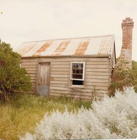
Built by J D McHaffie as a Shepherd's Hut in the 1850 - 60s. At one stage called Julyan's Cottage. Finlay Julyan born there, owned by various families. At one time by H Grayden and R McKinley. Privately owned now. (Noted on the caption that it was built by John Evans about 1870??)Small wooden building on corner of Lyall Street and Ventnor Beach Road. Brick chimney still in situ.local history, photographs, buildings - historic, coloured photograph, john cook, phillip island, settlers home -
 Eltham District Historical Society Inc
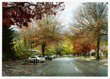
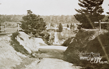
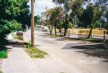
Photograph, Diamond Creek Trail, Eltham
Colour photograph of Autumn view of Diamond Creek Trail opposite Dalton Street west of Main Roaddalton street, walkways -
 Eltham District Historical Society Inc
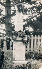
Photograph, Eltham War Memorial
Unveiled by Lieut. Governor Sir William Irvine, 3 August 1919 at 3:30 p.m.Postcard image of First World War Memorial (obelisk) cnr. Main Road and Bridge Street, ElthamOriginal inscriptions obscured by large paper label stuck to rear for Nillumbik Mail publication details, Edition 26, 25 Octobermemorials, war memorials, main road, bridge street, eltham -
 Eltham District Historical Society Inc
Photograph, Eltham (Bridge Street)
Colour photograph of an original sepia image of Bridge Street, Eltham looking west from Main Roadeltham, bridge street, main road -
 Eltham District Historical Society Inc
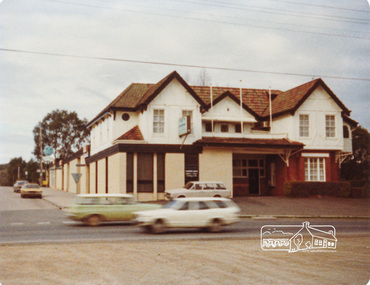
Photograph, Peter Bassett-Smith, Eltham Hotel, Eltham, June 1977, 1977
Colour photograph of Eltham Hotel viewed from opposite on Main Road looking up Pitt Streeteltham, eltham hotel, main road, pitt street, hotels -
 Eltham District Historical Society Inc
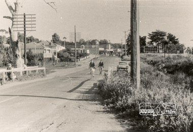
Photograph, Main Road near Cecil Street, Eltham, 1962
Black and white photograph of Main Road, Eltham looking south near Cecil Street, October 1962main road, cecil street, eltham -
 Eltham District Historical Society Inc
Photograph, Main Road, Eltham, 1990c
Two colour photographs of Main Road, Eltham from corner of Bridge Street, c. early 1990smain road, eltham, york street, bridge street -
 Eltham District Historical Society Inc
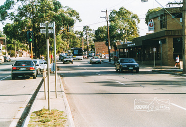
Photograph, Main Road at Pryor Street, Eltham
Five colour photographs showing Main Road at Pryor Street in Eltham Shopping Centre looking southmain road, pryor street, shops, eltham -
 Eltham District Historical Society Inc
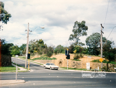
Photograph, Main Road, Eltham looking south near Diamond Street
Colour photograph of Main Road, Eltham looking south near Diamond Street on the right hand sidemain road, eltham, wattletree road, colemans corner, coleman -
 Clunes Museum
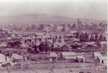
Photograph
BLACK AND WHITE PHOTOGRAPH OF CLUNES TOWNSHIP, TAKEN FROM LESLIE STREET EAST, OFF SMEATON ROAD.METHODIST & PRESBYTERIAN CHURCHES IN CENTRE TAKEN FROM LESLIE ST. EAST OF SMEATON ROAD NOTE WESLEYAN CHURCH HAS SPIRElocal history, photography, photographs, clunes township -
 Whitehorse Historical Society Inc.
Document, Advance Blackburn!, c. 1900
Circular letter and street plan regarding donations sought to fund a proposed extension of The Avenue to Blackburn Road.Circular letter and street plan regarding donations sought to fund a proposed extension of The Avenue to Blackburn Road.Circular letter and street plan regarding donations sought to fund a proposed extension of The Avenue to Blackburn Road.blackburn road blackburn, elmore, algernon john, williams, e. g., page, chas. d, the avenue, blackburn -
Whitehorse Historical Society Inc.
Document, Livermore's property, n.d
Hand drawn map of original Livermore home, Verona Street, Morack Road. See Photograph album.livermore family, city of nunawading, verona street, vermont south, morack road, vermont south -
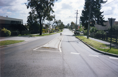 Whitehorse Historical Society Inc.
Photograph, Rooks Road, Mitcham, 1/10/2000 12:00:00 AM
Coloured photograph of Rooks Road, Mitcham, looking north. Taken from Gibson Street, Mitcham corner.rooks road, mitcham -
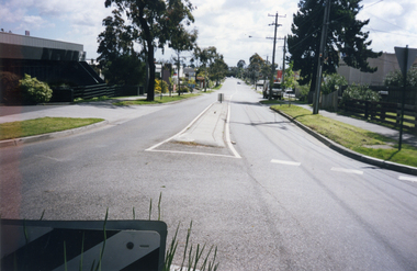 Whitehorse Historical Society Inc.
Photograph, Rooks Road, Mitcham, 1/10/2000 12:00:00 AM
Coloured photograph of Rooks Road, Mitcham looking north. Taken from round-about at Gibson Street.rooks road, mitcham -
 Whitehorse Historical Society Inc.
Photograph, Chapel Street/ Railway Road, Blackburn, 6/01/2001 12:00:00 AM
Black and white photograph of shops on corner of Chapel Street and Railway Road, Blackburn. Fruiterer closed 2000chapel street, blackburn, railway road, blackburn. -
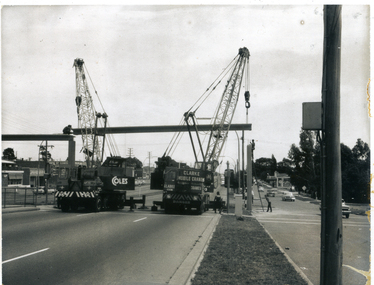 Whitehorse Historical Society Inc.
Photograph, Pedestrian Overpass Mitcham 2, 30/01/1969 12:00:00 AM
Black and white photograph of the placing of the spans for the pedestrian overpass in Whitehorse Road, Mitcham at Peel Street Mitchampeel street mitcham, pedestrian overpass, whitehorse road, mitcham -
Canterbury History Group
Photograph - Young's Milk Bar and Dairy, Susan Barnett, 1/06/2012 12:00:00 AM
Black and white photograph of Young's Milk Bar and Dairy corner of Highfield Road and Leeds Street, Canterburycanterbury, highfield road, leeds street, milk bars, shops, dairies, advertising signs, barnett> susan -
Canterbury History Group
Photograph - Young's Milk Bar and Dairy, Susan Barnett, 1/06/2012 12:00:00 AM
Black and white photograph of Young's Milk Bar and Dairy, corner of Highfield Road and Leeds Street Canterburycanterbury, highfield road, leeds street, milk bars, shops, dairies, advertising signs, barnett> susan -
Canterbury History Group
Photograph - Street view of the mail boxes at Canterbury Post Office from the Maling Road side, Stuart Warmington, 1995
Coloured photograph of street view of the mail boxes at Canterbury Post Office from the Maling Road sidecanterbury, maling road, shops -
Canterbury History Group
Photograph - Street view of the Telephone Exchange next to Canterbury Post Office from Maling Road, Stuart Warmington, 1995
Coloured photograph of street view of the Telephone Exchange next to Canterbury Post Office from Maling Roadcanterbury, maling road, shops, public telephone boxes -
Canterbury History Group
Photograph - Street view of the shop No.117 Maling Road, Canterbury, Stuart Warmington, 1995
Coloured photograph of Street view of the shop No.117 Maling Road, Canterbury. The original entrance to the Canterbury Theatrecanterbury, maling road, shops, theatres -
Canterbury History Group
Photograph - Balwyn Road, Canterbury looking north, c. 1909
Black and white photograph of Canterbury looking north up Balwyn Road from Logan Street c1909.canterbury, balwyn road, logan street, maling road, shops, street trees, canterbury gardens, duncan and weller -
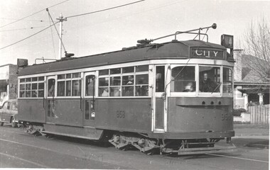 Melbourne Tram Museum
Photograph - Tram SW6 958 - Dash Canopy lighting, Lindsay Crow, early 1950s
Photograph - SW6 958 (City Route 4), fitted with dash canopy lighting rather than a single headlight. The tram was built in June 1950 and converted to a single headlight in May 1956, Photos by Lindsay Crow, published by Windsor Publications.Yields information about tramcars fitted with dash canopy lighting.Photograph of Tram SW6 958 - fitted with Dash Canopy lighting In Glen Huntly Road at Peace Street. Has the stamp of Windsor Publications on rear.trams, tramways, tram 958, sw6 class tram, route 4 -
Canterbury History Group
Photograph - Street view of Shop at No. 129 Maling Road and adjoining shops, Jan Pigot, 27/03/1993 12:00:00 AM
Coloured photograph of the street view of Wilson and Walsh at No. 129 Maling Road. Also showing adjoining shops.canterbury, maling road, shops, streetscapes -
Canterbury History Group
Photograph - Street view of the 2 plaques at 245 and 241 Canterbury Road, Canterbury, Jan Pigot, 2004
Coloured photograph of the street view of the 2 blue enamel plaques at 245 and 241 Canterbury Road, Canterburycanterbury, canterbury road, shops, signs, plaques -
Canterbury History Group
Photograph - Street view of the corner of Maling Road and Bryson Street, Jan Pigot, 27/03/1993 12:00:00 AM
Coloured photograph of of the stage coach going down Maling Road taken from the Bryson Street corner.canterbury, maling road, shops, bryson street -
Canterbury History Group
Photograph - Street view of the demolition of the Uniting Church on the corner of Canterbury Road and Hopetoun Ave., Canterbury, Jan Pigot, 1994
Coloured photograph of Street view of the demolition of the Uniting Church on the corner of Canterbury Road and Hopetoun Ave., Canterburycanterbury, canterbury road, churches