Showing 4549 items matching "historical maps"
-
 Victorian Railway History Library
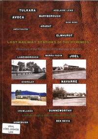
Book, Jeffrey, Max et al, Lost Railway Stations of the Pyrenees, 2019
Illustrated history of the railway stations on the closed railway lines of the Victorian Pyrenees including the line to Navarre & Ararat to Maryborough.ill, maps, p.226.non-fictionIllustrated history of the railway stations on the closed railway lines of the Victorian Pyrenees including the line to Navarre & Ararat to Maryborough.pyrenee range (vic.) -- buildings, structures, etc -- history, railroad stations -- victoria -- pyrenee range -- history -
 Victorian Railway History Library
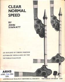
Booklet, Australian Railway Historical Society Victorian Division, Clear Normal Speed: An Outline of Three Position Automatic Signalling on the Victorian Railways, 1966
Details of the use of 3 position automatic semaphore signals on the Victorian Railways.ill, maps, p.34.non-fictionDetails of the use of 3 position automatic semaphore signals on the Victorian Railways.railroad operations - victoria, railroad signalling - victoria -
 Victorian Railway History Library
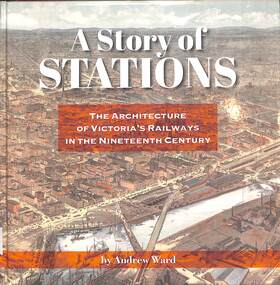
Book, Ward, Andrew, A Story of Stations The Architecture of Victoria's Railways in the Nineteenth Century, 2019
Details of the architecture of railway stations building in Victoria Australia in the 19th century.index, ill, maps, p.337.non-fictionDetails of the architecture of railway stations building in Victoria Australia in the 19th century.railroad infrastructure - victoria, railroads - victoria - history -
 Victorian Railway History Library
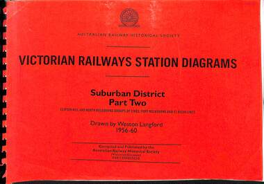
Book, Langford, Weston, Victorian Railway Station Diagrams 1956-1960 - Suburban District Part Two, 1956-1960
Railway diagrams of the stations on the Clifton Hill, North Melbourne Port Melbourne & St Kilda group of lines in the Suburban district of Melbourne Victoria in 1956 to 1960.maps, p.52.non-fictionRailway diagrams of the stations on the Clifton Hill, North Melbourne Port Melbourne & St Kilda group of lines in the Suburban district of Melbourne Victoria in 1956 to 1960.railroad infrastructure - victoria, railroads - victoria -
 Victorian Railway History Library
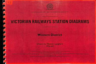
Book, Langford, Weston, Victorian Railway Station Diagrams 1956-1960 - Western District, 1956-1960
Railway diagrams of all the stations in the Western district of Victoria in 1956 to 1960.maps, p.56.non-fictionRailway diagrams of all the stations in the Western district of Victoria in 1956 to 1960.railroad infrastructure - victoria, railroads - victoria -
 Victorian Railway History Library
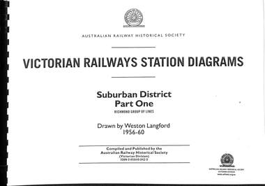
Book, Langford, Weston, Victorian Railway Station Diagrams 1956-1960 - Suburban District Part One, 1956-1960
Railway diagrams of all the stations on the Richmond group of lines in the Suburban district of Melbourne Victoria in 1956 to 1960.maps, p.64.non-fictionRailway diagrams of all the stations on the Richmond group of lines in the Suburban district of Melbourne Victoria in 1956 to 1960.railroad infrastructure - victoria, railroads - victoria -
 Victorian Railway History Library
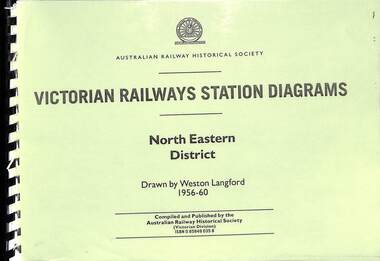
Book, Langford, Weston, Victorian Railway Station Diagrams 1956-1960 - North Eastern District, 1956-1960
Railway diagrams of all the stations in the North Eastern district of Victoria in 1956 to 1960.maps, p.132.non-fictionRailway diagrams of all the stations in the North Eastern district of Victoria in 1956 to 1960.railroad infrastructure - victoria, railroads - victoria -
 Victorian Railway History Library
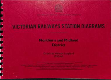
Book, Langford, Weston, Victorian Railway Station Diagrams 1956-1960 - Northern and Midland District, 1956-1960
Railway diagrams of all the stations in the Northern and Midland district of Victoria in 1956 to 1960.maps, p.43.non-fictionRailway diagrams of all the stations in the Northern and Midland district of Victoria in 1956 to 1960.railroad infrastructure - victoria, railroads - victoria -
 Victorian Railway History Library
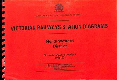
Book, Langford, Weston, Victorian Railway Station Diagrams 1956-1960 - North Western District, 1956-1960
Railway diagrams of all the stations in the North Western district of Victoria in 1956 to 1960.maps, p.84.non-fictionRailway diagrams of all the stations in the North Western district of Victoria in 1956 to 1960.railroad infrastructure - victoria, railroads - victoria -
 Victorian Railway History Library
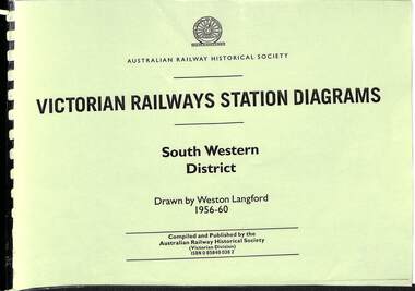
Book, Langford, Weston, Victorian Railway Station Diagrams 1956-1960 - South Western District, 1956-1960
Railway diagrams of all the stations in the South Western district of Victoria in 1956 to 1960.maps, p.76.non-fictionRailway diagrams of all the stations in the South Western district of Victoria in 1956 to 1960.railroad infrastructure - victoria, railroads - victoria -
 Victorian Railway History Library
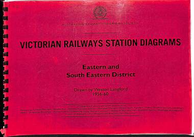
Book, Langford, Weston, Victorian Railway Station Diagrams 1956-1960 - Eastern and South Eastern District, 1956-1960
Railway diagrams of all the stations in the Eastern and South Eastern district of Victoria in 1956 to 1960.maps, p.67.non-fictionRailway diagrams of all the stations in the Eastern and South Eastern district of Victoria in 1956 to 1960.railroad infrastructure - victoria, railroads - victoria -
 Phillip Island and District Historical Society Inc.
Booklet, Phillip Island Holidays Development Pty Ltd, Ideal Summerland on the Nobbies, Phillip Island, Late 1920s
Subdivision of Summerland commenced in the 1920s with 12 large allotments created, along with features such as a roundabout and cypress trees. Between 1927 and 1931, 227 new blocks were created, and from 1929 to 1940 there was a nine-hole golf course on what is now the Penguin Parade car park.Historical Large 8 page glossy booklet advertising Summerland Estate, describing attractions of the area ,maps, houses , golf course. Basically black and white with some orange print and a coloured map.Ideal Summerland on the Nobbies Phillip Island. "The land of somewhere we long to go". Published by Phillip Island Holidays Development Pty Ltd. 6o Market Street, Melbourne.housing, tourism phillip island, summerland estate -
 Phillip Island and District Historical Society Inc.
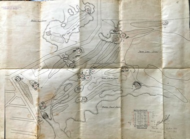
Map, Map of Summerland Golf Course, 15/12/1927
Summerland Estate was created in the 1920s by A.K. T. Sampbell. It consisted of a housing estate, guest house and golf course. This area was acquired and all buildings, roads etc removed by the Victorian Government in the 1980s for a nature reserve for the penguins. This is believed to be the only time in the world when humans have been removed to benefit nature. HistoricalPurple leather covered fold out linen map with hand drawn diagram of the topography, layout of golf holes and club house Broken sand dunes, rough sandy hills, grassy hills and mounds, Swan Lake, Par for nine holes 34, Scratch score for nine holes 36, Drawn by A. Russell 12/12/1927summerland estate, a.k. t. sampbell, map, penguin reserve, summerland golf course -
 Victorian Railway History Library
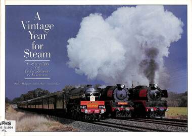
Book, Malpass, Steve et al, A Vintage Year for Steam: Aus Steam 88 and Flying Scotsman in Australia, 1992
A pictorial history of the Aus Steam event in 1988 and the visit of Flying Scotsman A3 3-cylinder 4-6-2 from England to Australia 1988-1990.ill, maps, p.121.non-fictionA pictorial history of the Aus Steam event in 1988 and the visit of Flying Scotsman A3 3-cylinder 4-6-2 from England to Australia 1988-1990.flying scotsman - australia - pictorial history, steam locomotives - australia - history -
 Victorian Railway History Library
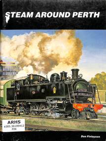
Book, Finlayson, Don, Steam Around Perth, 1986
A Pictorial history of steam locomotives working in Perth Western Australia up to the 1980s.ill, maps, p56.non-fictionA Pictorial history of steam locomotives working in Perth Western Australia up to the 1980s.steam locomotives - western australia - history, railroads - western australia - history -
 Clunes Museum
Map, A.C. BROOKS GOVERNMENT PRINTER MELBOURNE, EGLINTON COUNTY OF TALBOT, 1965
... HISTORICAL MAP...MAP OF EGLINTON EGLINTON HISTORICAL MAP ADMINISTRATIVE ...MAP OF EGLINTONMAP OF EGLINTON, COUNTY OF TALBOT PRINTED ON CANVAS WITH PLASTIC TAB FOR HANGING. MAP SHOWS TOWN ALLOTMENTSADMINISTRATIVE STAMP ON BOTTOM LEFT AND ON THE BACK OF THE MAP ANOTHER STAMP - NORTHERN DIVISION (299) FORESTS COMMISSION BENDIGOeglinton, historical map -
 Whitehorse Historical Society Inc.
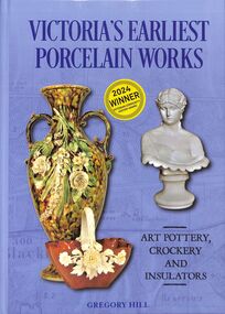
Book - Historical Reference, Gregory HILL, Victoria's Earliest Porcelain Works, 2023
This book covers the formative years of Victoria's porcelain industry from 1857 to the late 20th century.With a glossy cover, this book details the history of Victorian Potteries illustrated by color photographs, maps, diagrams. non-fictionThis book covers the formative years of Victoria's porcelain industry from 1857 to the late 20th century.pottery, dahlke, crockery, hill gregory, springfield pottery, white brothers, commonwealth art pottery and insulator company, springfield road -
 Bendigo Historical Society Inc.
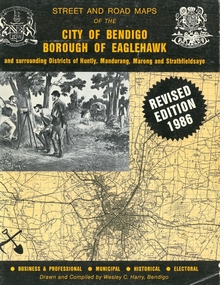
Book - STREET AND ROAD MAPS OF THE CITY OF BENDIGO BOROUGH OF EAGLEHAWK, c1980
... map buildings streetscapes historical pictures advertisements ...Street and Road Maps of the City of Bendigo Borough of Eaglehawk and surrounding Districts of Huntly, Mandurang, Marong and Strathfieldsaye, in color. Drawn and compiled by Wesley C Harry, Bendigo. Publisher: Cambridge Press, Bendigo. ISBN: 9598608.2.2. 68 pages. Photographs, Illustrations & maps. Photos include: Bendigo buildings, scenery mines, streetscapes, parades, pioneer leaders of Bendigo. Many advertisements throughout. List of Justices of the Peace, hospitals, homes for the aged, schools, churches. Page 58: Copy of ''Freedom of the City to the Australian Survey Regiment'' proclamation, 14th June 1970. Maps cover an area of some 169 sq. miles (43,772 hectares). Origin of the name Bendigo. Information on the five Wards of Bendigo, and their councilors. Revised Edition 1986Wesley C Harrybook, bendigo, bendigo & district maps, bendigo and districts map, buildings, streetscapes, historical pictures, advertisements, historical information, commisioners camp, sandhurst -
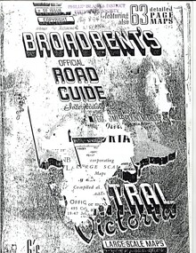 Phillip Island and District Historical Society Inc.
Booklet, Broadbent's Official Road Guide incorporating Central Victoria 55th Edition, About 1951
These are only the pages relevant to Phillip Island from the guide. Broadbent's Official Road Guides Company took over George R. Broadbent's business in 1935. In 1963, it changed its name to Broadbent's Road Maps Pty. Ltd. Each Victorian guide contains maps, plans of routes, a detailed description of roads, mileage, hotels, garages, guesthouses, shops etc.HistoricalFoolscap sized, black and white photocopied pages stapled into booklet.broadbent's guides, guesthouses, shops, hotels, rothsay guesthouse, cowes main garage, co-operative society, hislop's newsagency, wagner's butchery, the nobbies tea rooms