Showing 7104 items matching "snowy-river"
-
 Eltham District Historical Society Inc
Photograph, Liz Pidgeon, Heritage Excursion; Eltham Lower Park Walk and Talk, 1 July 2017, 1 July 2017
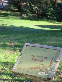
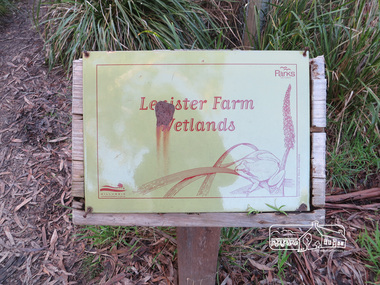
Information Board - Lenister Farm Wetlands Newsletter No., 234, June 2017 Heritage Excursion - Saturday 1st July - Eltham Lower Park - Walk and Talk Eltham Lower Park has played an important part in the history of our area since the early days of European settlement when it was used by local residents as an informal racecourse. Prior to that its location at the junction of the Diamond Creek and the Yarra River made it an important meeting place for the Wurundjeri people. The park combines formal elements and sporting facilities with remnant bushland that is of environmental significance. It is home to sporting and horse riding clubs, popular play spaces and the Diamond Valley Miniature Railway, which attracts large numbers of visitors. The park will be the venue for our July excursion which will comprise a walk of about 3.5 km around the park and adjacent areas. Along the way we will discuss the history and natural history of the area. The path along the creek and the river provides a pleasant and scenic walk. This walk on Saturday 1st July is about 3.5 km in length and will take 2 to 2.5 hours. It will start at 2pm at the Main Road car park at the front of the park. (Melway ref 21 H 10). Born Digitalheritage excursion, activities, eltham district historical society, eltham lower park, information board, lenister farm -
 Eltham District Historical Society Inc
Photograph, Liz Pidgeon, Heritage Excursion; Eltham Lower Park Walk and Talk, 1 July 2017, 1 July 2017
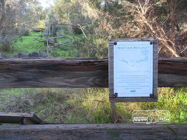
Sign on trail - what is a wetland Newsletter No., 234, June 2017 Heritage Excursion - Saturday 1st July - Eltham Lower Park - Walk and Talk Eltham Lower Park has played an important part in the history of our area since the early days of European settlement when it was used by local residents as an informal racecourse. Prior to that its location at the junction of the Diamond Creek and the Yarra River made it an important meeting place for the Wurundjeri people. The park combines formal elements and sporting facilities with remnant bushland that is of environmental significance. It is home to sporting and horse riding clubs, popular play spaces and the Diamond Valley Miniature Railway, which attracts large numbers of visitors. The park will be the venue for our July excursion which will comprise a walk of about 3.5 km around the park and adjacent areas. Along the way we will discuss the history and natural history of the area. The path along the creek and the river provides a pleasant and scenic walk. This walk on Saturday 1st July is about 3.5 km in length and will take 2 to 2.5 hours. It will start at 2pm at the Main Road car park at the front of the park. (Melway ref 21 H 10). Born Digitalheritage excursion, activities, eltham district historical society, eltham lower park, sign -
 Eltham District Historical Society Inc
Photograph, Liz Pidgeon, Heritage Excursion; Eltham Lower Park Walk and Talk, 1 July 2017, 1 July 2017
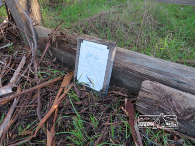
Faded Information Board - Wetland Wildlife situated in Lenister Wetlands Newsletter No., 234, June 2017 Heritage Excursion - Saturday 1st July - Eltham Lower Park - Walk and Talk Eltham Lower Park has played an important part in the history of our area since the early days of European settlement when it was used by local residents as an informal racecourse. Prior to that its location at the junction of the Diamond Creek and the Yarra River made it an important meeting place for the Wurundjeri people. The park combines formal elements and sporting facilities with remnant bushland that is of environmental significance. It is home to sporting and horse riding clubs, popular play spaces and the Diamond Valley Miniature Railway, which attracts large numbers of visitors. The park will be the venue for our July excursion which will comprise a walk of about 3.5 km around the park and adjacent areas. Along the way we will discuss the history and natural history of the area. The path along the creek and the river provides a pleasant and scenic walk. This walk on Saturday 1st July is about 3.5 km in length and will take 2 to 2.5 hours. It will start at 2pm at the Main Road car park at the front of the park. (Melway ref 21 H 10). Born Digitalheritage excursion, activities, eltham district historical society, eltham lower park, information board -
 Eltham District Historical Society Inc
Photograph, Liz Pidgeon, Heritage Excursion; Eltham Lower Park Walk and Talk, 1 July 2017, 1 July 2017
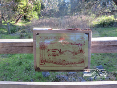
Information Board : Not just a pretty place Newsletter No., 234, June 2017 Heritage Excursion - Saturday 1st July - Eltham Lower Park - Walk and Talk Eltham Lower Park has played an important part in the history of our area since the early days of European settlement when it was used by local residents as an informal racecourse. Prior to that its location at the junction of the Diamond Creek and the Yarra River made it an important meeting place for the Wurundjeri people. The park combines formal elements and sporting facilities with remnant bushland that is of environmental significance. It is home to sporting and horse riding clubs, popular play spaces and the Diamond Valley Miniature Railway, which attracts large numbers of visitors. The park will be the venue for our July excursion which will comprise a walk of about 3.5 km around the park and adjacent areas. Along the way we will discuss the history and natural history of the area. The path along the creek and the river provides a pleasant and scenic walk. This walk on Saturday 1st July is about 3.5 km in length and will take 2 to 2.5 hours. It will start at 2pm at the Main Road car park at the front of the park. (Melway ref 21 H 10). Born Digitalelection day, heritage excursion, activities, eltham district historical society, eltham lower park, information board -
 Eltham District Historical Society Inc
Photograph, Liz Pidgeon, Heritage Excursion; Eltham Lower Park Walk and Talk, 1 July 2017, 1 July 2017
Information Board with rust - Lenister Farm Wetlands Newsletter No., 234, June 2017 Heritage Excursion - Saturday 1st July - Eltham Lower Park - Walk and Talk Eltham Lower Park has played an important part in the history of our area since the early days of European settlement when it was used by local residents as an informal racecourse. Prior to that its location at the junction of the Diamond Creek and the Yarra River made it an important meeting place for the Wurundjeri people. The park combines formal elements and sporting facilities with remnant bushland that is of environmental significance. It is home to sporting and horse riding clubs, popular play spaces and the Diamond Valley Miniature Railway, which attracts large numbers of visitors. The park will be the venue for our July excursion which will comprise a walk of about 3.5 km around the park and adjacent areas. Along the way we will discuss the history and natural history of the area. The path along the creek and the river provides a pleasant and scenic walk. This walk on Saturday 1st July is about 3.5 km in length and will take 2 to 2.5 hours. It will start at 2pm at the Main Road car park at the front of the park. (Melway ref 21 H 10). Born Digitalelection day, heritage excursion, activities, eltham district historical society, eltham lower park, information board, lenister farm wetlands -
 Eltham District Historical Society Inc
Photograph, Liz Pidgeon, Heritage Excursion; Eltham Lower Park Walk and Talk, 1 July 2017, 1 July 2017
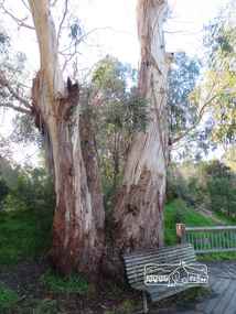
Connecting trunks of gum trees near the viewing platform on the Diamond Creek. Newsletter No., 234, June 2017 Heritage Excursion - Saturday 1st July - Eltham Lower Park - Walk and Talk Eltham Lower Park has played an important part in the history of our area since the early days of European settlement when it was used by local residents as an informal racecourse. Prior to that its location at the junction of the Diamond Creek and the Yarra River made it an important meeting place for the Wurundjeri people. The park combines formal elements and sporting facilities with remnant bushland that is of environmental significance. It is home to sporting and horse riding clubs, popular play spaces and the Diamond Valley Miniature Railway, which attracts large numbers of visitors. The park will be the venue for our July excursion which will comprise a walk of about 3.5 km around the park and adjacent areas. Along the way we will discuss the history and natural history of the area. The path along the creek and the river provides a pleasant and scenic walk. This walk on Saturday 1st July is about 3.5 km in length and will take 2 to 2.5 hours. It will start at 2pm at the Main Road car park at the front of the park. (Melway ref 21 H 10). Born Digitalheritage excursion, activities, eltham district historical society, eltham lower park, gum trees -
 Eltham District Historical Society Inc
Photograph, Liz Pidgeon, Heritage Excursion; Eltham Lower Park Walk and Talk, 1 July 2017, 1 July 2017
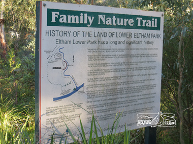
Information Board titled: Family Nature Trail - History of the land of Lower Eltham Park Newsletter No., 234, June 2017 Heritage Excursion - Saturday 1st July - Eltham Lower Park - Walk and Talk Eltham Lower Park has played an important part in the history of our area since the early days of European settlement when it was used by local residents as an informal racecourse. Prior to that its location at the junction of the Diamond Creek and the Yarra River made it an important meeting place for the Wurundjeri people. The park combines formal elements and sporting facilities with remnant bushland that is of environmental significance. It is home to sporting and horse riding clubs, popular play spaces and the Diamond Valley Miniature Railway, which attracts large numbers of visitors. The park will be the venue for our July excursion which will comprise a walk of about 3.5 km around the park and adjacent areas. Along the way we will discuss the history and natural history of the area. The path along the creek and the river provides a pleasant and scenic walk. This walk on Saturday 1st July is about 3.5 km in length and will take 2 to 2.5 hours. It will start at 2pm at the Main Road car park at the front of the park. (Melway ref 21 H 10). Born Digitalheritage excursion, activities, eltham district historical society, eltham lower park, information board, trail -
 Eltham District Historical Society Inc
Photograph, Liz Pidgeon, Heritage Excursion; Eltham Lower Park Walk and Talk, 1 July 2017, 1 July 2017
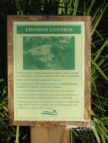
Information board titled "erosion control" including a photo and causes produced by the Shire of Nillumbik Newsletter No., 234, June 2017 Heritage Excursion - Saturday 1st July - Eltham Lower Park - Walk and Talk Eltham Lower Park has played an important part in the history of our area since the early days of European settlement when it was used by local residents as an informal racecourse. Prior to that its location at the junction of the Diamond Creek and the Yarra River made it an important meeting place for the Wurundjeri people. The park combines formal elements and sporting facilities with remnant bushland that is of environmental significance. It is home to sporting and horse riding clubs, popular play spaces and the Diamond Valley Miniature Railway, which attracts large numbers of visitors. The park will be the venue for our July excursion which will comprise a walk of about 3.5 km around the park and adjacent areas. Along the way we will discuss the history and natural history of the area. The path along the creek and the river provides a pleasant and scenic walk. This walk on Saturday 1st July is about 3.5 km in length and will take 2 to 2.5 hours. It will start at 2pm at the Main Road car park at the front of the park. (Melway ref 21 H 10). Born Digitalheritage excursion, activities, eltham district historical society, eltham lower park, erosion, information board -
 Eltham District Historical Society Inc
Photograph, Liz Pidgeon, Heritage Excursion; Eltham Lower Park Walk and Talk, 1 July 2017, 1 July 2017
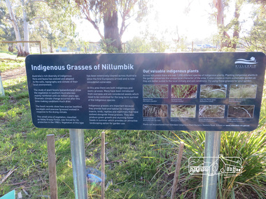
Plaque explaining "Indigenous grasses of Nillumbik" from the Shire of Nillumbik Newsletter No., 234, June 2017 Heritage Excursion - Saturday 1st July - Eltham Lower Park - Walk and Talk Eltham Lower Park has played an important part in the history of our area since the early days of European settlement when it was used by local residents as an informal racecourse. Prior to that its location at the junction of the Diamond Creek and the Yarra River made it an important meeting place for the Wurundjeri people. The park combines formal elements and sporting facilities with remnant bushland that is of environmental significance. It is home to sporting and horse riding clubs, popular play spaces and the Diamond Valley Miniature Railway, which attracts large numbers of visitors. The park will be the venue for our July excursion which will comprise a walk of about 3.5 km around the park and adjacent areas. Along the way we will discuss the history and natural history of the area. The path along the creek and the river provides a pleasant and scenic walk. This walk on Saturday 1st July is about 3.5 km in length and will take 2 to 2.5 hours. It will start at 2pm at the Main Road car park at the front of the park. (Melway ref 21 H 10). Born Digitalheritage excursion, activities, eltham district historical society, eltham lower park, information board, indigenous grass, indigenous plants -
 Eltham District Historical Society Inc
Photograph, Liz Pidgeon, Heritage Excursion; Eltham Lower Park Walk and Talk, 1 July 2017, 1 July 2017
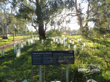
Area planted with indigenous plants with information sign board Newsletter No., 234, June 2017 Heritage Excursion - Saturday 1st July - Eltham Lower Park - Walk and Talk Eltham Lower Park has played an important part in the history of our area since the early days of European settlement when it was used by local residents as an informal racecourse. Prior to that its location at the junction of the Diamond Creek and the Yarra River made it an important meeting place for the Wurundjeri people. The park combines formal elements and sporting facilities with remnant bushland that is of environmental significance. It is home to sporting and horse riding clubs, popular play spaces and the Diamond Valley Miniature Railway, which attracts large numbers of visitors. The park will be the venue for our July excursion which will comprise a walk of about 3.5 km around the park and adjacent areas. Along the way we will discuss the history and natural history of the area. The path along the creek and the river provides a pleasant and scenic walk. This walk on Saturday 1st July is about 3.5 km in length and will take 2 to 2.5 hours. It will start at 2pm at the Main Road car park at the front of the park. (Melway ref 21 H 10). Born Digitalheritage excursion, activities, eltham district historical society, eltham lower park, indigenous plants -
 Eltham District Historical Society Inc
Photograph, Liz Pidgeon, Heritage Excursion; Eltham Lower Park Walk and Talk, 1 July 2017, 1 July 2017
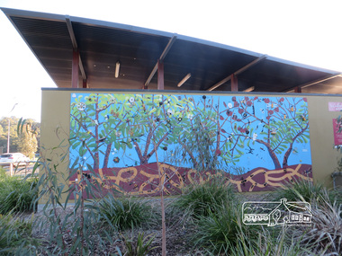
Mural artwork painted on the wall divider of the new toilet block at Eltham Lower Park Newsletter No., 234, June 2017 Heritage Excursion - Saturday 1st July - Eltham Lower Park - Walk and Talk Eltham Lower Park has played an important part in the history of our area since the early days of European settlement when it was used by local residents as an informal racecourse. Prior to that its location at the junction of the Diamond Creek and the Yarra River made it an important meeting place for the Wurundjeri people. The park combines formal elements and sporting facilities with remnant bushland that is of environmental significance. It is home to sporting and horse riding clubs, popular play spaces and the Diamond Valley Miniature Railway, which attracts large numbers of visitors. The park will be the venue for our July excursion which will comprise a walk of about 3.5 km around the park and adjacent areas. Along the way we will discuss the history and natural history of the area. The path along the creek and the river provides a pleasant and scenic walk. This walk on Saturday 1st July is about 3.5 km in length and will take 2 to 2.5 hours. It will start at 2pm at the Main Road car park at the front of the park. (Melway ref 21 H 10). Born Digitalheritage excursion, activities, eltham district historical society, eltham lower park, mural, tiolet block -
 Eltham District Historical Society Inc
Photograph, Liz Pidgeon, Heritage Excursion; Eltham Lower Park Walk and Talk, 1 July 2017, 1 July 2017
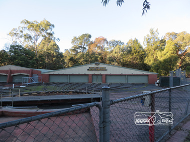
Diamond Valley Miniature Railway Sheds Newsletter No., 234, June 2017 Heritage Excursion - Saturday 1st July - Eltham Lower Park - Walk and Talk Eltham Lower Park has played an important part in the history of our area since the early days of European settlement when it was used by local residents as an informal racecourse. Prior to that its location at the junction of the Diamond Creek and the Yarra River made it an important meeting place for the Wurundjeri people. The park combines formal elements and sporting facilities with remnant bushland that is of environmental significance. It is home to sporting and horse riding clubs, popular play spaces and the Diamond Valley Miniature Railway, which attracts large numbers of visitors. The park will be the venue for our July excursion which will comprise a walk of about 3.5 km around the park and adjacent areas. Along the way we will discuss the history and natural history of the area. The path along the creek and the river provides a pleasant and scenic walk. This walk on Saturday 1st July is about 3.5 km in length and will take 2 to 2.5 hours. It will start at 2pm at the Main Road car park at the front of the park. (Melway ref 21 H 10). Born Digitalheritage excursion, activities, eltham district historical society, eltham lower park, diamond valley miniature railway -
 Eltham District Historical Society Inc
Photograph, Liz Pidgeon, Heritage Excursion; Eltham Lower Park Walk and Talk, 1 July 2017, 1 July 2017
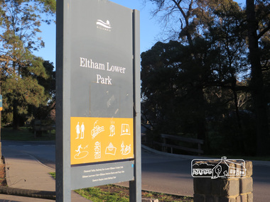
Eltham Lower Park sign with Council logo at the entrance of the Park. Newsletter No., 234, June 2017 Heritage Excursion - Saturday 1st July - Eltham Lower Park - Walk and Talk Eltham Lower Park has played an important part in the history of our area since the early days of European settlement when it was used by local residents as an informal racecourse. Prior to that its location at the junction of the Diamond Creek and the Yarra River made it an important meeting place for the Wurundjeri people. The park combines formal elements and sporting facilities with remnant bushland that is of environmental significance. It is home to sporting and horse riding clubs, popular play spaces and the Diamond Valley Miniature Railway, which attracts large numbers of visitors. The park will be the venue for our July excursion which will comprise a walk of about 3.5 km around the park and adjacent areas. Along the way we will discuss the history and natural history of the area. The path along the creek and the river provides a pleasant and scenic walk. This walk on Saturday 1st July is about 3.5 km in length and will take 2 to 2.5 hours. It will start at 2pm at the Main Road car park at the front of the park. (Melway ref 21 H 10). Born Digitalelection day, heritage excursion, activities, eltham district historical society, eltham lower park, sign -
 Eltham District Historical Society Inc
Photograph, Liz Pidgeon, Heritage Excursion; Eltham Lower Park Walk and Talk, 1 July 2017, 1 July 2017
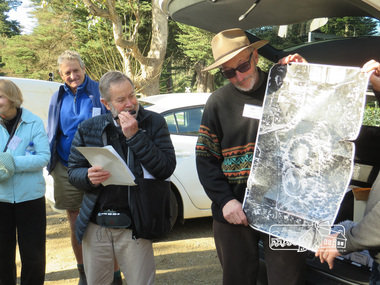
Local historian Russell Yeoman with EDHS President Jim Connor Newsletter No., 234, June 2017 Heritage Excursion - Saturday 1st July - Eltham Lower Park - Walk and Talk Eltham Lower Park has played an important part in the history of our area since the early days of European settlement when it was used by local residents as an informal racecourse. Prior to that its location at the junction of the Diamond Creek and the Yarra River made it an important meeting place for the Wurundjeri people. The park combines formal elements and sporting facilities with remnant bushland that is of environmental significance. It is home to sporting and horse riding clubs, popular play spaces and the Diamond Valley Miniature Railway, which attracts large numbers of visitors. The park will be the venue for our July excursion which will comprise a walk of about 3.5 km around the park and adjacent areas. Along the way we will discuss the history and natural history of the area. The path along the creek and the river provides a pleasant and scenic walk. This walk on Saturday 1st July is about 3.5 km in length and will take 2 to 2.5 hours. It will start at 2pm at the Main Road car park at the front of the park. (Melway ref 21 H 10). Born Digitalheritage excursion, activities, eltham district historical society, eltham lower park, russell yeoman, jim connor -
 Eltham District Historical Society Inc
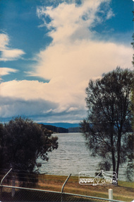
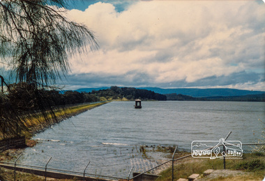
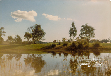
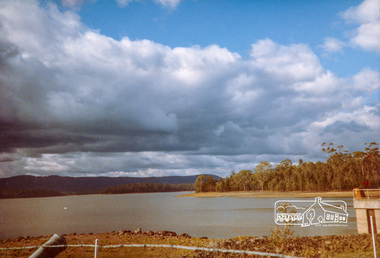
Photograph, Yan Yean, 1987, 1987
Originally contained in a 'magnetic' photo album of scenic photos of Yan Yean and Warrandyte believed to be donated by Mrs Eric Stephenson, Jingalong, 110 Ryans Road, Eltham, Vic. 3095; relocated to archival safe storage. On the 20th December 1853 Lieut Governor Charles LaTrobe took his spade to turn the first sod of an embankment across the swampy bed of the Plenty River at a lonely place called Yan Yean, in order to create Melbourne’s first water supply. In the early 1850’s water had been drawn from the Yarra which even then was known as Yarra Soup. A convict by the name of James Blackburn produced the basic design for supplying water to Melbourne from a reservoir on the Plenty River at Yan Yean, and later on he was appointed consulting engineer on the project. In 1853 a contract was let for the building of the wall for 91 thousand 575 pounds, and at one stage some 400 labourers were at work in the area. A tramway was constructed to convey stone and other materials from Melbourne. So famous was this magnificent stretch of water that illustrations of the bluestone embankment and tower appeared in London journals Whittlesea Historical Society – Historic items for Diamond Valley Community Radio September 1990 Colour photographyan yean, yan yean reservoir -
 Eltham District Historical Society Inc
Photograph, Yan Yean, 1987, 1987
Originally contained in a 'magnetic' photo album of scenic photos of Yan Yean and Warrandyte believed to be donated by Mrs Eric Stephenson, Jingalong, 110 Ryans Road, Eltham, Vic. 3095; relocated to archival safe storage. On the 20th December 1853 Lieut Governor Charles LaTrobe took his spade to turn the first sod of an embankment across the swampy bed of the Plenty River at a lonely place called Yan Yean, in order to create Melbourne’s first water supply. In the early 1850’s water had been drawn from the Yarra which even then was known as Yarra Soup. A convict by the name of James Blackburn produced the basic design for supplying water to Melbourne from a reservoir on the Plenty River at Yan Yean, and later on he was appointed consulting engineer on the project. In 1853 a contract was let for the building of the wall for 91 thousand 575 pounds, and at one stage some 400 labourers were at work in the area. A tramway was constructed to convey stone and other materials from Melbourne. So famous was this magnificent stretch of water that illustrations of the bluestone embankment and tower appeared in London journals Whittlesea Historical Society – Historic items for Diamond Valley Community Radio September 1990Colour photographyan yean, yan yean reservoir -
 Eltham District Historical Society Inc
Photograph, Yan Yean Reservoir
Originally contained in a 'magnetic' photo album of scenic photos of Yan Yean and Warrandyte believed to be donated by Mrs Eric Stephenson, Jingalong, 110 Ryans Road, Eltham, Vic. 3095; relocated to archival safe storage. On the 20th December 1853 Lieut Governor Charles LaTrobe took his spade to turn the first sod of an embankment across the swampy bed of the Plenty River at a lonely place called Yan Yean, in order to create Melbourne’s first water supply. In the early 1850’s water had been drawn from the Yarra which even then was known as Yarra Soup. A convict by the name of James Blackburn produced the basic design for supplying water to Melbourne from a reservoir on the Plenty River at Yan Yean, and later on he was appointed consulting engineer on the project. In 1853 a contract was let for the building of the wall for 91 thousand 575 pounds, and at one stage some 400 labourers were at work in the area. A tramway was constructed to convey stone and other materials from Melbourne. So famous was this magnificent stretch of water that illustrations of the bluestone embankment and tower appeared in London journals Whittlesea Historical Society – Historic items for Diamond Valley Community Radio September 1990 Colour photographyan yean, yan yean reservoir -
 Eltham District Historical Society Inc
Photograph, Yan Yean, 1988, 1988
Originally contained in a 'magnetic' photo album of scenic photos of Yan Yean and Warrandyte believed to be donated by Mrs Eric Stephenson, Jingalong, 110 Ryans Road, Eltham, Vic. 3095; relocated to archival safe storage. On the 20th December 1853 Lieut Governor Charles LaTrobe took his spade to turn the first sod of an embankment across the swampy bed of the Plenty River at a lonely place called Yan Yean, in order to create Melbourne’s first water supply. In the early 1850’s water had been drawn from the Yarra which even then was known as Yarra Soup. A convict by the name of James Blackburn produced the basic design for supplying water to Melbourne from a reservoir on the Plenty River at Yan Yean, and later on he was appointed consulting engineer on the project. In 1853 a contract was let for the building of the wall for 91 thousand 575 pounds, and at one stage some 400 labourers were at work in the area. A tramway was constructed to convey stone and other materials from Melbourne. So famous was this magnificent stretch of water that illustrations of the bluestone embankment and tower appeared in London journals Whittlesea Historical Society – Historic items for Diamond Valley Community Radio September 1990 Colour photographyan yean, yan yean reservoir -
 Eltham District Historical Society Inc
Photograph, Flowering Gum at Yan Yean, 1988, 1988
Originally contained in a 'magnetic' photo album of scenic photos of Yan Yean and Warrandyte believed to be donated by Mrs Eric Stephenson, Jingalong, 110 Ryans Road, Eltham, Vic. 3095; relocated to archival safe storage. On the 20th December 1853 Lieut Governor Charles LaTrobe took his spade to turn the first sod of an embankment across the swampy bed of the Plenty River at a lonely place called Yan Yean, in order to create Melbourne’s first water supply. In the early 1850’s water had been drawn from the Yarra which even then was known as Yarra Soup. A convict by the name of James Blackburn produced the basic design for supplying water to Melbourne from a reservoir on the Plenty River at Yan Yean, and later on he was appointed consulting engineer on the project. In 1853 a contract was let for the building of the wall for 91 thousand 575 pounds, and at one stage some 400 labourers were at work in the area. A tramway was constructed to convey stone and other materials from Melbourne. So famous was this magnificent stretch of water that illustrations of the bluestone embankment and tower appeared in London journals Whittlesea Historical Society – Historic items for Diamond Valley Community Radio September 1990 Colour photographyan yean -
 Nillumbik Shire Council
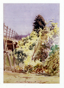
Painting: Walter WITHERS (b.1854 Warwickshire, UK — d.1914 Eltham, Aus), Trestle Bridge, Eltham, c.1903-10
Walter Withers was a significant Australian landscape artist and a member of the Heidelberg School of Australian Impressionists. In 1903 Withers bought 'Southernwood', a house on 2½ acres (1 ha) at Eltham, to which he added a studio. Because of ill health, he lived during the week at his studio in Oxford Chambers, Melbourne, and on weekends and holidays with his family at Eltham until his death in 1914. The Eltham rail bridge is a unique and valuable historic relic of an earlier steam locomotive transport era in the Diamond Creek Valley and has long formed an important part of a magnificent Eltham landscape. When built in 1902 it was close to the terminus point of the Heidelberg-Eltham rail extension, on the route of the proposed Diamond Valley Railway that was then planned to continue much further up the valley towards Kinglake. This bridge is situated in attractive river-valley parkland amidst the tall and spreading manna gums and candlebarks of the Diamond Creek Valley. The Alistair Knox Park river-valley landscape, of which the timber trestle bridge is an important visual component, has been classified by the National Trust. Large manna gum and candlebark trees adorn the adjacent creek banks, and historic Shillinglaw Cottage is also part of this much-prized Eltham landscape. Eltham is home to a historic wooden railway trestle bridge. Mainly of timber-pier and timber-beam construction, but varied by a few longer steel-joists spans on timber piers at the main stream channel, this substantial bridge has almost two hundred metres of timber deck. Built in 1902, it is the only railway bridge of predominantly timber construction that is still in regular use as an integral part of Melbourne's metropolitan electric railway network and one of extremely few timber rail bridges in the State that still carry trains. Apart from its important continuing social function as a carrier of rail transport for the Hurstbridge line, this impressive bridge and its beautiful parkland environs contribute much to the character of Eltham township and that town's special reputation as an historic centre of environmental and conservation concerns. This section of the Diamond Creek Valley was the subject of a Walter Withers painting in the earliest years of the twentieth century and has strong historic links with our Heidelberg School of painters. Watercolour painting on paper of Eltham's Trestle Bridge in the middle of the day. A small section of the wooden bridge is located to the left of the painting. The focus is predominately on the wattle, manna gum and candlebark trees that is to the right of the bridge. The golden hues typically represent the australian sunlight and landscape. "W.W" in gothic script on the lower right side of the painting. Not dated. withers, eltham, trestle bridge, railway, watercolour -
 Rutherglen Historical Society
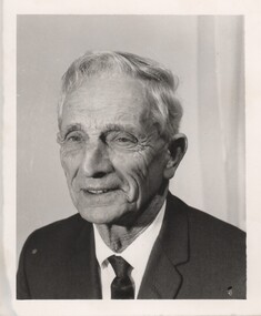
Photograph - Image, 1970s
Greatly relieved by his son’s safe return from war, John Richard Stanton (1872-1955) buys a parcel of productive farming land for his son John Charles “Jack” Stanton (1895-1989) to give him a “good start in life”. Jack’s wife Ethel Capper, devised the name “Gracerray” for the property to honour her sister Grace and the nearby Murray River. After the First World War, fourth generation Jack Stanton (1895-1989) with the help of his father started building a new winery (at the current site of the winery and cellar door) called ‘Gracerray’ named after his wife’s sister Grace and the Murray River. It is pronounced “Grah-sair-ray”. Jack built Gracerray around some existing cement open top vats from a winery that was demolished after phylloxera ravaged the region in the late 1890s. He used second hand materials from the defunct Great Southern gold mine and propped up the roof with huge tree trunks. Jack only made fortified wine up until the 1960s when he and his son-in-law Norman Killeen started making red wine to meet changing Australian tastes.Black and white portrait photograph of a mature man in suit and tie.On back of photo: "145% [upper case E in small circle] J.C. Stanton" wineries, north east victoria, wine industry, j c stanton, stanton & killeen winery, jack stanton -
 Falls Creek Historical Society
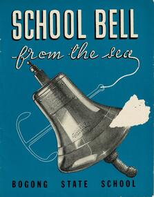
Booklet - School Bell from the sea - Bogong State School
This booklet tells the story of the bell from the "S. S. Santhia" and how it came to Bogong State School, Victoria. "Santhia" belonged to the British India Line. On 6th November 1943 she was in service as a troopship when she caught fire and capsized at No. 3 Garden Reach Jetty, Calcutta. Due to the additional weight of water pumped into her to extinguish the fire, "Santhia" heeled over and remained in the mud of the River Hooghly until a successful salvage was completed in January 1946. The salvage operation was carried out by Captain J. P. Williams of Melbourne and his team of Australian divers nine and a half months after the commencement of operations. "Santhia" was the sixty seventh ship salvaged by Captain Williams. "Santhia's" Bell was presented by Captain Williams to Mr G.G. Jobbins, Chairman of Commissioners for installation at Bogong State School. The ceremony of presenting the bell took place on 21st February 1947. The bell bears the following inscription:- "Presented to G.G.Jobbins, Esq., Chairman, State Electricity Commission, by Captain J.P. Williams for Bogong School, on December 6th, 1946. This bell was recovered from the wreck of the "S.S.Santhia" sunk in the Hooghly River, Calcutta, and raised by an Australian salvage party."This booklet is significant because it documents an unusual event linking Bogong State School to a World War II salvage operation.A booklet consisting of images and text which tells the story of S.S. Santhia, of her sinking while in service as a troopship, of her subsequent salvage and how her bell came to Bogong State School in Victoria's High Country. The booklet consists of 12 pages including the cover. It consists of text and images. Primarily printed in black and white, the booklet uses blue boxes to highlight text including titles and explanation of images. The cover is blue with white text and features an image of the bell of the S. S. Santhia.Inside front cover: THIS BOOKLET is presented by THE STATE ELECTRICITY COMMISSION OF VICTORIA to the children of BOGONG STATE SCHOOLbogong state school, s.s.santhia, santhia bell -
 Wodonga & District Historical Society Inc
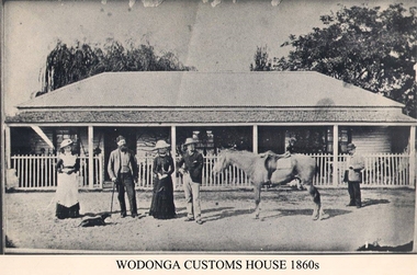
Photograph - Old Customs House, Wodonga, 1860s
Customs duties were a means of raising revenue between the 1850’s and Federation. They were first introduced by NSW in November 1854 after it was separated from the colony of Victoria three years earlier. J P Hanify was appointed as sub-collector at Belvoir, the official name present day Wodonga at that time. Wodonga Customs House was built near the end of Union Bridge over the Murray River in 1859 Tariffs or customs duties greatly angered residents and it was little wonder the customs officer of the day was always an unpopular man. Tariffs had to be paid on articles such as tobacco, many food items and new clothing that were carried across the Border. The range of items was extended over time, leading to some farmers even swimming their livestock across the river to avoid duties at the Customs house. The levying of duties ended with Federation in 1901. Francis Cobham depicted in this photograph, took up the position of Customs officer in 1867 and remained there until his retirement in 1890. The building was originally a 2 roomed custom house in 1856 but was extended to provide living quarters for the Cobham family while a nearby cottage became the Customs house. The building was moved to a position south of the lagoon in the mid 1980’s and is now a restaurant.This image represents an important stage in the development of colonial relationships and rivalries in Australia.Black and white photograph of Customs officer Francis Cobham in Wodonga c 1860customs house wodonga, albury wodonga border, colonial rivalry victoria /nsw, tariffs -
 Eltham District Historical Society Inc
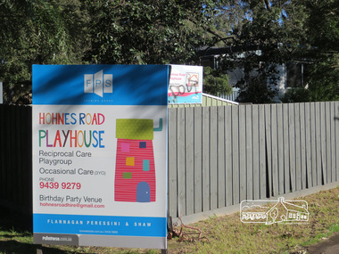
Photograph, Liz Pidgeon, Hohnes Road Playhouse, 1 July 2017
Photo taken as part of an EDHS Heritage Excursion - Saturday 1st July - Eltham Lower Park - Walk and Talk. "Eltham Lower Park has played an important part in the history of our area since the early days of European settlement when it was used by local residents as an informal racecourse. Prior to that its location at the junction of the Diamond Creek and the Yarra River made it an important meeting place for the Wurundjeri people. The park combines formal elements and sporting facilities with remnant bushland that is of environmental significance. It is home to sporting and horse riding clubs, popular play spaces and the Diamond Valley Miniature Railway, which attracts large numbers of visitors.The park will be the venue for our July excursion which will comprise a walk of about 3.5 km around the park and adjacent areas. Along the way we will discuss the history and natural history of the area. The path along the creek and the river provides a pleasant and scenic walk.This walk on Saturday 1st July is about 3.5 km in length and will take 2 to 2.5 hours. It will start at 2pm at the Main Road car park at the front of the park. (Melway ref 21 H 10)". Newsletter No., 234, June 2017 Born Digitalheritage excursion, activities, eltham district historical society, eltham lower park, sign, hohnes road playhouse -
 Warrnambool and District Historical Society Inc.
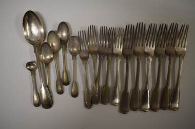
Functional object - Cutlery, George Rolfe, Mid to late 19th century
In 1854 in Melbourne George Rolfe Senior established an import business dealing in groceries, wines and spirits and tea. His son George, born in England, took over the business of Rolfe and Co in 1871. A keen sportsman, George Rolfe’s love of fishing led him to take frequent holidays in Warrnambool. He began buying blocks of land near the mouth of the Hopkins River in Warrnambool in the 1870s. By the 1880s Rolfe owned 50 acres in the Hopkins River area and named the property, Lyndoch. He built stables, chaff and bone sheds, a jetty, a boatshed, a water well, a windmill, a reservoir and extensive gardens. He also bought the nearby properties of Shipley and Fairy Hill, establishing a stud farm and breeding cattle. In 1891 he married Jane Ann Lake, the widow of his property manager, and when he died in 1919 his step-daughters, Florence and Annie Lake, inherited Lyndoch. The property was sold and became an aged care facility in 1952. The cutlery items were in use in the building erected by Florence Lake in 1920 and known today as Lyndoch but the ‘R’ monogram on the items suggest that they belonged to George Rolfe or even his father before him.These cutlery items are of considerable importance as mementoes of George Rolfe and his family. They were prominent in Warrnambool’s history in the late 19th and early 20th centuries with the establishment and development of the property, Lyndoch, near the mouth of the Hopkins River. These are 17 pieces from a silver cutlery set that belonged to the Rolfe family (one tablespoon, six large forks, five smaller forks, four small spoons and one mustard spoon.) All the pieces of cutlery have a monogrammed ‘R’ at the end of the handles. Twelve of the items are tarnished and one small spoon is very worn. All the items have six hallmarks. ‘R’george rolfe, lyndoch, warrnambool, rolfe & co. melbourne, florence lake, lyndoch warrnambool., history of warrnambool -
 Glenelg Shire Council Cultural Collection
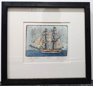
Artwork, other, BRIGIT THOMAS, Lady Nelson, c. 2015
From - theladynelson.org.au T The original Lady Nelson was built at Deptford, in England, in 1799, for service to the Transport Office on the River Thames. She was designed with sliding keels (centre boards), a device invented by Captain John Schank of the Royal Navy to allow surveying in rivers and shallow water ways. On completion she was selected for exploration services in the Colony of New South Wales and sailed for Port Jackson on 18 March 1800 under the command of Lieutenant James Grant. A brig of 60 tons, she carried a crew comprising the commander, two mates and twelve seaman. As she left the River Thames sailors on nearby ships ridiculed her because of her size and shape, calling her, as she sailed past, 'His Majesty's Tinderbox'. At Portsmouth on the 9th February 1800 she was fitted with four brass carriage guns, three to four pounders, in addition to the two guns already on board. Because of the heavy load she was carrying she was very low in the water, having only two feet nine inches freeboard amidships. The ship finally left Portsmouth on 17th March 1800 as part of an East Indian Convoy. From 1800 to 1825 the Lady Nelson operated around the Australian Coast and fulfilled a variety of roles including exploration, surveying, forming settlements, shifting goods and people around the colonies and capturing pirates. She played pivotal roles in the European settlement of Hobart, Northern Tasmania, Melbourne, Newcastle, Port Macquarie and Northern Territory. Those onboard charted much of Bass Strait, Port Philip, Newcastle, Port Macquarie and (with the Investigator) the coasts of northern New South Wales and southern Queensland. She also has links to other locations around the East Coast such as Trial Bay in NSW and the Mt Gambier area of SA. After 25 years of service while trading on the island of Baba the Lady Nelson was overrun by the islanders, the crew was killed and the ship stripped and later burnt and sunk. A replica of the Lady Nelson was built in the 1980s.Image of a tall ship in sail. The ship is flying both the Aboriginal flag and the Australian Flag. It sails on a calm sea. There are figures on the deck - four in total. The image is mounted on cream board and framed in dark timber. Etching, hand coloured,.Front: 'Lady Nelson A/P BT' - hand written, pencil in between etching and mount Back: Artist's business card glued to back of etching, lower left hand corner:ady nelson, femal artists, female artist, women -
 Glenelg Shire Council Cultural Collection
Photograph - Contact Print - Scenes of Portland, Victoria, 1970s
Sheet of 12 contact prints of rephotographed photographs: (a) 5 young women on dam wall (b) sailors (c) Bentinck Street, looking north from Post Office (d) Julia Street looking east from Percy Street (e) Railway line and Duttons (Nuns) Beach towards Whalers Bluff (f) Fawthrop Lagoon (g) sailors (h) Post Office (i) River, bush close to banks both sides (j) Botanic Gardens (k) Town and Port of Portland reproduced from III London News (l) North side, Julia Street looking west, Bank AustralasiaFront: (c) Bentinck Street approx. 1900 (d) Julia Street, portland Nicholls (h) Portland Post Officeportland scene, street scene, photography, portland harbour, portland seafront, julia street