Showing 581 items
matching trees on farms
-
 Kew Historical Society Inc
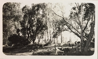
Photograph - Yarra at Kew, 1925
Henry Beater Christian (1886-1962) , was a descendant of one of the earliest settler families in Kew. Employed at the Kew Asylum as a 'public servant', he was a skilled amateur photographer, photographing numerous scenes in Kew and on his travels around Victoria. The majority of his photographs date from 1916 to 1929. His finest photographs are housed in two photograph albums. Digital copy of a photograph from page 4 of the 47-page photograph album containing 261 gelatinous silver images, loaned by Diane Washfold with permission given to digitise and hold a copy in our collection. This photograph is of a bank of the Yarra at Kew where cows graze among the trees"Yarra at Kew"henry beater christian (1886-1962), landscape photography, kew (vic.) — yarra river, christian-washfold collection, photograph albums, dairying, dairy farms -
 Monbulk Historical Society
Ben Simcox
Bennie Simcox first came to the Monbulk area about 1860, following the first important gold discovery at the end of 1858. As the gold rush was short lived Simcox returned to Collingwood but later came back to Monbulk, built himself a hut to live in and become its first known permanent resident. The hut was burnt in the 1913 fires. Monbulk was thrown open to selection in 1894, and that's when the first farmers including Bennie Simcox went into Monbulk. It was a big, timbered country in those days. Once Ben had cleared some of his land he started to grow raspberries on it. He would be up before daylight ready to start picking. Ben also picked for a local family, the Camms to help make ends meet. When Ben Simcox was virtually at the retired stage, he wanted to develop his bit of the gully as a tourist attraction, As his nephew Fred Gay who owned the 10 acres below Ben wanted to farm, he was happy to swap his treed block with Ben. At a time when most settlers were clearing their properties, Ben Simcox, by contrast, cultivated the native plants and planted most of the large trees seen on the property today. And so Nathania Springs was developed as a tourist resort, and a mini-botanical garden. He diverted the natural water supply to form ornamental garden pools stocked with trout and tame native black fish. There were many visitors came to the Dandenongs, Some arriving in motor cars others in converted furniture vans lined with seats or charabancs with the long extended chassis and the open canvas roofs. Identities such as Billy Hughes, Madame Melba would often come to look through Nathania Springs. Bennie sold Nathania Springs to Councillor Ferdinand Thomas Le Juge, a boarding house proprietor and later the town baker in 1909 then in about 1921 Ben’s nephew Fred and his wife and family continued to open Nathania Springs to the public. It was not unusual in around 1924-25 for up to a thousand people a day to arrive at Nathania Springs to go through the gardens. At sixpence a time, that was a lot of money in those days. This photo is part of a collection of historic and social significance of the early settlement of Monbulk. Copies of photographs can be purchased from the Monbulk Historical Society.simcox, nathania springs, monbulk, 1860, berries -
 Surrey Hills Historical Society Collection
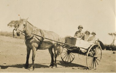
Photograph, Gwen and Beryl Mair and Mrs Jarman in a jinker, Derrinallum, c1927, c1927
David Miller (Dave) Mair (1879-1938) married Lily Vipond Deakin (1890-1945) in 1910. They had 5 children: Geoffrey David (1913-1970), Beryl (1916-1976), Gwynneth (1917-1997), Isabel Lillian (1921-1997) and Shirley Inez (1928-1968). Personal communication from Laurie Newton, Beryl's daughter: Dave and Lily initially lived in East Melbourne after they married. Dave walked across the gardens to work at the MCG. He never drove or owned a car. Geoffrey, Beryl and Gwynneth were born in East Melbourne. They subsequently moved to Louise Avenue, Mont Albert and Isabel may have been born while they were there. Later they purchased 20 Barton Street, Mont Albert. Shirley was born after they moved to Barton Street. Electoral roll details: 1919 1922 24 Louise Avenue, Mont Albert 1924 20 Barton Street, Mont Albert Dave Mair was a very keen sportsman. This is part of a large donation of material from the Deakin, Mair and Young families. The Deakin, Mair and Young families had many connections with Mont Albert and Surrey Hills.A sepia photo of a woman and 2 girls in a jinker. They are all wearing brimmed hats as if going on an outing. Apart from a couple of straggly trees in the background along what may be a boundary or paddock fence, the surroundings look very bare.In blue biro: " Gwen / Beryl / Mrs Jarman / Derrinallum" Thought to be Beryl Mair's handwriting. Photographic process stamp "C 311" "KODAK PRINT" in black. beryl mair, gwen mair, mrs jarman, farms, children, horse-drawn vehicles -
 Surrey Hills Historical Society Collection
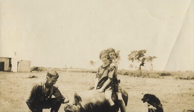
Photograph, Gwen and Beryl Mair with Mr Jarman, Derrinallum, c1927, c1927
David Miller (Dave) Mair (1879-1938) married Lily Vipond Deakin (1890-1945) in 1910. They had 5 children: Geoffrey David (1913-1970), Beryl (1916-1976), Gwynneth (1917-1997), Isabel Lillian (1921-1997) and Shirley Inez (1928-1968). Personal communication from Laurie Newton, Beryl's daughter: Dave and Lily initially lived in East Melbourne after they married. Dave walked across the gardens to work at the MCG. He never drove or owned a car. Geoffrey, Beryl and Gwynneth were born in East Melbourne. They subsequently moved to Louise Avenue, Mont Albert and Isabel may have been born while they were there. Later they purchased 20 Barton Street, Mont Albert. Shirley was born after they moved to Barton Street. Electoral roll details: 1919 1922 24 Louise Avenue, Mont Albert 1924 20 Barton Street, Mont Albert Dave Mair was a very keen sportsman. This is part of a large donation of material from the Deakin, Mair and Young families. The Deakin, Mair and Young families had many connections with Mont Albert and Surrey Hills.A sepia photo of 2 girls on the back of a pig, which is being lightly held by a man, squatting beside the animal. A cattle dog sits nearby. In the background are some straggly trees along what may be a boundary or paddock fence, apart from which the surroundings look very bare. Off to the LHS in the background is farm shedding.In black ink: "Off for a joy ride / B. Mair / 20 Barton St / SUrrey Hills / E10." - thought to be in Lily Mair's handwriting. In blue biro: " Gwen Beryl (IN FRONT in lead pencil) / Mr Jarman / Derrinallum" Thought to be Beryl Mair's handwriting. "KODAK PRINT" in black. beryl mair, gwen mair, mr jarman, farms, children, derrinallum -
 Surrey Hills Historical Society Collection
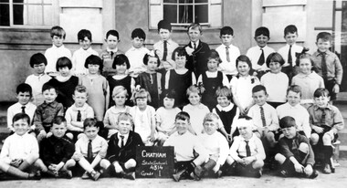
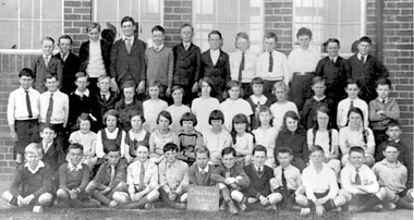
Photograph, Chatham State School Grade 1 1927, 1927
Chatham School, located in Weybridge Street Surrey Hills, was opened on 1 August 1927 following pressure from local residents as nearby schools (Balwyn, Mont Albert & Surrey Hills) were all over-crowded. This followed a surge in development following WW1. Land in surrounding streets was sub-divided. This included part of John Butler Maling (Jnr)'s small farm bounded by Banool Road, Wharton Road, Weybridge Street and Whitehorse Road. An area surrounding his home, 'The Willows' was retained and not sold until after he died in 1931. leased by Mr John Butler Maling in 1861. Three acres of his land were purchased by the Education Department. Some of the early students have referred to Chatham’s land as Mr Maling’s bull paddock. Some of the original yellow box trees remain on the property. The most significant of these is now called the Friendship Tree. On 1 August 1927 212 students were enrolled; Ralph Rae was one of these. The school was official opened on 15th February 1928. The school number is 4314. A black and white photograph of a group of 39 Grade 1 students from Chatham State School.1927, schools, chatham state school, clothing and dress, primary schools, john butler maling (jnr), ralph rae (mr) -
 Surrey Hills Historical Society Collection
Photograph, Chatham State School Grade 5 1931, 1931
Chatham School, located in Weybridge Street Surrey Hills, was opened on 1 August 1927 following pressure from local residents as nearby schools (Balwyn, Mont Albert & Surrey Hills) were all over-crowded. This followed a surge in development following WW1. Land in surrounding streets was sub-divided. This included part of John Butler Maling (Jnr)'s small farm bounded by Banool Road, Wharton Road, Weybridge Street and Whitehorse Road. An area surrounding his home, 'The Willows' was retained and not sold until after he died in 1931. leased by Mr John Butler Maling in 1861. Three acres of his land were purchased by the Education Department. Some of the early students have referred to Chatham’s land as Mr Maling’s bull paddock. Some of the original yellow box trees remain on the property. The most significant of these is now called the Friendship Tree. On 1 August 1927 212 students were enrolled; Ralph Rae was one of these. The school was official opened on 15th February 1928. The school number is 4314. A black and white photograph of a group of 51 Grade 5 students from Chatham State School.schools, chatham state school, clothing and dress, primary schools, john butler maling (jnr), ralph rae (mr) -
 Surrey Hills Historical Society Collection
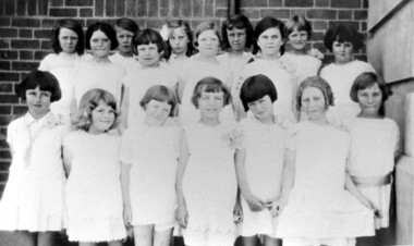
Photograph, Chatham State School Grade 2 1928, 1931
Chatham School, located in Weybridge Street Surrey Hills, was opened on 1 August 1927 following pressure from local residents as nearby schools (Balwyn, Mont Albert & Surrey Hills) were all over-crowded. This followed a surge in development following WW1. Land in surrounding streets was sub-divided. This included part of John Butler Maling (Jnr)'s small farm bounded by Banool Road, Wharton Road, Weybridge Street and Whitehorse Road. An area surrounding his home, 'The Willows' was retained and not sold until after he died in 1931. leased by Mr John Butler Maling in 1861. Three acres of his land were purchased by the Education Department. Some of the early students have referred to Chatham’s land as Mr Maling’s bull paddock. Some of the original yellow box trees remain on the property. The most significant of these is now called the Friendship Tree. On 1 August 1927 212 students were enrolled; Ralph Rae was one of these. The school was official opened on 15th February 1928. The school number is 4314. Front row centre is Jocelyn Cerini who married Ken Hall, another Chatham student. A black and white photograph of a group of Grade 2 female students from Chatham State School. They are dressed in white.schools, chatham state school, clothing and dress, primary schools, john butler maling (jnr), ralph rae (mr), jocelyn cerini (miss), jocelyn hall (mrs) -
 Surrey Hills Historical Society Collection
Photograph, Entrance to Wattle Park from Riversdale Road, 1912-1914
... 1912 farms 1914 fenwicks farm fennies fences trees roads ...Information provided by Stan Smith: Riversdale Road looking east 1912-1914. Wattle Park, then a farm is on the right. The near row of trees across the picture, indicates the driveway in Wattle Park. Wattle Park was then Fenwick's farm - or - Fennies to the local boys. Note: Riversdale Road becomes not much more than a track after passing the farm entrance.A dirt road in the lower left corner of the photograph is bounded by a post and rail fence. Two cyclists are on the road. "Wattle Park" is written to the right side of the road.wattle park, 1912, farms, 1914, fenwicks farm, fennies, fences, trees, roads and streets, riversdale road, pine trees, gum trees, cyclists -
 Surrey Hills Historical Society Collection
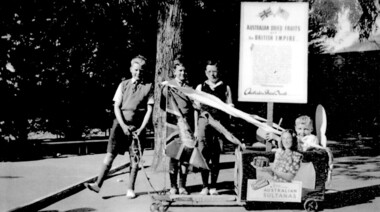
Photograph, Chatham students support the Empire, Surrey Hills, c 1947, 1947
The billycart was possibly decorated for celebrations associated with Empire Day. Image was originally copied by Chatham Primary School for inclusion in their pictorial history "A Patchwork of People - Chatham Past and Present" [ISBN 0 646 29370 2], by Susan Barnett and Julia Ashby, published in 1996 for the school's 70th anniversary. Copied for the SHNCHC with the school and donor's permission. There is also a laminated copy of it for display purposes.Black and white image of four boys and their billycart. Two are identified as Bruce Hansen, standing behind the flag and Jimmy Boyd, seated in the billycart, which is decorated with streamers, an English flag and advertising signs promoting Australian sultanas and the export of Australian dried fruit to the [British] Empire. The photo was taken in the grounds of Chatham Primary School. In the background can be seen some of the cypress trees that were planted along the side of the oval, a remnant eucalypt from the time when the land was part of J B Maling's farm and part of the shelter shed.chatham primary school, billycarts, advertising signs, empire day, bruce hansen, jimmy boyd -
 Surrey Hills Historical Society Collection
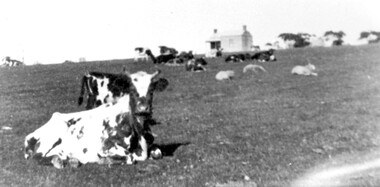
Photograph, Norman Carter, Part of Black's dairy farm in Mont Albert in the 1920s, 1920s
... and scattered trees. Part of Black's dairy farm in Mont Albert ...Photo is likely to have been taken pre-1924 when the land was subdivided. Donor information is that this was taken from a home in Churchill Street, Mont Albert; it would be looking south towards Mont Albert Road. Black's dairy farm occupied the area just east of Hamilton Street to near Elgar Road. It was subdivided into 88 house allotments along Churchill Street, Bruce Street, Black Street, Proudfoot Street and View Street. The solicitors were Proudfoot & Horton, 360 Collins Street; estate agents were Duncan & Weller, 29 Queen Street. The real estate subdivision notice on the SLV website states that Neil Black had been the owner for 50 years. To date no trace of a Neil Black has been found. Box Hill rate books simply give BLACK as the owner in 1877 (no first name); the entry for 1878-1884 states Robert Black. The 1909 electoral roll has entries for Mont Albert Road for Robert Black (farmer), Thomas Black (carter) & Elizabeth Black (HD). The 1912 electoral roll has entries for Mont Albert Road for Robert Black (farmer), Thomas Black (labourer), John Arthur Black (carter) & Elizabeth Black (HD). Robert Black died in 1920 (b. 1836) and is buried in Box Hill Cemetery (CE-*-0057). His parents were John and Margaret Black. He married Lizzie Foley in 1878. She was the daughter of Margaret & John Foley, born in 1859. She died in 1902 aged 43 years and is probably buried in the same grave, although the cemetery records record her age as 0 years. Children: 1. James Hughbert (1880-1954) 2. John Arthur (1881-1959) 3. Alice (1882-1883) - died aged 6 months 4. Laura Elizabeth (1883-1951) 5. Thomas (1885-1965) 6. Isabella (1887-1963) 7. Eleanor (1889-1963) 8. Ada Maud (1890-1968) 9. Robert (1892-1930). BDM Victoria states places of birth as Box Hill, Surrey Hills or Mont Albert. Many of the family are buried in Box Hill Cemetery. None of the girls appear to have married. Communication from a descendant of John Arthur Black gives the following: "John Arthur Black, son of Robert & Lizzie Foley, married Gladys Anne Layton had 4 children, Robert, Elenore, Marion (Follett) & Annie; they had farm on Stud Road, Dandenong where they milked 30 cows that he retired to after being a earth-moving contractor with draft horses and dug irrigation ditches around Shepparton." This is important as documentation of the area's early farming land use.Black and white photo of a paddock with cows and sheep grazing. On the horizon is a simple cottage with a small veranda and 2 chimneys and scattered trees.black's dairy farm, dairying, farms, churchill street, black street, proudfoot street, bruce street, view street, neil black, proudfoot & horton, duncan & weller, robert black, lizzie black, lizzie foley, james hubert black, john arthur black, alice black, laura elizabeth black, thomas black, isabella black, eleanor black, ada maud black, robert black jnr, box hill cemetery -
 Surrey Hills Historical Society Collection
Book, Wattle Park: a short history, Oct-89
This book includes a description of the early settlement of Wattle Park; who owned the farms prior to it becoming parkland; and the development and management since including the Melbourne and Metropolitan Tramways Board.This book includes a description of the early settlement of Wattle Park; who owned the farms prior to it becoming parkland; and the development and management since including the Melbourne and Metropolitan Tramways Board.wattle park, trees, box trees, golden wattle trees, she-oak trees, (mr) james atkinson, aborigines, first tree, (mr) hector bell, croquet, golf, orienteering, (mr) henry de carle, (mr) john lawler, (mr) walter craig, (mrs) eliza welch, the grange, (miss) effie eliza ball, hawthorn tramways trust, (mr) - membrey, metropolitan tramways park, (mr )david pureau, by-laws, g. t. usher, o. fenwick, f. c. garyder, e, bennet, a. snowden, g. tweedy, (mr) (sir) arthur stanly, (mr)alan holt, (mrs) a bennet, world war, 1939-1945, eucalypts, elm trees, ash trees, (ms) faye shepherd -
 National Wool Museum
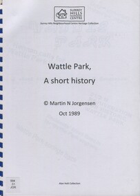
Photograph - Lennoxville Farm, Quebec, Canada, J W Allen, 1928-1929
This photograph was found loose in the first of three albums compiled and owned by J W Allen, Secretary of New South Wales Grazier's, and is associated with the New South Wales Graziers Association world tour of sheep 1928-1929. The album contains photographs of travel, sheep, farms, stations, people and landscapes from around the world. Locations include Naples, Port Said, Suez, Birregurra (Vic), Alexandra (Vic), Ballangeich (Vic), Keith (SA), Mt Gambier (SA), Buckland Park (SA), Tasmania, Winton (QLD), Sydney Harbour, Canberra (ACT), Toowoomba (QLD), Rockhampton (QLD), Tocal (NSW), Deepwater (NSW), Glen Innes (NSW), Longreach (QLD), Moree (NSW), Barraba (NSW) and Mudgee (NSW). Properties depicted include Mooleric, Turkeith, Woolongoon, Minadale, Crower Station, Merrindie, Koomooloo Station, Cappeedee, Koonoona, Rathmore, Ellenthorpe, Camden Park Station, Glenlegh, Strathmore Station, Ilparran Station, Binneguy, Midkin, Terlings, Ashley, Bereen, Plumthorpe, Mayvale and Havilah. The album was found in a clean out at the Great Southern Agricultural Research Institute and donated to the National Wool Museum, along with other related material such as photographs, glass lantern slides and ephemera.Black and white photograph showing sheep in a field in the foreground with trees in the background. back: [handwritten] Lennoxville Farm / [printed] 265agriculture, sheep, farming, stations, research, breeding, photography, travel -
 National Wool Museum
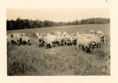
Photograph - Lennoxville Farm, Quebec, Canada, J W Allen, 1928-1929
This photograph was found loose in the first of three albums compiled and owned by J W Allen, Secretary of New South Wales Grazier's, and is associated with the New South Wales Graziers Association world tour of sheep 1928-1929. The album contains photographs of travel, sheep, farms, stations, people and landscapes from around the world. Locations include Naples, Port Said, Suez, Birregurra (Vic), Alexandra (Vic), Ballangeich (Vic), Keith (SA), Mt Gambier (SA), Buckland Park (SA), Tasmania, Winton (QLD), Sydney Harbour, Canberra (ACT), Toowoomba (QLD), Rockhampton (QLD), Tocal (NSW), Deepwater (NSW), Glen Innes (NSW), Longreach (QLD), Moree (NSW), Barraba (NSW) and Mudgee (NSW). Properties depicted include Mooleric, Turkeith, Woolongoon, Minadale, Crower Station, Merrindie, Koomooloo Station, Cappeedee, Koonoona, Rathmore, Ellenthorpe, Camden Park Station, Glenlegh, Strathmore Station, Ilparran Station, Binneguy, Midkin, Terlings, Ashley, Bereen, Plumthorpe, Mayvale and Havilah. The album was found in a clean out at the Great Southern Agricultural Research Institute and donated to the National Wool Museum, along with other related material such as photographs, glass lantern slides and ephemera.Black and white photograph showing sheep in a field in the foreground with trees in the background. back: [handwritten] Lennoxville Farm / [printed] 265agriculture, sheep, farming, stations, research, breeding, photography, travel -
 National Wool Museum
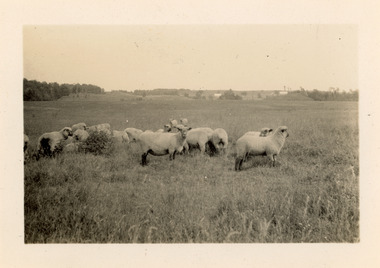
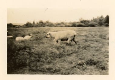
Photograph - Lennoxville Farm, Quebec, Canada, J W Allen, 1928-1929
This photograph was found loose in the first of three albums compiled and owned by J W Allen, Secretary of New South Wales Grazier's, and is associated with the New South Wales Graziers Association world tour of sheep 1928-1929. The album contains photographs of travel, sheep, farms, stations, people and landscapes from around the world. Locations include Naples, Port Said, Suez, Birregurra (Vic), Alexandra (Vic), Ballangeich (Vic), Keith (SA), Mt Gambier (SA), Buckland Park (SA), Tasmania, Winton (QLD), Sydney Harbour, Canberra (ACT), Toowoomba (QLD), Rockhampton (QLD), Tocal (NSW), Deepwater (NSW), Glen Innes (NSW), Longreach (QLD), Moree (NSW), Barraba (NSW) and Mudgee (NSW). Properties depicted include Mooleric, Turkeith, Woolongoon, Minadale, Crower Station, Merrindie, Koomooloo Station, Cappeedee, Koonoona, Rathmore, Ellenthorpe, Camden Park Station, Glenlegh, Strathmore Station, Ilparran Station, Binneguy, Midkin, Terlings, Ashley, Bereen, Plumthorpe, Mayvale and Havilah. The album was found in a clean out at the Great Southern Agricultural Research Institute and donated to the National Wool Museum, along with other related material such as photographs, glass lantern slides and ephemera.Black and white photograph showing sheep with trees in the background.back: [handwritten] Lennoxville Farm / [printed] 265agriculture, sheep, farming, stations, research, breeding, photography, travel -
 Federation University Art Collection
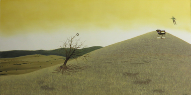
Painting - Artwork - Painting, Nick Dridan, 'Vertigo' by Nick Dridan, 2010
"This work, 'Vertigo', was done in my final year of study. I had begun to focus on landscape, and this painting tries to capture an amalgam of bits and pieces from where I grew up in a playful way."Nick DRIDAN (1988- ) Nick Dridan grew up on a farm in Amphitheatre. Studying Visual Art at University of Ballarat's Art Academy (Now Federation University) Nick Dridan completed a Bachelor of Fine Arts (2007-2009) and Honours (2010) at University of Ballarat (now Federation University). This work was done in 2010 when the artist was focusing on landscape. This item is part of the Federation University Art Collection. The Art Collection features over 2000 works and was listed as a 'Ballarat Treasure' in 2007. A landscape painting where a bare tree stands in a hilly, golden landscape. To the right a man and a house appear to have been ejected into the air. art, artwork, nick dridan, landscape, available -
 University of Melbourne, Burnley Campus Archives
Administrative record, The University of Melbourne, Brochures & Forms, 2000-2001
registration forms, farm chemical users, burnley master gardener course, short courses, turfgrass science and management, tree care, home gardener, subject evaluation, transcripts of results -
 University of Melbourne, Burnley Campus Archives
Photograph - Black and white and colour slides, colour negative, Miscellaneous Horticulture, 1947-1985
57 slides and 1 negative. (1) "1947 Rolling the surface," in front of the newly constructed Administration Building. (2) "5-5-60 Same tree 7 months later-New Growth." (3) Men standing around a large horticultural machine. (4) "Lawns Housing Com" Aug "66?" (5) "Flemington Racecourse." (6) "Mustard-Cover Crop. 1960." (7) Tree climbing. (8) "Grafting-scions. BHC." (11) "Mildura-Soil Probe Oct 67." (12) Virus tested stock trees & layout Flemings Apr 70." (13) "Best's Winery Mar 75." (15, 16) Best's single student and group. (17) "Ploughing-Diagram to show incomplete cover of trash? Farm Practices." (18) "Spraying Hand Equipment for Insect Control in and around Buildings USA Yearbook 1952." (19) "Pasture Harrows." (20) "Mould Board Plough-Tractor." (21) "Disc Harrows-Offset-Tractor." (22) Tyne Cultivator-for Tractor." (23) See B91.258." (24) Burnley College libary. (25) "Irrigation-Delver Tatura 12/59." (26) "Tatura 12/59 Delver Ferguson T." (27) "Wilson's Prom? date." (28) "Wilson's Promontary Nov 1960 lunch." (29) "W. Prom." (30) Camp 1957 Wilson's Promontary." (31)" Longeronong Field Day 1964 Machinery Combination (Small)." (32, 33) "Longeronong Field Day 1964 Machinery Cultivating." (34-36) Photographs of plants in book. (35) Alnus? (37) "Meterosideros excelsa." (38) "Rhipsalidopsis rosea." (39) "Protea neriifolia." (40) Banksias-Species." Insects: (41) "Lacewing larva." (42) "Mites Aug 75." (43) "Yellow Mite, Red Spider (Arachnida)." (44) "Jassid-Life Cycle 9/51." (45) "Grape Fruit Crop (Florida) Destroyed by Fruit Fly. Animals without backbones." (46) "Jassid-Vegetable 9/51." (47) "Field Day 57 (Fruit Fly-Enlarged)." (48) "Field Day 57 (Fruit Fly-Stages)." (49) Insect Life Cycle. (50) "Comatibility (sic) Chart." for Insecticides & Fungicides. (51) "Insecticides-Toxicity." (52) "Life Cycle of the Leather Jacket." (53) "Grasshopper-Head Dissected Mouth Parts." (54) "Types of Antennae." (55) "Spider Mites USA Yearbook 1952." (56) "Cultivator." (57) "Organic Phosphates." (58) Negative Isopogon anemonifolius.administration building, lawns, flemington racecourse, mustard-cover crop, tree climbing, grafting, mildura, soil probe, pests, machinery, excursions, tatura, library, wilsons promontory, plants, alnus, zygocactus, schlumbergia, feijoa, acca sellowiana, protea neriifolia, banksia, isopogon anemonifolius -
Canterbury History Group
Photograph - Hazeldene
... melbourne Canterbury Hazeldene Balwyn Road Trees Gardens Farm ...Sepia photograph of the south side of "Hazedene" 8 Balwyn Road Canterbury and gardencanterbury, hazeldene, balwyn road, trees, gardens, farm and garden equipment, danks family -
 Tarnagulla History Archive
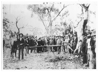
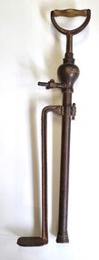
Photograph of Treloar's Foundry employees demonstrating a stump extractor, Treloar's Foundry employees demonstrating a stump extractor, between 1855 and 1894
Murray Comrie Collection. This photograph shows the Treloar Foundry employees (possibly Henry Treloar with hand resting on the stump extractor) conducting a demonstration of their tree and stump extracting device on a farm in Inglewood while a large crowd watches. Information collated by Murray Comrie: H.W. (Henry) Treloar was a native of Redruth in Cornwall, where he was born in 1811. He worked as a blacksmith in his father's Cornwall foundry and then in 1840 went to work in Cuba as a foreman smith to the Royal Santiago Copper Mining Co. Returning to England in 1851 he remained for two years just as the reports of rich Victorian goldfields began to be heard there. He brought his family to Australia in September 1853, arriving in Geelong and then working in Heidelberg for eighteen months. He returned to Geelong to set up a business but after three months was drawn to the Maryborough goldfields, then Dunolly and then Sandy Creek (as Tarnagulla was then known), arriving in March 1855. He remained in Tarnagulla until his death. He established the Foundry in Tarnagulla in 1855 and was known as the best 'mining' smith in the district. After the decline of mining he turned to production of agricultural implements and the firm built a reputation in the field, through devices such as the 'NONPARIEL' tree and stump extractor, double furrow ploughs, seed harrows and scarifiers. On 26th October 1878 the firm won three first prizes for their implements at the North Western Agricultural Show at Inglewood. The business of Treloar & Son was taken over by the James Bros in November 1894. This photograph is a reasonable copy created from an older original, owned by Miss Doris Nicholls. Copy probably made by Murray Comrie in the 1970s. Monochrome photograph of a large crowd of people watching a stump-removal demonstration in a bush setting.tarnagulla, commerce, industry, blacksmithing, smithing, foundry, businesses, treloar, james, buildings, commercial road, main street -
 Tarnagulla History Archive
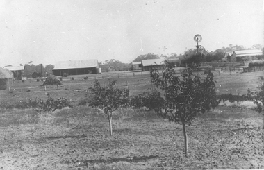
Photographs: Rosemont Homestead, Laanecoorie, Rosemont Homestead, Laanecoorie, 1896
Murray Comrie Collection. Rosemont was the residence of John E. Douglas and Maryan Douglas Two copies of a monochrome photograph, image depicting open paddocks with small fruit trees, several buildings and a windmill in background. This is a slightly dark copy of an older original. Copy probably made by Murray Comrie in the 1960s.laanecoorie, rosemont, douglas, farms -
 Melton City Libraries
Photograph, Mrs Knox and Beryl Gillespie at the First Hundred Years Celebration of Melton State School 430, 1970
... farmland either side and a couple of farm houses and large gum... of farm houses and large gum trees on the properties. Page 2 ...Beryl Knox speaking about early life in Melton. Page 1 1949 – 64 years ago. We began our married life at Melton Sth. The house on the corner of the Exford Rd and Staughton St-- dusty gravel roads, box thorns and noxious weeds everywhere and a sprinkling of houses and vacant land. It was a friendly community consisting of old family names. McDonalds, Blacks, Dodemaide, Cahill, Coopers, Minns, Tinklers, Nesbitts, Cochranes, Wickhams, Exells. Mavis Butler. The home owned by Mr. Robinson and Miss Robinson had been shifted in two parts transported from Diggers Rest and it is still standing 2013. Bruce’s father purchased the house and two adjoining blocks, the Conways built on one and the Rawlinson family on the other block. Eileen still resides there, she was only a baby in a pram and the family had not long arrived from England. The railway line was close to the house and the contents would rattle when heavy steams trains went through, and on a clear frosty night the 1am paper train would echo roar through very loudly when labouring towards the Exford Bridge. Then the two carriage motor train was introduced, this was great for the workers and schoolies who travelled to Melbourne. The train pulled up at the crossing or riding to pick up or drop off. Melva Gillespie (nee Hirt) Bill Cahill delivered the milk by the billy and then in bottles. Len Kennedy (Paul Kennedy’s father, Norma Murrays son) delivered Jongebloeds bread, he always had a sweep going for the Melbourne Cup and raffles for the footy club. Mr. Woodgate owned an old bus and pick up point was the Post Office when there was a Saturday film on a Melton. There were no doctors or dentists in the district. If we need a Doctor we had to travel to Bacchus Marsh or discuss problems over the phone. In later years a Bacchus Marsh Doctor rented the Bluestone building in McKenzie St a couple of days a week. If we needed the Dentist we had to travel to West Footscray or Footscray. We did our banking at “State Savings” then the Miss Minns had the agency and then Bardsleys Store. We travelled to Bacchus Marsh to the National and Commercial banks. Station Rd to Western Highway, now (High Street) was a narrow stretch of bitumen and gravel farmland either side and a couple of farm houses and large gum trees on the properties. Page 2 North of the Railway line Mrs Bessie Jones, mother of Chas and Betty Jones managed the Post Office, next door to her Chas and Betty had the Shell Centre, and later moved the business to Melton. Hughie Nesbitt and mother owned the grocery and hardware store, and I bought my first set of saucepans there. On the opposite side of Station road Mr Coombe owned the fruit shop, and also provided soft drinks and lollies for children. The Chaff Mill was on the corner of Station Rd and Brooklyn Rd. Mr Lumsden was manager and later years Bernie Trethowan and Jack Butler were partners. It finally burnt down and is a Service Station now. Along Brooklyn Rd there were a few houses and Victoria Hall, not a very big hall, but catered for lots of functions, Balls, Fancy Dress, Bazaars, Square Dancing and meetings. The Bacchus Marsh Baptists held Sunday School in the hall. A group of shops were built south of the railway line Molly and Len Skinner managed the Post Office and handled a few essential groceries. Tom McDonald and Ron Lunsberg were the butchers. Mary and Syd Cooper lived next door to us and often in turn would run out of something when we had a baking spree we would borrow or exchange, sugar flour etc over the fence. Mavis and Jack Butler lived there before the Coopers. Bernie and Iris Trethowan lived two doors up. Neighbours were invited into their home to view the first black and white television in Melton Sth. Bill Exell was one of the first Melton Sth farmers to sell his land to developers, the land was idle for years before housing developed. I joined the Melton Valley Golf Club in 1960. The Gun Club as our Club House, an old tin shed consisting a water tank, trestle table and forms and dirt floor. It was a 9 hole course with sand scraps and landscape putting before greens. The Common or parkland was part of the Golf Course. It was open for every ones recreation. Roy Norton an old identity trained his trotters on the Common and wouldn’t clear the track for the golfers. The golfers had to avoid him to continue to play. We had to keep clear when the young youths came in their paddock cars and motorbikes. Over the years the Toolern Creek flooded its banks, water and debri covered the course on one year our first Club house was flooded out. It took several working bees to clean it up. We lived at Melton Sth for 15 years and moved to Melton on the farm “Croxton Park.” The Nixon family farm “Mowbray” adjoined the farm. Bruce worked the land cropping the farm when Mrs Nixon died. Page 3 (page 4 on the handwritten script) Bruce had the first offer to buy, in those days it wasn’t easy to get good bank loans. Part of the land is the Golf Course now and Mr O’Shea purchased the bulk. Moving to Melton was totally different – I became involved with Committees, Scouts, Guides, Mothers Clubs, CWA, Church Op shop (8 years). Melton Amateurs players produced and tutored by Mabel Rogers exerts from Pyjama Game, South Pacific, Carousel - later years a group of ladies did gentle water exercise at Essendon and Station Road swimming pool. I was 20 or so years in Probus. The local followed the football, there was always a Gymkhana on the long weekend in June. The tennis always created a lot of interest during the finals. It didn’t matter which team played the supporters were treated to a cup of tea and leftovers from their afternoon tea. In 1978 were the first residents to move into the Jennings Estate Kurunjang and lived there 31 years and retired 4 years ago into Unit. The amazing changes I have experienced. Merrimu supplied our water, after depending on tanks. The landscape changed completely when developers came in, no more dusty plains \ typed web Sept 2013 McFarlane, Mrs Knox and Beryl Gillespie at the First Hundred Years Celebration of Melton State School 430. The event was held at Mechanics Hall, Melton.local identities, local significant events, education -
 Wodonga & District Historical Society Inc
Functional object - Brass Stirrup Pump
A stirrup pump is a portable reciprocating water pump used to extinguish or control small fires. It is operated by hand. The operator places a foot on a stirrup-like bracket at the bottom of the pump to hold the pump steady. The bottom of the suction cylinder was placed inside a bucket of water. Water was drawn by pumping the handle up and down to create suction. The pumps were used in a variety of settings to enable quick action if a small fire broke out. They were a vital tool in London during the Blitz of World War 11. On the local level they were also used for spraying fruit trees, plants and vines. The Crescent Tool Company was founded in 1907. The Crescent brand has changed ownership multiple times. It is currently owned by Apex Tool Group but still also trades as Crescent in Australia. This pump was donated by Geoff Williams of Wodonga and was used at "Orange Vale" farm at Oxley Flats near Wangaratta. "Orange Vale" was owned by Mr. Robert Williams. Widely known as "Uncle Bob". in the 1940s Mr. Williams opened up the family property, established in the 1860s, as a camp for young people from Wangaratta. By 1951, this had extended to catering to group camps for children from Victoria, New South Wales and Queensland. 250 children could be accommodated at one time and as many as 3,000 children enjoyed the facilities each year.These pumps were important in fire fighting in a range of settings and were adapted for use in agricultural and small farm settings,A brass stirrup pump with wooden handle. It consists of 2 parallel brass pieces, one with a foot piece attached to keep the pump steady. The base of the pump is fitted with a pierced metal filter that prevents grit and debris being drawn into the pump and fouling it. 2 butterfly screws enable adjustment of height and securing a hose.crescent tools, orange vale, fire equipment -
City of Kingston
Photograph - Colour, 6 March 1993
Edithvale is a suburb in the City of Kingston. It is located between Aspendale and Chelsea on the Port Phillip Bay and built within remnant areas of the Carrum Carrum swamp. The foreshore precinct comprises a wide sandy beach, with low sand dunes and numerous historic boat sheds. The suburb consists of older style dwellings and former holiday houses, combined with mid-century housing and newer homes. The large blocks are increasingly subdivided and the existing dwellings demolished to accommodate units and townhouses, thus changing the landscape of the area and reducing the tree canopy.The beachside suburb of Edithvale was previously part of the extensive Carrum Carrum Swamp. The area was once a source of fish and eels for the Mayone-Bulluk clan of the Bunurong people. Over time the area was drained and predominantly devoted to dairy farming and holiday houses. The farms were gradually sold and subdivided with a large number of homes built after World War II and in the 1960s. Edithvale is mainly residential with a shopping strip along Nepean Highway but little significant industry was ever established in the area apart from a plaster works and confectionary factory, both now closed.Laminated aerial colour photograph of Edithvale as viewed from Alexandra Avenue in the north to Ella Grove Chelsea/Edithvale in the south. regents Park Aspendale can be seen in the top left. The area is built-up with residential housing and facilities including Edithvale Primary School, numerous churches and the Edithvale Railway station. Large sections depict the remnant Carrum Carrum swamp. Edithvale Common and the former "Duck Inn" (Melbourne Water/Friends of Edithvale Seaford Wetlands) can be seen. Edithvale Recreational reserve, the valodrome and Edithvale Public Golf Course are prominent. The image shows vacant land in the area now known as Aspendale Gardens and the newer residential section of Chelsea Heights is not developed. A bike path has been established to cover the secondary drain. The Golf Links Court residential development located off Hughes Avenue is a large vacant block.Black type on white adhesive label: 6-3-93 Black type on white adhesive label: 25/9211, 6/3/93, 11.20 am Black type on white adhesive label: 9211 Yellow circular adhesive sticker Black pencil: 9211 6-3-93 arrow pointing Nedthvale, carrum carrum swamp, aspendale, chelsea -
 Surrey Hills Historical Society Collection
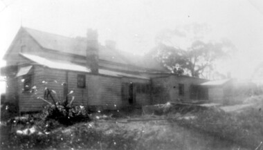
Photograph, 6a Thistle Street, Surrey Hills, 1924
One of the oldest homes in Surrey Hills. The photo was taken in 1924 when the property was purchased by Mr John Francis Evans, father of Mrs Lillian Austin. The Evans family came from Gembrook. John Evans was born in Wales; he and his wife Mary had 3 children, 2 daughters and one son. Mary Evans pre-deceased her husband, who died on 23 October 1924 at Hillsborough, 6A Thistle Street. The first owner of the property was Mrs Rachel Sweetnam (nee Lewis) who married Thomas Edward Sweetnam on 24 September 1884 at St John's Church, Camberwell. REF: THE ARGUS 4 Oct 1884 Thomas second eldest surviving son of Matthew Sweetnam married to Rachel (Ray) third eldest daughter of Captain T.D. Lewis, Culm Haven, Camberwell. Thomas was active in land sales and variously described as a land agent, real estate agent and auctioneer. The property - Hillsboro or Hillsborough - was originally a house on a farm of 10 acres owned by her. It became 6A Thistle Street. According to the Alan Holt property register Rachel Sweetnam owned the property prior to 1890 and a family tree on Ancestry.com has that it was owned by her in c1886. It is likely that at this stage the property was an investment rather than the Sweetnam's family residence. Other property owners or residents are: 1890 Selina Gaylor 1900 Stephen Pullen 1910 William Murray (draftsman) 1920 George C Hughes 1930 Arthur Leslie Austin (tram driver) 1980 Mrs Lillian Evelyn Austin Lillian Austin died on 19 August 1983 and the property was sold that year for $87,000. The house is still extant (January 2025). Note that we also have material / photos regarding George Hughes and family.Black and white photo of a timber home with brick chimneys and a (?) corrugated iron roof. There are sheds and outbuildings attached to the house. The garden looks untended. In the background a mature eucalypt tree can be seen.houses, hillsboro, timber houses, mrs lillian austin, hillsborough, selina gaylor, stephen pullen, william murray, george hughes, arthur austin, john francis evans, thistle street -
 Surrey Hills Historical Society Collection
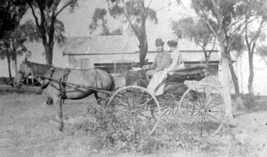
Photograph, 'Hillsboro' or "Hillsborough' - 6a Thistle Street, Surrey Hills, pre-1890
The photo was found behind a mantelpiece in the house at 6A Thistle Street while it was being renovated. It is thought to be of the first owner, Mrs Rachel Sweetnam (nee Lewis) and her husband, Thomas Edward Sweetnam. They were married on 24 September 1884 at St John's Church, Camberwell. REF: THE ARGUS 4 Oct 1884 Thomas second eldest surviving son of Matthew Sweetnam married to Rachel (Ray) third eldest daughter of Captain T.D. Lewis, Culm Haven, Camberwell. Thomas was active in land sales and variously described as a land agent, real estate agent and auctioneer. The property - Hillsboro or Hillsborough - was originally a house on a farm of 10 acres owned by her. It became 6A Thistle Street. According to the Alan Holt property register Rachel Sweetnam owned the property prior to 1890 and a family tree on Ancestry.com has that it was owned by her in c1886. It is likely that it was an investment rather than a family residence. Thomas Sweetnam was President of the Boroondara Shire 1888/89 and a councillor from 1886-1891. During his time as Shire councillor in 1887 he was charged with assaulting Charles A. Chandler, a window blind manufacturer, in response to an ‘insulting note’ left at Sweetnam’s house. Sweetnam was fined two guineas and 31 shillings. Sweetnam was also President of the Camberwell Gun Club from around 1890 – 91. In 1893 he relocated to Ferntree Gully, where he contested for the municipality’s North Riding council seat. Multiple references can be found on Trove. Note that the gentleman in this photo does bear a resemblance to Thomas Sweetman, President of Boroondara Shire in 1888-1889 found in the City of Boroondara Library Service mayoral portrait collection. No known photo of Rachel Sweetnam. Other property owners or residents are: 1890 Selina Gaylor 1900 Stephen Pullen 1910 William Murray (draftsman) 1920 George C Hughes 1930 Arthur Leslie Austin (tram driver) 1980 Mrs Lillian Evelyn Austin Sold in 1983 for $87,000. The house is still extant (January 2025). Note that we also have material / photos regarding George Hughes and family.This photo is one of the earliest photos of residences of Surrey Hills.Black and white photo of a woman and man in a buggy behind which is a simple house with a verandah at one end, surrounded by eucalypt trees.hillsboro, house names, thistle street, horse-drawn vehicle, clothing and dress, hillsborough, rachel sweetnam, rachel lewis, thomas sweetnam, selina gaylor, stephen pullen, william murray, george hughes, arthur austin, lillian austin -
 Linton and District Historical Society Inc
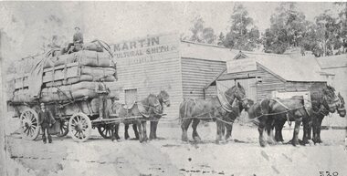
Photograph, W.M. Grigg Carting Wool
Black and white copy of original photograph of a team of horses with a load of wool with a man on the front of the wagon and one man sitting on top of the load. Buildings and trees are in the background.w m grigg, wool, farm -
 Lakes Entrance Historical Society
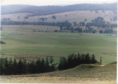
Photograph - Sarsfield Flats, Tambo Shire, 1994 c
Also second identical copyColour photograph of Sarsfield Flats. Distant view of cattle grazing and farm buildings, foothills in background, and glimpse of mountains. Pine trees in the foreground. Bruthen Victoriaagriculture, topography -
 Lakes Entrance Historical Society
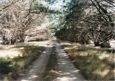
Photograph, Tambo Shire, 1994 c
Also second identical copyColour Photograph of a typical farm driveway, shows a long driveway bordered with cypress trees. Nicholson Victoriaroads and streets -
 Eltham District Historical Society Inc
Photograph - Digital Photograph, Alan King, Panton Hill Hotel, 27 March 2008
Today’s Panton Hill Hotel was built around 1920. Published: Nillumbik Now and Then / Marguerite Marshall 2008; photographs Alan King with Marguerite Marshall.; p61 Panton Hill was originally known as Kingstown, and consisted of only one hotel when the Orams Reef was discovered in 1859. Kingstown was a quartz mining centre and many old mine shafts remain in the area. Orams Reef was one of the first reefs with a rich find of gold in the area. The Hotel Francais, which had been operating in 1861, was well situated on the way to Queenstown (later St Andrews). So was Herr Hirt’s Hotel and store at Smiths Gully. The Kingstown hotel, known as the Frenchman’s and in 1864 as the Hotel de France, was run by a Monsieur Emile Hude and his wife Jeanne, and known for its good food. They hosted social events, business conventions and debates, attracting patrons from as far as Melbourne. The hotel’s name was changed to Panton Hill Hotel in 1905. In 1883 Charles Caudwell built another hotel nearby, possibly in Long Gully Road,3 which it is thought, was burnt down early last century. Today’s Panton Hill Hotel, built around 1920, is the only one of the cluster of buildings in the main road, not to date from around the turn of last century. It was severely damaged by fire in 2003, then underwent extensive alterations. It is the township’s only hotel and is an example of a modest hotel building exterior, constructed early last century. In its early days the hotel also housed the first post office, newsagency and store. Orams Reef yielded a total of £100,000, and fossikers also found alluvial gold in the creeks and gullies, but there is no record of the total value of their finds. Gold greatly increased the Panton Hill population, which peaked between 1865 and 1885. On holidays large sports meetings were held with wood chopping contests and foot races and the day would end with a ball. Miners came from various countries to seek their fortune, including many from China. The Chinese became unpopular however, and gradually left the district, although some stayed and grew and sold vegetables.5 Panton Hill was named after Joseph Panton, who in 1862 was appointed Police Magistrate for the Woods Point, Heidelberg and Yarra districts. Panton was an outstanding man, who in 1852, was Commissioner of Crown Lands and Assistant Commissioner of Goldfields at Bendigo. In 1874 he was promoted to Chief Magistrate for the Melbourne Police. Panton was also an artist, becoming president of the Victorian Arts Society in 1888, and in 1913, president of the Royal Geographical Society. Despite Panton Hill’s prosperity, it still lacked many services as poor roads made access to Melbourne difficult. A horse-drawn mail coach travelled to Melbourne until 1890, when the railway came to Heidelberg. The nearest doctor was at Yarra Glen or Heidelberg, and the Indian hawker Singh’s annual visit was very welcome. A miner’s shack opposite the school was used as a post office. Today’s general store and post office in the main road dates from early last century, and has changed considerably. While most people searched for gold, the more enterprising ones established farms to feed the diggers. Farmers grew wheat, barley and oats, and sent animal skins to the Eltham tannery, to make furs in Melbourne. As gold became scarce from around 1880, miners took up farming on 19 to 20 acre (8ha) allotments. The first settlers in Cherry Tree Road included Purcell, Smith, Owens, Hughes and Shillinglaw. By 1900 all the land had been taken up around Panton Hill and Hurstbridge. The orchards in Panton Hill and the wider district, particularly of apple and pear, were very successful, and made Panton Hill a cohesive and successful community. About 1914 the Moores built the first cool-store and refrigeration plant at their orchard in Cherry Tree Road. Many settlers planted vineyards and made high quality wine, but in 1922 the blight destroyed them.This collection of almost 130 photos about places and people within the Shire of Nillumbik, an urban and rural municipality in Melbourne's north, contributes to an understanding of the history of the Shire. Published in 2008 immediately prior to the Black Saturday bushfires of February 7, 2009, it documents sites that were impacted, and in some cases destroyed by the fires. It includes photographs taken especially for the publication, creating a unique time capsule representing the Shire in the early 21st century. It remains the most recent comprehenesive publication devoted to the Shire's history connecting local residents to the past. nillumbik now and then (marshall-king) collection, panton hill hotel -
 Lakes Entrance Historical Society
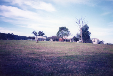
Photograph - Historic House, Bennett, Vera, 1991
... , showing a timber and corrugated iron structure amongst farm... structure amongst farm buildings and trees. Lakes Entrance Victoria ...Date made May 1991|Old building demolished c2008. Ostler family arrived at Cunninghame (Lakes Entrance) by boat, walked to the site with their belongings, cleared the land, built a dwelling, farmed dairy herd, grew maize, had beehives.| Also one colour photograph of new dwelling constructed next to the old dwelling taken 29th September 2007|Also two other colour photographs old dwelling.Colour photograph of Ostlers old home, 106 Ostlers Road, showing a timber and corrugated iron structure amongst farm buildings and trees. Lakes Entrance Victoriahouses, local history