Showing 10846 items
matching maps
-
 Bendigo Historical Society Inc.
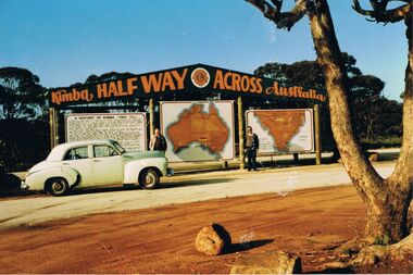
Photograph - PETER ELLIS COLLECTION: PETER ELLIS AND JOHN MEREDITH
Colour photo of Peter Ellis and John Meredith standing in front of the sign at Kimba Half Way Across Australia. There are three signs, one has the History of Kimba, one is a map of Australia and the other is a map with Spencer Gulf printed on it. A green Holden car is parked in front of the History sign.photo, group, male, peter ellis collection, peter ellis, john meredith -
 Melbourne Tram Museum
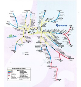
Map, VicTrip, Melbourne rail network - Connex and M>Train, 2000
Map - Colour print - of Melbourne's railway station network, shows the Connex and M>Train areas, zones, V/Line Metcards, Premium stations - used in Fares and Travel Guide - 2000 and 2001 Map - see Reg Item 2508. Also used in poster Reg Item 2514.trams, tramways, connex, map, melbourne, railways, m>tram, connex -
 Melbourne Tram Museum
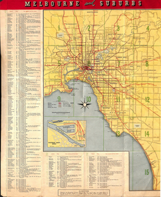
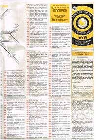
Map, Tourist Development Authority of Victoria, "Melbourne Holiday City", c1963
Fold out map (8 sections 4 across x 2 deep), coloured of Melbourne's Tram and train routes, route numbers, rail lines, detailed for Melbourne and suburbs. On rear description is map of CBD and places of interest. Has contact details for cinemas, theatres and sporting venues.trams, tramways, melbourne, map, tram & train services, railways, mmtb -
 Ringwood and District Historical Society
Map - Public Land Sale by Thomas Ham, 2000 Acres for Sale - Crown Sections 20, 23, 24 - Ringwood, Victoria - 1855
Two 1850s surveyor's maps on cardboard backing showing area from Melbourne extending East beyond Bulleen and Nunawading. Detailed description of lots for sale and navigational directions to the property from Richmond by Thomas Ham, Victorian public servant, map maker, publisher, lithographer and original Ringwood land owner. Inset map enlarging area between Yarra River and Dandenong Creek, with southern boundary of allotments later forming part of Oban Road, North Ringwood.TRANSCRIPT: "This really valuable Property is now offered to the public for sale, in lots to suit purchasers at the Iow rate of £1 per Acre for 80 acres and upwards, and £1.10s per Acre for any smaller portion. Terms of payment Half Cash, Balance in 6 and 12 months, bearing 8 per cent interest. The Estate is well wooded with Gum, Cherry Tree and Stringy Bark, with Wattle in the valleys of the several creeks. Every lot is Staked and Trenched at the corners marked on the Plan thus - The Surveyor has carefully sub-divided the Property, in order to give every Farm a Creek for Water, Valley for Cultivation, and Hills for House and Grass Paddock. The ROADS have been very carefully laid out so as to give a firm, well drained, and nearly level road to each Homestead. Intending purchasers can readily find the property by the following directions, viz: Start from Richmond Bridge, at Hawthorne, then take the left-hand road to KEW. When at the "Woodman Inn", take the Cotham Road to the right, bearing due east, keep this Road, passing Trainor's "White Horse" Inn, and before you leave the fences, you will see calico bills (see margin) nailed to the Trees on the bush track leading to the Upper Yarra country, follow the Bills till you come to the SOUTH boundary line of the Property, which bears East and West (see Plan) where you will see Bills nailed up "THIS PROPERTY FOR SALE, etc." The Bills from Town lead direct to where Mr. Jull is erecting his Store, and arrangements have been made with him to show the lots to intending purchasers free of charge. At the respective corners of the lots the Bills are nailed up double, with numbers to denote the lot, and that the corner stake is adjacent. Any parties wishing to proceed to the property by way of BULLEEN will find Bills nailed on the Trees, commencing at the NEW INN, at "Wilson's Slip Rail." Keep this Track till you come to the Log Bridge, over the Deep Creek at Bloxhome's Paddock; go through the land now being cleared; keep the track over the hill till you come to an Iron House, you will then be on the property, which Iies to the North and East as per Plan. Follow the Bills till you come to Mr. Jull's Store, etc. etc. Further particulars can be had from the Agent for the Property. THOMAS HAM. " -
 Bendigo Historical Society Inc.
Map - YALLOOK : COUNTY OF BENDIGO, 1957
Map. Yallook, County of Bendigo, Talambe, Neilborough, Yarraberb, Salisbury, Pompapiel. Drawn and reproduced at the Department of Lands and Survey, Melbourne,1957. Distances shown on the plan are derived from original surveys of varying dates and whilst approximately correct do not necessarily conform to modern standards of accuracy. For survey information application should be made to the central plan office, or to the office of titles. Some ink scibbles appear at the right top of this map. Price 2/-. (number 14 in map cupboard 1)By Authority W.M.Houston, Govt.Printer,Melbourne.map, bendigo, yallook -
 Melbourne Tram Museum
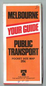
Map, Ministry of Transport, "Metropolitan Transport Services Map - Melbourne Tram, Train and Bus Services", 10/1971
Fold out map (27 sections 9 across x 3 deep), coloured of Melbourne's Tram and Bus routes, route numbers, rail lines, detailed for the central part of Melbourne. On rear description of routes, private bus routes and map of Melbourne metro lines. Has contact details for bookings and lost property etc. Priced at 10c. Launched in a newspaper advert 26/10/1971. Has map scale in miles. 2nd copy added 16/7/2014On front cover in ink "#1" in top right hand corner and "4 G 33" along bottom edge.trams, tramways, melbourne, map, tram & bus services, railways, mmtb, minister for transport -
 Melbourne Tram Museum
Map, Ministry of Transport, "Melbourne Transport Services Map - Tram, Train and Bus Services", 1977
Fold out map (27 sections 9 across x 3 deep), coloured of Melbourne's Tram and Bus routes, route numbers, rail lines, detailed for the central part of Melbourne and insert section for Frankston. On rear description of routes, private bus routes and map of Melbourne metro lines. Map No. 7, 1977. Has contact details for bookings and lost property etc. Priced 20c. 1977, route 59 showing as terminating opposite Essendon Airport.On front cover in ink "" in top right hand corner and "4 G 33 " along bottom edge.trams, tramways, melbourne, map, tram & bus services, railways, mmtb, minister for transport -
 Melbourne Tram Museum
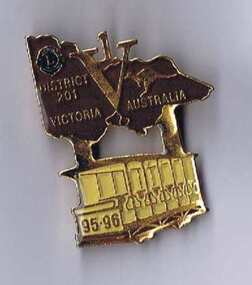
Ephemera - Badge, Douglas badges for Lions club District No. 201, 1995
Badge - issued by the Lions District No. 201, Vic, featuring a map of Victoria with the letter V and number 1 included in the map, featuring a Box Hill toastrack style tramcar under the badge with the numbers 95-96 on the front of the tram. Gold badge with brown paint infill in the map of Victoria and a yellow paint infill on the tram finished with a gloss varnish. Has a pin clip on the rear with a locking mechanism. Made by Douglas batches of Melbourne - has their phone number on the rear.trams, tramways, box hill, badges, lions club -
 Melbourne Tram Museum
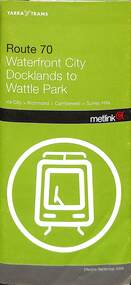
Ephemera - Timetable/s, Yarra Trams, Set of two timetable books - route 70 & 75, 5/2008, 9/2009
Set of two timetable books - Provide details about Yarra Trams, Metcards, route map, timing points and route description. .1 - printed 40 pages with fold out map, green cover, stapled timetable for "Route 70 Waterfront City Docklands to Wattle Park", dated September 2009. .2 - printed 44 pages with fold out map, green cover, stapled timetable for "Route 75 City Spencer St to Vermon South", dated May 2008.trams, tramways, tickets, yarra trams, tram services, timetables, route 70, route 75, wattle park, burwood -
 Kiewa Valley Historical Society
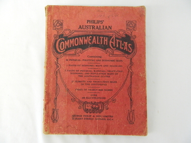
Atlas Australian Commonwealth, Philips' Australian Commonwealth Atlas, 1944
This atlas, printed in 1944, details not only the geographic and political boundaries of the world as it was at that time but also the snap shot of life of the time. This snap shot in time covers the major Australian cities, the major farming, grazing, industrial and sporting/recreational activities. Also there are snap shots of similar activities from other global areas. The period also covered World War II, detailed by a photo of "shell making", munitions, required by Australian soldiers. The great political and territorial changes made as a result of World War II can be clearly identified for example , Israel (the Jewish homeland). The various prewar colonies of major European nations.This atlas was used by children of a Kiewa Valley family and shows the value and the general educational exposure that these children had at this time. The rural setting and within the backdrop of a world war did not severely alter the life style of children in this region. The "news reels" shown in cinemas of cities and larger towns were the only visual realisations of major events of global significance available to these children. The information provided by this atlas allowed students to glimpse at what the "outside world" was. The majority of these students would possibly never see these regions for themselves. The great communication facilities of the late 1900s and beyond, was still only science fiction.This atlas has a thick (350 g/m) red cardboard cover with bold black lettering and shading. The cover is set out within a shield like frame. The shield is held up by two square markings, each with a four part circular pattern and a cord entwining two pendulum structures ending with a bowl figure at the bottom. There is a semi circular form enclosing a printed book contents list. The inside cover has the atlas title and contents and the publisher details. The atlas contain 56 pages of world and Australian maps, vegetation and rainfall maps. Within this atlas there are 27 double sided pages of black and white photographs depicting life styles, buildings, landscapes and prominent and significant to Australia males from 1652 to 1944. The pages are of approximately 200 g/m and have the yellow aged appearance.On front cover "Philips' Australian COMMONWEALTH ATLAS" and underneath "Containing" underneath "60 PHYSICAL, POLITICAL AND ECONOMIC MAPS". Publisher George Philip & Son, Limited 32 Fleet Street, London E.C. 4. Inside cover are: written, in freehand and in ink the following names and dates; "J.Muller Form V 1945", "L L Muller Form IV 1946", "N.J. Muller Form I + II + III 1948 +49 + 50" and "D Muller Form I 1949". also handwritten and in pencil is "Peter Leslie". On the last page is a small freehand sketch of Australia in biro.1940s school curriculum, rural education, 1940s atlas, australian atlas -
 Bendigo Military Museum
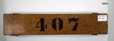
Instrument - Ruler Parallel Rolling 15" with box, Department of Defence Australia, 1944
Used by Army Survey Units to quickly draw parallel lines for map production since 1944.A Brass 2.5" (6.5cm) wide Ruler 15" (38cm) long with brass rollers. Ruler is enclosed in a wooden protective boxRuler engraved with " A.L. FRANKLIN SYDNEY No 514 1944 D^D", Box labeled 407royal australian survey corps, rasvy, fortuna, army survey regiment, army svy regt, asr -
 Eltham District Historical Society Inc
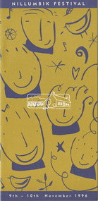
Program, Nillumbik Festival, 9th - 10th November 1996, 1996
12 page DL size booklet plus Welcome, Contents, fold-out map and covers12 page DL size booklet1996, eltham festival, nillumbik festival, program -
 Lara RSL Sub Branch
Book, Australia in the War of 1939-1945 CIVIL Volume 2 Author Paul Hasluck The Government and the People of 1942-1945, First published 1970
This book is a follow one from the first volume written by Paul Hasluck. Maps, illustrations and photographsThe development and significant events of Australian politics during 1942-1945Australia in the War of 1939-1945 - The Government and the People 1942-45Australian War Memorialfall of singapore, south west pacific command, bombs on australian soil, macarthur, macarthur takes command, industrial - coal, austerity, manpower difficulties, 1943 elections, san francisco conference, the end of hitler's war, john curtin is dead, the surrender of japan -
 Lara RSL Sub Branch
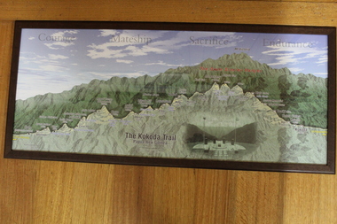
Photograph The Kokoda Trail - "Courage, Mateship, Sacrifice, Endurance", Kokoda Trail - "Courage, Mateship, Sacrifice, Endurance"
Tourist map of the Kokoda Trail, Owen Stanly Ranges - IIolo to Kokoda, Papua to New GuineaGraphical map of the Kokoda TrailPicture Kokoda Trail - Papua New Guinea - Owen Stanley Ranges showing a cut through to emphasize the variation in height in the Ranges, with left to right of the villages and townships that represent the trail. Also contains an inset picture of the Memorial at Isurava Village.Nonekokoda trail, owen stanley ranges -
 Bendigo Military Museum
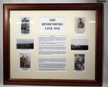
Artwork, other - PHOTOGRAPH, FRAMED, 2014
Refer to map, cat No 1635, Grinton collection. Refer Cat No 1280 for Jack Grintons detailsPhotos mounted on cream background with ornate light brown frame with glass front, white cardboard backing with wire hanging strap. Down left hand side: Photo of Sgt J GRINTON, photo of view toward Bony, photo of Sgt BRUNKER verso & Lt CALLAN Down right hand side: Photo of Fredrick LEHMANN, photo of L/CPL RISBEY's Cross, photo of Roy A INGLETON. Centre: The history relating to these photos is in black print on a white background. Top centre: The Hindenburg Line 1918photos, framing, ww1 -
 Marysville & District Historical Society
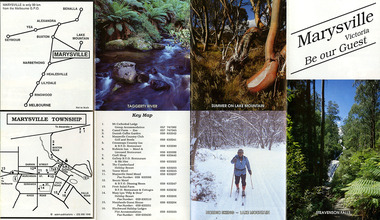
Ephemera (Item) - Tourist Guide, Marysville Tourist Association, Marysville Victoria Be our Guest, Unknown
A fold out tourist guide to Marysville and the surrounding district. This map was produced by the Marysville Tourist Association.A fold out tourist guide to Marysville and the surrounding district.marysville, victoria, australia, tourist guide, steavenson falls, mt cathedral lodge, camelot camel farm, danish coffee garden, marysville country club, crossways country inn, kufstein inn, marysville craft shop, gallery restaurant, the cumberland, tower motel, marysville hotel, scenic motel, fruit salad farm, marylyn guest house, marylands guest house, blackwood lodges, taggerty river, lake mountain -
 Marysville & District Historical Society
Ephemera (Item) - Tourist Guide, Marysville Tourist Association, Marysville Victoria Be our Guest, Unknown
A fold out tourist guide to Marysville and the surrounding district. This map was produced by the Marysville Tourist Association.A fold out tourist guide to Marysville and the surrounding district.marysville, victoria, australia, tourist guide, steavenson falls, mt cathedral lodge, camelot camel farm, danish coffee garden, marysville country club, crossways country inn, kufstein inn, marysville craft shop, gallery restaurant, the cumberland, tower motel, marysville hotel, scenic motel, fruit salad farm, marylyn guest house, marylands guest house, blackwood lodges, taggerty river, lake mountain -
Tatura Irrigation & Wartime Camps Museum
Book, Birchip, Essays on a Shire, 1970
To record history of Birchip Shire for 75th Anniversay. Includes fold out aerial map of town.Cream and brown covered book, photographs of old shops on coverbirchip shire -
Tatura Irrigation & Wartime Camps Museum
Document, Map of encounter
Map of encounter between HMAS "Sydney" and HSK "Kormoran" copied from Captain Detmer's book. -
 Stawell Historical Society Inc
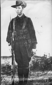
Photograph, Mr Sydney Davidson as a Soldier in WW1 in uniform with rifle, webbing, & map case 1914-1918 -- Studio Portrait
Portrait Sydney Davidson 1914-18 Soldier WW1 in uniform with rifle webbing and map casestawell war -
 Stawell Historical Society Inc
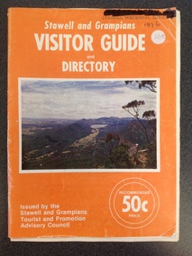
Book, Forests Commission, Stawell & Grampians Visitor Guide & Directory 1976, 1976
Tourist Brochure for Stawell and Grampians Region. Included is a Map Titled Grampain's Wonderland Forest ParkOrange Paper cover with white Print Middle of cover is a colour Picture of the Grampians.Stawell and Grampians VISITOR GUIDE and Directory. On teh Bottom right. Issued by the Stawell and Grampians Tourist Promotion Advisory Council . On the Left in two White circles "Recommended 50c Price."stawell tourism -
 Dandenong/Cranbourne RSL Sub Branch
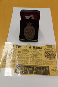
ANZAC Bronze medal, Commemorative Medal, UNKNOWN
SIMPSON AND DONKEY on face of medal. Map of AUSTRALIA / NEW ZEALAND together with Southern Cross on reverse.Heavy bronze medal dated 1915 ANZAC newspaper clipping reason or MedalAWARED TO R.V.FARKENS -
 Eltham District Historical Society Inc
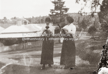
Photograph, Possibly Nancy (left) and Emily Withers outside their home, Southernwood, standing in Bolton Street at the intersection with Brougham Street, Eltham, n.d
View looking south along Bolton Street towards Southernwood https://goo.gl/maps/cMv5NPi1tJYwg9Z39Many items in this collection have suffered from significant water damage and black mouldjohn withers collection, eltham, bolton steet, scan - 620 format 6x9 negative, southernwood, emily gladys withers, nancy josephine pitt withers -
 Bendigo Military Museum
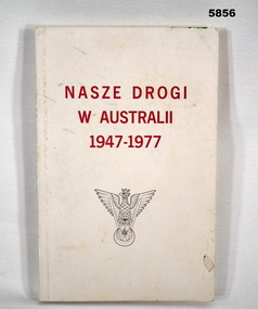
Book - BOOK, WW2, "NASZE DROGI/ W AUSTRALII/ 1947-1977", 1978
Owner and donor details - see Cat No. 5836.3. This book has been written in Polish - a number of photographs have captions with Australian Cities named. Appears to be an Association history.Soft cover book. Cover cardboard, red and black print on front and back. Off white background. Illustrated - grey print, crowned eagle emblem with the word "TOBRUK". Back - map in black and white. 185 pages - cut, plain, white paper. Illustrated - black and white photographs and maps.books, military history, ww2, polish -
 Bendigo Historical Society Inc.
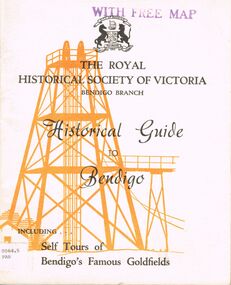
Book - HISTORICAL GUIDE TO BENDIGO
Five copies of 'The Royal Historical Society of Victoria Bendigo Branch Historical Guide to Bendigo. Including Self Tours of Bendigo's Famous Goldfields.' Revised Edition. Printed by Cambridge Press, Bendigo 1968. photos, maps, illustrations. Two copies only have WITH FREE MAP stamped on the front cover.bendigo, history, gold mining, book, books, bendigo, history, royal historical society of victoria bendigo branch, gold, goldfields, victoria, victorian history, gold mines, gold, australian history, gold discoveries, mining. sticker bottom left front cover of two copies only 0064.5 par. 0064.6 par -
Bendigo Historical Society Inc.
Map - KIMBOLTON : COUNTY OF BENDIGO, 1966
Map. Kimbolton, County of Bendigo. Eppalock, Lyell, Knowsley, Langwornor, Redesdale, County of Dalhouse, County of Rodney, Campaspe River, Coliban River,By authority A.C.Brooks, Government Printer, Melbourne. Drawn and reproduced at the Department of Lands and Survey, Melbourne, 1966, Price $1.00 (number 65 in map cupboard 1)A.C. Brooks, Government Printer, Melbourne.map, bendigo, kimbolton -
Bendigo Historical Society Inc.
Map - CAMPBELL COLLECTION: BENDIGO AND DISTRICT MAPS, 22-3-29
Map. Marong, Parishes of Marong, Lockwood and Mandurang, Scale 20 chains to 1 inch, Total area 5106 acres. Crusoe Reservoir & Viaduct and water race. Compiled in W.P.B. fro Field Survey and Parish Plans. B.W.L.22-3-29 (number 389 in map cupboard 1)B.W.L.map, bendigo, allotments -
Bendigo Historical Society Inc.
Map - BENDIGO GOLD FIELD LONGITUDINAL VERTICAL PROJECTIONS
Bendigo gold field map showing vertical projections of portions of three anticlinal axial planes showing stratigraphical zones and caps of known saddle reefs. This map forms part of the Geological Survey of Victoria, Structure of Bendigo Goldfield report, No. 47, 1923. H.Herman, late Director of Geological Survey.Geological Survey Victoriabendigo, gold mining, vertical projections, bendigo, goldfield, gold mining, reef lines, mining companies, geological survey -
Bendigo Historical Society Inc.
Map - TANDARRA : COUNTY OF BENDIGO, 14-3-24
Map. Tandarra, County of Bendigo, Talambe, Yallook, Neilborough, Whirrakee, Kamarooka. Photo-Lithographed at the Department of Lands and Survey, Melbourne by W.J. Butson,14-3-24. Price 1/-.Myers Creek, Tandarra Estate. By authority Mullett, Government Printer, Melbourne. (number 24 in map cupboard 1)Albert J. Mullett, Government Printer, Melbourne.map, bendigo, tandarra -
Bendigo Historical Society Inc.
Map - CAMPBELL COLLECTION: BENDIGO AND DISTRICT MAPS, June 1953
Map. Marong, County of Bendigo, Scale 40 chains to 1 inch. Woodstock, Leichardt, Nerring, Sandhurst, Lockwood, Shelbourne. Drawn and reproduced at the Department of Lands and Survey, Melbourne, Victoria. By Authority : W.M. Houston, Government Printer. June 1953. Price 2/-. (number 403 in map cupboard 1)W.M. Houston, Government Printer.map, bendigo, agricultural lands