Showing 11731 items
matching ringwood
-
 Ringwood and District Historical Society
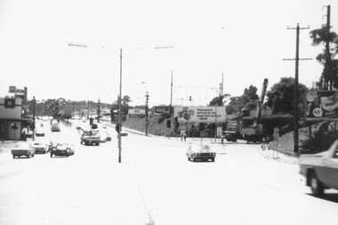
Photograph, Old Level Crossing, Ringwood, looking North with Webdales Licensed Grocers. Mid 1976
Also Webdales Licensed Grocer StoreWritten on back of photograph, "Old level crossing looking north. Mid 1976". -
 Ringwood and District Historical Society
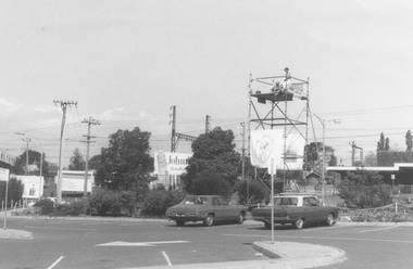
Photograph, Car park Eastland, near Safeways. Ringwood (undated)
Catalogue card reads, "Car park Eastland, near Safeways". -
 Ringwood and District Historical Society
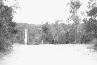
Photograph, Glenvale Road, North Ringwood - a Boundary looking north. 1979
Written on back of photograph, "Jan. 79. Glenvale Road - a Boundary looking north from top of a hill. 'Wild' country - few homes". Looking north from Glenvale Road, near the corner of Kubis Drive, just near Cantala Crescent. -
 Ringwood and District Historical Society
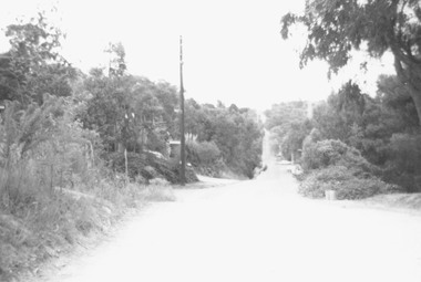
Photograph, Glenvale Road, North Ringwood - a boundary looking south. 1979
[Kubis Dve or Kubba Rd?.]Written on back of photograph, "Jan. 79. Glenvale Road - a boundary looking south from top of same hill (near Kubla Rd?).More homes south than north." -
 Ringwood and District Historical Society
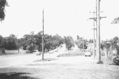
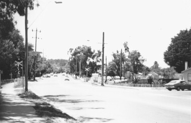
Photograph, Canterbury Road, Ringwood taken under power lines looking east just east of Heatherdale Road. 1979
Written on back of photograph, "Jan. 79. Canterbury Road taken under power lines looking east just east of Heatherdale Road looking up the two-laned Road towards Cadbury McRobertsons before road widening". -
 Ringwood and District Historical Society
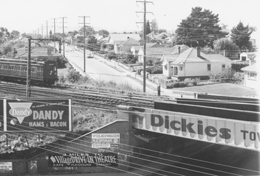
Photograph, Pitt St. Ringwood, from clock tower. 1960
Showing Wantirna Rd railway bridge and trainWritten on back of photograph, "Pitt St. from clock tower. 1960". -
 Ringwood and District Historical Society
Photograph, View from Clock Tower to Adelaide St, Ringwood. 1960
Written on back of photograph, "From clock tower to Adelaide St. "Mail" office with entrance to "Pines" Private Hospital on right. 1960". -
 Ringwood and District Historical Society
Photograph, Warrandyte Road, Ringwood, looking north from clock tower. 1960
Written on back of photograph, "Warrandyte Road, looking north from clock tower. Feb. 1960". 3 versions of the same photo. -
 Ringwood and District Historical Society
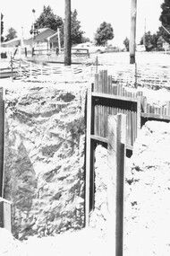
Photograph, Construction work Bedford Road railway crossing, Ringwood. 1977
Catalogue card reads, "Construction work Bedford Road railway crossing. 11/77 -
 Ringwood and District Historical Society
Photograph, Widening of railway bridge on Warrandyte Rd, Ringwood 1977
Catalogue card reads, "Widening of railway bridge on Warrandyte Rd.". 1977 -
 Ringwood and District Historical Society
Photograph, Railway crossing, Bedford Road. Ringwood 1977
Catalogue card reads, "Railway crossing, Bedford Road." 11/77 -
 Ringwood and District Historical Society
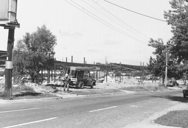
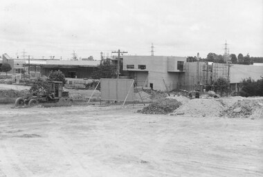
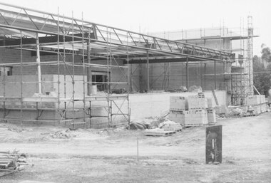
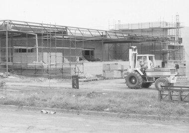
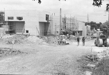
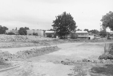
Photographs, New hall at Civic Centre, Ringwood, Under Construction (6 views). 1979
Written on back of photograph, "Feb. 79. New hall at Civic Centre (Construction of) -
 Ringwood and District Historical Society
Photograph, The Crag standing beside Eastland, Ringwood.1979 (2 views)
Written on back of photograph SS0336a, "2/79. The Crag. Standing all by itself beside Eastland.", and on SS0336b: "2/79. The Crag in distance standing all by itself beside Eastland." -
 Ringwood and District Historical Society
Photograph, Bond St, Ringwood - Telecom works. 1982
Written on back of photograph, "E653, N21A. 18/1/82. Where the doctors' surgery was in Bond St. at no 6-3(?). Telecom preparing for service lane extensions to Bond St. at that section." -
 Ringwood and District Historical Society
Photograph, New Market - Corner of New and Charters Streets, Ringwood. The northern facade of 'Target'. 1982
Written on back of photograph, "Corner of New and Charters Streets. The northern facade of 'Target'." -
 Ringwood and District Historical Society
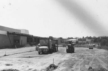
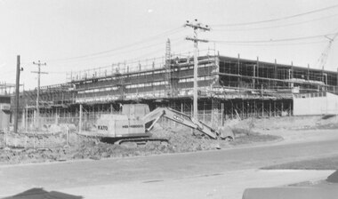
Photograph, New market - View of goods intake section 'Target'. Ringwood 1982
Written on back of photograph, "E648. 8/1/82. View of goods intake section 'Target'". -
 Ringwood and District Historical Society
Photograph, New market - View from Charters St. of unloading bay at 'Target'. Ringwood 1982
Written on back of photograph, "E648. N2A. 8.1.82. View from Charters St. of unloading bay at 'Target'." -
 Ringwood and District Historical Society
Photograph, New market - The Charters St. facade of 'Target'. Ringwood 1982
Written on back of photograph, "E650. 8.1.82. The Charters St. facade of 'Target'. The two men are walking along the centre of Charters St. Looking west." -
 Ringwood and District Historical Society
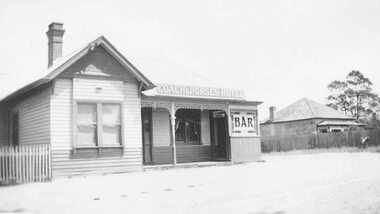
Photograph, Coach and Horses Hotel, Ringwood. 1909-1939, taken in 1939
Black and white photograph of Coach and Horses Hotel.Typed below photograph, "Coach and Horses Hotel. 1909-1939". -
 Ringwood and District Historical Society
Photograph, New market - The southern facade of Target along Seymour St. Ringwood. 1982
Written on back of photograph, "E655. N27A. 18/1/82. The southern facade of Target along Seymour St." -
 Ringwood and District Historical Society
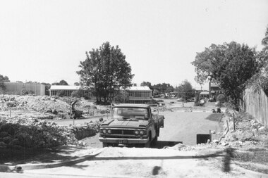
Photograph, New market - The Bond St. entrance to the new street across Seymour and Charters. Ringwood 1982
Written on back of photograph, "E656, 24A. 18/1/82. The Bond St. entrance to the new street across Seymour and Charters. Billy Guyatts building in centre". -
 Ringwood and District Historical Society
Photograph, New market - Bond St. entrance to the new street across Charters Seymour Streets, Ringwood 1982
Written on back of photograph, "E661. 8/1/82. Bond St. entrance to the new street across Charters Seymour Streets. Looks south." -
 Ringwood and District Historical Society
Photograph, View of corner of Middlebrook Dr and Tortice Drive looking east towards Wonga Rd, North Ringwood. 1981
Written on back of photograph, "24/8/81. View of corner of (Blank) court and Tortice Drive looking east towards Wonga Rd. Thought to be Middlebrook Drive, not a court. -
 Ringwood and District Historical Society
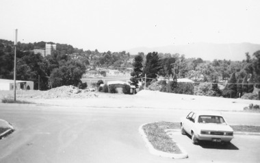
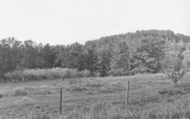
Photograph, View north from Avery Court over valley of the golf course. North Ringwood 1981
Written on back of photograph, "24/8/81. View north from Avery Court over valley of the golf course. Tortice Drive passes the end of Avery Crt, 75 metres behind the camera". -
 Ringwood and District Historical Society
Photograph, Looking south from Parkwood High School over Tortice Drive, North Ringwood. 1982
Written on back of photograph, "24/8/82. Looking south from Parkwood High School over Tortice Drive to where it disappears right among the houses. It was not here 3 months ago." -
 Ringwood and District Historical Society
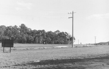
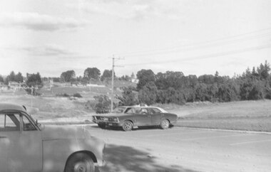
Photograph, Opposite end of Mines Road on Maroondah Highway, Ringwood. 1981
Written on back of photograph, "24/7/81. Opposite end of Mines Road on Maroondah Highway." -
 Ringwood and District Historical Society
Photograph, South east corner of Mines Road and Maroondah Highway, Ringwood. 1981
Written on back of photograph, "24/7/81. South east corner of Mines Road and Maroondah Highway." -
 Ringwood and District Historical Society
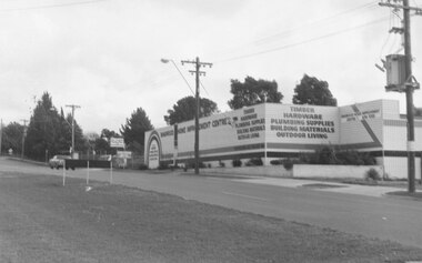
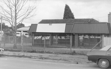
Photograph, 477 Maroondah Highway Ringwood. S.A.M.. New and second-hand agricultural machinery. 1981
Written on back of photograph, "11.8.81 477 Maroondah Highway. S.A.M.. New and second-hand agricultural machinery." -
 Ringwood and District Historical Society
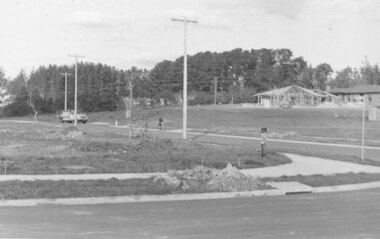
Photograph, Looking from parking area in front of Parkwood High School towards Wonga Road over new subdivision, North Ringwood, 1981
Written on back of photograph, "24.4.81 Looking from parking area in front of Parkwood High School towards Wonga Road over new subdivision. In the area seen there are six new courts under construction. Three months ago there was nothing there." -
 Ringwood and District Historical Society
Photograph, Digging for the big barrel drain which runs down New Street from "Target" to the creek, Ringwood. 1981
Written on back of photograph, '25.8.81 - Digging for the big barrel drain which runs down New Street from "Target" to the creek."