Showing 5612 items matching " suburbs"
-
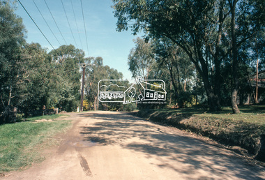
 Eltham District Historical Society Inc
Slide, Park Road, Eltham, Nov. 1981
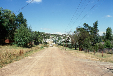
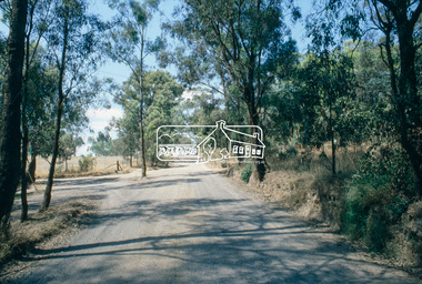
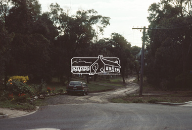
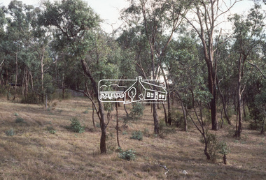
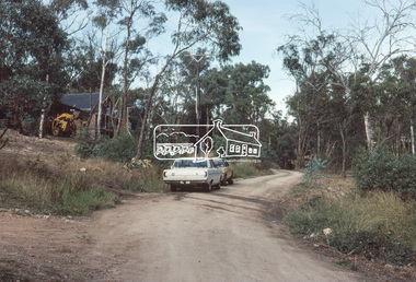
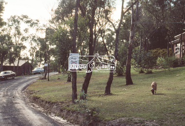
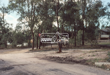
Roll of film taken by Eltham Shire Council officers (Nov. 1981) of the Beard street group, a private street scheme, before construction commenced in February 1982. They provide perspective of the changes in housing styles and road development that began sweeping in from the mid 1970s with increasing urbanisation of what was once more outlying suburbs and regions.35 mm colour positive transparency (1 of 27) Mount - Kodak Ektachrome CardProcessed 18 Jan 1982roads, housing estate, infrastructure, private street scheme, park road -
 Eltham District Historical Society Inc
Slide, Park Road, Eltham, Nov. 1981
Roll of film taken by Eltham Shire Council officers (Nov. 1981) of the Beard street group, a private street scheme, before construction commenced in February 1982. They provide perspective of the changes in housing styles and road development that began sweeping in from the mid 1970s with increasing urbanisation of what was once more outlying suburbs and regions.35 mm colour positive transparency (1 of 27) Mount - Kodak Ektachrome CardProcessed 18 Jan 1982roads, housing estate, infrastructure, private street scheme, park road -
 Eltham District Historical Society Inc
Slide, Beard Street, Eltham, Nov. 1981
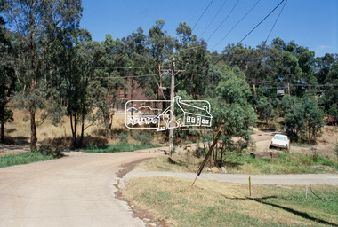
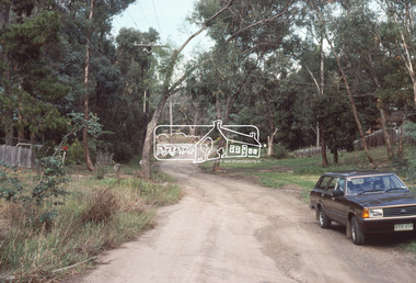
Roll of film taken by Eltham Shire Council officers (Nov. 1981) of the Beard street group, a private street scheme, before construction commenced in February 1982. They provide perspective of the changes in housing styles and road development that began sweeping in from the mid 1970s with increasing urbanisation of what was once more outlying suburbs and regions.35 mm colour positive transparency (1 of 27) Mount - Kodak Ektachrome CardProcessed 18 Jan 1982roads, housing estate, infrastructure, private street scheme, beard street, eurabbie court -
 Eltham District Historical Society Inc
Slide, Beard Street, Eltham, Nov. 1981
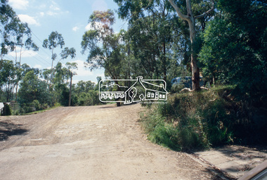
Roll of film taken by Eltham Shire Council officers (Nov. 1981) of the Beard street group, a private street scheme, before construction commenced in February 1982. They provide perspective of the changes in housing styles and road development that began sweeping in from the mid 1970s with increasing urbanisation of what was once more outlying suburbs and regions.35 mm colour positive transparency (1 of 27) Mount - Kodak Ektachrome CardProcessed 18 Jan 1982roads, housing estate, infrastructure, private street scheme, beard street, frank street, shalbury avenue -
 Eltham District Historical Society Inc
Slide, Shalbury Avenue, Eltham, Nov. 1981
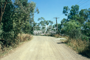
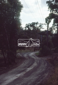
Roll of film taken by Eltham Shire Council officers (Nov. 1981) of the Beard street group, a private street scheme, before construction commenced in February 1982. They provide perspective of the changes in housing styles and road development that began sweeping in from the mid 1970s with increasing urbanisation of what was once more outlying suburbs and regions.35 mm colour positive transparency (1 of 27) Mount - Kodak Ektachrome CardProcessed 18 Jan 1982roads, housing estate, infrastructure, private street scheme, shalbury avenue -
 Sunbury Family History and Heritage Society Inc.
Photograph, Glengala Park Primary School, 12th March 1993
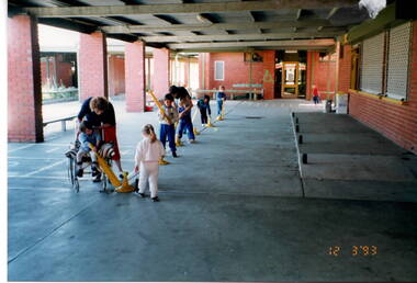
The children from Bulla Primary School visited Glengala Primary School near Sunshine in March 1993. During their visit they joined in a number of activities with the Glengala children. In this photograph they were practicing soft ball skills in the covered courtyard area. Glangala school was one of the newer schools built in the Western suburbs in the late 1980s-early 1990s. A non-digital coloured photograph of five young children being supervised by two adults in a sheltered courtyard of a school. The children are playing with a softball bats and balls. glengala primary school, bulla primary school, ball handling skills, school excursions -
 City of Kingston
Photograph - Black and white, 3 March 1954
Cheltenham and Moorabbin are suburbs within the City of Kingston that were originally established as rural market gardening communities The area is bordered by Highett and Mentone. The market gardens, farms and paddocks have gradually been sub-divided into housing and industrial estates. Highett is developed with residential homes but was also the site of major facilities such as the Highett Gas Works. This aerial image covers a diverse section of the City of Kingston, taking in the suburbs of Moorabbin, Cheltenham, Highett and Mentone Residential housing development is prominent along the Frankston Railway line and the area still retains extensive market gardens and paddocks yet to be converted to a large industrial and commercial zone.Aerial photograph of Mentone, Cheltenham and Moorabbin within the City of Kingston. The area depicted in this 1954 aerial view includes Warrigal Road and Centre Dandenong Road intersection (top left); Charman Road, Patty Street, Bourke Street, Collins Street Mentone (top right); Keys Road Moorabbin (bottom left); Bay Road, Cheltenham (bottom right), Friendship Square, Cheltenham Park, Victoria Golf Club and Jack Barker Oval are visible. Nepean Highway and the Frankston railway line run centrally through the image. Highett Gasworks is also evident.White handwriting and type [indecipherable]. White image of clockface White image of compass White type 42956 Black handwriting 3/3/54 Williams [indecipherable] Black pencil: S [arrow] Black ink: 3/3/1954cheltenham, moorabbin, mentone, highett, market gardens -
Ballarat Tramway Museum
Document, "The electric light supply - a successful opening ceremony", 10/1923
Typed extract from the Geelong Advertiser, 4/5/1901, titled "The electric light supply - a successful opening ceremony", by the Electric Lighting and Traction Co. formed by Hendy Leary & Co and J A Dawson. Electrical Engineer F W Clements, Mechanical Engineer - Mr Hutchinson. The system provided lighting to the Geelong and some suburbs.Yields information about the provision of lighting to the Geelong area in 1901.Document - 3 quarto typed sheets, was stapled in top left hand corner. tramways, geelong, town lighting, lights, power station -
 Melbourne Tram Museum
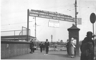
Photograph - Princes Bridge - Batman Ave tram signage, 1920s
Photo shows the signage at the Batman Ave tram terminus showing which suburbs or locations, trams ran to, for both Batman Ave and St Kilda Road. Under the main sign is a sign stating "Melbourne V Collingwood Semi-finals today". Based on https://www.afltables.com/afl/seas/1926.html - could be either 1926 or 1928.Yields information about the MMTB signage at the Batman Ave tram stop c1920.Black and white photograph with a plain back.tramways, batman ave, princes bridge, football -
 Bialik College
Newspaper article, 'Why Another College?', The Herald, 1962, 1962
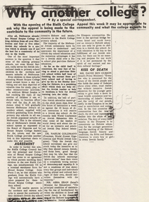
"Why Another College?", The Herald, 28 November 1962. "With the opening of Bialik College Appeal this week it may be appropriate to ask why the appeal is being made to the community and what the college expects to contribute to the community in the future. After all Melbourne already has Mount Scopus College taking children from all over Melbourne and four or five other Jewish day schools in a system which is already one if not the best for a community of its size in the world. One of the most important answers to the question is that none of the existing primary schools, not even Mount Scopus, really serves the Jewish educational needs of primary school children in the northern and eastern suburbs of Melbourne. Even children in these suburbs attending Mount Scopus College spend several hours a day travelling and are thus deprived of valuable time for study, play or other extra curricular activities...."israel, zionist, hebrew school, shakespeare grove, fundraising -
 Eltham District Historical Society Inc
Slide, Belmont Crescent, Montmorency, c. Mar. 1981
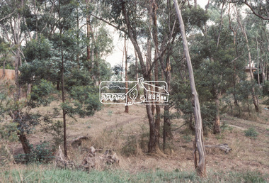
One of a series of images of road infrastructure focussed on Belmont Crescent in Montmorency taken by Eltham Shire Council Planning and Engineering officers. They provide perspective of the changes in housing styles and road development that began sweeping in from the mid 1970s with increasing urbanisation of what was once more outlying suburbs and regions. All images have been identified with GPS35 mm colour positive transparency (1 of 8) Mount - Kodak Kodachrome CardProcessed Mar 1981infrastructure, montmorency, roads, belmont crescent, olympic avenue -
 Eltham District Historical Society Inc
Slide, Belmont Crescent, Montmorency, c. Mar. 1981
One of a series of images of road infrastructure focussed on Belmont Crescent in Montmorency taken by Eltham Shire Council Planning and Engineering officers. They provide perspective of the changes in housing styles and road development that began sweeping in from the mid 1970s with increasing urbanisation of what was once more outlying suburbs and regions. All images have been identified with GPS35 mm colour positive transparency (1 of 8) Mount - Kodak Kodachrome CardProcessed Mar 1981infrastructure, montmorency, roads, belmont crescent -
 Eltham District Historical Society Inc
Slide, Belmont Crescent, Montmorency, c. Mar. 1981
One of a series of images of road infrastructure focussed on Belmont Crescent in Montmorency taken by Eltham Shire Council Planning and Engineering officers. They provide perspective of the changes in housing styles and road development that began sweeping in from the mid 1970s with increasing urbanisation of what was once more outlying suburbs and regions. All images have been identified with GPS35 mm colour positive transparency (1 of 8) Mount - Kodak Kodachrome CardProcessed Mar 1981infrastructure, montmorency, roads, belmont crescent, aanensen court reserve -
 Eltham District Historical Society Inc
Slide, Belmont Crescent, Montmorency, c. Mar. 1981
One of a series of images of road infrastructure focussed on Belmont Crescent in Montmorency taken by Eltham Shire Council Planning and Engineering officers. They provide perspective of the changes in housing styles and road development that began sweeping in from the mid 1970s with increasing urbanisation of what was once more outlying suburbs and regions. All images have been identified with GPS35 mm colour positive transparency (1 of 8) Mount - Kodak Kodachrome CardProcessed Mar 1981infrastructure, montmorency, roads, belmont crescent -
 Eltham District Historical Society Inc
Slide, Belmont Crescent, Montmorency, c. Mar. 1981
One of a series of images of road infrastructure focussed on Belmont Crescent in Montmorency taken by Eltham Shire Council Planning and Engineering officers. They provide perspective of the changes in housing styles and road development that began sweeping in from the mid 1970s with increasing urbanisation of what was once more outlying suburbs and regions. All images have been identified with GPS35 mm colour positive transparency (1 of 8) Mount - Kodak Kodachrome CardProcessed Mar 1981infrastructure, montmorency, roads, belmont crescent, grand boulevard -
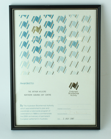 Vision Australia
Award - Text, Certificate awarded by the Australian Bicentennial Authority, 2 July 1987
Certificate reads "Awarded to Association for the Arthur Wilkins Northern Suburbs Day Centre. By the Australian Bicentennial Authority which was established to plan and coordinate a nationwide profram of celebrations in 1988 to commemorate the 200th anniversary of permanent European settlement in Australia" Signed by the Executive Director (illegible), dated 2nd July 1987. All text on this certificate is located on the bottom half of the document. 1 x paper certificate from Australian Bicentennial AuthorityThe top half is populated by a repeated stylised graphic of a map of Australia, in various shades of green and gold. There is also a gold version of the same logo, labelled with "Endorsed Bicentennial Activity" , situated above the official signatures. arthur wilkins centre, essendon, association for the blind -
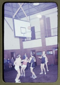 Melbourne Legacy
Slide, Basketball, 1959
Images from a junior legatee basketball competition in 1959. During the 1950s the Legacy boys classes from different suburbs would play each other in a tournament. The slides have been photographed to make digital images and moved to archive quality sleeves. In many cases the original images were not well focussed and the digital image is the best available.A record of the type of activities Legacy provided for the Junior Legatees.Colour slide x 6 of a junior legatee basketball competition, in a beige Anscochrome mount.The mount is imprinted with date 'AUG59' and numbers 11, 12, 13, 14, 19, 20. Handwritten on reverse of one is 'Basketball' and another has 'Boys Basketball finals' in blue penjunior legatee, basketball -
City of Kingston
Photograph - Colour, 29 January 1993
Bonbeach, Carrum and Patterson Lakes are suburbs in the City of Kingston. Bonbeach and Carrum were holiday destinations in early 20th century and over time the housing has converted to permanent residential structures. In Patterson Lakes, the area consists predominantly of newer housing developments and the tidal canal system which is accessible to many dwellings joins Port Phillip Bay.Bonbeach, Carrum and Patterson Lakes were previously part of the extensive Carrum Carrum Swamp. The area was once a source of fish and eels for the Mayone-Bulluk clan of the Bunurong people. Over time the area was drained and this allowed farming at Carrum and Bonbeach, although the area was prone to flooding. In the early 1920s and 30s the land was converted to residential dwellings. In 1973 investigations commenced nearby to Bonbeach and Carrum into the development of a unique residential area comprising canals and waterways. It was originally proposed to be known as "Gladesville". Circa 1974, the area was rezoned from rural to residential and named Patterson Lakes. Development has been continuous since the 1970s with staged construction of the waterways, residential housing, and supporting infrastructure and facilities.Laminated colour aerial photograph of the Bonbeach, Carrum and Patterson Lakes region within City of Kingston. This 1993 image includes Bonbeach High School prior to demolition, Bonbeach Primary School and Patterson River Golf Club. Sections of Patterson Lakes are not yet developed, including Rhode and Staten Islands. Long Island Point appears to be a recent development with many spare blocks and new houses under construction. The Patterson River marina is prominent and the river mouth as it meets Port Phillip Bay. The Carrum railway station is visible.Black type on white adhesive sticker: No. 6661 Black type on white adhesive sticker: 26E/6661, 29/1/93, 4.25 pm Black type on white adhesive sticker 29-1-93 Yellow circular adhesive stickerbonbeach, carrum, patterson lakes, patterson river, carrum carrum swamp, canals and waterways -
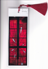 Whitehorse Historical Society Inc.
Document, Nunawading Uniting Church and commemorative Bookmark, 2025
A commemorative bookmark produced for the final Service of the Nunawading Uniting Church in May 2025 and documentation of the Church11 A4 pages and a laminated bookmarknon-fictionA commemorative bookmark produced for the final Service of the Nunawading Uniting Church in May 2025 and documentation of the Churchearle james, nunawading uniting church -
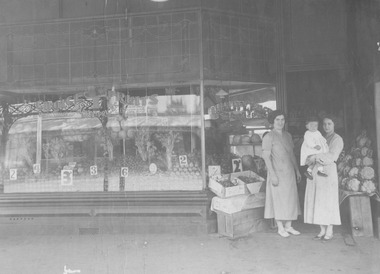 Ithacan Historical Society
Photograph, Choice Fruits, South Melbourne, c late 1920s - early 1930
The fruit shop photographed was owned and run by Spiros Kallinikos and was one of the many similar businesses that Ithacans, who had settled in Melbourne during the first half of the twentieth century, operated within the CBD and surrounding suburbs. Pictured us Spiro's wife Evrilikia holding her daughter Calliope together with her Spiro's sister Chrisoula Sikiotis (nee Kallinikos). A black and white photograph of two ladies standing in the doorway of a suburban fruit shop. One of the ladies is holding a little child. The display window is attractively stocked with a variety of fruit and vegetables. There are also cauliflowers stacked on the right side of the doorway, and fruit in boxes on the left. -
 Robin Boyd Foundation
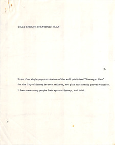
Document - Manuscript, Robin Boyd, That Sneaky Strategic Plan, 1971
Boyd discusses the role of Sydney and its Strategic Plan. He touches on floor space ratio but focuses on the goal of enticing residents to return to the inner city as the real challenge of the plan.Original manuscript of the article ‘Sydney’s Sneaky Strategic Plan’, published in The Sunday Australian, 15.8.1971.Typewritten (c copy), quarto, 11 pagesThe last page is a redraft of the third last page.sydney, strategic plan for sydney, urbanisation, decentralisation, city, suburbs, master plan, harry seidler, floor space ratio, inner city residential, robin boyd, manuscript -
 Vision Australia
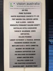
Photograph - Image, Mel Robbins, Plaques at Newcastle office
Silver plaque with black writing mounted on board inside black frame, and silver plaque with black writing. Both list the companies that financially supported the Newcastle office for Vision Australia (formerly the Royal Blind Society of New South Wales). The first plaque reads: Vision Australia Blindness and low vision services Vision Australia is proudly supported in the Hunter by: Ian Paul Prime Television Hunter Readymixed Concrete Pty Ltd Port Waratah Coal Services Limited Blue Illusion - Hamilton Newcastle Permanent Building Society Australian Hotels Association Sandalyn Wilderness Estate AmpControl Colleen Praniess Lidbury Retirement & Financial Services Passmores Business College Maitland Black & White Committee Belmont 16ft Sailing Club Cessnock Supporters Club The Boulevard on Beaumont Sydney Junction Hotel Gallipoli Legion Club VDB Chartered Accountants Salvation Army - McIntosh Trust The second plaque reads: Royal Blind Society vision to share This Client Service Centre was made possible thanks to generous support from Ian Paul as well as the following organisations Prime Television Newcastle Knights Hunter Water Western Suburbs (Newcastle) Leagues Club Management Advisors Corporation Drayton Building & Construction The Plan Centre Hunter Land2 images of plaques displayed at the Newcastle officeVision Australia Blindness and low vision services Vision Australia is proudly supported in the Hunter by: Ian Paul Prime Television Hunter Readymixed Concrete Pty Ltd Port Waratah Coal Services Limited Blue Illusion - Hamilton Newcastle Permanent Building Society Australian Hotels Association Sandalyn Wilderness Estate AmpControl Colleen Praniess Lidbury Retirement & Financial Services Passmores Business College Maitland Black & White Committee Belmont 16ft Sailing Club Cessnock Supporters Club The Boulevard on Beaumont Sydney Junction Hotel Gallipoli Legion Club VDB Chartered Accountants Salvation Army - McIntosh Trust Royal Blind Society vision to share This Client Service Centre was made possible thanks to generous support from Ian Paul as well as the following organisations Prime Television Newcastle Knights Hunter Water Western Suburbs (Newcastle) Leagues Club Management Advisors Corporation Drayton Building & Construction The Plan Centre Hunter Landvision australia, royal blind society of nsw, plaques -
 Bendigo Historical Society Inc.
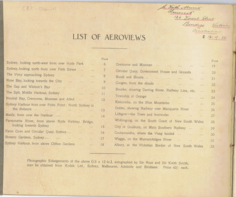
Book - BASIL WATSON COLLECTION: THE FIRST AEROPLANE VOYAGE FROM ENGLAND TO AUSTRALIA, 1920
32 page booklet ''The first aeroplane voyage from England to Australia'' by Sir Ross Smith KBE, MC, DFC, AFC with 27 aeroviews by Capt. Frank Hurley. Four page description of the flight by Ross Smith (no flight photos). NSW Edition with aerial photos of Sydney, suburbs and country towns. Inscribed on front cover (handwritten) ''Left England November 12th 1919; Arrived Australia December 9th 1919''. Also, stamp of ''R Keith Munro'' and inside cover: address of ''Inveresk'', 126 Forest Street, Bendigo, Victoria, Australia 16-4-20''Sir Ross Smith, K.B.E, A.F.C,D.F.C, M.C.event, official -
 Melbourne Tram Museum
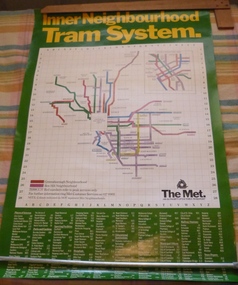
Poster, The Met, "Inner Neighbourhood tram system", mid 1980's
Poster, full colour printed on gloss paper titled "Inner Neighbourhood tram system", giving a diagrammatic Map of the tram system, suburbs, tram route destination names and route numbers and peak service route numbers. Has a separate section for the City area. Shows the routes that ran into the Greensborough and Box Hill Neighbourhoods. At the base of the map has The Met logo and name, a customer service number which has been glued over the printed number. At the base of the poster is a location guide for places of interest, sporting facilities, parks and gardens, railway stations etc.trams, tramways, the met, map, tickets, neighbourhood tickets, tramways -
 Eltham District Historical Society Inc
Slide, Quinn Estate, Sackville Street, Montmorency, 15 Sep. 1982
One of a series of images of roads and infrastructure taken by Eltham Shire Council Planning and Engineering officers of the Quinn Estate in Montmorency, Stage 1, Private Street Scheme during construction, September 1982. They provide perspective of the changes in housing styles and road development that began sweeping in from the mid 1970s with increasing urbanisation of what was once more outlying suburbs and regions.35 mm colour positive transparency (1 of15) Mount - Kodak Kodachrome CardProcessed 15 Sep1980housing estate, infrastructure, montmorency, quinn estate, roads, sackville street, private street scheme