Showing 648 items
matching local water
-
 Melton City Libraries
Drawing, Windmill, Unknown
The windmill and water tank are located at the rear of the houseIllustration of the windmill and the water tank at the Willows sitelocal architecture -
 Melton City Libraries
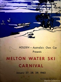
Poster, Melton Water Ski Carnival, 1962
Speedboat Carnival and Canadian Hell Drivers was part of the carnivalPoster from Holden promoting the carnival local significant events -
 Kilmore Historical Society
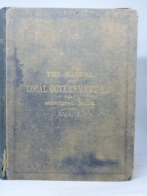
THE MANUAL OF LOCAL GOVERNMENT LAW, The Manual of Local Government Law and Municipal Guide. Vol.1, 1905
Green cloth-bound hardcover book, faded and worn at extremities. Back cover in very poor condition - torn cloth and part board missing lower left side. Water staining on cover. Foxing front flyleaf & title page. End papers torn at lower right corners, foxing. 479 pp. Poor condition.Front flyleaf, various pencilled inscriptions of page references.local government law, kilmore court house library -
 Tarnagulla History Archive
Box of Donald Clark's Research Notes, Donald Clark's Research Notes, circa 1960s-2000s
Donald Clark Collection. Blue-grey archive box containing research notes of Donald Clark. Within this set are multiple archival folders with the following subject matter: Hotels Gold, prospecting & mining Peace Picnic Street lighting Churches Cemetery Poems Shire of Bet Bet Chinese Clubs Police Transport Local businesses/premises Local people Post Offices Previous history work / previous history enquiries Back To Tarnagulla events Victoria Theatre / Entertainment Schools Water and waterways Early town Mapping and geography Photocopies of photos Miscellaneous Rail Link Centenary Newbridge Eddington Waanyarra Bet bet (town) Llanelly Murphy's Creek / Irishtown Laanecoorie Military Service Fire Brigade Tarnagulla Landmarks / Places of Interest Family Histories Births, Deaths, Marriage info Transcript of St. Saviour's Records A plastic pocket containing duplicate copies of local history images held elsewhere in the collection. The contents of these files were research notes compiled by Donald Clark from his local history research about Tarnagulla and district. tarnagulla & district, donald clark, research -
 Parks Victoria - Point Hicks Lightstation
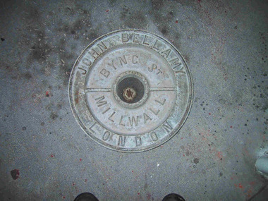
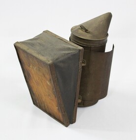
Lid, ship tank
The heavy cast iron, round lid was originally fastened into a large, riveted metal box, known as a ship tank. It has the name ‘John Bellamy London’ cast in capitals in a continuous circle on the outer edge of the lid face, and the words ‘Byng St Millwall’ on the inner circle. , of Millwall, London, manufactured boilers and ship tanks from the 1860s to the 1930s and came from a family of tank makers who began manufacturing tanks some time before 1856. Ship tanks were invented in 1808 by notable engineer, Richard Trevithick and his associate John Dickinson. Their patent obtained the same year described the tank’s superior cubic shape that allowed it to fit squarely as a container in vessels and thus use space efficiently, while its metal fabric preserved and secured its liquid or solid contents from damage. The containers revolutionised the movement of goods by ship and made wooden casks redundant. Research by Michael Pearson has determined that they were carried on passages to Australia from at least the 1830s conveying ships’ victuals and water storage, as well as general goods heading for the colonies. Pearson found photographic evidence of their use in the 1860s, and by the 1870s they appeared to be in common use. lids surviving from containers indicate that nearly all the tanks transported to Australia came from London manufacturers. It was usual for the brand name to also feature as a stencil on the tank but in most cases this eventually wore off. A tank without its original stencil survives at Wilsons Promontory. Tanks transporting ‘drinking water or perishable dry goods were hermetically sealed by the use of the tightly fitting lid with a rubber sealing ring ‘which was screwed tight with the aid of lugs cast into the lid and wedges cast into the rim of the loading hole’. The raised iron rod welded across the outer face of many lids such as the Bellamy example, allowed for screwing the lid tight. Once in the colonies, the ship tanks were often recycled and adapted for many resourceful uses such as packing cases, dog kennels, water tanks, oil containers and food stores and this invariably led to the separation of the lid and tank. The Bellamy lid could have been salvaged from a shipwreck but is more likely to have to have originated from a recycled tank that was brought to the lightstation for water storage purposes. Pearson writes that: Ship tanks show up at a wide range of sites, many of them isolated like lighthouses. They were, I think, usually taken there for the purposes they filled, usually water storage, as they were readily available, relatively light to transport, and probably very cheap to buy as second-hand goods containers. In rural areas they may have been scavenged for their new uses from local stores, to whom goods were delivered in them. Parks Victoria has identified five tank lids in the lightstation collections covered by this project. In addition to the Bellamy lid at Point Hicks, they include a Bow brand lid at Point Hicks and another at Cape Otway, unidentified lids at Cape Otway and Wilsons Promontory. Pearson and Miles Lewis have each recorded two versions of the Bellamy trade name on the lids; one being ‘John Bellamy Byng St. London’; the other, ‘John Bellamy Byng St. Millwall London’. The Point Hicks lid has the second version of the name, as do other examples in Victoria that Lewis has identified at Illawarra, Toorak; Warrock homestead, Casterton; Eeyeuk homestead, Terang; Ward’s Mill, Kyneton; and Boisdale homestead near Maffra, and in NSW at Ayrdale Park, Wolumla; and Bishop’s Lodge, Hay. Pearson’s list includes the same lids in NSW at Tumbarumba; the Quarantine Station, Sydney; Willandra Station; Bedervale, Braidwood; Gunnedah Museum; Walla Walla and Macquarie Island. The Point Hicks lid is currently stored in the lighthouse although it is unlikely that its use had any association with this building. The lid is in good condition and retains the central bung. Pearson notes that ‘surviving lids are far less numerous than the tanks themselves, presumably because the uses to which the tanks were put did not require the lid to be retained’.347 The Bellamy ship tank lid has first level contributory significance for its historic values. Circular cast-iron disc with raised outer ridge with inscription. It also has an inner depression with inscription. Two metal sections form handles over inner depression. Hole in middle of disc.Around perimeter of outer edge "JOHN BELLAMY LONDON" Around inner area "BYNG ST MILLWALL" -
 Melton City Libraries
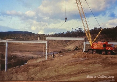
Photograph, Construction of Dam Wall- Melton Water Supply, 1963
Photographs of the construction of the dam wall for Melton's water supplylocal significant events, council, local architecture, local identities -
 Melton City Libraries
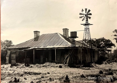
Photograph, The Willows, 1973
Corner view of front and east side showing telephone insulator connection, and small elevated water tank connected to windmill. This photo was taken before the restoration of the property. local identities, local special interest groups, council, local architecture -
 Melton City Libraries
Photograph, The Willows, 1973
View of rear of house with water tank and windmill.local architecture, local special interest groups, council, local identities -
 Melton City Libraries
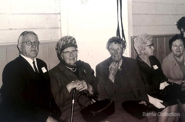
Photograph, Mrs Knox and Beryl Gillespie at the First Hundred Years Celebration of Melton State School 430, 1970
Beryl Knox speaking about early life in Melton. Page 1 1949 – 64 years ago. We began our married life at Melton Sth. The house on the corner of the Exford Rd and Staughton St-- dusty gravel roads, box thorns and noxious weeds everywhere and a sprinkling of houses and vacant land. It was a friendly community consisting of old family names. McDonalds, Blacks, Dodemaide, Cahill, Coopers, Minns, Tinklers, Nesbitts, Cochranes, Wickhams, Exells. Mavis Butler. The home owned by Mr. Robinson and Miss Robinson had been shifted in two parts transported from Diggers Rest and it is still standing 2013. Bruce’s father purchased the house and two adjoining blocks, the Conways built on one and the Rawlinson family on the other block. Eileen still resides there, she was only a baby in a pram and the family had not long arrived from England. The railway line was close to the house and the contents would rattle when heavy steams trains went through, and on a clear frosty night the 1am paper train would echo roar through very loudly when labouring towards the Exford Bridge. Then the two carriage motor train was introduced, this was great for the workers and schoolies who travelled to Melbourne. The train pulled up at the crossing or riding to pick up or drop off. Melva Gillespie (nee Hirt) Bill Cahill delivered the milk by the billy and then in bottles. Len Kennedy (Paul Kennedy’s father, Norma Murrays son) delivered Jongebloeds bread, he always had a sweep going for the Melbourne Cup and raffles for the footy club. Mr. Woodgate owned an old bus and pick up point was the Post Office when there was a Saturday film on a Melton. There were no doctors or dentists in the district. If we need a Doctor we had to travel to Bacchus Marsh or discuss problems over the phone. In later years a Bacchus Marsh Doctor rented the Bluestone building in McKenzie St a couple of days a week. If we needed the Dentist we had to travel to West Footscray or Footscray. We did our banking at “State Savings” then the Miss Minns had the agency and then Bardsleys Store. We travelled to Bacchus Marsh to the National and Commercial banks. Station Rd to Western Highway, now (High Street) was a narrow stretch of bitumen and gravel farmland either side and a couple of farm houses and large gum trees on the properties. Page 2 North of the Railway line Mrs Bessie Jones, mother of Chas and Betty Jones managed the Post Office, next door to her Chas and Betty had the Shell Centre, and later moved the business to Melton. Hughie Nesbitt and mother owned the grocery and hardware store, and I bought my first set of saucepans there. On the opposite side of Station road Mr Coombe owned the fruit shop, and also provided soft drinks and lollies for children. The Chaff Mill was on the corner of Station Rd and Brooklyn Rd. Mr Lumsden was manager and later years Bernie Trethowan and Jack Butler were partners. It finally burnt down and is a Service Station now. Along Brooklyn Rd there were a few houses and Victoria Hall, not a very big hall, but catered for lots of functions, Balls, Fancy Dress, Bazaars, Square Dancing and meetings. The Bacchus Marsh Baptists held Sunday School in the hall. A group of shops were built south of the railway line Molly and Len Skinner managed the Post Office and handled a few essential groceries. Tom McDonald and Ron Lunsberg were the butchers. Mary and Syd Cooper lived next door to us and often in turn would run out of something when we had a baking spree we would borrow or exchange, sugar flour etc over the fence. Mavis and Jack Butler lived there before the Coopers. Bernie and Iris Trethowan lived two doors up. Neighbours were invited into their home to view the first black and white television in Melton Sth. Bill Exell was one of the first Melton Sth farmers to sell his land to developers, the land was idle for years before housing developed. I joined the Melton Valley Golf Club in 1960. The Gun Club as our Club House, an old tin shed consisting a water tank, trestle table and forms and dirt floor. It was a 9 hole course with sand scraps and landscape putting before greens. The Common or parkland was part of the Golf Course. It was open for every ones recreation. Roy Norton an old identity trained his trotters on the Common and wouldn’t clear the track for the golfers. The golfers had to avoid him to continue to play. We had to keep clear when the young youths came in their paddock cars and motorbikes. Over the years the Toolern Creek flooded its banks, water and debri covered the course on one year our first Club house was flooded out. It took several working bees to clean it up. We lived at Melton Sth for 15 years and moved to Melton on the farm “Croxton Park.” The Nixon family farm “Mowbray” adjoined the farm. Bruce worked the land cropping the farm when Mrs Nixon died. Page 3 (page 4 on the handwritten script) Bruce had the first offer to buy, in those days it wasn’t easy to get good bank loans. Part of the land is the Golf Course now and Mr O’Shea purchased the bulk. Moving to Melton was totally different – I became involved with Committees, Scouts, Guides, Mothers Clubs, CWA, Church Op shop (8 years). Melton Amateurs players produced and tutored by Mabel Rogers exerts from Pyjama Game, South Pacific, Carousel - later years a group of ladies did gentle water exercise at Essendon and Station Road swimming pool. I was 20 or so years in Probus. The local followed the football, there was always a Gymkhana on the long weekend in June. The tennis always created a lot of interest during the finals. It didn’t matter which team played the supporters were treated to a cup of tea and leftovers from their afternoon tea. In 1978 were the first residents to move into the Jennings Estate Kurunjang and lived there 31 years and retired 4 years ago into Unit. The amazing changes I have experienced. Merrimu supplied our water, after depending on tanks. The landscape changed completely when developers came in, no more dusty plains \ typed web Sept 2013 McFarlane, Mrs Knox and Beryl Gillespie at the First Hundred Years Celebration of Melton State School 430. The event was held at Mechanics Hall, Melton.local identities, local significant events, education -
 Melton City Libraries
Photograph, Brooklyn Estate, Unknown
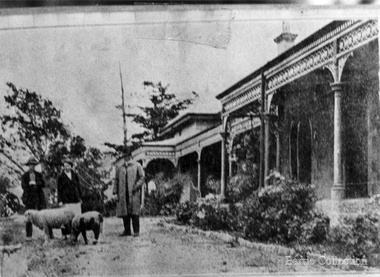
Brooklyn Park homestead built 1875 by Stephen George Staughton, son of Simon Staughton. In 1907 the residence was refurbished for Cr Stephen John Staughton who was returning from England with his bride. The building contained over 25 rooms some 25x20 feet. There were elaborately decorated rooms with friezes, embossed wall papers, massive curtains, marble and carved mantle pieces. A Ryder Erickson Hot air engine pumped water from underground tanks up to elevated tanks to circulate water through the house. Acetylene gas generator for 100 light and chandeliers. Prominent family with civic connection in Melton holding very large areas of land. 'Brooklyn' mansion built by Stephen Staughton, local identities, pioneer families -
 Melton City Libraries
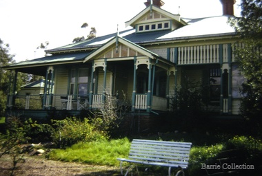
Photograph, "Green Hills" Borbidge, 1978
Built by Water Browne c.1903 Greenhills was one of the first pastoral runs, and centres of European settlement, established in the Shire of Melton. Estate in Diggers Rest Coimadai Road, Toolern Valelocal architecture, pioneer families -
 Phillip Island Conservation Society Inc.
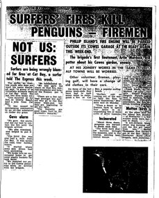
Work on paper - Photocopy of newspaper cutting, The Express, "SURFERS' FIRES KILL/ PENGUINS - FIREMEN//NOT US:/SURFERS"
Written during the 1960s when surfing was burgeoning across Australia’s coast and Phillip Island surf beaches had become extremely popular, few management strategies were in place to control interaction of the public with the delicate flora and fauna of the coastal environments. There were few good access tracks, car parks, bins, toilets etc at coastal/surfing hotspots around the Phillip Island coast. A number of management issues occurred with the influx of surfers. These included dune erosion caused by surfers climbing dunes to see the surf before going on the beach; informal parking on wildlife habitat; numerous access paths from wherever cars were parked down to the beach cutting through habitat; illegal camping on foreshores; illegal lighting of fires on beach and in dunes; surfers’ dogs let out of the car while surfers were out on the water. The dogs were uncontrolled. Certainly some surfers behaved responsibly, as is almost invariably the case these days. However, in that era of this article few people understood the delicate nature of the coastal environment and that it need to be protected through public education, infrastructure and enforcement of regulations. As now, most rural Fire services were run by dedicated volunteers who faced many challenges in their roles as Country Fire Authority firefighters. However, it was not uncommon for visitors and locals to also assist with fire-fighting efforts.The article is significant in containing quotes from both sides of the discussion who were directly involved in coastal fire incidents on Phillip Island in the 1960s. It also indicates the large number of surfers visiting Phillip Island beaches, the volunteer nature of the firefighting service and the extra challenges they faced on Phillip Island as a visitor destination. The anonymous university student surfer who is quoted, also describes possible causes of the fires, methods he and his fellow surfers used to extinguish the fires and raise the alarm, and the way they assisted the volunteer firefighters . The reference to him breaking into one of the Summerland housing estate holiday houses is also significant because that housing estate was purchased over 2 decades by successive Victorian governments to remove management issues caused to the wildlife habitat on Summerland Peninsula.Photocopy of newspaper cuttings including 2 related articles. Five columns of black text on white paper with one poorly reproduced photo bottom rightphillip island, cat bay, country fire authority, artie murdoch, alf towns, frank dixon, barry thompson, newhaven-san remo rural fire brigade, penguin parade, cowrie beach, surfers, coastal fires -
Harcourt Valley Heritage & Tourist Centre
Book, Harcourt Speaks, 2009
'Harcourt Speaks' represents the collaboration of a group of local orchardists, farmers, growers and local community who worked together to gather photos and stories of strength, cohesion and innovation around the impact of relentless drought and changing climatic conditions. This was a drought assistance project supported by the Mount Alexander Shire Council and the Victorian Government Dept of Community Planning and Development.Project Facilitator was Phillippa Gregory and Photography Community Development was provided by Deanna Neville.Provides a cross-section of the working adults of a rural community as they faced the grim reality of extended drought with attendant restrictions on the use of irrigation water and the consequent near disastrous impact on horticulture in this famed horticultural valley. Each photo has a brief story attached. The captions tell how this community responded by acceptance and innovation, using words like "we adapted' 'we were innovative' 'new directions chosen' 'resilience' 'optimistic'.This project is significant in that it depicts a community that, faced with real adversity, was not weakly submissive, nor crushed, but made the best of it.It has significance as an example of a creative response to a prolonged negative situationSixteen page, spiral bound, A4 'landscape'book with coloured title page, with 31 coloured photographs.Harcourt Speaks -
 Wodonga & District Historical Society Inc
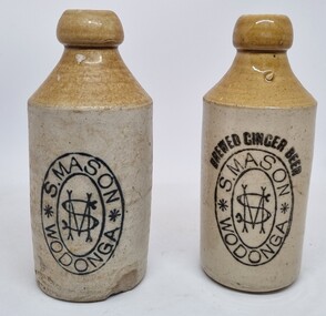
Domestic object - Earthenware Bottles - S. Mason Wodonga, c1870
This bottle was used as a form of advertising for the Wodonga Business of Samuel Mason. Samuel Mason was born at Bethnal Green, a suburb of London in 1824. He came to Australia via California, landing in Sydney in 1847. After a return to the California goldfields Samuel returned to Australia, arriving in Albury, NSW in 1855. He opened a bakery in Albury, and also commenced the manufacture of ginger beer for which he gained a reputation across Australia. Mr Mason continued in business in Albury for some time, but he established himself in Wodonga c1857, continuing a branch business in Albury. Twice a month in the early days Mr Mason walked to Beechworth for the purpose of transacting business. Occasionally he was summoned to attend the Beechworth courts as a juror. In 1901 Mr Mason retired from business, handing over the reins to his only son, Mr Samuel Mason Jr. who continued the aerated water business for some years. In about 1920 the business changed hands, being take over by E. Bartel. Samuel Mason Sr. died on 6 April 1908 and is buried in Wodonga. Mr. Mason Jr. was a prominent townsman. For some years he was a councillor of the Town Riding of the Wodonga Shire Council. He was also the first chairman of the Wodonga Water Trust in 1908. Samuel Mason Jr. moved to Melbourne in March 1920, primarily due to failing health. He died on 6 February 1929 and was interred in Melbourne.This bottle has strong local significance as it is representative of one of the earliest businesses established in Wodonga in the 1850s which operated until c1920. The business continued after 1920 under different ownership and names.2 earthenware pottery bottles manufactured by Bendigo Pottery and imprinted with the business brand of S. Mason, Wodonga. One bottle still contains a marble as part of the Codd sealing system to prevent gas from the ginger beer seeping out and the drink going flat. The bottles Within two elliptical circles are painted (in freehand) "S. MASON" in the top half and "WODONGA" in the bottom half. These are separated by an asterisk on both sides. A large "S" overlaid by a similarly large "M" is within the inner circle. 2nd bottle also includes "BREWED GINGER BEER" above the brand. At bottom of bottle 1 "PINNACLE BRAND" At bottom of bottle 2 in an oval shape: "THE BENDIGO POTTERY CO./ EPSOM/BENDIGO"s. mason wodonga, aerated drinks, bendigo pottery -
 Wodonga & District Historical Society Inc
Functional object - Brass Stirrup Pump
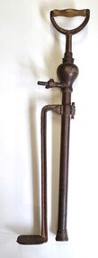
A stirrup pump is a portable reciprocating water pump used to extinguish or control small fires. It is operated by hand. The operator places a foot on a stirrup-like bracket at the bottom of the pump to hold the pump steady. The bottom of the suction cylinder was placed inside a bucket of water. Water was drawn by pumping the handle up and down to create suction. The pumps were used in a variety of settings to enable quick action if a small fire broke out. They were a vital tool in London during the Blitz of World War 11. On the local level they were also used for spraying fruit trees, plants and vines. The Crescent Tool Company was founded in 1907. The Crescent brand has changed ownership multiple times. It is currently owned by Apex Tool Group but still also trades as Crescent in Australia. This pump was donated by Geoff Williams of Wodonga and was used at "Orange Vale" farm at Oxley Flats near Wangaratta. "Orange Vale" was owned by Mr. Robert Williams. Widely known as "Uncle Bob". in the 1940s Mr. Williams opened up the family property, established in the 1860s, as a camp for young people from Wangaratta. By 1951, this had extended to catering to group camps for children from Victoria, New South Wales and Queensland. 250 children could be accommodated at one time and as many as 3,000 children enjoyed the facilities each year.These pumps were important in fire fighting in a range of settings and were adapted for use in agricultural and small farm settings,A brass stirrup pump with wooden handle. It consists of 2 parallel brass pieces, one with a foot piece attached to keep the pump steady. The base of the pump is fitted with a pierced metal filter that prevents grit and debris being drawn into the pump and fouling it. 2 butterfly screws enable adjustment of height and securing a hose.crescent tools, orange vale, fire equipment -
 Wodonga & District Historical Society Inc
Domestic object - Haeusler Collection Lactogen baby formula measuring spoon c.1920s
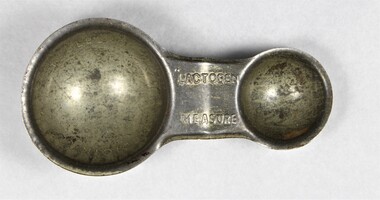
The Wodonga Historical Society Haeusler Collection provides invaluable insight into life in late nineteenth and early twentieth century north east Victoria. The collection comprises manuscripts, personal artefacts used by the Haeusler family on their farm in Wodonga, and a set of glass negatives which offer a unique visual snapshot of the domestic and social lives of the Haeusler family and local Wodonga community. The Haeusler family migrated from Prussia (Germany) to South Australia in the 1840s and 1850s, before purchasing 100 acres of Crown Land made available under the Victorian Lands Act 1862 (also known as ‘Duffy’s Land Act’) in 1866 in what is now Wodonga West. The Haeusler family were one of several German families to migrate from South Australia to Wodonga in the 1860s. This item is a Nestlé Lactogen baby formula measuring scoop used in the preparation of formula for bottle feeding. It was used by Ilma Margaret Ernestine Haeusler (née Tasker, b.1900 in Tallangatta) to feed her son Alfred who was born in 1922. Ilma died in childbirth in 1928. This measuring spoon is one of several objects in the Haeusler Collection concerning early childhood that provide insight into family and home life in early twentieth century Wodonga. The first fully artificial infant milk formula, Farine Lactee, was developed in the 1860s. Companies continued to attempt to develop synthetic formulas which nutritionally replicated human breast milk in the decades that followed. Nestlé began producing Lactogen in 1921. It was marketed to women as a nutritionally superior substitute for breast milk, and as a nutritional supplement for breast feeding mothers. From the 1920s, when the Haeusler Collection measure was produced and used, Nestlé employed nurses in major Australian cities to promote Lactogen and its supposed health benefits to new mothers. They also used print advertisements to offer free product samples and instruction booklets advising on pregnancy and infant care for the same purpose. Nestlé was formed in 1905 by the merger of the Anglo-Swiss Milk Company, established in 1866 by brothers George and Charles Page, and Farine Lactée Henri Nestlé, founded in 1866 by Henri Nestlé. The company grew significantly during the First World War and again following the Second World War, expanding its offerings beyond its early condensed milk and infant formula products. In the twenty-first century, Nestlé has faced criticism and boycotts over its decision to market baby formula as an alternative to breastfeeding in developing countries. The adoption of bottle feeding in countries without access to clean water and sanitation infrastructure has contributed to high infant mortality rates. This item has well documented provenance and a known owner. It forms part of a significant and representative historical collection which reflects the local history of Wodonga. It contributes to our understanding of domestic and family life in early twentieth century Wodonga, as well as providing interpretative capacity for themes including local history, social history, and women’s history.Silver toned alloy measuring spoon for Lactogen infant formula, produced by food and drink manufacturing company Nestlé. Embossed with the Lactogen brand name, and teaspoon and tablespoon measurements. "LACTOGEN MEASURE" on central handle/"TABLESPOON" on large inner scoop/"TEASPOON" on small inner scoopchildren, babies, household, domestic, motherhood, family, kitchen -
 Wodonga & District Historical Society Inc
Functional object - Beehive Smoker c. early 1900s
Beehive smokers douse bees with smoke to calm them and make them less likely to sting while honey is extracted from beehives. They were invented in the mid nineteenth century, prior to which bees were killed in order to extract their honey. The invention of the bee smoker was an important innovation in the history of apiary. The Wodonga Historical Society beehive smoker appears to be of the same design as the patented Woodman’s Bingham Bee Smoker, produced from 1878 by T. F. Binghan of Albronia, Michigan. The Wodonga Historical Society beehive smoker is an important artefact connected to local history, and the history of apiary in Wodonga. Beekeeping was a popular pastime in the late nineteenth and early twentieth century, and apiaries were subject to regulation by the Wodonga Shire Council. At a 1914 meeting of the council, for instance, a by-law governing beekeeping in Wodonga was enacted after Mrs Smyth complained that Mr Bassett’s bees were swarming the watering holes in her paddocks and preventing livestock from drinking. There were areas within the Wodonga township where apiaries were prohibited, and Mr Bassett’s bees had fallen foul of the law. A canvas, wood and metal beesmoker from the early twentieth century. apiary, bees, beekeeping, honey, apiarists, wodonga, council, wodonga council, wodonga shire council, rural, livestock -
 Wodonga & District Historical Society Inc
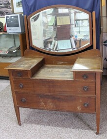
Furniture - Wooden dresser with a mirror from the Terminus Hotel, Wodonga
The wooden dresser came from the Terminus Hotel in High St., Wodonga. In 1873, James Thompson Hatch built the two-storeyed Terminus Hotel at 79 Sydney Road (later known at High Street), then sold it to George Day and Kenneth McLennan for £1,230. It was first licensed to J. G. Morton in January 1874. In 1879, Annie Allen, from Ireland, took over as licensee of the hotel containing 14 rooms, after she and her husband, George James Allen, purchased it. He became licensee in 1883. Under the Allens, the Terminus became, ‘a principal rendezvous for visitors to the town.’ September 1888 saw additions to the building that included a billiard room, a dining room, and 18 other rooms. Following the death of her husband in 1889, Annie Allen continued to run the Terminus Hotel. She later married John Haldon and was licensee of the hotel until 1893 when the licence was transferred to William Carkeek. In the early 1900s the Hotel was thoroughly renovated. The Terminus Hotel was for sale by auction on 5th March 1909. It comprised about 50 rooms, a two-storey building built of brick and iron with hot and cold water service and acetylene gas throughout. The principal hotel in Wodonga, was let from 1st January 1909 on a seven years’ lease at a rental of £9 per week. 1935 saw extensive improvements by proprietor W. P. Kinney, while in 1941 further extensive improvements were carried out to make a good hotel better. A pall of shock and disbelief descended over Wodonga’s historic Terminus Hotel on 1st June 1998 when it was destroyed by fire then demolished in 1999. The site was sold for almost $1 million and redeveloped for a medical clinic. The wooden dresser has local significance as it came from the Terminus Hotel in High St., Wodonga.Wooden dresser with a mirror, two small side drawers and two large drawers with circular recessed metal handles and metal castors.dressers, dressers with mirrors, wooden dressers -
 Wodonga & District Historical Society Inc
Functional object - Haeusler Collection Men's 'Baronex' Stainless Steel Wrist Watch, c. Mid-century
The Wodonga Historical Society Haeusler Collection provides invaluable insight into life in late nineteenth and early twentieth century north east Victoria. The collection comprises manuscripts, personal artefacts used by the Haeusler family on their farm in Wodonga, and a set of glass negatives which offer a unique visual snapshot of the domestic and social lives of the Haeusler family and local Wodonga community. The Haeusler family migrated from Prussia (Germany) to South Australia in the 1840s and 1850s, before purchasing 100 acres of Crown Land made available under the Victorian Lands Act 1862 (also known as ‘Duffy’s Land Act’) in 1866 in what is now Wodonga West. The Haeusler family were one of several German families to migrate from South Australia to Wodonga in the 1860s.This item has well documented provenance and a known owner. It forms part of a significant and representative historical collection which reflects the local history of Wodonga. It contributes to our understanding of domestic and family life in early twentieth century Wodonga, as well as providing interpretative capacity for themes including local history, social history, and women’s history. Men's 'Baronex' analogue, stainless steel wrist watch, c. mid-century. On back of watch face "STAINLESS STEEL BACK/WATER RESISTANT/ANTIMAGNETIC SHOCKPROOF/DUST PROOF". On watch band near clasp "100% /STAINLESS STEEL/HONG KONG". On watch face "BARONEX/JEWELS INCABLOC"watch, clock, time, timepiece, haeusler collection, wodonga, social history -
 Wodonga & District Historical Society Inc
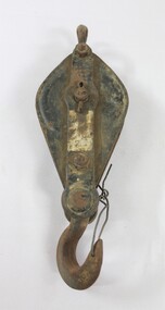
Functional object - Pulley, North East Region Water Authority, Wodonga
... water of improved quality to Wodonga, in accordance ...The pulley was used by the Wodonga Waterworks Trust and Sewerage Authority, which were established in 1897, and had the responsibility for providing Wodonga's drinking water and managing the wastewater. In 1923 a Wodonga Waterworks Trust referendum to provide funding for new infrastructure to supply more water of better quality to Wodonga was passed. This included building the Wodonga Water Tower and it was completed in 1924. It supplied water to Wodonga until 1959, when it was drained and decommissioned after the No 1 Basin on Huon Hill was completed in 1958. In 1983 the Wodonga Waterworks Trust and the Wodonga Sewerage Authority became part of the Wodonga Council. And by 1989 a filtration plant at Huon Hill was completed, which provided filtered water of improved quality to Wodonga, in accordance with the World Health Organisation’s guidelines. In 1994 the Kiewa Murray Region Water Authority took over the Wodonga Council’s water and wastewater operations, and then in 1999 the Kiewa Murray Region Water Authority combined with the Ovens Region Water Authority and became the North East Region Water Authority or NERWA. NERWA then became known as North East Water. The pulley has local significance due to its use by the Wodonga Waterworks Trust and Sewerage Authority, and donation from the North East Region Water Authority. It also has wider historical significance as an example of the equipment used in the early management of water in Victoria and Australia.Elongated ellipse-shaped iron pulley, painted black on the flat exterior surfaces. Considerable light brown dirt on the surface and traces of a silver coloured rectangular label on the central raised section on the front. The light brown surface dirt covers nearly the entire back surface. Piece of iron wire attached to the hook at the bottom of the pulley."Backwards R 6" on the central raised section on the back surface.wodonga waterworks trust, wodonga sewerage authority, wodonga water, pulleys, north east region water authority, north east water, n.e. water, nerwa -
 Wodonga & District Historical Society Inc
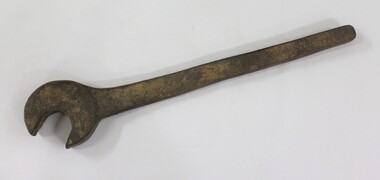
Tool - Large Spanner, North East Region Water Authority, Wodonga
The large wrench was used by the Wodonga Waterworks Trust and Sewerage Authority, which were established in 1897, and had the responsibility for providing Wodonga's drinking water and managing the wastewater. In 1923 a Wodonga Waterworks Trust referendum to provide funding for new infrastructure to supply more water of better quality to Wodonga was passed. This included building the Wodonga Water Tower and it was completed in 1924. It supplied water to Wodonga until 1959, when it was drained and decommissioned after the No 1 Basin on Huon Hill was completed in 1958. In 1983 the Wodonga Waterworks Trust and the Wodonga Sewerage Authority became part of the Wodonga Council. And by 1989 a filtration plant at Huon Hill was completed, which provided filtered water of improved quality to Wodonga, in accordance with the World Health Organisation’s guidelines. In 1994 the Kiewa Murray Region Water Authority took over the Wodonga Council’s water and wastewater operations, and then in 1999 the Kiewa Murray Region Water Authority combined with the Ovens Region Water Authority and became the North East Region Water Authority or NERWA. NERWA then became known as North East Water. The large spanner has local significance due to its use by the Wodonga Waterworks Trust and Sewerage Authority, and donation from the North East Region Water Authority. It also has wider historical significance as an example of the equipment used in the management of water in Victoria and Australia.Large cast iron spanner with some red/brown rust corrosion and light brown ingrained surface dirt.north east region water authority, nerwa, wodonga sewerage authority, north east water, n.e. water, wodonga, large spanners, spanner, wodonga waterworks trust -
 Wodonga & District Historical Society Inc
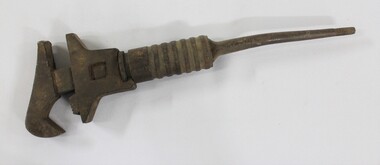
Tool - Shifter Wrench, North East Region Water Authority, Wodonga
The Shifter Wrench was used by the Wodonga Waterworks Trust and Sewerage Authority, which were established in 1897, and had the responsibility for providing Wodonga's drinking water and managing the wastewater. In 1923 a Wodonga Waterworks Trust referendum to provide funding for new infrastructure to supply more water of better quality to Wodonga was passed. This included building the Wodonga Water Tower and it was completed in 1924. It supplied water to Wodonga until 1959, when it was drained and decommissioned after the No 1 Basin on Huon Hill was completed in 1958. In 1983 the Wodonga Waterworks Trust and the Wodonga Sewerage Authority became part of the Wodonga Council. And by 1989 a filtration plant at Huon Hill was completed, which provided filtered water of improved quality to Wodonga, in accordance with the World Health Organisation’s guidelines. In 1994 the Kiewa Murray Region Water Authority took over the Wodonga Council’s water and wastewater operations, and then in 1999 the Kiewa Murray Region Water Authority combined with the Ovens Region Water Authority and became the North East Region Water Authority or NERWA. NERWA then became known as North East Water. The shifter wrench has local significance due to its use by the Wodonga Waterworks Trust and Sewerage Authority, and donation from the North East Region Water Authority. It also has wider historical significance as an example of the equipment used in the early management of water in Victoria and Australia.Large cast iron wrench with an adjustable grip and a circular turning mechanism at the top of a thin tapering handle. 2.6 cm thread on the end of the thin tapering handle. "GSP 23/15" on one side of the thin tapering handle.north east region water authority, nerwa, wodonga sewerage authority, north east water, n.e. water, wodonga, shifter wrench, wodonga waterworks trust -
 Wodonga & District Historical Society Inc
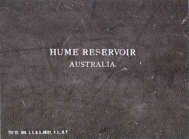
Album - Hume Reservoir Australia Album - Cover, Department of Public Works, N.S.W, 1927
This set of photos is from a leather bound album bearing the inscription "HUME RESERVOIR AUSTRALIA" plus 'The Rt. Hon. L. C. M. S. Amery, P. C., M .P.' all inscribed in gold. It was presented to The Rt. Hon. L. C. M. S. Amery, P. C., M. P, Secretary of State for Dominion Affairs on the occasion of his visit to the Hume Reservoir on 2nd November 1927. To ensure preservation of the album and its contents, the images and information pages have all been digitised. It is assumed that over the past 70 to 80 years there has been some loss of contrast due to fading, and probably detail. Thus, each photo was enhanced in several steps. Digitalisation of the album was completed by Eric Eulenstein in Wodonga in April 2002. The position of Secretary of State for Dominion Affairs was a British cabinet-level position created in 1925 and responsible for British relations with the Dominions — Canada, Australia, New Zealand, South Africa, Newfoundland, and the Irish Free State — and the self-governing Crown colony of Southern Rhodesia.This album is of local and national significance as it documents the planning and development of the Hume Reservoir up to 1927. It was the largest water reservoir in the British Empire. The album records the pioneering engineering work that went into its construction.Leather bound cover of the album of photos and information documenting the planning and development of the Hume Reservoir up to 1927. It was presented to The Rt. Hon. L.C.M.S. Amery, P.C., M.P, Secretary of State for Dominion Affairs on the occasion of his visit to the Hume Reservoir on 2nd November 1927. Embossed in gold in centre of cover "HUME RESERVOIR/AUSTRALIA" At bottom left "The Rt. Hon. L.C.M.S. Amery, P.C., M.P."hume reservoir australia, the rt. hon. l.c.m.s. amery -
 Wodonga & District Historical Society Inc
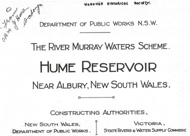
Album - Hume Reservoir Australia Album - Title Page, Department of Public Works, N.S.W, 1927
This set of photos is from a leather bound album bearing the inscription "HUME RESERVOIR AUSTRALIA" plus 'The Rt. Hon. L. C. M. S. Amery, P. C., M .P.' all inscribed in gold. It was presented to The Rt. Hon. L. C. M. S. Amery, P. C., M. P, Secretary of State for Dominion Affairs on the occasion of his visit to the Hume Reservoir on 2nd November 1927. To ensure preservation of the album and its contents, the images and information pages have all been digitised. It is assumed that over the past 70 to 80 years there has been some loss of contrast due to fading, and probably detail. Thus, each photo was enhanced in several steps. Digitalisation of the album was completed by Eric Eulenstein in Wodonga in April 2002. The position of Secretary of State for Dominion Affairs was a British cabinet-level position created in 1925 and responsible for British relations with the Dominions — Canada, Australia, New Zealand, South Africa, Newfoundland, and the Irish Free State — and the self-governing Crown colony of Southern Rhodesia.This album is of local and national significance as it documents the planning and development of the Hume Reservoir up to 1927. It was the largest water reservoir in the British Empire. The album records the pioneering engineering work that went into its construction.Title page of album, including official name and construction authorities."DEPARTMENT OF PUBLIC WORKS N.S.W./ (FROM MRS J. HORE WODONGA) /THE RIVER MURRAY WATER SCHEME./ HUME RESERVOIR NEAR ALBURY, NEW SOUTH WALES/CONSSTUCTING AUTHORITIES,/ NEW SOUTH WALES/DEPARTMENT OF PUBLIC WORKS/VICTORIA/STATE RIVERS & WATER COMMISSION"hume reservoir australia, river murray waters scheme -
 Wodonga & District Historical Society Inc
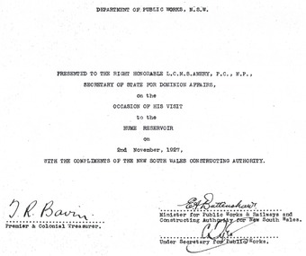
Album - Hume Reservoir Australia Album - Dedication, Department of Public Works, N.S.W, 1927
This set of photos is from a leather bound album bearing the inscription "HUME RESERVOIR AUSTRALIA" plus 'The Rt. Hon. L. C. M. S. Amery, P. C., M .P.' all inscribed in gold. It was presented to The Rt. Hon. L. C. M. S. Amery, P. C., M. P, Secretary of State for Dominion Affairs on the occasion of his visit to the Hume Reservoir on 2nd November 1927. To ensure preservation of the album and its contents, the images and information pages have all been digitised. It is assumed that over the past 70 to 80 years there has been some loss of contrast due to fading, and probably detail. Thus, each photo was enhanced in several steps. Digitalisation of the album was completed by Eric Eulenstein in Wodonga in April 2002. The position of Secretary of State for Dominion Affairs was a British cabinet-level position created in 1925 and responsible for British relations with the Dominions — Canada, Australia, New Zealand, South Africa, Newfoundland, and the Irish Free State — and the self-governing Crown colony of Southern Rhodesia.This album is of local and national significance as it documents the planning and development of the Hume Reservoir up to 1927. It was the largest water reservoir in the British Empire. The album records the pioneering engineering work that went into its construction. Hume Reservoir Australia Album - Dedication page recording the presentation of the album to 'The Rt. Hon. L. C. M. S. Amery, P. C., M.P" and his visit to Albury in 1927. “DEPARTMENT OF PUBLIC WORKS, N.S.W./ PRESENTED TO THE RIGHT HONOURABLE L.C.M.S. AMERY, F.C., M.P.,/ SECRETARY OF STATE FOR DOMINION AFFAIRS/ on the/ OCCASION OF HIS VISIT/ to the /HUME RESERVOIR/ on/ 2ND NOVEMBER 1927, /WITH THE COMPLIMENTS OF THE NEW SOUTH WALES CONSTRUCTING AUTHORITY./(SIGNED) T.R. BAVIN, Premier & Colonial Treasurer./ E.A. BATTENSHAW, Minister for Public Works & Railways and Constructing Authority for New South Wales/ C. TYLE, Under Secretary for Public Works”hume reservoir australia, river murray waters scheme -
 Wodonga & District Historical Society Inc
Album - Hume Reservoir Australia Album - Introduction - Part 1, Department of Public Works, N.S.W, 1927
This set of photos is from a leather bound album bearing the inscription "HUME RESERVOIR AUSTRALIA" plus 'The Rt. Hon. L. C. M. S. Amery, P. C., M .P.' all inscribed in gold. It was presented to The Rt. Hon. L. C. M. S. Amery, P. C., M. P, Secretary of State for Dominion Affairs on the occasion of his visit to the Hume Reservoir on 2nd November 1927. This album is of local and national significance as it documents the planning and development of the Hume Reservoir up to 1927. It was the largest water reservoir in the British Empire. The album records the pioneering engineering work that went into its construction.RIVER MURRAY WATERS SCHEME, HUME RESERVOIR THE LARGEST IN THE BRITISH EMPIRE. ' The history of the inception of the River Murray Waters Agreement under the terms of which the Hume Reservoir is being constructed, the purposes of the work, its correlation to the other works on the Murray and the methods of construction are all outlined in the attached article entitled “The River Murray Waters Scheme, the Nile of Australia”, by Mr H.H. Dare, M.E., M.Inst.C.E., Commissioner, Water Conservation and Irrigation, and the New South Wales Representative on the River Murray Commission. The article was published in 1925 and some alterations brought about by the efflux of time are necessary. As far as personnel is concerned, the death of Mr J.S. Dethridge, M.Inst.C.E., removed a very able engineer from the councils of the Commission. His place as Representative of Victoria has been taken by Mr R. Horsfield. It is also to be regretted that ill-health has caused the retirement of Mr E.M. de Burgh, M.Inst.C.E., the eminent Chief Engineer for New South Wales, who, with Mr Dethridge, was largely responsible for the Agreement cemented by the River Murray Waters Acts and, inter alia, for the design of the Hume Dam. The following summary of the progress of work on the Locks might be substituted for the latter part of Mr Dare’s paragraph. Up to the present time six locks and weirs have been completed, the highest in the series being at Torrumberry and the lowest at Blanchetown. Locks No.26 at Torrumberry and No.11 at Mildura were built by Victoria and are in use. A lock and weir (No.10) is in progress at Wentworth, and the necessary camp arrangements, purchase of plant, etc., have been undertaken in connection with lock and weir No.15 at Euston, both under the direction of New South Wales. Lock No.9, which forms part of the Lake Victoria Scheme, Lock No.5 at Renmark and Lock No.3 in South Australia hume reservoir australia, river murray waters scheme -
 Wodonga & District Historical Society Inc
Album - Hume Reservoir Australia Album - Introduction - Part 2, Department of Public Works, N.S.W, 1927
This set of photos is from a leather bound album bearing the inscription "HUME RESERVOIR AUSTRALIA" plus 'The Rt. Hon. L. C. M. S. Amery, P. C., M .P.' all inscribed in gold. It was presented to The Rt. Hon. L. C. M. S. Amery, P. C., M. P, Secretary of State for Dominion Affairs on the occasion of his visit to the Hume Reservoir on 2nd November 1927. This album is of local and national significance as it documents the planning and development of the Hume Reservoir up to 1927. It was the largest water reservoir in the British Empire. The album records the pioneering engineering work that went into its construction.DEPARTMENT OF PUBLIC WORKS, N.S.W. (continued from previous image). have been completed, Locks Nos. 2, 4 and 6, also in South Australia, are under construction. In the description of the Hume Dam the following emendations have to be made. The total length will be 5,300 feet of which 4,258 feet will consist of an earthen embankment. The maximum depth of water conserved will be 24 feet more than originally intended with an additional allowance of 9 feet for surcharge, the total capacity will be 2,000,000 acre feet, the water surface at full supply level 44,000 acres, and provision is being made for a flood discharge of 182,000 cusecs. For handy reference, the main dimensions and figures and comparisons with other dams throughout the world are given in a tabulated statement attached. The Hume Reservoir will be the largest in the British Empire. Photographs showing the work at various stages of construction are appended. The Resident Engineer for New South Wales from the start of the work until his recent promotion to the position of Inspecting Engineer was Mr J. Keith Ross, M.A., B.Sc., A.M.Inst.C.E., who has been succeeded by Mr S.W. Jones, B.E., A.M.Inst.C.E. The Resident Engineer for Victoria is Mr A.W. Johnson, B.E. (Signed) M. Inst.C.E. Chief Engineer New South Wales Constructing Authority 27th October 1927. hume reservoir australia, river murray waters scheme -
 Wodonga & District Historical Society Inc
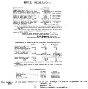
Album - Hume Reservoir Australia Album - Dimensions of Hume Reservoir, Department of Public Works, N.S.W, 1927
This set of photos is from a leather bound album bearing the inscription "HUME RESERVOIR AUSTRALIA" plus 'The Rt. Hon. L. C. M. S. Amery, P. C., M .P.' all inscribed in gold. It was presented to The Rt. Hon. L. C. M. S. Amery, P. C., M. P, Secretary of State for Dominion Affairs on the occasion of his visit to the Hume Reservoir on 2nd November 1927. This album is of local and national significance as it documents the planning and development of the Hume Reservoir up to 1927. It was the largest water reservoir in the British Empire. The album records the pioneering engineering work that went into its construction.Table outlining the Dimensions of the Hume Weir and comparisons with MAKWAR and BURRINJUCK DAMS, and some other comparisons. MAKWAR Dam is located on the Blue Nile about five miles south of Sennar and 175 miles south of Khartoum in Sudan. The construction of this dam started in 1922 and was completed in May 1925, while the British Empire colonised Sudan. It was officially opened on 21st January 1926. The BURRINJUCK DAM is situated in the upper catchment of the Murrumbidgee River, approximately 60 kms from Yass, N.S.W. It was built from 1907 to 1927 The stated purpose of the Hume Reservoir is to get storage to ensure regulated output for:- 1. Irrigation 2. Navigation 3. Hydro-electric Generation.hume reservoir australia, river murray waters scheme, hume dimensions -
 Wodonga & District Historical Society Inc
Album - Hume Reservoir Australia Album - Plans and Progress Photos - River Murray Water Scheme, Department of Public Works, N.S.W, 1927
This set of photos is from a leather bound album bearing the inscription "HUME RESERVOIR AUSTRALIA" plus 'The Rt. Hon. L. C. M. S. Amery, P. C., M .P.' all inscribed in gold. It was presented to The Rt. Hon. L. C. M. S. Amery, P. C., M. P, Secretary of State for Dominion Affairs on the occasion of his visit to the Hume Reservoir on 2nd November 1927. This album is of local and national significance as it documents the planning and development of the Hume Reservoir up to 1927. It was the largest water reservoir in the British Empire. The album records the pioneering engineering work that went into its construction.1. Locality Plan and Plan of Dam. The dam is about ten miles by road upstream from Albury and about three-quarters of a mile below the confluence of the Mitta Mitta River and the Murray River. Its main features consist of a concrete portion across the bed of the river with earth embankment at both ends. The foundations throughout are on hard granite, found at an average depth of about 40 feet below the surface, the centre line being located to take advantage of the most favourable rock levels.Heading on page "WORKS UNDER RIVER MURRAY WATERS AGREEMENT/HUME RESERVOIR" Beneath top diagram "FIG. 1. ELEVATION" Beneath second diagram "FIG. 2. PLAN" On map "LOCALITY PLAN"hume reservoir australia, river murray waters scheme, hume weir diagrams, hume weir location -
 Wodonga & District Historical Society Inc
Album - Hume Reservoir Australia Album - Detail plan and explanation, Department of Public Works, N.S.W, 1927
This set of photos is from a leather bound album bearing the inscription "HUME RESERVOIR AUSTRALIA" plus 'The Rt. Hon. L. C. M. S. Amery, P. C., M .P.' all inscribed in gold. It was presented to The Rt. Hon. L. C. M. S. Amery, P. C., M. P, Secretary of State for Dominion Affairs on the occasion of his visit to the Hume Reservoir on 2nd November 1927. This album is of local and national significance as it documents the planning and development of the Hume Reservoir up to 1927. It was the largest water reservoir in the British Empire. The album records the pioneering engineering work that went into its construction.2. Detail Plan and Section. Starting from the New South Wales and there will be an earthen embankment 430 feet 6 inches long which is retained by the North Wing Wall. Then come the sluice section 284 feet 3 inches long, the spillway 720 feet long and the South Wing Wall, making a total length of 1,042 feet 6 inches of concrete wall. Beyond the South Wing Wall is earth embankment again to a length of 3,827 feet. The Full Supply Level is R.L.626.00 and allowance has been made for a surcharge of 9 feet. A road will run along the top of the dam at R.L.642.00. The sluice section contains seven offlets, the three nearest the north wing wall being 13 feet in diameter for hydro-electric purposes and the other four 9 feet in diameter for regulation purposes only. There are to be stony sluice gates on the upstream ends of the outlets and needle valves on the downstream ends. The shock of the discharged water will be taken by a stilling pool. Trash racks will protect the intake ends of the outlets. Next comes the spillway section, which is curved on the downstream face, and carried up to within 15 feet of the full supply level. Above that will be a series of piers between which will be the flood gates and on top of which the roadway will be carried. The gates will be 20 feet wide and 15 feet high and will be 29 in number. They will slide down the face of the wall when opened for the escape of the water. The investigation of the control of this cascade of water was made by means of a model and as a result the form of “bucket” or energy dissipater shown on the section of the spillway was decided upon. The earth embankment in Victoria is being constructed by the State Rivers and Water Supply Commission of Victoria who are the Constructing Authority for that State under the River Murray Waters Agreement. The core of the embankment is of concrete 6 feet wide at the base tapering to 2 feet at the top end and is reinforced with steel rods from the level of the decomposed rock upwards. On the downstream side, at about natural surface level, is a tunnel for drainage and inspection purposes. Above the tunnel is a vertical layer of large stones to drain any seepage to the tunnel. Against the core wall is packed selected material of as impervious a character as can be got locally and beyond that the bank is carefully built up in horizontal layers by means of horses and wheel scoops. The upstream slope is 3-to-1 hardening to 2½-to-1 at the top and the downstream slope is 2½-to-1 hardening to 2.07-to-1 at the top. The thrust of the upstream toe is taken by a mass of granite blocks, and this face is protected by concrete laid in situ. The width of the bank at base is 650 feet and at top 32 feet.hume reservoir australia, river murray waters scheme, hume weir diagrams, hume plan details