Showing 1381 items
matching north-east district
-
 Ringwood and District Historical Society
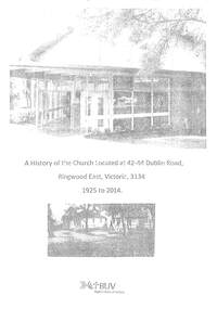
Book, A History of the Church Located at 44-44 Dublin Road, Ringwood East, 2014
Draft of A History of the Church Located at 44-44 Dublin Road, Ringwood East, 3134 from 1925 to 2014 covering Ringwood East Baptist Church from 1929 to 1989, Ringwood Christian Family Centre from 1990 to 1999 and Maroondah Family Church from 2000 to 2014 -
 Ringwood and District Historical Society
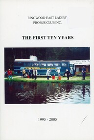
Book, Ringwood East Ladies' Probus Club Inc, 2005
The first ten years of Ringwood East Ladies' Probus Club Inc 1995-2005 -
 Ringwood and District Historical Society
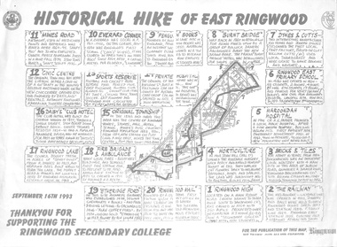
Pamphlet, Historical Hike of East Ringwood, 1996
20 points of Interest September 1996 -
 Ringwood and District Historical Society
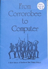
Book, From Corrorobee to Computer, 1986
History of Heathmont East Primary School No 4819 (1961-1986) -
 Ringwood and District Historical Society
Book, The Diaries of John Helder Wedge
The Diaries of John Helder Wedge 1824-1835 Association with Wedge family in East Ringwood -
 Ringwood and District Historical Society
Book, Favourite Escapes to the Outer East
Favourite Escapes to the Outer East - 100 years Holidays, Camps, Picnics, Excursions & Sporting Carnivals held in the Outer Eastern region of Melbourne -
 Ringwood and District Historical Society
Book, Maurie Dear et al, History of Ringwood East Transport (Red Cross), 2007
History of Ringwood East Red Cross Transport 1958-2007 plus Histories of Red Cross in Maroondah area - 45 pages -
 Ringwood and District Historical Society
Book, A South Australian Colonist of 1836 and his Descendants
East Family - Who's Who records the coming to South Australia of its first colonists in 1836 - this book is a supplement to Volumes I, II, III. -
 Ringwood and District Historical Society
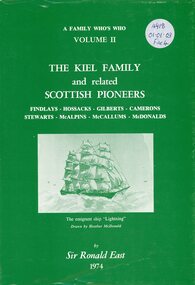
Book, The Kiel Family and Related Scottish Pioneers
Keil Family and related Scottish Pioneers includes McAlphin families of Ringwood - A Family Who's Who Volume II -
 Ringwood and District Historical Society
Pamphlet, Historical Tour of Ringwood East, 2008
Notes for historical Ringwood East tour taken 2008 with details of various stops -
 Ringwood and District Historical Society
Photograph, Warrandyte Road, east side, to Aird Street and bowling green. Jan. 1975
Written on back of photograph, "Warrandyte Road, east side, to Aird Street and bowling green. Jan. 1975". -
 Ringwood and District Historical Society
Photograph, Boundary photo. Heatherdale Rd. looking north east from Shibor Drive, Vermont. Jan. 1979
Written on back of photograph, "Jan. 79 - Boundary photo. Heatherdale Rd. looking north east. Taken at end of Shibor Dve (Vermont) (on high part end corner of school ground). One of 3 that join up." -
 Ringwood and District Historical Society
Photograph, Boundary Photo across Dandenong Ck towards Ringwood (H E Parker Reserve). 1979
Written on back of photograph, "Jan. 79 - boundary photo. Looking across Dandenong Creek towards Ringwood (H.E. Parker Reserve) - ?? South East corner of Ringwood. From children's playground end of Derwent (?) St." -
 Ringwood and District Historical Society
Photograph, Canterbury Road, Ringwood taken under power lines looking east just east of Heatherdale Road. 1979
Written on back of photograph, "Jan. 79. Canterbury Road taken under power lines looking east just east of Heatherdale Road looking up the two-laned Road towards Cadbury McRobertsons before road widening". -
 Ringwood and District Historical Society
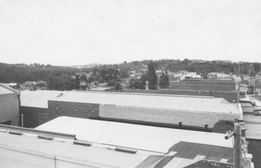
Photograph, View from Ringwood Town Hall Roof looking East (2 views). 1962
Catalogue card reads, "Picture taken from town hall roof. 1962". Looking towards East Ringwood. (2 copies) -
 Ringwood and District Historical Society
Photograph, View of corner of Middlebrook Dr and Tortice Drive looking east towards Wonga Rd, North Ringwood. 1981
Written on back of photograph, "24/8/81. View of corner of (Blank) court and Tortice Drive looking east towards Wonga Rd. Thought to be Middlebrook Drive, not a court. -
 Ringwood and District Historical Society
Photograph, South east corner of Mines Road and Maroondah Highway, Ringwood. 1981
Written on back of photograph, "24/7/81. South east corner of Mines Road and Maroondah Highway." -
 Ringwood and District Historical Society
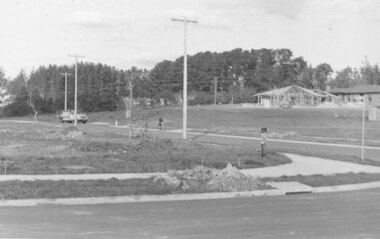
Photograph, Tortice Drive North Ringwood from outside Parkwood High School, 1981
Written on back of photograph, "24/8/81. Tortice Drive North Ringwood from outside Parkwood High School, east towards Wonga Road. Showing some of the subdivisional roads under construction." -
 Ringwood and District Historical Society
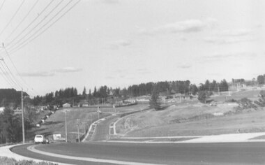
Photograph, Intersection of Warrandyte Road and Oban Road, North Ringwood. Looking south-east. 1981
Written on back of photograph, "18/4/81. Intersection of Warrandyte Road and Oban Road. Looking south-east". -
 Ringwood and District Historical Society
Photograph, Sign listing doctors at consulting rooms at north-east corner of Warrandyte and Oban Roads, North Ringwood. 1981
Written on back of photograph, "18/4/81. The doctors at the consulting rooms at north-east corner of Warrandyte and Oban Roads". -
 Ringwood and District Historical Society
Photograph, Warrandyte Road from east corner of Oban Rd. intersection. North Ringwood 1981
Written on back of photograph, "18/4/81. Warrandyte Road from north-east corner of Oban Rd. intersection". -
 Ringwood and District Historical Society
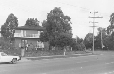
Photograph, Ringwood Baths, Ringwood Street. 1971
Written on back of photograph, "May 1971. Baths, Ringwood Street, east side between Miles Ave. and Reynolds Ave." -
 Ringwood and District Historical Society
Photograph, South-east corner Ringwood Street and Reynolds Ave. Ringwood. Undated but probably 1971-73
No date, but other photos in this SS358 series are 1971-73Written on back of photograph, "South-east corner Ringwood Street and Reynolds Ave." -
 Ringwood and District Historical Society
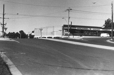
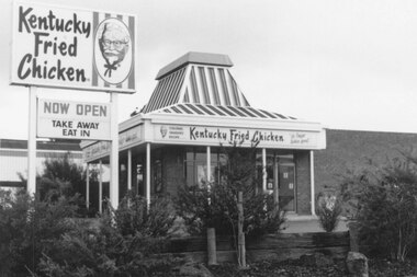
Photograph, Kentucky Fried Chicken, Whitehorse Rd, East side, Ringwood. Probably 1982
Undated, but others in the SS036 series are 1982.Catalogue card reads, "Kentucky Fried Chicken, Whitehorse Rd, East side." -
 Ringwood and District Historical Society
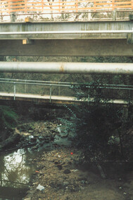
Photograph, Ringwood, Mullum Mullum Creek, east side. Warrandyte Road Bridge. 1986
Written on backing sheet, "Bridge, Mullum Rd. Completed May 1987." Writing on back of photograph reads, "Aug., 1986. Ringwood, Mullum Mullum Creek, east side. Warrandyte Road Bridge". -
 Orbost & District Historical Society
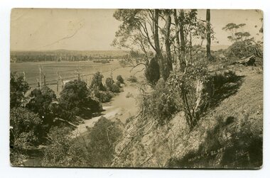
black and white postcards, Sherwood, Herbert, first half 20th century
3185.1 is a view from Hofen's Bluff at Bete Bolong. 3185.2 is a view taken from Mt Raymond looking west at swampland. 3185.3 was taken from Warrens Road, Newmerella looking over the flats towards Orbost, north-east. 3185.4 was taken at Cameron's Lagoon / Lochiel Lagoon in Orbost.These postcards are pictorial records of Orbost in the first half of the 20th century.Four black / white postcards of views around Orbost. postcards-orbost hofen's-bluff newmerella lochiel-lagoon cameron's-lagoon -
 Orbost & District Historical Society
black and white photographs, 1980s? (winter months)
All photographs seem to have been takenfrom the Telecom tower on the corner of Browning and Wolseley Streets in Orbost 3259.1 is a view of the Orbost township looking north-east. The swimming pool and bowling club can be seen in the foreground. 3259.2 is aview looking north-west and showing the tennis courts and clubhouse, the Recreation Reserve oval, the Youth Centre, Historical Museum, Municipal Offices, Senior Citizens clubrooms with the fire station in the foreground. 3259.3 is a view looking south with the Shire of Orbost Municipal offices and Ruskin Street in the foreground. Munro Street can be seen running from Ruskin Street to St Joseph's School in the middle distance. Lochiel Park oval, Lochiel House, the Snowy River and highway bridge are in the background. 3259.4 is a view looking south showing the Club Hotel, C.B.C. Bank in the middle distance and Hoffman's paddock (Forest Park) and the Snowy River beyond. 3259.5 is a view looking north-east over houses. 3259.6 is aview over the main street, Nicholson Street.showing the main shopping precinct. Shop signs for Permewans, Williams Shoes, F.B. Dicken and Orbost Bakery can be seen. 3259.7 is a view looking south west and shows Forest park and beyond towards Bete Bolong.These photographs are detailed pictorial records of the township of Orbost.Seven black / white photographs taken from above a township. Chimney smoke can be seen in the photographs.orbost-township-1980s aerial-photograph-orbost -
Ringwood and District Historical Society
Legal record - Conditions of Sale (C.E.Carter)- F.H.Patterson & Co, Ringwood East - F.Wiltshire to E.A.Story. Dated 14 March 1925
Particulars and Conditions of Sale of Property , Lots 16,17,18,& 19, Railway Station Estate. From F.Wiltshire to E.A.Story -
Ringwood and District Historical Society
Legal record - Conditions of Sale (C.E.Carter), Ringwood East - Crown Allotments 35 & 36 - R. Davidson to Mrs J. A. E. Tudman. 1926
Particulars and Conditions of Sale of Property , from Robert Davidson to Jessie Tudman -
 Ringwood and District Historical Society
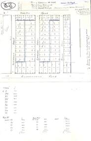
Plan, Plan of Subdivision No.11498 with handwritten costing notations - East Ringwood Central Estate c.1948
Two handwritten pages showing layout of Subdivision no 11498 with surveyor notations including property sizes and road construction cost calculations. Drainage easement 6 feet wide shaded blue.Plan of Subdivision No. 11498, Part of Crown Allotment 27, Parish of Ringwood, County of Mornington, (Certificate of Title Vol 5120 Fol 1023945). Owner Mr Vogel. Subdivision includes Knaith Road, Northwood Street, Langley Street, Bondi Street, and Government Road (later Alexandra Road), Ringwood East. G. Parsons & Sons, Licensed Surveyors, 389 Flinders Lane (Melbourne).