


Historical information
All photographs seem to have been takenfrom the Telecom tower on the corner of Browning and Wolseley Streets in Orbost
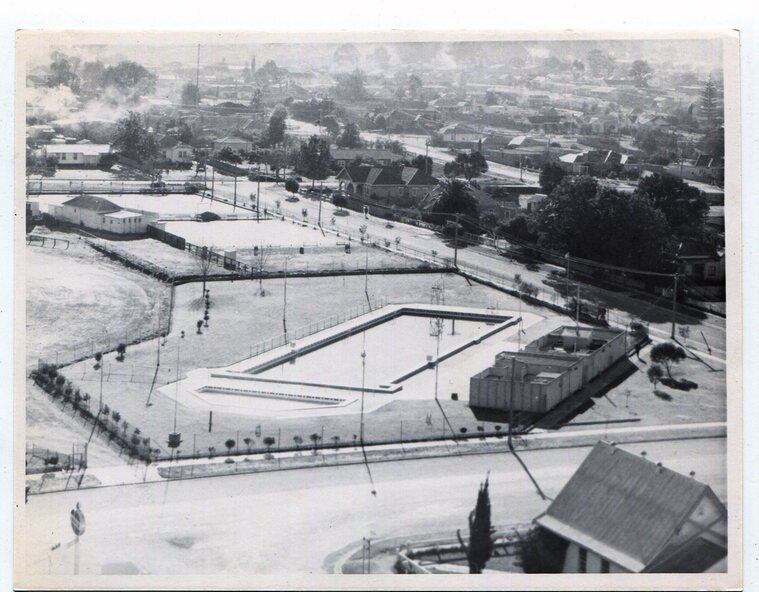
3259.1 is a view of the Orbost township looking north-east. The swimming pool and bowling club can be seen in the foreground.
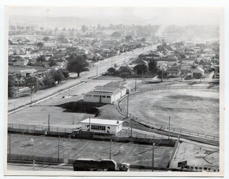
3259.2 is aview looking north-west and showing the tennis courts and clubhouse, the Recreation Reserve oval, the Youth Centre, Historical Museum, Municipal Offices, Senior Citizens clubrooms with the fire station in the foreground.
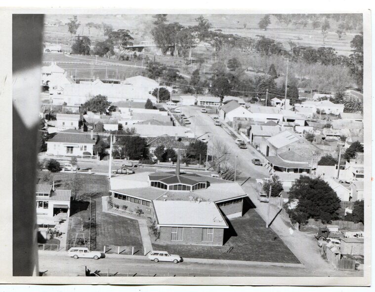
3259.3 is a view looking south with the Shire of Orbost Municipal offices and Ruskin Street in the foreground. Munro Street can be seen running from Ruskin Street to St Joseph's School in the middle distance. Lochiel Park oval, Lochiel House, the Snowy River and highway bridge are in the background.
3259.4 is a view looking south showing the Club Hotel, C.B.C. Bank in the middle distance and Hoffman's paddock (Forest Park) and the Snowy River beyond.
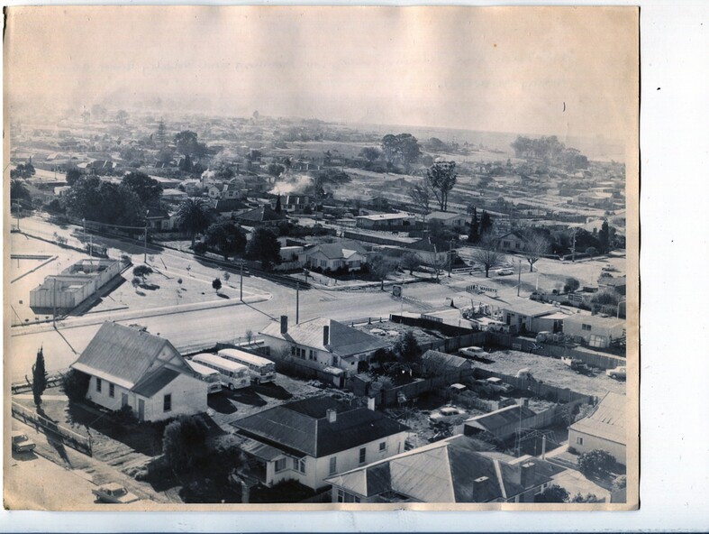
3259.5 is a view looking north-east over houses.
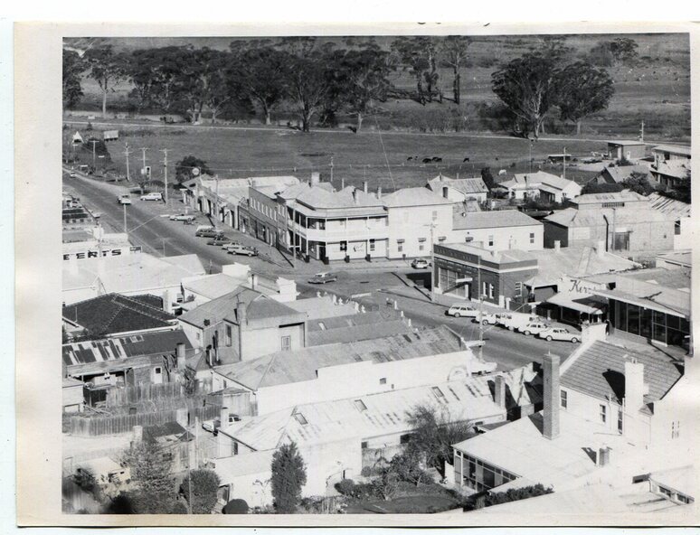
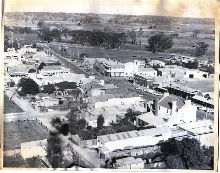
3259.6 is aview over the main street, Nicholson Street.showing the main shopping precinct. Shop signs for Permewans, Williams Shoes, F.B. Dicken and Orbost Bakery can be seen.
3259.7 is a view looking south west and shows Forest park and beyond towards Bete Bolong.
Significance
These photographs are detailed pictorial records of the township of Orbost.
Physical description
Seven black / white photographs taken from above a township. Chimney smoke can be seen in the photographs.