Showing 9485 items
matching warrandyte
-
 Ringwood and District Historical Society
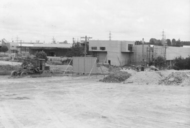
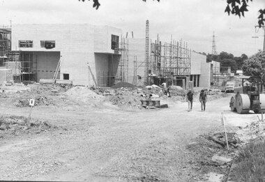
Photograph, New Market - Where Ringwood's new street will be 1982
Written on back of photograph, "8/1/82. Where Ringwood's new street will be."(3 views) -
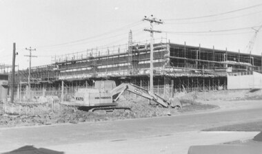
 Ringwood and District Historical Society
Photograph, New Market - Corner of New and Charters Streets, Ringwood. The northern facade of 'Target'. 1982
Written on back of photograph, "Corner of New and Charters Streets. The northern facade of 'Target'." -
 Ringwood and District Historical Society
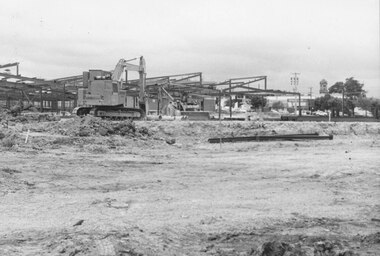
Photograph, New market - View of goods intake section 'Target'. Ringwood 1982
Written on back of photograph, "E648. 8/1/82. View of goods intake section 'Target'". -
 Ringwood and District Historical Society
Photograph, New market - View from Charters St. of unloading bay at 'Target'. Ringwood 1982
Written on back of photograph, "E648. N2A. 8.1.82. View from Charters St. of unloading bay at 'Target'." -
 Ringwood and District Historical Society
Photograph, New market - The Charters St. facade of 'Target'. Ringwood 1982
Written on back of photograph, "E650. 8.1.82. The Charters St. facade of 'Target'. The two men are walking along the centre of Charters St. Looking west." -
 Ringwood and District Historical Society
Photograph, New market - Where Ringwood's new street will be between ANZ Bank and Billy Guyatts. 1982
Written on back of photograph, "E650. 8/1/82. Where Ringwood's new street will be between ANZ Bank and Billy Guyatts." -
 Ringwood and District Historical Society
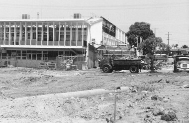
Photograph, New market - Truck clearing portion of Billy Guyatts building to make way for new road. 1982
Written on back of photograph, "E652. N14!. 15/1/82. Truck clearing portion of Billy Guyatts building to make way for new road to be seen above and front of truck". -
 Ringwood and District Historical Society
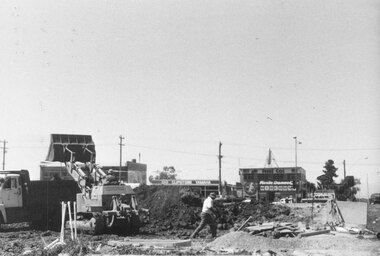
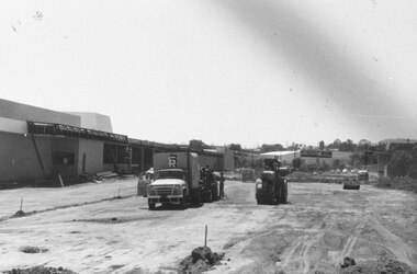
Photograph, New market - Work on Ringwood's new street showing men demolishing part of Billy Guyatts buildings. 1982
Written on back of photograph, "E652. N16N. 15/1/82. Work on Ringwood's new street showing broken barrel drain in the foreground and men demolishing part of Billy Guyatts buildings to make way for the street's extension to the highway". -
 Ringwood and District Historical Society
Photograph, Heathmont 1965. State Savings Bank to left. Bridge on right
Typed below photograph, "Heathmont 1965. State Savings Bank to left. Bridge on right". -
 Ringwood and District Historical Society
Photograph, New market - Corner of Seymour and New Streets. Where Ringwood Timber offices and sales rooms used to be. 1982
Written on back of photograph, "E655. 18/1/82. Corner of Seymour and New Streets. Where Ringwood Timber offices and sales rooms used to be." -
 Ringwood and District Historical Society
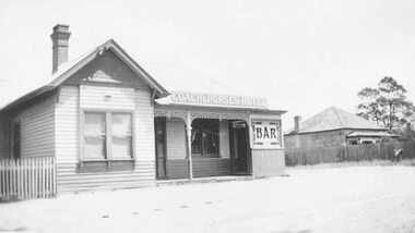
Photograph, Coach and Horses Hotel, Ringwood. 1909-1939, taken in 1939
Black and white photograph of Coach and Horses Hotel.Typed below photograph, "Coach and Horses Hotel. 1909-1939". -
 Ringwood and District Historical Society
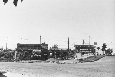
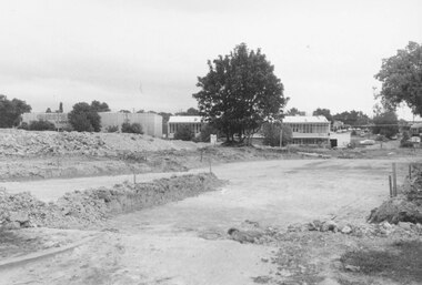
Photograph, New market - Removing the soil that was under Ringwood Timber offices. 1982
Written on back of photograph, "E655. 18/1/82. Removing the soil that was under Ringwood Timber offices. Corner of New and Seymour Streets." -
 Ringwood and District Historical Society
Photograph, New market - Where Ringwood Timber used to be. The corner of New Street and the Highway. 1982
Written on back of photograph, "E655. 18/1/82. Where Ringwood Timber used to be. The corner of New Street and the Highway." -
 Ringwood and District Historical Society
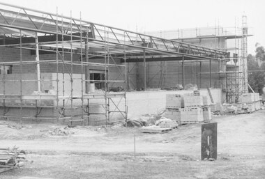
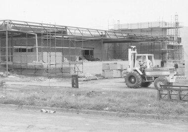
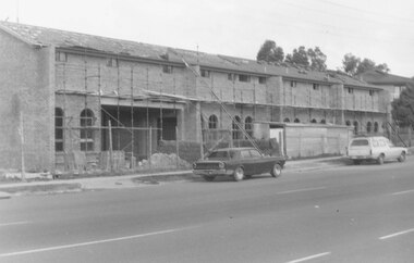
Photograph, New market - The southern facade of Target along Seymour St. Ringwood. 1982
Written on back of photograph, "E655. N27A. 18/1/82. The southern facade of Target along Seymour St." -
 Ringwood and District Historical Society
Photograph, New market - The Bond St. entrance to the new street across Seymour and Charters. Ringwood 1982
Written on back of photograph, "E656, 24A. 18/1/82. The Bond St. entrance to the new street across Seymour and Charters. Billy Guyatts building in centre". -
 Ringwood and District Historical Society
Photograph, New market - Bond St. entrance to the new street across Charters Seymour Streets, Ringwood 1982
Written on back of photograph, "E661. 8/1/82. Bond St. entrance to the new street across Charters Seymour Streets. Looks south." -
 Ringwood and District Historical Society
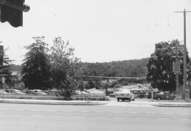
Photograph, Looking south from Bond Street Ringwood, across new market site. Clock tower right centre. Ringwood 1982
Written on back of photograph, "8/1/82. Looking south from Bond St. across new market. Clock tower right centre." -
 Ringwood and District Historical Society
Photograph, View of corner of Middlebrook Dr and Tortice Drive looking east towards Wonga Rd, North Ringwood. 1981
Written on back of photograph, "24/8/81. View of corner of (Blank) court and Tortice Drive looking east towards Wonga Rd. Thought to be Middlebrook Drive, not a court. -
 Ringwood and District Historical Society
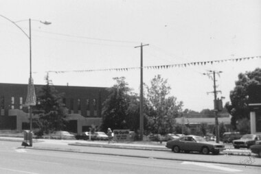
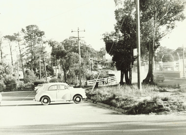
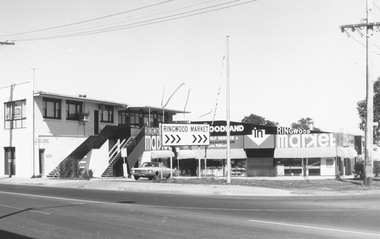
Photograph, Ringwood Market, 1973'
Catalogue card reads, 'Ringwood Market, 1973'. -
 Ringwood and District Historical Society
Photograph, View north from Avery Court over valley of the golf course. North Ringwood 1981
Written on back of photograph, "24/8/81. View north from Avery Court over valley of the golf course. Tortice Drive passes the end of Avery Crt, 75 metres behind the camera". -
 Ringwood and District Historical Society
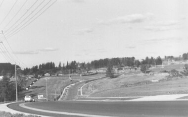
Photograph, Looking south from Parkwood High School over Tortice Drive, North Ringwood. 1982
Written on back of photograph, "24/8/82. Looking south from Parkwood High School over Tortice Drive to where it disappears right among the houses. It was not here 3 months ago." -
 Ringwood and District Historical Society
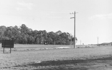
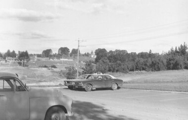
Photograph, Opposite end of Mines Road on Maroondah Highway, Ringwood. 1981
Written on back of photograph, "24/7/81. Opposite end of Mines Road on Maroondah Highway." -
 Ringwood and District Historical Society
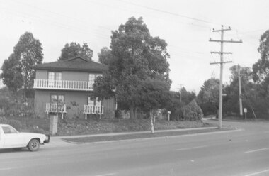
Photograph, Ringwood Motor Inn, Maroondah Highway, 1981
Written on back of photograph, "24/7/81. Ringwood Motor Inn, Maroondah Highway." -
 Ringwood and District Historical Society
Photograph, South east corner of Mines Road and Maroondah Highway, Ringwood. 1981
Written on back of photograph, "24/7/81. South east corner of Mines Road and Maroondah Highway." -
 Ringwood and District Historical Society
Photograph, Looking south from Monterey Place, North Ringwood 1981
Written on back of photograph, "24/8/81. Looking south from Monterey Place, North Ringwood over where is soon to be subdivided - towards Jull Road and Oban Road (seen in distance)". -
 Ringwood and District Historical Society
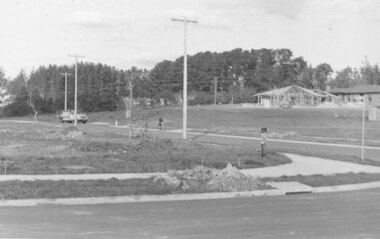
Photograph, Tortice Drive North Ringwood from outside Parkwood High School, 1981
Written on back of photograph, "24/8/81. Tortice Drive North Ringwood from outside Parkwood High School, east towards Wonga Road. Showing some of the subdivisional roads under construction." -
 Ringwood and District Historical Society
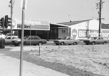
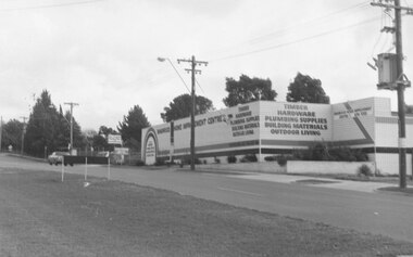
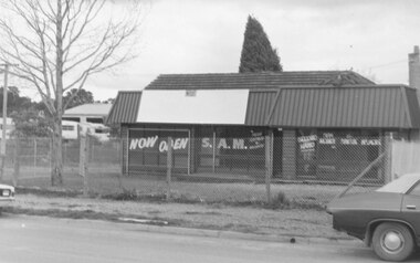
Photograph, 477 Maroondah Highway Ringwood. S.A.M.. New and second-hand agricultural machinery. 1981
Written on back of photograph, "11.8.81 477 Maroondah Highway. S.A.M.. New and second-hand agricultural machinery." -
 Ringwood and District Historical Society
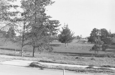
Photograph, Looking from parking area in front of Parkwood High School towards Wonga Road over new subdivision, North Ringwood, 1981
Written on back of photograph, "24.4.81 Looking from parking area in front of Parkwood High School towards Wonga Road over new subdivision. In the area seen there are six new courts under construction. Three months ago there was nothing there." -
 Ringwood and District Historical Society
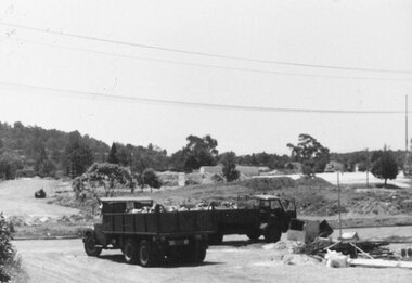
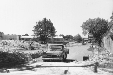
Photograph, Digging for the big barrel drain which runs down New Street from "Target" to the creek, Ringwood. 1981
Written on back of photograph, '25.8.81 - Digging for the big barrel drain which runs down New Street from "Target" to the creek." -
 Ringwood and District Historical Society
Photograph, Old baths site looking west to Ringwood Street, Ringwood. Late 1980's
Written on back of photograph, "Lat '80. Old baths site looking west to Ringwood Street."