Showing 10847 items
matching maps
-
 Yendon History Group
Boxed set of four (4) coasters - coaster 3
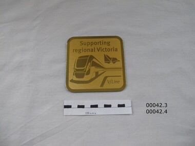
Part of the contents of a souvenir gift bag given to those who rode on the re-enactment train for the 150th anniversary of the Geelong to Ballarat railway on 10 April 2012.Gold aluminium coaster, backed with royal blue felt. Embossed with a picture of a modern intercity train and a map of Victoria. Identical to coaster 4Supporting regional Victoria / V/Linegeelong ballarat railway, railway 150th anniversary -
 Yendon History Group
Boxed set of four (4) coasters - coaster 4
Part of the contents of a souvenir gift bag given to those who rode on the re-enactment train for the 150th anniversary of the Geelong to Ballarat railway on 10 April 2012.Gold aluminium coaster, backed with royal blue felt. Embossed with a picture of a modern intercity train and a map of Victoria. Identical to coaster 3.Supporting regional Victoria V/Linegeelong ballarat railway, railway 150th anniversary -
 Federation University Historical Collection
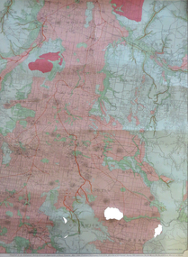
Map, Creswick, Clunes, Smeaton, Newstead, Yandoit and District, 1904, 06/1904
A coloured geological map with green and pink predominating. The shows Ascot, Creswick, Clunes, Franklinford, Miners Rest, Sandon, Smeaton, Tourello, Yandoitascot, creswick, clunes, franklinford, miners rest, sandon, smeaton, tourello, yandoit, mt moorookyle, powlett's hill, woodhouse's hill, smeaton hill, mcdonald's hill, green hill, spring hill, horse shoe hill, mt cameron, strangways, avoca forest, stanley hunter, j.w. gregory, d. mcleod, donald mcleod, daruel -
 Federation University Historical Collection
Program, Booklet, Newspaper Cuttings, Map, Mount Lyell Contour Map
Copy of a contour map of Mount Lyell, Tasmania, showing the mining areas of West Lyell, Glen Lyell. Gormanston, Cape Horn and Comstock.mount lyell, tasmania, contour map -
 Ringwood and District Historical Society
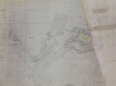
Map, Survey of Dividing Range between Yarra Yarra and Western Port - William Wedge Darke, 1843
Extract - Ringwood, Place of Many Eagles - Hugh Anderson (1974): William Wedge Darke, from Hereford, England, was a nephew of John Helder Wedge of the Port Phillip Association, who was also a surveyor. William's most important work was probably his survey of the Dividing Range and the country between the Yarra River and Western Port, completed in May 1843, and during which he made a traverse between the Mullum and Dandenong creeks along the higher ground that he labelled the "best line of road from Melbourne". This road was for many years the major route to Gippsland and to the higher country about Alexandra and Mansfield, sometimes known as White Horse Road, and now Maroondah Highway.Surveyor's relief map of features to the east of Melbourne including Yarra Yarra River, Mullum Mullum Creek, Anderson's Creek, Dandenong Creek.Transmitted to the Surveyor General with my letter of 10th May 1843 (signed) Wm Wedge Drake, Assistant Surveyor. Scale: two inches to a mile. Descriptive remarks include upstream area of Yarra River - "impassable, appears to have been formerly a lake", and to the south - "barren and scrubby swamps of the Western Port Country". Marked tracks include "best line of road from Melbourne", "track to Dandenong", "Road to Port Albert may probably be found on this range", "Best line to Upper Yarra". Several huts also marked. -
 City of Moorabbin Historical Society (Operating the Box Cottage Museum)
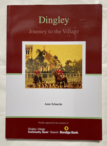
Book, Schaeche, Anne, Dingley : journey to the village
vi, 120 p. : ill. (some col.), 1 col. map, ports. Includes bibliographical references (p. 115-117) and index.non-fictiondingley, dingley village -
 Bendigo Historical Society Inc.
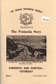
Book - STRAUCH COLLECTION: THE PENINSULA STORY BOOK 1
The Peninsula Story Book 1 Sorrento and Portsea Yesterday presented by the Nepean Historical Society, 63 pages with black and white photographs & maps.victoria, history, nepean peninsula, victoria-history-nepean peninsula- sorrento - portsea -
 Bendigo Historical Society Inc.
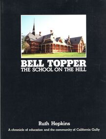
Book - STRAUCH COLLECTION: BELL TOPPER THE SCHOOL ON THE HILL
Bell Topper The School On The Hill, a chronicle of education and the community of California Gully, soft cover, 115 pages with black and white photographs & maps.Ruth Hopkinsschool, history, california gully, bendigo-schools-california gully -
 Bendigo Historical Society Inc.
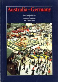
Book - STRAUCH COLLECTION: AUSTRALIA - GERMANY
Australia - Germany Two hundred years of contacts, relations and connections, soft cover 160 pages with black & white photographs, illustrations and maps.Johannes H Voigtaustralia, history, germany, australia-germany-history -
 Bendigo Historical Society Inc.
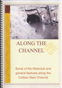
Book - ALONG THE CHANNEL
Along The Channel, some of the historical and general features along the Coliban main channel, 90 pages with black and white and colour photographs & maps.Philip Wilkincivil engineering, water supply, coliban -
 Bendigo Historical Society Inc.
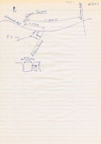
Document - DWYER COLLECTION: DRAWINGS MAPS AND PHOTOGRAPHS OF STONE WELL MAIDEN GULLY
Map on lined writing paper, showing location of stone well in Maiden Gully, on Biffins Track, off Edward Rd., Maiden Gully.bendigo, buildings, stone well map -
 Bendigo Historical Society Inc.
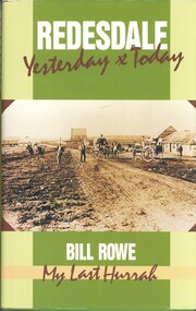
Book - REDESDALE YESTERDAY & TODAY, 1989
Redesdale Yesterday & Today, My last hurrah.Published by Bill Rowe, 256 pages, history of Redesdale, Rowe & Harrington families with photographs & maps.Bill Rowehistory, redesdale, redesdale - history, rowe family, harrington family. -
 Bendigo Historical Society Inc.
Book - RICHARD LARRITT'S MAPS, 1959
Richard Larritt's Maps with Index. Copies not owned by BHS. Copies provided by Pam Houston and John Kelly. Prepared by Carol Holsworth 2011 -
Bendigo Historical Society Inc.
Book - SANDHURST MAPS, 1870s
Sandhurst Maps Prepared by George Black Surveyor. Enlarged from original survey Field Book. Prepared by Carol Holsworth December 2011 -
Bendigo Historical Society Inc.
Book - URBAN RENEWAL PROPOSAL BOROUGH OF EAGLEHAWK
16 page spiral bound booklet ' Summary of the Urban Renewal Proposal of the Borough of Eaglehawk, December 1976' Includes proposed plan maps.Urban Renewal Authority, Melbourne -
 Bendigo Historical Society Inc.
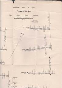
Map - STRUGNELL COLLECTION: UNDERGROUND SURVEY OF MINES, BENDIGO, 28-3-01
Map, Underground Survey of Mines, Bendigo, Shamrock Co., New Chum Line. Surveyed under the Supervision of H.Herman. Signed H.S.Whitelaw 28.3.01H.S.Whitelawmap, bendigo, shamrock co. -
Port Melbourne Historical & Preservation Society
Booklet, Open Space 2000. Bay to ranges, Caring for Port Phillip Bay. Now and into the future, 2000
"Caring for Port Phillip Bay. Now and into the future" Booklet with blue and white cover and coloured map of Port Phillip Bay and surrounding area.natural environment, maritime, port phillip bay -
Port Melbourne Historical & Preservation Society
Document - Time line, Pat Grainger, Activities and achievements during the first twenty months PMHPS, 1995
Collated by Pat GraingerActivities and achievements during the first twenty months PMHPS. A3 sheet. Reverse side has B&W map of part of Melbounesocieties clubs unions and other organisations, social activities, port melbourne historical & preservation society, pmhps -
 National Vietnam Veterans Museum (NVVM)
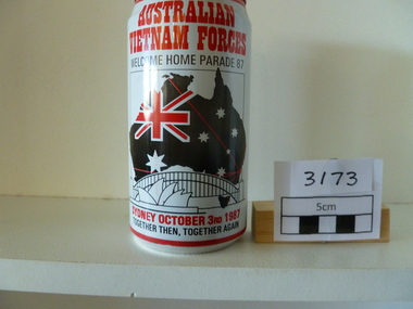
Memorabilia, Beer Can
Commemoration Australian Vietnam Forces Welcome Home Parade '87. Map of Australia with flag superimposed and picture of the Sydney Harbour Bridge and the OperaHhouse.Australian Vietnam Forces Welcome Home Parade '87, Sydney October 3rd 1987, together then, together againbeer can, welcome home parade -
 Port Melbourne Historical & Preservation Society
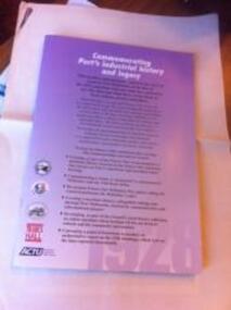
Booklet, Commemorating Port's Industrial History and Legacy, Feb 2011
Published to commemorate the anniversary of the 1928 waterfont lockout.Booklet with mauve background and black and white and dark red text. Back cover has map of "historic watersiders Port Melbourne walk"built environment, piers and wharves - princes pier, industrial disputes, allan whittaker, piers and wharves - waterside workers, maritime union of australia, mua, hogan's flat, beacon cove, james laurence murphy, george sangster -
Port Melbourne Historical & Preservation Society
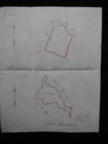
Map - Road plans for Fishermens Bend, R S Atkinson, 30 Apr 1946
CRB Map outlining road plans for Fishermens Bend and including the site of the Commonwealth Aircraft Corporation, Aerodrome, General Holdens and C.S.R.I., 1946transport - aviation and aerodrome, industry - manufacturing, fishermans bend -
 Churchill Island Heritage Farm
Map - Hand drawn map of Churchill Island, May 1939 (approx.)
Dr Harry Jenkins owned Churchill Island from 1936 to 1963 and bequeathed it to Margaret Campbell on his death. Sister Campbell had been nurse to his disabled son and wife and she lived on the island from the time of World War Two. The item was given to Arthur Evans, a family friend, on the day of the auction sale of artifacts when she sold the island, approximately 1973. This document is an example of a hand drawn map of the era, measured in links.Hand drawn map in pencil on paper of situation and measurements of land contained in Vendor's Title. Attached to solicitor's letter catalogue item No. 0108.1[signed] Hen B [bottom right hand corner]churchill island, purchase, harry jenkins, jenkins, margaret campbell, sister campbell, real estate, solicitor -
Port Melbourne Historical & Preservation Society
Plan - Melbourne and suburbs sewerage works, MMBW, 1 Jul 1908
MMBW map of Melbourne and Suburbs sewerage work to 1-7-1908. Reticulation areas in red, reticulation areas under construction in blue.engineering - canals and drainage, engineering - board of works -
Bendigo Historical Society Inc.
Archive - BENDIGO COMPENDIUM 1, 1851-1936
DVD. Bendigo Compendium 1 2 discs. In this Compendium are 10 books and one large map all relating to Bendigo and the surrounding districts. -
Bendigo Historical Society Inc.
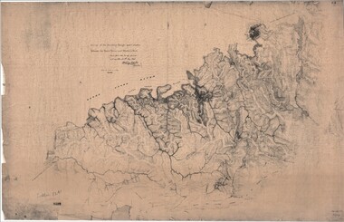
Map - SURVEY OF MINES, SANDHURST, NEW CHUM, Circa 1881
Map: Survey of Mines, Sandhurst, New Chum, Longtitudinal Section of the New Chum, reef. 2 sheets. Sheet 5 and Sheet 8map, mining plan, survey of mines , sandhurst, new chum, gold mines bendigo -
 Bendigo Historical Society Inc.
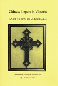
Book - CHINESE LEPERS IN VICTORIA, 2009
Chinese Lepers in Victoria, a case of charity and cultural clashes, published by Friends of the Bendigo Cemeteries Inc, 94 pages with photographs, illustrations and maps.Carol Holsworthvictoria, history, chinese lepers, victoria - chinese, chinese lepers, chinese burials, infectious diseases. -
 Bendigo Historical Society Inc.
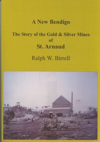
Book - A NEW BENDIGO, THE STORY OF THE GOLD & SILVER MINES OF ST ARNAUD, 2008
A New Bendigo, The Story of the Gold & Silver Mines of St Arnaud. Published by R.W.Birrell, 257 pages with photographs, illustrations & Map. Signed by the Author.Ralph.W.Birrell.book, st arnaud, st arnaud - history, mining - gold & silver. -
Bendigo Historical Society Inc.
Map - BIG 180 SHAFT POSITION, No date visible
Map: Plan showing the location of various shafts in the Victoria Hill area, hand draughted in pencil. Scale 2 Chains to 1 inchmap, bendigo, mining plan, mining , gold mines. victoria hill, big 180 -
 National Vietnam Veterans Museum (NVVM)
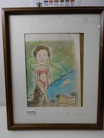
Print, Framed Cartoon, Alan R Reed, 1987 (estimated)
Framed (brown wood) caricature of Aileen Reed (wife of Alan Reed) in a red bikini against a background Map of North and South CarolinaAILEEN REED XXXXX KEPT THE HOME FIRES BURNING JUNE 1968framed picture, alan reed -
 National Vietnam Veterans Museum (NVVM)
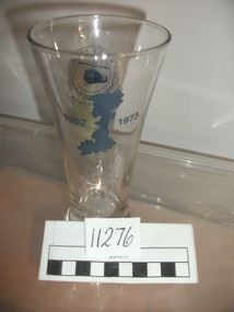
Memorabilia, Beer Glass
Beer glass with map of Vietnam 1962-1973 on back. Logo of HMAS Sydney Vietnam logistics support Veterans Association with Huey in centrebeer glass, hmas sydney