Showing 17199 items matching "bay-bridge"
-
 Hume City Civic Collection
Photograph, Early 1970s
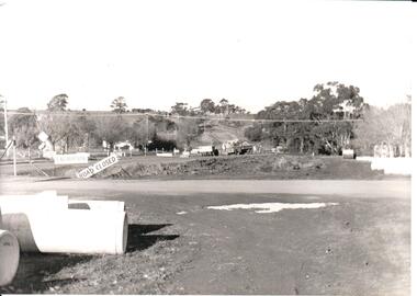
The two arch bluestone bridge which spanned the Jacksons Creek was replaced in the early 1970s with a wider double lane bridge. Dangerous curves were also taken out of the road. The area in the foreground on the RHS has now been incorporated into a public picnic area.A black and white photograph of road works taking place on the Sunbury Road over Jacksons Creek. Large concrete drain pipes are in the foreground and on the RHS of the photograph with roadwork signs on the LHS. Three trucks are at the foot of the hill.macedon street, macedon street road bridge, jacksons creek, road construction, george evans collection -
 St Kilda Historical Society
Ephemera - Entree card, Official Opening of the New Children's Welfare Centre, 1938
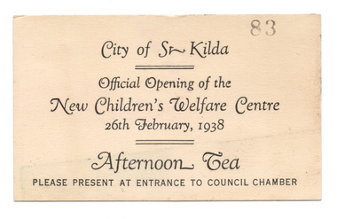
Entree card to afternoon tea at the official opening of the City of St Kilda's Children's Welfare Centre, at 171 Chapel Street, on 26 February 1938. The building was replaced in 1971 with a new Children's Centre and Maternal & Child Health Centre, which was later demolished and replaced in 2013 with the Bubup Nairm Children's Centre. Bubup means 'children' in local Boon Wurrung language, and Nairm is Port Phillip Bay: i.e. “ Children of Port Philip Bay”.Cream coloured card printed on one side in black.Stamped number 83city of st kilda, children's welfare centre -
 Geelong Naval and Maritime Museum
Souvenir, Miniature Life Buoy from the Ozone Paddle Steamer
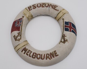
The Ozone was built in 1886 in Scotland. She was commissioned by the Bay Excursion Company and serviced Port Philip Bay from 1886 with Melbourne to Queenscliff her first run. She was involved in a number of collisions and was withdrawn from service by 1918. She was purchased by Melbourne ship breaker J. Hill in 1925 and was scuttled later that year at Indented Head. Souvenir life buoys were often made by the ships crew as an additional source of income.The souvenir life buoy is likely to have been made during the service of the Ozone paddle steamer from 1886 to 1918. It may have been made by a former crew man. The buoy is significant for its connections to the former transporation of Victorians by sea. A miniature souvenir life buoy, handmade and painted white. Cloth attached to make the stripes on the buoy and fastened by small tacs. Lettering is in red and gold paint. Decorated with painted anchors and flags."PS Ozone Melbourne"ozone, paddle steamer, bay excuersion company, indented head, geelong maritime museum, port philip bay, j. hill -
 Bendigo Historical Society Inc.
Book - STRAUCH COLLECTION: THE PENINSULA STORY BOOK 2
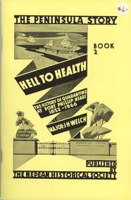
Victoria's first quarantine station was established at Hobson's Bay in 1840. However with the influx of immigrants during the gold rush, a new station was needed in Port Phillip Bay. In 1852 the "Ticonderago" arrived with 300 passengers ill with scarlet fever and typhus. They were landed at Point Nepean, Portsea, which which was known as the "Sanitary Station" until the 1880's when it's name changed to the Quarantine Station. It ceased quarantine duties in 1980.The Peninsula Story Book 2 Hell to Health the history of quarantine at Port Phillip Heads 1852 - 1966 by Major J.H.Welch, published by the Nepean Historical Society. Soft cover 96 pages with black and white photographs.Major J H Welchvictoria, history, quarantine station, australia-quarantine station-portsea vic-history-victoria -
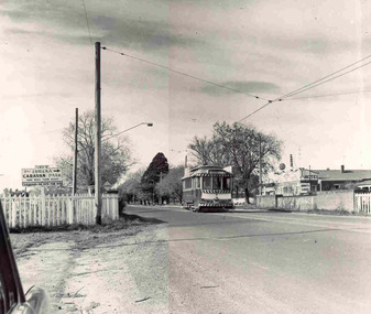 Ballarat Tramway Museum
Photograph - Ballarat tram 31, Victoria St, Buninyong Railway bridge, John Phillips, 1968
Photo of Ballarat No. 31, just after leaving Victoria St. terminus, late 1960's or early 1970s crossing over the Eureka siding railway bridge. Taken by John Phillips. Tram has destination of Gardens via Sturt St. West, Twin Lakes advertisement on the front. In the background is Meagher's Hotel with Abbots Lager and Victoria Bitter sign. On the bridge is graffiti "Smash US Imperialism". On the Ballarat side of the bridge is a sign directing travellers to the "Eureka Caravan Park". Yields information about the vicinity of the Victoria St terminus and the bridge over the Buninyong Railway line.Black and White photograph mounted on heavy cardboard backing. Has 6 Velcro dots on the rear and marks where mounting devices have been removed on the rear. Note: image scanned in two runs through a scanner, resulting in the shading in the image file. .1 - Second copy with 4 black Velcro squares and 4 dots on rear - wider view on the right-hand side with an additional pole - not scanned.trams, tramways, victoria st, eureka, twin lakes, tram 31 -
 Eltham District Historical Society Inc
Album - Photograph, J.A. McDonald, Eltham-Templestowe Road, c. 1957
Site for bridge over Yarra River looking from Eltham bank.Record of various Shire of Eltham infrastructure works undertaken during the period of 1952-1962 involving bridge and road reconstruction projects, sometimes with Eltham Shire Council Project Reference numbers quoted. It was during this period that a number of significant improvements were made to roads and new bridges constructed within the shire that remain in place as of present day (2022). In many situations, the photos provide a tangible visible record of infrastructure that existed throughout the early days of the Shire. The album was put together by or under the direction of the Shire Engineer, J.A. McDonald.infrastructure, road construction, shire of eltham, bridge construction, bridge street bridge, 1957, fitzsimons lane bridge, eltham-templestowe road -
 Eltham District Historical Society Inc
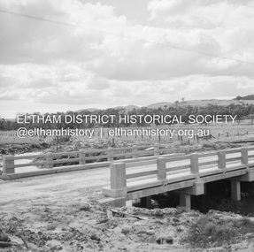
Negative - Photograph, J.A. McDonald, Old Healesville Road, Sep 1959
Paul Creek Road Prestressed slabs September 1959 Bridge finishedRecord of various Shire of Eltham infrastructure works undertaken during the period of 1952-1962 involving bridge and road reconstruction projects, sometimes with Eltham Shire Council Project Reference numbers quoted. It was during this period that a number of significant improvements were made to roads and new bridges constructed within the shire that remain in place as of present day (2022). In many situations, the photos provide a tangible visible record of infrastructure that existed throughout the early days of the Shire. The album was put together by or under the direction of the Shire Engineer, J.A. McDonald.infrastructure, shire of eltham, bridge construction, 1959-09, old healesville road, paul creek road -
 Eltham District Historical Society Inc
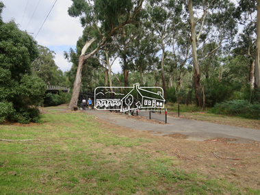
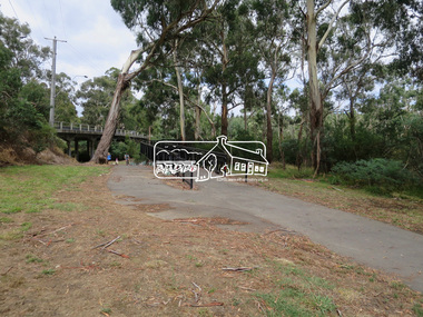
Photograph, Jim Connor, Main Road, Eltham, 14 Jan 2017
Eltham Gateway, Wingrove Park Trail and Main Road Bridge, ElthamTomorrow's history documented todayeltham, jim connor collection, main road, eltham gateway, main road bridge, wingrove park trail -
 Eltham District Historical Society Inc
Photograph, Jim Connor, Main Road, Eltham, 14 Jan 2017
Eltham Gateway, Wingrove Park Trail and Main Road Bridge, ElthamTomorrow's history documented todayeltham, jim connor collection, main road, eltham gateway, main road bridge, wingrove park trail -
 Eltham District Historical Society Inc
Photograph, Jim Connor, Main Road, Eltham, 14 Jan 2017
Eltham Gateway, Wingrove Park Trail and Main Road Bridge, ElthamTomorrow's history documented todayeltham, jim connor collection, main road, eltham gateway, main road bridge, wingrove park trail -
 Eltham District Historical Society Inc
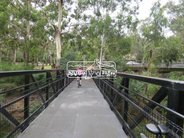
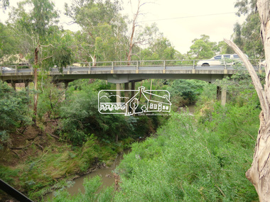
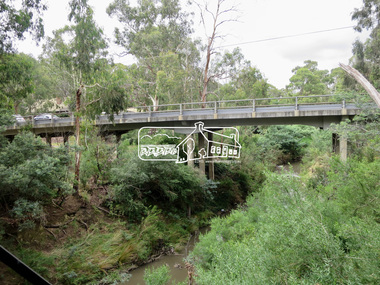
Photograph, Jim Connor, Main Road, Eltham, 14 Jan 2017
Eltham Gateway, Main Road Bridge, Eltham over the Diamond CreekTomorrow's history documented todayeltham, jim connor collection, main road, eltham gateway, main road bridge, wingrove park trail, diamond creek -
 Eltham District Historical Society Inc
Photograph, Jim Connor, Main Road, Eltham, 14 Jan 2017
Eltham Gateway, Wingrove Park Trail and Main Road Bridge, ElthamTomorrow's history documented todayeltham, jim connor collection, main road, eltham gateway, main road bridge, wingrove park trail -
 Eltham District Historical Society Inc
Photograph, Jim Connor, Main Road, Eltham, 14 Jan 2017
Eltham Gateway, Wingrove Park Trail and Main Road Bridge, ElthamTomorrow's history documented todayeltham, jim connor collection, main road, eltham gateway, wingrove park trail, eltham south, wingrove park -
 Eltham District Historical Society Inc
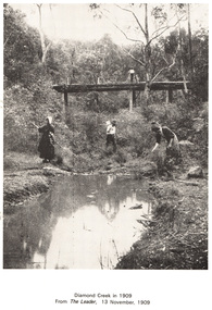
Work on paper (Sub-Item) - Photograph, Diamond Creek in 1909
People along the Diamond Creek, probably at Eltham with wooden bridge in backgrounddiamond creek, bridge -
 Greensborough Historical Society
Slide - Photograph, John Ramsdale, Slide 43
Photograph shows Bridge Inn Hotel Mernda and Mernda Mechanics InstitutePart of the John Ramsdale collection of slides and audio visual material.Colour photograph scanned from slide.No maker's marks. No caption on slide. -
 Greensborough Historical Society
Photograph - Digital image, Plenty River in Flood 2017: Graffiti, 14/12/2017
Photograph of graffiti on the Plenty River bridge, Greensborough. This flood was in December 2017.Digital copy of colour photograph.plenty river, floods, graffiti -
 Eltham District Historical Society Inc
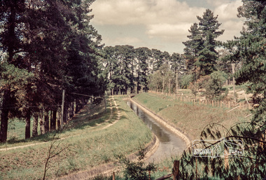
Photograph, Russell Yeoman, Maroondah Aqueduct, Research, c.1979, 1979c
Looking west, The Esplanade to the right and Ingrams Road Bridge in centre distance. Digital file only; created from original colour positive slide transparencymaroondah aqueduct, research (vic.), ingrams road, the esplanade, russell yeoman collection -
 Eltham District Historical Society Inc
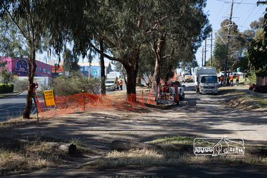
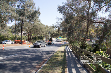
Photograph, Peter Pidgeon, Bolton Street upgrade, Eltham, 13 November, 2017, 13/11/2017
North bound lane closure, near Bridge Street, McDonalds on left. Born Digitalbolton street, bolton street upgrade, eltham, streets, mcdonalds restaurant -
 Eltham District Historical Society Inc
Photograph, Peter Pidgeon, Bolton Street upgrade, Eltham, 13 November, 2017, 13/11/2017
North bound lane closure, near Bridge Street, McDonalds on left. Born Digitalbolton street, bolton street upgrade, eltham, streets, mcdonalds restaurant -
 Eltham District Historical Society Inc
Photograph, Peter Pidgeon, Bolton Street upgrade, Eltham, 13 November, 2017, 13/11/2017
North bound lane closure, near Bridge Street, McDonalds on left. Born Digitalbolton street, bolton street upgrade, eltham, streets, middy's -
 Eltham District Historical Society Inc
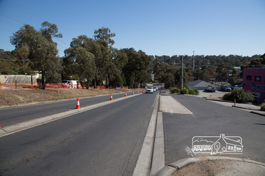
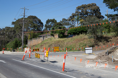
Photograph, Peter Pidgeon, Intersection with Grand Boulevard, Bolton Street upgrade, Eltham, 13 November, 2017, 13/11/2017
North bound lane closure, near Bridge Street, McDonalds on left. Born Digitalbolton street, bolton street upgrade, eltham, streets, grand boulevard -
 Eltham District Historical Society Inc
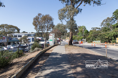
Photograph, Peter Pidgeon, Bolton Street upgrade, Eltham, 13 November, 2017, 13/11/2017
North bound lane closure, near Bridge Street, McDonalds on left. Born Digitalbolton street, bolton street upgrade, eltham, streets, eltham ridge, shops -
 Eltham District Historical Society Inc
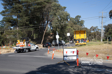
Photograph, Peter Pidgeon, Intersection with Pedersen Way, Bolton Street upgrade, Eltham, 13 November, 2017, 13/11/2017
North bound lane closure, near Bridge Street, McDonalds on left. Born Digitalbolton street, bolton street upgrade, eltham, streets, pedersen way -
 Eltham District Historical Society Inc
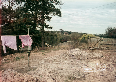
Photograph, Russell Yeoman, 66 Susan Street, Eltham, c.1965, 1965c
Looking southeast from backyard, Bridge Street visible under washing.Digital file only; created from original colour positive slide transparencyeltham, streets, susan street, eltham skate park, alistair knox park, bridge street, russell yeoman collection -
 Eltham District Historical Society Inc
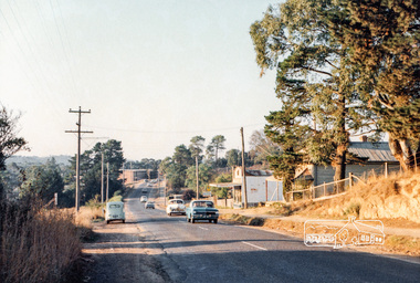
Photograph, Michael Aitken, Main Road, Eltham, c.1967, 1967c
Looking north from near Bridge Street. York Street on right.Digital file only Photo scanned from the collection of Michael Aitken on loan to EDHS, 13 Feb 2018michael aitken collection, postcards, eltham, main road, shillinglaw cottage, shillinglaw trees, york street, bakery -
 Tatura Irrigation & Wartime Camps Museum
Booklet, Nagambie Anniversary Book
Artist's impression of Nagambie's Historical streetscape and bridges over past years.Cream cover, green writing. Sketch of buildings in main street, Nagambie.nagambie tourism inc, books, history, local, nagambie streetscape, nagambie bridges -
 Forests Commission Retired Personnel Association (FCRPA)
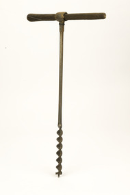
Wood Auger, With timber handle
Wood auger often used to drill holes for bridge decking spikes.Wood auger with handletimber tools