Showing 8468 items matching " 20"
-
 Eltham District Historical Society Inc
Photograph, Liz Pidgeon, Heritage Excursion; East of Eltham, 6 Sep 2014, 20 May 2017
Newsletter No. 218, September 2014 September Excursion - East of Eltham Walk In Newsletter No. 197, March 2011, there was a brief history of Crown Allotment 15 Section 5 Parish of Nillumbik (CA 15) a parcel of land of a quarter of a square mile extending from Eucalyptus Road to Reynolds Road at the eastern extremity of Eltham. From the 1940s it was known as Stokes orchard. In later years it has been subdivided for residential purposes but leaving significant areas as power line and water supply reserves and bushland reserves that are habitat for the threatened For our excursion on 6th September we intend to walk through CA 15 to a bushland reserve east of Reynolds Road. The walk will traverse the boundary between suburban Eltham and the non-urban areas to the south and east. This is a pleasant walk through residential areas and bushland. Along the way we will discuss the early and more recent history of CA 15 as well as local natural history and geology. This walk is about 3.5 km in length and will take 2 to 2.5 hours. It will start at 2pm at the corner of Eucalyptus Road, Pitt Street and Nyora Road.Born Digitaleltham east, eltham district historical society, heritage excursion, activities, nyora road, reynolds road, gum tree road reserve, diosma road, stokes orchard, eucalyptus road -
 4th/19th Prince of Wales's Light Horse Regiment Unit History Room
Signal, Chief Ordnance Officer Cairo, 20 Dec 1916
A signal sent to the Officer Commanding Det 4th Light Horse Regt in regard to re-arming, directing him to have all their rifles and Mk VI ammunition returned to the Citadel Magazine in Cairo, and be re-issued with Mk VII ammunition and rifles sighted for the Mk VII. Signed by Chief Ordnance Officer Cairo.signal, ammunition, 4th light horse -
 Emerald Museum & Nobelius Heritage Park
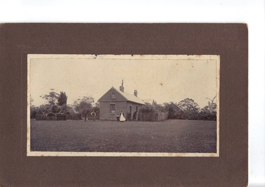
Photograph, Nightingale/Thompson Collection, 20/11/1906
Alice May (known as May) Nightingale married Frederick Sparks. They were living in Cranbourne (Lyndhurst) in 1906Thompson CollectionB/W photograph of 4 people outside brick building Cranbourne/Lyndhurst area'To Dear Mother, with love from May Nov 20th 1906may sparks nee nightingale, frederick sparks -
 Emerald Museum & Nobelius Heritage Park
Photograph, Nightingale/Thompson Collection, circa 20's
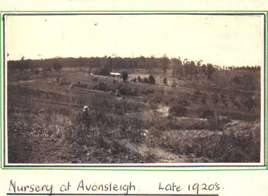
Photograph of Nightingale Nursery in Avonsleigh (belonging to Alfred George Nightingale) One of only three photographs of Nightingale Nursery, important as it augments the collection of family photographs of the Nightingale/Thompson CollectionCopy of photograph pasted on cream board. Front: handwritten 'Nursery at Avonsleigh Late 1920's. nightingale nursery, thompson -
 Emerald Museum & Nobelius Heritage Park
Photograph, Nightingale/Thompson Collection, c. 20's
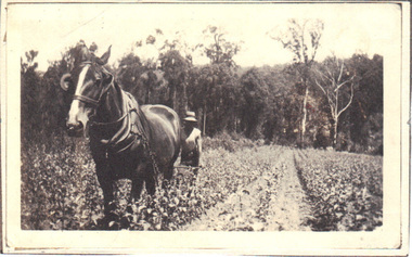
Nursery owned by Alfred George Nightingale, who originally work for Nobelius Nurseries. Nightingale Nursery sold fruit and ornamental trees.Part of the horticultural history of Emerald and surrounding districtCopy of photograph pasted on cream cardBack: Mr. C. Worell working Nightingale's Nursery, Avonsleighnightingale nursery, nightingale, thompson -
 RSL Victoria - Anzac House Reference Library and Memorabilia Collection
Diary of David Reginald Tynan, David Reginald Tynan, 30/9/1915 to 20/1/1919
Diary covers the period from embarkation in Adelaide on 11 January 1916 until part way through the return trip to Australia in January 1919.Black, card-cover notebook. WW1 diary of David Reginald Tynan (1837 - 32nd Battalion, 2nd Reinforcement).ww1, diaries, david reginald tynan, 32 battalion, 4 pioneer battalion -
 Orbost & District Historical Society
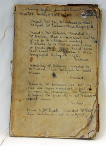
minute book, from November 20, 1928
Brodribb State School was State School 3635. It is now on the grounds of the Primary School at Orbost. The schoolopened on 1st of January 1910. It consisted of a building constructed by the parents of the children concerned. This early structure was leased to the Department which had refused requests by the parents to provide a school. This arrangement persisted until 1950. The first Head Teacher was Hubert E. Neville who served there from 1st of January 1910 to 7th of July 1910. In 1950 the Jarrahmond School building was moved to Brodribb, and provided much improved facilities for the teacher and pupils. This building remained in use until 1965 when the school closed because of insufficient numbers. The Brodribb School remained vacant until 1968, when, moved to Orbost, it became an integral part of the school in Ruskin Street Orbost. This school record is of immediate interest and value to the pupils and staff who have learned and taught in the Brodribb State School. The record also has a much wider significance, to the community in which the school is situated, as a record and research tool.Hand - written minutes of the Brodribb State School Committee. They are bound together but with no cover. The writing is in black ink.brodribb-state-school-history