Showing 1947 items matching "floods"
-
 Eltham District Historical Society Inc
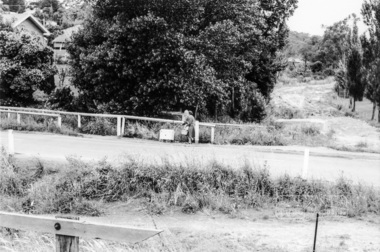
Photograph, Looking east across Main Road from just north of intersection with Diamond Street, Eltham, February 1968, Feb 1968
The watercourse passes under the road and railway at this point. Significant flash flooding occurred along this water course on Christmas Day 2011 causing significant damage to the railway line and road and flooding of Judge Book Village. In February 1968 an unknown person took a series of photos from the Eltham Hotel at Pitt Street heading north along Main Road through the shopping centre to just north of Elsa Court covering the length of the section of Main Road which was duplicated shortly thereafter. Shows the condition and environment of the streesscape of Main Road, Eltham immediately prior to the duplication between Pitt Street and Elsa Court through the shopping centre. Also shows a number of shops and businesses that operated at that time.Black and white photographduplication, eltham, main road, diamond street, bible street reserve, watercourse, drainage -
 Eltham District Historical Society Inc
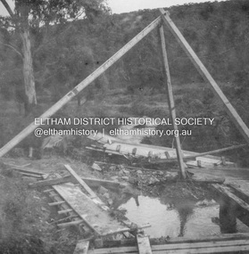
Album - Photograph, J.A. McDonald, Yarra Glen-Glenburn Road, Apr. 1956
Showing first flood debris April 1956Record of various Shire of Eltham infrastructure works undertaken during the period of 1952-1962 involving bridge and road reconstruction projects, sometimes with Eltham Shire Council Project Reference numbers quoted. It was during this period that a number of significant improvements were made to roads and new bridges constructed within the shire that remain in place as of present day (2022). In many situations, the photos provide a tangible visible record of infrastructure that existed throughout the early days of the Shire. The album was put together by or under the direction of the Shire Engineer, J.A. McDonald.infrastructure, shire of eltham, bridge construction, jehosophat creek, road construction, yarra glen-glenburn road, 1956-04 -
 Eltham District Historical Society Inc
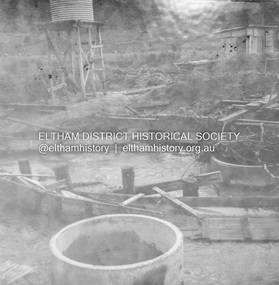
Album - Photograph, J.A. McDonald, Yarra Glen-Glenburn Road, Apr. 1956
Showing first flood debris April 1956Record of various Shire of Eltham infrastructure works undertaken during the period of 1952-1962 involving bridge and road reconstruction projects, sometimes with Eltham Shire Council Project Reference numbers quoted. It was during this period that a number of significant improvements were made to roads and new bridges constructed within the shire that remain in place as of present day (2022). In many situations, the photos provide a tangible visible record of infrastructure that existed throughout the early days of the Shire. The album was put together by or under the direction of the Shire Engineer, J.A. McDonald.infrastructure, shire of eltham, bridge construction, jehosophat creek, road construction, yarra glen-glenburn road, 1956-04 -
 Victorian Interpretive Projects Inc.
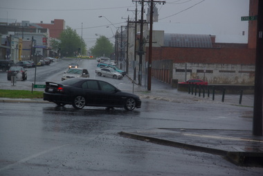
Photograph - Colour, Clare Gervasoni, Rain Inundation on the corner of Armstrong Street (south) and Eyre Streets, Ballarat, 2011, 22/10/2011
The flooded area is on the part of Ballarat known as the escarpmentrain, ballarat, flood -
 Bendigo Historical Society Inc.
Photograph - BERT GRAHAM COLLECTION: GROUP PHOTO, 1956
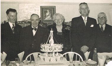
Black & white photograph, Bert Graham Collection, 5 people in photo are from left to right are; Bert Graham, Mr. & Mrs. Tully, Tom Flood, Tom Norris, the occasion was the 25th Birthday 1956, of the Bendigo East progress Association.bendigo, clubs, bendigo east progress association -
 Bendigo Historical Society Inc.
Photograph - SHELBOURNE EAST SS 1012 COLLECTION: BACK TO SHELBOURNE EAST
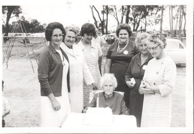
Black and white photograph of seven women. On the back: Mabel Levershia, Alma Wiegard, Pat Flood, Bill Levershia, Olive Wiegard, Jess Levershia. At back to school E. Sh. With older back to lady (Roberts) Mrs. Jean Brotherton.education, bendigo, shelbourne east -
 Lakes Entrance Historical Society
Photograph - Bullock Island, 1930c
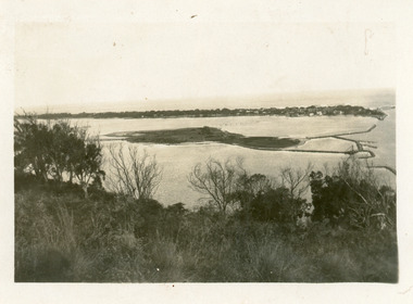
Black and white photograph of Bullock Island, showing the footbridge to the island, the rock groynes at the western end of the island, built to direct flood and tide waters to entrance. Photo taken from Kalimna Hill, scub in foreground. Lakes Entrance Victoriawaterways, islands, township -
 Bendigo Historical Society Inc.
Newspaper - JENNY FOLEY COLLECTION: HEADING HOME
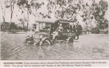
BHS CollectionBendigo Advertiser ''The way we were'' from 2003. Heading home: duck shooters return aboard the Pedersen and Gows Grocery Van in the late 1920s. The group had to contend with floods on the Old Murray Road in Huntly. The clip is in a folder.newspaper, bendigo advertiser, the way we were -
 Clunes Museum
Photograph
SUSPENSION BRIDGE WAS SWEPT AWAY IN A FLOOD ABOUT 1909.BLACK AND WHITE PHOTOGRAPH SHOWING THE SUSPENSION BRIDGE IN FOREGROUND, GOVERNMENT BRIDGE IN CENTRE.MAYBE THIS IS THE SWING BRIDGE WHICH WAS SWEPT AWAY ABOUT 1909. IT WAS ABOVE EBERHARD'S CORDIAL FACTORY.local history, photography, bridges, suspension bridge -
 Heidelberg Golf Club
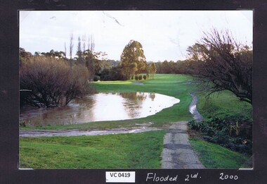
Photograph, Flooded 2nd fairway 2000: Heidelberg Golf Club, 2000
Flooded 2nd fairway 2000 at Heidelberg Golf Club.Colour photograph.hgc course, 2nd fairway -
 Heidelberg Golf Club
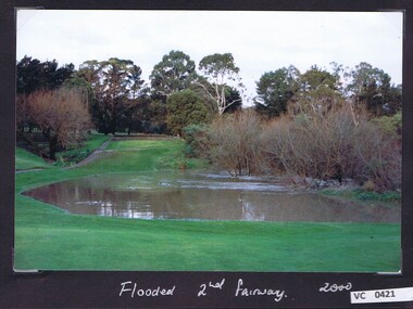
Photograph, Flooded 2nd fairway 2000: Heidelberg Golf Club, 2000
Flooded 2nd fairway 2000 at Heidelberg Golf Club.Colour photograph and caption.hgc course, 2nd fairway -
 Canterbury History Group
Photograph, 1983
Canterbury Bowling Club green flooded December 1983Opening Day 03/09/1982Coloured Photograph 15cm x 10cmbowling green, canterbury bowling club, railway lines -
 Eltham District Historical Society Inc
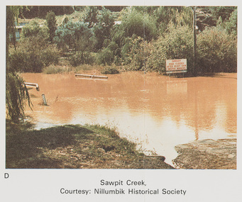
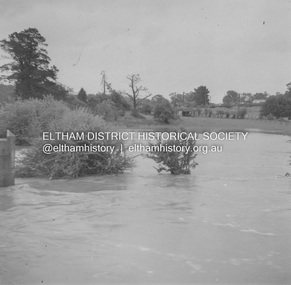
Work on paper (Sub-Item) - Photograph, Sawpit Creek in flood, Diamond Creek Township, 8 April 1977
Colour photograph. Sawpit Creek near the Diamond Creek in flood at Diamond Creek township, 8 April 1977 A road sign reads" DANGER ROAD FLOODED AFTER HEAVY RAIN OBSERVE MARKERS" Nillumbik Historical Society collectionflood, diamond creek, flooding, nillumbik historical society, give way, sawpit creek, campbell street, watkins street, danger, road sign -
 Lakes Entrance Historical Society
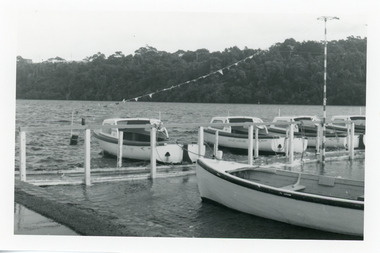
Photograph - Business, Lakes Post Newspaper, 1998c
Black and white photograph of the North Arm, showing hire boat jetty covered with flood waters caused by a high tide, four hire boats and rowing boat at jetty. House visible on top of Kalimna Heights in background. Lakes Entrance Victoriaboats and boating, tourism, businesses -
 Eltham District Historical Society Inc
Album - Photograph, J.A. McDonald, Eltham-Greensborough Road, 18 Oct. 1956
... floods ...Bridge Street Bridge Flooding on Hill’s property 18th October 1956 This view is looking west north west from the Bridge Street Bridge across the present day Eltham Skatepark. The shed visibile in the distance is directly opposite Brisbane Street where it used to run into Susan Street but now turns the corner. To the right of the shes is the site for present-dayHarris Plumbing which was formerly occupied by Sibbel Builders; to the left the site now occupied by Bunnings. At the skyline to the right of centreeline is a gap in the trees where the railway line runs. The Silver Street bridge over the railway is visible. Beware!.. our rivers are rising (1956, October 19). The Argus (Melbourne, Vic. : 1848 - 1957), p. 1. Retrieved August 24, 2022, from http://nla.gov.au/nla.news-article84392304Record of various Shire of Eltham infrastructure works undertaken during the period of 1952-1962 involving bridge and road reconstruction projects, sometimes with Eltham Shire Council Project Reference numbers quoted. It was during this period that a number of significant improvements were made to roads and new bridges constructed within the shire that remain in place as of present day (2022). In many situations, the photos provide a tangible visible record of infrastructure that existed throughout the early days of the Shire. The album was put together by or under the direction of the Shire Engineer, J.A. McDonald.infrastructure, road construction, shire of eltham, bridge construction, bridge street bridge, eltham, eltham-greensborough road, 1956-10-18, diamond creek (creek), floods, floodwater, hill property, silver street bridge -
 Eltham District Historical Society Inc
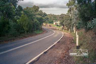
Photograph, Kangaroo Ground-Warrandyte Road, Kangaroo Ground, c.1988, 1988c
Looking southeast, Floods Road on right adjacent to bus stop.Roll of 35mm colour negative film, 7 stripsFuji 100eltham shire council, infrastructure, kangaroo ground-warrandyte road, kangaroo ground -
Tatura Irrigation & Wartime Camps Museum
Document, Our Saleyards War, 1950
Humorus poems regarding moving of saleyards in Tatura and reference to floods2 Humorous Poems and letter to the Editor (1950) copied from Tatura Guardianour saleyards war, local poems, letter, tatura, document, newspaper -
 Tatura Irrigation & Wartime Camps Museum
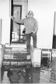
Photograph, Dosser, Bob
Dosser, Bob. Standing at his back door during floods. -
 Stawell Historical Society Inc
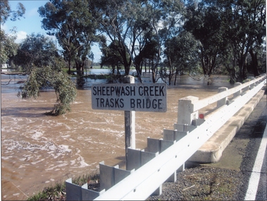
Photograph, Trasks Bridge at Sheepwash Creek at Campbells Bridge in flood 2011
Trasks Bridge Sheepwash Creek at Campbells Bridge in flood 2011.stawell shire -
 Eltham District Historical Society Inc
Newsletter, Newsletter, No. 161 March 2005
Contents: • Next meeting, guest speaker; Peter Dougherty: History in a Word • Annual General Meeting • Peter Dougherty • February Meeting and the Flood Connection • Art Streams • The 1934 Floods at Eltham by Harold Bird • Nillumbik Combined History Groups • What Else? The Shire of Eltham Historical Society was formed in October 1967. The first newsletter of the Society was issued May 1978 and has been published continuously ever since on a bi-monthly basis. With the cessation of the Shire of Eltham in late 1994, the Society's name was revised to Eltham District Historical Society and this name first appeared with issue No. 103, July 1995. The collection of the Society's newsletters provides a valuable resource on the history of the Society's activities, office bearers and committee members, guest speakers and subjects of historical interest pertinent to the former Shire of Eltham and the Eltham District.A4 photocopied newsletter distributed to membersnewsletter, eltham district historical society, shire of eltham historical society -
 Kew Historical Society Inc
Photograph - Yarra in Flood - Belford & Kilby Farms, 1903
The Yarra Valley in what was previously called North Kew, but is now East Kew, was frequently subjected to flooding. Apart from some development on higher ground, the City of Kew regularly introduced restrictions on development and the building of housing in the area because of flood levels. Panoramic photographic positive of North Kew where the Belford and Kilby Farms were located on the south side of the Yarra River. This photo is a copy of the original photo in the collection.floods -- yarra -- 1903, kew golf course, greenacres golf course -
 National Communication Museum
Photograph (item) - Floodwater pole repair, Sydney Press, June 1952
Postmaster-General's Department telegraph linesman, Chris Byrnes, received a British Empire Medal for bravery and devotion to duty for his response to the flooding at Darlington Point, New South Wales, in June 1952. As E Henderson, then Acting Director of Posts and Telegraphs recalled, the town's "communication lines were menaced by floodwaters" when the nearby Murrumbidgee River flooded. In order to retain communication to the town, Chris Byrnes, a Postmaster-General's Department employee of over 13 years, acted in the "best traditions of the service" (E Henderson). An eye witness, recorded in the Murrumbidgee Irrigator newspaper on June 27 1952, described Byrne’s efforts: "An interesting incident was witnessed when a Leeton post office linesman swam through flood waters to reach a telegraph post which had been washed out by the flood…With a rope tied around his waist, one end of which was held by other members of the linesmen's gang, Chris Byrne swam through the flood water…to release the trunk lines from the post." An eye witness, recorded in the Murrumbidgee Irrigator newspaper on June 27 1952, described Byrne’s efforts: "An interesting incident was witnessed when a Leeton post office linesman swam through flood waters to reach a telegraph post which had been washed out by the flood…With a rope tied around his waist, one end of which was held by other members of the linesmen's gang, Chris Byrne swam through the flood water…to release the trunk lines from the post."darlington point, murrumbidgee river, pmg, postmaster-general, linesman, flooding, natural disaster, emergency -
 Orbost & District Historical Society
black and white photograph, 1934
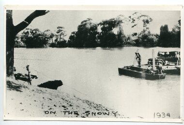
This photograph shows vehicles and people being ferried across the Snowy River during the 1934 flood. The Orbost punt was reinstated on a temporary basis following damage to the bridge. Damage estimated at £500,000 was caused by the 1934 floods in the Orbost district. This 1934 flood was devastating, destroying a section of the 1922 Orbost bridge, wrecking fences, bridges and roads, dumping silt and debris on the rich river flats and drowning cattle. The centre span of the Orbost Bridge was washed away.This is a pictorial record of the effects of the 1934 floods in the Orbost district.A large black / white photograph of a punt with a motor vehicle and people making their way across a river.on front - "On the Snowy 1934"snowy-river-orbost flood-1934 river-transport-punt -
 Greensborough Historical Society
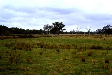
Slide - Photograph, John Ramsdale, Plenty River flood plain: Slide 95, 1990s
Photograph shows water over paddocks; Plenty River flood plain.Part of the John Ramsdale collection of slides and audio visual material.Colour photograph scanned from slide.No maker's marks. No caption on slide.plenty river, plenty river flood -
 Greensborough Historical Society
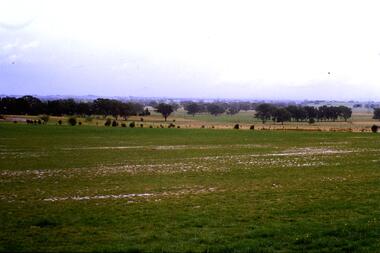
Slide - Photograph, John Ramsdale, Flood plain of the Plenty River: Slide 90, 1990s
Photograph shows farmland on the flood plain of the Plenty River, north of MerndaPart of the John Ramsdale collection of slides and audio visual material.Colour photograph scanned from slide.No maker's marks. Caption on slide "Plenty"plenty river, mernda -
 Bendigo Historical Society Inc.
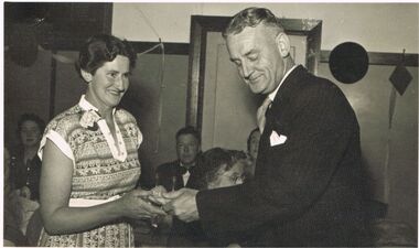
Photograph - BERT GRAHAM COLLECTION: TOM FLOOD, MRS POWELL
Black & white photograph, Bert Graham Collection, Tom Flood is presenting something to Mrs. Powell. Names on the back also Reorder o. B35/11. Kiwi Candid Photos Town Hall Pharmacy, 226 Hargreaves St., Bendigo. Phone 1467.bendigo, clubs, bendigo east progress carpet bowls -
 Bendigo Historical Society Inc.
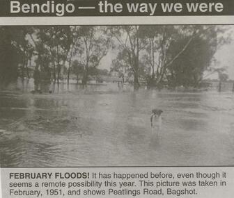
Newspaper - JENNY FOLEY COLLECTION: FEBRUARY FLOODS
BHS CollectionBendigo Advertiser ''The way we were'' from Friday, February 6, 2004. February floods: it has happened before, even tough it seems a remote possibility this year. This picture was taken in February, 1951, and shows Peatlings Road, Bagshot. The clip is in a folder.newspaper, bendigo advertiser, the way we were -
 Lakes Entrance Historical Society
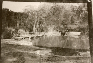
Photograph - Bridges, 1910
Also black and white identical copy 10 x 15 cm, donated by Marion Holding. 02288.1Sepia toned photograph of the old road crossing at Bunga Creek, between Lake Tyers and Lakes Entrance. It shows a rustic footbridge over waterway beside flooded road, horse and buggy with man and woman on board at edge of water. Lakes Entrance Victoriabridges, waterways -
University of Melbourne, Burnley Campus Archives
Plan, Swinburne College of Technology Ltd. Detail Survey of Willsmere Park, 1978-c.1987
Plan dated 27.10.1978 for Swinburne College of Technology Ltd. With updated handwritten notes post 1978, imcluding 1987 flood level, by T.Smith, B. Jones, B.S. Ooi, D.Ong. Photocopy of page from Melways street directory showing location of parkswinburne college of technology, willsmere park, t.smith, b. jones, b.s. ooi, d.ong, kew east -
 Bendigo Historical Society Inc.
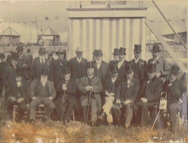
Photograph - M. ROSE COLLECTION: BENDIGO AGRICULTURAL AND HORTICULTURAL SHOW SOCIETY, circa 1905
The Bendigo Horticultural and Agricultural Show began in 1859 when a meeting was held at the Shamrock hotel to form a committee. The first competitive event was a ploughing competition held at Lockwood in June 1859.Photograph - black and white. A group of men, sitting and standing in the Bendigo Showgrounds (now known as Tom Flood Centre) looking South. On the 30th Nov.2001 James Lerk gave his opinion that the above is correct. Bendigo Agricultural and Horticultural Show Society.organization, club/society, agricultural and horticultural show, bendigo agricultural and horticultural show.