Showing 53516 items matching "hobsons-bay-city-council"
-
 Greensborough Historical Society
Magazine, Banyule Banner September 2023, 2023_09
The Banyule Banner is published by Banyule Council to advertise upcoming events in the City of Banyule and to report on past events. This edition contains reports on Banyule Carer Support Program, Spring in Banyule, Watsonia Town Square and community events.A record of events within the City of Banyule.24 pages, colour illustrations. banyule banner, banyule council -
 Greensborough Historical Society
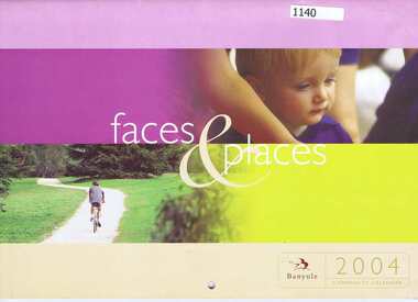
Calendar, Banyule City Council, Banyule Community Calendar 2004: faces and places, 2004_
This community calendar is distributed to residents of the City of Banyule each year. Each year it focusses on an aspect of the local community. The 2004 calendar contains photographs of local people and activities. Some council services are detailed in the back pages.The annual report is a record of the activities and services in the Banyule City Council area28 pages. Colour illustrations of local people and activities.banyule city council, banyule community calendar -
 Greensborough Historical Society
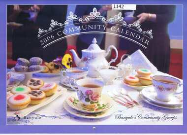
Calendar, Banyule City Council, Banyule Community Calendar 2006: Banyule's Community Groups, 2006_
This community calendar is distributed to residents of the City of Banyule each year. Each year it focusses on an aspect of the local community. The 2006 calendar contains photographs of local community groups. Some council services are detailed in the back pages.The annual calendar is a record of the activities and services in the Banyule City Council area.28 pages. Colour illustrations of local community groups.banyule city council, banyule community calendar -
 Greensborough Historical Society
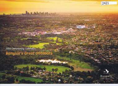
Calendar, Banyule City Council, Banyule Community Calendar 2016: Banyule's great outdoors, 2016_
This community calendar is distributed to residents of the City of Banyule each year. Each year it focusses on an aspect of the local community. The 2016 calendar contains photographs of local scenes and activities. Some council services are detailed in the back pages.The annual report is a record of the activities and services in the Banyule City Council area.28 pages. Colour illustrations. Illustrations of local scenes and landmarks.banyule city council, banyule community calendar -
 Kew Historical Society Inc
Document - Urban Planning Document, City of Kew, City of Kew : Minimum Size of Allotment Required, 1945-1955
A document outlining the relevant by-laws produced by the City Of Kew to regulate the minimum size of allotments in Barkers Road, Burke Road, Cotham Road, Glenferrie Road and Studley Park Road, as well as in other streets more generally. The by-laws specify the size of allotments in which single unit dwellings, attached houses and maisonettes, and flats could be built. In the ‘main streets’ a minimum land area for single unit dwellings was 8,100 square feet, with an average frontage of 60’ and a depth of 135’. In other streets this was reduced to an overall size of 6,250 square feet, with an average dimensions of 50’ x 125’. In specifying the land area required by flats, different sizes were regulated for the construction of between two and six flats. Six flats at the time when the regulations were passed must have been the upper limit permitted. Understanding the size of land listed in imperial measurements can be a challenge. Within Australia, the so-called quarter acre block was approximately 11,000 square feet. Those specified in the by-laws would appear to be smaller. The document was pasted on the reverse of a subdivision plan in the collection.This is a rare (undated) document produced by the City of Kew defining how subdivision within the municipality should occur. The document was created to constrain unbridled speculation in subdivisions in the various parts of Kew and East Kew.Undated typed document, issued by the City of Kew (1921-1994) indicating the minimum size of allotment required in Barkers Road, Burke Road, Cotham Road, Glenferrie Road and Studley Park Road. The document is mounted on board and waterstained. It was presumably used by a real estate agent. [Formerly catalogued as MAP.0066].city of kew - by-laws and regulations, subdivisions - kew - studley park -
 Kew Historical Society Inc
Archive (Sub-series) - Subject File, Boroondara, City of - Community Directories, 1994
City of BoroondaraReference, Research, InformationKHS OrderSubject file containing publications listing community services and groups within the City of Boroondara published in the 1990s. There are two editions of the so-called ‘Boroondara Book’, with amendments.city of boroondara - community directoriescity of boroondara - community directories -
 Greensborough Historical Society
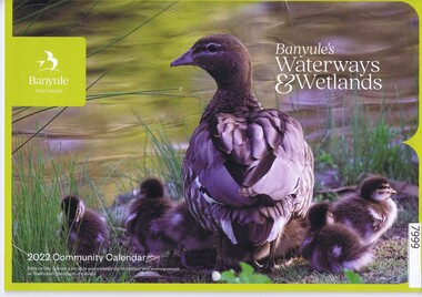
Calendar, Banyule City Council, Banyule Community Calendar 2022: Banyule's Waterways & Wetlands, 2022
This community calendar is distributed to residents of the City of Banyule each year. Each year it focusses on an aspect of the local community. The 2022 calendar contains action photographs of local waterways and wetlands. Some council services are detailed in the back pages.The annual report is a record of the activities and services in the Banyule City Council area.30 pages. Colour illustrations. Illustrations of local waterways and wetlands. banyule city council, banyule community calendar, rivers, wetlands -
 Greensborough Historical Society
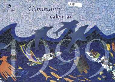
Calendar, Banyule City Council, Banyule Community Calendar 1999, 1999_
This community calendar is distributed to residents of the City of Banyule each year. Each year it focusses on an aspect of the local community. The 1999 calendar contains photographs of artwork by local school students. Some council services are detailed in the back pages.The calendar is a record of the activities and services in the Banyule City Council area.28 pages. Colour illustrations of artwork by local school students.banyule city council, banyule community calendar -
 Greensborough Historical Society
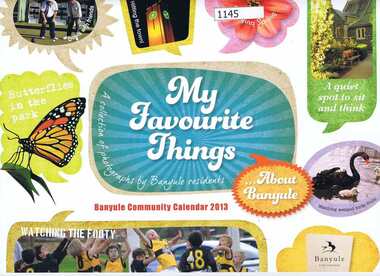
Calendar, Banyule City Council, Banyule Community Calendar 2013: My favourite things; a collection of photographs by Banyule residents, 2013_
This community calendar is distributed to residents of the City of Banyule each year. Each year it focusses on an aspect of the local community. The 2012 calendar contains photographs of the Banyule area by local residents. Some council services are detailed in the back pages.The annual calendar is a record of the activities and services in the Banyule City Council area.28 pages. Colour illustrations of Banyule scenery taken by local residents.banyule city council, banyule community calendar -
 Greensborough Historical Society
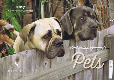
Calendar, Banyule City Council, Banyule Community Calendar 2017: celebrating Banyule's pets, 2017_
This community calendar is distributed to residents of the City of Banyule each year. Each year it focusses on an aspect of the local community. The 2017 calendar contains photographs of pets from the local area. Some council services are detailed in the back pages.The annual report is a record of the activities and services in the Banyule City Council area.28 pages. Colour illustrations. Illustrations of local sporting clubs in pets from the local area.banyule city council, banyule community calendar -
 Greensborough Historical Society
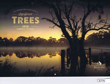
Calendar, Banyule City Council, Banyule Community Calendar 2018: Celebrating Banyule's significant trees, 2018_
This community calendar is distributed to residents of the City of Banyule each year. Each year it focusses on an aspect of the local community. The 2018 calendar contains photographs of significant trees in the Banyule area. Some council services are detailed in the back pages.The annual calendar is a record of the activities and services in the Banyule City Council area.28 pages. Colour illustrations of significant local trees.banyule city council, banyule community calendar, trees - banyule -
Whitehorse Historical Society Inc.
Pamphlet, Special Commemorative Council Meeting, 1/11/1994 12:00:00 AM
City of Nunawading economic strategy 1993-9Agenda for special commemorative meeting of the Council of the City of Nunawading, Monday 28 November 1994. Includes details of councillors of the Shire of Blackburn and Mitcham and the City of Nunawading, 1925 - 1994. This was the final meeting of the City of Nunawading Council prior to amalgamation.City of Nunawading economic strategy 1993-9city of nunawading., councillors, shire of blackburn and mitcham -
 Melbourne Tram Museum
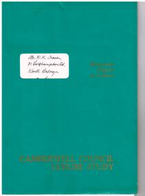
Document - Report, City of Camberwell, "City of Camberwell - Community Transport Services Discussion Paper", May. 1980
Report - 60 pages clip bound with green card covers, titled "City of Camberwell - Community Transport Services Discussion Paper" with a covering letter to Ken Craven dated 30/5/1980 and a covering note back from a friend after reading the report. Report looks at transport in the City area, the problems, users, community use, alternatives, accessibility. Has maps, tables, table of contents and appendices.trams, tramways, public transport, camberwell, bus services, community -
 Greensborough Historical Society
Calendar, Banyule City Council, Banyule Community Calendar 2014: Sporting Heroes, 2014_
This community calendar is distributed to residents of the City of Banyule each year. Each year it focusses on an aspect of the local community. The 2014 calendar contains action photographs of local sporting activities and teams. Some council services are detailed in the back pages.The annual report is a record of the activities and services in the Banyule City Council area.28 pages. Colour illustrations. Illustrations of local sporting clubs in action. banyule city council, banyule community calendar -
 Greensborough Historical Society
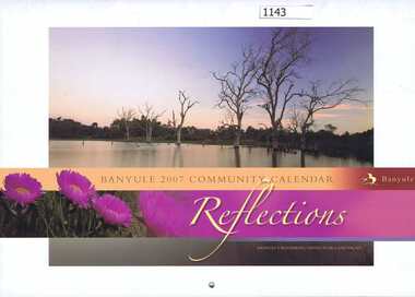
Calendar, Banyule City Council, Banyule Community Calendar 2007: Reflections - Banyule's waterways, native flora and fauna, 2007_
This community calendar is distributed to residents of the City of Banyule each year. Each year it focusses on an aspect of the local community. The 2007 calendar contains photographs of Banyule's waterways, native flora and fauna. Some council services are detailed in the back pagesThe annual calendar is a record of the activities and services in the Banyule City Council area28 pages. Colour illustrations of Banyule's waterways, native flora and faunabanyule city council, banyule community calendar -
 Greensborough Historical Society
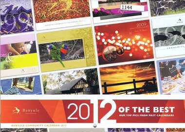
Calendar, Banyule City Council, Banyule Community Calendar 2012: 12 of the best; our top picks from past calendars, 2012_
This community calendar is distributed to residents of the City of Banyule each year. Each year it focusses on an aspect of the local community. The 2012 calendar contains photographs taken from previous Community Calendars. Some council services are detailed in the back pages.The annual calendar is a record of the activities and services in the Banyule City Council area.28 pages. Colour illustrations from previous community calendars.banyule city council, banyule community calendar -
 Melbourne Tram Museum
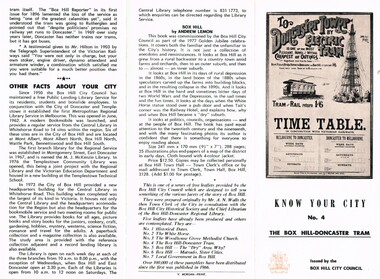
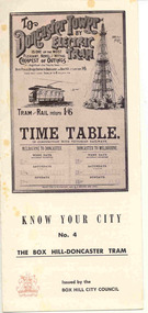
Pamphlet, City of Box Hill, "Know your City No. 4 - The Box Hill - Doncaster Tram", mid 1980's
Two colour pamphlet describing the history of the Australia's first electric tram service - Box Hill to Doncaster in 1889. Pamphlet folded into 3, with 1 photo and copy of timetable. Includes notes on brochure preparation and other facts about City. Part of "Know your City No. 4 - The Box Hill - Doncaster Tram" Has a list of other pamphlets on the City, Andrew Lemon's book "Box Hill". Printed on off-white paper, with a reddish brown colour for headings and photo background. Three copies held. See Reg Item 2146 for a full set of these pamphlets - earlier versions. See Reg Item 2534 for an A3 and larger version of .2.trams, tramways, box hill, centenary, exhibitions, tramways, doncaster, city of box hill -
 Ballarat Tramway Museum
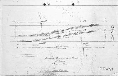
Drawing - Brisbane City Council Tramway Trackwork drawings
Prepared by the City of Brisbane for the design of trackworkYields information on the design of trackwork.Set of nine City of Brisbane Tram Track drawings .1 - PPW91 - Standard Crossover left hand - 4'6" between tracks .2 - PPW2450 - Data for British Standard Crossings .3 - PPW 241 - Data for British Standard Lateral Switches .4 - PPW 463 - Concrete Track Construction is 102.73lb rail. .5 - PPW 501 - ditto for AS 82lb rail and other rails .6 - Not numbered - Concrete roads when using T rail sleepers .7 - PPW 575 - 150' radius RH crossover - 5' between tracks .8 - PPW 576 - 150' radius RH Crossover - 4'6" between tracks .9 - PPW 577 - 150' radius LH Crossover - 5' between tracks - 14/12/1948trackwork, points, switches, bcc transport, tramways -
 Greensborough Historical Society
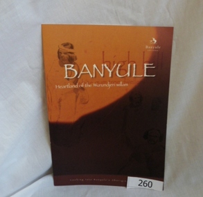
Booklet, Banyule City Council, Banyule: Heartland of the Wurundjeri willam, 2011_
This booklet "looks into Banyule's Aboriginal heritage" by detailing some of the history of the Wurundjeri willam clan, including William Barak. Illustrations are from La Trobe Picture Collection, State Library of Victoria. Booklet prepared for Banyule City Council by Phillippa Sutherland.6 pages, colour illustrations. Cover is mainly orange with line drawings courtesy of the Rare Book collection State Library of Victoria. 2 copiesbanyule, wurundjeriwillam, william barak, phillippa sutherland -
Greensborough Historical Society
Magazine, Banyule City Council, Banyule Banner July 2024, 2024_07
The Banyule Banner is published by Banyule Council to advertise upcoming events in the City of Banyule and to report on past events. This edition contains reports on local playgrounds, protection for trees on private property, Watsonia Town Square and the start of work on the new Rosanna Library.A record of events within the City of Banyule.24 pages, colour illustrations. banyule banner, banyule council -
Broadmeadows Historical Society & Museum
Administrative record - Annual Report, Phillip Shannihan, City of Broadmeadows Annual Report 1994, 1993-94
Annual Report of last year City of Broadmeadows existed.32pp, Paperboard Stapled Cover. Ex library has Moreland City Library labels + numbers. Stamps. Insert of Annual Financial Report.non-fictionAnnual Report of last year City of Broadmeadows existed.broadmeadows, 1994, annual report -
 Greensborough Historical Society
Booklet, Emily Fitzgerald et al, Welcome to Wurundjeri country: the Wurundjeri history of Yarra, 2014
Brief history of the Wurundjeri-willam people of the area now known as the City of Yarra, from pre-settlement times to the present.44p., paperback, printed in black and orange, illus.wurundjeri willam, city of yarra, aborigines - victoria -
 Hume City Civic Collection
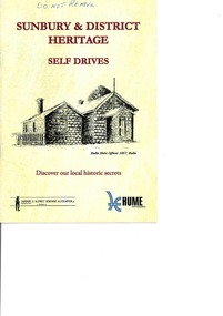
Booklet - Self Drive booklet, Sunbury & District Heritage Association, Sunbury & District Heritage SElf Drives, 2006
A paperback booklet featuring 4 drives explaining historic and natural sites in the Sunbury area.A 26 page booklet with cream cover and pages featuring 4 self drives that are recommended in the Sunbury district. There are illustrations and text throughout the bookletnon-fictionA paperback booklet featuring 4 drives explaining historic and natural sites in the Sunbury area.sunbury, self drive booklet, heritage, + -
 Hume City Civic Collection
Photograph, Hume City Council, April 2015
Joan Huston and Rosa McCall, members of the Sunbury & bDistrict Heritage Association were attending an afternoon tea organised by Hume City Council that was held at the Sunbury Bowling Club in April 2015. The people who attended the function were recipients of local community grants. A coloured photograph of three ladies standing at a table which has been set out with food.joan houston, rosa mccall, sunbury & district heritage association inc, community grants, hume city council, afternoon tea -
 Victorian Interpretive Projects Inc.
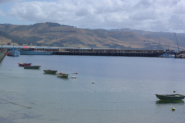
Photograph - Colour, Clare Gervasoni, Apollo Bay Marina, 2013, 27/01/2013
The image show the number and typs of boats moored at Apollo Bay Marina in late January 2013.Two colour photgraphs showing the marina at Apollo Bay from the pier. .1) a number of anchored boats .2) a number of fishing vessells at the marina. apollo bay, boat, vessel, fishing -
 Ballarat Tramway Museum
Pamphlet, City of Box Hill, 351 - "Know your city No. 1, The Box Hill - Doncaster Tram" 351.1 - "Know your City No. 4, The Box Hill - Doncaster Tram", Aug. 1974
Two colour pamphlet describing the history of the Australia's first electric tram service - Box Hill to Doncaster in 1889. Pamphlet folded into 3, with 1 photo and copy of timetable. Includes notes on brochure preparation and other facts about City. Printed on off-white paper, with a reddish brown colour for headings and photo background. On rear noted as "4th edition 8/74 10M-VM". Folds into three. (Image btm351i1) 351.1 - similar to above, but without 4th edition notes. Gives a list of the other pamphlets and notes Andrew Lemon's book on Box Hill published in 1977. (Image btm351i)trams, tramways, box hill, city of box hill, doncaster -
![Mount St. George, Addis Bay / [by] Nicholas Caire, circa 1876](/media/collectors/550653872162f11fb04854aa/items/57833f9fd0cdd1176c6828f5/item-media/57833ffdd0cdd1176c685980/item-fit-380x285.jpg) Kew Historical Society Inc
Kew Historical Society IncPhotograph, Anglo-Australasian Photographic Company, Mount St. George, Addis Bay, c. 1876
Nicholas Caire was born on Guernsey in the Channel Islands in 1837. He arrived in Adelaide with his parents in about 1860. In 1867, following photographic journeys in Gippsland, he opened a studio in Adelaide. From 1870 to 1876 he lived and worked in Talbot in Central Victoria. In 1876 he purchased T. F. Chuck's studios in the Royal Arcade Melbourne. In 1885, following the introduction of dry plate photography, he began a series of landscape series, which were commercially successful. As a photographer, he travelled extensively through Victoria, photographing places few of his contemporaries had previously seen. He died in 1918. Reference: Jack Cato, 'Caire, Nicholas John (1837–1918)', Australian Dictionary of Biography.An original, rare photograph from the series 'Views of Victoria: General Series' by the photographer, Nicholas Caire (1837-1918). The 60 photographs that comprise the series were issued c. 1876 and reinforced a neo-Romantic view of the Australian landscape to which a growing nationalist movement would respond. Nicholas Caire was active as a photographer in Australia from 1858 until his death in 1918. His vision of the Australian bush and pioneer life had a counterpart in the works of Henry Lawson and other nationalist poets, authors and painters.‘Mount St. George, Addis Bay’ : Views of Victoria (General Series) No.56 : Albumen silver photograph | Photo on card with Title and Description on reverse | Mounted 24 x 30 cm; Photo 12 x 17 cm.On Reverse: ‘Addis Bay is situated to the north-east of Appollo Bay, and very near Cape Patten. This mountain is 6,000 feet high, and commands one of the finest views on the Cape Otway Ranges. The ascent is a somewhat difficult one, but visitors to this locality not unfrequently make this a favourite outing.’nicholas caire (1837-1918), landscape photography -
Broadmeadows Historical Society & Museum
Souvenir - Commemorative spoon, Stokes, c. 1981-82
Commemorative spoon 125th anniversary.Commemorative SpoonWhite metal commemorative spoon, with enameled City of Broadmeadows logo.Enameled City of Broadmeadows logo with "City of Broadmeadows 125th Anniversary" around logo.city of broadmeadows, anniversary -
 Flagstaff Hill Maritime Museum and Village
Document - Navigation Chart, Admiralty Office, Lady Bay and Warrnambool Harbour, 03/04/1871
This Chart titled “Lady Bay and Warrnambool Harbour” was surveyed by Nav. Lieut. H.J. Stanley, of Britain's Royal Navy, in 1870 and printed in April 1871. The chart was made before the Warrnambool Breakwater was built (construction had begun in 1874 and was completed in 1890). The chart includes Directions for entering Lady Bay, Warrnambool Harbour. These are "Vessels entering Warrnambool Harbour must bring the Red Light in sight and steer in with it in line with the upper white Light bearing North, until the Green Light on the Jetty is opened, when steer towards it and anchor. The best anchorage is in 2 ¼ fms [fathoms)] of water, about a cable from ledge off Breakwater rock. Or where convenient, according to draught of water, only endeavouring to anchor as close as possible to Breakwater rock. It is not safe to enter or leave the Harbour in south westerly or Southerly gales.” This chart is significant for its strong connection to the maritime history of Warrnambool Harbour and Lady Bay, and eventually to the Warrnambool Breakwater. The Warrnambool Breakwater is registered as a place of significance on the Victorian Heritage Database (VHR H2024). A copy of the same chart was used to plan several submissions for future changes to the jetty and breakwater. The chart is a historical record of structures existing in 1870; the Warrnambool Jetties, Lady Bay, the leading lights (lighthouses), streets, roads, bridges and many buildings. It also shows the lay of the land and seabed.Canvas chart of Australia, South Coast, Victoria Title: Lady Bay and Warrnambool Harbour Surveyed by Nav. Lieut. H.J. Stanley, R.N., 1870. Magnet Variation, 1870 Published April 3, 1871, by the Admiralty, London. Directions for vessels entering Warrnambool Harbour are printed on the chart. The chart has a lacquer or seal over it.Top of chart has logo "HYDROGRAPHER OFFICE" "Price Eighteen Pence". "Engraved by Edward Weller" Along bottom of Chart: “London… Published at the Admiralty, 3rd April 1871, under the Superintendence of Rear Admiral G.H. Richards, F.R.S. Hydrographer, Corrections July 71” Bottom of chart “Australia South Coast Victoria Lady Bay and Warrnambool Harbour. 2494”flagstaff hill, warrnambool, chart of lady bay warrnambool 1870, warrnambool harbour, cartography, navigation, warrnambool breakwater, 1871, australia – south coast / victoria, lady bay, 1870, nav. lieut. h.j. stanley, r.n, directions for entering warrnambool harbour, hydrographer office, rear admiral g.h. richards, edward weller, port of warrnambool, flagstaff hill maritime museum & village, maritime museum, maritime village, shipwreck coast, map, chart, navigation chart, admiralty chart, breakwater, jetty, pier, vhr h2024 -
 Box Hill Historical Society
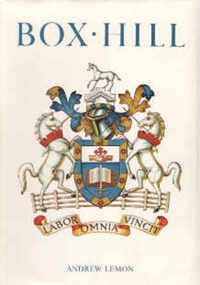
Book, Lemon, Andrew, Box Hill, 1978
History of Box Hill from its beginning to 1978. Index; photos; plan of Box Hill in 1905 on endpapers; Members of Council in order of election. Presentation Edition: #15box hill