Showing 71299 items matching "melbourne street"
-
 Eltham District Historical Society Inc
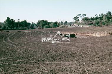
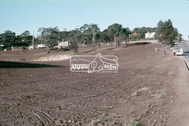
Slide - Photograph, Army Map, Yan Yean (Part, 1934), c.Aug. 1990
Part of a presentation, "Roads and Byways of the Shire of Eltham", by Russell Yeoman to the 12 September 1990 Society meeting. Slides shown included copies of old photos and recent images ranging from the suburban streets of Eltham and Montmorency to the mountain roads of Kinglake. In the byways category are views of some iof the Shire's bicycle paths including then recently completed sections of the Main Yarra Trail at Lower Plenty.35mm colour positive transparency (1 of 37) Mount - Agfachrome Agfa CS System black 8 dotsinfrastructure, roads, map, shire of eltham -
 Eltham District Historical Society Inc
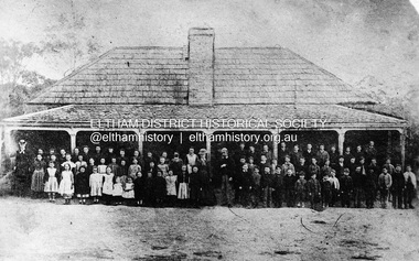
Negative - Photograph, Eltham State School No. 209, Dalton Street, Eltham, c.1990 (1864)
Negative copy of copy by Yeoman and Co. of original c.1864 photograph. The first Eltham State School building with school group. David Clarke (Head Teacher) and his sister, Catherine are standing in the centre of the group. Built with stone walls and wooden shingles on the roof. This was the first State School building which was built in 1856 and replaced with a new building in 1875 after the stone walls collapsed outwards. Published in Nillumbik Maii; Edition 20, 13 Sep Harry Gilham notes: - Believed to be the National School at Eltham on the Dalton Street site 1857-1874 - £220 cost; £110 National Board and £110 local patrons - 40' (38'6") x 16' x 10' walls - David Clark Head Teacher and Catherine Clark, Sewing Mistress - Its building materials came from the western edge of the site where sandstone removed is still evident and children are protected from the site by the fences of 1994 of wire mesh and palings beside the residence - School had 7' verandah added in 1861 - Clarks used half the building as a residence from 1857-1866 when enrollments required use of the whole building - The Clarks moved to then Shoestring residence in Metery Road adjacent to the end of the school ovalRoll of 35mm Black and White negative film, 3 strips, (2 of 14 frames)Film - Agfa Ortho 25catherine clarke, class photo, dalton street, david george clark, eltham, eltham state school no. 209, school group, national school -
 Eltham District Historical Society Inc
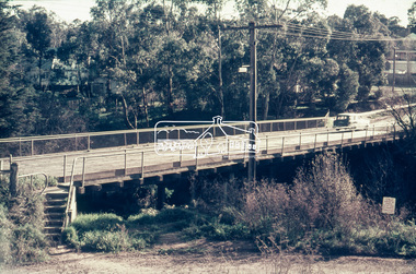
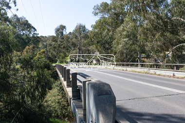
Slide - Photograph, Russell Yeoman, Para Road / Carter Street Bridge over the Plenty River, Briar Hill, c.Jul 1969
Bridge over the Plenty River at Briar Hill before widening and alterations. The Plenty River at Briar Hill represented the boundary between the Shire of Eltham and the Shire of Diamond Valley. The bridge was known as the Carter Street Bridge as prior to 1969 Para Road, Briar Hill became Carter Street, Greensborough across the river. It was at this time that the name Para Road was continued and replaced Carter Street.35mm colour positive transparency blue Agfacolour Service plastic mount1969-07, briar hill, carter street bridge, para road, para road bridge, shire of diamond valley, shire of eltham, bridge, plenty river, shire of eltham pioneers photograph collection -
 Eltham District Historical Society Inc
Slide - Photograph, Cressy Street, Montmorency, 1986
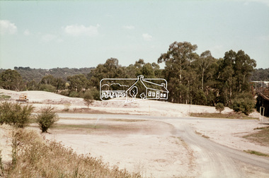
... melbourne infrastructure roads Cressy Street Montmorency Process ...35mm colour positive transparency (1 of 7) Mount - Kodak Kodachrome CardProcess Date JUN 86Minfrastructure, roads, cressy street, montmorency -
 Eltham District Historical Society Inc
Slide - Photograph, Sackville Street, Montmorency, c.Mar. 1985
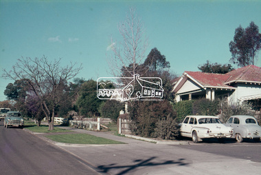
... melbourne Sackville Street, Montmorency (part of the Quinn Estate ...Sackville Street, Montmorency (part of the Quinn Estate) looking towrds Bolton Street from outside No. 102, c. Mar. 198535mm colour positive transparency (1 of 15) Mount - Kodak Kodachrome Cardinfrastructure, roads, montmorency, quinn estate, sackville street -
 Eltham District Historical Society Inc
Photograph, Sackville Street, Montmorency, 15/10/1990
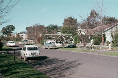
... melbourne Sackville Street, Montmorency, 15 October 1990 ...Sackville Street, Montmorency, 15 October 1990Colour photographinfrastructure, shire of eltham, montmorency, sackville street, quinn estate, roads -
 Eltham District Historical Society Inc
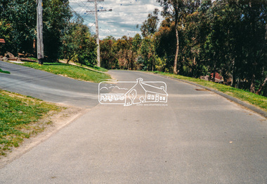
Slide - Photograph, Main Road at Bridge Street, Eltham, c.May 1988
Main Road at Bridge Street, Eltham, c.May 198835mm colour positive transparency (1 of 36) Mount - Kodak KodachromeProcess Date MAY 88Mbridge street, eltham, infrastructure, main road, roads -
 Eltham District Historical Society Inc
Slide - Photograph, 728 Main Road, cnr of Brougham Street, Eltham, May 1988, c.May 1988
728 Main Road, cnr of Brougham Street, Eltham, May 1988. Former Police House (1859) which at time of photo was the offices of the Shire of Eltham Parks and Environment. This photo was taken prior to the building of the replica Police Station to serve as a lunch room. The origional timber weatherboard building had been relocated around the rear of the residence years earlier but had since been demolished due to termite infestation. Ten years later (1998) the residence was made available by Nillumbik Shire Council for occupation by the Eltham District Historical Society (former Shire of Eltham Historical Society) to be used as their Local History Centre.35mm colour positive transparency (1 of 36) Mount - Kodak KodachromeProcess Date MAY 88Meltham, infrastructure, main road, brougham steet, eltham justice precinct, local history centre, parks and environment, police residence, shire of eltham -
 Eltham District Historical Society Inc
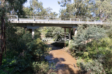
Photograph, Peter Pidgeon, Main Road Bridge, Eltham South, 8 Sep. 2021
The original timber bridge over the Diamond Creek was built around 1840. It was destroyed by floodwaters in October 1923. A temporary bridge was rigged up but further damaged in April 1924. A new concrete bridge was built and opened in October 1926. The bridge decking was widened along with Main Road to Dalton Street by the Road Construction Authority in 1984., The uygraded bridge was opened in October 1984, 78 years after its original opening. Born Digitaleltham south, main road bridge, diamond creek (creek) -
 Eltham District Historical Society Inc
Photograph, Peter Pidgeon, Manna Gum, Main Road Bridge, Eltham South, 8 Sep. 2021
This significant tree located near the Main Road Bridge over the Diamond Creek at Eltham dates back to approximately 1870-1880. Though dead now, its trunk has been left as a wildlife habitat. The original timber bridge over the Diamond Creek was built around 1840. It was destroyed by floodwaters in October 1923. A temporary bridge was rigged up but further damaged in April 1924. A new concrete bridge was built and opened in October 1926. The bridge decking was widened along with Main Road to Dalton Street by the Road Construction Authority in 1984., The uygraded bridge was opened in October 1984, 78 years after its original opening.These trees are not only significant for the natural environment but also present a navigational beacon back in time as the environmental landscape is developed around them.Born Digitaleltham south, main road bridge, manna gum, significant tree -
 Eltham District Historical Society Inc
Photograph, Peter Pidgeon, Manna Gum, Main Road Bridge, Eltham South, 8 Sep. 2021
This significant tree located near the Main Road Bridge and Diamond Creek Trail footbridge over the Diamond Creek at Eltham dates back to the early 1900s. The original timber bridge over the Diamond Creek was built around 1840. It was destroyed by floodwaters in October 1923. A temporary bridge was rigged up but further damaged in April 1924. A new concrete bridge was built and opened in October 1926. The bridge decking was widened along with Main Road to Dalton Street by the Road Construction Authority in 1984., The uygraded bridge was opened in October 1984, 78 years after its original opening.These trees are not only significant for the natural environment but also present a navigational beacon back in time as the environmental landscape is developed around them.Born Digitaleltham south, main road bridge, manna gum, significant tree, diamond creek trail -
 Eltham District Historical Society Inc
Slide, Pryor Street, Eltham, 25 Jul 1973
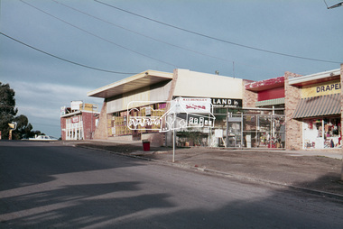
Looking east across Pryor Street towards the Eltham Police Station. The Police purchased the residence at 23 Pryor Street in 1959 to move from the old town centre of the late 1800s to be closer to the new town centre that shifted as a result of the railway opening in 1901. The residential house was renovated to Police requirements and operations commenced from this location in 1961. Diretly opposite and to the left of the Police Station is now a busy shopping centre car park.35 mm colour positive transparency Mount - Agfacolor Service (Blue)eltham, eltham police station, pryor street, streets, houses -
 Eltham District Historical Society Inc
Slide, Pryor Street carpark, Eltham, 25 Jul 1973
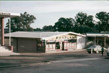
View through the Pryor Street carpark which ran between Luck and Pryor streets. The original Safeway supermarket is visible in the background off Pryor Street. Cars in the immediate vicinity are a Morris 100, and HD/HR Holden wagon and an HQ Holden35 mm colour positive transparency Mount - Agfacolor Service (Blue)eltham, pryor street, carparks, hd holden, hq holden, morris 1100, safeway supermarket, shopping centre, streets, hr holden, luck street -
 Eltham District Historical Society Inc
Slide, Luck Street, Eltham, 25 Jul 1973
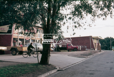
Shows the entrance to the carpark which ran through to Pryor Street. A Chrysler S series Valiant at the entrance35 mm colour positive transparency Mount - Agfacolor Service (Blue)eltham, carparks, shopping centre, streets, valiant s, luck street, houses -
 Eltham District Historical Society Inc
Slide, Luck Street, Eltham, 25 Jul 1973
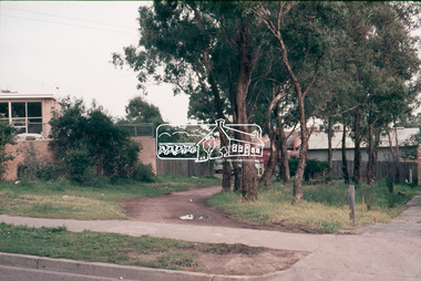
View looking east up Luck street from opposite the carpark entrance35 mm colour positive transparency Mount - Agfacolor Service (Blue)eltham, shopping centre, streets, luck street, houses -
 Eltham District Historical Society Inc
Slide, Briar Valley Reserve Playground, 11 Porter Street, Briar Hill, 25 Jul 1973
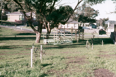
Looking east through the playground to Porter Street35 mm colour positive transparency Mount - Agfacolor Service (Blue)briar hill, playground, briar valley reserve playground, 11 porter street -
 Eltham District Historical Society Inc
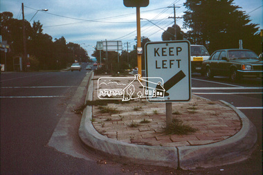
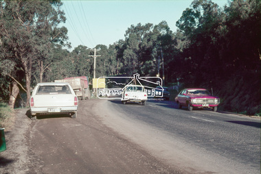
Slide, Main Road at Bolton Street, Eltham, 25 Jul 1973
Looking east along Main Road towards Bolton Street. Bolton street shops visible. Prior to duplication of Main Road35 mm colour positive transparency Mount - Agfacolor Service (Blue)bolton steet, bolton steet shops, eltham, main road -
 Eltham District Historical Society Inc
Slide, Construction of Eltham Town Park, 25 Jul 1973
Construction of Eltham Town Park; landscape has been scupltured and lakes formed. Shillinglaw Cottage , Main Road, Eltham Shire Council Offices and Catholic Church all visible. The park was later renamed Alistair Knox Park.35 mm colour positive transparency Mount - Agfacolor Service (Blue)Memorial Park 25 July 1973eltham, main road, alistair knox park, eltham town park, shillinglaw cottage, bridge street -
 Eltham District Historical Society Inc
Slide, Construction of Eltham Town Park, 25 Jul 1973
Construction of Eltham Town Park; landscape has been scupltured and lakes formed. View looking up towards intersection of Bridge Street with Main Road. On the high side of Main Road is Garni Burges former home at the corner of Bridge Street then further to the left the former bakery on the corner of York Street. On the opposite corner is the feed store now the site of Le Pine Funerals. The park was later renamed Alistair Knox Park.35 mm colour positive transparency Mount - Agfacolor Service (Blue)Memorial Park 25 July 1973eltham, main road, alistair knox park, eltham town park, shillinglaw cottage, bridge street -
 Eltham District Historical Society Inc
Slide, Construction of Eltham Town Park, 25 Jul 1973
Construction of Eltham Town Park; landscape has been scupltured and lakes formed. View looking from near Shillinglaw Cottage south to Bridge Street. The park was later renamed Alistair Knox Park.35 mm colour positive transparency Mount - Agfacolor Service (Blue)Memorial Park 25 July 1973eltham, main road, alistair knox park, eltham town park, shillinglaw cottage, bridge street -
 Eltham District Historical Society Inc
Slide, Were Street, Montmorency, 25 Jul 1973
... melbourne montmorency were street 35 mm colour positive transparency ...35 mm colour positive transparency Mount - Agfacolor Service (Blue)montmorency, were street -
 Eltham District Historical Society Inc
Slide, Were Street, Montmorency, 25 Jul 1973
... melbourne montmorency were street 35 mm colour positive transparency ...35 mm colour positive transparency Mount - Agfacolor Service (Blue)montmorency, were street -
 Eltham District Historical Society Inc
Slide, Were Street, Montmorency, 25 Jul 1973
... melbourne montmorency were street 35 mm colour positive transparency ...35 mm colour positive transparency Mount - Agfacolor Service (Blue)montmorency, were street -
 Eltham District Historical Society Inc
Slide, Were Street, Montmorency, 25 Jul 1973
... melbourne montmorency were street 35 mm colour positive transparency ...35 mm colour positive transparency Mount - Agfacolor Service (Blue)montmorency, were street -
 Eltham District Historical Society Inc
Slide, Main Road, Lower Plenty, 25 Jul 1973
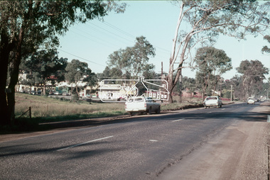
This section of Main Road was known by locals as the "Windy Mile" due to its many little wists and turns. It was also the setting for Billy Cart derbies held on special occassions such as the Eltham Easter Gymkhana at Eltham Lower Park. Contestants would line up and race each other down the hill to the finish line at Bolton Street. Main Road, Lower Plenty underwent substantial changes when it was duplicated with the road becoming two lanes each way and split level due to the cross gradient. This particular section running down the hill from Panorama Avenue to Bolton Street with its twists and turns had many of them straightened out during the road widening constuction work.35 mm colour positive transparency Mount - Agfacolor Service (Blue)main road, infrastructure, lower plenty, roads, windy mile -
 Eltham District Historical Society Inc
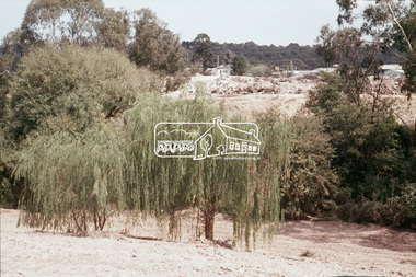
Slide, Construction of Eltham Town Park, 22 Feb 1974
Construction of Eltham Town Park, later renamed Alistair Knox Park. In the distance can be seen the Eltham Tip accessed from Susan Street and the Shell Service Station which was situated on the corner of Susan Street and Bridge Street, now the site of Bunnings35 mm colour positive transparency Mount - Agfacolor Service (Blue)alistair knox park, eltham town park, eltham tip, shell service station, susan street -
 Eltham District Historical Society Inc
Slide, Construction of Eltham Town Park, 22 Feb 1974
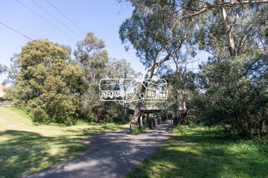
Construction of Eltham Town Park, later renamed Alistair Knox Park. In the foreground is where the Diamond Creek Trail runs along the creek and in the distance is the Bridge Street bridge.35 mm colour positive transparency Mount - Agfacolor Service (Blue)alistair knox park, eltham town park, bridge street bridge -
 Eltham District Historical Society Inc
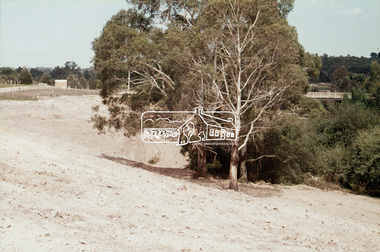
Slide, Construction of Eltham Town Park, 22 Feb 1974
Construction of Eltham Town Park, later renamed Alistair Knox Park. View looking towards the intersection of Main Road and Bridge Street. The lake body has been formed and young trees planted.35 mm colour positive transparency Mount - Agfacolor Service (Blue)alistair knox park, eltham town park, bridge street, main road -
 Eltham District Historical Society Inc
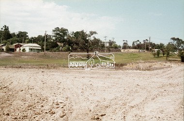
Slide, Construction of Eltham Town Park, 22 Feb 1974
Construction of Eltham Town Park, later renamed Alistair Knox Park. View looking across the front of Shillinglaw Cottage and what was to be developed as the Eltham Town Common (now the site of the Eltham Library) across to the Eltham Town Park development. To the right is the Eltham Trestle Bridge and to the left what was once the overflow site for the Susan Street Tip.35 mm colour positive transparency Mount - Agfacolor Service (Blue)alistair knox park, eltham town park, eltham tip, eltham town common, eltham trestle bridge