Showing 3449 items
matching garden road
-
![Photograph - Digital Image, 14 Poulter Avenue [exterior, side of house and garden], 21/05/2014](/media/collectors/4f729f5697f83e03086015b8/items/550904842162f1199c252e79/item-media/550904b72162f1199c253270/item-fit-380x285.jpg) Greensborough Historical Society
Greensborough Historical SocietyPhotograph - Digital Image, 14 Poulter Avenue [exterior, side of house and garden], 21/05/2014
Built in the 1930s, the exterior of this property is in close to original condition.Digital copy of colour photograph.poulter avenue -
 Greensborough Historical Society
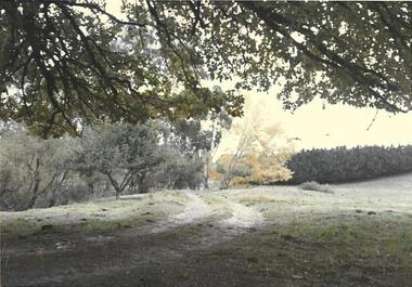
Photograph, Partington's Flat Greensborough Circa 1968, 1968_
Partington's Flat Greensborough was created in the 1950s when Heidelberg Council bought 12 acres from the Partington family to make the park. Fruit trees can be seen in this photograph. Gary Partington (on 2/2/2017) was hazy on the precise locale of the photo. It may have been a track from Willis Vale house going toward the Plenty River with maybe Marsh's Pine trees in the right background defining the border fence line of the Marsh Farm.Colour photographHandwritten on back "Partington's Flat Greensborough about 1968"alan partington, greensborough, partingtons flat, farms, landscapes, gardens -
 Greensborough Historical Society
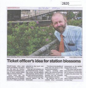
Newspaper Clipping, Ticket officer's idea for station blossoms, 02/03/2016
Graham Osborne, ticket officer at Greensborough Station has planted a garden between the track and Poulter Avenue.News clipping, black text, colour image.greensborough station, graham osborne -
![Photograph - Digital image, Marilyn Smith, Greensborough Historical Society Resource Centre Front Garden Implements [Donation from the Partington Family Farm], 17/06/2014](/media/collectors/4f729f5697f83e03086015b8/items/58677586d0cde904fc057a07/item-media/586775edd0cde904fc0590c6/item-fit-380x285.jpg) Greensborough Historical Society
Greensborough Historical SocietyPhotograph - Digital image, Marilyn Smith, Greensborough Historical Society Resource Centre Front Garden Implements [Donation from the Partington Family Farm], 17/06/2014
In 2013, Gary Partington generously donated farm implements to Greensborough Historical Society. These implements had been used at the family property "Willis Vale" up to the 1960s. From June 2013 until December 2016 these implements were sited in the front garden at the GHS Resource Centre. Unfortunately, the plough, shoe last and kitchen kettle were stolen in December 2016. Digital copy of colour photograph.greensborough historical society, partington family -
 Greensborough Historical Society
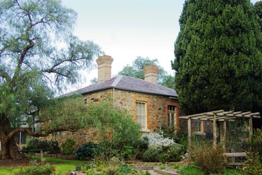
Photograph - Digital image, Marilyn Smith, Ellis Cottage, May 2016: Exterior and Garden, 27/05/2016
In May 2016, the Nillumbik Historical Society invited Greensborough Historical Society to visit its historical centre at Ellis Cottage in Diamond Creek. Ellis Cottage was built in 1865 and is made of local uncut stone. The cottage is a typical farmers residence of this period. The stone construction is unique in this district as most construction is weatherboard. This photo shows the exterior and garden of Ellis Cottage.Digital colour photographellis cottage, nillumbik historical society inc. -
 Greensborough Historical Society
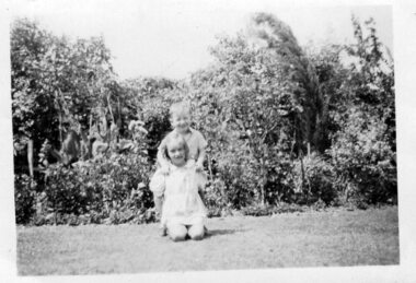
Photograph - Digital Image, Lesley Hills and Geoffrey Butterworth in garden, 1942c
Black and white photograph of Lesley Hills and Geoffrey Butterworth in garden c1942Digital copy of black and white photograph.lesley hooper, geoff butterworth -
 Greensborough Historical Society
Photograph - Digital Image, Hazel and Lesley Hills in garden, 1939c
Black and white photograph of Hazel and Lesley Hills in garden c1939Digital copy of black and white photograph.lesley hooper, hills family -
 Greensborough Historical Society
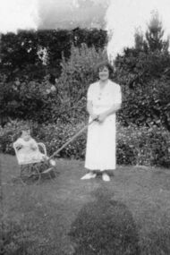
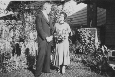
Photograph - Digital image, Wedding photograph, 10/06/1933
Photograph of man and woman in garden. Woman is holding a bouquet of flowers. Possibly a wedding photograph.Digital copy of black and white photograph. -
 Greensborough Historical Society
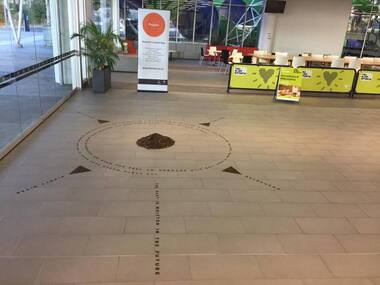
Photograph - Digital Image, Art at WaterMarc, July 2017, 22/07/2017
Photographs of an art installation by Jessie Stanley at WaterMarc Greensborough on 22/07/2017. From Jessie Stanley's FaceBook page :Dust to Dust is complete... It's an ephemeral site-specific work about how the Melbourne suburb of Greensborough has transformed over time. This area's exceptionally fertile soil [used by] by white settlers for farms, market gardens and orchards reshaped the Wurundjeri's traditional lands - and today the private sale and division of these farms informs the streetscape and town plan. With soil sourced locally this work reveals some of the area’s history - the text running around the perimeter was written by former resident Val Wilson, a snippet of her recollections of growing up in the area in the 1950s. The arrows and text act like a compass to orientate this site with greater Melbourne. On display in the lobby of Banyule Council until chance, time (or a broom) sweeps it away, Many thanks to Banyule City Council, Greensborough Historical Society and Valerie Wilson. "An artistic representation of Greensborough's history.Digital photographs of art installation.jessie stanley, watermarc, greensborough historical society, banyule council -
 Greensborough Historical Society
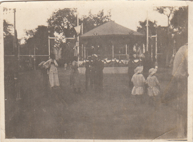
Photograph - Digital image, Charles Marshall et al, Ezbekia gardens Cairo, Bandstand, 1918_
This photographs shows a group of people at the band stand at Ezbekia Gardens, Cairo.Digital copy of black and white photograph. "The band stand Ezbekia Gardens Cairo"charles marshall, world war 1 -
 Greensborough Historical Society
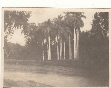
Photograph - Digital image, Charles Marshall et al, Ezbekia gardens Cairo, 1918_
This photograph shows a stand of palm trees at Ezbekia Gardens, Cairo.Digital copy of black and white photograph. "Ezbekia Gardens Cairocharles marshall, world war 1 -
 Greensborough Historical Society
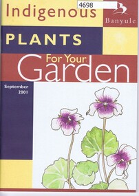
Book, Banyule City Council, Indigenous plants for your garden, 2001_07
A guide to using indigenous plants in Banyule64 pages. black and white print and illustrations. native gardens, banyule -
 Greensborough Historical Society
Poster, Banyule City Council, Banyule's indigenous plants, 2001_
Line drawings and lists of plants indigenous to the City of Banyule.Double-sided coloured poster, foldednative gardens, banyule -
 Greensborough Historical Society
Plaque - Digital Image, Garden State Award plaque, Briar Hill Primary School 1995 BH4341, 1995c
Photo of Briar Hill Primary School "Garden State Award" plaque, 1995.Digital copy of colour photobriar hill primary school, briar hill state school, garden state award -
 Greensborough Historical Society
Photograph - Digital image, June Roberts, The garden at Blackjack, 1960c
The garden at "Blackjack", Hume Street Greensborough, formerly the home of the Roberts family who moved here in 1957.Digital copy of black and white photographjune roberts, roberts family, blackjack, hume street greensborough -
 Greensborough Historical Society
Photograph - Digital image, June Roberts, The garden at Blackjack 2, 1960c
The garden at "Blackjack", Hume Street Briar Hill, formerly the home of the Roberts family who moved here in 1957.Digital copy of black and white photographjune roberts, roberts family, blackjack, hume street briar hill -
 Greensborough Historical Society
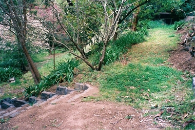
Photograph - Digital image, June Roberts, Garden steps at Blackjack, 1999c
Garden steps at "Blackjack", Hume Street Briar Hill. The Roberts family moved here in 1957. These colour photos are from late twentieth century.Digital copy of colour photographjune roberts, roberts family, blackjack, hume street briar hill -
 Greensborough Historical Society
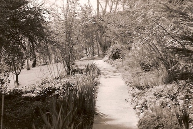
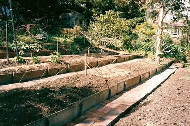
Photograph - Digital image, June Roberts, Garden terraces at Blackjack, 1999c
Garden terraces at "Blackjack", Hume Street Briar Hill. The Roberts family moved here in 1957. These colour photos are from late twentieth century.Digital copy of colour photographjune roberts, roberts family, blackjack, hume street briar hill -
 Greensborough Historical Society
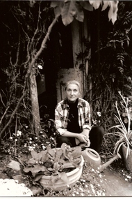
Photograph - Digital image, June Roberts, June Roberts at Blackjack, 1990c
June Roberts in the garden at "Blackjack", Hume Street Briar Hill. The Roberts family moved here in 1957. These colour photos are from late twentieth century.Digital copy of black and white photographjune roberts, roberts family, blackjack, hume street briar hill -
 Greensborough Historical Society
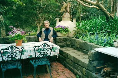
Photograph - Digital image, June Roberts, June Roberts at Blackjack 2, 2002c
June Roberts in the garden at "Blackjack", Hume Street Briar Hill. The Roberts family moved here in 1957. These colour photos are from late twentieth century.Digital copy of colour photographjune roberts, roberts family, blackjack, hume street briar hill -
 Greensborough Historical Society
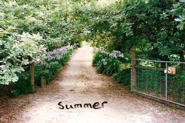
Photograph - Digital image, June Roberts, Summer garden at Blackjack, 1999c
The summer garden at "Blackjack", Hume Street Briar Hill. The Roberts family moved here in 1957. These colour photos are from late twentieth century.Digital copy of colour photographjune roberts, roberts family, blackjack, hume street briar hill -
 Greensborough Historical Society
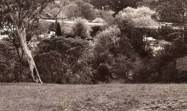
Photograph - Digital image, Jan Lewis, View from Sondemeyer's House overlooking the Greensborough Tea Gardens and bridge circa 1958, 1958c
From Sondemeyer's overlooking Tea Gardens and bridge circa 1958Digital copy of black and white photographsondemeyers hill -
 Greensborough Historical Society
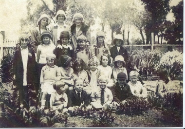
Photograph - Digital image, John Gibson et al, Kindergarten group in vicarage garden, 1930, All Saints Anglican Church, 1930_
All Saints Anglican Church Sunday school - Kindergarten group in Vicarage garden 1930. Teachers are Beryl Yandell, Lydia Hudd and Mary Gilmore. Jean Luxford has white ribbons in her hair and her brother Keith is looking away.Digital copy of black and white photograph. luxford family, all saints anglican church greensborough -
 Greensborough Historical Society
Photograph - Digital image, John Gibson et al, Jean Luxford at Mentone Station gardens 1942, 1942_
Jean Luxford at Mentone Station gardens 1942. Digital copy of black and white photograph. luxford family -
 Greensborough Historical Society
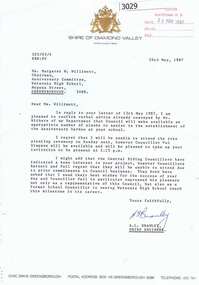
Letter, Letter from Shire of Diamond Valley to Mrs Margaret Willimott 1987, 26/05/1987
Letter from Shire Engineer, Shire of Diamond Valley to Mrs Margaret Willimott of Watsonia High School, confirming a donation of plants for the school's 25th Anniversary Garden. Single page typed on letterhead.shire of diamond valley, watsonia high school, margaret willimott -
![Photograph - Digital image, Marilyn Smith, Mont Park: Central Block [garden], 30/07/2017](/media/collectors/4f729f5697f83e03086015b8/items/5a0ff18921ea67165ce9ad52/item-media/5a0ff1ae21ea67165ce9b6f8/item-fit-380x285.jpg) Greensborough Historical Society
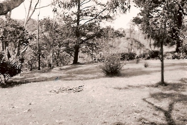
Greensborough Historical SocietyPhotograph - Digital image, Marilyn Smith, Mont Park: Central Block [garden], 30/07/2017
Mont Park: Central Block - buildings in their garden setting. Part of a collection of photographs of the original buildings at the Mont Park Hospital site. Digital copy of 2 colour photographsmont park hospital -
 Glenelg Shire Council Cultural Collection
Photograph - Photograph - Portland Botanical Gardens, 1915
... Cliff Street Portland great-ocean-road Portland botanical ...Portland Botanical Gardensportland, botanical gardens -
 Glenelg Shire Council Cultural Collection
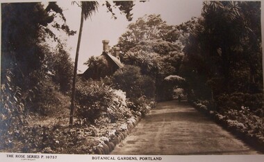
Postcard - Postcard - Botanical Gardens, Portland, n.d
... Cliff Street Portland great-ocean-road Portland Botanic Gardens ...Black and white photograph of Portland Botanical Gardens. Showing an unpaved path edged with rocks in a garden. In the background left in a cottage with two chimneys.Front: THE ROSE SERIES. P. 10757/ COPYRIGHT (typed, lower left) BOTANICAL GARDENS, PORTLAND (typed, lower centre)portland botanic gardens, postcards, travel, tourism -
 Glenelg Shire Council Cultural Collection
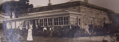
Photograph - Photograph - Burswood, Portland, n.d
Photographs taken by Esther Winifred Hall (nee Smallpage) - great grand-daughter of Stephen George Henty. Taken in 1934 Centenary celebrations in Portland.Black and white photograph showing a house (Burswood) set in a garden. Eight people posed in the garden.esther winifred hall, henty, photography, 1934, centenary celebrations -
 Glenelg Shire Council Cultural Collection
Photograph - Contact Print - Portland Botanical Gardens, n.d
... Cliff Street Portland great-ocean-road Portland Botanic Gardens ...Black and white contact print from glass plate negative. Image shows a young woman sitting on, and two others standing near a bridge in Portland Botanical Gardens. Dress is late 19th, early 20th century.portland botanic gardens, photography, 19th century, 20th century