Showing 1562 items
matching documents - maps
-
 Bendigo Historical Society Inc.
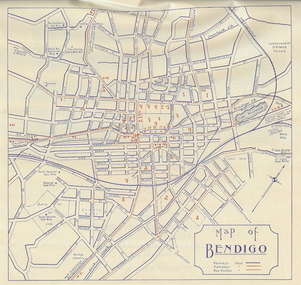
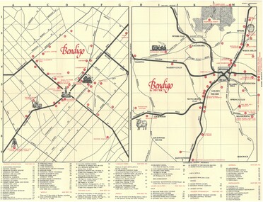
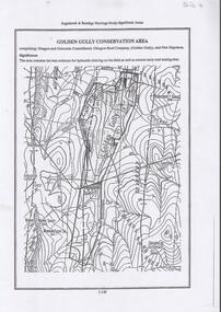
Document - BASIL MILLER COLLECTION: BENDIGO MAP, September 1956
Map of Bendigo with places of interest. Issued by Victorian Railways Public Relations and Betterment Board.person, individual, baby portrait -
 Bendigo Historical Society Inc.
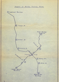
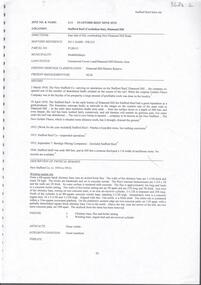
Document - BASIL MILLER COLLECTION: MAP: BENDIGO TRAMWAY ROUTES
... on pale bluish paper with dark blue print. Document BASIL MILLER ...Diagram of Bendigo Tramway Routes. Showing Eaglehawk terminus through to Quarry Hill Terminus and North Bendigo Terminus to Golden Square Terminus. Printed on pale bluish paper with dark blue print.person, individual, baby portrait -
 Bendigo Historical Society Inc.
Document - Bendigo Tramways Brochure, abt 1950s
In 1890 Bendigo's first tramway battery-electric carriages operated between Sanhurst and Eaglehawk. In 1892 Battery-electrics were replaced by steam tram cars on the Bendigo Railway Station track to Eaglehawk. In 1903 Electric traction overhead was inaugurated extending to Quarry Hill, Golden Square and Lake Weeroona. In 1913 Open cross-seat cars added for the service Quarry Hill to Eaglehawk. In 1945 Traction bogie cars replaced older cars. In 1947 Birney safety cars (dead man controllers) replaced older carsBrochure, a "Welcome to Bendigo, and "Evolution of Bendigo Tramways." 8668.1 Brochure is titled "Welcome to Bendigo," on the front a photo of Charing Cross and Trams, also the Bendigo City Coat of Arms. Inside two pages and descriptions of six tram showing the "Evolution of Bendigo tramways." On the rear is a map of the tramways and places of interest to visit. The brochure was "Printed for the preservation committee in co-operation with the Royal Historical Society of Victoria (Bendigo and District Branch) All donations for a preservation fund."history, bendigo tramways, evolution of bendigo tramways -
 Bendigo Historical Society Inc.
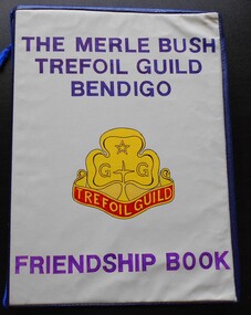
Album - Merle Bush Trefoil Guild: Friendship Book
The Merle Bush Trefoil Guild was registered in Bendigo on 18/06/1981.The decision to disband the Merle Bush Trefoil Guild was made at a General Meeting on 17/02/2016. The group agreed to continue as the Merle Bush Friendship Group. The Australian Trefoil Guilds connect women who are either actively involved in Girl Guiding or have a history with Girl Guiding. The purpose of a Trefoil Guild is to keep alive the spirit of the Promise and Law, carry this spirit into the community and to give support Guiding.Dark blue vinyl covered four ring binder containing a Friendship Book for the Merle Bush Trefoil Guild. The front cover has alight brown vinyl insert attached with purple stamped lettering - THE MERLE BUSH TREFOIL GUILD BENDIGO FRIENDSHIP BOOK and an image of the Trefoil Guild logo. It includes photographs, type written documents, booklets and photocopies. The items are mounted or glued on to buff coloured card from manilla folders cut in half. 22 pp. The first page has a title label - STATE PRIZE WINNER FRIENDSHIP BOOK 1986. The pages have typed or handwritten annotations of names of people in the photographs and descriptions of the attached items and documents. Includes North central Region Map Biography of Miss Merle Bush History of Bendigo Didtrict Photographs of Trefoil Guild members Diamond Jubilee photos and ephemera The Koska sisters Typed memories of Guiding - Maud McConville. the Young family, Anne Butler Flora and Fauna of Bendigo District - photographs by Mr. Rob Watkins Map of the Whipstick Copies of "Little Mattie" the newsletter of the North Central Region Girl Guide Association Victoria. Edited y Bette McLaughlin Newspaper clippings Day Tour Program 21 Feb 1985 girl guides, guiding, merle bush, trefoil guild, friendship book -
 Bendigo Historical Society Inc.
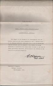
Document - REPORT ON THE BENDIGO GOLDFIELD, EDWARD DYASON
Grey cover document, 21 typed pages with map of goldfield appended. On front page 'Report on the Bendigo Goldfield Central Area. This report is the outcome of an investigation into the present condition and future prospects of the Central Area of the Bendigo goldfield, undertaken with a view to seeing what improved methods could be adopted in the conduct of mining operations to neutralise the recent heavy increase in the cost of labour and mining requisites, and so restore the industry to the level of its previous prosperity' Signed by E.C. Dyason, B.Sc. B.M.E., Commonwealth Chambers, Bendigo, Victoria, 15th November, 1918.bendigo, gold mining, report on goldfield, bendigo goldfield, goldmining, mining companies, reef lines, underground workings, e.c. dyason -
 Bendigo Historical Society Inc.
Document - TED BEATIE COLLECTION: MAP, Pre 1980s
... and District tourist Association Document TED BEATIE COLLECTION: MAP ...Bendigo tourist map and information guide - printed by the Bendigo and District tourist Association -
 Bendigo Historical Society Inc.
Document - AULSEBROOK COLLECTION: HISTORY OF AYERS ROCK BOOKLET, 1968-1970
... and maps Document AULSEBROOK COLLECTION: HISTORY OF AYERS ROCK ...The Significance if Ayers Rock for Aboriginies A5 Booklet, black and white, gloss paper 20 pages Extensive information on the local Aboriginal history in Ayers Rock Various images of Ayers Rock and maps -
Bendigo Historical Society Inc.
Document - CERTIFICATE OF TITLE MCKENZIE STREET
Certificate of title under the transfer of land act 1890. Vol.3219 fol.643627. James Dunlop Boyd medical practitioner and Annie Sophia Boyd married woman, both of McKenzie Street Bendigo areas tenants in common the proprietors of an estate in fee simple, subject to the encumbrances notified hereunder in all this piece of land delineated and colored red on the map in the margin being part of crown allotment fourteen section two B city of Bendigo, together with a right of carriageway over the road colored brown on the said map. Dated the fourteenth day of August 1907.buildings, commercial, mckenzie street -
 Bendigo Historical Society Inc.
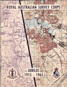
Document - AULSEBROOK COLLECTION: ROYAL AUSTRALIAN SURVEY CORPS JUBILEE 1965, 1965
Aulsebrook Collection: two pamphlets relating to a Jubilee events at the Royal Australian Survey Corps. Title: Royal Australian Survey Corps, Jubilee 1915-1965 (x 2 pamphlets) Two pamphlets for same event, A5, colourful map on the front of the booklet, -First pamphlet is a dinner and wine menu for Jubilee event -Second pamphlet is a information booklet on a brief history of the Corps, and a list of ranks and individuals in the Survey Corps. Booklet also has some photos of Fortuna where the Corps is. -
 Bendigo Historical Society Inc.
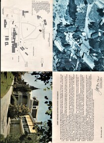
Document - AULSEBROOK COLLECTION: ARMY HEADQUARTERS SURVEY REGIMENT - OPEN DAY PAMPHLET, 1967
... Colonel Commanding Officer and a map with a key. Document ...Aulsebrook Collection: Military Pamphlet -Army Headquarters Survey Regiment 'Open Day at Fortuna' 12th November,1967. -Fold out to larger A4 -Fold out includes: several pictures of the building and the grounds at Fortuna. Also a welcome statement from the Lieutenant Colonel Commanding Officer and a map with a key. -
 Bendigo Historical Society Inc.
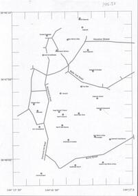
Document - CENTRAL DEBORAH GOLD MINE : GOLDEN SQUARE MINE SITES
... . Latitude and Longitude on map. Document CENTRAL DEBORAH GOLD MINE ...Map showing mines in the Golden Square, Diamond Hill area. Roads include Diamond Hill Road, Burns Street, Woodward Road, Belle Vue Road, Houston Street. Latitude and Longitude on map.bendigo, mining, golden square mine sites -
 Bendigo Historical Society Inc.
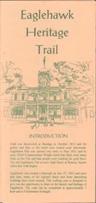
Document - EAGLEHAWK HISTORICAL SOCIETY COLLECTION: EAGLEHAWK HERITAGE TRAIL
Small brochure titled: Eaglehawk Heritage trail, after an introduction a map of the points of interests, few drawing of different buildings, in total the brochure give small information on 33 locations.eaglehawk, history, walking tour -
 Bendigo Historical Society Inc.
Document - ALBERT RICHARDSON COLLECTION: SECRETARY FOR MINES ANNUAL REPORT 1911
Three page typed report titled ' Notes on diagram showing pitch lines, Bendigo'. Longitudinal sections along the lines of reefs or anticlines within the 8 mile block at Bendigo are shown in a diagram' (diagram not included with notes) Mines and reef lines mentioned in the report are : New Chum line, New Chum Railway mine, Catherine United mine, Hercules and Energetic mine, Garden Gully, Hustlers and Redan, Sheepshead Reef, Sea Mine, Garden Gully, Miller's line of reef and Bendigo Development Mine. The 'old stacks' or chimneys, on Bendigo are described. 'Among the earliest of the stacks built at Bendigo in connexion with Quartz crushing plant, are the two figured in this Annual report No 1 was situate in Sailor's Gully but was demolished about three years ago. This, if not the first, must have been one of the first built, for it had a stone inserted on which chiselled the date 1854. It was built altogether of rough masonry. The other, No. 2, is still standing at the Sheepshead line and was apparently of later date, the upper portion being of brick. They are intersting landmarks of an era that is rapidly passing.' Map attached to report showing location of stacks. Stack at Sailors Gully was near the corner of Murchison Street and Lester Street. The stack at Sheepshead ( Deborah Triangle area) was near the intersection of Belle Vue Road and Adam Street.bendigo, mining, pitch lines bendigo -
 Bendigo Historical Society Inc.
Document - NEVILLE KING COLLECTION: MINISTER'S VISIT TO COLIBAN DISTRICT
Manilla folder titled: Minister's visit to Coliban district on Friday 3rd November, 1967. Inside the itinerary, a map of the Coliban system of waterworks, a one page Coliban water investigation committee invitation to lunch November 3rd, 1967 with all the names of the people invited and a three page report titled ''State rivers and water supply commission Coliban system of waterworks''civil engineering, water supply, coliban -
Bendigo Historical Society Inc.
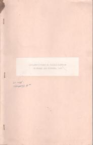
Document - PETER ELLIS COLLECTION: SUBMISSION BY THE BENDIGO FIELD NATURALIST CLUB FOR THE PRESERVATION OF THE WHIPSTICK 1985 OVERHEAD PROJECTOR PRESENTATION, 1985
... of projector overheads, maps and notes. Document PETER ELLIS COLLECTION ...PETER ELLIS COLLECTION: SUBMISSION BY THE BENDIGO FIELD NATURALIST CLUB FOR THE PRESERVATION OF THE WHIPSTICK 1985 Overhead Projector Presentation Collection of projector overheads, maps and notes.person, individual, peter ellis oam -
 Bendigo Historical Society Inc.
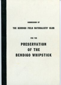
Document - PETER ELLIS COLLECTION: SUBMISSION BY THE BENDIGO FIELD NATURALIST CLUB FOR THE PRESERVATION OF THE WHIPSTICK 1971, 1971
PETER ELLIS COLLECTION: Submission by The Bendigo Field Naturalist Club for the Preservation of the Whipstick Bendigo 1971 The submission was sent to the Minister for Forests. 'On behalf of the Bendigo Field Naturalist's Club, we, the President and Honorary Secretary, make application to the Forests Commission to have two areas, as approximately shown in green on the maps submitted (under separate cover), and being in the parishes of Huntly Nerring and Whirakee, Edgerton declared as Forest Parks under the Appropriate Act.' The Submission has the following contents: Bendigo's Claim for a Forest Park or National Park The Proposed Foiorest Parks Near Bendigo The Flora of The Proposed Whipstick Forest Park Species of Native Plants Bendigo Whipstick Area 1971 Species of Birds Bendigo Whipstick Area 1971 Mammals of the Whipstick Historical Bendigo Whipstick Statisticsperson, individual, peter ellis oam -
 Bendigo Historical Society Inc.
Document - BIG HILL TUNNEL DESCRIPTION
... on it with a detailed map of the area. Document BIG HILL TUNNEL DESCRIPTION ...Description of the Big Hill Tunnel, why it was built and David Ogilvie who worked on it with a detailed map of the area.bendigo, planning, big hill tunnel -
Bendigo Historical Society Inc.
Document - STRUCTURE OF BENDIGO GOLDFIELD BULLETIN NO. 47
Booklet, 36 pages, that describes the structure of the Bendigo Goldfield. Booklet is enclosed in an envelope. On front of booklet : 1923 Victoria, Department of Mines, Bulletins of the Geological Survey of Victoria, W. Baragwanath, Director. Structure of Bendigo Goldfield, by H. Herman, late Director of Geological Survey. Maps under catalogue number 3769 accompanied the booklet and are listed as 'plates' on the contents page. Plans and Sections to accompany Bulletin No 47, Structure of Bendigo Gold-Field, by H Herman, B.C.E., M.M.E., F.G.S., late Director of Geological Survey.Geological Survey of Victoriabendigo, gold mining, structure of goldfield, bendigo, goldfield, gold mining, geology -
 Bendigo Historical Society Inc.
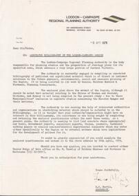
Document - LODDON - CAMPASPE REGIONAL PLANNING AUTHORITY LETTER
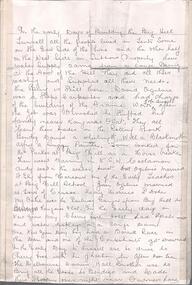
Two letters from the Loddon - Campaspe Regional Planning Authority the first dated 9th April, 1979 the second 12th April, 1979 both titled: annotated bibliograpghy of the Loddon-Campaspe Region. Also a map of the Loddon-Campaspe regional Autorithy area of study. Two stapled pages of the Annotated Bibliography of the Loddon - Campaspe Regionorganisation, government, loddon campaspe -
Bendigo Historical Society Inc.
Document - GREAT EXTENDED HUSTLERS: MAPS OF HUSTLERS MINE SITE
... . Document GREAT EXTENDED HUSTLERS: MAPS OF HUSTLERS MINE SITE ...Three maps, copies. Great Extended Hustlers mine site. Hustlers Royal Reserve No. 2 Mine. Streets around Great Extended Hustlers mine site and reserve.bendigo, mining, great extended hustlers -
 Bendigo Historical Society Inc.
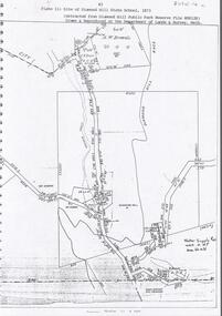
Document - DIAMOND HILL STATE SCHOOL SITE
Map (copy) showing the site of Diamond Hill State School, 1873. On top of page 'extracted from Diamond Hill Public Park Reserve File RS8128, drawn and reproduced at the Department of Lands and Survey, Melbourne'bendigo, education, diamond hill state school -
 Bendigo Historical Society Inc.
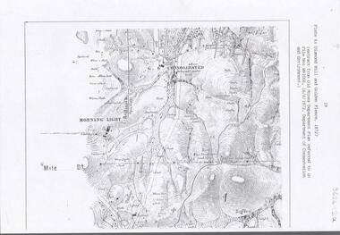
Document - DIAMOND HILL AREA MAP
... . Document DIAMOND HILL AREA MAP ...Map copy, 2 pages, from 'Old Mines Department Plan, Dept of Conservation and Environment File No W91006, 16.6.1972' Map shows Golden Gully area with 'Town and Country Hotel' on north side and further south, with shafts and mine names marked.bendigo, mining, diamond hill -
 Bendigo Historical Society Inc.
Document - DIAMOND HILL, GOLDEN GULLY COSERVATION AREA
Map of Golden Gully conservation area comprising Glasgow and Golconda Consolidated, Glasgow Reef Company (Golden Gully) and New Napoleon. The area is significant because it contains the 'best evidence for hydraulic sluicing on the field as well as several early reef mining sites' On top of page 'Eaglehawk & Bendigo Heritage Study, Significant areas' Mines marked on page: Goldfields Extended shaft South Concord shaft Concord shaft Morning Light shaft Hansel and Mundy shaftbendigo, mining, golden gully -
 Bendigo Historical Society Inc.
Document - STAFFORD REEF MINE SITE, DIAMOND HILL
One page document describing the Stafford Reef Mine Site, Diamond Hill, Site 4.11, prepared by David Bannear. Information includes the map/grid references of the site and an overview of the history of the Stafford Reef Mine. The physical remains of the mine are described..bendigo, mining, stafford reef mine -
Bendigo Historical Society Inc.
Document - DIAMOND HILL HISTORIC AREA PARKS VICTORIA
Document, two pages, prepared by Parks Victoria in relation to the Diamond Hill Historic Area. Contains information regarding the history of the area; German Miners; Plants and animals. On second page is a map of the area showing historic features: Deborah Consolidated Gold workings Red, White and Blue Extended gold workings Goldfields Extended gold workings Dead Dog Gully, alluvial gold workings Glasgow & Golconda Gold workings and tramway Surface gold mining site Hansel Mundy gold workings Bendigo Goldfields Pty gold workings Stafford gold workings Langdon gold workings Great Opossum Gully alluvial gold workingsbendigo, mining, diamond hill -
 Bendigo Historical Society Inc.
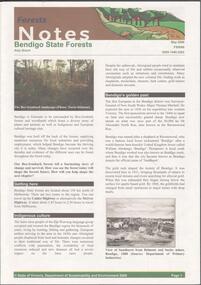
Document - BENDIGO STATE FORESTS - FORESTS NOTES
Forests Notes: Bendigo State forests newsletter published May 2006 by the State of Victoria, Department of sustainability and Environment. Getting there - indigenous culture - Bendigo's golden past - Geology and geomorphology - Discover nature treasures - Bendigo State forests - Activities to enjoy in State forests. Map of Bendigo State forests.government, state, department of sustainability -
 Bendigo Historical Society Inc.
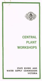
Document - STATE RIVERS AND WATER SUPPLY COMMISSION VICTORIA : CENTRAL PLANT WORKSHOPS
State Rivers and Water Supply Commission of Victoria. Brochure titled 'Central Plant Workshops'. Double-sided, three pages on each. Information about the workshops (CPW for short) and the setting up of the Bendigo site from 1946. There is a map of the layout of the site, and information given under the following headings - Central Plant Workshops, Work of the CPW, Meter Wheels, Pump Station Equipment, Steel Fabrication, Precast Concrete, and the Area and its Equipment. The brochure is dated June, 1968.state infrastructure, water supply, coliban system, state rivers and water supply commission of victoria. coliban system. central plant workshops. -
 Bendigo Historical Society Inc.
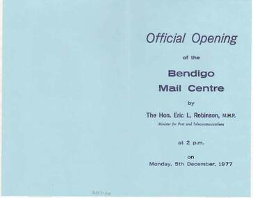
Document - DOCUMENT - OFFICIAL OPENING OF THE BENDIGO MAIL CENTRE, 05/12/1977
The Victorian Mail Network brochures, two with Official Opening of the Bendigo Mail Centre Programs. The Opening took place on Monday, 5th December, 1977.In the program are some Postal Historical notes and the program for the day. The brochure Victorian Mail Network has a map of the postal districts of Victoria with Country and Metropolitan Mail Centres and some notes on the front. On the inside, is another map from Kyneton - Echuca, Robinvale, Wentworth, Ouyen and to Bendigo via Charlton. Also Castlemaine. It has a list of the Benefits of the Scheme. On the back is a table, Standard of Service - Final posting times.bendigo, institutions, bendigo post office, document, official opening of the bendigo mail centre, the hon. eric l. robinson, m.h.r., joseph cusworth, sir john nimmo, john w henderson, r j page, cr r f turner, c g primmer, j w bourchier, b coughlan -
 Bendigo Historical Society Inc.
Document - OLD PEOPLES WELFARE SOCIETY COLLECTION: BANK STATEMENTS
COLLECTION OF RECORDS OF BENDIGO AND DISTRICT OLD PEOPLES WELFARE SOCIETY / Manilla folder / writing note on front B.O.P.W.S.Salvation Army , St Lukes , St Vincents De Paul , Bendigo Uniting Church Outreach , Notice to Members / inside includes news clippings , Bank statements , passbook , letters / history of the society , mention of founder Ken Hesse , Annual Return , Rules , map of Golden Oaks Villagedocument, ken hesse -
 Bendigo Historical Society Inc.
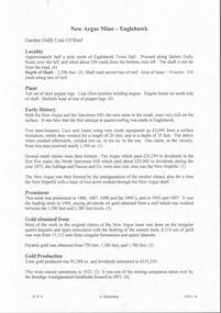
Document - NEW ARGUS MINE - NOTES ON THE NEW ARGUS MINE
One handwritten and four typed copies of notes on the New Argus Mine at Eaglehawk. One typed copy has a locality map attached. Notes mention locality, depth of shaft, early history, prominence, amou;nt of gold obtained and production. References; Special Edition Australian Mining Standard 1/6/1899, Mines Dept. Booklet 'Bendigo Goldfield' 1936, Mines Department Annual and Special Reports, Annals of Bendigo Mining Section 1886 - 1922 and A. Richardson. 4 Typewritten copies of this item have not been scanned.document, gold, new argus mine, new argus mine, notes on the new argus mine, eaglehawk, specimen hill mine, mr cave, mr amos, the argus mine, north specimen hill mine, adlinga and pascoe & co, new hopeful, bendigo amalgamated goldfields, special edition australian mining standard 1/6/1899, mines dept. booklet 'bendigo goldfield 1936, mines dept. annual and special reports, annals of bendigo mining section 1886 - 1922, a richardson